
Contents
Cypriot communities built walls around their settlements in a few distinct episodes, separated by long stretches in which they did not. The first is the enclosure of Aceramic Neolithic Khirokitia, long misread as a road. The second is the wave of hilltop forts and enclosures at the end of the Middle Bronze Age, around 1750–1450 BCE. The third is the Cyclopean town walls of the thirteenth and twelfth centuries BCE at Enkomi, Kition and new sites on the coast. The fourth is the city walls of the Iron Age kingdoms, which were tested when the Persians put down the Cypriot revolt in 498 BCE, most visibly at Paphos. At every stage the same question recurs: were the walls built for war, or to mark out, display and control a community? The weapons are covered under Bronze Age weapons and the wider weapons and armour hub; building techniques in general belong to architecture.
Khirokitia: an enclosure wall read as a road
Porphyrios Dikaios excavated Khirokitia-Vouni in 1936–39 and in 1946, uncovering about 2,700 m² on both sides of "a c. 185 m long structure which he called the 'Main Road'" [1, p. 51]. The French mission led by Le Brun, working from the late 1970s, showed that the "Main Road" is in fact an enclosure wall, now numbered Mur 100, "delimiting the initial occupation of the settlement at least in the east sector" [1, p. 51]. The village later spread west beyond it, "probably due to the increase of population", and the new sector was enclosed by a second wall, Mur 284. The gate in that second wall "appears to have served at least partially to control the access into the settlement" [1, p. 51].
The two main sources differ on the size of the walled village. Winkelmann gives about 2.5 ha and some 65 circular structures [1, p. 52]; Le Brun's team give a built-up area of about 3 ha at its maximum [2]. The site lies on the south-west slopes of a hill, with the Maroni River curving round its north, east and south-east sides, about 6 km from the coast [1, p. 51].
Whether the wall was defensive is doubtful. Winkelmann writes that "a fortificational function is questionable since there are no (clear) signs of violent conflicts" [1, p. 51]. She places Khirokitia in a wider Aceramic Neolithic pattern: settlements "usually located in a prominent position with good view", whose "defensive character is enhanced by walls (and sometimes ditches)", although "the reasons for the building of these structures is still unknown" [1, p. 50]. Bernard Knapp, quoted by Winkelmann, offers two social readings: the walls may have served "to mark out the main community of the island, preserving the social cohesion of that site", and they show that "some person or group could marshal the labour necessary to build and maintain communal structures" [1, p. 51]. The Aceramic culture ended around 5500 BC with what Winkelmann calls "a general, and apparently peaceful, intentional abandonment" [1, p. 51].
Abandonment and relocation in the Middle Bronze Age
The villages of the Early and Middle Bronze Age are described elsewhere on this site. For the history of fortification, the relevant point is how the Middle Bronze Age ended. Eilis Monahan and Matthew Spigelman note that fortification arrived as "the abandonment and subsequent relocation of settlements paired with the construction of new fortified sites, rather than the construction of defensive walls around existing sites" [3, p. 133]. Late Middle Cypriot villages in the Troodos foothills and on the northern slopes of the Kyrenia range were all abandoned: "As fortresses were constructed elsewhere, the people of these villages chose to move rather than to encircle themselves with defensive walls" [3, p. 141].
The Middle Cypriot III–Late Cypriot I forts
Monahan and Spigelman place the forts in the "transitional" Middle Cypriot III to Late Cypriot I period, about 1750–1450 BCE, following Sturt Manning [3, p. 133]. They are "generally dated to MC III–LC I (1700–1450 BCE)", although Robert Merrillees lowered the start to Late Cypriot IA and argued that they were abandoned before Late Cypriot IB, which would limit their life "to at most one hundred years" [3, p. 134]. They cluster in the Kyrenia Mountains, the Karpas Peninsula and on the plateaus of the Mesaoria [3, pp. 133, 141], with others on the Kormakiti Plateau, in the Elenja hills and on the Yeri plateau [3, p. 144, table 4.1]. Michel Fortin counted 21 fortified settlements, but Martin Bartelheim, Bülent Kizilduman and Uwe Müller stress that none "has been securely dated (there are hardly any 14C dates), sufficiently researched as to their building structure, or ... extensively excavated" [4]. The entry on Bronze Age weapons sets out the shifting dates of Korovia-Nitovikla and the older list of explanations (drought, invasion, trade rivalry, local elites).
Monahan and Spigelman divide the sites into three classes: "fortified settlements, outposts, and enclosures" [3, p. 142]. Fortified settlements are large (over 80 by 80 m), with stone-built houses inside and walls more than 1 m thick, often with bastions, towers and gates. Enclosures have heavy walls and no buildings inside; they may have held livestock or served as short-term refuges, or, following Baurain, as shelter "for mobile trade missions or caravans". Outposts are single thick-walled buildings too small to hold many people, suited to "secure surveillance" [3, pp. 142, 145]. Their table lists Nikolidhes at 250 by 250 m and the outpost at Glyka Vrysi at 20 by 35 m [3, p. 144, table 4.1].
The best-studied group stands on the Ayios Sozomenos plateau. Kafkallia, Barsak and Nikolidhes sit on cliffs 40–50 m high, and Glyka Vrysi at the cliff foot by a spring. Together they have "a shared viewshed that extends nearly 360 degrees, encompassing much of the Mesaoria"; the work continues with Despina Pilides of the Department of Antiquities [3, p. 148]. Bartelheim and colleagues note that finds on the heights are scant, with no pottery at all in places, while the open settlements below at Dziropoulos and Ampelia have storage vessels and workshops. They conclude that the forts "had primarily a protective character for the valley settlements", show no insignia of power, and replaced one another, Barsak giving way to Kafkallia and Nikolidhes [4]. Fortin excluded Glyka Vrysi and the "fortress" in Area III at Enkomi, both rectangular with 1–2 m walls in poor strategic positions, from the defensive group, assigning them "rather representative functions" [4].
In the Kyrenia Pass four sites stand on cliff edges in a chain of intervisibility from the Mesaoria to the north coast. Krini-Merra has "a heavy stone-built double wall and a series of bastions". Paul Åström read the chain as guarding copper on its way to northern ports, but Monahan and Spigelman point out that no major centre of this period is known on that coast [3, p. 146].
Korovia-Nitovikla stands on a low cliff above a small bay on the south-east coast of the Karpas, 140 km due west of Ugarit [3, p. 148]. The Swedish Cyprus Expedition dug it and Hult restudied it in 1992. In Merrillees's phasing, a "humble settlement" of late Middle Cypriot III was followed in Late Cypriot IA by a fortress with a 20 by 24 m courtyard, 36 by 40 m overall, entered by a gateway of ashlar blocks flanked by towers; it burned, was rebuilt in Late Cypriot IB and was abandoned in Late Cypriot IIA [3, pp. 149–150]. The whole plateau was walled. Because survey found its interior empty it was once read as a refuge, but Bartelheim and colleagues note that the plateau is only about 30 m high and has two boat landings, and they call it "a fortified settlement with maritime connections" that "to some extent anticipates the location model of the coastal centres" of the thirteenth and twelfth centuries [4].
Not every "fort" is accepted as one. Phlamoudhi-Vounari, an artificial clay mound about 8 m high carrying a 16 by 16 m platform in Late Cypriot IB, was read by its excavators as a sanctuary [3, p. 150]; Bartelheim and colleagues list it as disputed, since the Columbia excavations found no defensive structures [4].
Why the forts were built
The most influential recent model ties the forts to copper. On this view, associated with Edgar Peltenburg and with Priscilla Keswani and Knapp, elites at Enkomi (or at Enkomi and Toumba tou Skourou) built them to secure the transport of copper, and the Ayios Sozomenos group lies on a route from Enkomi up the Gialias valley [3, p. 134; 4]. Monahan and Spigelman argue against it. "There are no known fortifications from this period in close proximity to the copper sources", and Politiko-Phorades, the only excavated copper-production site of the period, "has no evidence for fortification" [3, pp. 141–142]. The clusters on the Karpas and the Kormakiti plateau are hard to explain as copper guards. Knapp himself has described the forts as elite "place-making", intended to "control people's movements and interactions by appropriating, enclosing, and monumentalizing space" [3, p. 134]. Monahan and Spigelman see "highly variable responses" to local landscapes, "rather than a top-down, centralized response to foreign demand for copper" [3, p. 141].
Cyclopean walls of the Late Bronze Age
A second wave of walls belongs to the end of Late Cypriot IIC and to Late Cypriot IIIA, the late thirteenth and early twelfth centuries BCE (see Late Bronze Age). The builders set large, roughly shaped blocks in facings and carried the upper wall in mudbrick. At two sites, Enkomi and Kition, existing towns were walled; at Maa and Pyla, settlements were founded on naturally defended ground.
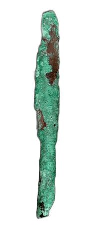
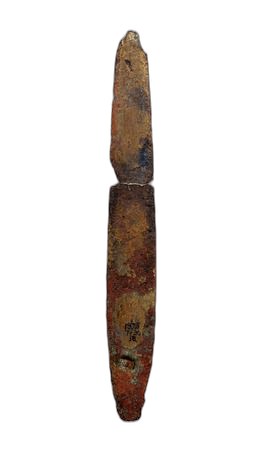
At Enkomi the lower wall consists of "two parallel rows of large, unhewn blocks, c. 1.5 m high", the outer blocks larger, with a rubble core and mudbrick above. Towers 4–5 m long and 2–3 m deep project at irregular intervals on the south, west and north sides of a town about 400 m north–south and 350 m east–west, laid out on a grid of straight streets [5, p. 94]. Dikaios dated the wall to the very end of Late Cypriot IIC, "contemporary with the cyclopean walls of Kition, Maa and Sinda"; Vassos Karageorghis suggests the large "tower" by the north gate "may in fact be a sanctuary" [5, p. 94]. Bartelheim and colleagues give the wall a width of 2.5–3 m and describe the north gate with a bastion of 20 by 16.5 m; the French excavators date the wall to Late Cypriot IIC, in use until the town was abandoned in Late Cypriot IIIB [4]. Bronze weapons from Enkomi in the British Museum include a socketed spearhead and a riveted dagger.
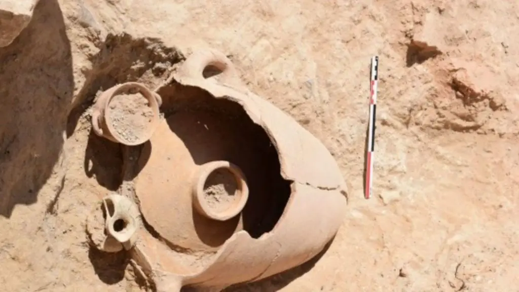
At Kition a new Cyclopean wall was built on the mudbrick debris of a wall destroyed at the end of Late Cypriot IIC, enclosing a city of about 1500 by 700 m. Two bastions at its north end "already existed in Late Cypriot II" [5, p. 94]. About 100 m of the wall is exposed in Area II: it is about 2.4 m wide, with stone to a height of some 1.25 m and mudbrick above. A stone anchor measuring about 1.3 by 1.07 by 0.32 m is built into it, a 3 m street with wheel ruts runs outside, and a towered gate in the north-east was damaged by stone-robbing [5, p. 95]. Bartelheim and colleagues describe a first phase in mudbrick in Late Cypriot IIC, renewed with Cyclopean blocks in Late Cypriot IIIA [4]. Between 1075 and 1050 BC, Karageorghis writes, "the mudbrick superstructure of the cyclopean walls and the rectangular bastions tumbled down onto an adjacent street, burying Proto-White Painted pottery" [5, p. 93].
The size of Sinda depends on the source. Karageorghis describes an irregular polygon about 250 by 200 m [5, p. 95], while Bartelheim and colleagues give about 67 ha [4], which the dimensions cannot accommodate. Its north gate had a guardhouse placed so that anyone entering "had to expose their uncovered right flank", and its excavator looked for Anatolian models [5, p. 95]. At Maa-Palaeokastro Karageorghis describes "a formidable fortress, combining both manmade and natural features", with landward and seaward walls 3.5–4 m wide and two gates [5, p. 95]. Bartelheim and colleagues put Maa at about 5 ha, founded at the Late Cypriot IIC/IIIA transition and abandoned within IIIA [4]. Pyla-Kokkinokremos, a plateau of about 6 ha standing some 80 m above Larnaca Bay, had no separate wall: houses built against each other along its edge formed "a casemate-like fortification with their thickened outer walls" [4]. At Kourion-Bamboula a Cyclopean wall seems to have been built in Late Cypriot IIC and used into IIIA [4].
At Dali-Ambelleri (Idalion), a site founded in Late Cypriot IIIA, a wall of large blocks with mudbrick above was built in IIIA, rebuilt twice in IIIB and used into the Iron Age; it had two gates, one flanked by two bastions [4]. The American excavators suggest that this West Acropolis settlement, the only Late Cypriot occupation at Idalion, gave the Dhali region "a ceremonial center" and "a place of refuge" [6, p. 487]. Balandier identifies an underground postern at Idalion and Enkomi as early as the twelfth century BC [7, p. 39].
Iron Age city walls
Balandier argues that the city walls of the Cypriot kingdoms carried Bronze Age practice forward. At Idalion the Cypro-Archaic I wall follows the line of the Cypro-Geometric III enclosure, in the same rough blocks of local soft limestone bonded with clay [7, p. 33]. On her reading Cypriot fortification is older than that of mainland Greece and not directly comparable to it: walls with a stone core in a mudbrick casing appear in the Cypro-Geometric period at Salamis, and the first wall at Palaepaphos combines a mudbrick-and-stone core with an outer stone facing, a mixed technique that Greek builders took up only in the late fifth and fourth centuries [7, pp. 36–37]. At most sites only stone footings survive; mudbrick upper walls are attested at Kition, Salamis, Palaepaphos, Idalion, Tamassos and Golgoi, stone upper walls in parts of Amathus, Paphos and Kourion [7, p. 34]. Gypsum mortar appears in wall cores from Cypro-Classical I and perhaps Cypro-Archaic II [7, pp. 34–35].
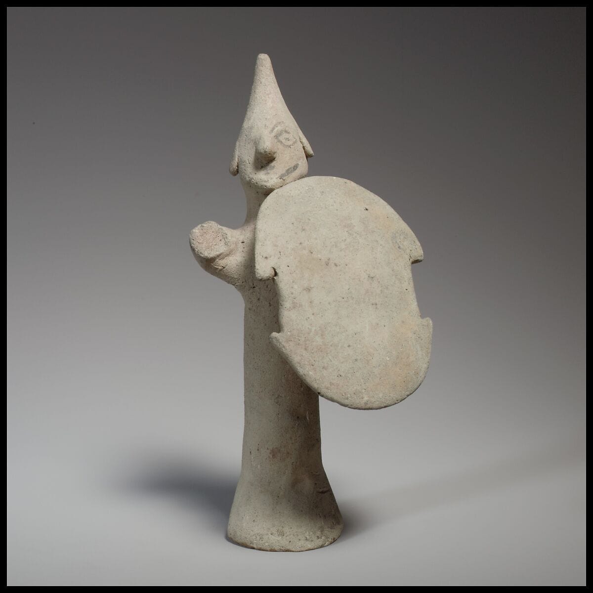
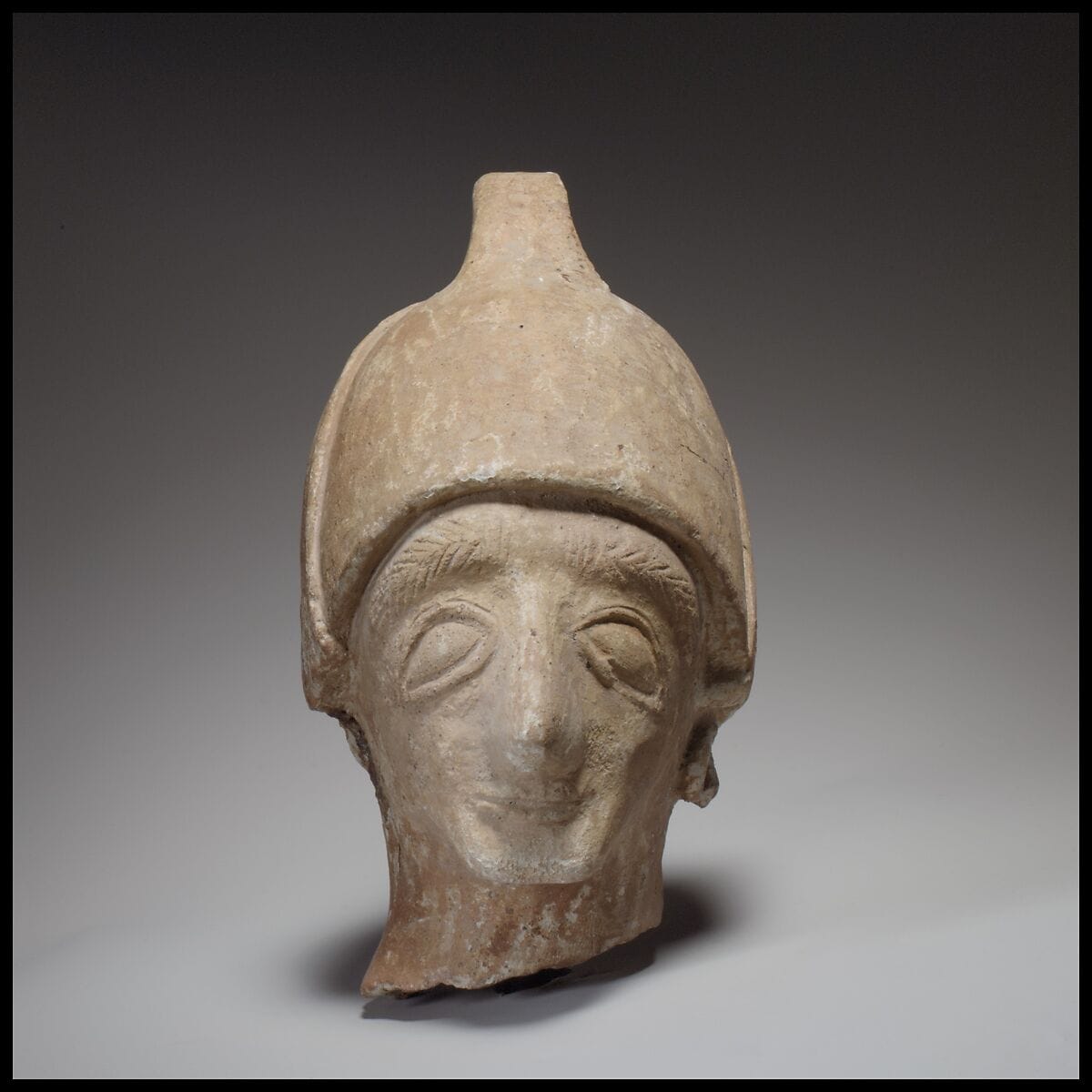
Idalion has the fullest record. The Swedish Cyprus Expedition found that the West Acropolis was refortified in Cypro-Geometric III, and the American expedition identified early Cypro-Archaic I ashlar walls on the West Terrace as the first citadel fortification [6, pp. 487–488]. Around 475 BC, at the end of Cypro-Archaic II or the beginning of the Cypro-Classical period, "the whole city [was] enclosed with a fortification wall" of limestone rubble faced with ashlar (sandstone on some outer faces), probably with mudbrick above and bonded with gypsum mortar. On the West Terrace it survives 7.80 m high and 10.75 m wide; in the Lower City it is 1.60 m high and 4.25 m wide; one bastion is 8.25 m wide. It enclosed about 40 ha, and the excavators estimate 8,000–10,000 inhabitants in the Cypro-Classical period [6, pp. 488–489]. They leave open who built it: "the Phoenicians or the Greek Cypriots; the kings of Kition or the kings of Idalion?" [6, p. 489]. The question matters because Kition was a Phoenician kingdom. A fifth-century siege of Idalion is the subject of the article on the Idalion bronze tablet. The Metropolitan Museum has a terracotta shield bearer and a male head wearing a helmet, both said to be from Idalion and dated about 600–480 BC.
At Amathus, Catherine Kearns writes that "ruling authorities built perimeter walls with fortified gates at the end of the Archaic period, and reinforced or added to them during the fifth century BCE", making the town's extent visible "even from the sea". She describes the walled lower town as "arguably ideological, and not defensive", a sign of "a need to display political belonging" [8, p. 275]. This judgement follows a synthesis citing Aupert (1996) and Balandier (2000). The site is described in the article on the ancient city of Amathus. A spearhead from Amathus found by the Swedish Cyprus Expedition in 1930 is in the Medelhavsmuseet, Stockholm.
The palace at Vouni, on a hill 268 m above sea level 6 km west of Soli, was excavated by the Swedish Cyprus Expedition in 1928–29. Theodoros Mavrojannis notes that the palace itself, about 60 by 60 m, "is not fortified, but the hill was defended by a strong fortification wall" protecting a settlement that ran down towards the sea [9]. Metal arrowheads from Vouni found by the Swedish Cyprus Expedition are in the Medelhavsmuseet. At Soli, Herodotus says the city held out for five months against the Persians and describes them undermining its walls [10, p. 24; 11, p. 285]. As G. R. H. Wright and D. White observe, "no trace of this operation has been revealed by excavation" [10, p. 24].
The siege of Palaepaphos, 498 BCE
After the defeat of the Cypriot rebels at Salamis and the death of Onesilos, the Persians besieged and garrisoned the cities that had joined the revolt. Herodotus names Soli but does not mention a siege of Paphos [10, p. 24]. The evidence for it is archaeological. The British Kouklia Expedition of St Andrews University and the Liverpool Museum, under Mitford and Iliffe, dug "Site A" on the Marchello (or Marcello) hill at Kouklia in 1950–55, and F. G. Maier's German-Swiss mission resumed work in 1966 and finished in 1973 [10, pp. 25–26; 12]. They exposed the north-east gate and a 110 m stretch of wall dated from the eighth to the fourth century BC [12]. The site belongs to the Paphos landscape.
Wright and White describe the defences around 500 BC. The wall was of rubble and mudbrick. The north-east gate, about 30 by 15 m, was a bent entrance, with a projecting tower of about 8 by 8 m some 50 m to the east, and a fosse 30 m broad ran about 15 m out from the wall [10, p. 26]. They give the city's extent as "about a square kilometre", which they equate with "about 25 hectares"; the two figures do not agree (a square kilometre is 100 ha), so the area remains unsettled. Between tower and gate lay a mound about 45 by 45 m, preserved about 5 m high, built of earth, stones, timber and smashed material from an Archaic sanctuary outside the walls [10, pp. 25–26; 12]. Among that material were more than 200 syllabic inscriptions, published by Olivier Masson and Mitford in 1986 [12], and, as Maria Iacovou quotes from Maier, "more than 1,000 fragments of human and animal statues" [11, p. 284]. On the script, see writing and literacy.
On the standard reading the mound is a Persian siege ramp. Wright and White describe it as "an all-purpose fighting platform" for rams to breach the wall, a siege tower to clear the ramparts and shorter scaling ladders [10, p. 26]. There is no evidence that the Persians sapped the wall, but "the defenders strove mightily to sap the siege mound: four tunnels were driven underneath it from within the city" [10, p. 26]. Iacovou cites Maier for "more than five-hundred bronze and iron arrowheads and spear points" and a Greek bronze helmet from the mound [11, p. 285]. Balandier asks whether the defenders' tunnels and passage into the ditch are the ancestor of the eight sortie tunnels at the north-west gate of Nea Paphos, of the late third or early second century BC [7, pp. 38–39].
In 2013 Iacovou proposed an alternative that she calls "tentative" and expects "to seem heretical". Construction details, including larger boulders reinforcing the south face, suggest that the rampart faced south, so that Mitford may have "interpreted the rampart inside out". She suggests that it defined "a special function zone of the Cypro-Archaic capital that was contained on the top terrace of the plateau" [11, p. 284]. Her key evidence is Maier's sounding of 1973, reported by Karageorghis, which found that "the dry ditch in front of the Archaic city wall does not continue on the other (northwest) side of the Gate". If there was no moat, the ditch may have been dug inside the rampart, and the sculpture and inscriptions need not have come from an extramural sanctuary "(one that has never been located)"; they may belong to the top terrace itself, among them a dedication naming two sixth-century kings of Paphos, Stasis and Onasicharis [11, p. 284]. Iacovou does not deny a fight. The weapons still point to violent confrontation, perhaps in 498 BC, possibly followed by the punishment of the Paphian dynasty, though she labels this speculation, and she keeps Maier's stratigraphy as "the most reliable guide" [11, p. 285]. Her wider argument about the Iron Age kingdoms is summarised in the article on Maria Iacovou.
Sites at a glance
| Site | Period | Wall | Source |
|---|---|---|---|
| Khirokitia-Vouni | Aceramic Neolithic | Enclosure wall Mur 100, then Mur 284 with a gate | [1] |
| Ayios Sozomenos-Barsak | MC III–LC I | Empty enclosure, 250 × 200 m | [3] |
| Krini-Merra | MC III–LC I | Double stone wall with bastions | [3] |
| Korovia-Nitovikla | LC IA–IB (Merrillees) | 36 × 40 m fort, ashlar gateway with towers, walled plateau | [3], [4] |
| Enkomi | End of LC IIC–LC IIIB | Two rows of unhewn blocks, mudbrick above; towers; north-gate bastion 20 × 16.5 m | [5], [4] |
| Kition | Mudbrick LC IIC; Cyclopean LC IIIA | About 2.4 m wide; rectangular bastions; anchor in wall | [5], [4] |
| Sinda | LC IIC–IIIA | Cyclopean; gate with guardhouse | [5], [4] |
| Maa-Palaeokastro | LC IIC/IIIA–IIIA | Landward and seaward walls about 3.5–4 m, two gates | [5], [4] |
| Pyla-Kokkinokremos | End of LC IIC–IIIA | Casemate-like ring of houses | [4] |
| Idalion | LC IIIA; CG III; CA I; c. 475 BC | Acropolis walls; city wall up to 10.75 m wide | [4], [6] |
| Palaepaphos (Marchello) | 8th–4th c. BC | Rubble and mudbrick wall, bent north-east gate, tower, fosse | [12], [10] |
| Amathus | End of Archaic, 5th-c. additions | Perimeter walls with fortified gates | [8] |
| Vouni | 5th c. BC | Hill wall; palace unfortified | [9] |
What remains open
At Khirokitia the enclosure controlled access, but nothing shows violence, and Knapp's social reading remains an interpretation. The Middle Cypriot III–Late Cypriot I forts are still read either as guards on copper routes or, with Monahan and Spigelman, as regional responses, and almost none has radiocarbon dates or large-scale excavation. In the Iron Age the builders of the Idalion city wall are unknown, the purpose of the Amathus walls rests on a single discussion, and the siege of Soli has left no excavated trace. At Palaepaphos the siege-ramp reading has held for half a century; Iacovou's reversal awaits the fieldwork she calls for. The period sequence is set out under Cypro-Archaic.
Objects on this page
References
- 1.Winkelmann, C. (2020). The Neolithic and Chalcolithic figurines of Cyprus. Zaphon.
- 2.Le Brun, O. D.-L., Hourani, F., & Le Brun, A. (2017). Khirokitia (Chypre, VIIe–VIe millénaires av. J.-C.), la séquence stratigraphique dans son contexte. In J.-D. Vigne, F. Briois, & M. Tengberg (Eds.), Nouvelles données sur les débuts du Néolithique à Chypre (Séances de la Société préhistorique française 9, pp. 217–228). Société préhistorique française. (Abstract consulted.)
- 3.Monahan, E., & Spigelman, M. (2019). Negotiating a new landscape: Middle Bronze Age fortresses as a component of the Cypriot political assemblage. In C. Kearns & S. W. Manning (Eds.), New directions in Cypriot archaeology (pp. 133–159). Cornell University Press.
- 4.Bartelheim, M., Kizilduman, B., & Müller, U. (2019). Bronze Age fortifications on Cyprus. In S. Hansen & R. Krause (Eds.), Bronze Age fortresses in Europe (Universitätsforschungen zur prähistorischen Archäologie 335). Habelt.
- 5.Karageorghis, V. (1982). Cyprus: From the Stone Age to the Romans. Thames and Hudson.
- 6.Stager, L. E., & Walker, A. M. (Eds.). (1989). American Expedition to Idalion, Cyprus 1973–1980 (Oriental Institute Communications 24). The Oriental Institute of the University of Chicago.
- 7.Balandier, C. (2001). Les techniques de construction des fortifications chypriotes: héritages et influences du VIIIe s. av. J.-C. au VIIe s. apr. J.-C. Cahiers du Centre d'Études Chypriotes, 31. https://www.persee.fr/doc/cchyp_0761-8271_2001_num_31_1_1380
- 8.Kearns, C. (2022). The rural landscapes of Archaic Cyprus: An archaeology of environmental and social change. Cambridge University Press.
- 9.Mavrojannis, T. Consequences of the battle at Salamis in the Eastern Mediterranean and Cyprus from 478 to 449 B.C.: The «Hellenikos Polemos». Rivista di antichità, 22–23 (2013–2014).
- 10.Wright, G. R. H., & White, D. (2005). Siegecraft and spoliation, c. 500 BC: A tale of two cities. Libyan Studies, 36, 21–42. https://doi.org/10.1017/S0263718900005483
- 11.Iacovou, M. (2013). Paphos before Palaepaphos: New approaches to the history of the Paphian kingdom. In D. Michaelides (Ed.), Epigraphy, numismatics, prosopography and history of ancient Cyprus: Papers in honour of Ino Nicolaou (Studies in Mediterranean Archaeology Pocket-book 179, pp. 275–291). Uppsala.
- 12.Rosół, R. A note on a syllabic inscription from Paphos-Mantissa (Kouklia no. 228). Eos, 98(2) (2011).