
Contents
Idalion was one of the city-kingdoms of Iron Age Cyprus, and one of the most thoroughly excavated of those that lay inland. The ancient city stands at the village of Dali (Dhali), which keeps its name, in the valley of the Yialias river some 12 miles south of Nicosia [1, p. 52]. It grew round two limestone hills, the west and east acropoleis, with a walled lower city between and below them and cemeteries outside [1, pp. 52, 54]. Its kings first appear in the 7th century BC, when "Ekishtura of Edi'il" is listed among the ten kings of Cyprus on the prism of the Assyrian king Esarhaddon [2, p. xxii]. In the first half of the 5th century BC the city was besieged by "the Medes and the Kitians", an event recorded on the bronze tablet from Idalion, the longest text known in the Cypriot syllabary [3, p. 141]. Soon afterwards Idalion passed to the Phoenician kings of Kition, and the archive of their administration, found on the west terrace, is the largest Phoenician archive yet excavated [4, p. 194].
A city between two hills
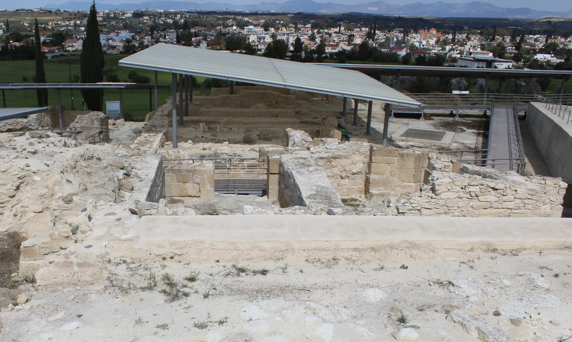
The city lay on what was then a meander of the Yialias. The river later changed its course, and the site now lies about a third of a mile south of the present riverbed [1, p. 52]. The west acropolis, called Ambelleri, carries the sanctuary of Athena on its summit. On its eastern flank, about 25 m below the summit and 15 m above the lower city to the north, a broad terrace of about 2 ha, the west terrace, held the palace and later the Phoenician administrative centre [5, p. 5]. The east acropolis, Moutti tou Arvili, carries another sanctuary on its summit and a terrace of public buildings below it [1, pp. 54–56]. The main road from Nicosia to Larnaca now runs through the gap between the two hills, where the American excavators placed the ancient main entrance of the city [5, p. 463].
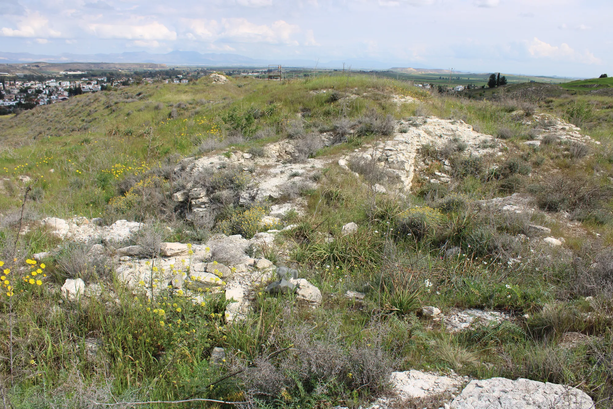
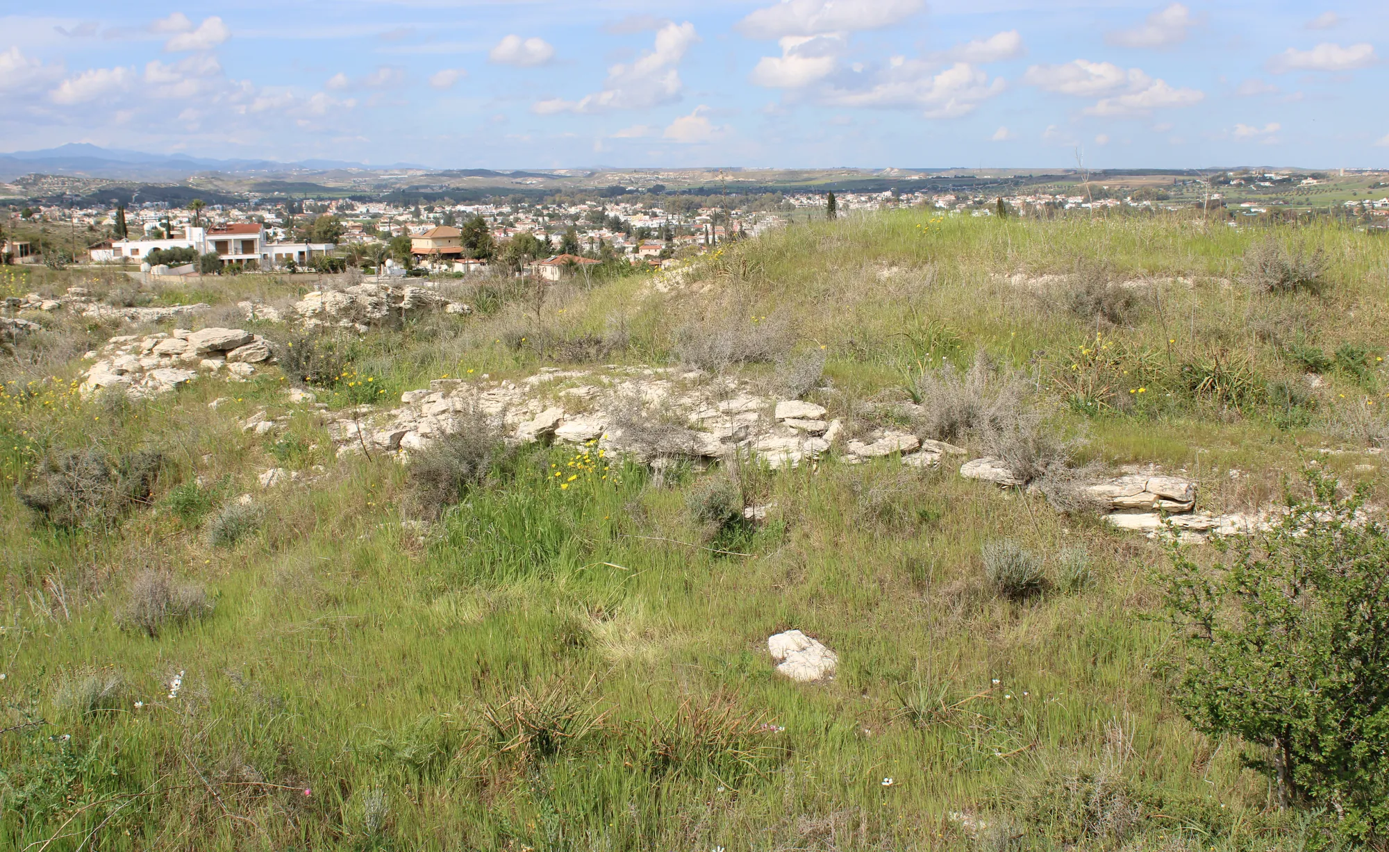
A fortification wall ran from the west acropolis round the lower city. Lawrence Stager and Anita Walker estimated that it enclosed about 40 ha, and from the size of the walled area they calculated a population of 8,000 to 10,000. An ethnographic study of the catchment round modern Dali found that traditional farming could feed at most about 1,500 people, so most of the city's inhabitants must have lived by work other than farming [5, p. 463].
Plan · the walled city, early 5th to late 4th century BC
The city of Idalion
Dali, the two acropoleis and the walled lower city
Choose a number on the plan, or a name below, to read what was found there and how well it is known.
Key
- City wall, excavated
- City wall, as the 1989 plan draws it
- Line of the wall, uncertain
- Main road today
- Excavated area laid out today
- American Expedition area, 1971 to 1980
- Contours at 5 m
That work was largely copper. The copper-bearing foothills of the Troodos lie 10 to 15 km away, and pottery of the city's periods is scattered round the ancient mines of the Sha, Mathiati and Lythrodonda area, which suggests that Idalion's territory reached that far. The geologist Frank Koucky traced an old road leading west from the gap between the acropoleis towards the mines [5, p. 463; 6]. By the Cypro-Archaic period the first smelting was done at the mines, and Idalion was a centre for the final processing of the metal, on the route from the mines to the port of Kition [1, p. 56]. The wider story is told in copper metallurgy and in our article on copper and the city-kingdoms.
Map of Cyprus
- Ground above 200, 500, 1,000 m
Discovery and excavation
Because the name survived in Dali, the site has never been lost, and it has been dug, legally and otherwise, for more than 150 years [1, p. 52; 2, p. xxii]. The bronze tablet came to light in 1850 or 1851 [1, p. 55]. The Marquis Melchior de Vogüé visited in 1862 but left no exact record. Luigi Palma di Cesnola dug at Idalion "off and on" between 1867 and 1875, claimed to have opened 15,000 tombs, and exposed a structure on the summit of the east acropolis; his collection became the founding core of the Metropolitan Museum of Art [1, p. 53].
In the summer of 1868 workmen came upon limestone statuary, and Robert Hamilton Lang excavated the spot for two months that year and again in 1869. He had found a sanctuary of the god called Reshef-Mikal in Phoenician and Apollo Amyklos in Greek [1, p. 53; 7; 8]. Many of its statues were bought from Lang by the British Museum. Max Ohnefalsch-Richter dug at Idalion in 1883 and 1885 and returned many times. He surveyed and mapped the site, found the remains of five sanctuaries, and published his plan in Kypros, the Bible and Homer [1, pp. 53–54; 9]. Pamela Gaber calls him "the last of the nineteenth-century antiquarians and the first of the twentieth-century archaeologists" [1, p. 54].
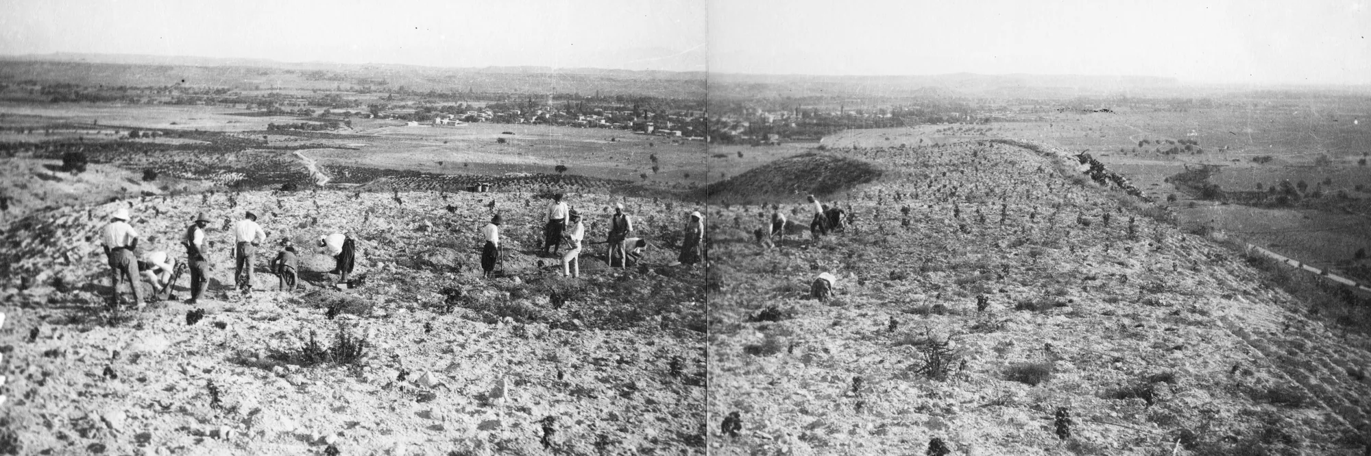
The Swedish Cyprus Expedition under Einar Gjerstad excavated the summit of the west acropolis completely, sounded the terrace below it, and opened tombs of the Cypro-Archaic to Hellenistic periods outside the city wall. The sequence of the acropolis became one of the foundations of Gjerstad's pottery chronology for the Iron Age [1, p. 54; 10].
From 1971 to 1980 the American Expedition to Idalion, set up through G. Ernest Wright of Harvard and directed by his students Lawrence Stager and Anita Walker, surveyed the city and its hinterland and excavated areas A to G: houses in the west lower city, the palace on the west terrace, the lower city wall and the east terrace [1, p. 54; 5, p. 4]. Its first report appeared in 1974 and its final report in 1989 [2; 5]. In 1972 Stager and Walker went looking for Lang's temple where Ohnefalsch-Richter's plan placed it, and found a Roman villa and bath house instead. Allowing for a deviation of about 12 degrees in the old compass bearings, caused by the magnetic rocks of the Troodos, they moved their trenches some 225 m to the south-east and found a Hellenistic administrative building on the east terrace [1, pp. 58–59; 11].
Pamela Gaber dug on the west terrace and in the lower city for the University of New Hampshire in 1987, and from 1992 for the University of Arizona and then Lycoming College, mainly in the lower city and on the terrace of the east acropolis [1, pp. 56, 58–59; 12]. From 1991 the Department of Antiquities under Maria Hadjicosti excavated the west terrace and the lower slopes of Ambelleri, where the Phoenician archive was found between 1992 and 2012 [1, p. 57; 4, p. 194]. In recent years the Berlin-Idalion-Project of Stephan G. Schmid has worked on the summit of the east acropolis [13].
Phases of the city
The date of Idalion's foundation is disputed. Gjerstad dated the first fortified settlement on the west acropolis to Late Cypriot III, about 1200 to 1050 BC. Stager and Walker found little Late Cypriot settlement and none of the earliest Cypro-Geometric phases [1, pp. 54–55]. Later excavation by Gaber and the Department of Antiquities found industrial installations of the Late Cypriot period and the Geometric period in the lower city and on the lower slopes of Ambelleri [1, p. 58], and Gaber sees the Bronze Age town across the river at Agios Sozomenos as Idalion's predecessor [1, p. 61; 14].
Phases
- Late Cypriot installations13th–11th century BC
Industrial installations in the lower city and on the lower slopes of Ambelleri. Gjerstad dated the first fortified settlement on the west acropolis to Late Cypriot III.
- Cypro-Geometric and early Cypro-Archaicabout 850–600 BC
A fortified sanctuary of Athena on the west acropolis. A monumental building on the west terrace by the 7th century BC. Edi'il on Esarhaddon's prism.
- The independent kingdom at its heightlate 6th to early 5th century BC
Houses in the west lower city; coins of four kings.
- Rebuilding and siegeabout 475 BC
A city wall and a new palace on the west terrace. The siege by the Medes and the Kitians falls in the first half of the century.
- Kitian ruleabout 450 to the late 4th century BC
A Phoenician administrative centre on the ruins of the palace, with its archive. The lower city goes on without a break.
- Hellenisticfrom about 300 BC
The west terrace centre ends; a new administrative building on the east terrace.
- Roman and laterfrom the 1st century BC
Idalion shrinks to an agricultural village, the village of Dali.
The west acropolis and the sanctuary of Athena
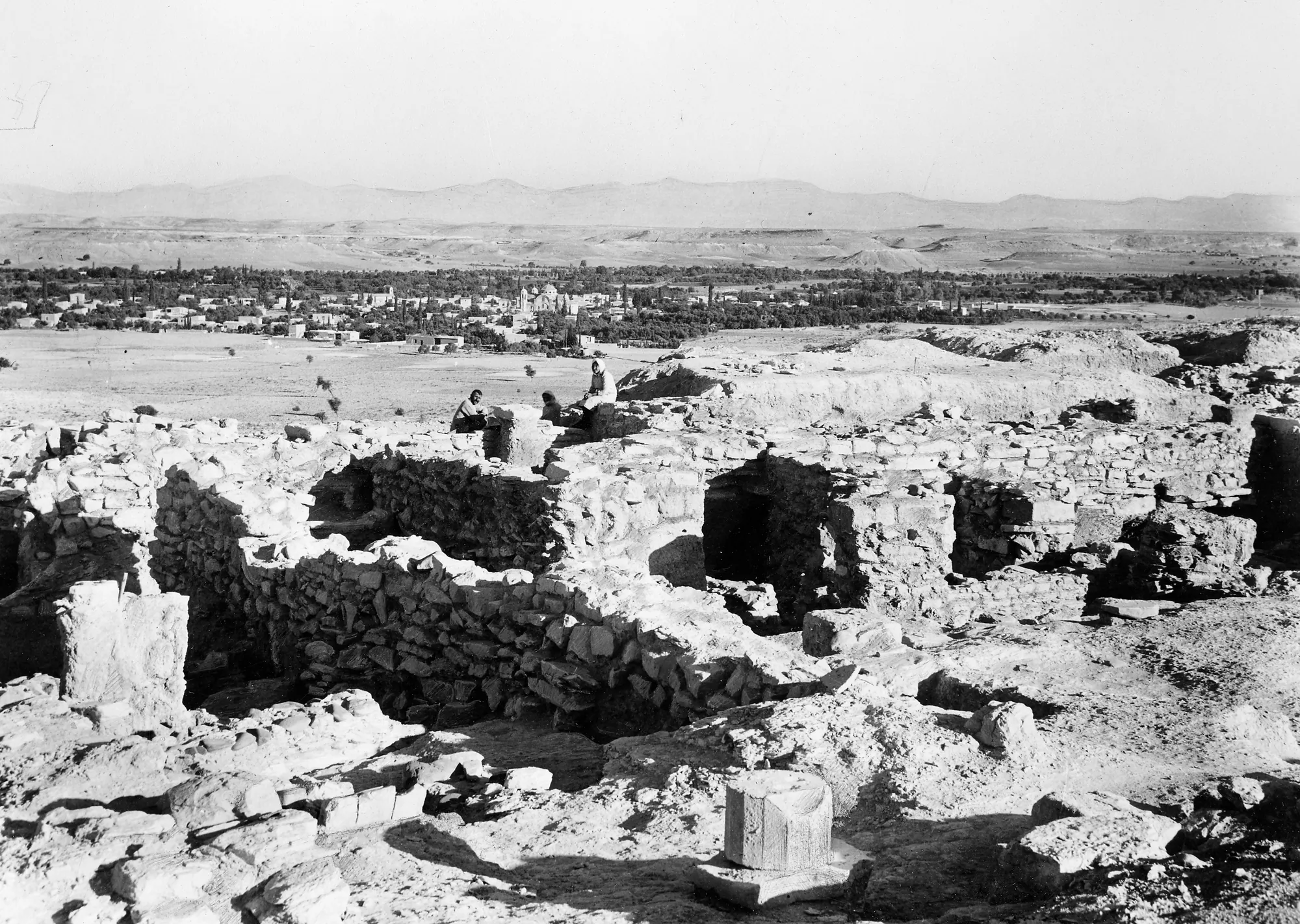
On the summit of Ambelleri the Swedish expedition found a fortified settlement with a shrine, which Gjerstad dated to Late Cypriot III. In Cypro-Geometric III it was replaced by a new fortification and a sanctuary with a court and an altar, dedicated to a goddess known in Phoenician as Anat and in Greek as Athena. The sanctuary lasted into the early Cypro-Classical period, to about 475 BC [1, p. 54]. The bronze tablet was found on this hill, and the king and city of its text dedicated it to Athena, "she (who protects) the area around Idalion" [1, p. 55; 15, p. 219].
The palace on the west terrace
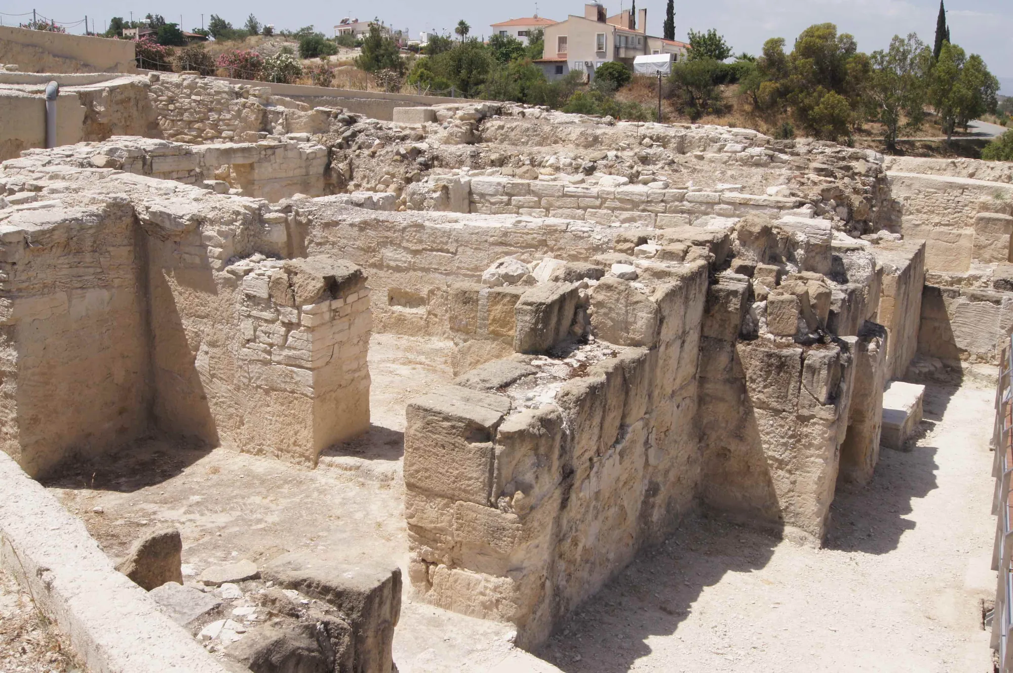
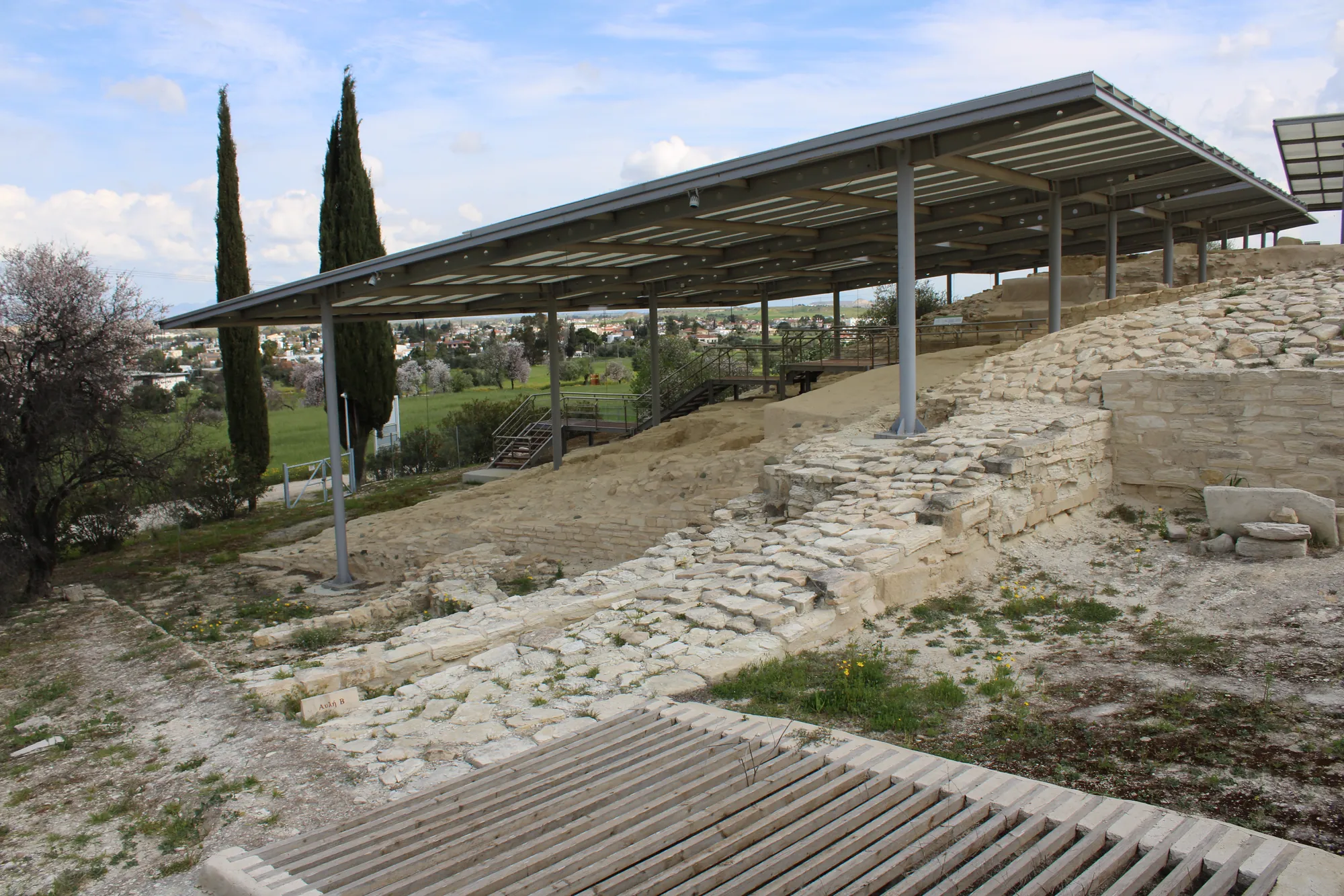
In his last days at Idalion Gjerstad cut a narrow trench across the west terrace and suspected a palace there. The American Expedition sounded the terrace in areas C and D in 1977 and 1978 and enlarged the work in 1980 [5, p. 5], when Stager exposed enough monumental architecture to name the building the Palace [1, p. 55]. It is built of sandstone ashlar set in gypsum mortar, like the lower city wall. Stager dated its foundation to about 475 BC, and Phoenician inscriptions first appear in the fourth phase of a room in area D [5, pp. 11, 463].
Gaber's soundings of 1987 showed that the terrace held more than one building. A North Building, founded in the 7th century BC at the latest, had walls more than a metre thick of a hard sandstone brought from about 30 km away, and a street beside it of about 600 BC had a worn kerb. A metre of destruction debris of about 450 BC lay over the buildings [1, pp. 56–57].
The bronze tablet and the siege of Idalion
The bronze tablet from Idalion (ICS 217) is now in the Cabinet des médailles of the Bibliothèque nationale de France in Paris [1, p. 55; 3, p. 143]. It is inscribed in the Cypriot syllabary, in the Arcado-Cypriot dialect of Greek, and is the longest text known in that script [3, p. 141] (see writing and literacy).
In Beatrice Pestarino's translation the text opens: "When the Medes (Persians) and Kitians besieged the city of Idalion in the year of Philokypros, son of Onasagoras". King Stasikypros and the city of Idalion had called on the physician Onasilos, son of Onasikypros, and his brothers to treat the men wounded in the fighting without fee. In return the king and the city promised them a talent of silver, and in its place gave them a plot of the king's land in the district of Alampria, with its young trees, to hold free of taxes for ever. Onasilos alone was promised a further sum of silver, and received instead land of the king in the valley of Malania, reaching to the river Drymios, and a garden. Anyone who evicted the family was to pay the sum in silver. The king and the city dedicated the tablet to Athena and placed a curse on anyone who broke its terms [15, p. 219]. The text is a land grant to one family, and its value for the history of medicine lies in the payment it records for a physician's work in wartime.
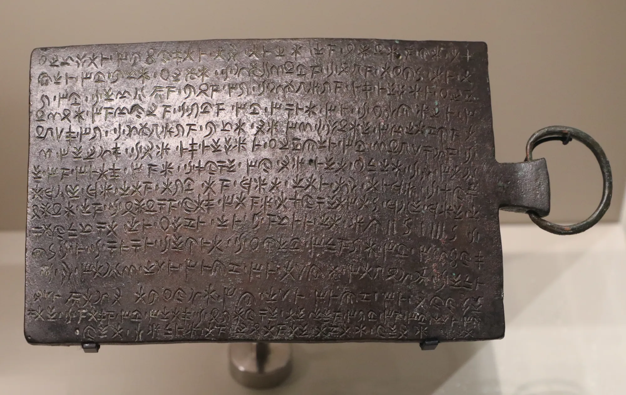
The king and the city act together throughout, and the tablet is the best-known evidence that a Cypriot king shared some decisions with the citizen body; scholars describe it as a form of mixed government [1, p. 55]. The "Medes" of the text are the Persians (see Achaemenid Persia) [1, p. 55].
The date of the siege is debated. Gjerstad placed it in 499/498 BC, during the Ionian Revolt, because he dated the end of the administrative centre to about 470 BC. Stager, Walker and Wright put it between 475 and 450 BC and identified Stasikypros with the king whose name begins "Sa" on the last coins of Idalion [1, p. 55]. Anna Georgiadou, re-examining the tablet, dates it broadly to the first quarter of the 5th century, after 499 and before 475 BC [3, p. 171]. Miltiades Hatzopoulos has also returned to the question [16].
The coins themselves begin late in the 6th century. After a group of issues without inscriptions, four kings struck coins with a seated sphinx and a lotus flower or an incuse square, with legends in the syllabary [2, p. xxii; 1, p. 54]. Georgiadou sets Athena's place in the tablet beside the helmeted head of Athena on the last coin series [3, p. 183] (see coins).
Kition takes Idalion
The siege recorded on the tablet was followed by the conquest of Idalion by Kition. The Kitian king Ozibaal struck coins as "king of Kition and Idalion", and a later title added Tamassos [1, p. 55; 5, p. 19]. Two bilingual inscriptions from Frangissa name "the king of Kition and Idalion" [17, p. 57]. Gjerstad dated the conquest to about 470 BC and Stager and Walker to about 450 BC; Gaber links it with the disarray of the Greek cities after the failure of Cimon's expedition in 449 BC [1, pp. 55–56]. Antoine Hermary has studied the last years of the kingdom and its annexation through the limestone sculptures offered in its sanctuaries in the second and third quarters of the 5th century BC [18, p. 99]. Gaber's explanation of Kition's interest is copper: whoever held Idalion controlled the processing of the metal on its way from the mines to the sea [1, p. 56] (see Phoenicians).
The buildings on the west terrace came to a violent end about 450 BC [1, p. 57]. On their foundations the Kitians built a new administrative complex [17, p. 59]. Its two series of long rooms lie north and west of a large courtyard; most of the ten rooms excavated by 1997 held storage jars in place, and slag, crucible fragments and stone vessels in Room 10 and Courtyard A show that metal was worked there [17, pp. 57–58].
The Phoenician archive
The archive was found on the floors of the complex. Ostraca, mostly in Phoenician with a few in the syllabary, lay chiefly on the paved floor of Room 1 in the north wing; a larger group written in black ink on gypsum plaques came from Rooms 6 and 8 in the west wing. Olivier Masson and Maurice Sznycer read them as the economic records of the Phoenician administration [17, p. 58]. Coins found with them, down to issues of Pumiathon of Kition and of Alexander the Great, date the group to the late 5th and 4th centuries BC [17, p. 59]. The catalogue of the 2012 exhibition Ancient Cyprus: Cultures in Dialogue counted more than 500 inscribed slabs of marble and limestone, with many inscribed potsherds, and described the archive as tax records and as "the largest Phoenician archive excavated so far and the only one referring to the administration of a city" [4, p. 194]. The texts are being published by Maria Giulia Amadasi Guzzo and José Ángel Zamora, who took over the study after Sznycer's death in 2010 [19, p. 86].
One ostracon reads "In the 1st year of Antigonos and Demetrios, over Alashiya". It dates to 306 BC, the first year of the rule of Antigonos Monophthalmos and his son Demetrios Poliorketes over Cyprus, and shows the Phoenician administration still at work. It is also the first time the island's Phoenician name, Alashiya, a name known from the Late Bronze Age, is found in a Phoenician text [19, p. 86].
Life in the lower city
The lower city went on through the change of rulers. In the west lower city the American Expedition excavated a quarter of houses first built in the late 6th century BC and lived in without a break beyond the conquest [5, p. 462; 1, p. 57]. In Gaber's Building B olive oil was produced; about 450 BC a fire destroyed one room, and a larger oil works was built at once on the same spot [1, p. 57]. Industrial work in the lower city runs from the Late Cypriot period to at least the 2nd century BC [1, p. 58]. A Greek Geometric kantharos found beneath the lower city wall, in a context of the Cypro-Archaic I period, shows contact with the Aegean by about 750 BC [5, p. 462].
The city wall
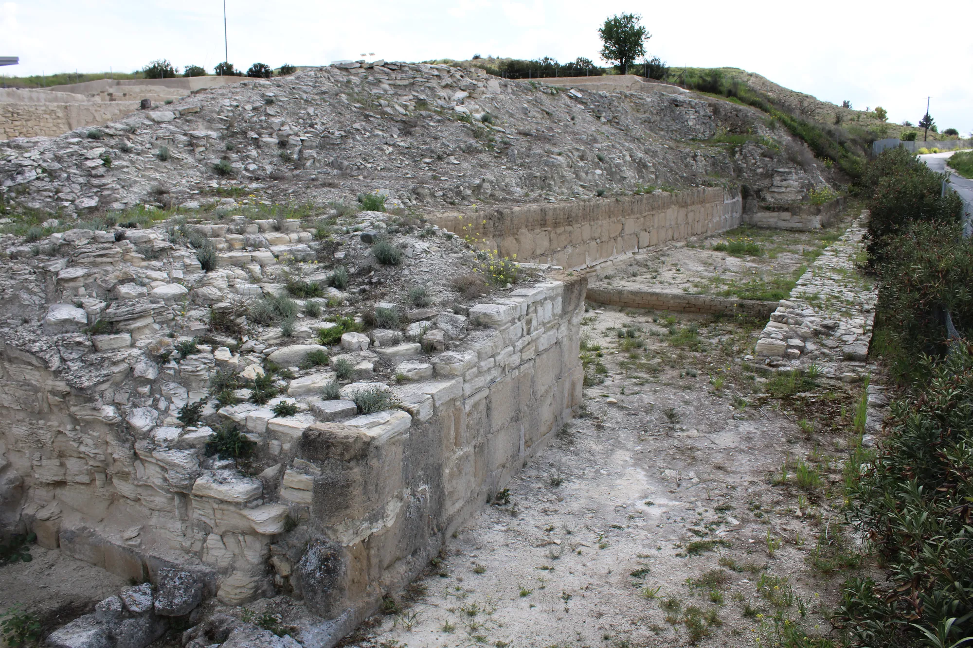
The wall is built with a core of limestone rubble faced on both sides with ashlar, mostly limestone, with sandstone on parts of the outer face; it probably carried a mudbrick superstructure. On the west terrace, in area D, a section of the citadel wall is 10.75 m wide and stands 7.80 m high; in the lower city the wall survives only 1.60 m high and 4.25 m wide, with one bastion 8.25 m across [5, pp. 462–463]. Stager and Walker thought the widest section might be a thickened bastion or pier, and that the builder was "one of the kings of independent Idalion prior to its conquest by Kition"; the date is about 475 BC [5, pp. 19, 463]. A bastion faced with sandstone in the lower city may be one side of a gate, perhaps the "Tamassian gate" named in an ostracon [5, p. 463] (see fortifications).
Sanctuaries
Idalion had many sanctuaries in and around the city. Their sculpture is now divided among museums in Nicosia, London, New York, Paris, Berlin, Vienna, Oxford and Stockholm.
The sanctuary of Reshef-Mikal and Apollo
The sanctuary Lang excavated in 1868 and 1869 was founded in the Cypro-Archaic period. Stager and Walker place it in the valley at the foot of the east acropolis [5, p. 462], and Reinhard Senff has published its architecture and sculpture [20]. Its votive statues of limestone and terracotta, of men with wreaths or helmets, temple boys and figures of the god as a master of lions, belong to a local school of Archaic limestone sculpture that Gaber has studied as the regional style of Idalion [5, p. 463].
 Cypriot Lion God StatueArchaic II · 500–450 BCBritish Museum
 Cypriot Herakles HeadClassical · 475–450 BCBritish Museum
 Bearded Worshipper StatueArchaic II · 570–540 BCBritish Museum
 Limestone Helmeted WorshipperArchaic II · 525–500 BCBritish Museum
 Crouching Temple Boy StatueClassical · 510–410 BCBritish Museum
The east acropolis
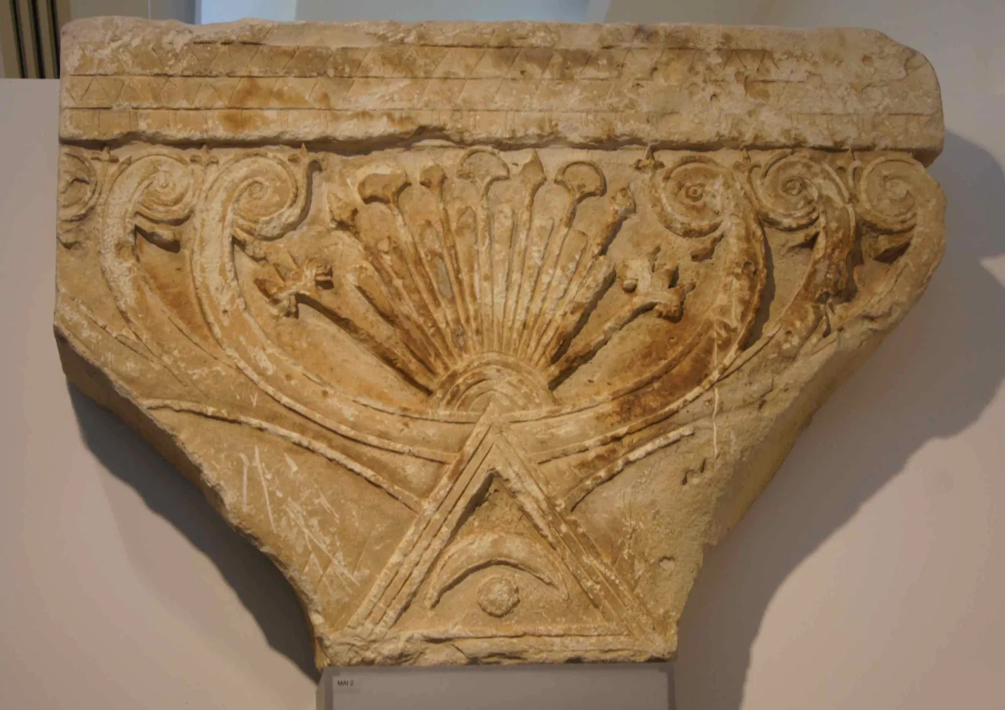
Ohnefalsch-Richter excavated on the southern end of the east acropolis what he called "the great chief sanctuary of the Idalion Aphrodite" [1, p. 54]. The Berlin-Idalion-Project has returned to the summit, and in 2022 found an inscribed statue plinth of a female votary with a Greek inscription of the Hellenistic period [13, p. 327]. A large carved capital in the form of a tree of life, found in 1894 on the eastern part of the acropolis, once crowned a votive stele; it is now in Vienna.
On the terrace below the summit, in 1992, Gaber found the steps of an open-air sanctuary that she identifies as Lang's temple. It was founded in the late Geometric or early Archaic period and used into Roman times. She reads it as a sanctuary of the Wanax, the lord and consort of the Wanassa, and connects it with the cult of Adonis [1, p. 59]. Stager and Walker placed Lang's temple in the valley below, so where Lang dug, and whether the terrace sanctuary is the same place, remains an open question.
Other sanctuaries
A temenos of a kourotrophos goddess, a goddess holding a child, has been published from the American Expedition's material by Cecilia Beer [21], and Gaber has published a city sanctuary in the south of the lower city [22]. A group of sculptures in the Ashmolean Museum is the earliest find-assemblage from Idalion with a recorded provenance in that collection [23] (see also temple boys and horse-and-rider figurines).
Pieces in the Drakopoulos collection of kinds found at this site. None of them comes from the site.
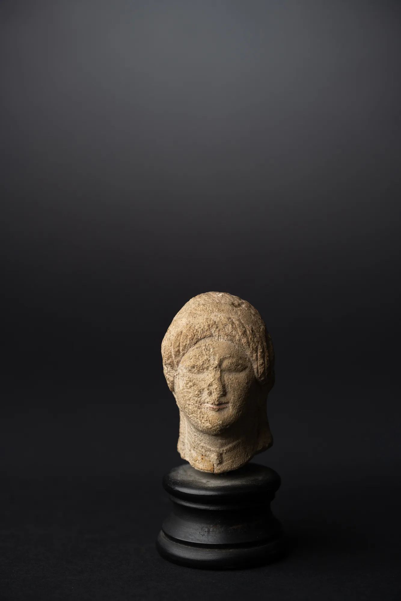 Limestone Head of a Votary with a WreathClassical · 475–400 BCDrakopoulos collection
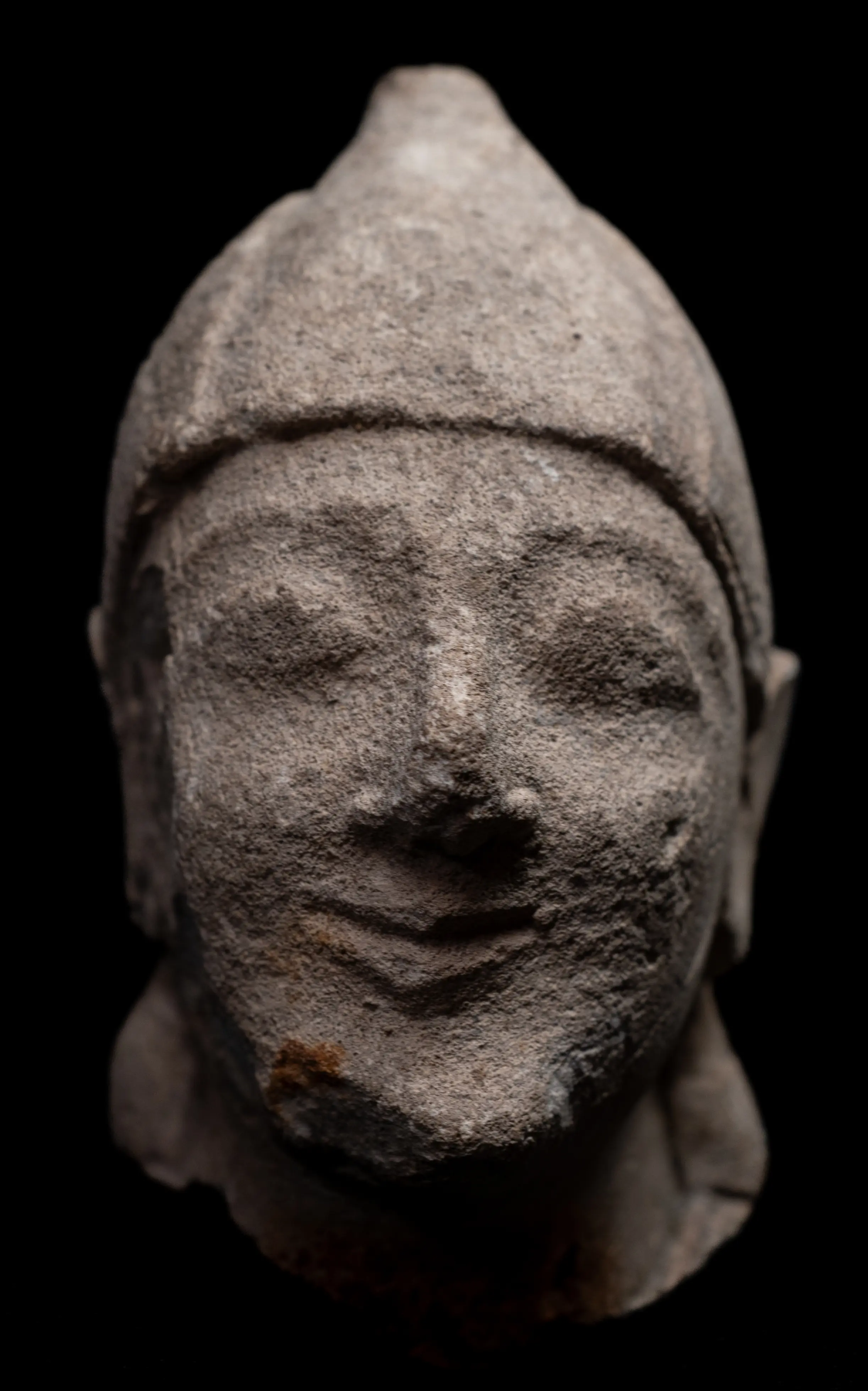 Limestone Head of a Beardless Votary in a Conical HelmetArchaic II · 600–500 BCDrakopoulos collection
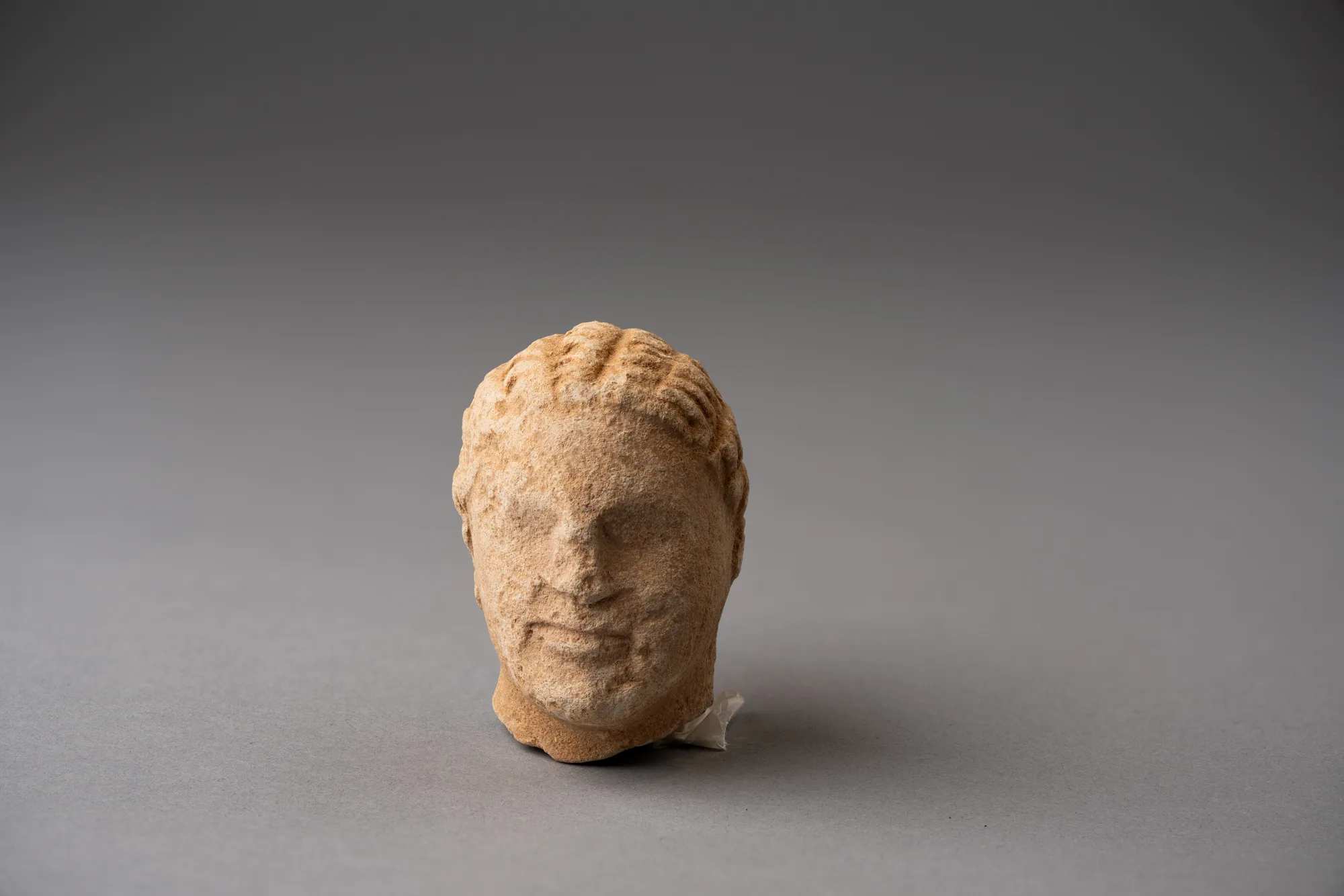 Limestone Head of a Boy, probably from a Temple Boy StatuetteClassical · 450–300 BCDrakopoulos collection
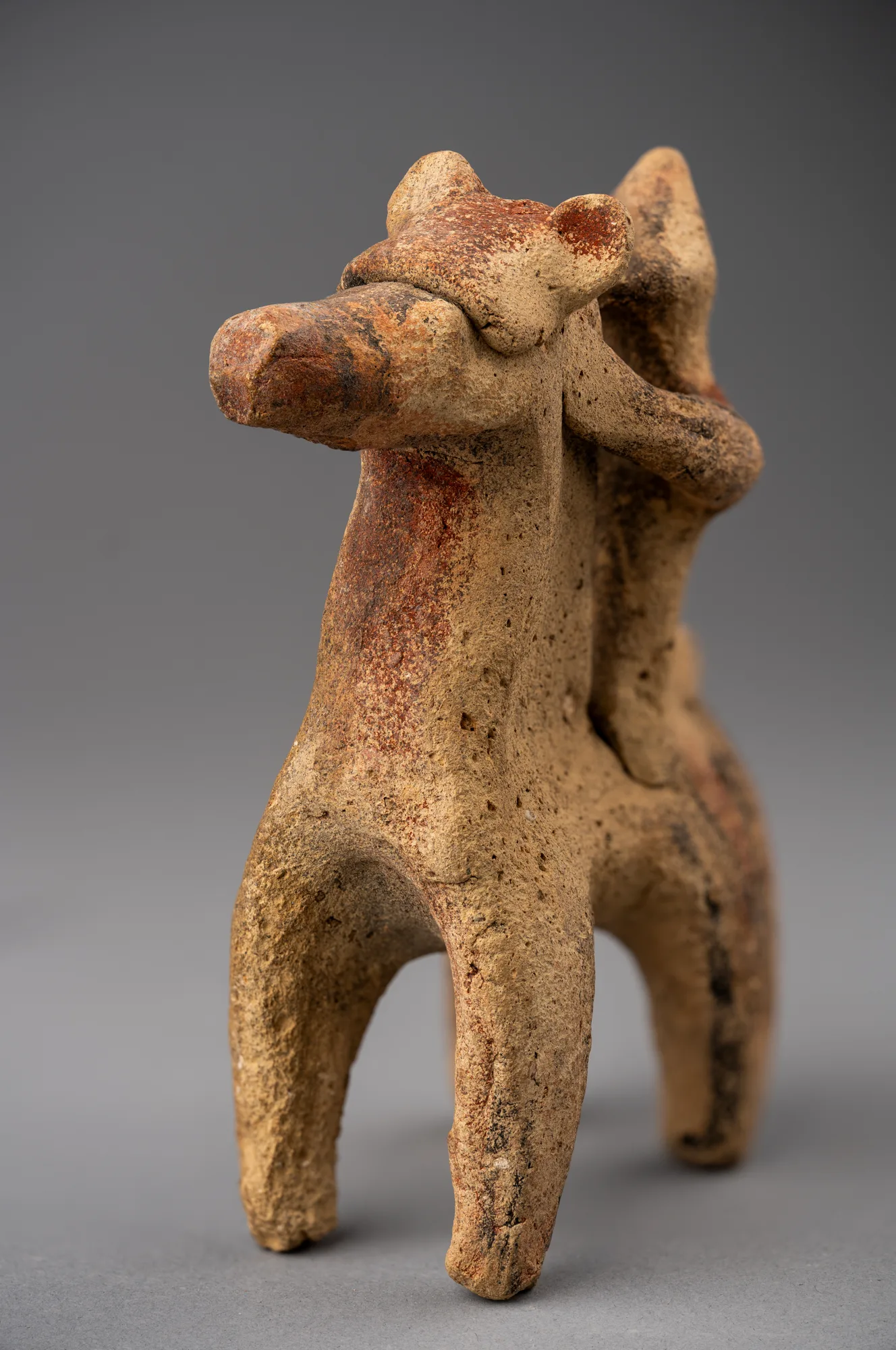 Horse and Rider Figurine with a Painted Star on the NeckArchaic II · 600–480 BCDrakopoulos collection
Cemeteries
The cemeteries lie east and west of the city and range from the Late Bronze Age to the Roman period [1, pp. 52, 54]. Cesnola's claim to have opened 15,000 tombs cannot be checked [1, p. 53]. Ohnefalsch-Richter recorded built chamber tombs, which Schmid and Caroline Huguenot have re-examined [24]. The Swedish expedition excavated tombs of the Cypro-Archaic to Hellenistic periods outside the city wall [1, p. 54]. The American final report publishes a Late Cypriot IIC tomb, Idalion Tomb 1.76 [5, pp. 119–201], and a recent study describes Locus 20 in the necropolis of Idalion-Platia, a deposit of the Early Iron Age [25].
Hellenistic and Roman Idalion
Just before 300 BC the administrative complex on the west terrace was abandoned, and an industrial installation was built over its remains. A new administrative building, faced with gypsum, went up on the terrace of the east acropolis [1, p. 56; 11]. This is the building that Stager and Walker found in 1972.
In the Roman period, the ore came to be smelted in a single process at the mines, the need for processing at Idalion ended, and the main road shifted to Ledra. In the Late Antique and medieval periods Idalion "shrank to an agricultural village" on the banks of the Yialias [1, p. 62]. Pliny the Elder lists Idalion among the former towns of Cyprus, though the excavations show that the site was still lived in under Rome [2, p. xxii]. To the Latin poets from Virgil onwards Idalion was a grove of Venus [2, p. xxii]. The modern village continued on the site, and after 1974, when the main road from Nicosia to Larnaca was cut and the road between the two acropoleis became the main route again, Dali doubled in size [1, p. 62].
Visiting Idalion
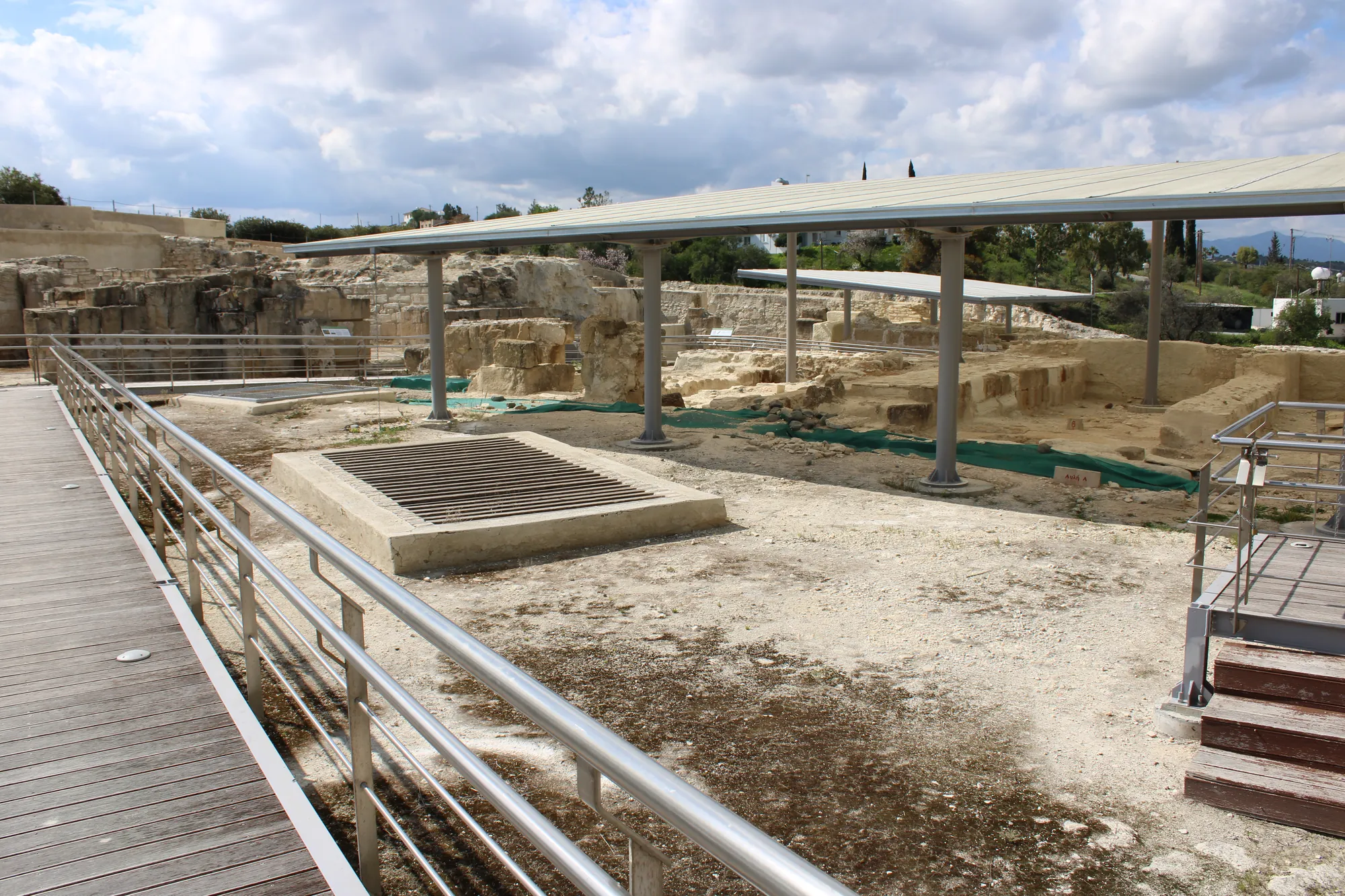
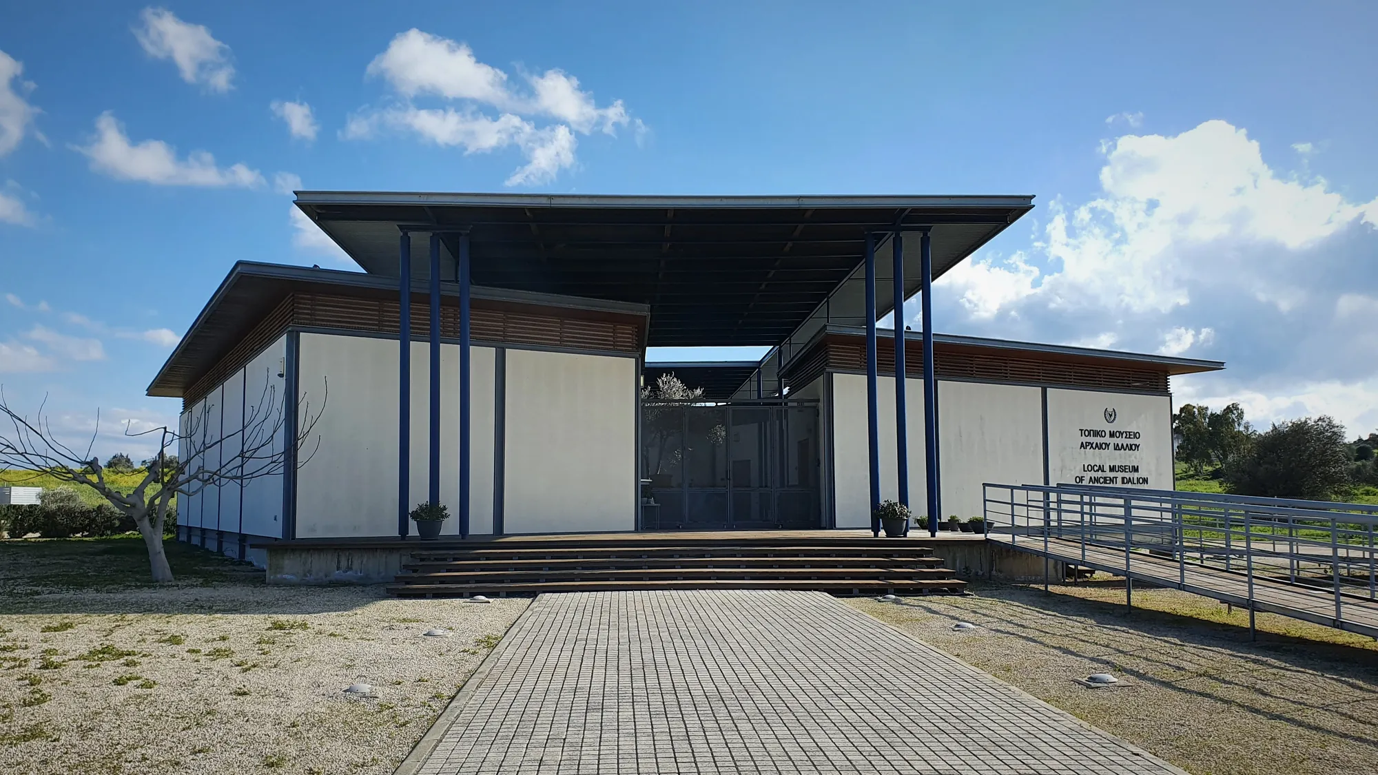
The excavated complex on the west terrace is protected by a modern roof and laid out for visitors with a walkway. Little is visible on the summit of the west acropolis. The Local Archaeological Museum of Ancient Idalion is in the village of Dali. Many of the most important finds are abroad: the bronze tablet in Paris, the sculpture from Lang's excavations in the British Museum, Cesnola's finds in New York, and the finds of the Swedish expedition in the Medelhavsmuseet in Stockholm. Finds from the modern excavations are in the Cyprus Museum and the Dali museum.
Finds from Idalion
- Cypriot Lion God StatueArchaic II · 500–450 BCBritish Museum
- Cypriot Herakles HeadClassical · 475–450 BCBritish Museum
 Achaemenid Persian HeadClassical · 475–450 BCBritish Museum
- Bearded Worshipper StatueArchaic II · 570–540 BCBritish Museum
- Limestone Helmeted WorshipperArchaic II · 525–500 BCBritish Museum
- Crouching Temple Boy StatueClassical · 510–410 BCBritish Museum
 Archaic Greek Kouros FigurineArchaic II · 600–540 BCBritish Museum
 Kouros StatuetteArchaic II · 500–475 BCBritish Museum
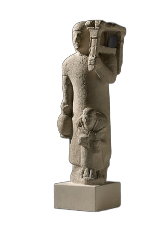 Limestone Votive GroupArchaic II · 600–550 BCBritish Museum
 Terracotta Lyre Player FigureArchaic II · 650–550 BCBritish Museum
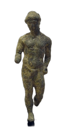 Bronze Doryphoros FigurineClassical · 440–420 BCBritish Museum
 Tree of lifeArchaic II · 650–550 BCVienna Museum
In the Drakopoulos collection
Pieces in the Drakopoulos collection of kinds found at this site. None of them comes from the site.
- Limestone Head of a Votary with a WreathClassical · 475–400 BC
- Limestone Head of a Beardless Votary in a Conical HelmetArchaic II · 600–500 BC
- Limestone Head of a Boy, probably from a Temple Boy StatuetteClassical · 450–300 BC
- Horse and Rider Figurine with a Painted Star on the NeckArchaic II · 600–480 BC
Excavation history
- 1845–1846Mas Latrie and Cerruti's small digs at DaliDirected by Louis de Mas Latrie and Marcello CerrutiClearance and early digging
- 1857Captain Sicard's dig, 1857Directed by Captain SicardClearance and early digging
- 1862–1865Golgoi and Athienou: the Vogüé MissionDirected by Melchior de Vogüé and Edmond DuthoitExcavation
- 1862The French consul's digs with Cesare MatteiDirected by Napoléon Antoine Aimé Péretié and Cesare MatteiClearance and early digging
- 1866–1875Luigi Palma di Cesnola's excavations at DaliDirected by Luigi Palma di CesnolaClearance and early digging
- 1867Colonna-Ceccaldi's digs at DaliDirected by Tiburce Colonna-CeccaldiClearance and early digging
- 1868–1869Idalion, Goshi and Pyla: Robert Hamilton Lang's excavations (sanctuary of Apollo)Directed by Robert Hamilton LangClearance and early digging
- 1883Ohnefalsch-Richter's excavations for the British Museum, 1883Directed by Max Ohnefalsch-RichterExcavation
Show all 22 projects
- 1885Ohnefalsch-Richter and Dummler's tomb clearance, 1885Directed by Max Ohnefalsch-RichterClearance and early digging
- 1885–1886The sanctuary of Aphrodite dug for Charles WatkinsDirected by Max Ohnefalsch-RichterExcavation
- 1887Ohnefalsch-Richter's survey and trial digs on Moutti tou Arvili, 1887Directed by Max Ohnefalsch-RichterSurvey
- 1888–1895The Berlin Museums' excavations under Ohnefalsch-RichterDirected by Max Ohnefalsch-Richter and Adolf FurtwänglerExcavation
- 1908Eustathios Constantinides's excavation, 1908Directed by Eustathios ConstantinidesExcavation
- 1928The Swedish Cyprus ExpeditionDirected by Erik Sjöqvist and Einar GjerstadExcavation
- 1957Yialias valley (Ayios Sozomenos and Idalion): Catling's surveyDirected by Hector CatlingSurvey
- 1963–1967Department of Antiquities tomb rescues, 1963–1967Directed by Vassos Karageorghis, Michael Loulloupis and A. ChristodoulouRescue excavation
- 1970–1980The American Expedition to IdalionDirected by G. Ernest Wright, Lawrence E. Stager, Anita Walker and othersExcavation
- 1987–todayPamela Gaber's excavations (New Hampshire, Arizona and Lycoming College)Directed by Pamela GaberExcavation
- 1991–2012The Department of Antiquities excavations at AmbelleriDirected by Maria HadjicostiExcavation
- 1995–1997Idalion Survey ProjectDirected by Margaret Morden and Sarah StewartSurvey
- 2011–2012Idalion-Platia: Department of Antiquities rescue of the Iron Age necropolisDirected by Anna SatrakiRescue excavation
- ongoingThe Berlin-Idalion-ProjectDirected by Stephan G. Schmid and George PapasavvasExcavation
In the news
·Events
Cesnola's biographer Anna Marangou lectures on him and the Ohnefalsch-Richters on 2 November·Jobs & funding
Swedish Cyprus Expedition centenary conference in Nicosia calls for papers by 31 October·Research
Strabo's Arsinoe near Palaepaphos probably never existed, argues study of a Ptolemaic queen's cult·Museums
This Week in Cypriot Archaeology: 12–18 October 2026·Research
This Week in Cypriot Archaeology: 14–20 September 2026
Nearby sites
- Dhali-Agridhi0.7 km
- Dhali-Kafkallia0.9 km
- Idalion, sanctuary of Reshef-Apollo0.9 km
- Dali-Ayios Georghios0.9 km
- Dhali-Petrera0.9 km
- Pera Chorio-Moutti3.1 km
Straight-line distances.
References
- 1.Gaber, P. (2008). The History of History: Excavations at Idalion and the Changing History of a City-Kingdom. Near Eastern Archaeology, 71(1/2), 52–63. https://www.jstor.org/stable/20361348
- 2.Stager, L. E., Walker, A., & Wright, G. E. (Eds.). (1974). American Expedition to Idalion, Cyprus: First Preliminary Report, Seasons of 1971 and 1972 (Bulletin of the American Schools of Oriental Research Supplement 18). American Schools of Oriental Research.
- 3.Georgiadou, A. (2010). La tablette d'Idalion réexaminée. Cahiers du Centre d'Études Chypriotes, 40, 141–203. https://doi.org/10.3406/cchyp.2010.961
- 4.Pilides, D., & Papadimitriou, N. (Eds.). (2012). Ancient Cyprus: Cultures in Dialogue. Department of Antiquities, Cyprus.
- 5.Stager, L. E., & Walker, A. M. (Eds.). (1989). American Expedition to Idalion, Cyprus, 1973-1980 (Oriental Institute Communications 24). Oriental Institute of the University of Chicago. https://isac-assets.s3.amazonaws.com/isac-publications/oic24.pdf
- 6.Koucky, F. L., & Steinberg, A. (1989). Ancient Mining and Mineral Dressing on Cyprus. In L. E. Stager & A. M. Walker (Eds.), American Expedition to Idalion, Cyprus 1973-1980 (Oriental Institute Communications 24, pp. 275–327). Oriental Institute of the University of Chicago.
- 7.Lang, R. H., & Poole, R. S. (1878). Narrative of Excavations in a Temple at Dali (Idalium) in Cyprus, with observations by R. S. Poole. Transactions of the Royal Society of Literature, 2nd ser., 11, 30–71.
- 8.Kiely, T. (2020). Robert Hamilton Lang and the Archaeology of Cyprus. Cahiers du Centre d'Études Chypriotes, 50, 483–523. https://journals.openedition.org/cchyp/536
- 9.Ohnefalsch-Richter, M. (1893). Kypros, the Bible and Homer. Asher & Co. https://archive.org/details/kyprosbiblehomer01ohneuoft
- 10.Gjerstad, E., Lindros, J., Sjöqvist, E., & Westholm, A. (1935). The Swedish Cyprus Expedition: Finds and Results of the Excavations in Cyprus 1927-1931, Vol. II (text). The Swedish Cyprus Expedition. https://archive.org/details/in.ernet.dli.2015.106120
- 11.Doermann, R. W. (1974). The Hellenistic Buildings on the East Terrace (Part 6). In L. E. Stager, A. Walker, & G. E. Wright (Eds.), American Expedition to Idalion, Cyprus: First Preliminary Report, Seasons of 1971 and 1972 (Bulletin of the American Schools of Oriental Research Supplement 18, pp. 63–76). American Schools of Oriental Research.
- 12.Gaber, P., & Dever, W. G. (1996). Idalion, Cyprus: Conquest and Continuity. In W. G. Dever (Ed.), Preliminary Excavation Reports: Sardis, Idalion, and Tell el-Handaquq North (Annual of the American Schools of Oriental Research 53, pp. 85–113). American Schools of Oriental Research.
- 13.Schmid, S. G., & Summa, D. (2024). A recently discovered inscribed statue 'plinth' of a female votary from Idalion-Moutti tou Arvili. Cahiers du Centre d'Études Chypriotes, 54, 327–346.
- 14.Devillers, B., Gaber, P., & Lecuyer, N. (2004). Notes on the Agios Sozomenos Bronze Age Settlement (Lefkosia district): Recent Palaeoenvironmental and Archaeological Finds. Report of the Department of Antiquities, Cyprus, 2004, 85–92.
- 15.Pestarino, B. (2022). Kypriōn Politeia: the Political and Administrative Systems of the Classical Cypriot City-Kingdoms (Mnemosyne Supplements: History and Archaeology of Classical Antiquity). Brill.
- 16.Hatzopoulos, M. (2011). 'Factoides' et la date du Bronze d'Idalion. In A. Dimitriou (Ed.), Proceedings of the IVth International Cyprological Congress, I.2, Nicosia, April 29-May 3, 2008 (pp. 499–506). Nicosia.
- 17.Hadjicosti, M. (1997). The Kingdom of Idalion in the Light of New Evidence. Bulletin of the American Schools of Oriental Research, 308, 49–63.
- 18.Hermary, A. (2005). Les derniers temps du royaume d'Idalion et son annexion par Kition. Cahiers du Centre d'Études Chypriotes, 35, 99–126. https://doi.org/10.3406/cchyp.2005.1478
- 19.Amadasi Guzzo, M. G., & Zamora, J. A. (2018). The Phoenician Name of Cyprus. New Evidence from Early Hellenistic Times. Journal of Semitic Studies, 63(1), 77–97. https://doi.org/10.1093/jss/fgx037
- 20.Senff, R. (1993). Das Apollonheiligtum von Idalion: Architektur und Statuenausstattung eines zyprischen Heiligtums (Studies in Mediterranean Archaeology 94). Åström.
- 21.Beer, C. (1997). The Kourotrophos temenos at Idalion (Cyprus). New evidence from the American Expedition 1971-1980. Cahiers du Centre d'Études Chypriotes, 27, 47–58.
- 22.Gaber, P. (2024). The sanctuary Ohnefalsch-Richter never saw: The city sanctuary in the lower city south at Idalion. In S. G. Schmid & W. M. Kennedy (Eds.), The Topography of Ancient Idalion and its Territory (pp. 121–136). Logos Verlag.
- 23.Ulbrich, A. (2011). Unpublished Sculptures from Ancient Idalion: The Earliest Provenanced Find-Assemblage in the Ashmolean Cypriot Collection. Cahiers du Centre d'Études Chypriotes, 41, 183–210. https://doi.org/10.3406/cchyp.2011.1106
- 24.Schmid, S. G., & Huguenot, C. (2020). Max Ohnefalsch-Richter's (1850-1917) Contribution to the Study of Cypriot Built Chamber Tombs - the Case of Idalion. In M. Christidis, A. Hermary, G. Koiner, & A. Ulbrich (Eds.), Classical Cyprus. Proceedings of the Conference, University of Graz, 21-23 September 2017 (pp. 65–93).
- 25.Georgiadou, A., Georgiou, A., & Satraki, A. (2024). A Window into Mortuary Practices and Ritual at Early Iron Age Idalion: Locus 20 in the Necropolis of Idalion-Platia. In S. G. Schmid & W. M. Kennedy (Eds.), The Topography of Ancient Idalion and its Territory (pp. 201–221). Logos Verlag.