
Ancient Cypriot Architecture·Lesson 5
Ashlar and the First Towns: the Late Bronze Age
How Late Bronze Age Cypriots built in cut stone: drafted-margin ashlar at Maroni, Kalavasos and Alassa, pillared halls of oil jars, the grid town of Enkomi, the ordinary courtyard house, and how to spot ashlar that has been carried away.
Alexis Drakopoulos·Period by period·14 min read
Share


Lesson 5·Course contents, 14 lessons
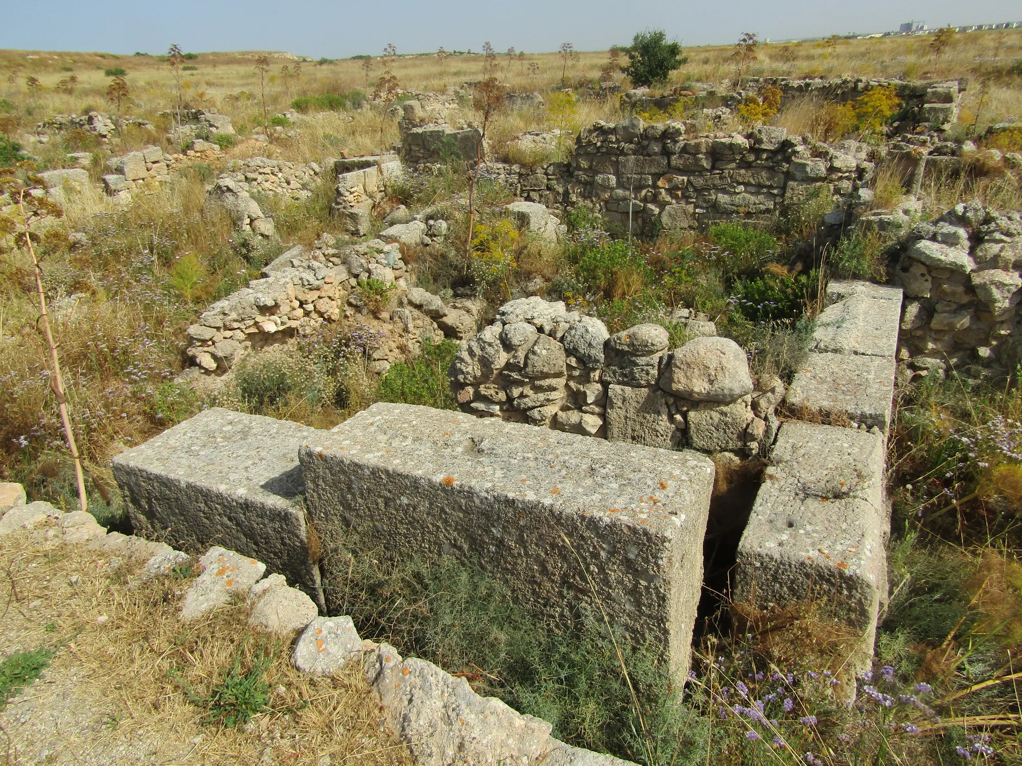
Late in the 14th century BC, on a low hill some 500 metres from the south coast at Maroni-Vournes, builders buried the past under a bed of dust. An earlier building, some tombs and a plaster workshop disappeared beneath a dense layer of plaster and stone chips, and the excavators think they know where the chips came from. Several cut blocks in the new building carry tool marks that run from one stone across the joint onto the next, which happens only when a face is dressed after the stones are already in the wall. The masons trimmed the blocks where they lay and let the waste fall around them [1].
They were building in ashlar: stone cut into squared blocks with flat faces, laid with tight joints. The core of the Ashlar Building at Maroni was ashlar inside and out, meant to be seen from every side, and it is among the earliest buildings on the island to use the technique on that scale [1]. Almost none of that ashlar is there now. Most of the blocks were carried off for reuse long ago, and what the excavators found was the socle, the rubble footing on which the dressed stone had stood [1].
That is the state of nearly every Late Bronze Age building on Cyprus. The Late Cypriot period (c. 1650 to 1050 BC) is when the island first built towns, streets and buildings of real size, and in the 13th century BC, the phase called Late Cypriot IIC, a handful of them were dressed in cut stone. What survives is a stone skirt: a plinth, sometimes a course or two of upright slabs, wrapped around walls whose upper parts were mudbrick and whose roofs were beaten earth, as in the villages of Lesson 4.
Copper and the first towns
Before the 17th century BC Cyprus had no towns and no hierarchy of large and small settlements [5; 21]. What changed was copper. By the 13th century there were perhaps eight towns, most of them on or near the coast, each the centre of its own copper-producing territory: Toumba tou Skourou, Enkomi, Kition, Hala Sultan Tekke, Maroni, Kalavasos, Kourion or Alassa, and Kouklia [3]. Set them on the map and the pattern is plain: they are spaced round the island, and the three ashlar court buildings of this lesson, at Maroni, Kalavasos and Alassa, all stand in the south.
Map of Cyprus
- Towns of the 13th century BC
- Other places in this lesson
- Ground above 200, 500, 1,000 m
Sites on this map
- 1Toumba tou Skourou
- 2Enkomi
- 3Kition
- 4Hala Sultan Tekke
- 5Maroni
- 6Kalavasos
- 7Episkopi-Bamboula (Kourion)
- 8Alassa-Paliotaverna
- 9Kouklia (Palaepaphos)
- 10Apliki-Karamallos (approx.)
- 11Pyla-Kokkinokremos
- 12Maa-Palaeokastro
- 13Korovia-Nitovikla
At Enkomi, copper working began inside an official building: the earliest metallurgical installations lay within the thick-walled building of Late Cypriot I that its excavator, Porphyrios Dikaios, called the "Fortress" [3; 19].
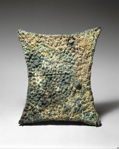
Mining, smelting and carting ore drew people away from their fields, and someone had to feed them [3]. Much of this lesson's architecture is the hardware of that arrangement: storerooms of giant jars, courts for gatherings, and cut stone to mark the people in charge.
How an ashlar wall was built
The finest Late Cypriot wall has two parts: the plinth, a bottom course of long, heavy blocks projecting a little beyond the wall face, and on it the orthostats, tall slabs set on edge. At Alassa-Paliotaverna the north wall of Building II keeps two courses of orthostats built in the shell-wall technique, two faces of dressed slabs with a fill packed between them, on a plinth that projects both inside and outside [2].
The face of each block is finished in a set way. A drafted margin, a narrow band chiselled smooth along the edges, frames a raised and rougher central panel. Many blocks also keep a boss, a knob of stone left standing on the face so that ropes or levers could grip it while the block was hauled into place. At Alassa the builders left the bosses on plinth blocks that were meant to be buried, and on the outer face of the orthostats wherever the wall could not be seen from the street [2]. One plinth block there weighs nearly 3 tonnes [2]. At Kalavasos-Ayios Dhimitrios ashlar blocks reach 3.20 m in length [2], and Claude Schaeffer recorded orthostats at Enkomi up to 3 m long, 0.7 m thick and 1.4 m high [14].
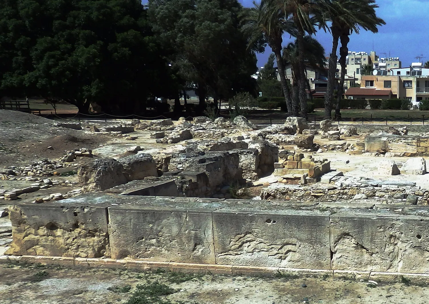
Above the stone, the walls were mudbrick. At Alassa the bricks were made of terra rossa, the red soil of the hills, and traces of pigment show the surface was painted red [2]. A pale dressed base carried a red earthen wall, and only the base is left to see.
Ashlar first appears in the gateway of the fort at Nitovikla in Late Cypriot I, where rubble walls took in blocks with drafted margins, and it was well established in monumental building by Late Cypriot IIC [21, p. 192]. Kevin Fisher reads it as a statement by the people who paid for it: the most elaborate masonry was placed where the most people would see it, and it tied Cypriot elites into a style shared with the courts of the Levant and the Aegean [4; 6]. The Alassa bosses, left on wherever no one would look, make the same point from the other side.
A second stone belongs with ashlar. Gypsum, called marmara locally, is abundant around Larnaca, splits into slabs of even thickness and carves easily; it has been used for building and paving from the Late Bronze Age to the present [16]. At Maroni a dismantled staircase corridor was paved over with gypsum slabs [1], and at the mining village of Apliki the floors were of hard gypsum plaster [3].
Three court buildings: Maroni, Kalavasos and Alassa
The three best-known ashlar buildings share a plan: three wings set around a central court, which excavators call the tripartite or Π plan after the Greek letter [1; 2]. On paper each is a thick-walled square or near-square with a court in the middle and long rooms down one side.
Maroni shows how such a building grew. Its first core, all ashlar, measured about 12 by 21.5 m, some 258 m². Then a North Wing of freestone (rough, undressed blocks) and an East Wing of mudbrick made from havara, the local soft limestone marl, doubled it to about 21 by 29.7 m, or 623 m² [1]. The court at its centre measured about 7.3 by 7 m. Traces of two successive staircases show there was an upper floor. Jan Driessen suggests the front may have been two storeys of gleaming white ashlar behind a pillared porch; that is a reconstruction, and he offers it as one [1]. Beside it stood the West Building, a storehouse whose ceiling beams rested on ashlar pillars in four bays, its other walls mudbrick on stone socles [1].
Building X at Kalavasos, a few kilometres to the west in the Vasilikos valley, is the fullest example. It is about 30.5 m square, with its main entrance, 3.50 m wide, in the middle of the south side, opening through a vestibule into a court paved with pebbles. Ashlar faced the outside and the important rooms within. Foundations up to 2 m thick and a staircase near the entrance suggest an upper storey, of which nothing survives [2].
The whole west wing of Building X is one room, the Pithos Hall, 19.5 by 7.25 m. A central row of monolithic ashlar pillars held up its roof, and about fifty pithoi, storage jars up to 2 m tall, stood in rows on stone blocks or sat in pits in the floor [3; 2]. The hall alone held about 33,500 litres, and the whole building about 50,000 with its second storeroom to the north; residues in 15 of 19 sampled jars point to olive oil [3]. Priscilla Keswani worked out that if only half the jars held oil, they could have supplied some 500 adults for two years [3].
Alassa-Paliotaverna Building II, in the Troodos foothills at 258 m above sea level, is the largest. The builders cut back the hillside to level it and raised the low side with packed havara. The building is 37.7 m square, its three wings set round a court that opened east behind a portico, a roofed row of columns, and it covers 1,410 m² [2]. Its north wing was a storeroom for at least sixteen great pithoi; a drain shaft built inside a wall carried rainwater out of the building; the floors were of lime cement [2].
Palace, office or great house?
These buildings are often called palaces, and the name is an interpretation. Sophocles Hadjisavvas, who excavated Alassa, describes Building II as "of palatial character", while Alison South, excavator of Kalavasos, offered for Building X either an administrative centre or a "residence for elite members of the society who had some control over the economic life of the community" [2]. Fisher prefers to call them monumental social spaces, and by counting how many doors one must pass to reach each room he finds two different machines. Building X is shallow and well connected, built to move traffic through its court; Alassa Building II is poorly connected inside, suited to large, staged gatherings in a court of 399 m² that he estimates could hold between 758 and 1,356 people [6]. He also stresses that most of these buildings were dwellings too, with living quarters probably on the lost upper floor [5].
Whether one ruler stood behind them is a separate question. Keswani reads Enkomi, with its wealth and fine buildings spread across the town, as a place of several competing elite groups, and Kalavasos, with its single great building, as more centralised [10]. None of it lasted long. Kalavasos, Building X and all, was abandoned within Late Cypriot IIC, by about 1200 BC [8].
Streets and grids
Around Building X lay a town of about 11.5 ha, laid out, in South's words, "on sound principles of town planning along long straight streets provided with good drains", and it had no defensive wall [8]. Estimates of its population run from 750 to 1,250 people [3]. Hala Sultan Tekke, on the shore of what is now the Larnaca Salt Lake and was then a sheltered bay, covered perhaps 25 ha and seems also to have been unwalled [8; 9]. Paul Åström called its plan "Hippodamic", with streets at right angles, though Fisher finds that hard to confirm from the published plans [5]. Swedish excavations there since 2010 have opened two city quarters, published in 2018 [20].
Enkomi, near Famagusta, is the only Late Cypriot settlement whose sequence has been followed in the ground from its foundation at the end of the Middle Cypriot period to its abandonment late in the 12th century BC [8]. In its first phase stood Dikaios's "Fortress"; in its developed form it had a "cyclopean" wall of large boulders (Lesson 11), households, sanctuaries and workshops, all set within a grid of blocks commanded by two main streets, one north to south and one east to west, each lined up on a city gate [8]. The grid on every published plan is the town's last form, laid out after a destruction around 1200 BC [5]. Only about a sixth of the town has been dug [5], yet Maria Iacovou calls it the only Late Cypriot settlement that "can be considered adequately excavated" [8]: elsewhere less than five per cent of almost every Late Cypriot settlement has been opened [5]. Enkomi lies in the north of the island, where excavation stopped in 1974.
The houses most people lived in
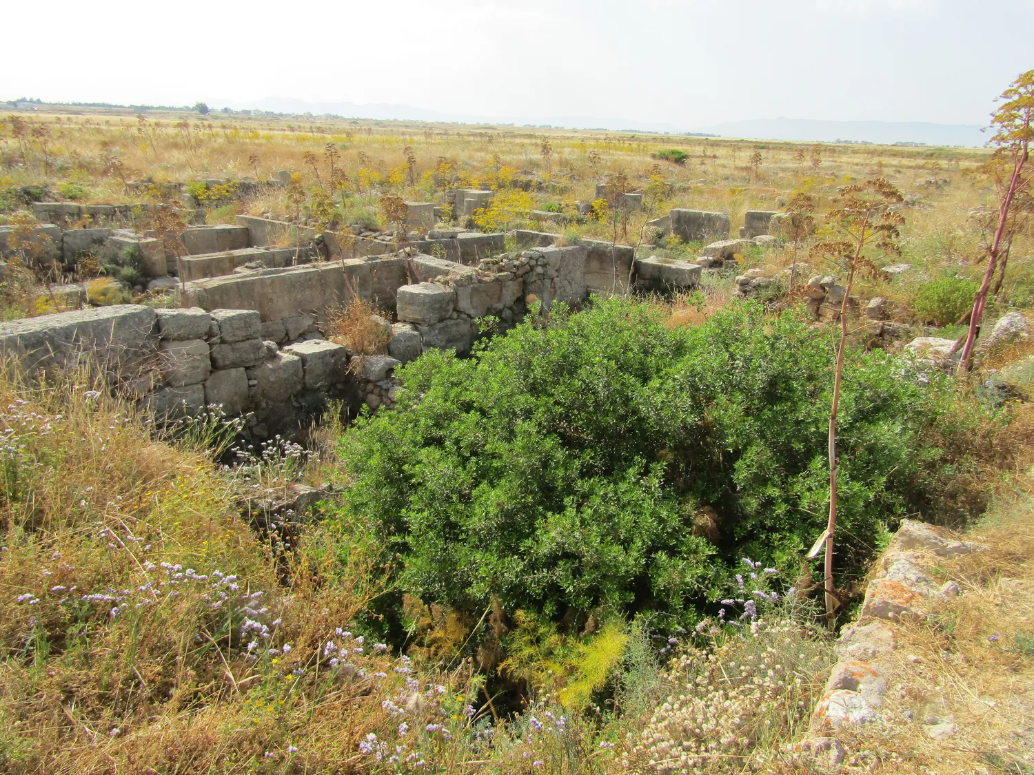
Most people lived in nothing like Building X. The usual Late Cypriot house was built around a courtyard: one street door, wider than the inner doors, opened into the court, the largest space in the house, and from it smaller roofed rooms were reached, the deepest through a short passage and out of sight [7]. Complexes A, B and C at Pyla-Kokkinokremos are the textbook examples [7; 13]. Another common type is L-shaped, with its courtyard outside [7].
The walls were the walls of Lesson 4: a rubble socle carrying mudbrick, plastered with mud. The roofs were flat, built of timber beams covered with reeds or brush, a bed of earth and a skin of chaff-tempered mud, the technique still used in Cypriot villages in the 20th century [18]. Swiny's reconstruction of such a roof for the Early Bronze Age house at Sotira shows the courses one by one, and eight or nine centuries later the roofs over the Late Cypriot houses, ashlar or not, were most likely built the same way.
Key to the line styles and hatching
Line: how well it is known
- ExcavatedMeasured on excavated remains
- Strong inferenceIndirect but good evidence
- ReconstructionWorked out from experiment, engineering or parallels
- SpeculativeNo direct evidence
- RejectedRuled out by the evidence; shown for comparison
Hatching: material
- Tabular limestone, cut
- Stone, seen
- Bedrock
- Ground outside
- Trodden floor debris
- Lime plaster
- Mud plaster, mud sills
- Dry earth (roof)
- Brush
- Reeds (roof bed or thatch)
- Timber, along the grain
- Timber, cut across
Scroll sideways to see the whole plate
A flat earth roof at the wall head of a stone house at Sotira-Kaminoudhia, about 2200 BC: beams, reeds, brush, a bed of earth and a skin of chaff-tempered mud. No roof survives there; the build-up is that of Cypriot village roofs recorded in the 20th century, which Swiny sets out as the likely method.
Drawing from A Stone House at Sotira-Kaminoudhia, fig. 6, where its sources are given in full.
The best-recorded house belongs to a mining village, Apliki-Karamallos, on a plateau in the Troodos foothills about 6.5 km south of Lefka, which Joan du Plat Taylor partly dug in 1938 and 1939 [11]. House A is an L-shaped building of at least eight rooms opening onto a courtyard, with rubble-and-mudbrick walls 75 cm thick, floors of hard gypsum plaster, benches and hearths; it was built in Late Cypriot IIC and destroyed by fire early in the 12th century [3; 11]. One storeroom held up to fifteen pithoi set on limestone blocks; the six found in place were about 1.5 m tall, and the room may have held up to 7,500 litres [3]. Keswani suggests House A was an official's residence, from which the mining was run [3]; the best "ordinary" house we have may belong to a manager.
Households held on to their plots. At Episkopi-Bamboula, near Kourion, two houses were rebuilt in the 12th century on the same layout, their new walls set directly on the old foundations [5].
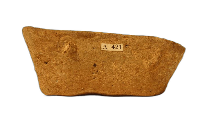
In Late Cypriot IIC and IIIA some houses and court buildings gained a new kind of room: small, with a fine lime-cement floor, sometimes a drain or a toilet, and a stone or clay bathtub with a hole in its base. They are known at Enkomi, Kalavasos, Maa, Alassa and Pyla; the one more or less complete clay tub from Pyla is 74 cm long, 46 cm wide and 57.4 cm high, big enough to sit in [17; 13]. Vassos Karageorghis read these rooms as a habit brought by Aegean settlers; Fisher argues that washing needs no tub, that tubs found in tombs and sanctuaries served purification, and that a bathroom is weak evidence for anyone's ethnicity [17].
After 1200: the new foundations and the rebuilt towns
Around 1200 BC, as Kalavasos was left empty, new places appeared. Maa-Palaeokastro, on a headland north of Paphos, was built on bare rock at the very end of Late Cypriot IIC and lived for about fifty years [12]. Its buildings line a single street. Building I, about 12 m square, uses ashlar only in its south front and its doorways, perhaps reused from elsewhere, and Building III is a set of long, narrow storerooms full of pithoi, a pithos hall on a smaller budget [12]. Who built Maa and Pyla, whose walls belong to Lesson 11, is argued: Karageorghis saw Aegean newcomers, while more recent work reads Maa as a planned Cypriot outpost [8].
At Kition the older town was not destroyed, and in Late Cypriot IIIA it was rebuilt on a grand scale, with drafted ashlar in its new temple (Lesson 9) [8]. At Enkomi Dikaios found the opposite sequence: a rich Late Cypriot IIC town destroyed, then a rebuilding in which ashlar appeared for the first time, together with locally made pottery in the Mycenaean style [8]. Both he and Schaeffer concluded that cut stone, like the pottery, came with settlers from the Mycenaean world of mainland Greece, and Dikaios compared Enkomi's Ashlar Building with the palace at Pylos [15]. Ora Negbi later argued that the Ashlar Building belongs to Late Cypriot II, before the destruction [15]. The decisive evidence lies on the south coast, where ashlar was well established by Late Cypriot IIC [21]: Maroni's stone chips had settled more than a century before Enkomi's rebuilding, and Building X was empty by about 1200 [1; 8]. Ashlar on Cyprus is a Cypriot technique, developed for Cypriot elites from a stock of eastern Mediterranean practice [4].
Enkomi itself was abandoned gradually before the end of the 12th century, as its harbour silted, and its people moved to nearby Salamis; the old town was never resettled [8]. In the 8th and 7th centuries BC, when the kings of Salamis built their tombs less than 2 km away, the orthostats of Tomb 47 measured up to 2.15 m long, 0.8 m thick and 1.8 m high, close to the slabs Schaeffer recorded at Enkomi, and Nicholas Blackwell suggests that some were taken from Enkomi's ruins [14]. Shallow holes in three of them had been filled with gypsum to smooth the faces [14].
Quiz
Check yourself
Question
Many Late Cypriot ashlar blocks keep a knob of stone standing out from the face. What was it for?
Question
How well do we know each of these about the Ashlar Building at Maroni-Vournes and its cut stone?
Tap a statement, then the bin it belongs in
To sort (5)
Question
About how many pithoi, storage jars up to 2 m tall, stood in the Pithos Hall of Building X at Kalavasos?
Question
Kevin Fisher counted how many doors one must pass to reach each room of Building X and of Alassa Building II. What did he find?
Question
Put the history of Enkomi in order, earliest first.
Tap an item, then tap its place. Or use the arrows
Question
A published plan of Enkomi shows a full grid of streets and blocks inside the town wall. How much of it has been dug?
Question
A Late Cypriot house has a small room with a lime-cement floor, a drain and a clay tub with a hole in its base. What does it tell you about the people who lived there?
What to look for
- A big block with a smooth chiselled band round its edges framing a raised, rougher panel, perhaps with a knob (boss) left on, is Late Cypriot ashlar of the 13th or early 12th century BC. Expect only the plinth and a course of upright slabs; the wall above was mudbrick.
- Where the ashlar has been robbed, a broad rubble socle, a spread of stone chips or a straight edge of empty bedding marks where it stood; on a plan these walls are drawn dashed or labelled "robbed".
- A square or near-square building 20 to 38 m across, with three wings round a court, is a Late Cypriot court building of the Maroni, Kalavasos or Alassa type. Call it an administrative or elite building; "palace" is a label scholars argue over.
- A long room with a row of square pillar bases down its middle and jar emplacements along its walls is a pithos hall or storehouse; count the emplacements and you have a rough measure of its capacity.
- Smaller units of rubble socle and mudbrick, each with a single street door into a court and roofed rooms behind, are the ordinary houses; a small room with a gypsum or lime-cement floor and a tub with a drain hole is a bathroom.
- Check the shading on any town plan: at Enkomi about a sixth of the town is excavated, at most sites less than a twentieth, and the rest of the grid is projection.
Go deeper
The site pages for Maroni, Alassa, Enkomi, Kition and Episkopi-Bamboula give the history of each excavation; the architecture overview in the compendium places the ashlar buildings in the island's whole sequence, and the fortifications page carries the walls of Enkomi, Maa and Pyla into Lesson 11. For the flat roof these buildings still carried, take apart the stone house at Sotira-Kaminoudhia; for the copper that paid for them, read the search for Alashiya and the copper kingdoms of ancient Cyprus.
References
- 1.Driessen, J. (2015). A power building at Maroni-Vournes. In C. F. Macdonald, E. Hatzaki & S. Andreou (Eds.), The Great Islands: Studies of Crete and Cyprus Presented to Gerald Cadogan. Athens: Kapon Editions.
- 2.Hadjisavvas, S. (2009). Aspects of regionalism in Late Cypriot architecture and the case of Alassa. In I. Hein (ed.), The Formation of Cyprus in the 2nd Millennium B.C.: Studies in Regionalism during the Middle and Late Bronze Ages. Vienna: Austrian Academy of Sciences, 127–134.
- 3.Keswani, P. S. (1993). Models of local exchange in Late Bronze Age Cyprus. Bulletin of the American Schools of Oriental Research 292.
- 4.Fisher, K. D. (2020). The materiality of ashlar masonry on Late Bronze Age Cyprus. In M. Devolder and I. Kreimerman (eds.), Ashlar: Exploring the Materiality of Cut-Stone Masonry in the Eastern Mediterranean Bronze Age. Louvain-la-Neuve: Presses universitaires de Louvain, 307–339.
- 5.Fisher, K. D. (2014). Making the first cities on Cyprus: urbanism and social change in the Late Bronze Age. In A. T. Creekmore and K. D. Fisher (eds.), Making Ancient Cities: Space and Place in Early Urban Societies. Cambridge: Cambridge University Press, 181–219.
- 6.Fisher, K. D. (2014). Investigating monumental social space in Late Bronze Age Cyprus: an integrative approach. In E. Paliou, U. Lieberwirth and S. Polla (eds.), Spatial Analysis and Social Spaces. Berlin: De Gruyter, 167–202.
- 7.Fisher, K. D. (2014). Rethinking the Late Cypriot built environment. In A. B. Knapp and P. van Dommelen (eds.), The Cambridge Prehistory of the Bronze and Iron Age Mediterranean. Cambridge: Cambridge University Press, 399–416.
- 8.Iacovou, M. (2013). Aegean-style material culture in Late Cypriot III: minimal evidence, maximal interpretation. In A. E. Killebrew and G. Lehmann (eds.), The Philistines and Other 'Sea Peoples' in Text and Archaeology. Atlanta: Society of Biblical Literature, 585–618.
- 9.Iacovou, M. (2007). Site size estimates and the diversity factor in Late Cypriot settlement histories. Bulletin of the American Schools of Oriental Research 348, 1–23.
- 10.Keswani, P. S. (1996). Hierarchies, heterarchies, and urbanization processes: the view from Bronze Age Cyprus. Journal of Mediterranean Archaeology 9(2), 211–250.
- 11.Kling, B. (1997). Apliki. In E. M. Meyers (ed.), The Oxford Encyclopedia of Archaeology in the Near East, vol. 1. New York: Oxford University Press.
- 12.Karageorghis, V., & Demas, M. (1988). Excavations at Maa-Palaeokastro 1979–1986. Nicosia: Department of Antiquities, Cyprus.
- 13.Karageorghis, V. and Demas, M. (1984). Pyla-Kokkinokremos: A Late 13th-Century B.C. Fortified Settlement in Cyprus. Nicosia: Department of Antiquities, Cyprus.
- 14.Blackwell, N. G. (2010). Mortuary variability at Salamis (Cyprus): relationships between and within the Royal Necropolis and the Cellarka cemetery. Journal of Mediterranean Archaeology 23(2).
- 15.Burdajewicz, M. (1990). The Aegean Sea Peoples and Religious Architecture in the Eastern Mediterranean at the Close of the Late Bronze Age. BAR International Series 558. Oxford: BAR.
- 16.Karageorghis, V. (1989). A Late Bronze Age mould from Hala Sultan Tekké. Bulletin de correspondance hellénique 113(2).
- 17.Fisher, K. D. (2006–2007). The 'Aegeanization' of Cyprus at the end of the Bronze Age: an architectural perspective. Scripta Mediterranea 27–28, 81–103.
- 18.Swiny, S. (2003). The settlement, with an appendix on roof beams in Cypriot vernacular architecture. In S. Swiny, G. Rapp & E. Herscher (Eds.), Sotira Kaminoudhia: An Early Bronze Age Site in Cyprus (ASOR Archaeological Reports 8 / CAARI Monograph 4, pp. 9–101). Boston: American Schools of Oriental Research.
- 19.Dikaios, P. (1969–1971). Enkomi: Excavations 1948–1958. 3 vols. Mainz am Rhein: Philipp von Zabern.
- 20.Fischer, P. M. and Bürge, T. (eds.) (2018). Two Late Cypriot City Quarters at Hala Sultan Tekke: The Söderberg Expedition 2010–2017. Studies in Mediterranean Archaeology 147. Uppsala: Åström Editions.
- 21.Fisher, K. D. (2009). Elite place-making and social interaction in the Late Cypriot Bronze Age. Journal of Mediterranean Archaeology 22(2), 183–209.