
Contents
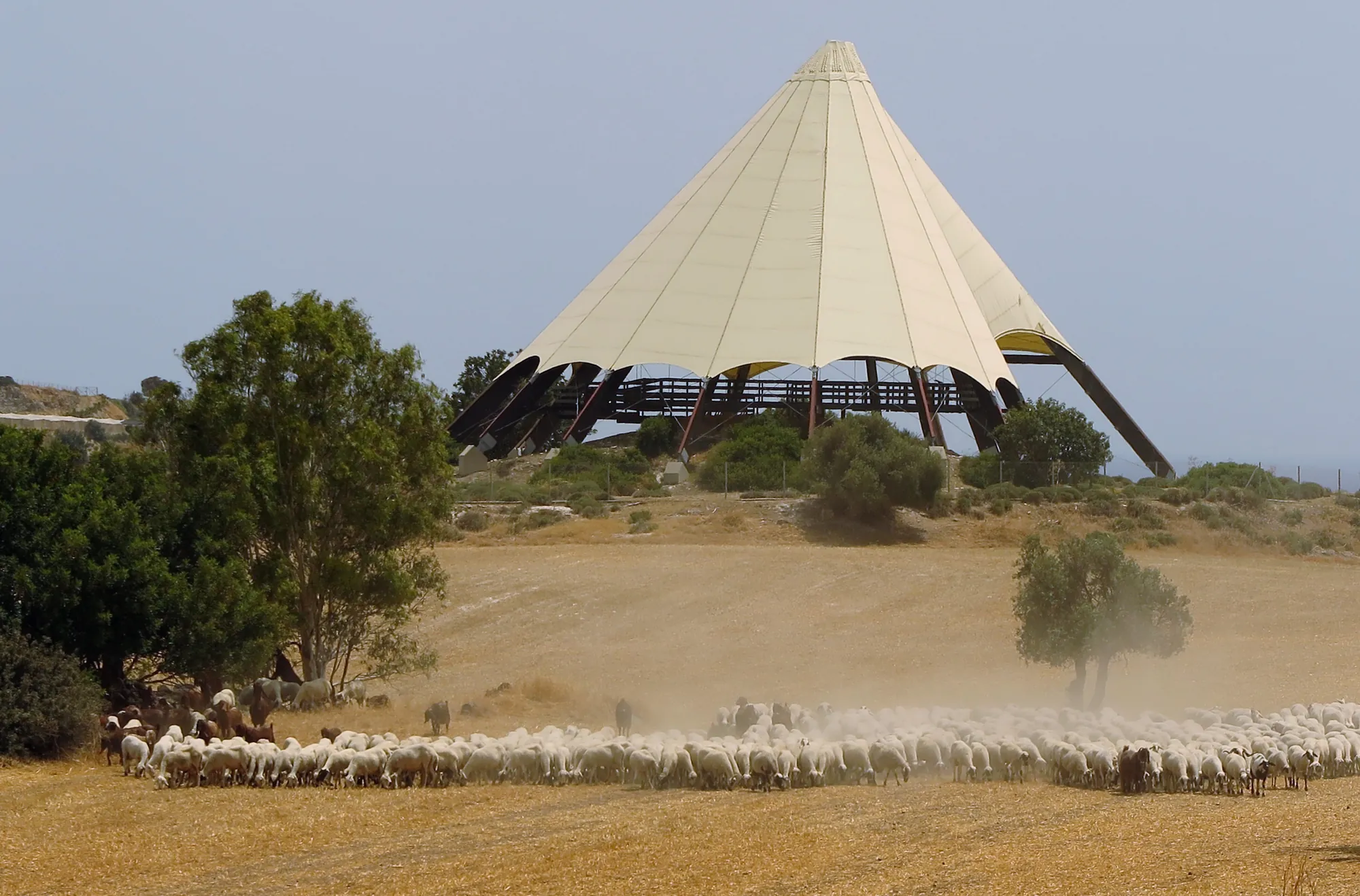
Kalavasos-Tenta is a small natural hill on the west side of the lower Vasilikos valley in Larnaca District, about 3 km inland from the south coast of Cyprus. From the 9th millennium BC into the 7th, farmers who made no pottery lived on it in round houses of stone and mudbrick, enclosed for part of that time by a wall and a ditch [1; 2]. It is one of the longest-lived villages of the Aceramic Neolithic on the island, and the pier of one of its houses carries the only Neolithic wall painting known in Cyprus [3, p. 47]. The site was excavated by the Vasilikos Valley Project between 1976 and 1984 and is now covered by a tall conical shelter beside the Nicosia to Limassol motorway.
A hill in the Vasilikos valley
The hill is the only rise of its kind in this stretch of the valley. Its summit stands 62.45 m above sea level, about 20 m above the valley floor beside it, and it commands a view north to the Troodos, east across the valley and south to the sea [4, p. 165]. The natural deposit is havara, a soft secondary limestone, on the Pleistocene river terrace that geologists call the Kalavasos Terrace [5]. The Vasilikos river runs about 100 m to the east, and in the Neolithic it probably flowed only in season [1]. The hill lies beside the route from the coast up to the Troodos and the route along the south of the island, and Ian Todd thought that "the desire for security clearly played a significant part" in the choice of the site [4, p. 165; 6].
The excavated village covers only about 0.26 ha. Surface finds spread over an area of up to about 300 by 200 m, but much of that scatter comes from later visits to the hill [5; 1]. The first substantial village has been estimated at about 1,600 m², growing to 2,500 to 3,000 m², and its population at about 60 people in Period 4, rising to about 120 and at most 150 [1].
Tenta is Greek for "tent". A local tradition holds that St Helena, mother of Constantine the Great, pitched her tent here in AD 327 on her way back from Jerusalem with the relic of the True Cross; there is no archaeological trace of any such visit [1]. The name is older than the modern tent-shaped roof. Porphyrios Dikaios, who first dug here, called the site Mari-Tenta, after the neighbouring village of Mari [4, p. 161].
Discovery and excavation
Dikaios made a small trial excavation on the southern slope in 1947 for the Department of Antiquities. He found round stone buildings of the Aceramic Neolithic and part of the long curving wall later numbered Structure 1, but he never published the work [6; 4, p. 175].
In 1975 Vassos Karageorghis, Director of the Department of Antiquities, drew the site to the attention of Ian A. Todd of Brandeis University [4, p. 162]. Todd's Vasilikos Valley Project set out to study the whole valley, from its first settlement to the Middle Ages, with Tenta as its Neolithic excavation. It was sponsored by Brandeis and, from late 1979, by the American Schools of Oriental Research, and the National Science Foundation provided all of its funding [3, p. 36]. The project excavated at Tenta for five seasons, in 1976, 1977, 1978, 1979 and 1984 [6; 7]. In 1979 it also carried out a rescue excavation at the Chalcolithic site of Kalavasos-Ayious, across the valley, and began work at the Late Bronze Age town of Kalavasos-Ayios Dhimitrios, about 300 m south-south-west of Tenta [8; 9].
The excavation concentrated on three areas: the top of the site, the lower south slope and the east slope. Every stretch of wall received its own "Structure" number as it was found, so one building can carry several numbers, and the numbers run past 100 [10]. Preliminary reports appeared in the Journal of Field Archaeology [4; 3]. The architecture and the radiocarbon dates were published in 1987 [10]; the finds, the burials, the plant and animal remains, and a revised history of the site followed in 2005 [11], with specialist chapters by Carole McCartney on the chipped stone, C. Jack Moyer on the human remains, Paul Croft on the animal bones and Julie Hansen on the plants [12; 13].
Periods and dates
Todd divided the Aceramic occupation into five periods, numbered from 5, the earliest, to 1, the latest [1]. The early radiocarbon dates, measured on material of the 1976 season, mostly fell in the 6th millennium BC in uncalibrated years, and Todd at first dated the village to the second half of that millennium, as a contemporary of Khirokitia [4]. Once older villages such as Parekklisha-Shillourokambos and Kissonerga-Mylouthkia had been excavated, McCartney and Todd reassessed the dates and the chipped stone and moved the main occupation back into the 8th and early 7th millennia BC [12]. In Joanne Clarke's summary of the final volume, all the standing architecture at Tenta is older than Khirokitia, by up to a millennium [14].
The calibrated dates still leave room for disagreement. Christine Winkelmann places Period 5 in the middle of the 9th millennium BC, Periods 4 to 2 in the later Cypro-PPNB, and Period 2 in the second half of the 8th millennium [1]. In a re-assessment of the site, Clarke and Alexander Wasse give the latest of the summit buildings, Structure 14, a date before about 7750 to 7250 BC from a hearth beside it, and argue that the three summit buildings belong earlier than the houses around them [2]. In the chart of periods they reproduce, Period 1 runs from about 6400 to 6000 BC [2]. The phases below follow that sequence; the dates are approximate.
Phases
- Period 5mid-9th millennium BC
Post-holes, stake-holes and pits, perhaps a timber palisade round the summit. No stone or mudbrick buildings.
- Period 48th millennium BC
The first substantial village: round houses, the large Structure 36 on the summit, the enclosure wall and the ditch.
- Period 3
Structure 17, of mudbrick, is built over Structure 36. The enclosure wall is thickened after the ditch goes out of use.
- Period 2later 8th or 7th millennium BC
The best-preserved village: houses packed on the hilltop, building outside the wall, and Structure 14 on the summit.
- Period 1to about 6000 BC
Scant remains of the Late Aceramic Neolithic, the time of Khirokitia.
- Gap
No settlement on the hill for a long time.
- Early Chalcolithic pitsabout 3900 to 3400 BC
Pits, hearths and floors without buildings, with Combed and Red-on-White pottery.
- Excavation1947; 1976–1979 and 1984
Dikaios's trial excavation; the Vasilikos Valley Project under Ian Todd.
Period 5 is broadly contemporary with the first phases at Shillourokambos and the wells of Kissonerga-Mylouthkia, and Periods 4 to 2 with the later phases of both sites [1]. Tenta therefore spans much of the Aceramic sequence in one place, from the early Cypro-PPNB to the Khirokitia culture. Its chipped stone suggests to Clarke and Wasse that its first occupants kept a way of life closer to the earlier hunter-cultivators of the island than to the farming newcomers. They present this as a proposal for further work [2]. Khirokitia lies "no more than about an hour and a half away on foot", and Croft considers it "a successor community to Tenta, at least at a general, regional level" [15].
Map of Cyprus
- Ground above 200, 500, 1,000 m
Sites on this map
- 1Kalavasos-Tenta
- 2Khirokitia
- 3Parekklisha-Shillourokambos (approx.)
- 4Kissonerga-Mylouthkia (approx.)
- 5Ayios Tychonas-Klimonas (approx.)
The enclosure wall and ditch
In Period 4 the village was enclosed by a wall, Structure 1, which continues on the east as Structure 100. It is the wall Dikaios had found. Founded on the havara, it survives up to 1.2 m high [4, p. 175]. It was built in two phases: an outer wall about 1 m thick was later added to its south face [3, p. 46]. It probably ran round the whole top of the hill [1].
Outside it on the south a ditch was cut into the havara, about 1.65 m deep; its full width was not exposed, and it was later deliberately filled in part with large stones [3, p. 46]. The ditch does not follow the wall everywhere. There is none on the east, and a stretch in the south-west seems to take a different line, so it may have been unfinished or may have enclosed a wider area than the wall [1]. A further stretch of ditch further down the south-east slope probably belongs to a later enclosure, dug after the village had spread beyond the wall [1]. In Period 3 the wall was thickened, after the ditch had gone out of use, and an inner ring wall was built against it [1].
Todd thought it "probably a defensive ditch" [3, p. 46]. Other readings are a means of controlling access to the village or a boundary that marked out its territory, as has been suggested for the walls of Khirokitia [1]. Clarke and Wasse place the ditch among the large ditches, banks and walls of several Aceramic sites on the island [2]. We know of no evidence that the village was attacked (see fortifications).
Houses
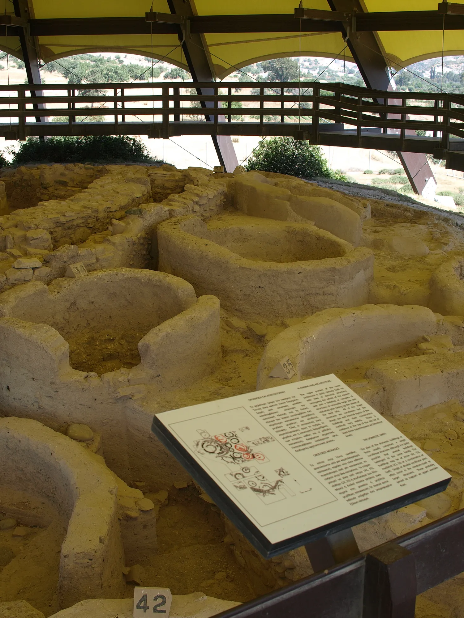
The houses are round or oval. Most have a stone footing carrying walls of mudbrick or pisé, though stone and mudbrick walls occur in the same phase [4]. Wall thickness ranges from about 25 cm in Structure 11 to 60 to 75 cm in Structures 10 and 14, and internal diameters are small: about 3.5 m in Structure 55 and 2.5 m in Structure 27. The inside faces were plastered. Many houses have one or two rectangular piers, often in the centre [4; 3]. They are usually read as supports for the roof or for an upper floor, though no collapsed upper floor has been found [1]. Whether the roofs were flat or sometimes domed is uncertain [1]. Hearths are mostly in the open spaces between buildings [4].
Three buildings on the south side, Structures 11, 42 and 55, form a group with double walls, a mudbrick outer face strengthened by an inner stone wall. Structure 35, with ground stone tools, a large stone basin and lumps of red ochre, may have been a workshop, and Structure 34 of Period 2 has been read as a store or granary [1]. As at Khirokitia, a household probably used several buildings, a dwelling with smaller ones round it, though no such groups can be picked out on the plan of Tenta [1]. Our reconstruction of a Khirokitia household shows how such a group worked in the later village.
By Period 2 the top of the hill was "quite dense, with narrow passageways and no signs of any larger open area", and houses were being built outside the enclosure wall [1]. The lower slopes were more thinly occupied [1].
The summit buildings: Structures 36, 17 and 14
On the western part of the summit three large round buildings stood one above another. Structure 36 of Period 4 had an outer wall of stone and an inner wall of mudbrick, and two plastered floors painted red. Structure 17 of Period 3, built over it entirely of mudbrick, was larger than the houses of its time and had four successive plastered floors with reddened surfaces [1].
The last of them, Structure 14, has three concentric walls with an outer diameter of 12.32 m, a central space about 4.2 m across, and small cells between the rings divided by cross-walls [16]. Its walls are the heaviest on the site. A ring wall round it enclosed an open yard with an entrance on the south-east, and a later concentric wall blocked that entrance [1]. The building contained very little: 345 pieces of chipped stone, only one of them used. The excavators wrote that "either the building was cleared out prior to abandonment, or it was never used for domestic or subsistence tasks", and concluded that it had been formally closed and completely backfilled when it was given up [10, p. 81; 2].
What these buildings were for is not known. Their size, construction and floors set them apart, and the same spot was used for an exceptional building through several periods. They could have been dwellings of a leading household or communal buildings; there is no evidence for a ritual use [1]. Edgar Peltenburg compared Structure 14 with the round communal buildings of the mainland at Jerf el-Ahmar [16], and Clarke and Wasse treat all three as communal buildings [2].
The wall painting in Structure 11
In 1979 the excavators found a painting on the east face of the central pier (Structure 82) of Structure 11, a building on the southern edge of the hilltop. Structure 11 was otherwise "undistinguished by size or any other features" [3, pp. 47–48]. The paint is red, presumably red ochre, which was available near the Kalavasos mines; lumps of ochre were found on the site. It was laid on a cream lime plaster like that of the floors [3, p. 47; 1].
The painting is a single composition of two human figures with a bare gap between them. The southern figure is the better preserved. It has a roughly square head with no features, on a long narrow neck, an upper body painted solid red, and both arms raised, each ending in five fingers; only fragments of the legs survive. The northern figure is much more fragmentary but seems to have been similar, with at least one raised arm [3, p. 48]. The better figure is about 40 cm high [8]. At some point in the life of the building the painting was covered with a thick layer of plaster [3, p. 47; 1]. Winkelmann dates Structure 11 to the later Cypro-PPNB [1].
Todd judged that "accurate interpretation of such a painting is clearly impossible", noted that the painted figures of Çatal Höyük in Anatolia are "not a close parallel", and wrote that "the temptation to attribute a religious significance to such a composition must be resisted" [3, p. 48]. The closest Cypriot comparison is a figure with raised arms carved on a stone vessel from Khirokitia [1].
Costas Hasapopoulos of the Department of Antiquities consolidated the southern figure, detached it from the pier and mounted it on a fibreglass support in Nicosia. In 1982 Todd reported it on display in the Cyprus Museum [3, pp. 47–48]. The northern part was left on the pier [8].
Burials
Fourteen burials were found, with at least 18 individuals: eight adults, two children and eight infants [1]. Six were in pits under house floors and seven outside the buildings, some in rubbish layers between houses or outside the enclosure wall; the excavators took these too for deliberate burials [1; 3, p. 48]. None of the 1979 burials had grave goods [3, p. 48]. The bodies were usually laid contracted, one to a grave. The bones are poorly preserved [1].
Several burials were treated in unusual ways. Burial 4 held four infants laid in at least two successive deposits, the only multiple primary burial. In Burial 7 a stone was placed on the body, and in Burials 6 and 10 the skull was propped upright. A pit near the outer ditch held the disarticulated bones of two people, the only secondary burial on the site [1]. Five burials lay under the floor of Structure 9 [1]. At least two skulls show artificial shaping in infancy [1], a custom better known from the much larger burial population of Khirokitia. As at Khirokitia, the dead were buried in and around the houses; Clarke and Wasse find on Cyprus nothing like the burial customs of the mainland in the Middle Pre-Pottery Neolithic B [2]. The burials of the period are set out more fully under Neolithic and Chalcolithic burial.
Tools, vessels and ornaments
Almost all the chipped stone is of local chert from the bed of the Vasilikos [4]. The industry changes through the sequence. Period 5 has small bladelets of translucent chert in an older tradition; Periods 4 to 2 adopt the bidirectional blade technology of the mainland Pre-Pottery Neolithic B [12; 2].
Obsidian does not occur on Cyprus. The excavations recovered 36 pieces, all finished blades, blade fragments and flakes, with no cores. Neutron activation analysis assigned all six samples tested to Göllü Dağ in central Anatolia, and obsidian occurs throughout the occupation. The analysts concluded that the villagers "were never completely isolated from the mainland" [5, pp. 503–505] (see seafaring and ships).
Containers were of stone. The excavations of 1976 and 1977 alone produced 136 stone vessels and fragments: 92 of hard stone such as diabase, 42 of soft limestone or gypsum and two of steatite. There are spouts, lugs and handles, a fragment with relief decoration and one with incised decoration, and broken vessels were sometimes built into walls [4, pp. 179–181] (see stone vessels). The ground stone includes polished axes and mace-heads; querns and rubbers are scarce, perhaps because the floors were left swept clean [4]. Ornaments are of steatite, calcite and other stones, and of shell, mostly pendants with a few rings [4, p. 181].
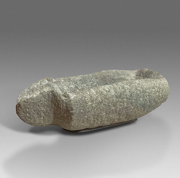
Figurines are almost absent. The 1978 report states that "no definite examples have been found" [4, p. 181]. A carved diabase head found in 1979 was probably the handle of a stone vessel, and a limestone head with grooved eyes from the rubbish outside Structure 1 is the one clear human image in stone from the village [3, p. 50; 1] (see Neolithic and picrolite figurines).
Farming, herding and hunting
The villagers lived on three animals: fallow deer, pig, and sheep and goat. Cattle are absent, and no dog has been identified [15]. The deer had been brought to the island by people and were not domesticated; they lived free and were hunted. Over time the share of deer in the bones fell, while pig and sheep and goat rose [15].
| Animal | Share of identified bones, Periods 4–2 | Trend |
|---|---|---|
| Fallow deer | 39.0% | Falls from 57.8% in Period 4 to 42.0% in Period 2 |
| Pig | 32.9% | Rises |
| Sheep and goat | 28.1% | Rises; mostly sheep |
| Cattle | None |
The figures are from Croft's study of 2,808 identified bones [15]. The plant remains were sparse but include einkorn and emmer wheat, six-row barley, lentil and pea, with caper, fig and pistachio gathered from the wild; olive and grape are absent [11]. The wider pattern on the island is described under food and diet.
The later pits
After the Aceramic village was abandoned, the hill stood empty for a long time. People returned to dig pits, some with hearths, and to lay floors in one part of the site, without building houses. Their pottery, which includes Combed Ware and Red-on-White, was found mostly out of its original position [4]. It was first taken for Ceramic Neolithic, but the project's study of the pottery dates it mainly to the Early Chalcolithic, about 3900 to 3400 BC [17] (see Chalcolithic). Sherds and a coin of the Byzantine emperor Manuel I Komnenos (1143–1180) from the topsoil record later visits to the hill [4].
Pieces in the Drakopoulos collection of kinds found at this site. None of them comes from the site.
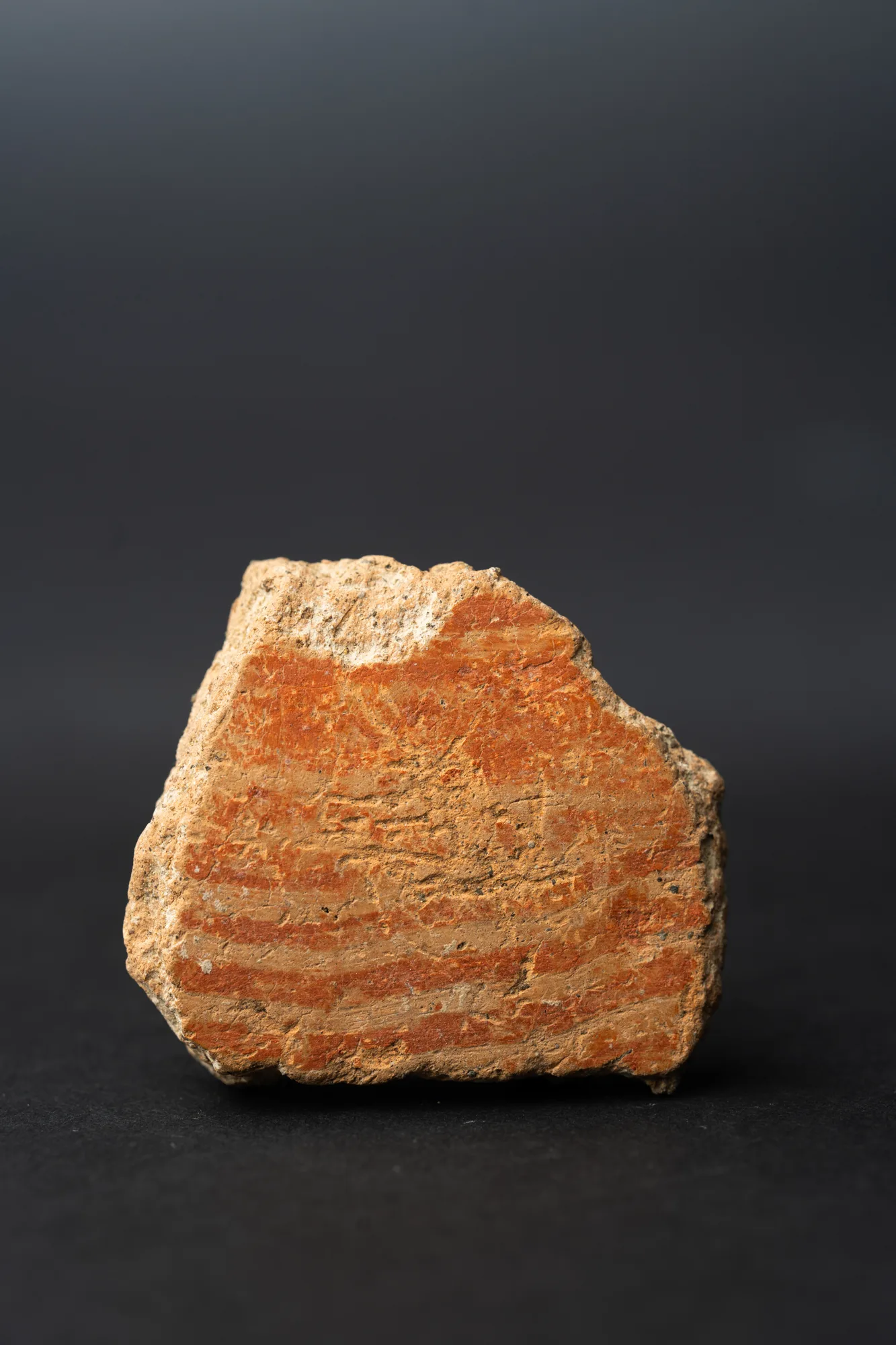 Combed Ware Bowl Fragment with Parallel BandsNeolithic · 4500–3900 BCDrakopoulos collection
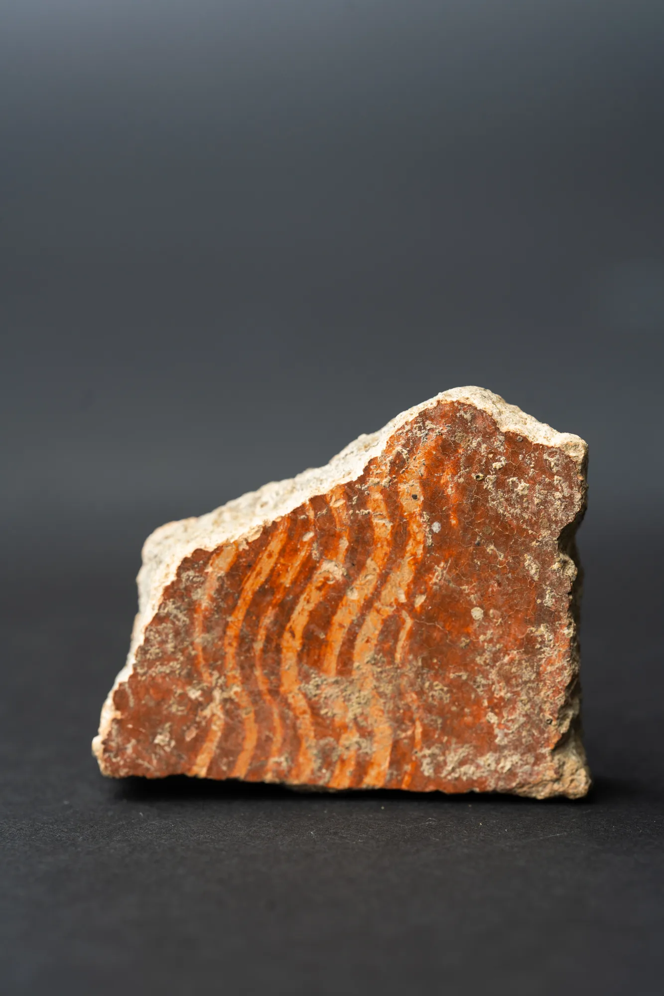 Combed Ware Bowl Fragment with Multiple Wavy BandsNeolithic · 4500–3900 BCDrakopoulos collection
The shelter
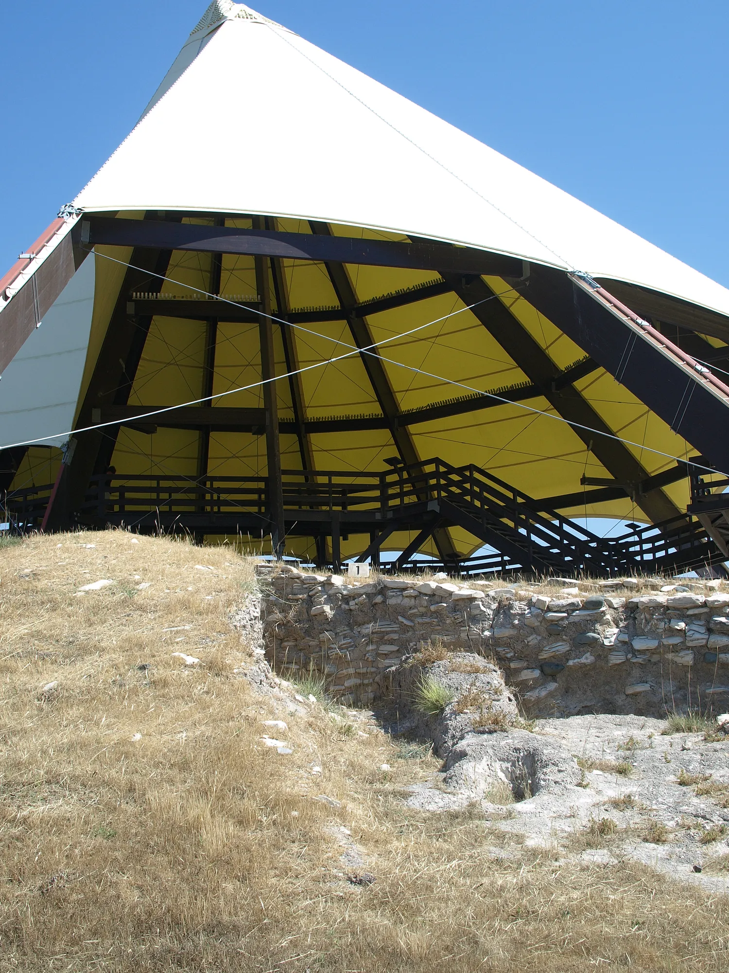
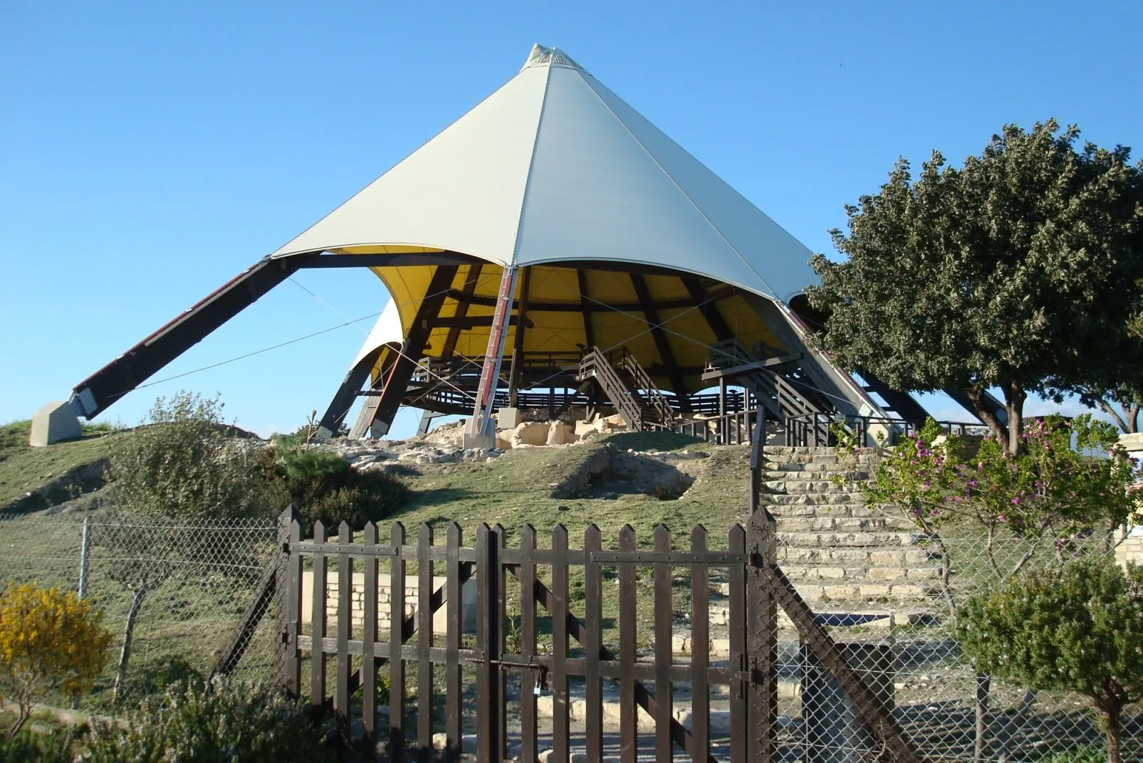
The first protective roof, a partial metal roof over the mudbrick buildings on the east of the hilltop, was organised and paid for by the Department of Antiquities at the time of the 1979–1980 seasons and designed by Androula Savvopoulou [3, p. 36; 18]. It was replaced in 1994–1995 by the present shelter, designed by Martin Schmid, an architect of the French School at Athens [18; 19, p. 313]. Fourteen straight beams of glued laminated timber, 16 to 30 m long, rise from concrete foundations to a steel ring at the apex and carry a translucent PVC membrane. A gap between the membrane and the ground lets air move across the remains, and a walkway hung from the beams lets visitors look down on the houses without walking on them [18]. The twelve-sided cone is about 16 m high [19, p. 313]. It cost 170,000 Cyprus pounds, with support from the A. G. Leventis Foundation [18; 19, p. 314].
In 2023 the Larnaka Tourism Board and Youth Makerspace Larnaka produced a virtual reconstruction of the village, built from drone photogrammetry [20].
Visiting Kalavasos-Tenta
The site is just outside Kalavasos village, about 40 km from Larnaca and 2.5 km from the motorway [21]. It is managed by the Department of Antiquities, and there is an entry charge [21]. Opening days and hours change with the season, so check the Department of Antiquities' current times before you go. Inside the shelter the remains are seen from the walkway [18].
Tenta is not a World Heritage Site. The walled village of Khirokitia, on the UNESCO list since 1998, lies about 10 km away by road and can be seen on the same day; its replica houses show what Tenta's buildings may have looked like.
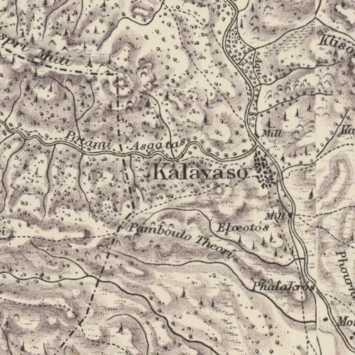
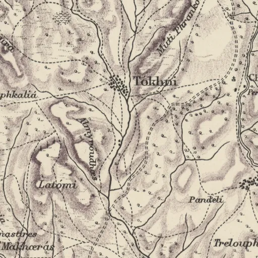
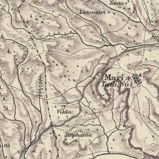
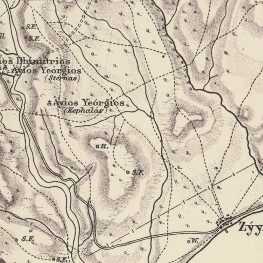
On Kitchener's map (1882)
Tenta · Sheepfold
Also on the map
- Kalavasó · mixed village
Excavation history
- 1939–1947Kalavasos: Dikaios's excavations at Pamboules, Kokkinoyia and TentaDirected by Porphyrios DikaiosExcavation
- 1976–1984The Vasilikos Valley Project excavationsDirected by Ian A. ToddExcavation
Nearby sites
- Kalavasos-Ayios Dhimitrios0.2 km
- Kalavasos-Ayious0.6 km
- Kalavasos-Mangia0.7 km
- Kalavasos-Arkhangelos0.8 km
- Kalavasos-Kafkalla0.8 km
- Kalavasos-Kokkinoyia0.8 km
Straight-line distances.
Mentioned in
38 mentionsDocuments · 12
- Protective shelters at the archaeological sites of Mallia (Crete) and Kalavasos-Tenta (Cyprus)
1998 · pp. 150, 152
Neolithic settlement in Cyprus, subject of a conical shelter
Schmid 1998, p. 150
- Revisiting the animal remains from Neolithic Kalavasos-Tenta, Cyprus
2017 · pp. 255, 256, 257, 263
Neolithic site whose animal remains are revisited
Croft 2017, p. 255
- Chronique des fouilles et découvertes archéologiques à Chypre en 1975
1976 · p. 860
A flint arrowhead was collected during a rapid surface survey of the Neolithic site of Mari-Tenda, formerly excavated by P. Dikaios.
Vassos Karageorghis, 1976, pp. 839-906
- Chronique des fouilles et découvertes archéologiques à Chypre en 1976
1977 · pp. 736, 738
The settlement consists of occupation deposits stratified on a small natural rise, and measures approximately 190 by 130 m. In the 1976 campaign, excavation…
Vassos Karageorghis, 1977, pp. 707-779
- Chronique des fouilles et découvertes archéologiques à Chypre en 1977
1978 · p. 907
Excavation of the Neolithic site of Kalavassos-Tenta was resumed during July, August and September 1977.
Vassos Karageorghis, 1978, pp. 879-938
- Chronique des fouilles et découvertes archéologiques à Chypre en 1978
1979 · pp. 676, 690
A particularly well-preserved structure (structure 42) was fully excavated on the heavily eroded south slope.
Vassos Karageorghis, 1979, pp. 671-724
Lectures and videos · 5
- Second Annual Study Day of the Archaeological Research Unit: Prehistoric Stone, Palaepaphos, and Ceramic Studies
2017
Georgiou et al. 2017
- Obsidian, carnelian and picrolite in the Aceramic Neolithic of Cyprus
2018 · 0:06:09
Obsidian shows greater dispersion, indicating at least two or three obsidian sources in use
Moutsiou 2018
- The Archaeological Work of the University of Cyprus, 2017: Neolithic stone, Bronze Age metals, field databases and medieval glazed wares
2018
Charalambous et al. 2018
- Reconstructing the Palaeoenvironment of the Xeros River Valley in Cyprus: A Geoarchaeological Approach
2021
Mylona 2021
- Everything in Nature Invites Us Constantly to Be What We Are: Exploring the Evolution of Humans and Natural Communities in Ancient Cyprus via Multi-Proxy Analysis
2023
Chelazzi 2023
Tomb records · 12
- Kalavasos-Tenta, Brandeis Tomb 1
1976
House floor burial
Todd 1978
- Kalavasos-Tenta, Brandeis Tomb 10
1976
Winkelmann 2020
- Kalavasos-Tenta, Brandeis Tomb 11
1976
Pit grave
Winkelmann 2020
- Kalavasos-Tenta, Brandeis Tomb 12
1976
Pit grave
Winkelmann 2020
- Kalavasos-Tenta, Brandeis Tomb 2
1976
House floor burial
Todd 1978
- Kalavasos-Tenta, Brandeis Tomb 3
1976
Pit grave
Todd 1978
News · 7
- Early Neolithic groups gathered seasonally at Ais Giorkis in the Troodos foothills, final report argues
2026
- Ian Todd, who led the Vasilikos Valley Project at Kalavasos for 23 seasons, has died
2026
- Kalavasos remembers Ian Todd on 7 November with talks and villagers' photographs of the digs
2026
- Kourion, Kalavasos-Tenta and Paphos Castle to take card payments only from 1 November
2026
- Syria's Ali Sharif Amrir speaks on the Levant's first farmers at ACOR in Amman on 26 October
2026
- This Week in Cypriot Archaeology: 3–9 August 2026
2026
- Excavations · 2listed under Excavation history
References
- 1.Winkelmann, C. (2020). The Neolithic and Chalcolithic Figurines of Cyprus (Marru). Zaphon.
- 2.Clarke, J., & Wasse, A. (2019). Time out of joint: A re-assessment of the Cypriot Aceramic Neolithic site of Kalavasos-Tenta and its regional implications. Levant, 51(1), 26–53. https://doi.org/10.1080/00758914.2020.1741969
- 3.Todd, I. A. (1982). Vasilikos Valley Project: Fourth Preliminary Report, 1979-1980. Journal of Field Archaeology, 9(1), 35–77. https://doi.org/10.1179/009346982791974714
- 4.Todd, I. A. (1978). Vasilikos Valley Project: Second Preliminary Report, 1977. Journal of Field Archaeology, 5(2), 161–195. https://doi.org/10.1179/009346978791489790
- 5.Gomez, B., Glascock, M. D., Blackman, M. J., & Todd, I. A. (1995). Neutron Activation Analysis of Obsidian from Kalavasos-Tenta. Journal of Field Archaeology, 22(4), 503–508. https://doi.org/10.1179/009346995791974080
- 6.Todd, I. A. (2001). Kalavasos-Tenta revisited. In S. Swiny (Ed.), The Earliest Prehistory of Cyprus: From Colonization to Exploitation (CAARI Monograph Series 2; ASOR Archaeological Reports 5). American Schools of Oriental Research.
- 7.Karageorghis, V. (1977). Chronique des fouilles et découvertes archéologiques à Chypre en 1976. Bulletin de correspondance hellénique, 101(2), 707–779. https://www.persee.fr/doc/bch_0007-4217_1977_num_101_2_6567
- 8.Mersereau, R. (1981). The 1979 Vasilikos Valley Project. In J. C. Biers & D. Soren (Eds.), Studies in Cypriote Archaeology (Institute of Archaeology, University of California, Los Angeles, Monograph 18). Institute of Archaeology, UCLA.
- 9.Todd, I. A., & Croft, P. (2004). Vasilikos Valley Project 8: Excavations at Kalavasos-Ayious (Studies in Mediterranean Archaeology 71:8). Paul Åströms Förlag.
- 10.Todd, I. A. (Ed.). (1987). *Vasilikos Valley Project 6: Excavations at Kalavasos-Tenta I* (Studies in Mediterranean Archaeology 71:6). Paul Åströms Förlag.
- 11.Todd, I. A. (Ed.). (2005). Vasilikos Valley Project 7: Excavations at Kalavasos-Tenta, Volume II (Studies in Mediterranean Archaeology 71:7). Paul Åström.
- 12.McCartney, C., & Todd, I. A. (2005). The chipped stone. In I. A. Todd (Ed.), Vasilikos Valley Project 7: Excavations at Kalavasos-Tenta, Volume II (Studies in Mediterranean Archaeology 71:7), 177–264. Paul Åströms Förlag.
- 13.Moyer, C. J. (2005). Human Burials. In I. A. Todd (Ed.), Vasilikos Valley Project 7: Excavations at Kalavasos-Tenta II (SIMA 71:7), 1–17.
- 14.Clarke, J. (2006). New volumes on the Vasilikos Valley in Cyprus [Review of I. A. Todd (Ed.), Vasilikos Valley Project 7: Excavations at Kalavasos-Tenta, Volume II, and other volumes]. Antiquity, 80(309), 727–730. https://doi.org/10.1017/S0003598X00094217
- 15.Croft, P. (2017). Revisiting the animal remains from Neolithic Kalavasos-Tenta, Cyprus. In P. Rowley-Conwy, D. Serjeantson, & P. Halstead (Eds.), Economic Zooarchaeology: Studies in Hunting, Herding and Early Agriculture, 255–262. Oxbow Books.
- 16.Peltenburg, E. (2004). Social space in early sedentary communities of Southwest Asia and Cyprus. In E. Peltenburg & A. Wasse (Eds.), Neolithic Revolution: New Perspectives on Southwest Asia in Light of Recent Discoveries on Cyprus (Levant Supplementary Series 1). Oxbow Books.
- 17.Todd, I. A. (1991). The Vasilikos Valley and the Chalcolithic Period in Cyprus. Bulletin of the American Schools of Oriental Research, 282/283, 3–16. https://doi.org/10.2307/1357259
- 18.Schmid, M. (1998). Protective shelters at the archaeological sites of Mallia (Crete) and Kalavasos-Tenta (Cyprus). Conservation and Management of Archaeological Sites, 2(3), 143–153. https://doi.org/10.1179/cma.1998.2.3.143
- 19.Herscher, E. (1998). Archaeology in Cyprus. American Journal of Archaeology, 102(2), 309–354. https://doi.org/10.2307/506471
- 20.Virtual Multimodal Museum (ViMM). (2023, February 21). Kalavasos-Tenta archaeological site: virtual reconstruction. https://www.vi-mm.eu/2023/02/21/kalavasos-tenta-archaeological-site-virtual-reconstruction/
- 21.Deputy Ministry of Tourism, Cyprus. (n.d.). Kalavasos-Tenta Archaeological Site. Visit Cyprus. https://www.visitcyprus.com/discover-cyprus/culture/sites-and-monuments/kalavasos-tenta-archaeological-site/
Corrections and additions
Do you know this site?
Help us keep this page right: recent work, the site as it is now, and what we may have missed.
We would like to hear about
- Recent fieldwork or publications
- A wrong location or name
- Access, opening times or the site's state today
- Photographs we may use
Tell us if you would like to be thanked by name on the page.