
Contents
Khirokitia stands on a steep hill in a bend of the Maroni river in Larnaca District, some 6 to 7 km inland from the south coast of Cyprus. From about 7000 BC until the later 6th millennium BC its people built round houses of stone and earth inside a succession of massive walls, ground their vessels from river stones, and buried their dead in pits beneath the floors of the houses they went on living in [1, pp. 54–55; 2, p. 27]. The village gives its name to the Khirokitia culture, the last stage of the Aceramic Neolithic on the island. UNESCO and the Republic of Cyprus spell the name Choirokoitia (Χοιροκοιτία) [3]; archaeologists call the hill Khirokitia-Vouni.
The hill above the Maroni
Vouni, "the hill", is a small, steep-sided spur that pushes out into the valley of the Maroni river. The river wraps round it on the north, east and south-east, and only the west side joins the higher ground behind, across a narrow saddle [2, p. 13]. The summit stands about 210 m above sea level [4, p. 22]. Today the site lies beside the Nicosia to Limassol motorway, just outside the modern village of Choirokoitia.
The position had several advantages for a farming community. The hill was easy to defend and stood clear of floods, the fertile valley floor lay at its foot, and there were perennial springs close by, which mattered because the Maroni itself runs dry for much of the year. The dry riverbed supplied the cobbles that the villagers used for house walls, tools and stone bowls [5, p. 107].
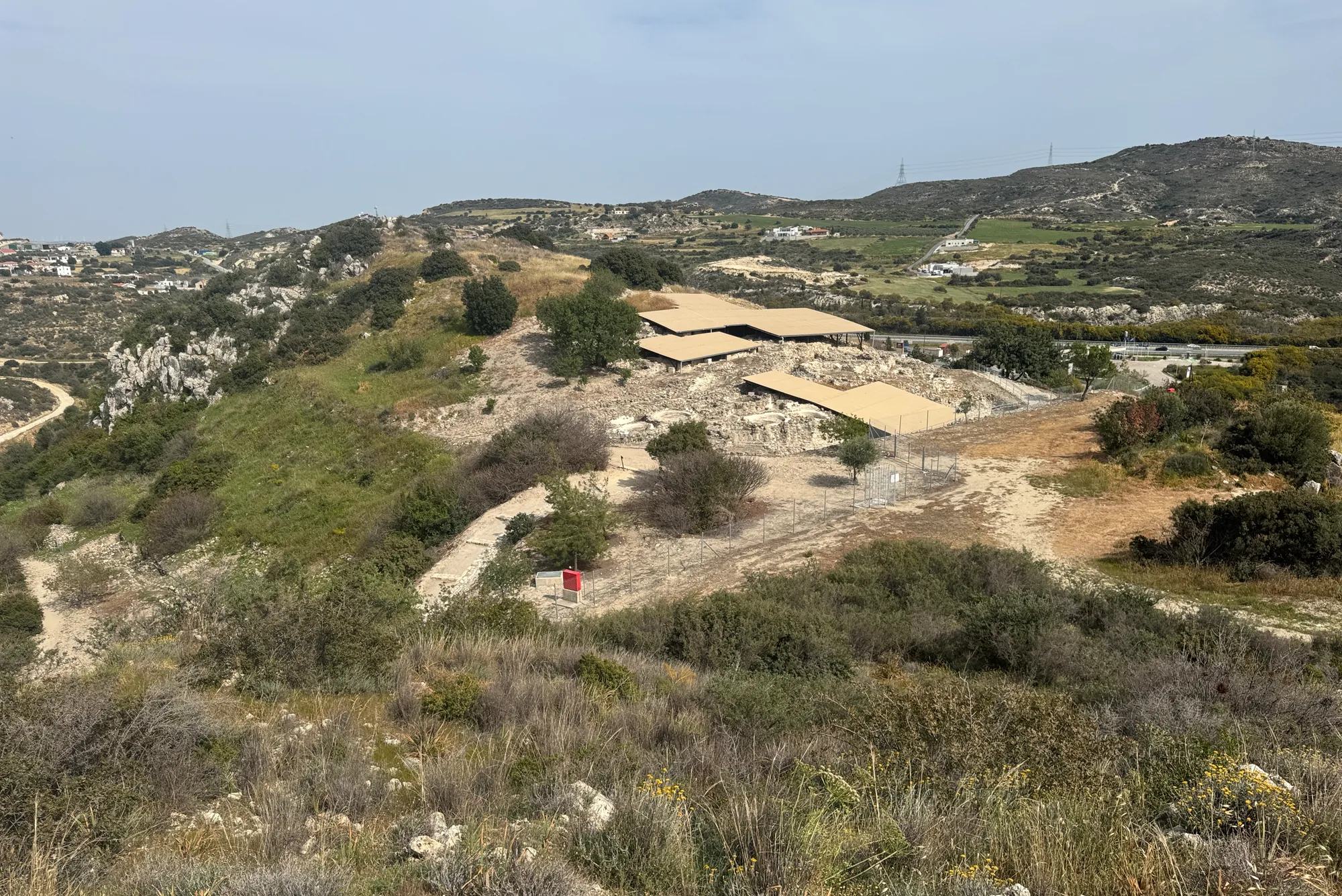
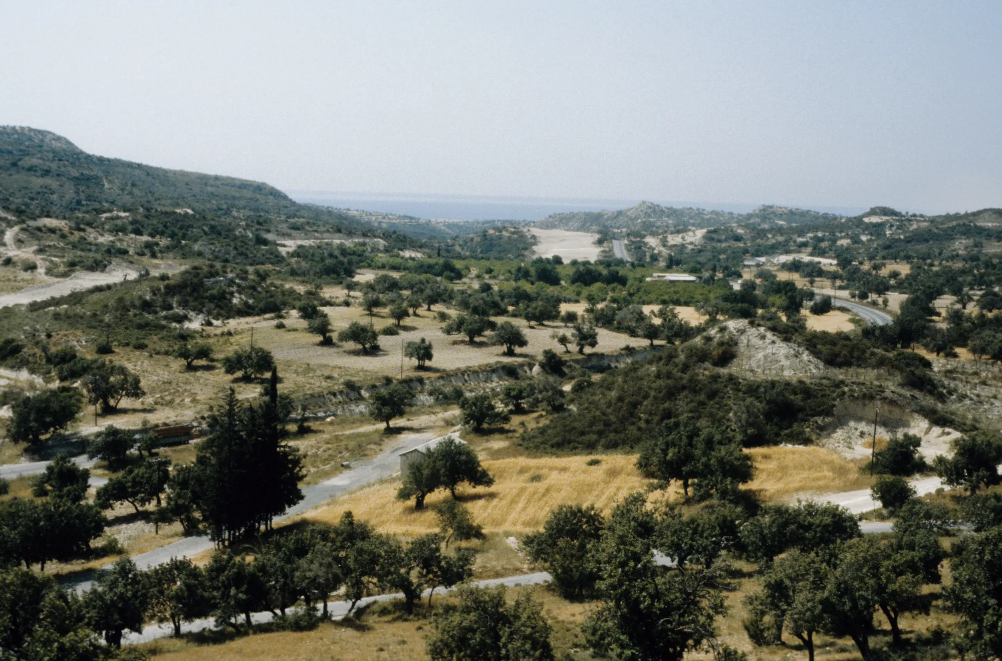
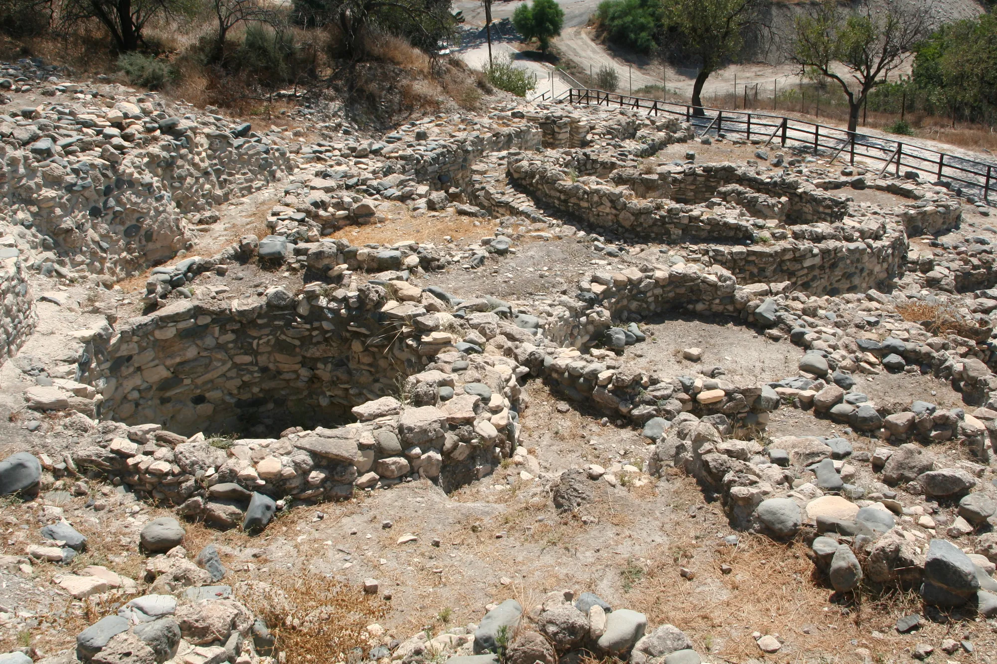
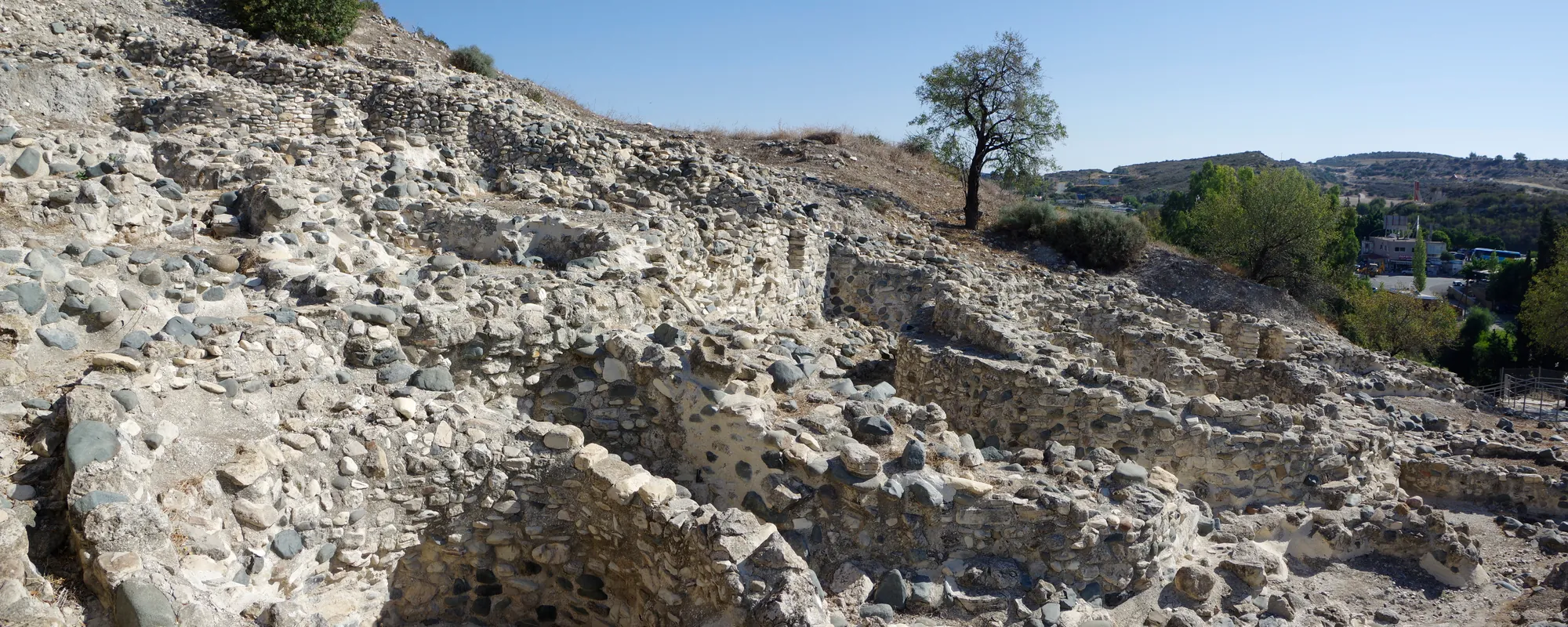
The houses spread "in a vast semicircle around the steepest and highest part of the hill" [2, p. 26], from the summit down to the foot of the slope over a distance of more than 180 m [4, p. 23]. Le Brun put the built-up surface at about 1.5 ha over all the phases of the village [2, p. 26]; other estimates of the whole site run to about 2.5 ha [6]. The village walls follow abrupt breaks in the slope, so that the levelled ground inside stood well above the ground outside [4, p. 21]. In modern times dry-stone field terraces and a ravine cut across the summit have damaged some of the houses [2, pp. 45, 47].
Discovery and excavation
Porphyrios Dikaios, then Curator of the Cyprus Museum, discovered the site in 1934, the year the Department of Antiquities was created, together with George Anastasiou of the museum staff [2, p. 12]. Dikaios later called Anastasiou his "faithful companion not only in the search for prehistoric sites but also in the discovery and excavation of the Khirokitia settlement" [7, p. viii]. The Swedish Cyprus Expedition's work on the islet of Petra tou Limniti in 1929 had only hinted at a stage of settlement before pottery. Khirokitia confirmed it [2, p. 12].
Dikaios excavated in seasons from 1936 to 1939, and the work was "rounded off in a supplementary campaign in 1946" [7]. He dug three zones, A, B and C, on both sides of a long stone structure that he called the "Main Road" [2, p. 12], and uncovered about 2,700 m² [8, p. 51]. Because the Neolithic levels lie just below the ploughsoil, he could clear what A. H. S. Megaw, in his foreword to the report, called "as great an area as had then been uncovered of any contemporary settlement in the Levant" [7]. The final report appeared in 1953 as the first monograph of the Department, with specialist studies that included J. Lawrence Angel's report on the human remains [7].
In 1972 the Department of Antiquities returned for two short operations: a trial trench in the north of zone C and the partial excavation of unit XII in zone A [2, p. 12]. In 1976 a preliminary joint season of the CNRS and the British School of Archaeology in Jerusalem, directed by N. P. Stanley Price and Alain Le Brun, mapped the limits of the site by surface collection and geophysical survey, with test soundings [9, p. 733].
From 1977 a French mission under Alain Le Brun, with Odile Daune-Le Brun as deputy, took up the excavation for the CNRS and the French Ministry of Foreign Affairs. It opened a new trench on the summit, zone D [2, p. 12], and worked on the site until the late 2000s. Its results appeared season by season in the Bulletin de correspondance hellénique and in three volumes of Fouilles récentes à Khirokitia [10; 11; 12].
Levels and dates
Dikaios divided the deposit into three main periods. Periods I and II had no pottery; period III, at the top, contained painted and combed pottery, and Dikaios took it for the last phase of the same village, which he dated early in the 4th millennium BC. Radiocarbon dates measured in Stockholm in 1959 placed the aceramic village much earlier, and Dikaios then reinterpreted the pottery as the work of later people who reoccupied the hill after a break [13].
Joanne Clarke's review of the radiocarbon evidence lists 18 measurements for Khirokitia, 14 of them reliable, spanning about 7300 to 5730 cal BC at one standard deviation [1, pp. 34, 54–55]. She notes that "there are a lot of dates for Khirokitia but they do not elucidate the chronological sequence very well" [1, p. 54]. A rounded span of about 7000 to 5200 BC is common, with abandonment in the latter part of the 6th millennium [1, p. 97].
The French excavators recorded two sequences. In the east sector the levels are lettered, from G/F upwards [4, p. 21]; in the west sector they are numbered IV to I, with I the latest, and the earliest western level is contemporary with or later than the last eastern one [12, p. 15]. No single level has its own calibrated date, so the phases below are given in their order, and dates only where the evidence allows.
Khirokitia stands at the end of the Aceramic Neolithic. Excavations in the 1990s at Akrotiri-Aetokremnos, Parekklisha-Shillourokambos, the wells at Kissonerga-Mylouthkia (see Kissonerga) and the lower levels of Kalavasos-Tenta pushed the first villages of Cyprus back by a millennium or more [14].
Phases
- The first village (east levels G/F to C)from about 7000 BC
Round houses on the summit and the east slope, closed by wall 435, rebuilt as 423, with an entrance (access 1) bridging a drop of at least 2.5 m.
- Mur 100 (east level B)
A massive wall of earth faced with stone is built along the outside of the old one and blocks access 1. Dikaios took it for a road.
- The village grows west (west level III)
A strip outside Mur 100 is built up and closed by wall 284, with the stepped entrance, access 2.
- Last levels (west II and I)to the later 6th millennium BC
A cross-wall closes the north of the built area and part of the western edge collapses. The village is then abandoned.
- Gapabout 5050 to 4750 BC
No settled village anywhere on Cyprus is dated to these centuries.
- Ceramic Neolithic reoccupation5th millennium BC
People of the Sotira culture leave combed and painted pottery in the top layers. How large this reoccupation was is not known.
- Excavation1936–1946, 1972, 1976 to the late 2000s
Dikaios for the Department of Antiquities; soundings by Christou and Stanley Price; the French mission under Alain Le Brun.
- World Heritage1998
Inscribed on the UNESCO World Heritage List.
The village walls
Dikaios's "Main Road"
The structure that dominated Dikaios's excavation is a long, massive bank of river stones, diorite and limestone, exposed for about 185 m [7, p. 188; 8, p. 51]. From the river cliff on the south-east it runs 30 m from east to west at a gradient of 1 in 3, then about 100 m north-west at no more than 1 in 4, and then curves across the saddle and runs north [7, p. 188]. It was built in two stages, first to a height of 1.50 to 2.50 m and later raised and thickened, and halfway up the slope it widens into a platform 3 m across [7, pp. 189, 195]. Dikaios read it as a raised street climbing through the village, though he admitted that "at first sight some stretches of it give the impression of a town wall" [7, p. 189].
Three walls in sequence
The French excavations showed that the east sector was lived in before the west, and that the "Main Road", now numbered Mur 100, was built before the houses to its west. It ran along the edge of the village: it was the village wall [2, pp. 13–14]. The 1981 season confirmed that everything west of it is later [15, p. 713]. Le Brun describes it as "a massive pisé structure, its exterior facade revetted in stone", modified several times [2, pp. 14–16].
Further work found that Mur 100 was itself the second of three walls [16; 4, p. 23]. Each marks a stage in the growth of the village, and the plan below, after the general plan in the excavation report [12, p. 12], follows them from east to west.
Plan · c. 7000 to 5200 BC
The village of Khirokitia
Khirokitia, the hill in the bend of the Maroni
West sector: west level III, wall 284 and access 2
3 of 10
Mur 100, the “Main Road”
A massive wall of earth faced with stone, exposed for about 185 m from the river cliff up the south slope and across the saddle, up to 3.5 m wide and 2.5 m high as preserved. Dikaios took it for a raised street. The French excavations showed that the houses west of it are later, so it was the edge of the village. It was built at east level B against the older wall, and closed access 1.
Dikaios 1953, pp. 216 to 217; Le Brun 1992, p. 23; Le Brun 1997, pp. 13 to 16
Key
- Wall, traced from the published plan
- Wall, placed from the excavators’ description
- Wall, line not known
- Household of level III, approximate
- Stair block and the structure before it
- Estimated extent of the village
- Excavated 1936 to 1946 (Dikaios)
- Excavated from 1977 (French mission)
- River bed
- Contours at 5 m
The first village, on the summit and the east slope, was closed by wall 435, built on virgin soil and rebuilt after a collapse as wall 423. Only 8 m of it has been exposed; it is 2.30 to 2.80 m thick [16, p. 931]. Mur 100 was built at east level B against its outer side, partly over the last floor of the entrance through it [4, p. 21; 16, p. 931]. When the village spread west, a strip outside Mur 100 was built up and closed by wall 284, about 10 m further out and parallel to it [15, p. 713]. Wall 284 is well built, up to 2.50 m thick, preserved to more than 3 m high and traced for more than 60 m [15, p. 713; 16, p. 931; 2, p. 16]. It "was built at the same time as the dwelling units adjoining it, whose walls are included in its very structure" [15, p. 713].
The western sector went on changing. At level II a new wall, 245, built at right angles to Mur 100 and wall 284, closed the built area on the north. At the end of level II part of the western edge collapsed, and at level I a line of large upright blocks stood inside the line of wall 284, as much a retaining kerb as a fence [15, pp. 713, 715].
Two entrances
At access 1 the top of wall 435/423, the village wall of east levels E to C, was interrupted over about 1.20 m. Its successive plastered floors continued outwards over a stone construction built against the outer face of the wall, because the village floor stood at least 2.50 m above the ground outside [4, p. 21; 16, p. 931]. Le Brun read it as a means of bridging that drop, and saw nothing in it designed to control who came in [4, p. 23]. The rebuilding of the wall as Mur 100 at level B blocked it [4, p. 21].
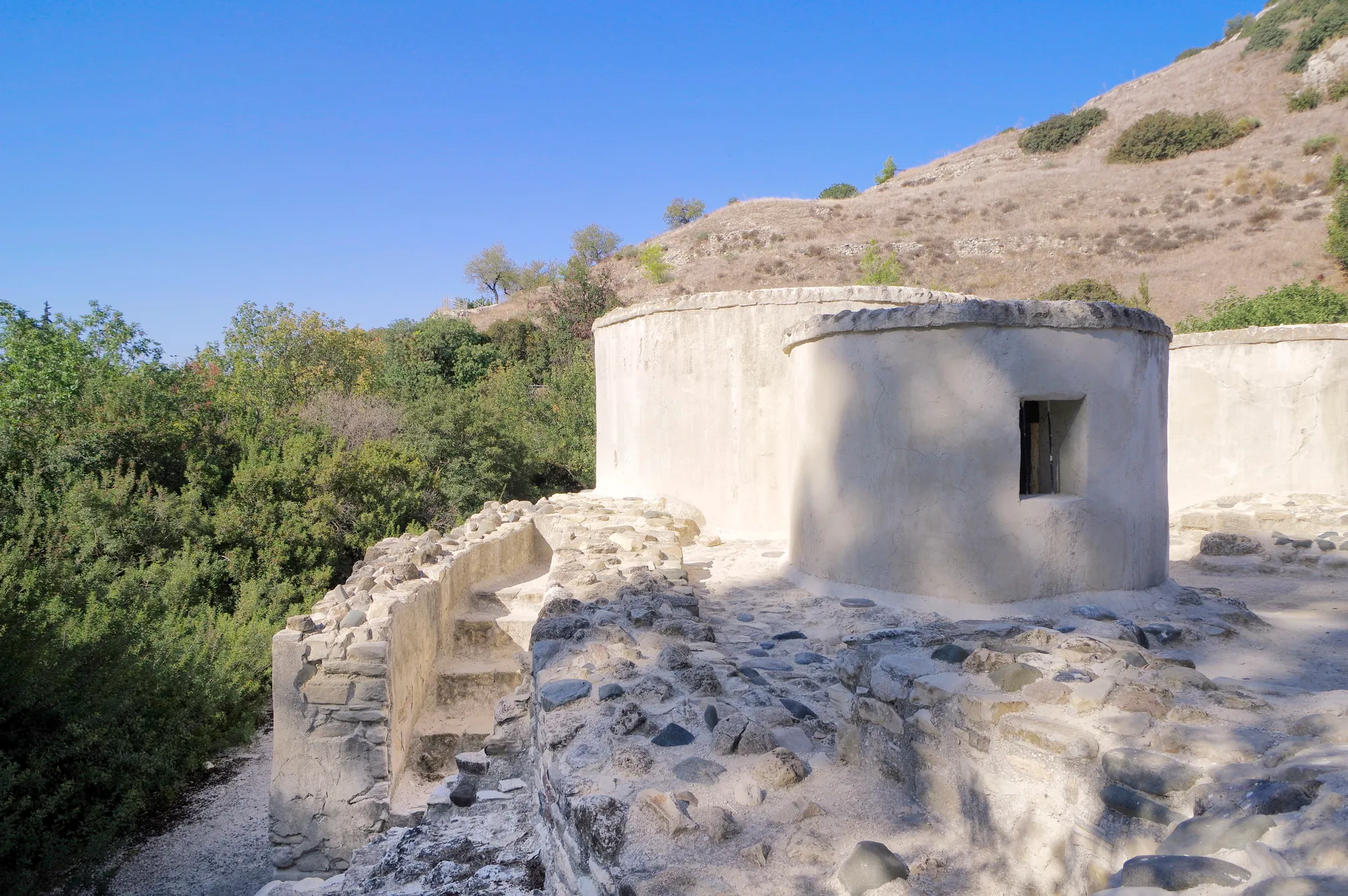
The entrance through wall 284, access 2, is more elaborate. Outside the wall the ground lay more than 2.80 m below the village surface. Against the outer face stands a massive block of stone, 10 m long and 1.60 m deep, "with carefully plastered faces" [2, p. 57], and built into it is a stair only 0.80 m wide, with treads of flat stones and pisé 0.45 m deep and risers of 0.30 to 0.40 m [4, p. 23; 2, p. 17]. The stair climbs in three flights at right angles; the middle flight is built inside the core of the block and hidden from view [2, p. 17]. In 1992, with seven steps cleared, Le Brun had described two flights [4, p. 23]. In front of its foot a stone structure, preserved almost 2.5 m high and leaning on an outcrop of rock, prevents a straight approach. Whether it was a free-standing bastion or part of an outer wall was still undecided in 1997 [2, pp. 17–19, 58].
A visitor came from the west, went round the blocking structure, climbed the first flight, turned left up the hidden flight, turned right up the third onto the top of the wall, and then turned right again along the wall top for several metres. The steps down into the village had not yet been excavated [2, p. 58]. The passage is too narrow and too carefully plastered for flocks, and no animal pens are known inside the village [4, p. 25]. Le Brun knew of no parallel for this arrangement in Cyprus or the Near East; the nearest earlier case, four steps in a retaining wall at Beidha in Jordan, works on a different principle [2, p. 17; 4, p. 25].
What the walls were for
Building a perimeter wall together with the village shows, in Le Brun's words, "forethought, planning, and considerable mobilization of manpower" [14]. The traditional reading is defence against rivals for land [17, p. 16]. Others see the walls as a boundary that marked out the community and showed that someone could marshal the labour to build them [8, p. 51]. The walls controlled access to the village, but we know of no evidence that it was ever attacked (see fortifications).
Houses and households
Round houses
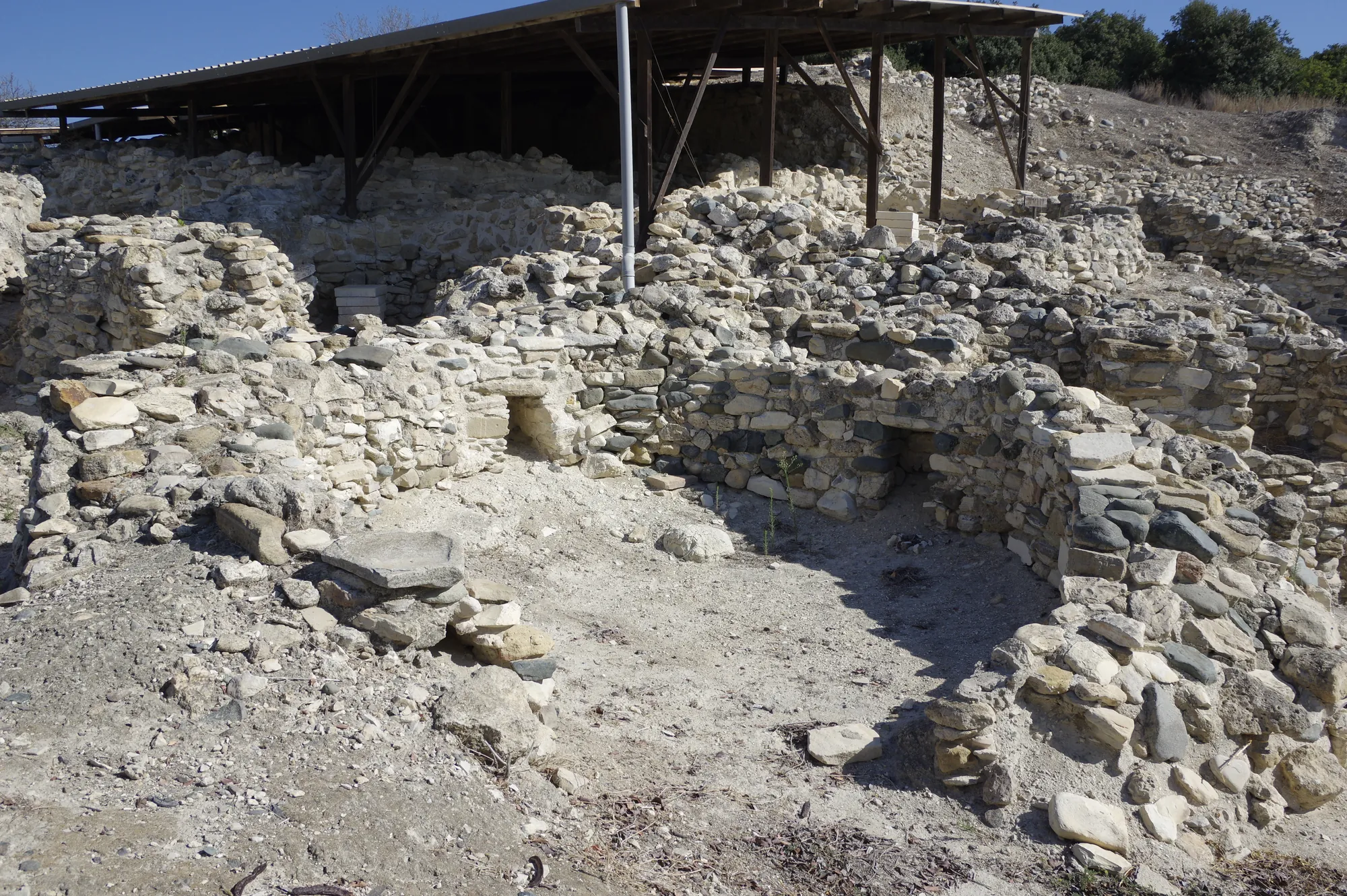
The buildings at Khirokitia are round, and Dikaios called them tholoi. Their external diameters range from about 2.3 to 9.2 m and their internal diameters from 1.4 to 4.8 m [2, p. 19]. The walls are thick, up to about 3 m in some units and 4 m in Tholos IA [5, p. 107], so the wall takes up much of each footprint. The commonest build is an inner ring of mudbrick or pisé doubled on the outside by a ring of stone, set on levelled ground without a foundation trench [2, p. 19]. The stone is pale limestone from the hill and dark diabase cobbles from the riverbed, laid in mud; the mudbricks of Tholos XXV measure 25 to 30 cm long and 6.5 to 7.5 cm thick [7, p. 141]. Walls were thickened over time by adding new rings on the inside [2, pp. 47–48].
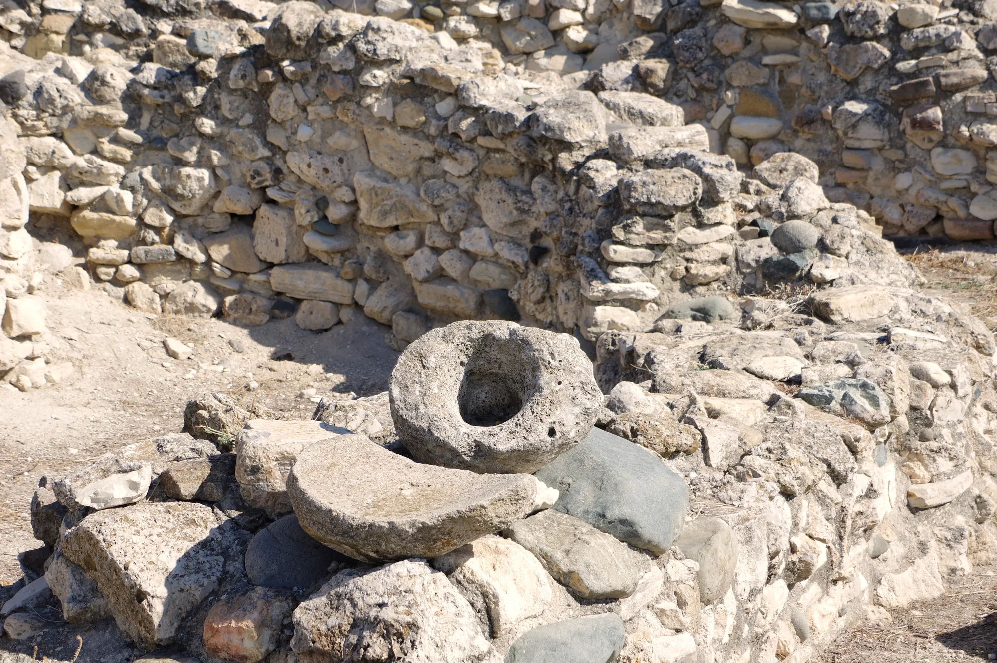
Doors are usually about 0.5 m wide, often with a paved threshold and sometimes reached by steps. The door is normally the only opening. Windows are rare, though house S.125 has three, each about 0.45 m wide [2, pp. 19, 60]. Inside, floors of plaster were laid one over another, and there are hearths, platforms and pits. Some of the larger houses, such as S.117 and S.122, have pairs of notched stone piers, which Le Brun read as supports for raised platforms [2, pp. 21, 59–60]. Some interior walls were painted with red ochre on plaster [2, pp. 20, 59; 15, p. 715].
A household of several rooms
A household occupied several round buildings. Le Brun describes the household as "a compound of several of these circular units around an unroofed space, a sort of small inner 'courtyard'", with a fixed quern in the court. Cooking was done indoors on small hearths covered with slabs, "designed only to hold charcoal from fires lit outside" [2, p. 22]. Three or four buildings usually stand round the court with their doors facing inwards [14]. Dikaios's group of Tholoi XXVII to XXIX is a clear example: a living room and a kitchen with a central hearth open onto a yard where a quern stood on a platform half a metre high [2, pp. 50–51].
The household plan below shows one such group in the west sector at level III, just inside wall 284 and access 2.
Plan · c. 7000 to 5200 BC
A household at Khirokitia
Khirokitia, level III, beside access 2
9 of 11
The court
Five units close round “a space of small dimensions whose floor is plastered”. Its outline here is ours.
BCH 1981 (Le Brun's site report)
Key
- Excavated
- Strong inference
- Reconstruction
- Speculative
- Roofed floor
- Court or yard
- Fitting
- Area marked on the floor
- Below the cut, or ruined
Flat roofs
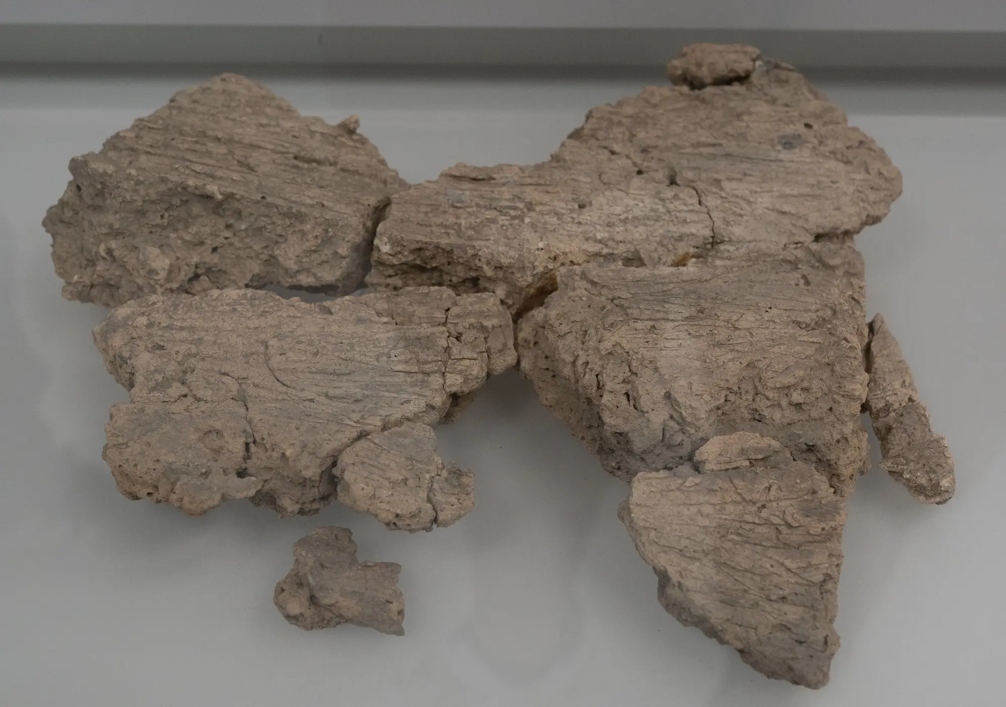
The roofs were flat. In west level III the roof of house S.85 burned and fell in a single block. Its pieces of earth, 5 to 8 cm thick, are flat on one face and carry the impressions of parallel branches and reeds on the other, and Le Brun reconstructed from them a flat roof terrace: a bed of branches covered with coats of pisé [16, pp. 931–934]. Dikaios had already found a burnt roof of timber and pisé over the corridor of Tholos IA, with sockets for the beams in the wall [7, pp. 15–18].
The domed roofs of older drawings rest on one house, Tholos XLVII, whose wall leans inwards. Le Brun showed that the lean is not a corbelled vault: "the wall in its entirety appears to have toppled over", pushed by the weight of earth on the steep slope, and a mudbrick wall nearby leans the same way [2, p. 54]. A conical thatched roof would need a central post. Dikaios listed only a few pits that might be post-holes, one of them in the centre of Tholos XI [7, pp. 207, 211], and the French excavators found none in the floor of S.85 [16, p. 934].
A crowded village
The houses were "crowded one against the other", separated only by narrow strips used as passages and for rubbish [2, p. 24]. Some open spaces, carefully plastered and with no fittings, were kept free on purpose [2, pp. 24, 26]. "No cult place has been found at Khirokitia" [2, p. 27]. The use of Tholos IA, the largest building, with walls up to 4 m thick and a roofed passage round part of it, is unknown; a leader's house, a workshop and a ritual building have all been suggested [17, p. 15; 18, pp. 115, 138].
Le Brun estimated that "the maximum population at Khirokitia lies between 300 and 600 inhabitants, but was no doubt closer to 300 than 600" [2, p. 27]. The figure assumes that the houses on the plan were in use together, which not all of them were (see population and demography).
Burials beneath the floors
The villagers buried their dead in pits dug into the floors of the houses, and went on living in them: "The dead therefore remained with the living" [2, p. 27]. Most burials are single and primary, the body tightly contracted and usually lying on its right side, and the pit was sealed by a new plaster floor [2, p. 27; 19, p. 72]. The excavations have recovered about 250 individuals [8, p. 52; 18, p. 77]. Dikaios's sample, studied by Angel, comprised 34 infants, 11 children, 39 adult men and 37 adult women [7, p. 416]. One house, Tholos XLVII, held 29 burials, 24 of them newborn infants [2, p. 55; 18, p. 89].
Grave goods were not the rule, and they were commoner with women. Necklaces of dentalium shell and carnelian occur only with women, and stone bowls, often deliberately broken, more often with women; a heavy stone, often a quern, was laid on the body about twice as often with men [2, pp. 27–28]. Dikaios recorded a young adult lying face down with a quern on the chest and a broken stone bowl round the body [7, p. 51]. Older accounts explain the stone as a way of keeping the dead from returning [17, p. 17]; the burials themselves cannot show why it was placed there.
Angel measured an average stature of 1.61 m for men and 1.51 m for women. Infant mortality was very high, and he put life expectancy at birth at about 22 years, a figure he thought "almost certainly a little too high" [2, p. 27; 7, p. 417]. Many skulls were flattened at the back by binding in infancy: Angel found the shaping in about 29% of the usable male skulls and about 50% of the female ones [7, p. 416]. Françoise Le Mort later studied the human remains for the French mission. Why the heads were shaped is unknown. Khirokitia's place in the wider history of burial on the island is set out under Neolithic and Chalcolithic burial.
Stone vessels, figurines and tools
Stone bowls
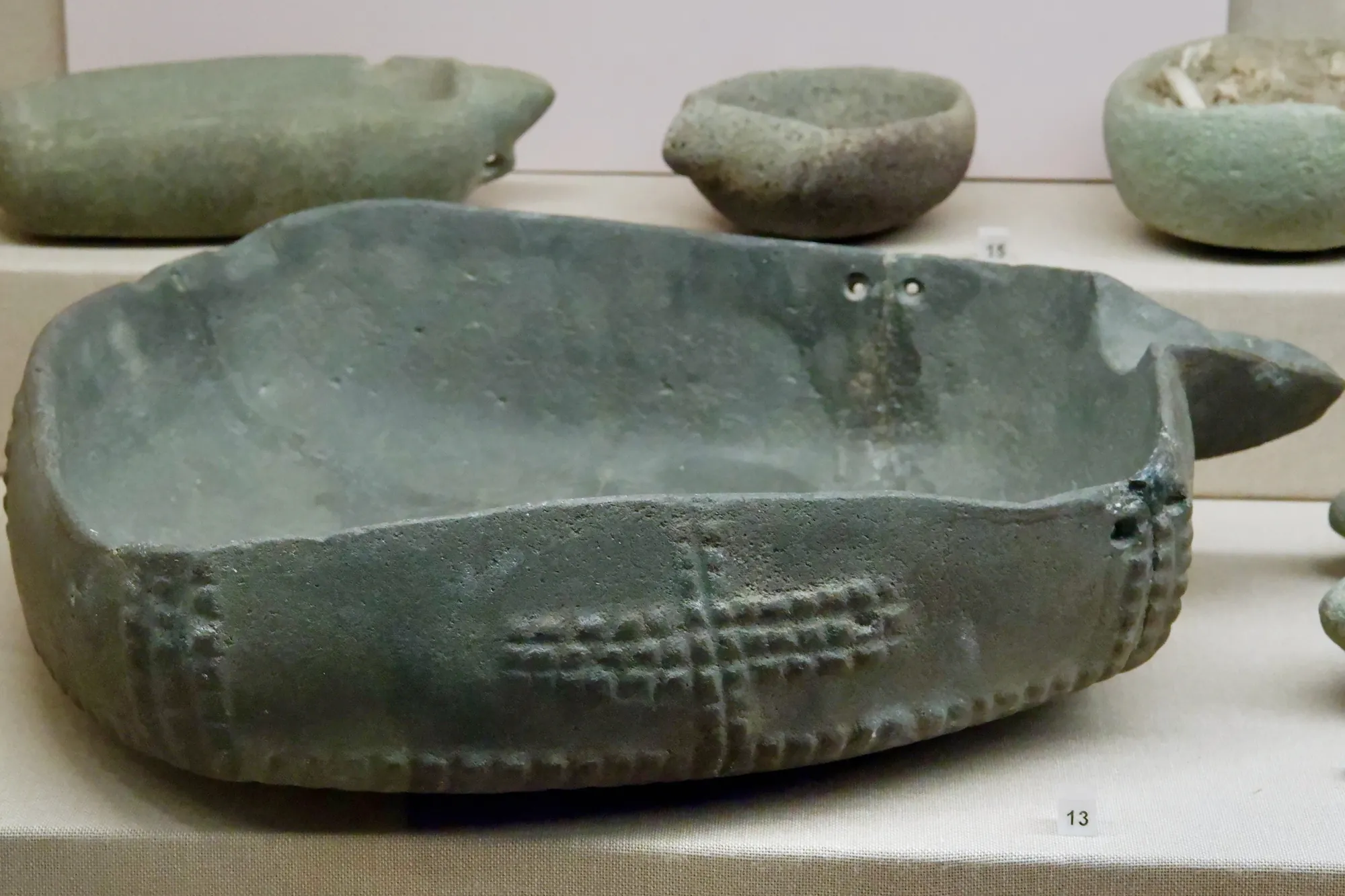
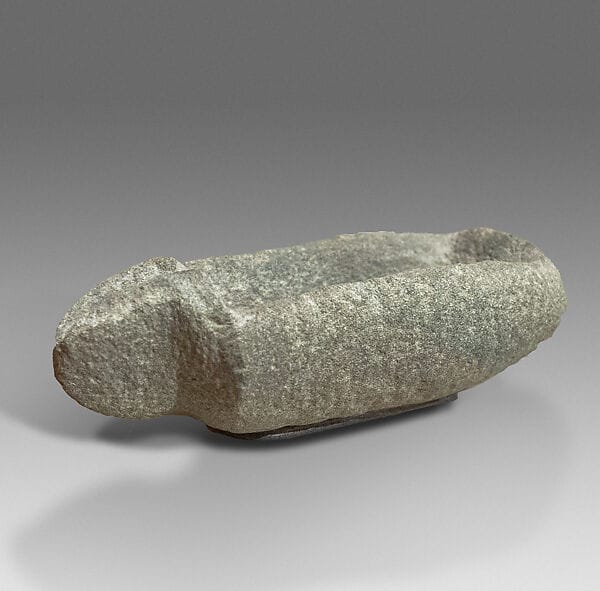
With no pottery, the villagers ground their vessels from stone. Bowls of grey andesite and diabase river cobbles have thin walls, polished surfaces, spouts and pierced lugs, and some are incised or carved in relief [5, p. 109]. Dikaios regarded the stone-vase industry as the chief feature of the Khirokitia culture [7, p. 232]. One bowl carved in relief with cross-shaped designs was found broken under the middle of a body in one of the large tholoi [20, p. 30]. The craft is described more fully under stone vessels.
Figurines
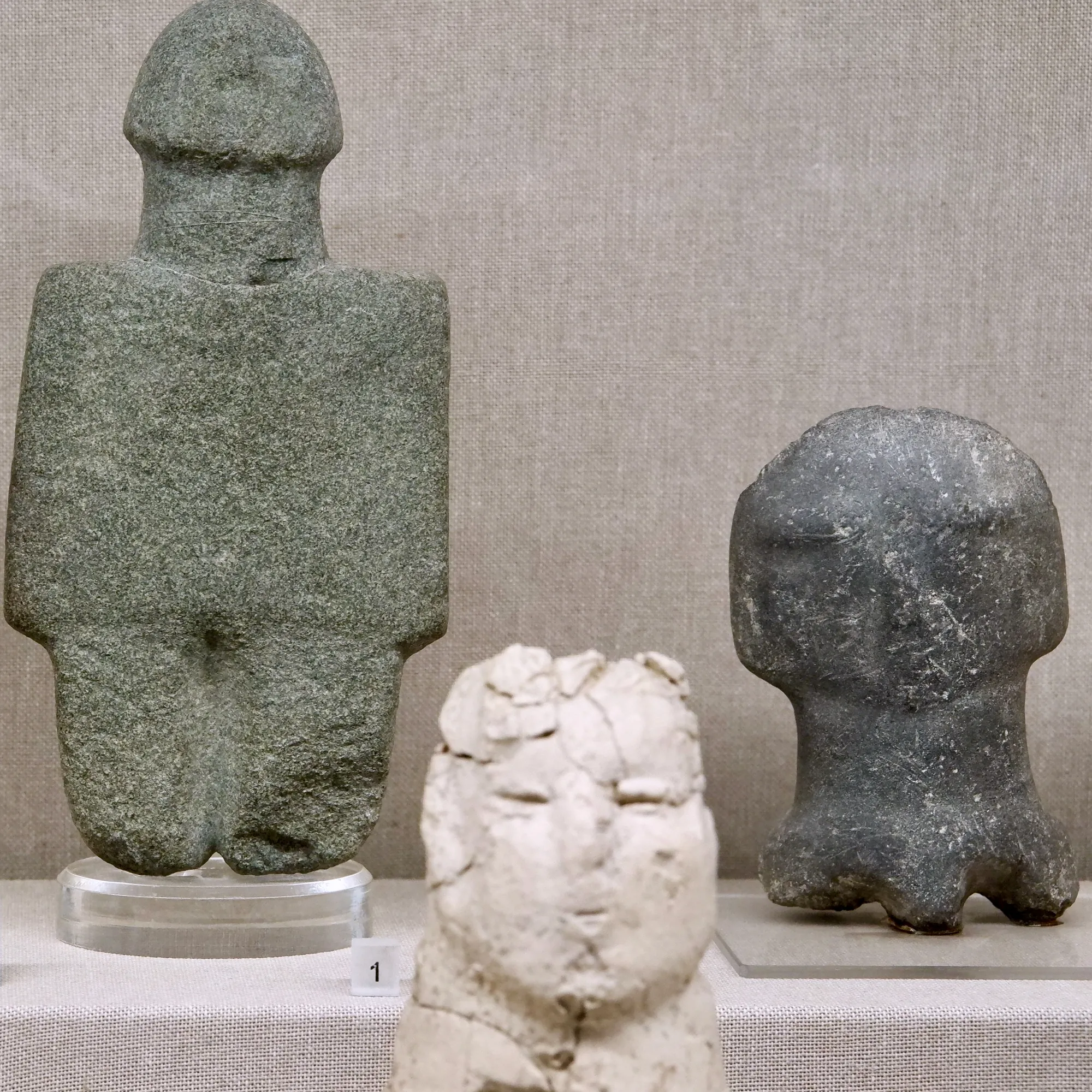
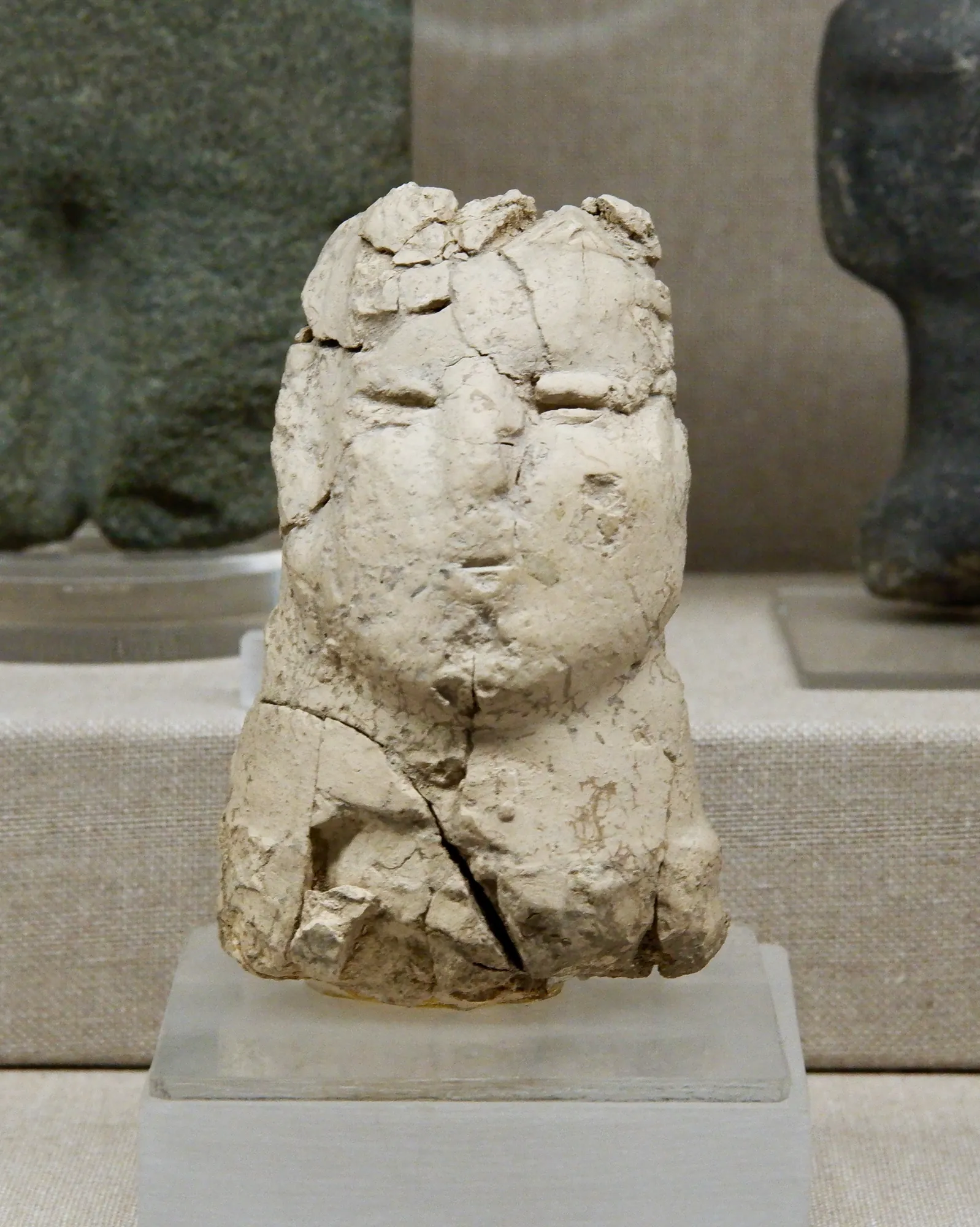
Khirokitia has produced the largest group of Neolithic figurines from any site on Cyprus, 27 pieces [8, pp. 93, 118]. Most are schematic figures of andesite or diabase, which Dikaios grouped as "fiddle-shaped", "squatting" and "flat"; the sex is usually not shown [5, p. 109]. The exception is a head of unbaked clay about 10.5 cm high, "commonly regarded as the most naturalistic anthropomorphic representation of the Neolithic" [8, p. 99]. Small grooved cones of andesite, sometimes called "mushroom" stones, have been read as house models or gaming pieces; their use is not known [21, p. 29]. The class as a whole is treated under Neolithic and picrolite figurines.
Ornaments, tools and contacts
The necklaces from the women's graves string sections of dentalium shell with carnelian beads, and there are pendants and other pieces of picrolite [22, p. 176]. Querns, rubbers and pounders are everywhere, with polished diabase axes. Sickle blades, scrapers and rare arrowheads were chipped from flint and chert, all of it worked on the site [7, p. 412; 5, p. 109]. The French excavations also recovered a large bone industry of needles, awls and points [23] (see ivory, bone and shell).
Two materials came from outside the island. Obsidian does not occur on Cyprus, and the few obsidian blades from the village were probably brought from Anatolia [7, p. 440]. The carnelian is "most probably of foreign origin" [20, p. 30]. The quantities are small, but they show that some contact with the mainland continued.
Fields and flocks
Querns are found throughout the village, and grain was ground in the courtyards [2, p. 22]. The villagers hunted fallow deer and kept sheep, goats and pigs, and in the western sector deer bones decline while those of sheep and goat increase from level III to level I [15, p. 715]. The absence of animal pens inside the walls suggests that the flocks were kept outside [4, p. 25]. The wider picture of diet on the island is set out under food and diet.
Abandonment and the later reoccupation
The village was abandoned in the later 6th millennium BC [1, p. 97]. Why is not known. Across Cyprus, the end of the Khirokitia culture is followed by a gap in the radiocarbon record of about 5050 to 4750 cal BC, bridged only by traces of short-lived camps; Clarke called it a "cultural black hole" [1].
When people returned to the hill they brought pottery. The painted and combed pottery of Dikaios's period III belongs to the Ceramic Neolithic, the Sotira culture named after Sotira-Teppes, and has been read since 1959 as a later reoccupation [13]. How large or lasting that settlement was is not known. Khirokitia belongs with the southern sites of the Ceramic Neolithic, where Combed Ware is the characteristic pottery beside Red-on-White [1]. Of the stone shapes of the earlier village, the only one the new potters copied in clay was the spouted bowl [7, p. 276].
Whether anything passed from the old village to the new one is debated. A study of the bone tools by Legrand-Pineau finds continuity between the Khirokitia and Sotira cultures, against the older view of a clean break [6].
Pieces in the Drakopoulos collection of kinds found at this site. None of them comes from the site.
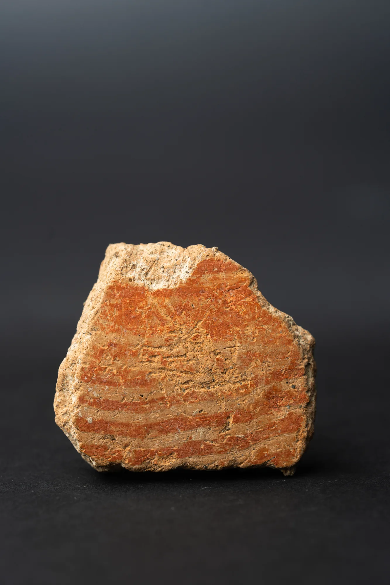 Combed Ware Bowl Fragment with Parallel BandsNeolithic · 4500–3900 BCDrakopoulos collection
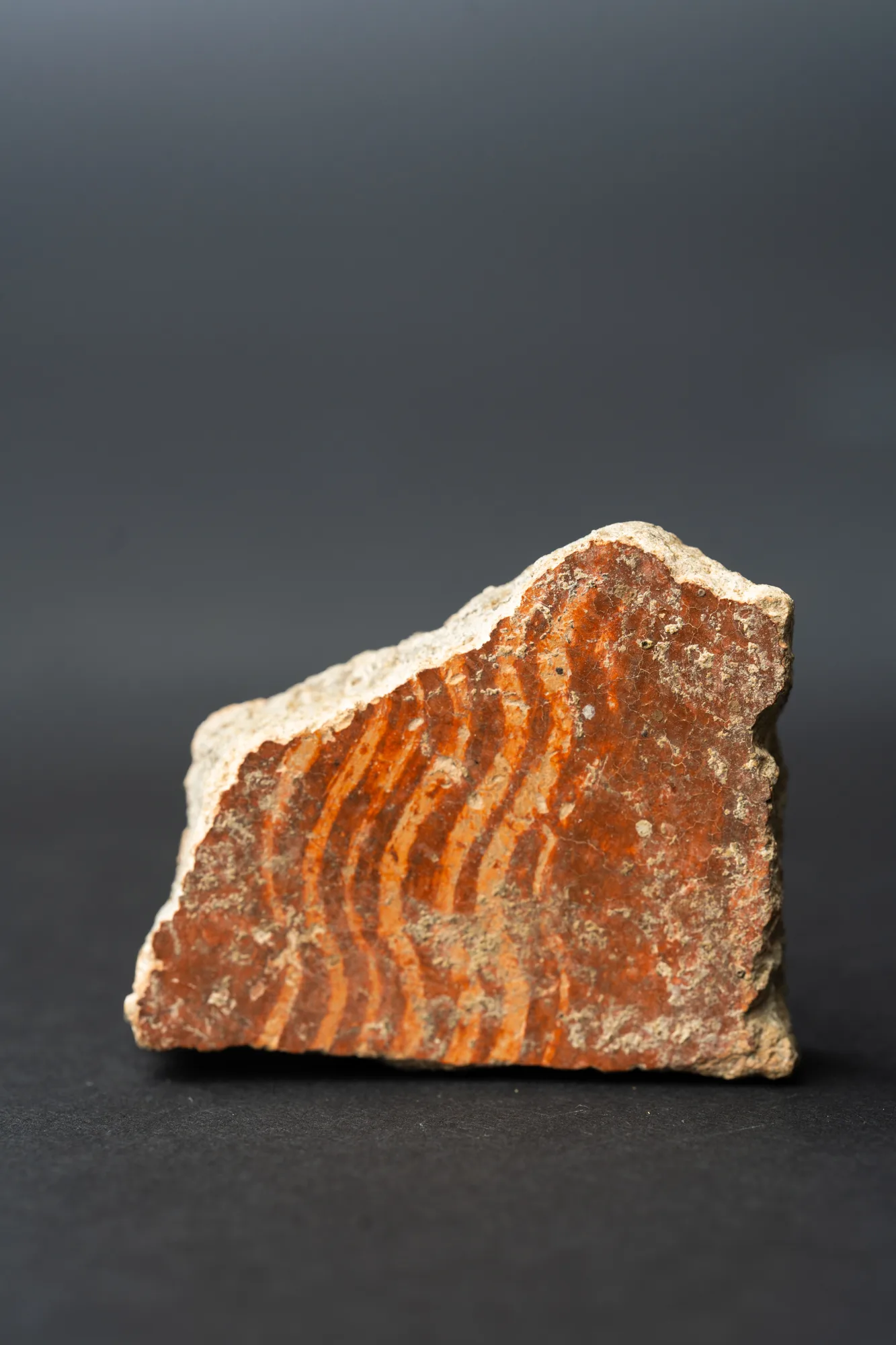 Combed Ware Bowl Fragment with Multiple Wavy BandsNeolithic · 4500–3900 BCDrakopoulos collection
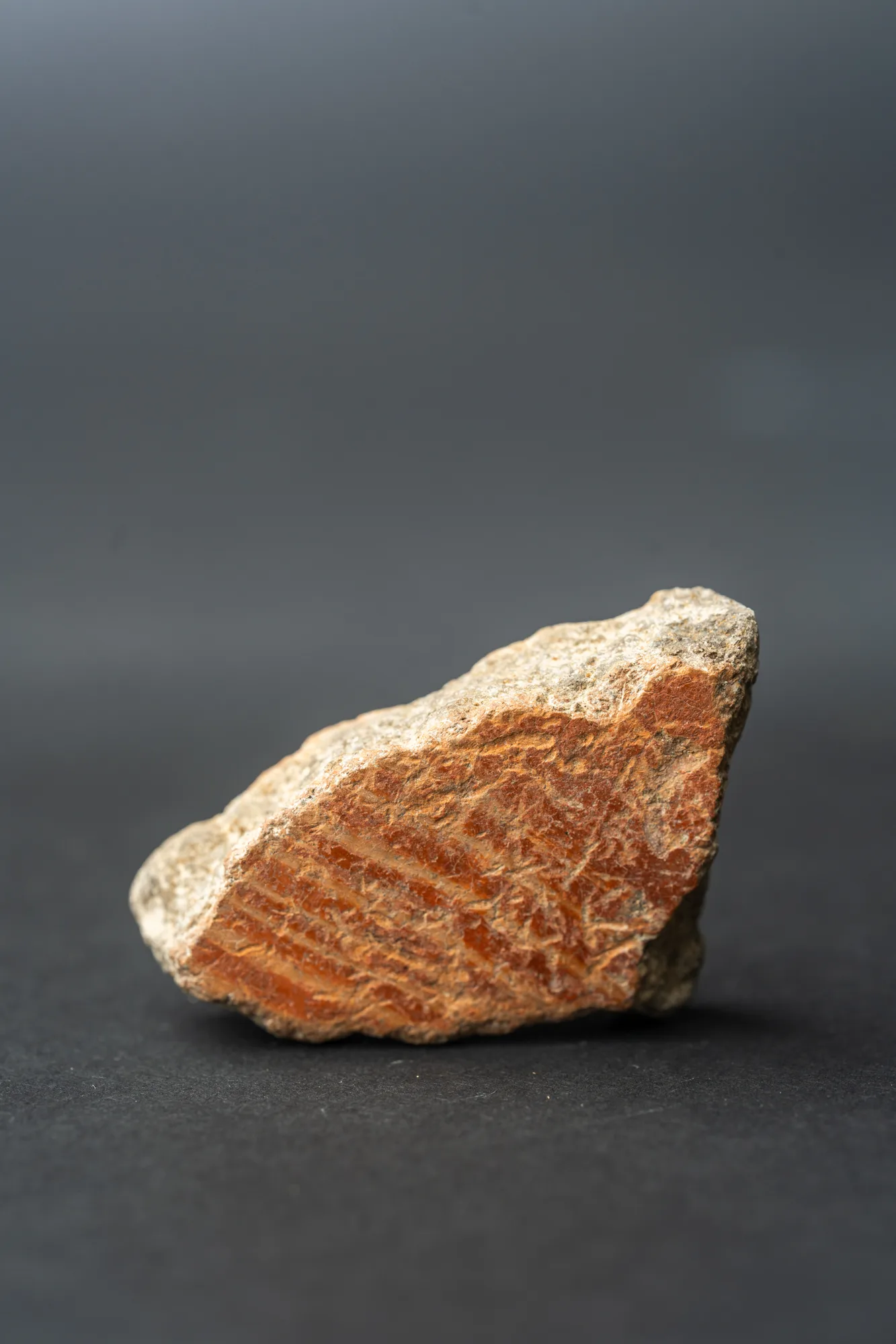 Combed Ware Bowl Fragment with Oblique BandsNeolithic · 4500–3900 BCDrakopoulos collection
Visiting Khirokitia
Choirokoitia was inscribed on the UNESCO World Heritage List in 1998 (no. 848). UNESCO notes that "both the excavated remains and the untouched part of Choirokoitia demonstrate clearly the origins of proto-urban settlement in the Mediterranean region and beyond" [3]. Most of the village has never been dug.
The site is about 32 km from Larnaca and 48 km from Nicosia, with a free car park. At the time of writing it is open daily from 08:30 to 17:00 between 16 September and 15 April and from 08:30 to 19:30 between 16 April and 15 September, closed on Christmas Day, New Year's Day and Orthodox Easter Sunday, and entry costs €2.50; check before you go (tel. +357 24 322 710) [24]. A path with steps and handrails climbs the hill through the excavated houses and along the walls. There is no shade, and the visit takes about an hour to an hour and a half. The hilltop is not accessible by wheelchair; the area of the replica houses is level [24].
Beside the visitors' area stands a group of replica houses and a copy of the stepped entrance. The Department of Antiquities built five houses, part of the village wall and the entrance with traditional techniques and materials from the site and the Maroni riverbed, to plans and dimensions supplied by the French mission, as Sophocles Hadjisavvas describes in Le Brun's guide; their flat roofs follow "the imprints on fragments of earth from a collapsed roof" [2, pp. 61–62]. Two of them copy S.117 and S.125, houses of the first village in the east sector, so the group sets earlier houses beside a copy of a later entrance [2, pp. 45, 59–60].
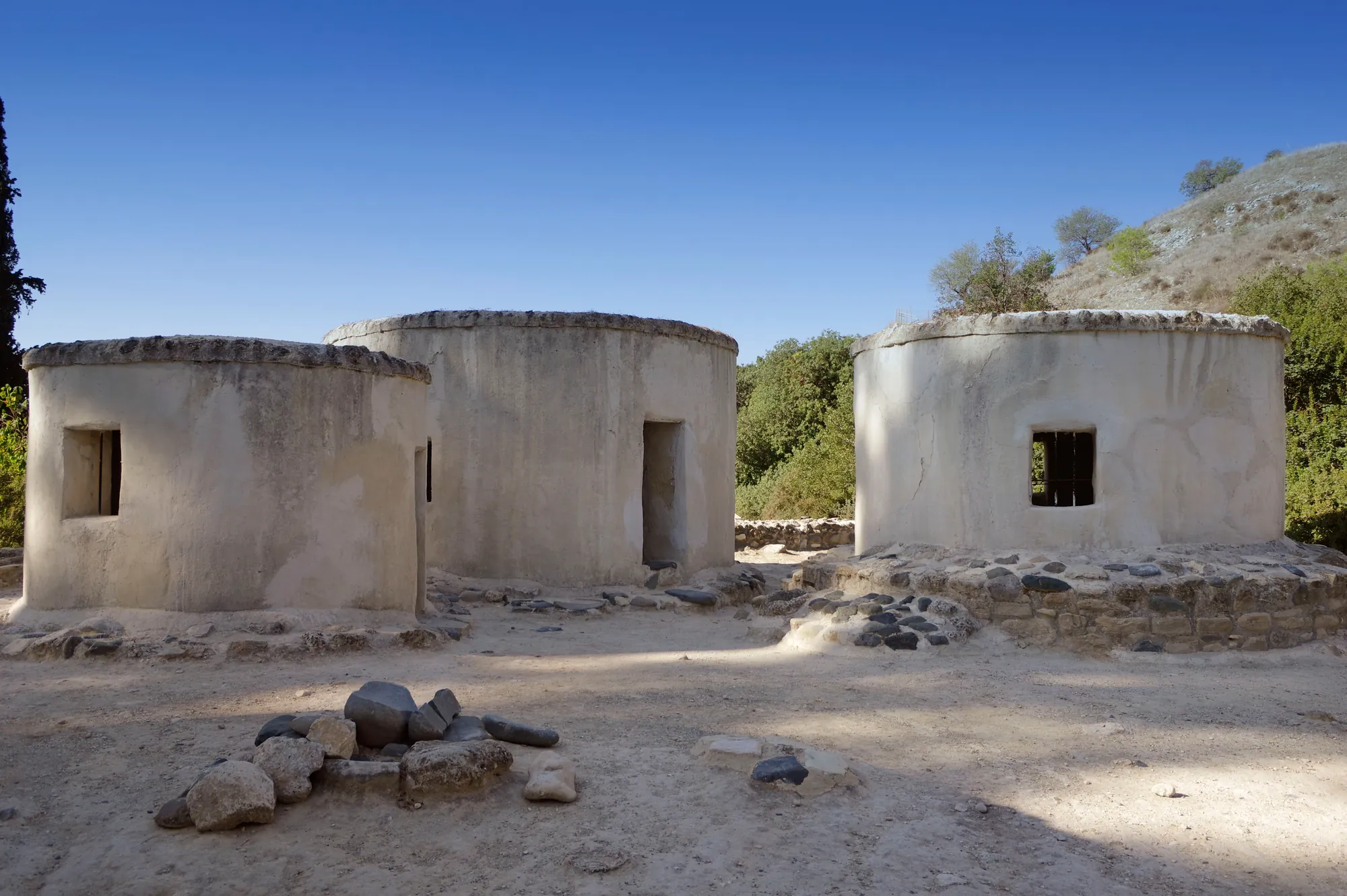
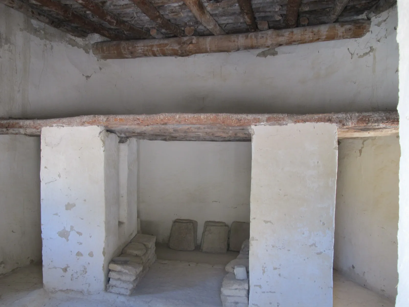
Nothing original is displayed on the site. The finds from Dikaios's excavations, including the stone bowls, the figurines, the clay head and the necklaces, are in the Cyprus Museum in Nicosia; finds from the French excavations, among them stone figurines, bowls, querns, bone tools and the roof fragment shown above, are in the Larnaca District Museum. The other Aceramic village open to visitors, Kalavasos-Tenta, lies about 6 km to the south-west in the Vasilikos valley.
Our reconstruction
Our reconstruction of a Khirokitia household takes the level III group beside wall 284 and access 2: units S.97, S.99 and S.102 and two unnumbered units round a plastered court with a fixed quern, the stair block with its three flights, and the structure in front of it, after Le Brun's plans [4, pp. 23–24]. Its roofs are flat, following the burnt roof of S.85. S.85 is only 1.85 m across, so carrying its roof over to the 3.3 m house S.97 is an extrapolation, and the reconstruction says so.
Reconstruction · Settlement · Aceramic Neolithic
A Khirokitia Household
c. 7000–5200 BC
One household of west level III, built room by room: round rooms with flat roofs of timber, reeds and earth round a small court, inside wall 284 and its stepped entrance.
Formats: Measured drawings · 3D model · Build sequence · Guided tour
Finds from Khirokitia
In the Drakopoulos collection
Pieces in the Drakopoulos collection of kinds found at this site. None of them comes from the site.
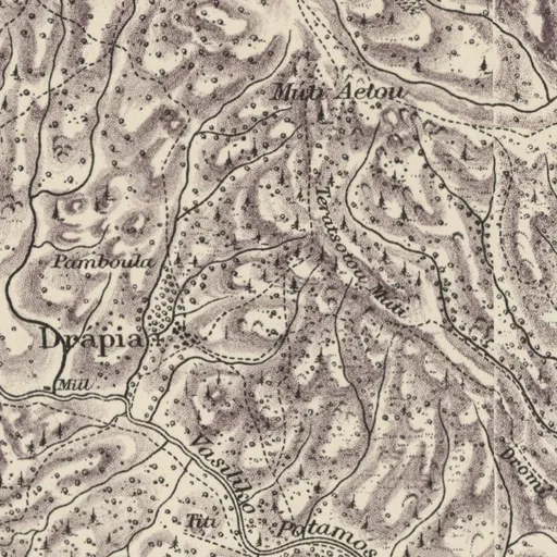
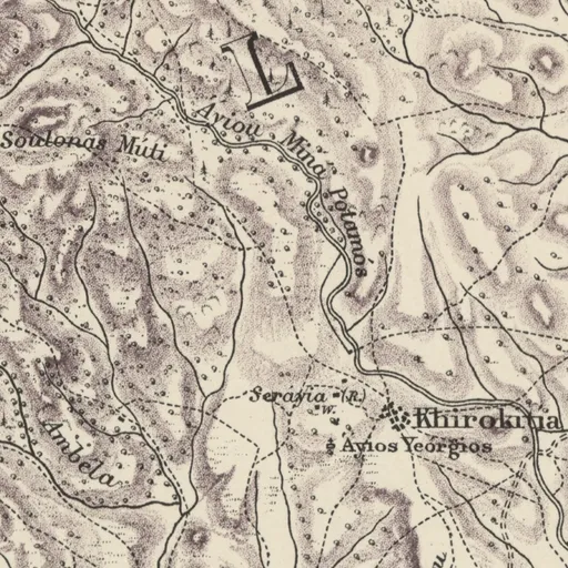
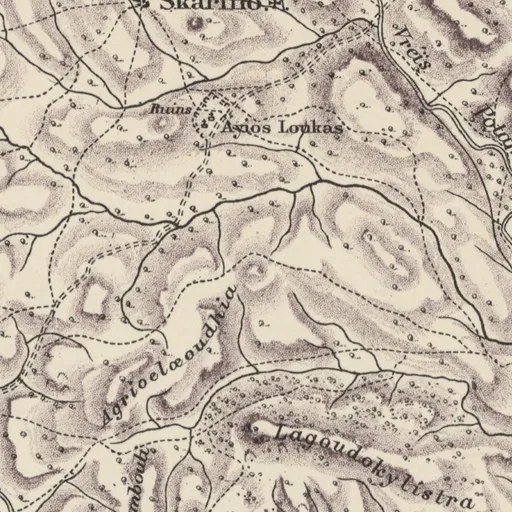
On Kitchener's map (1882)
Khirokitia · mixed village
Excavation history
- 1936–1948The Department of Antiquities excavations under DikaiosDirected by Porphyrios DikaiosExcavation
- 1972The 1972 trial trench (Stanley Price and Christou)Directed by N. P. Stanley Price and Demos ChristouSounding
- 1976–2009The French Mission under Le BrunDirected by Alain Le Brun and N. P. Stanley PriceExcavation
- 1983Rescue of a tomb at Anefandies, 1983Rescue excavation
- 2010Excavation at the church of Panagia tou Kampou, 2010Directed by Eleni ProcopiouExcavation
Reconstructions
Nearby sites
- Khirokitia, Cypro-Archaic cemetery0.8 km
- Tochni2.5 km
- Tochni-Pervolia2.5 km
- Tochni-Petreli2.5 km
- Tochni-Petreli North2.5 km
- Tochni-Lakkia2.6 km
Straight-line distances.
Mentioned in
166 mentionsDocuments · 73
- Khirokitia: Final Report on the Excavation of a Neolithic Settlement in Cyprus on Behalf of the Department of Antiquities, 1936-1946
1953 · pp. 1, 9, 232, 397
Neolithic settlement excavated 1936–1946 and reported here
Dikaios 1946, p. 1
- Chronique des fouilles et découvertes archéologiques à Chypre en 1989
1990 · pp. 955, 957
Neolithic village excavated by the CNRS mission in 1989
Papageorghiou 1989, p. 955
- Chronique des fouilles et découvertes archéologiques à Chypre en 2001
2002 · pp. 712, 715
Neolithic site, French mission excavations
Hadjisavvas 2001, p. 712
- Fouilles et découvertes archéologiques à Chypre en 2002
2003 · p. 664
Neolithic village excavation in two operations
Hadjisavvas 2002, p. 664
- A Description of the Historic Monuments of Cyprus. Studies in the archaeology and architecture of the island, with illustrations from measured drawings and photographs
1918 · p. 343
Site of the battle of July 1426 between the Cypriot army and the Mameluk invaders, per Strambaldi.
Jeffery 1918
- Cyprus: Report for 1936
1936 · p. 5
Department excavations under the Curator of the Museum; sacred enclosure brought to light
Colonial Reports—Annual no. 1803
Lectures and videos · 14
- Continuities and Discontinuities in Cypriot Prehistory and the Study of Cultural Change
2017 · 0:30:12
Had almost 200 tombs within the settlement
Voskos 2017
- Second Annual Study Day of the Archaeological Research Unit: Prehistoric Stone, Palaepaphos, and Ceramic Studies
2017
Georgiou et al. 2017
- Flesh on Bones: Latest Developments and State of Affairs in Cypriot Zooarchaeology
Probably · 2018 · 0:05:55
Site of work by Simon Davis
Hadjikoumis 2018
- The Consumption of Exotic Raw Materials in the Early Prehistory of Cyprus
2019 · 0:10:15
Carnelian beads found in necklaces with shell and picrolite beads
Moutsiou 2019
- Historiography and Archaeological Theory in Cypriot Prehistory
2020 · 0:08:00
Neolithic site excavated by Porphyrios Dikaios
Knapp 2020
- Archaeogeophysical Surveys: A Review from Cyprus
2021 · 0:11:51
Iconic Cypriot Neolithic site; electrical resistivity survey targeted the limits of the occupied space
Vella 2021
Tomb records · 43
- Khirokitia, Dikaios Tomb IA
1936
Built tomb
Dikaios 1953
- Khirokitia, Dikaios Tomb III
1936
Tholos
Dikaios 1953
- Khirokitia, Dikaios Tomb IX
1936
Bacvarov 2008
- Khirokitia, Dikaios Tomb LIV
1936
Tholos
Dikaios 1953
- Khirokitia, Dikaios Tomb V
1936
Tholos
Dikaios 1953
- Khirokitia, Dikaios Tomb VII
1936
Tholos
Dikaios 1953
Institutions · 6
- Cyprus Broadcasting Corporation
Films of it · 1972
ΠΟΡΦΥΡΙΟΣ ΔΙΚΑΙΟΣ - ΕΝΑΣ ΠΡΩΤΟΠΟΡΟΣ ΕΡΕΥΝΗΤΗΣ
Cyprus Broadcasting Corporation, film, 1972; Cyprus Broadcasting Corporation, film, 2009; Cyprus Broadcasting Corporation, film, 1983
- Costas and Rita Severis Foundation
Paintings and drawings of it · 2001
Khirokitia
Centre of Visual Arts and Research 2001
- Ashmolean Museum of Art and Archaeology
Objects from it in the collection
5 object records giving it as the find-place
Ashmolean Museum of Art and Archaeology, collection online
Also in Medelhavsmuseet (Museum of Mediterranean and Near Eastern Antiquities), collection online
- Metropolitan Museum of Art
Objects from it in the collection
1 object record giving it as the find-place
Metropolitan Museum of Art, collection online
Also in Museum of Archaeology and Anthropology, Cambridge, collection online
- Musée du Louvre
Objects from it in the collection
6 object records giving it as the find-place
Musée du Louvre, collection online
- National Museum of Denmark
Objects from it in the collection
16 object records giving it as the find-place
National Museum of Denmark, collection online
Press releases 1962–74 · 19
- First season of excavations at Cape St. Andreas completed (1970-09-29)
1970
A French team headed by Alain Le Brun completed the first season of excavations at Cape St. Andreas, finding a Neolithic village with circular houses, stone…
Press and Information Office, Republic of Cyprus, press release of 1970-09-29
- Έληξεν η πρώτη περίοδος ανασκαφών εις το Ακρωτήριον Αποστόλου Ανδρέου (1970-09-29)
1970
Excavations at Cape Apostolos Andreas uncovered Neolithic village remains, and traces of the same culture were also found at Choirokoitia and elsewhere in…
Press and Information Office, Republic of Cyprus, press release of 1970-09-29
- Ανασκαφαί εις Ακρωτήριον Αποστόλου Ανδρέου (1972-11-21)
1972
At Kastros, the dig uncovered remains of five circular pre-pottery Neolithic houses built of stone and sun-dried mud brick, a semicircular house with a light…
Press and Information Office, Republic of Cyprus, press release of 1972-11-21
- Εικονογραφημένοι οδηγοί (1965-10-19)
1965
The Department of Antiquities published illustrated guide-books in Greek and English for Khirokitia, the Palace of Vouni and the Theatre of Soli, priced at 50…
Press and Information Office, Republic of Cyprus, press release of 1965-10-19
- Week of Ancient Monuments (1970-07-30)
1970
Mr. A. Christodoulou, Assistant Archaeological Officer, gave a lecture and guided visitors at the Khirokitia Neolithic settlement.
Press and Information Office, Republic of Cyprus, press release of 1970-07-30
- Εβδομάς Αρχαίων Μνημείων (1970-07-30)
1970
Mr A. Christodoulou gives lectures at the entrance of the archaeological site and guided tours of the Neolithic Settlement at Choirokoitia on 5 August 1970…
Press and Information Office, Republic of Cyprus, press release of 1970-07-30
News · 6
- Cyprus's draft 2027 budget cuts antiquities development spending by 43%, to €3.8m
2026
- One-day Nicosia workshop on 12 December traces Cyprus's first pottery, Neolithic to Chalcolithic
2026
- Syria's Ali Sharif Amrir speaks on the Levant's first farmers at ACOR in Amman on 26 October
2026
- This Week in Cypriot Archaeology: 12–18 January 2026
2026
- This Week in Cypriot Archaeology: 30 March–5 April 2026
2026
- Two Jerusalem toilets of the 7th–6th century BCE held Giardia, a diarrhoea parasite
2026
- Excavations · 5listed under Excavation history
References
- 1.Clarke, J., McCartney, C., & Wasse, A. (2007). On the margins of Southwest Asia: Cyprus during the 6th to 4th millennia BC. Oxbow Books.
- 2.Le Brun, A. (1997). Khirokitia: A Neolithic site (L. Steel, Trans.; with an appendix on the archaeological park by S. Hadjisavvas). Bank of Cyprus Cultural Foundation.
- 3.UNESCO World Heritage Centre. (n.d.). Choirokoitia (World Heritage List no. 848). https://whc.unesco.org/en/list/848
- 4.Le Brun, A. (1992). Monter, descendre: les accès au village néolithique précéramique de Khirokitia (Chypre). In G. C. Ioannides (Ed.), Studies in honour of Vassos Karageorghis (Kypriakai Spoudai 54–55, 1990–1991), 21–26. Society of Cypriot Studies.
- 5.Karageorghis, V. (1978). Cyprus Museum and archaeological sites of Cyprus (K. Cicellis, Trans.). Ekdotike Athenon.
- 6.Legrand-Pineau, A. (2009). Bridging the gap: Bone tools as markers of continuity between Aceramic (Khirokitia culture) and Ceramic Neolithic (Sotira culture) in Cyprus (7th–5th millennia cal. BC). Paléorient, 35(2), 113–123.
- 7.Dikaios, P. (1953). Khirokitia: Final report on the excavation of a Neolithic settlement in Cyprus on behalf of the Department of Antiquities, 1936–1946 (Monographs of the Department of Antiquities of the Government of Cyprus 1). Oxford University Press. With a report on the human remains by J. L. Angel. https://archive.org/details/khirokitiafinalr0000porp
- 8.Winkelmann, C. (2020). The Neolithic and Chalcolithic figurines of Cyprus. Zaphon.
- 9.Karageorghis, V. (1977). Chronique des fouilles et découvertes archéologiques à Chypre en 1976. Bulletin de correspondance hellénique, 101(2), 707–779 (Khirokitia section by N. Stanley Price and A. Le Brun). https://www.persee.fr/doc/bch_0007-4217_1977_num_101_2_6567
- 10.Le Brun, A. (Ed.). (1984). Fouilles récentes à Khirokitia (Chypre), 1977–1981. Éditions Recherche sur les Civilisations.
- 11.Le Brun, A. (Ed.). (1989). Fouilles récentes à Khirokitia (Chypre), 1983–1986. Éditions Recherche sur les Civilisations.
- 12.Le Brun, A. (Ed.). (1994). Fouilles récentes à Khirokitia (Chypre), 1988–1991. Éditions Recherche sur les Civilisations.
- 13.Stanley Price, N. P. (1975). On the dating of Khirokitia in Cyprus. Proceedings of the Prehistoric Society, 41, 46–49. https://doi.org/10.1017/S0079497X00010896
- 14.Clarke, J. (2013). Cyprus during the Neolithic period. In M. L. Steiner & A. E. Killebrew (Eds.), The Oxford handbook of the archaeology of the Levant. Oxford University Press. https://doi.org/10.1093/oxfordhb/9780199212972.013.013
- 15.Karageorghis, V. (1982). Chronique des fouilles et découvertes archéologiques à Chypre en 1981. Bulletin de correspondance hellénique, 106(2), 685–744 (Khirokitia section by A. Le Brun). https://www.persee.fr/doc/bch_0007-4217_1982_num_106_2_6732
- 16.Karageorghis, V. (1984). Chronique des fouilles et découvertes archéologiques à Chypre en 1983. Bulletin de correspondance hellénique, 108(2), 893–966 (Khirokitia section by A. Le Brun). https://www.persee.fr/doc/bch_0007-4217_1984_num_108_2_6765
- 17.Karageorghis, V. (1981). Ancient Cyprus: 7,000 years of art and archaeology. Louisiana State University Press.
- 18.Jones, P. L. (2008). Moving heaven and earth: Landscape, death and memory in the Aceramic Neolithic of Cyprus (BAR International Series 1795). BAR Publishing. https://doi.org/10.30861/9781407302836
- 19.Steel, L. (2004). Cyprus before history: From the earliest settlers to the end of the Bronze Age. Duckworth.
- 20.Dikaios, P. (1961). A guide to the Cyprus Museum (3rd ed.). Department of Antiquities. https://archive.org/details/bwb_KU-429-217
- 21.Karageorghis, V. (1982). Cyprus from the Stone Age to the Romans. Thames and Hudson.
- 22.Buchholz, H.-G., & Karageorghis, V. (1973). Prehistoric Greece and Cyprus: An archaeological handbook. Phaidon.
- 23.Legrand, A. (2007). Fabrication et utilisation de l'outillage en matières osseuses du Néolithique de Chypre: Khirokitia et Cap Andreas-Kastros (BAR International Series 1678). Archaeopress.
- 24.Deputy Ministry of Tourism, Cyprus. (n.d.). Choirokoitia archaeological site (Neolithic settlement). Visit Cyprus. https://www.visitcyprus.com/discover-cyprus/culture/sites-and-monuments/choirokoitia-archaeological-site-neolithic-settlement/
Corrections and additions
Do you know this site?
Help us keep this page right: recent work, the site as it is now, and what we may have missed.
We would like to hear about
- Recent fieldwork or publications
- A wrong location or name
- Access, opening times or the site's state today
- Photographs we may use
Tell us if you would like to be thanked by name on the page.