Late Bronze Age town and cemetery · Limassol District
Episkopi-Bamboula
A Late Bronze Age town on the north end of a low ridge between Episkopi village and the Kouris river, with rock-cut chamber tombs beside its houses. J. F. Daniel excavated it for the University of Pennsylvania between 1937 and 1948. Its seals, seal impressions and marked pots laid the foundation for the study of Cypriot seals and the Cypro-Minoan script, and one wooden seal roller was used both here and at Alassa.
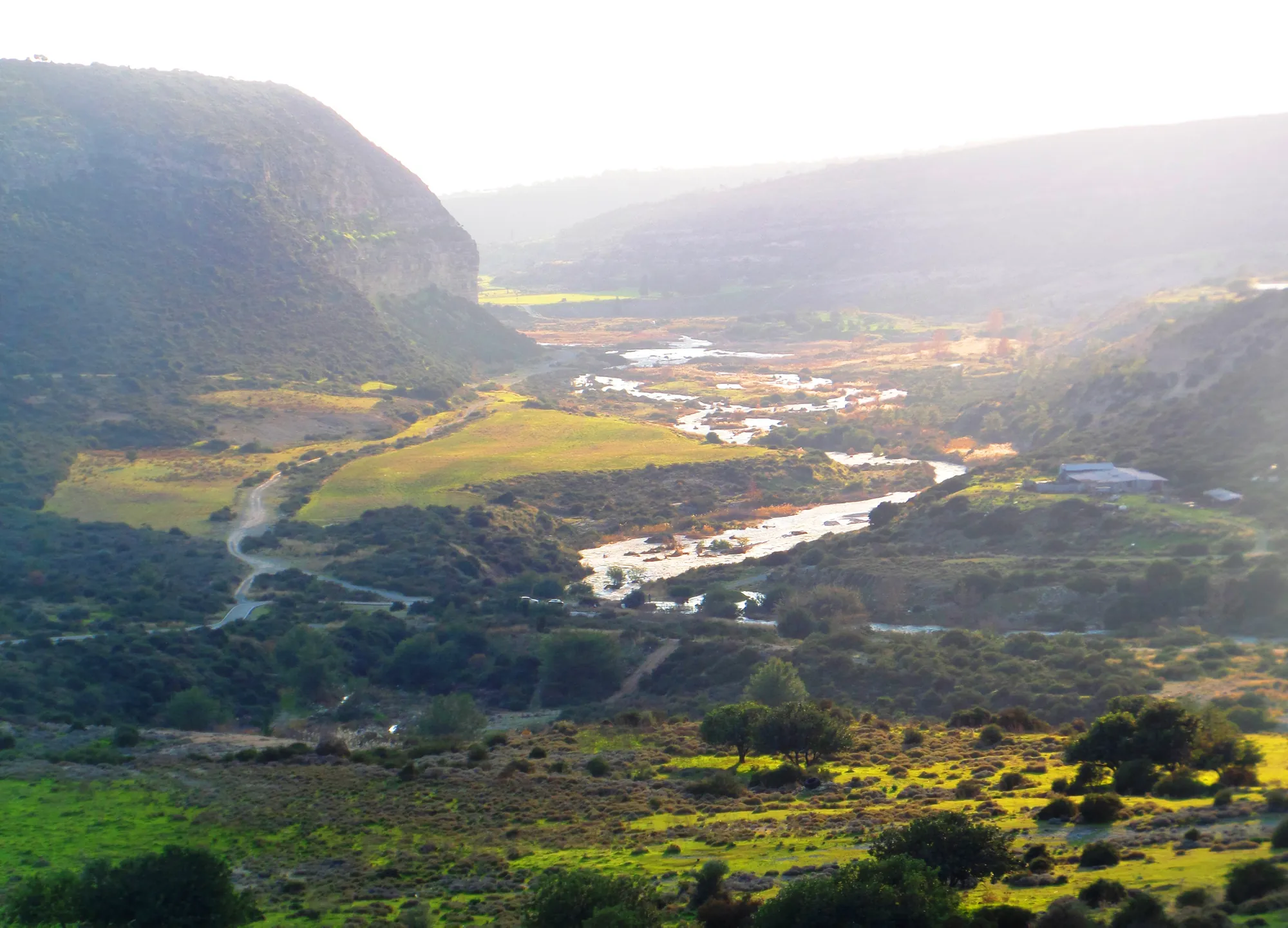
The valley of the Kouris river, upstream of Episkopi. The Bamboula hill stands above the river's lower course. Photo: Xaris333, CC BY-SA 4.0, via Wikimedia Commons, cropped.
Nearby sites
Kourion-Amathus Gate necropolis0.8 km
Kourion-Ayios Ermoyenis0.8 km
Episkopi-Maraes0.8 km
Episkopi-Village0.8 km
Episkopi-Phaneromeni0.9 km
Episkopi-Phoinitzi0.9 km
Straight-line distances.
Contents+
Episkopi-Bamboula is a Late Bronze Age town and cemetery on the Bamboula, the north end of a low ridge between the village of Episkopi and the Kouris river in Limassol District [1, p. 261]. People lived and buried their dead here from the 16th century BC, or a little earlier, until some time in the 12th century BC. The town had a circuit wall, streets, wells and houses of stone and mudbrick, and rock-cut chamber tombs on the slopes beside them. Its tombs held gold, ivory, glass and imported Mycenaean pottery, and its seals, seal impressions and marked pots, excavated by J. F. Daniel for the University of Pennsylvania, "laid the foundation" for the study of Cypriot seals and of the Cypro-Minoan script [2, p. 39]. The excavators thought the town moved towards the coast at its end, and the Iron Age city of Kourion grew up nearby; the Bamboula is often called Kourion-Bamboula after it.
The ridge begins in the south at Phaneromeni, where an Early Bronze Age settlement and cemetery lay, and runs north-west to culminate just south of the old Paphos road. It has a core of sandstone broken into terraces, and its flat top, "some forty feet above the plain", was used for threshing floors in Daniel's day [1, p. 261]. The town lay on the north and east slopes. They face the Kouris valley, which Daniel called "an important highway, as well as a source of water", and they are sunny in winter and sheltered from the prevailing west wind [1, p. 261]. Nothing of the buildings showed on the surface: Daniel found them with ten trial trenches [1, p. 261].
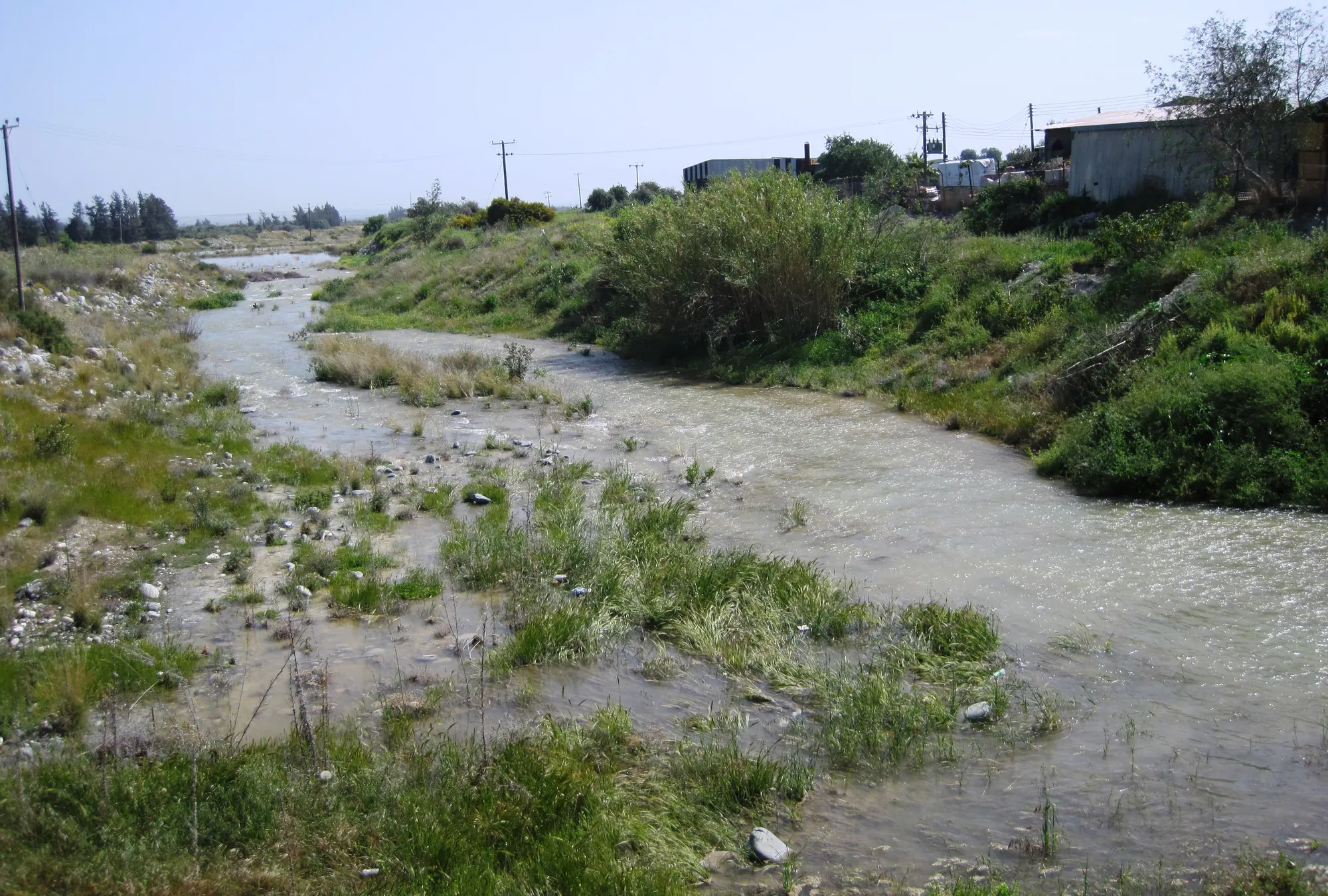
The lower Kouris near the old road bridge between Erimi and Episkopi, in spring. The town stood on the west side of the river.Photo: Shell from Limassol, Cyprus, cropped · CC BY-SA 2.0 · Wikimedia Commons
The settled area on the mound is estimated at about 6 ha, though how far the town spread beyond it is uncertain [2, p. 45]. Late Bronze Age settlement in the lower valley clustered at Episkopi on the west bank and Erimi on the east bank. The town and its cemetery stood on the edge of what was probably then a river delta, since silted up, and unlike later Kourion they are not on the modern coast [2, p. 45]. We know of no harbour.
From the 17th to 16th centuries BC the older settlements of the valley, at Phaneromeni and at Erimi-Laonin tou Porakou, were abandoned, and new centres grew up at Bamboula, at Alassa about 10 km upstream in the foothills of the Troodos, and at Erimi-Pitharka [3, p. 326; 2, p. 45]. The older sites of the Erimi area have their own page under Erimi.
The first excavators were from the British Museum, working in 1895 with money left by Emma Turner. At Kourion H. B. Waltersdug mainly Iron Age to Roman tombs, but "an extensive series of tombs located at Bamboula, close to Episkopi village, yielded numerous grave goods similar to finds from Mycenae" [4, p. 28]. The excavators thought their finds much later than they were, and they did not recognise the houses above the tombs as belonging to the same people [4, p. 28]. The results appeared in Excavations in Cyprus in 1900 [5]. Daniel later judged the British Museum's plan of the tombs "highly inaccurate", with a scale that varied from 1:646 to 1:2370. He matched several of its tombs to his own and showed that the British Museum's "tomb 104" was a well [6, pp. 3–4].
The University of Pennsylvania Museum had been digging at Kourion since 1934 with funds from George H. McFadden, and in the spring of 1937 Daniel opened the Late Bronze Age settlement on the Bamboula [1, p. 261; 2, p. 42]. He worked there in seasons up to 1948, interrupted by the Second World War, and died suddenly in Turkey that year, just after "his terminal campaign at Bamboula" [6, p. ix]. The expedition investigated some 40 tombs, relatively few of them intact [6, p. 3].
The final publication was shared out after Daniel's death. Saul S. Weinberg studied the architecture in Cyprus in 1951 with Ellen Kohler. After McFadden died in 1953, G. Roger Edwards and J. L. Benson went out that September; Benson took on the rest of Bamboula and the Kaloriziki cemetery and made a brief exploratory excavation [6, p. ix]. His volume on the necropolis and the finds appeared in 1972, with Edith Porada on the seals and J. Lawrence Angel on the skeletons; it was published ahead of the architecture, which was delayed [6, pp. ix–x]. Weinberg's Architecture followed in 1983 [7], and Benson's volume on Kaloriziki in 1973 [8].
From 2001 a team from the University of Cincinnati under Gisela Walberg returned to the hill. In 2001 they surveyed the site and opened eight trenches in Area E along the Erimi to Episkopi road. One held a well 9.5 m deep with a complete Red Lustrous arm-shaped vessel, a Mycenaean shallow cup, loom weights and a wall bracket in its lower fill. A Late Cypriot tomb nearby, plundered in the Iron Age, still held a potter's wheel, an ivory disc, whole unworked hippopotamus tusks, a bronze pin and a gaming stone, and ashlar fragments in the looters' pit suggest a monumental building close by. In 2002 the team found what may be an entrance to the Bronze Age town near the summit and a second well on the north slope, with a pithos sherd impressed with a seal showing men and bulls. In 2003 they uncovered two walls of havara blocks belonging to a large building on the summit, robbed out when a wall was built there in the Cypro-Archaic period [9, p. 99].
Benson set out the history of the site from its tombs, and Daniel and Weinberg from the houses. Dates below follow the Late Cypriot (LC) scheme Smith uses: LC IA about 1650 to 1550 BC, LC IB about 1550 to 1450 BC, LC IIA about 1450 to 1375 BC and LC IIIA about 1200 to 1125 BC [2, p. 43].
Phases
Before the townBefore c. 1650 BC
An Early Cypriot tomb under the later wall and a few early sherds. The village of the time was at Phaneromeni, at the south end of the ridge.
FoundingLC I, c. 1650–1450 BC
A few rich tombs and the first houses in Area E.
GrowthLC II, c. 1450–1200 BC
Most tombs in use; the circuit wall, the great well and copper working in Area E.
RebuildingLC IIC–IIIA, 13th–12th centuries BC
More houses in Areas A and E, in step with Alassa; seals and rollers in use.
Last houses12th century BC
A few houses remain. The excavators put this phase in LC IIIB; later study puts the latest houses in LC IIIA.
Abandoned hill11th–7th centuries BC
Old tombs reused in the Cypro-Geometric and Cypro-Archaic periods; the wall repaired, perhaps in the 7th century BC.
Benson found the evidence for use of the hill before the Late Bronze Age "very slight": Tomb 1 under the circuit wall in Area A, two early tombs of the British Museum dig and a few sherds [6, pp. 4–5]. The earliest Late Cypriot tombs are 9, 11, 12 and 13. They show that the first community, "if small, was not necessarily poor and provincial" [6, p. 5]. Benson dated Tomb 12 to LC IA; later study places it more probably in LC IB [2, p. 83]. Linear marks on pots appear here in LC I, possibly as early as LC IA and certainly by LC IB [2, p. 43].
In LC II there was "a veritable 'boom'" [6, p. 5]. Most of the tombs were in use, and Benson saw in this period "the high water mark of prosperity and size of Bamboula" [6, p. 5]. Building in Areas A and E increased in LC IIC and again in LC IIIA, the same rhythm as at Alassa [2, p. 46]. In LC III fewer tombs were in use, and Benson judged that the town had probably "already passed its peak" [6, p. 5].
Daniel's excavation uncovered the town in several areas, lettered A to F. Area A lies to the north-east, facing the Kouris; Areas D, E and F lie to the north and north-west, facing the route west of the river [2, p. 46]. Along the east side ran the circuit wall. It runs north and south a little above the lower edge of the field, and near its south end turns west around "an irregular tetragonal tower" [1, p. 261]. It stands on bedrock and is built of roughly rectangular unhewn stones laid on their broad sides without regular courses; it was probably the foundation for a mudbrick superstructure. Daniel thought it was built in LC II and lasted without material change until the town was deserted [1, p. 264].
Plan · about 1650 to the 12th century BC
The town and tombs on the Bamboula hill
Episkopi, the north end of the ridge above the Kouris valley
8580758088 mArea AArea EArea FArea BTr. 15to Episkopito Erimiirrigation channelKouris valley
050 m
Scale bar: 50 metres.
1 of 9
Area A, houses inside the wall
Area A lies along the east edge of the hill, above the Kouris valley. Daniel's trenches 2 and 4 here uncovered a street and an alley inside the circuit wall, lined with houses of the last town, of the Late Cypriot III period. Their walls were of mudbrick on stone footings, and most rooms had pits or sunken pithoi. These houses held most of the objects of imported materials and most of the Mycenaean and Levantine containers found in the town's houses.
Daniel 1938, pp. 261, 264; Smith 2012, p. 47
Key
Circuit wall, line approximate
Tomb or well, as marked on the plan
Threshing floor
Irrigation channel
Road, 1930s to 1950s
Excavated area, 1937 to 1954
Contours at 1 m
The Bamboula hill: the excavated areas, the tombs and the great well, redrawn after Benson 1972, pl. 1. The line of the circuit wall is placed from Daniel's description and is approximate.
Inside the wall Daniel found a street and an alley lined with houses of the last, LC III, town. The rooms measured from 2.00 by 2.60 m to 4.20 by 4.35 m, with narrow doors, usually at a corner. The walls were of mudbrick on footings of grey river stones and rough-hewn limestone, with "an occasional well-cut limestone block at a door or corner", and were faced with clay and sometimes whitewashed. Clay roofs lay on reeds or matting over beams, carried on posts set on stone bases. Floors were of plaster, stamped earth or smoothed bedrock, and most rooms had pits or sunken pithoi [1, p. 264]. Later fittings included a hearth, a flour bin beside a large saddle quern, a sunken pithos and a small brick oven [1, p. 265]. In the same houses Daniel found needles, tweezers, chisels, a fish-hook, querns, pestles, spindle whorls and loom weights, and a curved iron knife that "ranks with the Enkomi knives among the earliest iron objects found in Cyprus" [1, p. 269].
Most of the fine pottery of the LC II levels is White Slip and Base Ring ware [1, p. 265]. A Black Slip ware that had been thought foreign proved to be local: Daniel found misfired sherds that could only be discards from a kiln nearby [1, pp. 265–266]. In the LC III houses about 90 per cent of the pottery was plain. The painted pottery was all wheel-made, and some of the bowls are technically good imitations of the Mycenaean pottery imported from Greece, of which only sherds were found in the houses [1, pp. 266–267].
At the end of the stratum Weinberg called D some rooms were damaged by fire, and several houses in Area A were then rebuilt [7]. In Area B was the great well [6, p. 5]. In Area D, and below houses in Area E, were deposits that Weinberg identified as cellars. Underground rooms have since been found at Erimi-Pitharka as well, so the feature was shared by at least two settlements of the southern Kouris valley in LC IIC to LC IIIA [2, p. 58]. Kopanias and his colleagues note that the excavated buildings show domestic work such as food processing, cooking, weaving and short-term storage, and no large-scale storage or monumental architecture [3, p. 327]. The ashlar fragments found by the Cincinnati team suggest that one monumental building may yet be found [9, p. 99].
Weinberg saw a difference between the two main areas of houses. Those in Area E are larger, with thicker, more carefully laid walls and cut ashlar used selectively, as in a threshold of House VIII, and they seem to have been laid out to a more deliberate plan. Those in Area A share more party walls, have more repairs and are generally less sturdily built [2, p. 46].
Joanna S. Smith has traced further differences in what the two areas held. The houses of Area A were not built among tombs, and they held most of the objects of imported materials and most of the Mycenaean and Levantine containers found in houses; Smith suggests that some of their people were involved in shipping [2, p. 47]. The houses of Area E were built among the tombs of the north-western slope, and only Area E has evidence for melting copper, though copper and bronze objects were found in both areas [2, pp. 46–47]. Benson, for his part, stressed that there was "no formal connection between tombs and houses of Area E", and quoted Daniel's account of tombs entered from dromoi cut in the slope outside the houses [6, p. 3].
The main cemetery lay on the slope just north-east of Area E, round its north-east arm, along the edge of the bluff and up the street that divides Area E in two. Other groups lay on higher ground and to the south. No houses were found over the main, north-eastern part of the cemetery [6, p. 3].
Almost all the tombs are rock-cut chamber tombs reached by a dromos, and the dromoi face in every direction. The LC I tombs are irregular in plan, without sharp corners; those of LC II are round, oval, kidney-shaped or roughly rectangular, and Tombs 17 and 33 have two chambers opening off one dromos. Some dromoi are shallow square pits, a few with side niches, and Tomb 37 is a triple cist grave [6, pp. 6–7]. All the Late Cypriot burials were inhumations. The tombs were reused again and again, probably as family vaults, and although no grave markers were found, new tombs did not cut into old ones [6, p. 8].
The tombs held a great deal of imported pottery and prestige goods, and Kopanias and his colleagues find all the categories of luxury goods deposited in abundance from at least LC IIA, about the 15th century BC; the Mycenaean vessels are spread evenly over most of the tombs rather than concentrated in a few burials [3, p. 327]. Many of the British Museum's tombs, "with their numerous Mycenaean vases", belong to LC II [6, p. 5].
Grave goods from the British Museum's 1895 tombs at Bamboula: a gold bead necklace, a Base Ring bull rhyton and a White Slip tankard, British Museum.
Benson counted 31 burials of LC II that could be identified against 75 of LC III, but 47 of the later ones were in Tomb 19 alone, which he took to point to "an epidemic of some kind" [6, p. 5]. Angel's study of the skeletons found the marks of a hereditary anaemia. In Tomb 40, "almost certainly two out of the nine children (and three infants)" died of thalassaemia, a condition whose carriers have some protection against malaria [10, pp. 154–155].
The Bamboula has given 102 objects bearing linear marks, most of them incised on pots, and at least 32 seals and impressions of seals and rollers from Bamboula and Kaloriziki [2, p. 47]. Daniel published four pots and seven sherds with signs from the 1937 season [1, p. 272]. From three storage jars he read a two-sign word as Kuri, an early form of Kourion [1, p. 274]. The script, which scholars call Cypro-Minoan, remains undeciphered [2, p. 40], and his reading is not accepted.
Seals were owned by LC IIA: Tomb 12 held two cylinder seals at the lower body of a man [2, p. 65]. In Tomb 19 one burial of LC IIIA had four seals, and the worn cylinder among them may have been worn on a cord and used for sealing [2, pp. 63–64]. The earliest rolled impression found here was made with an Old Babylonian cylinder, rolled vertically on a pithos before firing; the sherd was found on its own in Area A [2, p. 63]. By LC IIIA some people owned both stamp and cylinder seals [2, p. 43].
A chlorite cylinder seal with a griffin, from the British Museum's 1895 tombs at Bamboula, British Museum.
Larger wooden rollers were also rolled on clay, usually on pithoi. At Bamboula and Alassa the evidence for impressing seals in clay is rich compared with other settlements of the time [2, p. 42]. One roller, broken in antiquity, was used after it broke at both Episkopi-Bamboula and Alassa-Paliotaverna [2, p. 98]. For Smith, "the use of the same wooden roller at both settlements points to the development by ca. 1200 B.C.E. of a bureaucratic system that was shared within the region" [2, p. 43]. Around the same time the older roller designs of a woman, a griffin and a tree gave way to scenes of men, bulls and combat [2, p. 43].
For decades Bamboula was taken for the main town of the Kouris valley. Its rather small size and the discovery of Alassa in the 1980s changed that view [3, p. 327]. At Alassa-Paliotaverna three ashlar buildings, two with storage of pithoi far beyond the needs of one household, show a centre of a different kind [2, p. 46]. Smith suggests that Alassa "might have had a certain amount of control over at least part of the settlement" at Bamboula [2, p. 41]. Kopanias and his colleagues go further and suggest that Alassa's elite needed a coastal centre as a gateway for foreign trade, while Bamboula depended on the hinterland for staple goods and copper [3, p. 331]. These are interpretations: the shared roller is the one direct link between the two towns.
The town was abandoned in the 12th century BC, and there is no sign that it ended in a destruction. In Daniel's houses the inhabited area "greatly reduced" after the second of his four periods, and an olive press was set up on ruined walls; he put the shrinkage down to "the moving of the population to another site" [1, p. 265]. Benson and Weinberg placed a last small phase, with Houses V, VI and VIII and two or three tombs, in LC IIIB, and Benson thought that "probably during this phase the site of the city was moved", presumably to the coastal plain at Kaloriziki, where the tombs begin in LC IIIB [6, p. 6; 7]. Only a few squatters stayed on, and they too had left before White Painted I pottery came into use [6, pp. 40–41]. Mountjoy's later study of the decorated pottery dates the strata the excavators called LC IIIB to LC IIIA, which would put the end of the houses in LC IIIA, before about 1125 BC [11].
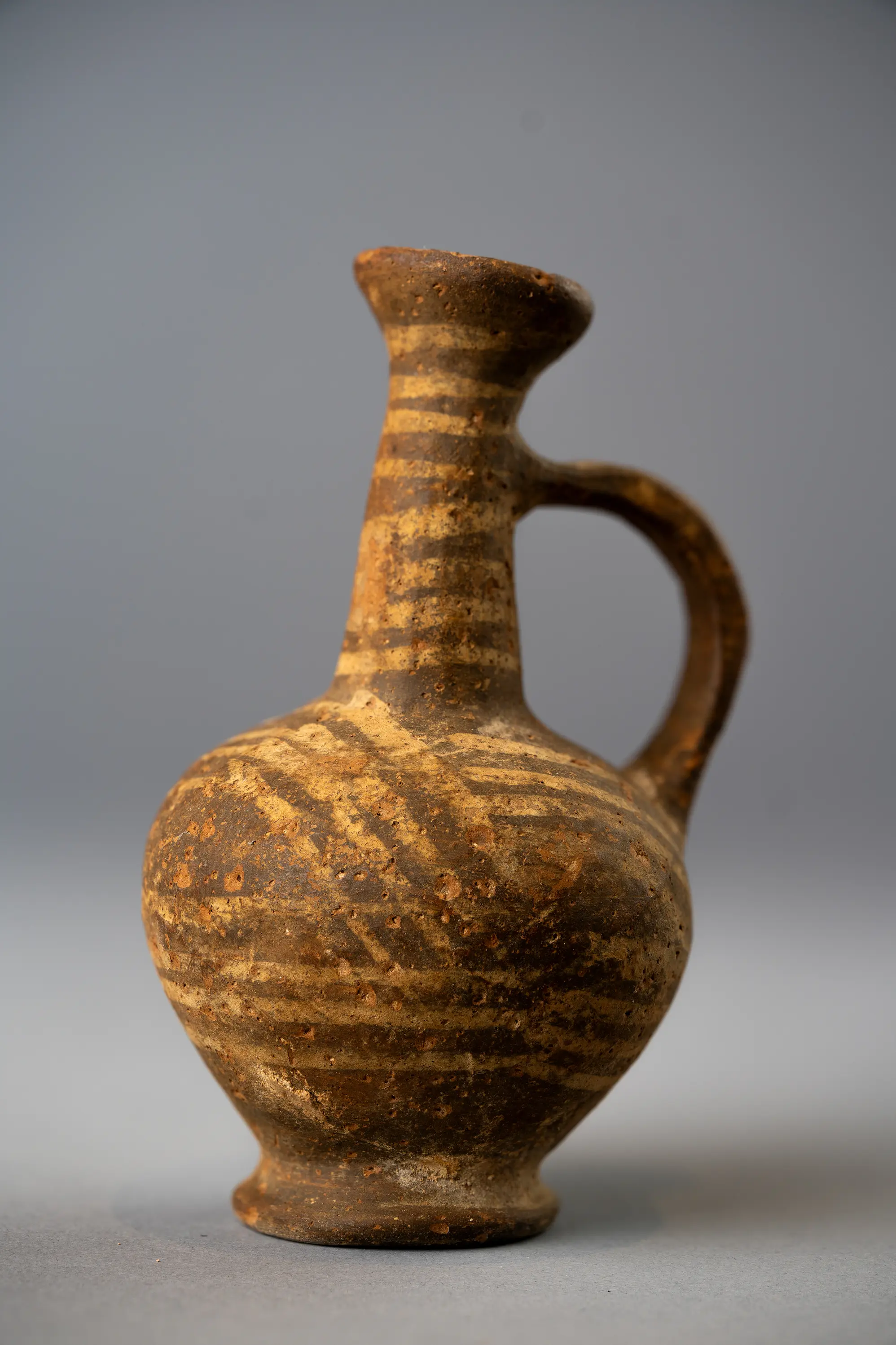
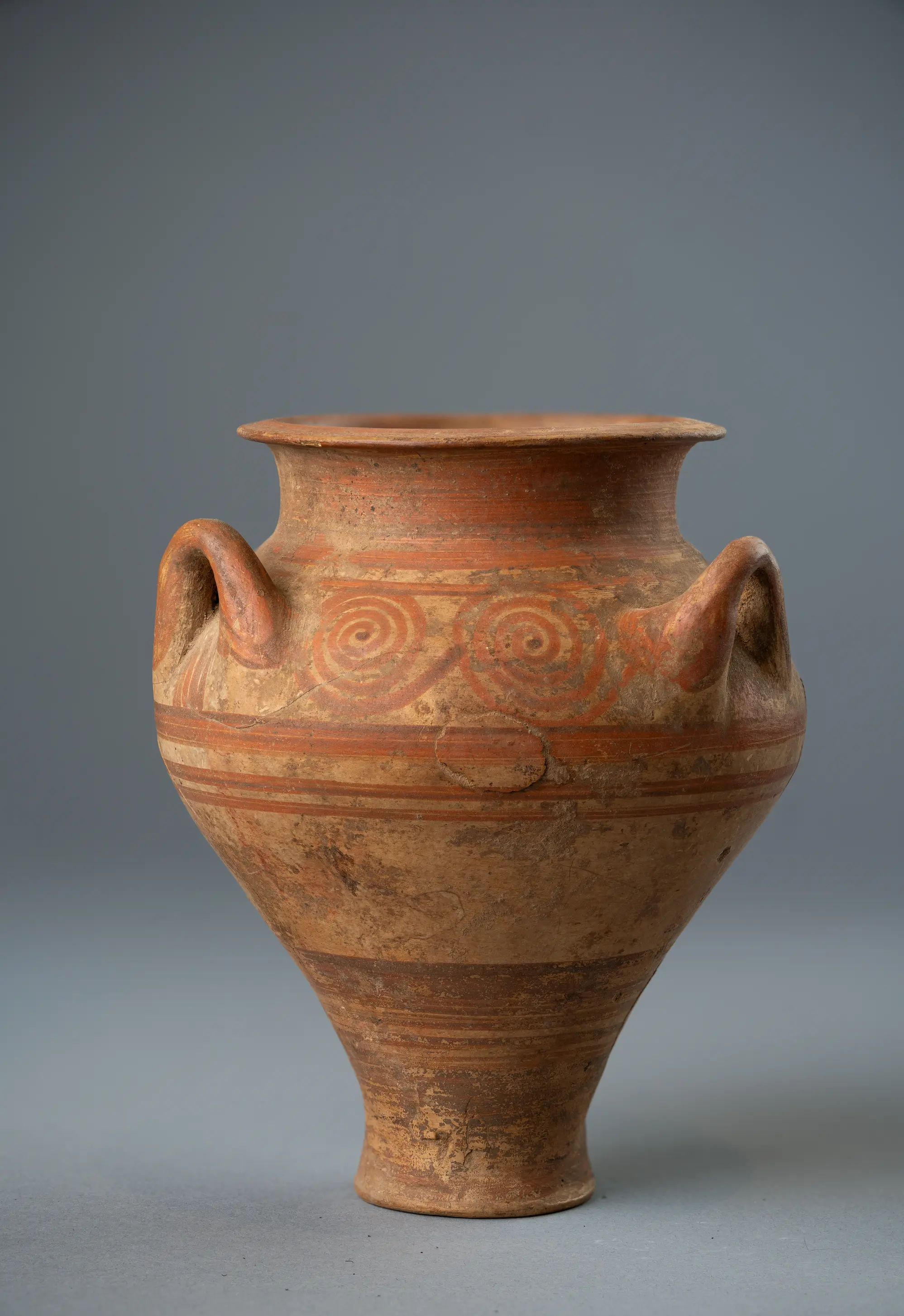
Wheel-made bowl and strainer jug of the 13th and 12th centuries BC, and a stone petal jar, from the British Museum's 1895 tombs at Bamboula, British Museum.
The hill was not forgotten. The old tombs were reused in the Cypro-Geometric period, Tomb 30 perhaps by squatters, and as late as the Cypro-Archaic period [6, p. 6]. About the 7th century BC the circuit wall was rebuilt, "perhaps to enclose a refuge for the rural population"; afterwards the hill was disturbed only by Roman and modern treasure hunters [1, p. 265].
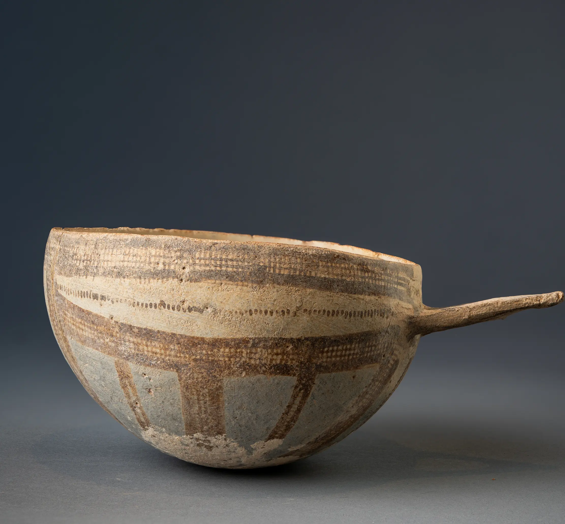
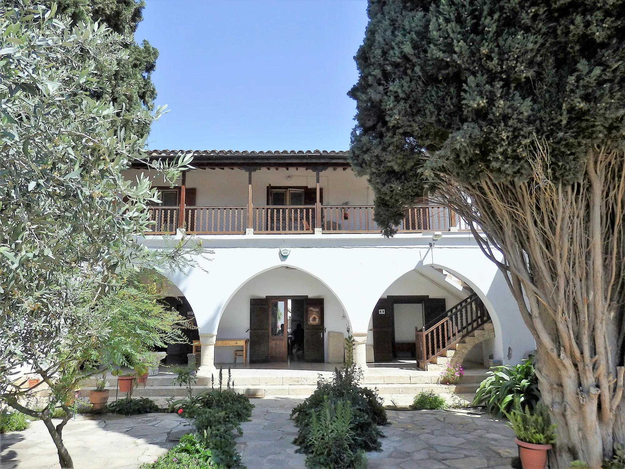
Daniel's finds were divided between Curium House in Episkopi, the Cyprus Museum in Nicosia and the University Museum in Philadelphia [6, pp. ix–x]. The British Museum keeps the finds of 1895, some of which are shown below. The Kourion Museum in Episkopi village, in the former house of George McFadden, shows Bronze Age finds from the area alongside finds from Kourion. It has been closed to visitors since 1 August 2026 for upgrading works, and its reopening date has not yet been announced [12].
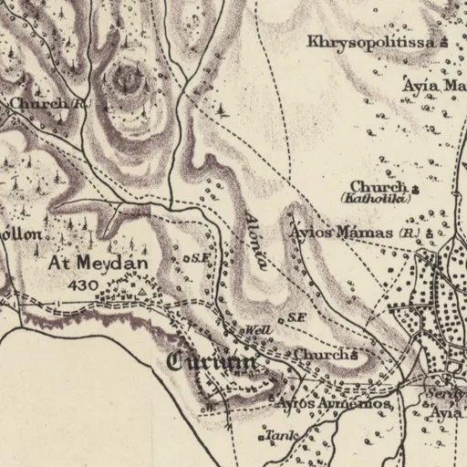
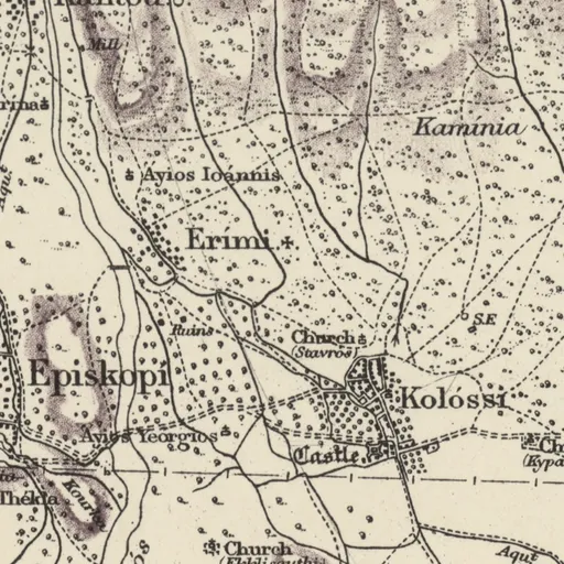
Sheet 14. H. H. Kitchener, Trigonometrical Survey of Cyprus, 1 inch to 1 mile, 1882 (scans: National Library of Scotland, CC BY)Open on Kitchener's map
7.Weinberg, S. S. (1983). Bamboula at Kourion: The Architecture. University Museum Monograph 42. Philadelphia: University Museum, University of Pennsylvania.

 Gold Bead NecklaceLate Bronze Age I · 1650–1050 BCBritish Museum
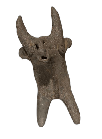 Base Ring Bull RhytonLate Bronze Age II · 1450–1100 BCBritish Museum
 White Slip TankardLate Bronze Age II · 1450–1200 BCBritish Museum
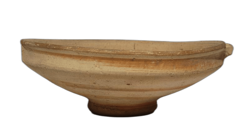 White Painted Spiral BowlLate Bronze Age III · 1250–1150 BCBritish Museum
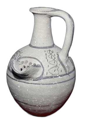 White Painted Strainer JugLate Bronze Age III · 1200–1100 BCBritish Museum
 Green Stone Petal JarLate Bronze Age III · 1250–1050 BCBritish Museum
 Black Chloritite Griffin SealLate Bronze Age II · 1450–1100 BCBritish Museum
 White Slip Wishbone BowlLate Bronze Age II · 1450–1200 BCBritish Museum
 Base Ring II Wishbone BowlLate Bronze Age II · 1450–1100 BCBritish Museum
 Base Ring PyxisLate Bronze Age II · 1400–1100 BCBritish Museum
 Base Ring Female FigurineLate Bronze Age II · 1450–1100 BCBritish Museum
 Terracotta Male FigureLate Bronze Age II · 1450–1100 BCBritish Museum