
Ancient Cypriot Architecture·Lesson 11
Walls and War
From Khirokitia's hidden stair to the Persian siege ramp at Palaepaphos: how Cypriots walled villages, forts and cities, what the walls were built of, and how to tell a defence from a boundary, a display or a real siege.
Alexis Drakopoulos·Across the periods·14 min read
Share


Lesson 11·Course contents, 14 lessons
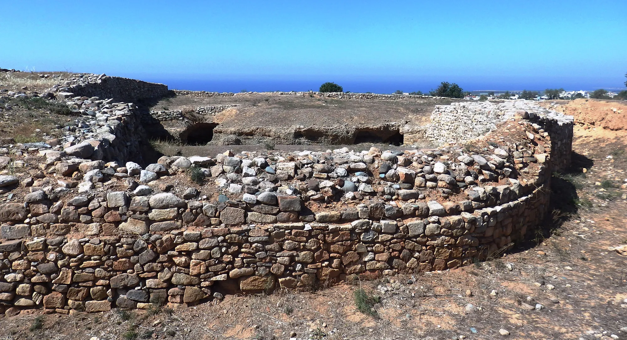
Around the time Khirokitia reached its greatest size, the way into the village did not go through the village wall. Someone coming up from the river on the west faced a stone wall standing more than 2.8 m above the slope, and in front of it a rough stone structure, preserved almost 2.5 m high, that blocked any straight approach [1, p. 23; 2]. Round its end, a stair only 0.80 m wide climbed into a separate block of masonry, 10 m long and 1.60 m deep, built against the wall's outer face and plastered with care. The stair rose towards the wall, turned left, climbed a flight hidden inside the block, turned right, and came out on top of the wall, where the path ran south along the wall top and down into the village [1, pp. 23, 25]. Alain Le Brun, who excavated it, found its one earlier Near Eastern parallel, at Beidha in Jordan, a plain flight set in the village wall; here a monumental block was built for the stair alone [1, p. 25].
Follow the climb on the plan, number by number, and look at the grey wedge: it is the ground a walker on the slope could not see. The profile beside it unrolls the route at its true length and height.
Key to the line styles and hatching
Line: how well it is known
- ExcavatedMeasured on excavated remains
- Strong inferenceIndirect but good evidence
- ReconstructionWorked out from experiment, engineering or parallels
- SpeculativeNo direct evidence
- RejectedRuled out by the evidence; shown for comparison
Hatching: material
- Stone, seen in elevation
- Stone, cut
- Stone rubble in mud
- Mudbrick
- Pisé and mud
- Earth plaster
- Roof earth
- Terrace fill and floor make-up
- Natural ground and rock
- Branches
- Reeds (and rejected thatch)
- Timber, along the grain
- Timber, cut across
Scroll sideways to see the whole plate
Drawing from A Khirokitia Household, fig. 8.
The entrance looks defensive, and nothing at Khirokitia shows that anyone ever attacked it. Cypriots built walls in a handful of episodes over seven thousand years, and only one of them, at the Northeast Gate of Palaepaphos, still holds the fight it was built for. Everywhere else the purpose of a wall has to be read from its shape, its site and what lay against it: keeping people or flocks out, holding up a slope, marking who belonged inside, showing off the labour that built it, or guarding copper. Nearly every wall in this lesson was a socle, a stone footing, carrying mudbrick that has since melted or gone (Lesson 1).
The first village walls: Khirokitia and Tenta
Khirokitia, a village of the Late Aceramic Neolithic (c. 7000 to 5200 BC), was walled more than once. The first village's boundary wall on the east was later doubled by a massive wall of pisé (rammed earth) faced with stone outside, which the French team numbers Mur 100 [1, p. 23; 2]. Porphyrios Dikaios, digging from 1936, exposed about 185 m of it and called it the "Main Road", admitting that some stretches gave "the impression of a town wall" [3].
When the settlement outgrew that wall, the villagers built over a strip about 10 m wide to the west and closed it with a new wall, number 284, up to 2.50 m thick [27]. It is preserved more than 3 m high and has been traced for more than 60 m [2]. The houses along its inner side were built with it, their walls part of its fabric [27], and the stair entrance, access 2, belongs to the same phase. The Khirokitia household reconstruction stands against this wall. Raise the wall in the model, then step on: the stair goes up as a separate plastered block against the outer face, with no opening cut through the wall, and in the step after that the largest house is built into its inner face.
Opens on the build sequence, step 2 of 12: raise wall 284.
A Khirokitia Household
Open the full reconstructionc. 7000 to 5200 BC · Khirokitia
Wall 284 rising in lifts along the terrace edge, bare stone outside and a rubble core behind. Step on to build the stair block against its outer face.
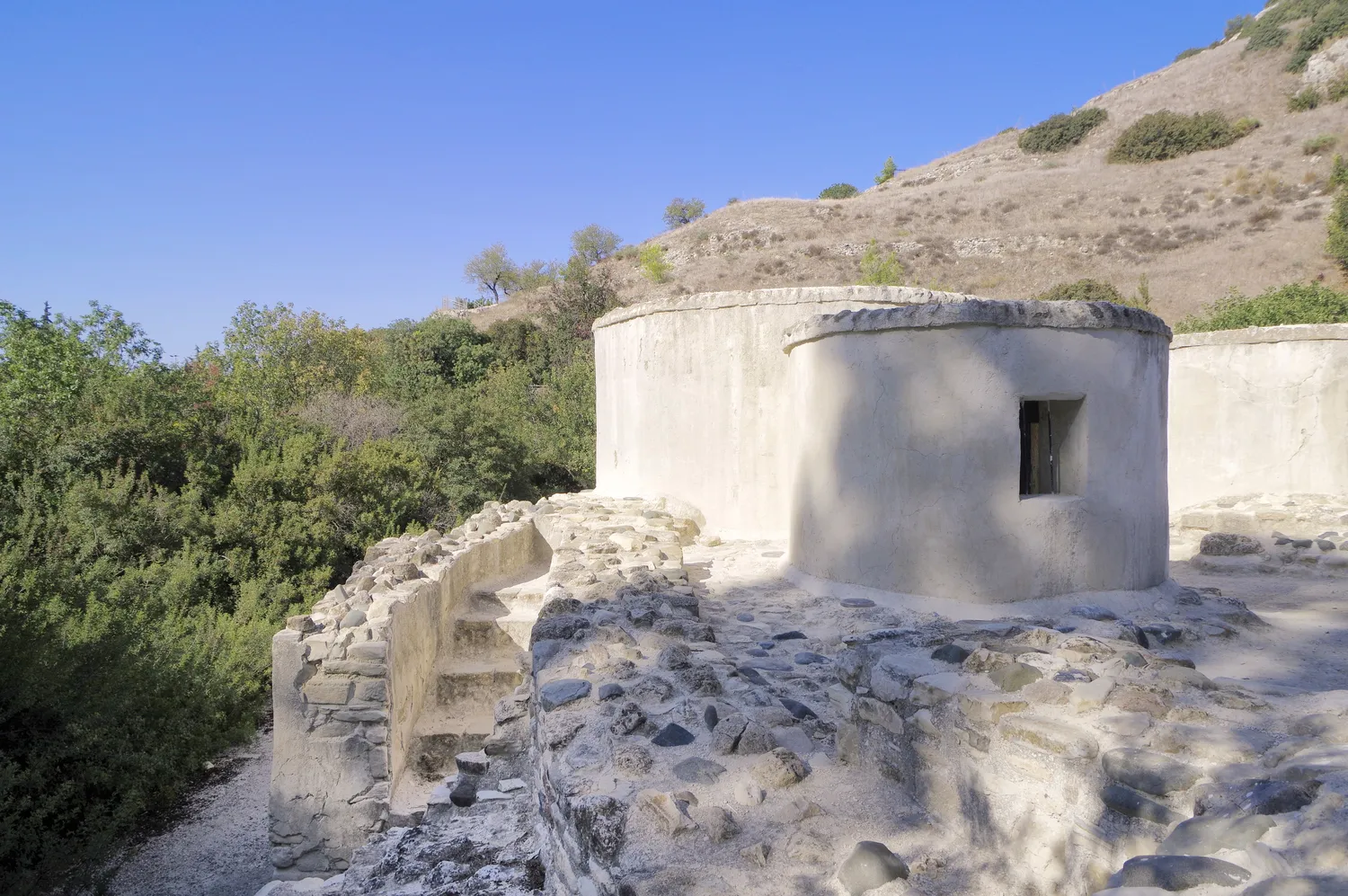
Access 1, in the first wall, was a gap about 1.20 m wide whose plastered floors ran out over a stone platform built against the outer face, only to bridge the drop [1, pp. 23, 25]. Access 2 was too narrow and too carefully plastered for flocks, and since no animal pens have been found inside, the animals were kept outside. Le Brun saw the paradox: a defensive work built so that its defence was never put to use [1, p. 25].
Louise Steel notes that such walls are "assumed" to be defensive, and asks what threat they met: there is no evidence for violent destruction or deaths, no weapons, and the danger "might equally have come from the wild landscape beyond" [4]. Bernard Knapp reads the walls as marking out the community, and at the least as proof that someone could organise the labour to build them [5]. On a hill this steep a wall also holds up the terraces behind it. What access 2 certainly did was control movement.
Walk in as a visitor would have done, from the slope below: round the end of the blocking structure, up the first flight, 0.80 m wide, along the middle flight screened from the slope, and out along the wall top. The tour marks the third flight, still unexcavated, as reconstruction.
Opens on the guided tour, stop 1 of 9: the way in.
A Khirokitia Household
Open the full reconstructionc. 7000 to 5200 BC · Khirokitia
The way in from the river side, with the blocking structure at the foot of the wall. Go on through the stops to climb the stair and walk the wall top.
Kalavasos-Tenta, a Cypro-PPNB hilltop village in the Vasilikos valley, was walled earlier still, "by a substantial encircling wall and a ditch cut in the havara", the soft natural limestone, immediately outside it [6]. The wall survives up to about 1.2 m and probably carried mudbrick. The ditch, about 1.65 m deep, is clear only on the south and elsewhere runs in disconnected stretches, so Ian Todd, the excavator, wondered whether it was ever finished [7]. The villages that followed were open [4], and as far as we know no village was ringed by a stone wall like Khirokitia's for some three and a half thousand years after it.
Forts on the plateau edges
The walls came back at the turn from Middle Cypriot (MC) III to Late Cypriot (LC) I, around 1650 BC on this course's dates. Michel Fortin counted about twenty fortified sites of this horizon in three belts: the Karpas peninsula, the passes and southern slopes of the Kyrenia range, and the plateaux of the central Mesaoria facing the copper-bearing foothills of the Troodos [8]. Most lie well inland. Their walls are plain: two parallel rows of undressed or roughly cut limestone with rubble between, 1 to 1.8 m wide, carrying mudbrick, set along plateau edges so that the cliffs did the rest. At Ayios Sozomenos, south of Nicosia, three enclosures stand on one plateau whose cliffs, 40 to 50 m high, did much of the defending [8].
One fort breaks the pattern. At Korovia-Nitovikla, above the south coast of the Karpas, Erik Sjöqvist of the Swedish Cyprus Expedition exposed in 1929 a square building about 40 by 36 m round a courtyard about 20 by 24 m, in one corner of a much larger walled plateau [25; 9]. Rooms lined the inner face of its curtain walls, which were about 2 m thick. These are casemates, rooms built against or inside a defensive wall; the excavators assumed their flat roofs were fighting platforms, though no roof survives [25]. The gate faced north-east between two square towers, its passage lined with orthostats, upright slabs of conglomerate up to about 1.95 m long with drafted margins (a smooth band chiselled round the edge of the face). Inside, a visitor met a blank wall and had to turn, past a cistern [25; 9].
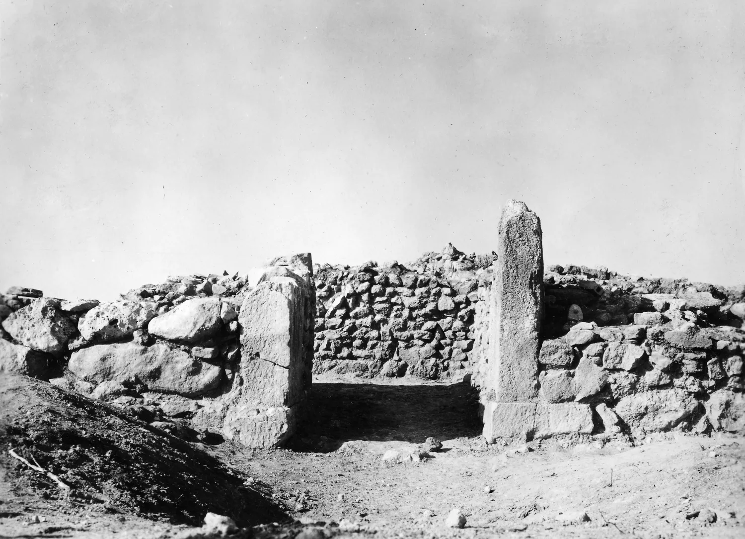
Its date has moved. Sjöqvist placed it in MC III; Gunnel Hult's restudy of the pottery put its building in LC IB, roughly 1550 to 1450 BC, with a rebuilding in LC IIA [9], a century or more after the "troubled end of the Middle Bronze Age" it used to illustrate.
Every generation has explained the forts differently. Sjöqvist in 1940 tied them to invaders in the age of the Hyksos; Hector Catling answered that forts so far from the sea pointed to trouble inside the island [4]. Fortin argued that they guarded copper and its routes to the coast [8], and Edgar Peltenburg made them the work of an emerging state centred on Enkomi [23], whose own "Fortress" Fortin read as a copper workshop secured against theft [12]. Lindy Crewe sees regional responses with no single centre [11]. Yet the copper sources, and Politiko-Phorades, the only excavated smelting site of the period, had no walls at all [10]. Whatever the forts were for, the need passed quickly: Crewe finds them out of use by LC IIA, in the 15th century BC [11], with Nitovikla's rebuilding of that phase the one late exception [9].
Cyclopean walls around 1200 BC
Towards the end of the 13th century BC, at the close of LC IIC, walls went up round towns near the coast in cyclopean masonry: very large unhewn or roughly shaped blocks, named after the giants said to have built Mycenae. At Enkomi the wall is two parallel rows of unhewn blocks about 1.5 m high, the outer row larger, with a rubble core and mudbrick above, and rectangular towers 4 to 5 m long at irregular intervals round a grid town about 400 by 350 m [13]. At Kition a destroyed mudbrick wall was rebuilt in cyclopean masonry about 2.4 m wide, with a stone anchor built into its face [13].
Two new settlements of the same moment show how far a "fortification" can vary. Maa-Palaeokastro occupies a narrow headland on the west coast. Across its neck runs a landward wall about 70 m long and 3.5 m thick, two faces of boulders with rubble between and mudbrick above, its overlapping ends forming a dog-leg gate; a second wall, 3.5 to 4 m thick, faces the sea [24; 14]. Pyla-Kokkinokremos, on a steep plateau above Larnaca Bay, had no separate wall. Its houses stood against one another along the edge, and their thickened outer walls made a casemate ring, "established to define and envelope the settlement rather than to firmly protect it", in Artemis Georgiou's words [14, p. 70]. Vassos Karageorghis and Martha Demas first read both as footholds of Aegean newcomers; their pottery and buildings are local, and Georgiou reads them as outposts of coastal centres, Palaepaphos for Maa and Kition for Pyla, guarding copper and sea trade [14].
Meanwhile Kalavasos-Ayios Dhimitrios, Maroni-Vournes and Alassa-Paliotaverna in the south put up the finest masonry of the age in ashlar, squared and dressed blocks (Lesson 5), and were never walled. In this period a town wall records a decision.
On a map the three kinds of place separate. The forts of about 1650 BC sit inland or on the Karpas, the walls of about 1200 BC ring towns at or near the coast, and the unwalled towns with the finest masonry, with the copper-smelting site at Phorades, lie in the south and the foothills.
Map of Cyprus
- Forts, c. 1650 to 1450 BC
- Town walls, c. 1200 BC
- Never walled
- Ground above 200, 500, 1,000 m
Sites on this map
- 1Ayios Sozomenos
- 2Korovia-Nitovikla
- 3Enkomi
- 4Kition
- 5Maa-Palaeokastro
- 6Pyla-Kokkinokremos
- 7Kalavasos-Ayios Dhimitrios
- 8Maroni
- 9Alassa
- 10Politiko-Phorades (approx.)
City walls of the kings
Claire Balandier sees the Iron Age kingdoms keeping Bronze Age habits, stone footings with mudbrick above: at Idalion the Cypro-Archaic I wall follows the line of a Cypro-Geometric III enclosure [15]. Early in the 5th century BC the whole city of Idalion was enclosed in a wall of limestone rubble faced with ashlar, probably with mudbrick above. At its best-preserved point it still stands 7.80 m high and 10.75 m wide, and it enclosed about 40 ha [16]. A bronze tablet from the site records a siege of Idalion by "the Medes and the Kitians", and a grant of land to a doctor who treated the wounded free of charge [18]. At Amathus, perimeter walls with fortified gates went up at the end of the Archaic period and grew in the 5th century; Catherine Kearns calls the walled lower town "arguably ideological, and not defensive" [17].
Palaepaphos, 498 BC: a siege left in place
In 498 BC every Cypriot kingdom except Amathus joined the Ionian revolt against Persia under Onesilos of Salamis; after their defeat in the plain of Salamis, the Persians took the cities one by one, Soli last, in the fifth month, by undermining its wall [26]. At Kouklia, the village on the site of Palaepaphos, the Marchello hill preserves what happened at one of them.
The wall there, first built in the second half of the 8th century BC, was a massive mudbrick structure with rough stone facings on both sides, 4.80 to 6.30 m wide [19]. Shortly before the siege the Northeast Gate had been remodelled into a narrow passage with a sharp double bend, covered by crossfire from bastions (solid towers projecting from the wall) on both sides, and closed at its city end by heavy wooden doors in an opening only 2.90 m wide [19, p. 194]. Outside lay a fosse, a dry ditch, beyond a berm, the level strip at the wall's foot.
The Persians demolished a Late Archaic sanctuary outside the walls and, with its debris, loads of soil and tree trunks, filled the ditch and raised a ramp up to the wall [19, p. 202]. What survives of it stands 4.50 m above the outer lip of the ditch and more than 7 m above its bottom [19, p. 197]. The fill holds the sanctuary it consumed: more than 1,000 fragments of limestone statues of people and animals, and hundreds of syllabic inscriptions [21, p. 284]. It also held more than 500 iron and bronze arrowheads, javelin points and spearheads, and a Greek bronze helmet of Corinthian type, which Franz Georg Maier, the excavator, called the only Greek bronze helmet then known from a battle rather than a grave or a sanctuary [19, p. 198].
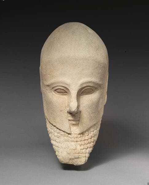
A limestone head of the same years from Golgoi wears the same type. More than 450 rounded limestones with one flattened side, weighing 2.7 to 21.8 kg, lay in the ramp too. Maier first suggested they were ammunition for a stone-throwing engine, which would put the catapult a century before Dionysios I's siege of Motya in 399/398 BC [19, p. 200]. In his later guide to the site he settled for missiles thrown by hand from the parapet [20, p. 68].
The defenders fought the ramp from underneath. They broke through the lower part of their own wall to dig a Passage across the berm and cut four tunnels in the rock beneath the wall. Tunnel 1, running from a trench inside the wall to the bottom of the ditch, is 1.20 to 1.70 m wide and 1.70 to 2.30 m high, with Archaic lamps in niches cut in its sides [19, p. 200]. Through the tunnels they dragged stone from the ramp into the city, propping the hollow with timber and mudbrick. Tunnel 2 was abandoned when part of its roof fell in, and Tunnel 4 was never finished: "apparently the fighting ended while it was still under construction" [19, p. 200].
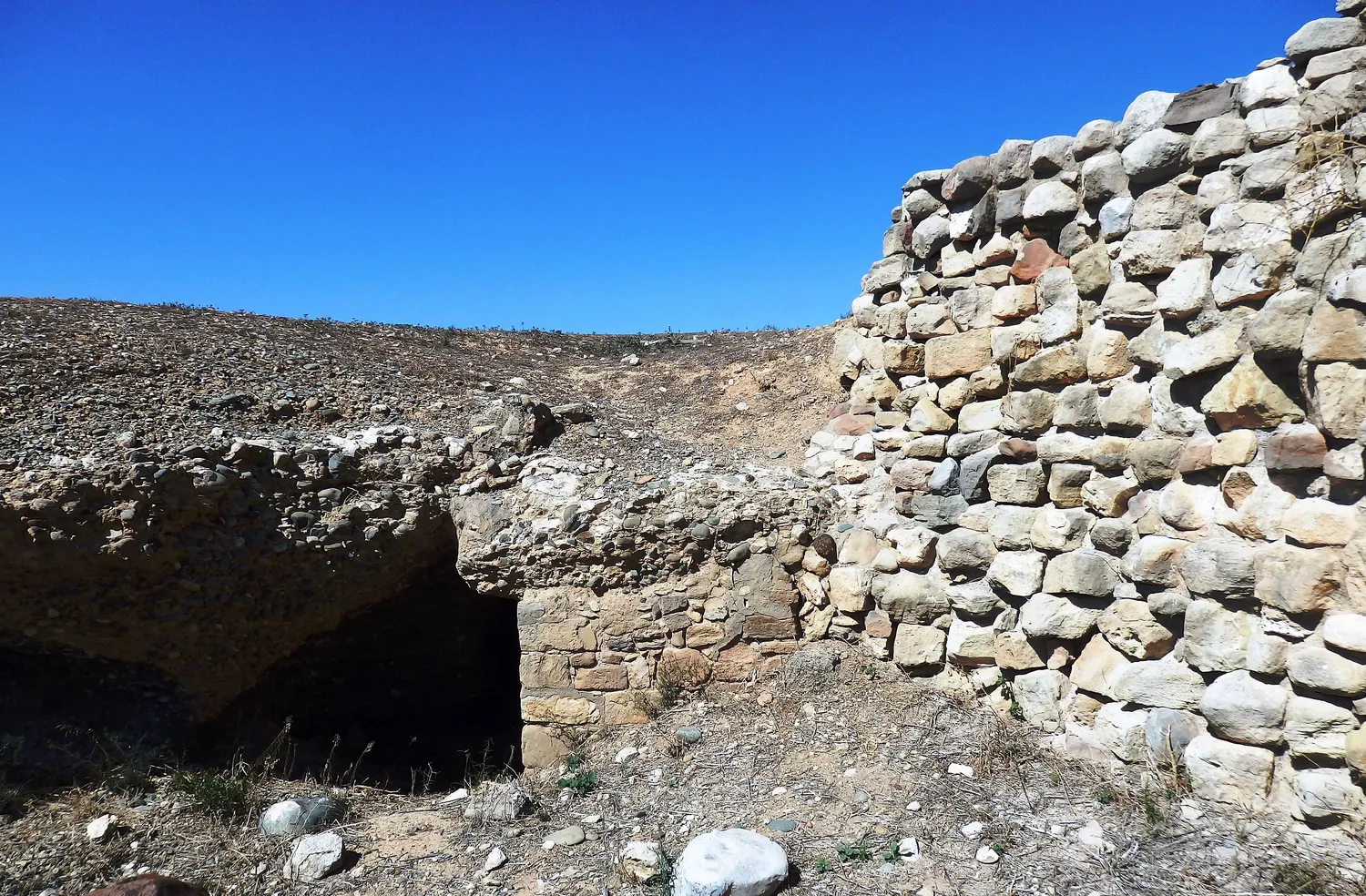
At the ends of the Passage and of Tunnels 1 and 3 stood the same arrangement: a large bronze cauldron, badly burnt, on two or three mudbricks, filled with charred wood and lime to fire the props [19, p. 200]. The tunnels drew like furnaces, parts of the ramp collapsed, and above the cauldrons the fill fused into a hard block of burnt stone and lime [19, p. 202]. Maier inferred that the Persians meant to roll wooden siege towers up the ramp, the only load worth bringing down by a sudden collapse; no tower was found [19, p. 202]. The mining did not save the gate: its doors burnt, and Maier concludes that the attackers forced the passage [19]. He called Marchello, apart from Masada, "the only archaeologically fully documented ancient siege operation" [19, p. 202].
That reading has held for half a century. Maria Iacovou notes that a sounding in 1973 found no ditch north-west of the gate, and that the rampart's south face is the one reinforced with larger boulders. She suggests, tentatively, that the wall faced south and set off a special zone on the plateau, so the sculpture need not have come from outside the walls [21, p. 284]. The fight itself, which the weapons attest, she does not deny [21].
When the walls were rebuilt, more than a century later, the Paphians, unable to shift the mound, faced it with stone and made it a horseshoe-shaped bastion [19].
After the kings: Nea Paphos and Pyla-Vigla
Nikokles, the last king of Paphos, moved his capital to a new harbour town, Nea Paphos, late in the 4th century BC. An inscription from the old sanctuary records that he ringed a "wide-spaced city" with towers, and scholars now almost all identify that city with Nea Paphos [21, p. 287]. At its Northwest Gate a rock-cut ramp about 35 m long climbed between two towers cut from the rock and faced with masonry [19]. Beside it Balandier recorded eight sortie tunnels through the rock base of the wall, linked in pairs, and asks whether their model was the tunnels dug at Palaepaphos in 498 or newer Hellenistic tactics; they are not yet dated [15].
The last fort here, Pyla-Vigla, stands on a plateau east of Larnaca, on the road between Salamis and Kition. A fosse cut in the bedrock guards its north side, and a wall 1.7 to 2.8 m thick runs round the plateau, built like the houses inside it: rough fieldstone faces on bedrock, a rubble core, and mudbrick above [22]. Its earliest floors and its final collapse hold finds of one date: a garrison held it briefly, around 300 BC, in the wars of Alexander's successors, for Ptolemy or for Antigonos; its excavators weigh both [22]. Its commonest weapon is the lead sling bullet. Among its bronze projectiles are tanged bolts for catapults [22], the machine Maier first proposed for Palaepaphos two centuries earlier, and then withdrew.
Quiz
Check yourself
Question
How wide was the stair of Khirokitia's access 2, in metres?
Question
Khirokitia's entrance looks defensive. Why do scholars hesitate to call its walls defences?
Question
Fortin argued that the forts of about 1650 BC guarded copper and its routes to the coast. What weighs against that?
Question
Pyla-Kokkinokremos, above Larnaca Bay, is counted among the fortified sites of about 1200 BC. What formed its defence?
Question
Put the story of the Northeast Gate at Palaepaphos in order.
Tap an item, then tap its place. Or use the arrows
Question
More than 450 rounded limestones lay in the Palaepaphos ramp. What did the excavator finally make of them?
Question
How sure can we be of each of these?
Tap a statement, then the bin it belongs in
To sort (5)
What to look for
- Read the socle first. A stone footing 1 to 2 m wide is the base of a mudbrick wall whose upper part has gone; two faces of big boulders with rubble between, as at Enkomi or Maa, is the cyclopean manner of about 1200 BC.
- Note where the wall runs. A wall along a plateau edge lets the cliff do the work (the MC III to LC I forts); a wall across the neck of a headland, as at Maa, closes the only way in.
- Count the turns at the gate. A bent or dog-leg entry, towers either side and a narrow inner opening (Nitovikla, Palaepaphos, Maa) were built to control who came in; a plain gap, like Khirokitia's access 1, served the walker.
- Look for rooms against the inside of the wall. These are casemates: a fort's own rooms at Nitovikla, the backs of houses at Pyla-Kokkinokremos.
- Check what an unwalled neighbour did. Kalavasos and Maroni built in fine ashlar without a wall, so a wall marks a choice, and its absence is evidence too.
- Look in the debris for burning, weapons in the fill, a ramp or tunnels. Most Cypriot walls have none of these, and the case for "defence" then rests on the plan alone.
- Separate old from new. Khirokitia's stair at the foot of the site is a full-size modern replica, Tunnel 1 at Kouklia stands on modern concrete supports, and at Nea Paphos most of what shows is the rock-cut bed of a vanished wall.
Go deeper
Walk Khirokitia's entrance in the Khirokitia household reconstruction (its report section "Up, left, right and right again" sets out every measurement), then read Fortifications in Ancient Cyprus for the full site table and the debates, and Iron Age arms and armour for the weapons in the Palaepaphos ramp. The site pages for Khirokitia, Kalavasos-Tenta, Enkomi, Kition, Idalion, Amathus and Paphos carry the places further; the articles on the excavations at Idalion, the city of Amathus and Maria Iacovou's kingdoms take up the kingdoms behind the walls.
References
- 1.Le Brun, A. (1992). Monter, descendre: les accès au village néolithique précéramique de Khirokitia (Chypre). In G. K. Ioannides (Ed.), Studies in Honour of Vassos Karageorghis (Kypriakai Spoudai), 21–26. Nicosia: Society of Cypriot Studies.
- 2.Le Brun, A. (1997). Khirokitia: A Neolithic Site. Nicosia: Bank of Cyprus Cultural Foundation. (With S. Hadjisavvas on the reconstructed houses.)
- 3.Dikaios, P. (1953). Khirokitia: Final Report on the Excavation of a Neolithic Settlement in Cyprus on Behalf of the Department of Antiquities, 1936–1946. London: Oxford University Press.
- 4.Steel, L. (2004). Cyprus before History: From the Earliest Settlers to the End of the Bronze Age. London: Duckworth.
- 5.Knapp, A. B. (2008). Prehistoric and Protohistoric Cyprus: Identity, Insularity, and Connectivity. Oxford: Oxford University Press.
- 6.Todd, I. A. (2001). Kalavasos-Tenta revisited. In S. Swiny (Ed.), The Earliest Prehistory of Cyprus: From Colonization to Exploitation. Boston: American Schools of Oriental Research.
- 7.Todd, I. A. (1982). Vasilikos Valley Project: Fourth Preliminary Report, 1979-1980. Journal of Field Archaeology, 9(1), 35-77.
- 8.Fortin, M. (1995). A cluster of Middle Cypriot III–Late Cypriot I fortified sites on the Ayios Sozomenos plateau. Bulletin of the Institute of Classical Studies, 40.
- 9.Hult, G. (1992). Nitovikla Reconsidered (Medelhavsmuseet Memoir 8). Stockholm: Medelhavsmuseet.
- 10.Monahan, E., & Spigelman, M. (2019). Negotiating a new landscape: Middle Bronze Age fortresses as a component of the Cypriot political assemblage. In C. Kearns & S. W. Manning (Eds.), New Directions in Cypriot Archaeology (pp. 133–159). Ithaca: Cornell University Press.
- 11.Crewe, L. (2007). Early Enkomi: Regionalism, Trade and Society at the Beginning of the Late Bronze Age on Cyprus (BAR International Series 1706). Oxford: Archaeopress.
- 12.Fortin, M. (1989). La soi-disant forteresse d'Enkomi (Chypre). Aegaeum, 3, 239–249.
- 13.Karageorghis, V. (1982). Cyprus: From the Stone Age to the Romans. London: Thames and Hudson.
- 14.Georgiou, A. (2012). Pyla-Kokkinokremos and Maa-Palaeokastro: a comparison of two naturally fortified Late Cypriot settlements. In A. Georgiou (Ed.), Cyprus: An Island Culture. Society and Social Relations from the Bronze Age to the Venetian Period (pp. 65–83). Oxford: Oxbow.
- 15.Balandier, C. (2001). Les techniques de construction des fortifications chypriotes: héritages et influences du VIIIe s. av. J.-C. au VIIe s. apr. J.-C. Cahiers du Centre d'Études Chypriotes, 31.
- 16.Stager, L. E., & Walker, A. M. (Eds.). (1989). American Expedition to Idalion, Cyprus 1973–1980 (Oriental Institute Communications 24). Chicago: The Oriental Institute of the University of Chicago.
- 17.Kearns, C. (2022). The Rural Landscapes of Archaic Cyprus: An Archaeology of Environmental and Social Change. Cambridge: Cambridge University Press.
- 18.Papasavvas, G. (2014). Warfare and the Cypriot kingdoms: military ideology and the Cypriot monarch. Cahiers du Centre d'Études Chypriotes, 44.
- 19.Maier, F. G., & Karageorghis, V. (1984). Paphos: History and Archaeology. Nicosia: A. G. Leventis Foundation.
- 20.Maier, F. G. (2004). Guide to Palaipaphos (Kouklia). With contributions by S. Hadjisavvas and M.-L. von Wartburg. Nicosia: Bank of Cyprus Cultural Foundation.
- 21.Iacovou, M. (2013). Paphos before Palaepaphos: new approaches to the history of the Paphian kingdom. In D. Michaelides (Ed.), Epigraphy, Numismatics, Prosopography and History of Ancient Cyprus: Papers in Honour of Ino Nicolaou (Studies in Mediterranean Archaeology Pocket-book 179, pp. 275–291). Uppsala: Åströms Förlag.
- 22.Olson, B. R., Moore, R. S., Landvatter, T., & Stephens, J. (2021). Pyla-Vigla: a case study assessing the imperial strategies of the Hellenistic Diadochoi in Cyprus. Études et Travaux, 34, 287–306.
- 23.Peltenburg, E. J. (1996). From isolation to state formation in Cyprus, c. 3500–1500 BC. In V. Karageorghis & D. Michaelides (Eds.), The Development of the Cypriot Economy from the Prehistoric Period to the Present Day (pp. 17–43). Nicosia.
- 24.Karageorghis, V., & Demas, M. (1988). Excavations at Maa-Palaeokastro 1979–1986. Nicosia: Department of Antiquities, Cyprus.
- 25.Gjerstad, E., Lindros, J., Sjöqvist, E., & Westholm, A. (1934). *The Swedish Cyprus Expedition: Finds and Results of the Excavations in Cyprus 1927–1931*, Vol. I. Stockholm: The Swedish Cyprus Expedition.
- 26.Herodotus, Histories, 5.104–116.
- 27.Karageorghis, V. (1982). Chronique des fouilles et découvertes archéologiques à Chypre en 1981. Bulletin de correspondance hellénique, 106 (the Khirokitia section, on the campaign directed by A. Le Brun).