
Contents
Cyprus built its first towns in the Late Bronze Age. Kevin Fisher calls the centuries from Middle Cypriot III to Late Cypriot IIB (c. 1750–1340/15 BC) a "proto-urban" period, and places the real growth of towns and of monumental building in LC IIC–IIIA, from the mid-fourteenth century to about 1100 BC [1]. The places that matter are Enkomi, Kalavasos-Ayios Dhimitrios, Maroni, Hala Sultan Tekke, Kition and Alassa. Each is known only in part. Generally less than 5% of any Late Cypriot site has been excavated [1], and Maria Iacovou counts Enkomi as "the only Late Cypriot settlement on the island that can be considered adequately excavated," with nearly one-sixth of the walled town dug [2, p. 8]. Other sites have simply gone: Toumba tou Skourou was bulldozed into orange groves, leaving an area of only 66 x 36 m [2, p. 7]. This page covers town plans, the large buildings and the houses; the cut-stone technique has its own entry on ashlar masonry, and the course lesson on ashlar and the first towns walks through the same ground with plans.
Enkomi from fort to grid town
The Fortress and the first compounds
Enkomi was founded on virgin soil in MC III/LC I, in the late seventeenth century BC [2, p. 10]. At the north end of the site stood the building its excavators called the "Fortress," about 30 x 10 m, where copper was worked on a large scale. Fisher counts it as one of some twenty-one forts built in the north and east of the island at the transition from the Middle to the Late Cypriot period, which guarded routes to the copper of the Troodos [1]; the forts and town walls are covered under fortifications. Priscilla Keswani noted that Enkomi's earliest metallurgical installations lie inside this Level I "fortress," and that later copper workshops sat within or beside official or religious buildings at Enkomi, Kition and Athienou [3, p. 76]. The trade itself is described under copper metallurgy.
The earliest town was loose. Under the later Ashlar Building lay a freestanding domestic complex about 30 x 22 m, its wings set round a court open at one end, and the open ground between such compounds was used for chamber tombs: two tombs lie directly in front of the Fortress entrance [1].
The rebuilt town and its grid
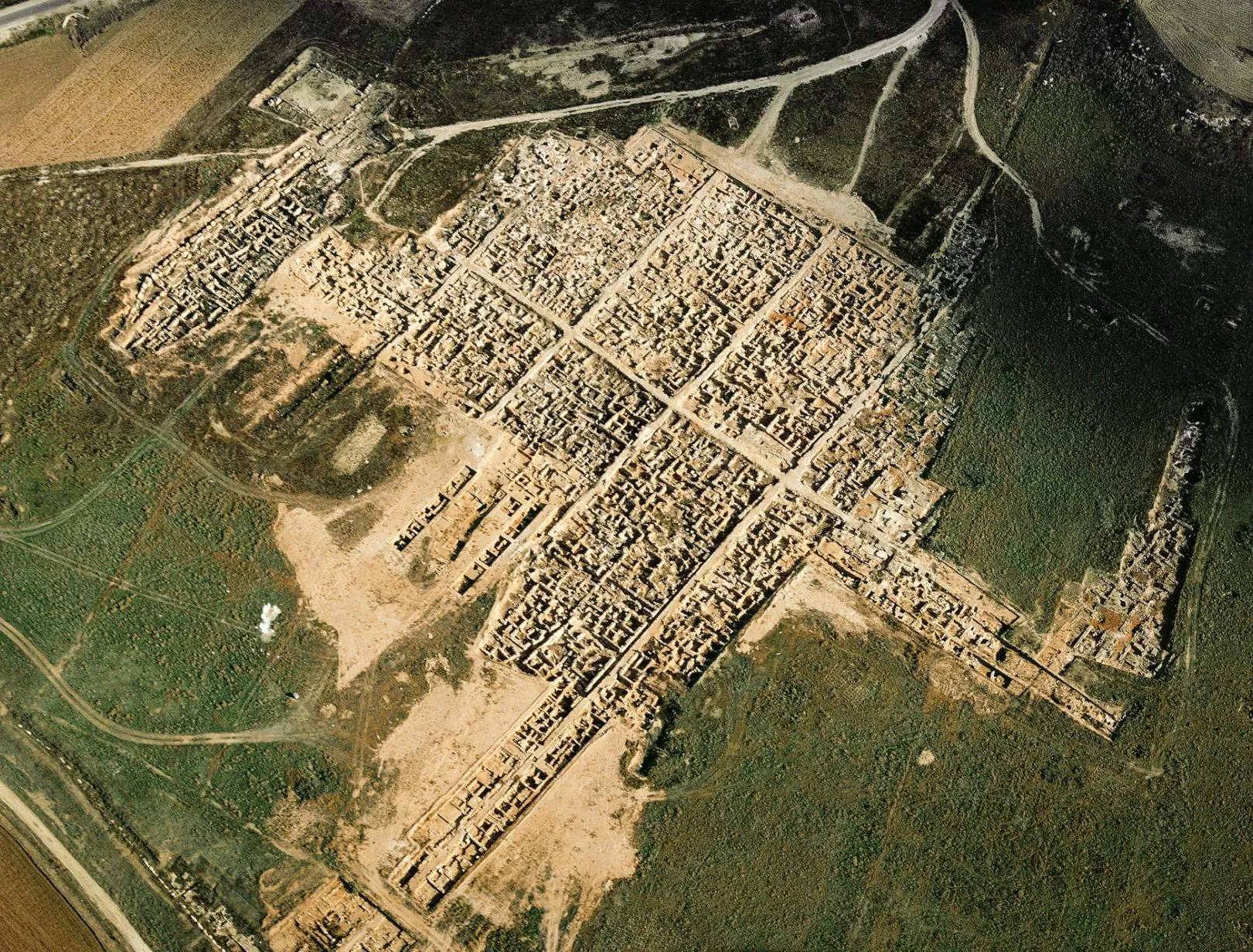
Enkomi was excavated by a French mission under Claude Schaeffer and by the Cyprus Department of Antiquities under Porphyrios Dikaios, working in parallel from 1948 to 1958 [4, p. 616]. Dikaios found that Level IIB (LC IIC) ended in a violent destruction, that the cyclopean town wall was already standing before it, and that ashlar construction was a novelty of the rebuilt Level IIIA [4, p. 617].
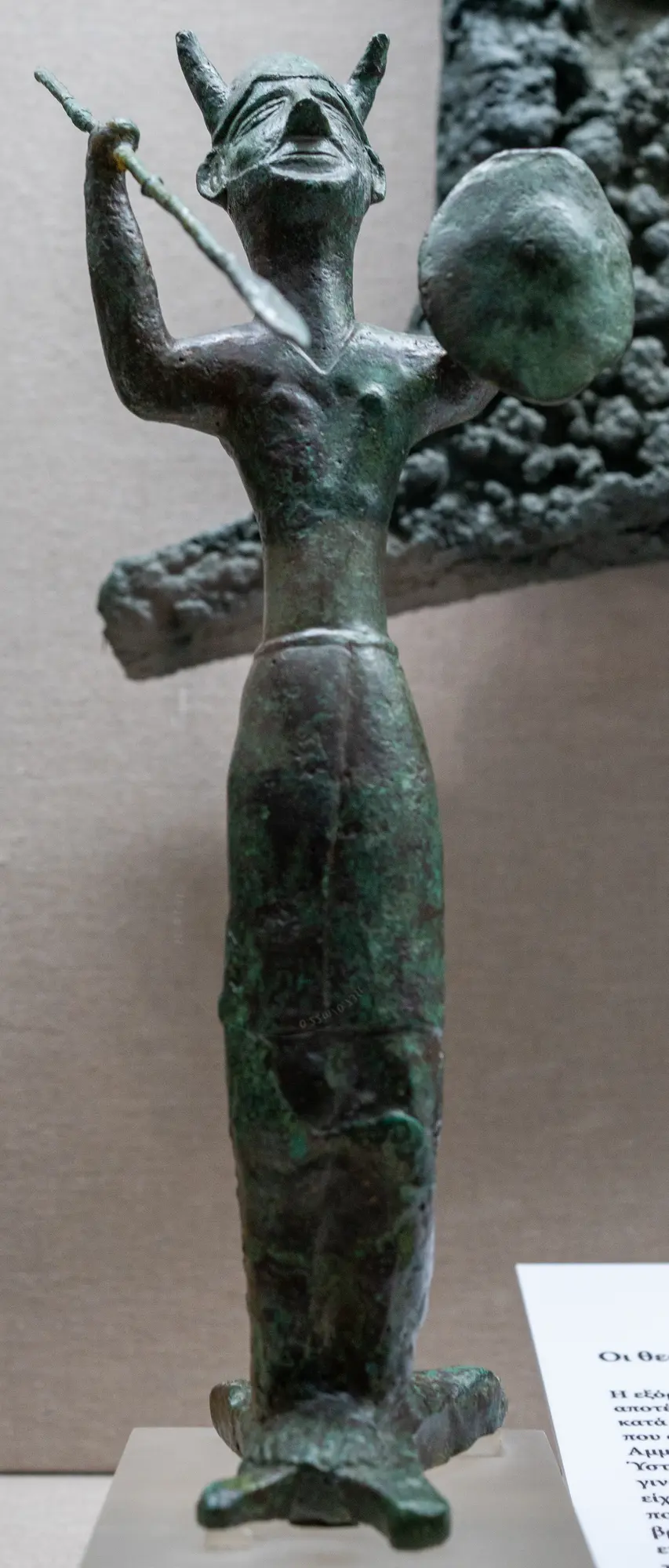
After this destruction, around 1200 BC, the town was laid out on a modular orthogonal plan oriented about 7° west of north: "a single, central north-south artery dissected by nine evenly spaced, east-west running streets, forming twenty blocks" [1]. Iacovou describes the grid as commanded by two main arteries, one north-south and one east-west, aligned with the city gates [4, p. 616]. A ring road seems to have run round the inside of the wall, which enclosed about 14 ha [1]; Iacovou gives the walled area as 400 m north-south by 350 m east-west, about 140,000 m² [2, p. 8]. Large buildings partly or wholly of ashlar stood on the central axes, among them Building 18, which Fisher reads as "a series of elite residential units," and the Ashlar Building [1]. The town's sanctuaries, including the one where the Ingot God was found, are described under Bronze Age sanctuaries.
How new the grid was is debated. The outer walls of the Ashlar Building follow the boundaries of a building of the previous phase, which suggests that parts of the layout were already in place before the rebuilding [1]. The cyclopean rampart itself, built in LC IIC and probably in the late thirteenth century, was "a very late addition" to the town [2, p. 10]. What lay outside the walls is unknown. Enkomi was gradually abandoned at the end of the twelfth century, when its population shifted to Salamis, a new port closer to the sea [4, p. 616; 2, p. 10].
Other towns and their plans
Kalavasos-Ayios Dhimitrios
Kalavasos-Ayios Dhimitrios, near the Vasilikos river, dates mainly to LC IIC (c. 1340/15–1200 BC); its plan is known from the work of Alison South. Its buildings and roads are oriented about 25° west of north, which shows a plan made in advance. No town wall has been found; surface finds and architecture suggest a site of about 11.5 ha [1], of which perhaps 5% has been excavated [2, p. 8]. The main north-south street, about 3.8 m wide, runs at least 150 m through three separate excavation areas, and the multiroom buildings front onto it as it leads north to Building X [1; 2, p. 8]. Iacovou describes it as "an LC IIC town with a high degree of organization, on a grid system" [2, p. 8].
There may have been zoning. The monumental administrative buildings lay in the northeast, larger houses (some with workshops) in the east and centre, and smaller houses on the western outskirts, on a slightly different alignment closer to north. South identified possible "lots" marked out by long stretches of wall [1]. A large wall may have enclosed the northeastern area around Building X, and geophysical survey supports this, with a structure narrowing the road where it enters [1]. A tomb from the cemetery beside the town is rebuilt in the Kalavasos Tomb 11 reconstruction.
Hala Sultan Tekke
At Hala Sultan Tekke, Paul Åström described a "so called 'Hippodamic' town plan with streets at right angles" there, with no defensive wall [2, p. 8]. Fisher finds the claim "difficult to substantiate" from the published plans, and notes that adjoining houses on a common alignment may reflect practical builders as much as a planner [1]. Estimates of size vary: Åström gave 276,000 m² in 1986 and 240,000 m² in 1996 [4, p. 618], but the 24–27 ha figure reflects the spread of tombs and industrial zones, with copper slag "almost everywhere," across an area of 600 x 460 m. The excavated remains of the town date exclusively to LC IIIA and are "extremely limited" [2, p. 9]; the LC II settlement lies buried beneath them [4, p. 618].
Kition
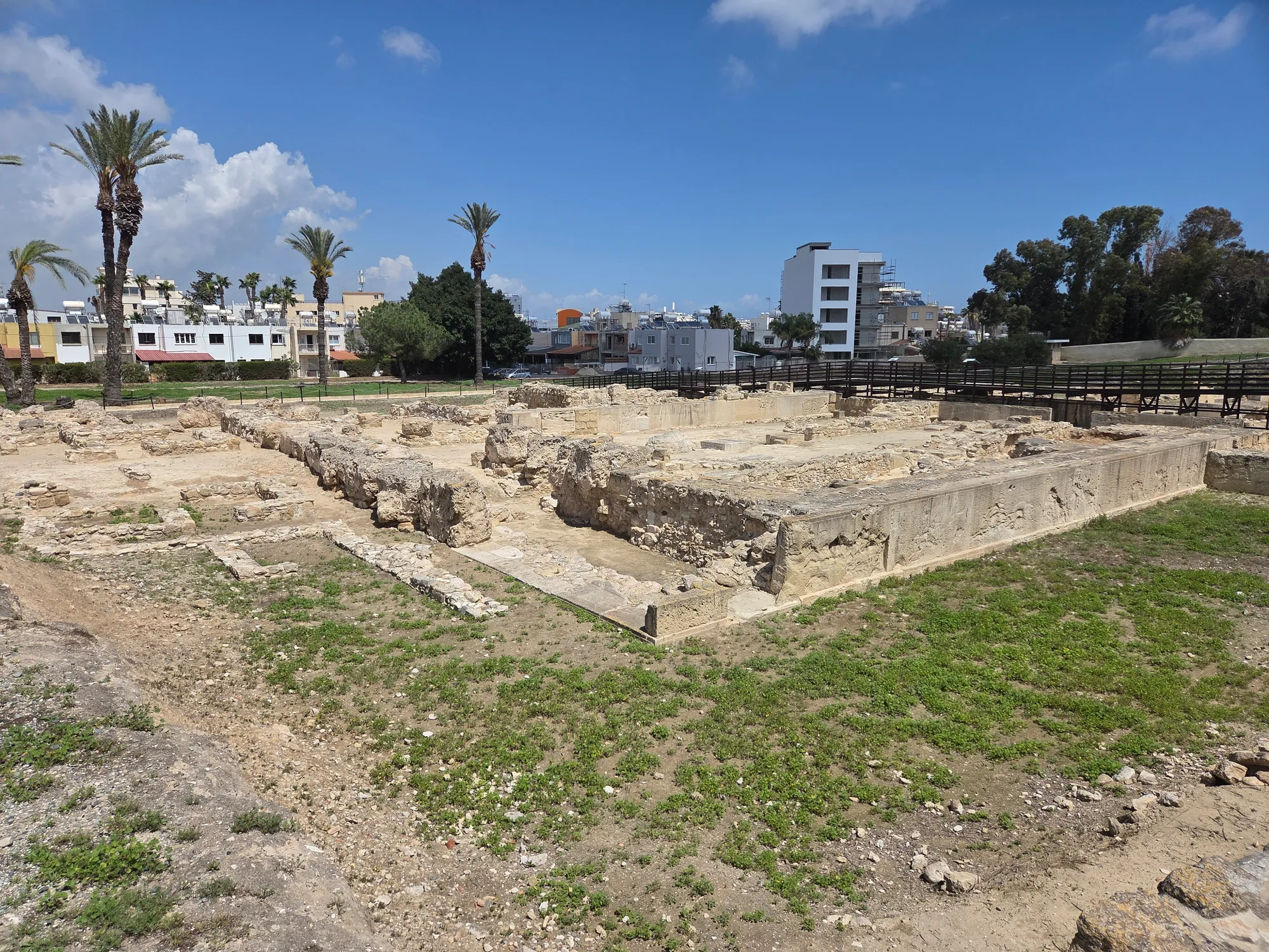
Kition occupied a low plateau about 600 x 1,500 m, less than 10 m above sea level. Its earliest remains belong to Floor IV (LC II). Of the Late Cypriot town, nearly 6,000 m² has been excavated, and 5,265 m² of that lies in the temple precinct of Area II; Area I measures only 22 x 17 m [4, p. 620]. What is known of Kition is therefore mostly its sacred quarter. Floor IV shows no evidence of violent destruction, and LC IIIA brought a new era of grand rebuilding, when Temple 1 (28 x 18.5 m) was built [4, p. 620]; the temples are described under Bronze Age sanctuaries. A mudbrick rampart of LC IIC was replaced in LC IIIA by a cyclopean wall of conglomerate [4, p. 621] (see fortifications).
Dispersed centres: Maroni and Alassa
Not every centre was a compact town. Bernard Knapp's estimate of 25 ha for Maroni adds together the excavated areas of Vournes and Tsaroukas, which lie up to 400 m apart with no continuous settlement between them; survey found five locations 250–400 m apart that belong to one large but dispersed site [2, p. 7]. Fisher describes Maroni as structures interspersed with open spaces, a "lower-density or less-integrated form of urbanism," with Tsaroukkas on a different alignment from Vournes [1].
Alassa, about 10 km north of Episkopi between the Kouris and Limnatis rivers, was found by survey in 1983 ahead of the Kouris Dam [5, p. 184], and shows the same pattern. Knapp's 12.5 ha joins Paliotaverna and Pano Mandilaris, about 500 m apart, and Sophocles Hadjisavvas places the great buildings outside the settlement, at 260 m altitude against 240 m for the houses of Pano Mandilaris [2, p. 7]. Iacovou argues that the Paliotaverna buildings "may have been purposefully isolated from the settlement," as at Maroni, and that it is "methodologically invalid" to compare the size of such sites with a walled town like Enkomi [2, p. 8]. Hadjisavvas himself gives Alassa a much larger extent of 50 ha [5, p. 184].
The large buildings
Building X at Kalavasos-Ayios Dhimitrios
Building X stood in a commanding position in the northernmost quarter of the town, on the west bank of the Vasilikos river, "by far the largest building at the site and the only one with ashlar masonry" [6, p. 130]. It is about 30.5 m square, with three wings round a central square court. A doorway 3.50 m wide in the middle of the south side led through a vestibule to a pebbled court. Ashlar blocks reach 3.20 m in length, many with drafted margins, and foundations up to 2 m thick suggest an upper storey reached by a staircase near the entrance [6, p. 131]. Fisher notes that the court was the only space in the building suited to large inclusive gatherings [5, p. 181].
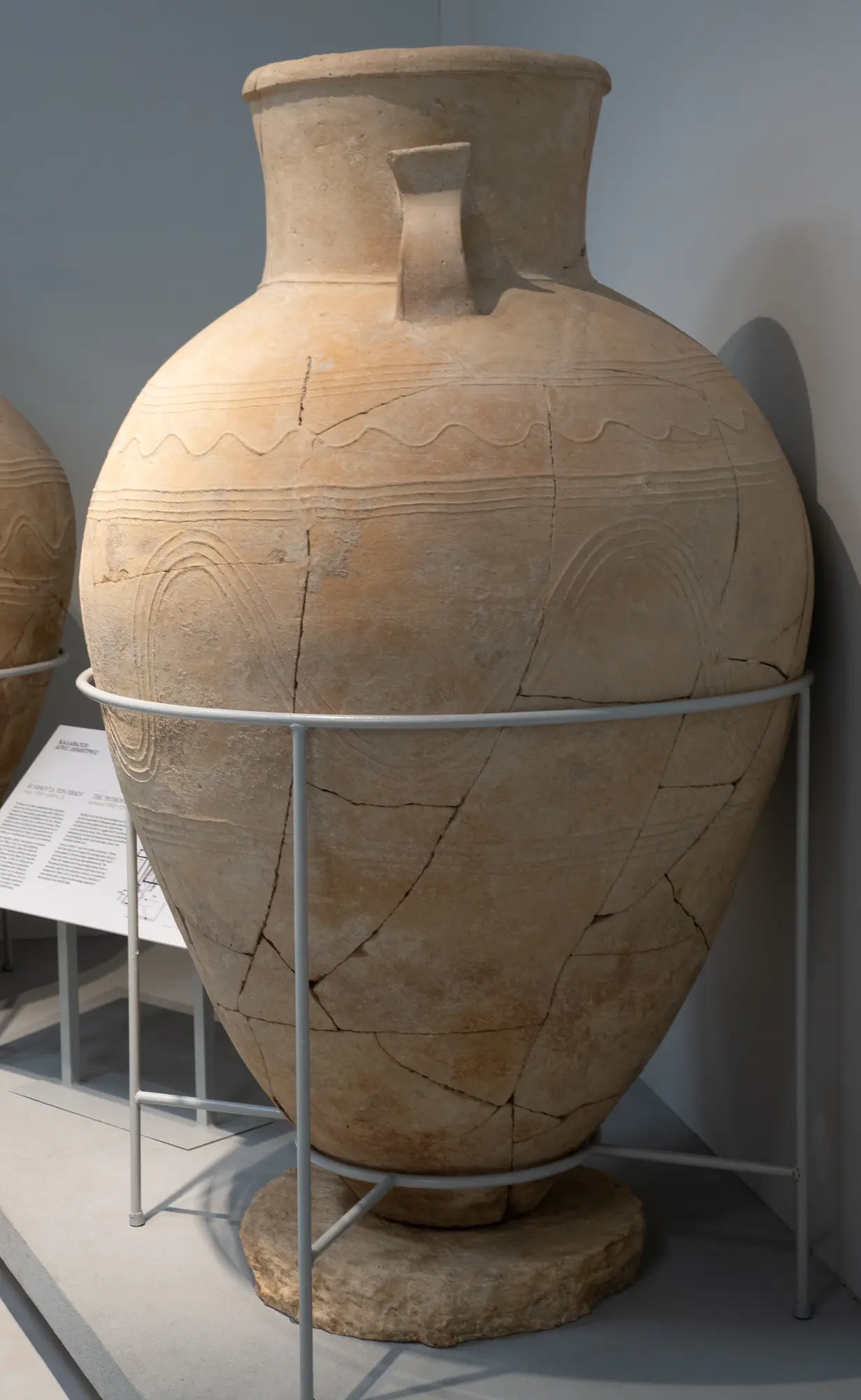
The west wing held the Pithos Hall, Room 152, the largest room in the building at 135 m², with the finest ashlar on its west wall. Six monolithic ashlar columns at least 2.5 m high stood on the long axis to carry the roof. Over 50 pithoi stood in rows on flat stones, six of them sunk between the columns; the jars were 1.5–2.0 m high with rims 0.50–0.68 m across [5, p. 182]. Hadjisavvas counts at least 47 [6, p. 131]. Keswani gives the hall as 19.5 x 7.25 m and its capacity as about 33,500 litres, about 50,000 litres for Building X once the North Pithos Magazine is added, and residue analysis identified olive oil in 15 of 19 samples [3, p. 76]. She wrote that "grouped together, they must have conveyed a tremendous impression of agricultural wealth" [5, p. 182]. A large pithos in the Larnaca District Museum, about 2 m tall, gives the scale of such jars; the storage of oil and grain is covered under food storage.
Room 176 held an olive-oil press with a robbed settling tank, and nearby Building XI had a tank cut from one block of calcareous sandstone of about 2.6 tons, holding about 2,000 litres. Five clay cylinders inscribed in Cypro-Minoan (see writing and literacy) led Fisher to call Building X "the administrative centre of Kalavasos-Ayios Dhimitrios," and he reads the central court as a place of ceremonial feasting [5, p. 183]. Keswani calculated that half the jars would have held oil for about 500 adults for two years, for a town of perhaps 750–1,250 people, and suggested that the oil may have paid for labour in the copper mines about 8 km to the north [3, p. 77].
Maroni-Vournes and Alassa-Paliotaverna
Hadjisavvas groups the ashlar buildings of Maroni, Kalavasos and Alassa together: each holds a high, commanding position at the northern end of its settlement, with big rooms and storage for olive oil, and thick walls that suggest a second storey, "most probably used as residence for the upper class" [6, p. 130]. The Maroni-Vournes Ashlar Building measures about 30.5 m by 20.5 m, narrowing to 18.5 m. Some of its walls were mudbrick plastered white to look like ashlar. Its east wing had seven rooms, among them the Room of the Olive Press, and a side entrance opened onto a street 4.50 m wide that separated it from the West Building, an aisled storeroom [6, p. 130]. Iacovou dates the establishment of a dominant authority at Vournes no earlier than LC IIC [2, p. 7].
Alassa-Paliotaverna, at 258 m, is in Hadjisavvas's words "the uppermost LBA settlement of urban character." Building I lies south of a street 4.30 m wide, exposed for 43 m, and has pillar bases 1.10 m across [6, p. 131]. Across the street, Building II forms a Π round a court open on the east, 37.70 m on each side and covering 1,410 m² [6, pp. 131–132]. The builders cut back the hillside and filled with havara; one plinth block weighs nearly 3 tons, and lifting bosses were left where they were underground or out of sight of the streets [6, p. 131]. Fisher describes it as "the largest and most architecturally elaborate building yet found" of LC II–IIIA, with a plinth and orthostats in shell construction and a mudbrick superstructure finished with red pigment; it was built in LC IIC, and a storage hall was added to the north wing in late LC IIC or early LC IIIA [5, p. 184]. The north wing held at least 16 pithoi, with a bedrock cellar and 8 more pithoi in the court; a portico ran along the inner east side, and a drainage shaft and spouted stone carried water away [6, p. 132]. Building III, about 25 x 16 m, contained a wine press [5, p. 184], with a pithos nearly 2 m deep still holding a wine-red residue [6, p. 132].
Palace, residence or administrative centre?
The function of these buildings is disputed, and the terms each scholar uses carry an argument. Hadjisavvas calls Alassa Building II a building "of palatial character" [6, p. 131]. South read Building X as a residence for elite members of society "who had some control over the economic life of the community" [6, p. 131], while Fisher, weighing the Cypro-Minoan cylinders and the storage, calls it an administrative centre [5, p. 183]. At Enkomi, Fisher finds that the Ashlar Building, "substantially larger than any other structure," was an elite residence and "lacks compelling evidence for administrative activities" [1]. Hadjisavvas notes that the coastal ashlar buildings were first identified as residences or sanctuaries, and the more recently excavated ones as administrative centres controlling agricultural products and perhaps copper [6, p. 129].
| Site | Plan | Size | Town wall | Main building |
|---|---|---|---|---|
| Enkomi | Grid of nine east-west streets and twenty blocks | c. 14 ha walled | Cyclopean, LC IIC | Ashlar Building, Building 18 |
| Kalavasos-Ayios Dhimitrios | Orthogonal streets, 25° west of north | c. 11.5 ha | None found | Building X, c. 30.5 m square |
| Maroni | Dispersed groups of buildings | 25 ha (Knapp), combining separate areas | None known | Ashlar Building, c. 30.5 x 20.5 m |
| Alassa | Monumental zone apart from the houses | 12.5 ha (Knapp) or 50 ha (Hadjisavvas) | None known | Building II, 37.70 m square |
| Hala Sultan Tekke | Rectilinear (disputed) | 24–27 ha including tombs | None | None known |
| Kition | Known mainly from the temple precinct | Plateau c. 600 x 1,500 m | Mudbrick, then cyclopean | Temple 1, 28 x 18.5 m |
Houses and neighbourhoods
The courtyard house
Hadjisavvas describes Late Cypriot houses as units of a few rooms on one or more sides of an inner court, built along a street or round a larger open space, and finds no abrupt break from earlier domestic building, with houses "similar all over the island" [6, p. 129]. Åström defined two main types: the three-aisled house round an open court, and the L-shaped house with two wings at right angles and an external court, such as House A.VIII at Episkopi-Bamboula [7, p. 420]. The three-aisled house encloses the Π-shaped plan with three wings round a court known from earlier levels at Enkomi; one of the earliest may be the MC III house at Kalopsidha-Tsaoudhi Çiftlik, with 11 rooms round an inner court [7, p. 420]. The earlier village houses are described under Early and Middle Bronze Age houses.
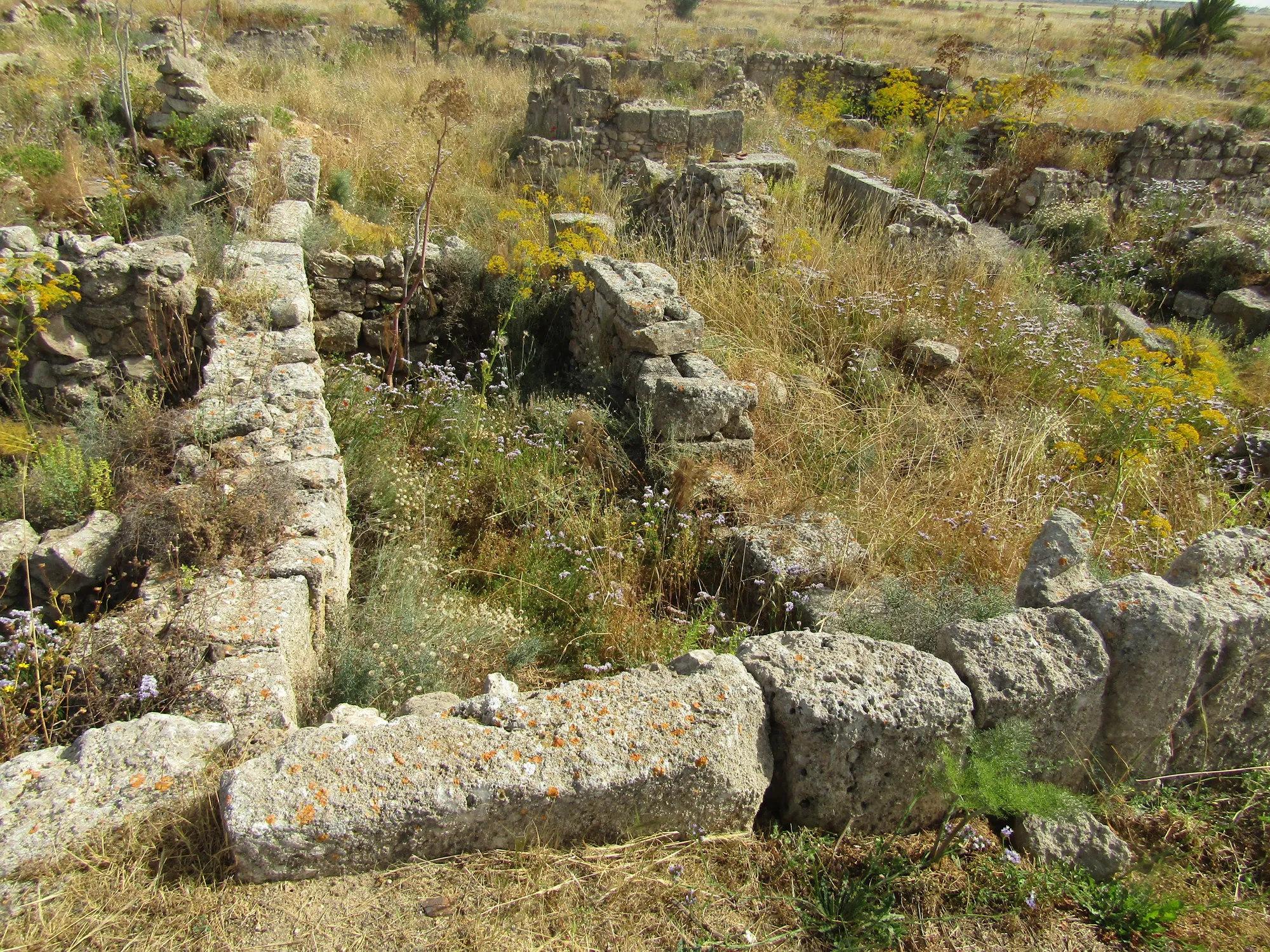
Fisher's study of eight houses from four sites, mostly of LC IIC–IIIA, finds them much larger than their predecessors, with more and smaller rooms [7, p. 421]. A single entrance from the street, wider than the other doorways, led into the court, sometimes through a vestibule (Pyla Complex D, Kalavasos Building II). The court was the largest space and controlled access to the rest of the house [7, p. 421]. It was used every day for weaving and other work [7, p. 427]. Storerooms held pithoi with carbonised grain (Pyla Complex A, Rooms 2 and 7), and there were pits, bins, hearths and ovens; rear rooms reached by a short hallway may have been private quarters, perhaps bedrooms, and Kalavasos Building II may have had an upper storey [7, p. 423]. Most floors were plastered, though Room 28 of Building II was paved with small flat stones and pithos sherds set in mud [7, p. 423]. Benches in the same building place guests within about 1.2–2.2 m of one another, a distance Fisher links with shared meals [7, p. 427]. Fisher questions how rigid the "house types" really were [7, p. 427]. For the household goods and routines inside such houses, see Late Bronze Age village life and furniture.
Streets, rebuilding and claims on space
Planned streets are known at Enkomi and Kalavasos, and also at Hala Sultan Tekke, Episkopi-Bamboula and Pyla [7, p. 428]. Ground between buildings, once shaped by where tombs were dug, was now built up along the streets. Fisher reads the city plan as a top-down decision by elites and the grid as "a tool of dominance" [7, p. 428]. At Enkomi, blocks of contiguous buildings formed "face-block" neighbourhoods facing each other across the main streets; at Kalavasos and Episkopi neighbourhoods show in differences of house size, alignment and quality of building [7, p. 428].
Households kept changing their houses. At Episkopi-Bamboula, Houses A.V and A.VI were rebuilt in Stratum E on the same plan over their Stratum D foundations, while House A.VIII was built afresh and extended beyond its predecessor [7, pp. 428–429]. People also took over public ground: partition walls were built in front of Houses A.V and A.IV at Episkopi in Stratum D, partitions blocked the street between Buildings II and III at Maa, and new tombs were cut in streets and open areas at Episkopi-Bamboula Area E and Alassa-Pano Mandilaris [7, p. 430].
A miners' house at Apliki
Apliki-Karamallos, a site of about 3–5 ha, shows a house of another kind. In Area A stood one well-built L-shaped building of eight rooms, with rubble and mudbrick walls 75 cm thick and floors of hard gypsum plaster. Tuyères, crucibles and "a sackful of slag" show metalworking. A storeroom held up to 15 pithoi on limestone blocks; six survived in place, about 1.5 m high and 1.0 m wide, each holding over 500 litres, up to 7,500 litres in all. Area B had three less substantial houses [3, p. 77]. A gold earring, a Mycenaean krater, an ivory cylinder and a steatite cylinder seal from House A led Keswani to read it as "an official residence and workplace," and plant remains of crops not grown locally show that supplies were brought in [3, p. 77].
The twelfth century
Pyla-Kokkinokremos and Maa-Palaeokastro
Pyla-Kokkinokremos and Maa-Palaeokastro are the only two settlements newly founded at the transition from the thirteenth to the twelfth century, and both were abandoned a couple of generations later [8]. Maa, about 46,000 m², was excavated from 1979 to 1986; at Pyla about 1,000 m² has been dug of a postulated 270,000 m² [8]. Both sit on natural strongholds: Pyla on a plateau 63 m above sea level with cliffs, less than 10 km from the Troulli copper mines, and Maa on a promontory between two bays 26 km west of Palaepaphos [8; 2, p. 10]. Both lacked water. Maa had cyclopean walls on its landward and seaward sides and a "Tower," while the "fortifications" of Pyla are the widened casemate wall of its house complexes [8] (see fortifications).
Both were planned. The Pyla complexes were built at one time: five adjoining complexes, of which A and B are practically identical, each half courtyard and half rooms [8]. At Maa the buildings line a street, with heavy cutting into the bedrock for foundations. On Floor II, Buildings I–IV have four different plans, and Building III has long, narrow, corridor-like rooms for storage beyond the needs of one household; most of the Plain White pithoi with cylinder-impressed friezes (a chariot hunt, goats and olive trees) come from it [8]. Floor II was destroyed and quickly rebuilt as Floor I with more structures, apparently by the same people. Ashlar appears only at Maa, in Building I and the "Tower" of Floor II, mainly at openings, and the blocks may be reused [8]. Built hearths occur at Maa (an elliptical hearth in Room 64 of Building II, a U-shaped one in Room 75 of Building IV) and at Enkomi, but no hearth rooms are known at Pyla [8].
Who built them is disputed. Vassos Karageorghis read Maa as a "military outpost," perhaps built by people from mainland Greece and Crete fleeing the destruction of the Mycenaean centres, and linked the violent end of the first settlement with "the arrival of the first Achaean colonists" [9, p. 115]. Artemis Georgiou finds no foreign cultural markers (language, religion or burial) at either site, though immigrants "cannot be excluded"; she argues that Pyla and Maa "cannot be considered as urban centres on their own account," and that Maa's walls and ashlar point to "a central authority that invested in the establishment of a fortified site" [8]. The Aegean side of the question is treated under the Mycenaeans.
Abandonment and continuity
Kalavasos and Maroni were abandoned at the end of the thirteenth century without violent destruction, and their inhabitants never returned to the still-standing buildings [8]. Enkomi's Areas I and III were destroyed at the end of LC IIC, but the town went on; Hala Sultan Tekke also survived until its port silted up [8]. Iacovou points out that Kalavasos, abandoned in LC IIC, shows that "urban planning does not, therefore, count as a novelty exclusively associated with the twelfth-century B.C.E. horizon," and that Tekke and Enkomi were deserted at the end of the twelfth century through the silting of their harbours rather than attack, and never resettled [4, p. 620]. Kition and Palaepaphos grew in the gap: Kition built its ashlar Temple 1, and Palaepaphos its Temenos I [8]. The towns of the following centuries are covered under Iron Age cities and palaces, and the built tombs of Enkomi and Kalavasos under royal and built tombs.
One kingdom or many polities
How these towns were governed remains open. Bernard Knapp argued in 1986 that by the fourteenth century Alashiya, as the island appears in the Amarna letters (see Egypt), was "a powerful and prosperous kingdom" whose ruler addressed the pharaoh as "my brother," and that copper refining in the coastal cities suggests "a centralized administration" over a hierarchy of coastal centres, industrial sites and farming villages [10, p. 41]. Priscilla Keswani saw no single administrative focus at Enkomi, where the richest goods are spread through elite graves across the town, and called its organisation heterarchical, with power held by several groups; at Kalavasos, by contrast, a single walled-off administrative zone implies a hierarchy [1]. Georgiou and Iacovou see a series of largely autonomous polities, and Georgiou writes that at the end of the Bronze Age "there was no central political administrative system to be lost to begin with" [8]. Iacovou also warns against "a homogeneous urban town model": Maroni and Alassa followed different paths from Enkomi, and LC IIC was the climax of urban development [2, p. 8]. Fisher concludes that "there was no ideal plan for a Late Bronze Age city on Cyprus," each town being the product of its own history [1].
Objects on this page
References
- 1.Fisher, K. D. (2014). Making the first cities on Cyprus: Urbanism and social change in the Late Bronze Age. In A. T. Creekmore III & K. D. Fisher (Eds.), Making ancient cities: Space and place in early urban societies (pp. 181–219). Cambridge University Press. https://doi.org/10.1017/CBO9781107110274.007
- 2.Iacovou, M. (2007). Site size estimates and the diversity factor in Late Cypriot settlement histories. Bulletin of the American Schools of Oriental Research, 348, 1–23.
- 3.Keswani, P. S. (1993). Models of local exchange in Late Bronze Age Cyprus. Bulletin of the American Schools of Oriental Research, 292, 73–83.
- 4.Iacovou, M. (2013). Aegean-style material culture in Late Cypriot III: Minimal evidence, maximal interpretation. In A. E. Killebrew & G. Lehmann (Eds.), The Philistines and other "Sea Peoples" in text and archaeology. Society of Biblical Literature.
- 5.Fisher, K. D. (2014). Investigating monumental social space in Late Bronze Age Cyprus: An integrative approach. In E. Paliou, U. Lieberwirth & S. Polla (Eds.), Spatial analysis and social spaces. De Gruyter. https://doi.org/10.1515/9783110266436.167
- 6.Hadjisavvas, S. (2009). Aspects of regionalism in Late Cypriot architecture and the case of Alassa. In I. Hein (Ed.), The formation of Cyprus in the 2nd millennium B.C.: Studies in regionalism during the Middle and Late Bronze Ages. Austrian Academy of Sciences Press.
- 7.Fisher, K. D. (2014). Rethinking the Late Cypriot built environment: Households and communities as places of social transformation. In A. B. Knapp & P. van Dommelen (Eds.), The Cambridge prehistory of the Bronze and Iron Age Mediterranean. Cambridge University Press.
- 8.Georgiou, A. (2012). Pyla-Kokkinokremos and Maa-Palaeokastro: A comparison of two naturally fortified Late Cypriot settlements. In A. Georgiou (Ed.), Cyprus: An island culture. Society and social relations from the Bronze Age to the Venetian period (pp. 65–83). Oxbow Books.
- 9.Maier, F. G., & Karageorghis, V. (1984). Paphos: History and archaeology. A. G. Leventis Foundation.
- 10.Knapp, A. B. (1986). Production, exchange, and socio-political complexity on Bronze Age Cyprus. Oxford Journal of Archaeology, 5(1), 35–60.