City-kingdom, Roman city and bishopric · Limassol District
Kourion
Kourion stands on a limestone bluff above Episkopi Bay, west of Limassol. It was the seat of one of the Iron Age kingdoms of Cyprus, then a Hellenistic and Roman city with a theatre, baths and houses with mosaic floors, and a great sanctuary of Apollo Hylates to the west. An earthquake in the later 4th century AD destroyed the city; a Christian town with a bishop's church grew up over the ruins and was abandoned in the later 7th century.
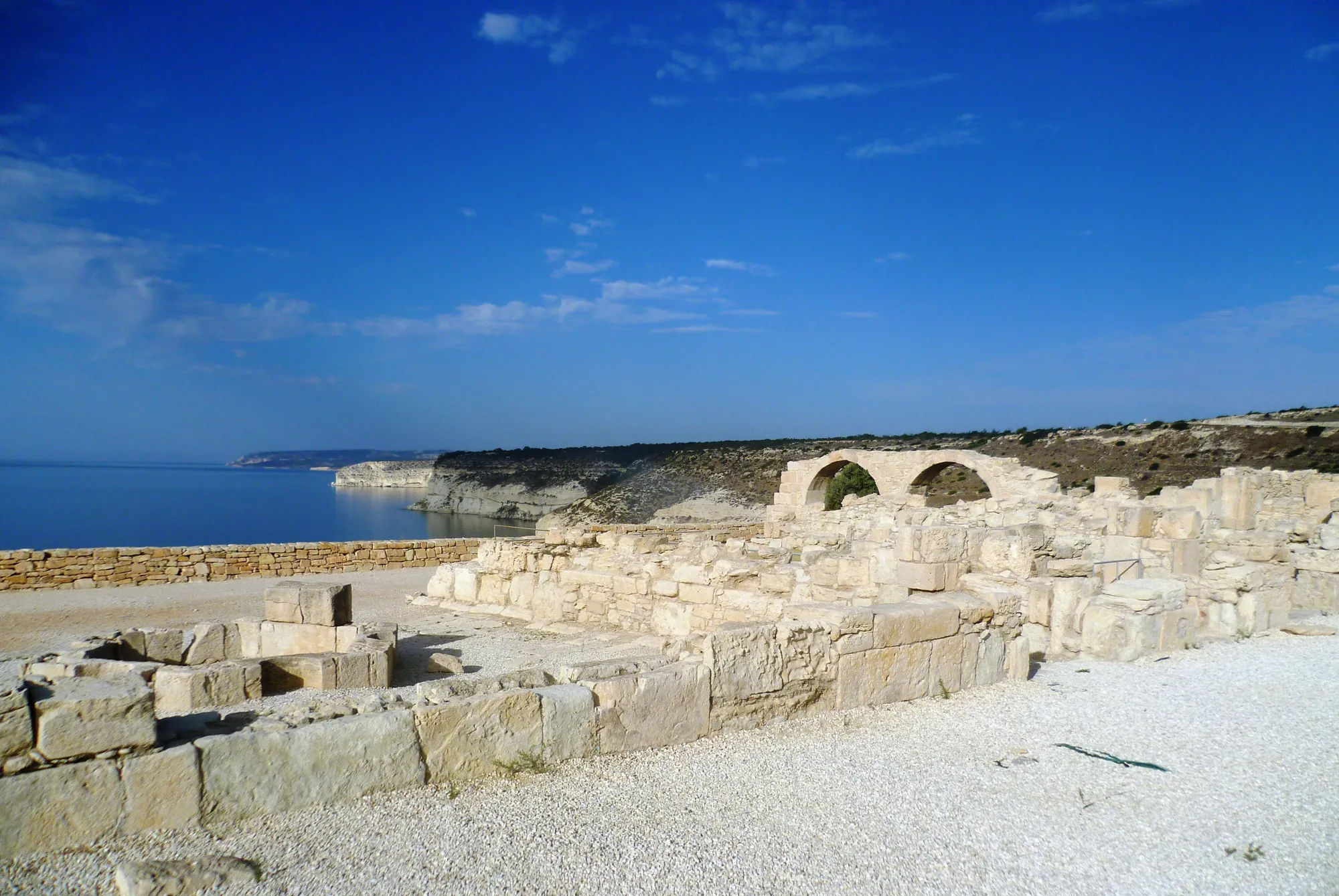
The edge of the Kourion bluff, with the arched wall of the episcopal precinct above the sea. Photo: Radosław Botev, CC BY 3.0 PL, via Wikimedia Commons, cropped.
Kourion (Latin Curium) stands on a long limestone bluff above Episkopi Bay, on the south coast of Cyprus west of Limassol. It was the seat of one of the Iron Age kingdoms of the island, whose king Damasos is named on an Assyrian prism of the 7th century BC [1, p. 28], and later a Hellenistic and Roman city with a theatre, public baths, a forum and houses with mosaic floors. West of the city lay the Sanctuary of Apollo Hylates, one of the great cult places of the island. An earthquake in the later 4th century AD brought the Roman city down. A Christian town with a large bishop's church grew up over the ruins in the 5th century and was abandoned in the later 7th [2; 3]. The cemeteries on the plain below the bluff go back to the 11th century BC, but the earlier settlement of the Late Bronze Age, at Episkopi-Bamboula, is a separate site with its own page.
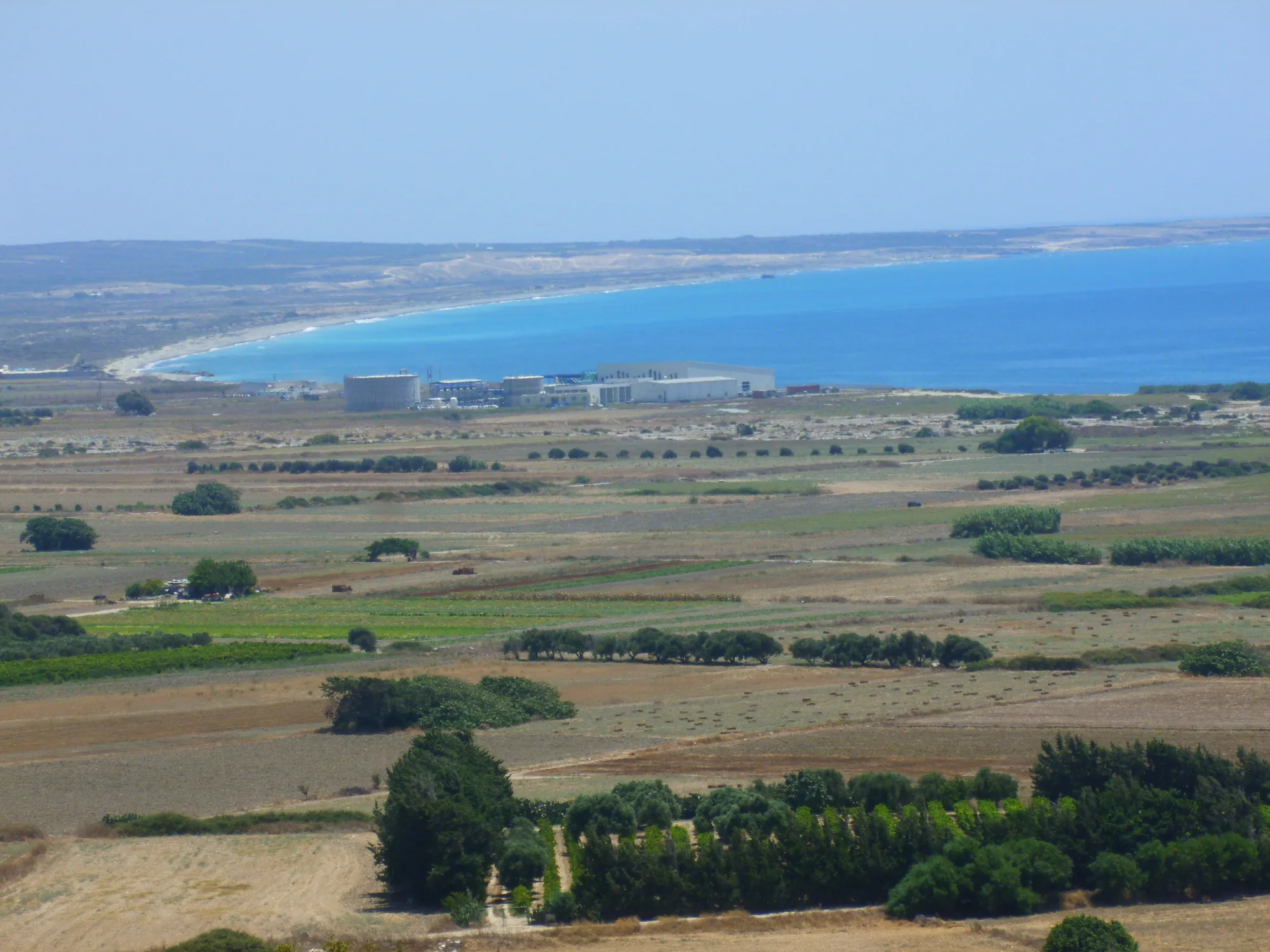
The city occupies the top of a steep-sided plateau that rises from the coastal plain of Episkopi, with cliffs to the south and west falling to the sea and the beach. R. Stillwell described the bluff as almost 1,300 yards (about 1,190 m) long and about 550 yards (about 500 m) across at its widest [4, p. 38]. The ruins visitors see today lie mostly along its southern edge, where the theatre looks out over the bay. The plain below, watered by the Kouris river, holds the cemeteries; the Sanctuary of Apollo and the stadium lie to the west along the road to Paphos.
The plain and bay of Episkopi from the ancient city. The cemeteries of Kourion lay on the plain below the bluff.Photo: Ray Ok, cropped · CC BY 3.0 · Wikimedia Commons
Kourion was never a single mound occupied without a break. Benjamin Costello describes it as "a series of settlements in the same general area that were occupied and dominant during different chronological periods" [3, p. 7]. A Middle Bronze Age village at Episkopi-Phaneromeni gave way to the Late Bronze Age town at Episkopi-Bamboula, on a ridge about 500 m to the north-west, which was abandoned around 1050 BC [3, p. 7; 5]. The town of the Iron Age kings has never been found: "despite many efforts, no one has yet been able to locate any trace of an Iron Age settlement or city. The only city so far located and excavated is the Hellenistic and Roman one" [1, p. 28]. After the ancient city was given up, its bishops moved down to Episkopi, whose name means "bishopric" [2].
Water was always the city's difficulty. The bluff has no springs of its own. Rock-cut cisterns supplied the Hellenistic town, and in the Roman period two conduits brought water from the hills to the north-west and north-east [6].
Ancient writers believed that Kourion had been founded from Argos in the Peloponnese. Herodotus (5.113) calls the Kourians "settlers from Argos", and Strabo (14.6.3) repeats that the city was an Argive foundation. In the Roman period the city honoured the Argive hero Perseus [1, p. 29; 7]. This is the tradition of the Greek writers, set down centuries after the events it describes. Archaeology can show contacts with the Aegean but cannot prove a migration from one Greek city [1, p. 29; 8].
The name first appears in a contemporary document on the clay prism of the Assyrian king Esarhaddon, who reigned from 680 to 669 BC. Among ten rulers of Cyprus who owed him tribute it lists "Damasu king of Kuri", that is Damasos king of Kourion [1, p. 28]. Cyprus was then part of the world of the Neo-Assyrian Empire; in the next century it passed under Egypt and then Persia.
Kourion and some of the other Iron Age kingdoms of Cyprus.Modern coastline (OpenStreetMap) and relief (Copernicus DEM). Tap or hover a site for its name and page.
Kourion's best-known moment in Greek history came in 498 BC. During the Ionian Revolt the Cypriot kingdoms, except Amathus, rose against Persia under Onesilos of Salamis. In the battle on the plain of Salamis, Herodotus (5.113) says, Stesenor (Stasanor), ruler of Kourion, changed sides with the large force he led, the war chariots of Salamis followed him, and the Persians won. Herodotus gives no reason for the defection. In 332 BC the Cypriot kings sent their ships to Alexander the Great at the siege of Tyre, and the flagship of Pasikrates of Kourion was one of those the Tyrians sank [3, p. 10]. Under the Ptolemies the power of the old kingdoms was suppressed or much reduced; a fragmentary decree, probably of the reign of Ptolemy II, names a city council (boule) at Kourion [3, p. 10].
The coins of the kingdom are a problem in their own right. A 1999 study argues that the early coinage of Kourion was wrongly assigned in the 19th century and attributes a different series to the city; this is a proposal and not yet accepted by all [9].
What is known of early Kourion comes mainly from the Sanctuary of Apollo and from tombs, a few excavated by archaeologists and most of them looted [1, p. 28]. The most important lie in the cemetery of Kaloriziki on the plain below the bluff. Its earliest tombs are dated by their Proto-White Painted pottery to Late Cypriot IIIB, the 11th century BC; most belong to Cypro-Geometric I, and the cemetery stayed in use into the Cypro-Classical period [1, pp. 28–29; 10]. J. L. Benson, who published the tomb groups, saw in them settlers drawn from several parts of the Greek world [1, p. 29].
In 1903 the police confiscated a group of objects said to come from Kourion. Among them was the gold and enamel sceptre now in the Cyprus Museum, a short gold tube topped by a globe with two birds of prey, together with two bronze tripods and a bronze cauldron that held a cremation [1, p. 28; 11]. Fifty years later George McFadden interviewed the last surviving tomb robber, was led to Kaloriziki Tomb 40, and in an undisturbed corner of it found objects like the confiscated ones [1, p. 28; 12]. Most scholars have accepted Tomb 40 as the source of the sceptre [1, p. 29], though the link rests on that one account and has been questioned [11]. McFadden read the tomb as the grave of an Achaean leader after the Trojan War, which goes further than the evidence [1, p. 29].
Contacts to the east are thin. A limestone stele found at Kaloriziki in 1969 carries a bilingual inscription, in the Cypriot syllabary and in Phoenician, dedicated by Bikri the Sidonian; it is dated by its script to the 7th century BC [1, p. 29]. On the island's scripts see writing and literacy.
Luigi Palma di Cesnola, the American consul in Cyprus, dug at Kourion in 1874 and 1875. In his book of 1878 he gave a dramatic account of finding, in spring 1875, vaulted "gold" and "silver" rooms full of jewellery and silver bowls, the "Treasure of Curium", which went with the rest of his collection to the Metropolitan Museum of Art [1, p. 30]. Nobody has found the treasury since. A British Museum expedition and French missions searched without result, and John Myres, cataloguing the Cesnola collection in 1914, rejected the Kourion provenance outright [1, p. 30].
Later work has softened that verdict without saving the story. Olivier Masson re-read Cesnola's letters, in which some of the objects are said to come from a tomb, and argued that they may well come from several tombs around Kourion rather than from a treasury in the city [13; 1, p. 30]. In 1989 Demos Christou excavated a built chamber tomb with a dromos near the chapel of Ayios Ermoyenis, on the plain next to Kaloriziki. Its three burials ran from about 500–474 BC to the mid-4th century BC, and although it had been robbed at least twice it still held gold, silver and bronze objects that Christou considered counterparts of pieces in the Treasure [1, p. 30]. The objects range from the 11th century BC to the Roman period, so even if they come from Kourion they come from many graves [1, p. 30]. Among them is a Late Geometric krater from Euboea, one of the largest Geometric vases sent overseas [1, p. 30]. Some pieces clearly name another kingdom: a silver-gilt bowl inscribed for Akestor, king of Paphos [1, p. 31; 14].
Two pieces that Cesnola recorded as part of the Treasure of Curium: a bronze sceptre head with bulls' heads, and a silver-gilt bowl whose inscription names a king of Paphos. Metropolitan Museum of Art. Their findspot rests on Cesnola's word.
After the 19th-century travellers, the first digging was Cesnola's, in the cemeteries, the city and the sanctuary [1, p. 30]. In 1895 the British Museum excavated tombs on the plain with money from the bequest of Emma Turner; H. B. Walters directed the work, and the results appeared in Excavations in Cyprus in 1900 [15; 3, p. 17]. Thomas Kiely has since reconstructed the tomb groups from the expedition's notebook [16]. Around 1890 the French consul Eugène de Castillon de Saint-Victor also opened tombs there, among them a Classical tomb with gold and silver jewellery and Athenian red-figure bell kraters [17; 1, p. 30].
Modern excavation began with the University of Pennsylvania Museum in 1934. George McFadden paid for the expedition and ran it in the field with J. F. Daniel, with Bert Hodge Hill. Over twenty years, with a break during the Second World War, they excavated the theatre, the House of Eustolios, the basilica, the stadium, the Sanctuary of Apollo, the cemeteries and Bamboula [3, pp. 17–18; 18; 19]. Daniel died in 1948 and McFadden drowned in Episkopi Bay in 1953 [20, p. 53; 3, p. 18], and no final report was written. Their work reached print in later monographs: the terracottas [21], the theatre [4], the architecture of the sanctuary [22], the inscriptions by T. B. Mitford [7], the water supply [6] and the cemeteries [5; 10]. The expedition house at Episkopi is now the local museum.
Episkopi-Phaneromeni, then the Late Bronze Age town at Episkopi-Bamboula.
Iron Age kingdom11th century to 332 BC
Kaloriziki tombs from the 11th century; the sanctuary from the late 8th century; kings Damasos (7th century), Stasanor (498 BC) and Pasikrates (332 BC). The royal town is not located.
Hellenistic cityLate 4th to 1st century BC
Ptolemaic rule; the first theatre in the later 2nd century BC; cisterns on the bluff.
Roman city58 BC to later 4th century AD
Theatre rebuilt under Nero and Trajan; temple, baths, stadium, forum and houses with mosaics.
EarthquakeLater 4th century AD
The city falls; the dead are left in the ruins; the site lies empty for some decades.
Christian KourionEarly 5th to later 7th century AD
Episcopal basilica and new houses on the bluff; abandoned after the Arab raids; the see moves to Episkopi.
The sanctuary lies west of the city, beside the road to Paphos. It was founded towards the end of the 8th century BC [1, p. 31]. The name of the god, Apollo, first appears in inscriptions of the 5th century BC, and his epithet Hylates, "of the woodlands", only in the Hellenistic period, though terracotta model trees from the earliest precinct suggest that the woodland character of the cult is much older [1, p. 31].
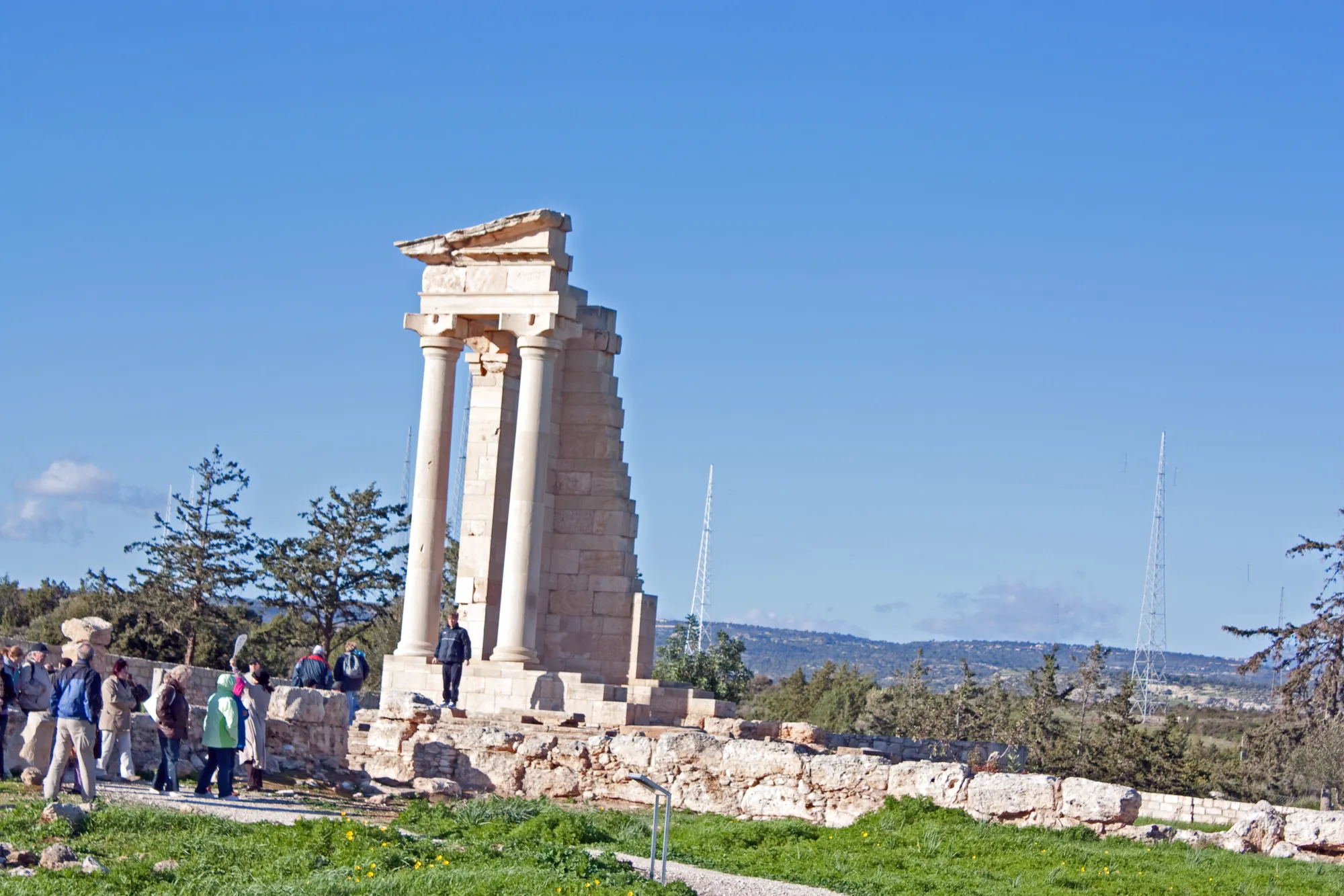
The Temple of Apollo, with its south-west corner re-erected.Photo: Wknight94, cropped · CC BY-SA 3.0 · Wikimedia Commons
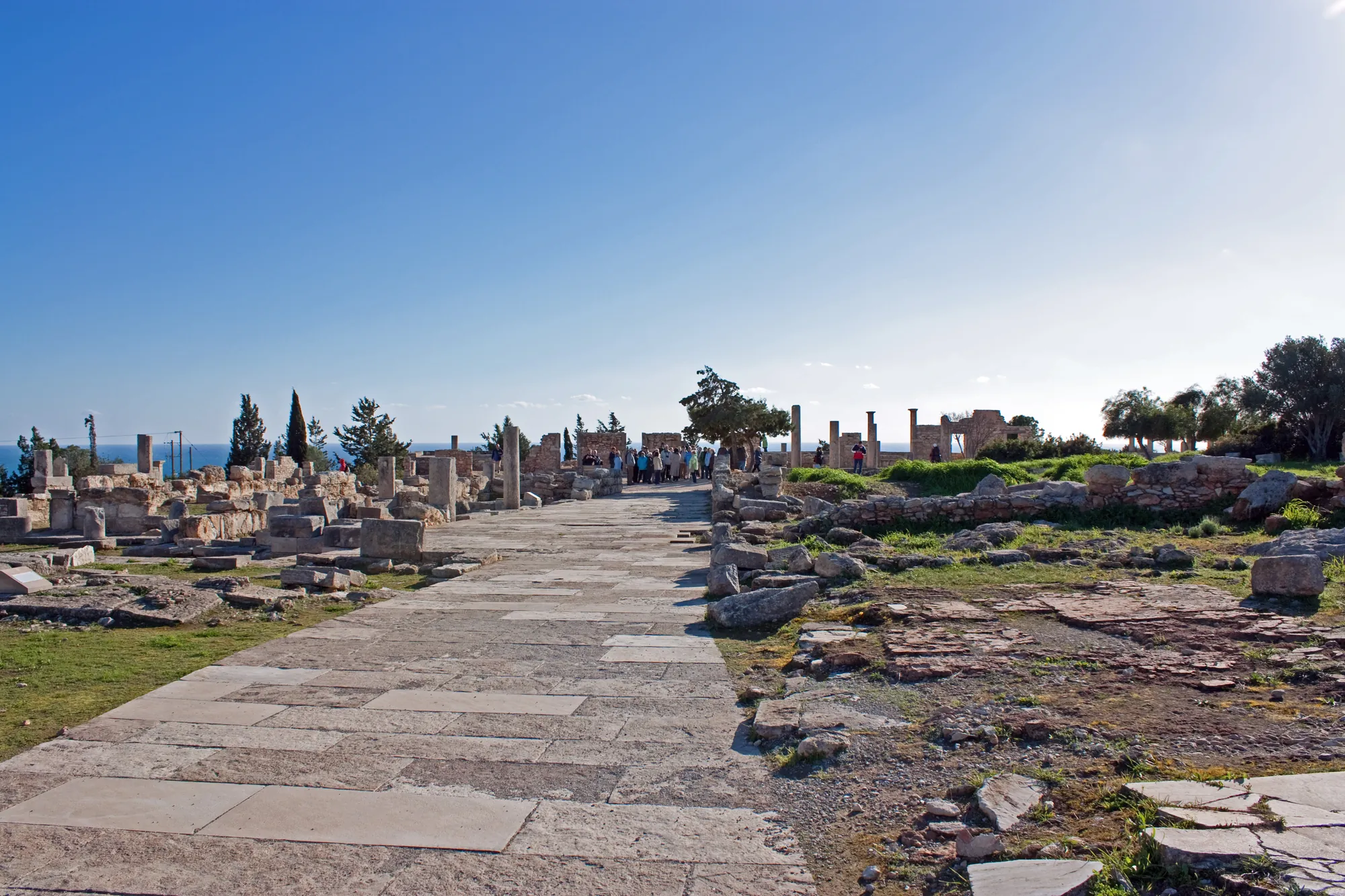
The paved street through the sanctuary towards the temple.Photo: Wknight94, cropped · CC BY-SA 3.0 · Wikimedia Commons
The heart of the early cult was the Archaic Precinct, with a large circular altar of rubble where animals, mostly sheep and goats, were burnt as offerings. Diana Buitron-Oliverpublished its excavation in 1996 [25]. In 1979 the excavators found to the west a roughly circular walled enclosure, the Round Building, whose floor of bedrock is cut with pits for planting trees. They connected it with a cult of sacred trees and possibly with ritual dances round them [31]. Two ancient writers add details that may belong here. Strabo (14.6.3) says that anyone who touched the altar of Apollo at Kourion was thrown from a cliff into the sea, and Aelian tells of deer that took refuge in the god's grove. Whether Strabo's altar is the excavated one is not certain.
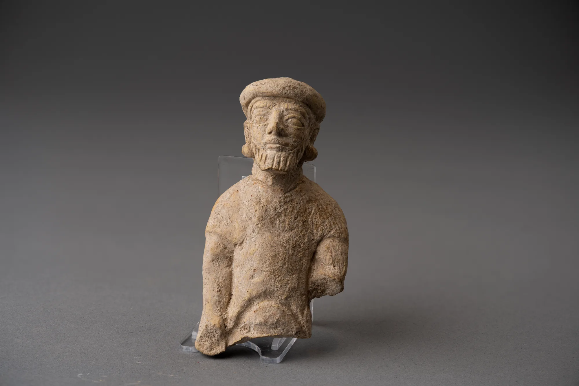
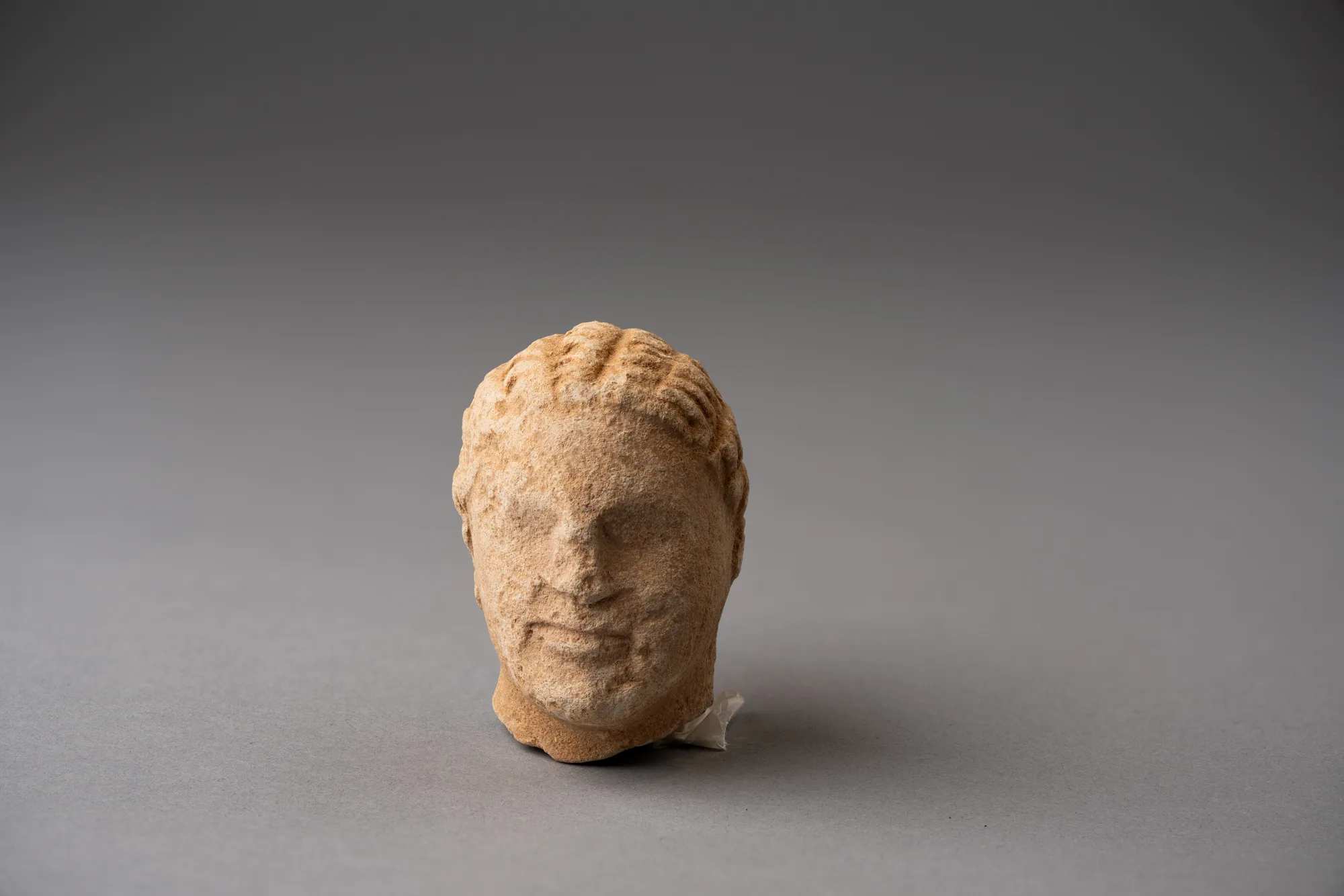
From the 6th century BC the sanctuary was enlarged with a main street, a first temple, the west enclosure and the Round Building, while the Archaic Precinct kept its original form until the sanctuary went out of use in the 4th century AD [24; 3, p. 9]. Worshippers left thousands of terracottas: bulls, horses and riders, chariot groups, and figures wearing bull masks [21]. In 1936 McFadden found a pit packed with broken figurines, a deposit of discarded offerings that had been cleared out of the sanctuary and buried [18; 21]. The figurines and the limestone temple boys from the site are the main evidence for the cult; on the terracotta types see horse-and-rider figurines and terracotta figurines.
A limestone warrior and a limestone model of a two-horse chariot from the Cesnola collection, which Cesnola recorded as found in the sanctuary of Apollo Hylates. Metropolitan Museum of Art.
In the Roman period the sanctuary was rebuilt rather than redesigned, with baths, a palaestra, lodgings for visitors, a priest's house and a new temple [24; 22]. The date of the temple is disputed. The excavators read a fragment of its dedicatory inscription as naming the proconsul Lucius Annius Bassus, who dedicated a statue of Nero in AD 65 or 66, and concluded that "the second temple could well have been built in 65 or 66 A.D., or at least erected between 50 and 75 A.D." [24, p. 202]. Stefanos Sinos, who restored the temple's south-west corner, found that its front staircase may be later, of the 2nd century [24, p. 202; 32]. Theodore Mavrojannis has argued for a Trajanic date, linked to Trajan's policy in Arabia, and the temple's capitals have been compared with Nabataean ones [33]. The partial re-erection of the temple by Stefanos Sinos is what visitors see [32]. The sanctuary was not rebuilt after the earthquake of the 4th century AD.
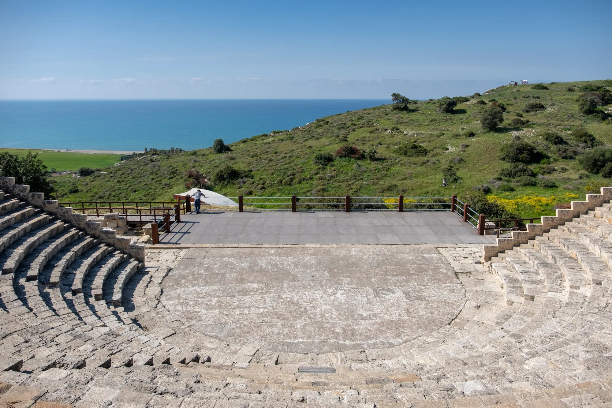
The theatre was built into the slope at the south edge of the bluff, so that the audience looked past the stage to the sea. Stillwell, who published the Pennsylvania excavation of it, distinguished eight periods [4, pp. 77–78]. The first, small Greek theatre dates from the later 2nd century BC, on the evidence of the coins found round it [4, p. 77]. It was remodelled after 15 BC, rebuilt under Nero in AD 64–65, and enlarged under Trajan between AD 102 and 117 [4, pp. 77–78]. An inscription of the Neronian rebuilding names the proconsul Quintus Julius Cordus [7].
The theatre from the upper seats, with the sea behind the stage.Photo: Jules Verne Times Two, cropped · CC BY-SA 4.0 · Wikimedia Commons
In its Trajanic form the auditorium was about 62 m across with seventeen rows of seats, round an orchestra about 17 m in diameter, and held about 3,500 people [34, p. 198]. In the early 3rd century, about AD 214–217 under Caracalla, it was turned into an arena for hunting shows; the lowest rows were removed and a metal grille set round the orchestra to protect the audience [4, p. 78; 34, p. 199; 3, p. 14]. After about AD 250 it became a theatre again, and it was finally abandoned in the 4th century [4, p. 78]. Coins from the shops beside the stage building, the latest of Valentinian I or Valens of about AD 372, show that they were still in use shortly before the end [4, pp. 62–63].
The Department of Antiquities, with the architect John Travlos, began restoring the seating in 1961 [3, p. 18], and the theatre is used again for performances in summer, including ancient Greek drama.
The richest finds of the Roman and Late Roman city are its mosaic floors.
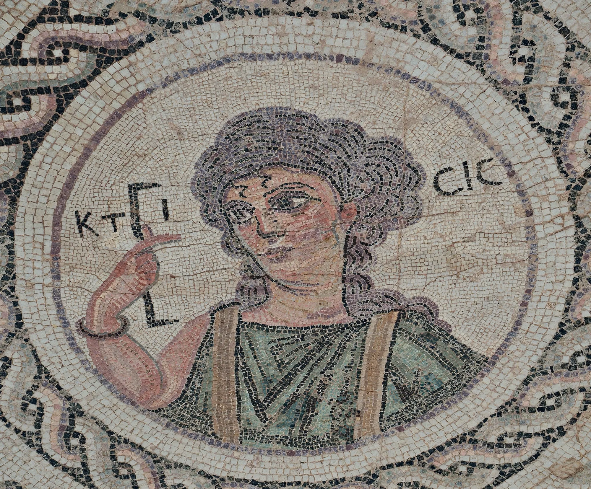
The House of Eustolios, east of the theatre, is a large complex of some thirty rooms with a bath suite, excavated by the Pennsylvania expedition. Its mosaic inscriptions are the most quoted texts from Kourion [7; 35]. One welcomes the visitor. Another says the house is girded with "the much-venerated signs of Christ", so its owners were Christian. A third, a short poem, records that Eustolios gave the baths to the Kourians and that he was taking care of the city as Phoebus (Apollo) once had. A medallion labelled Ktisis shows a woman holding a measuring rod, the personification of foundation or building [7]. Mitford restored the poem to say that Christ had replaced Apollo, and older guidebooks repeat this. R. S. Bagnall and T. Drew-Bear rejected that restoration: the poem itself contains nothing Christian and mentions Apollo without hostility [36]. The complex probably dates from after the earthquake, in the late 4th or early 5th century AD; whether it began as a private house and later became a public building is not proven.
Ktisis, with her name in Greek, in the bath of the House of Eustolios.Photo: Carole Raddato, cropped · CC BY-SA 2.0 · Wikimedia Commons
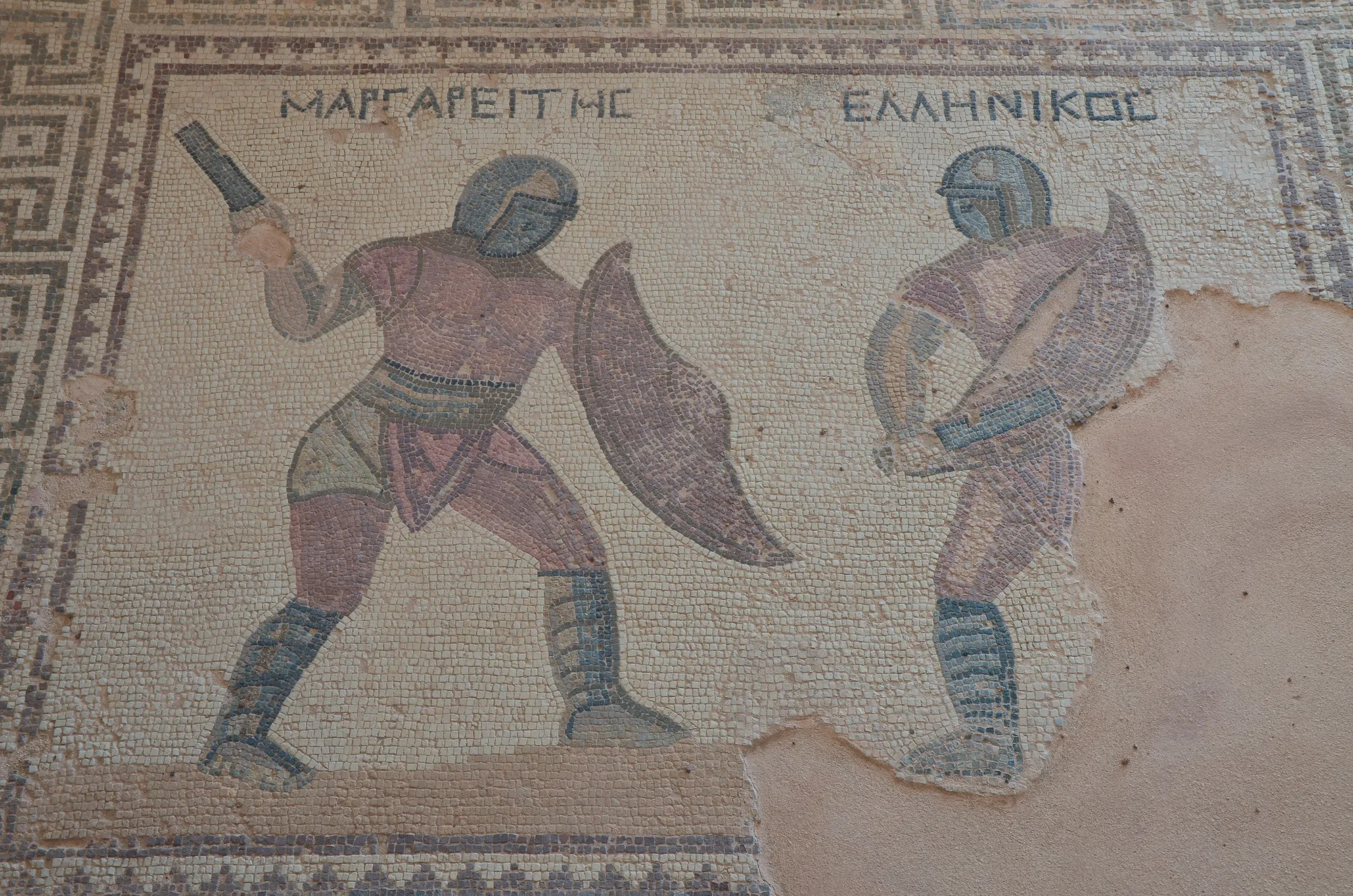
The House of the Gladiators, at the north-west edge of the excavated area, is a peristyle house of about 1,110 m² [3, pp. 42–43], excavated by Loulloupis from 1967 [23]. It takes its name from mosaics of gladiators labelled in Greek: Hellenikos and Margareites in one panel, and in another a fight in which an unarmed man named Dareios steps between the fighters [23]. The house was built in the later 3rd century AD and destroyed in the earthquake [3, p. 14].
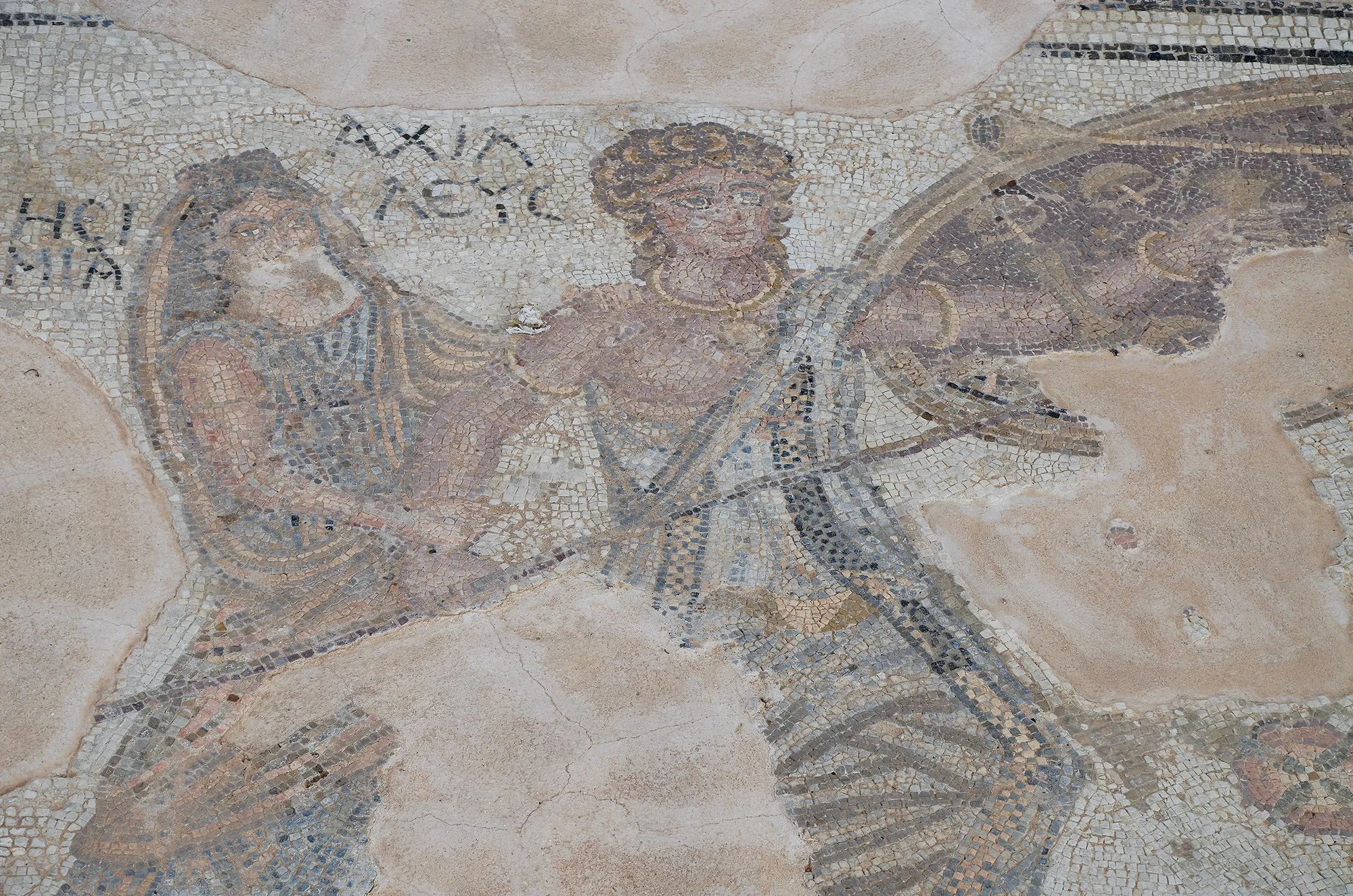
The House of Achilles, the first building visitors reach from the Paphos road, takes its name from a mosaic of Achilles on Skyros: hidden among the daughters of King Lykomedes in women's dress, he is unmasked by Odysseus. A second, damaged mosaic shows Ganymede carried off by the eagle of Zeus [7]. The building has not been fully excavated, and its date, probably in the 2nd century AD, and purpose are uncertain. Its place at one of the main entrances to the city has led some scholars to see it as a public reception hall for officials and guests rather than a house [3, p. 14].
Margareites and Hellenikos, House of the Gladiators.Photo: Carole Raddato, cropped · CC BY-SA 2.0 · Wikimedia Commons
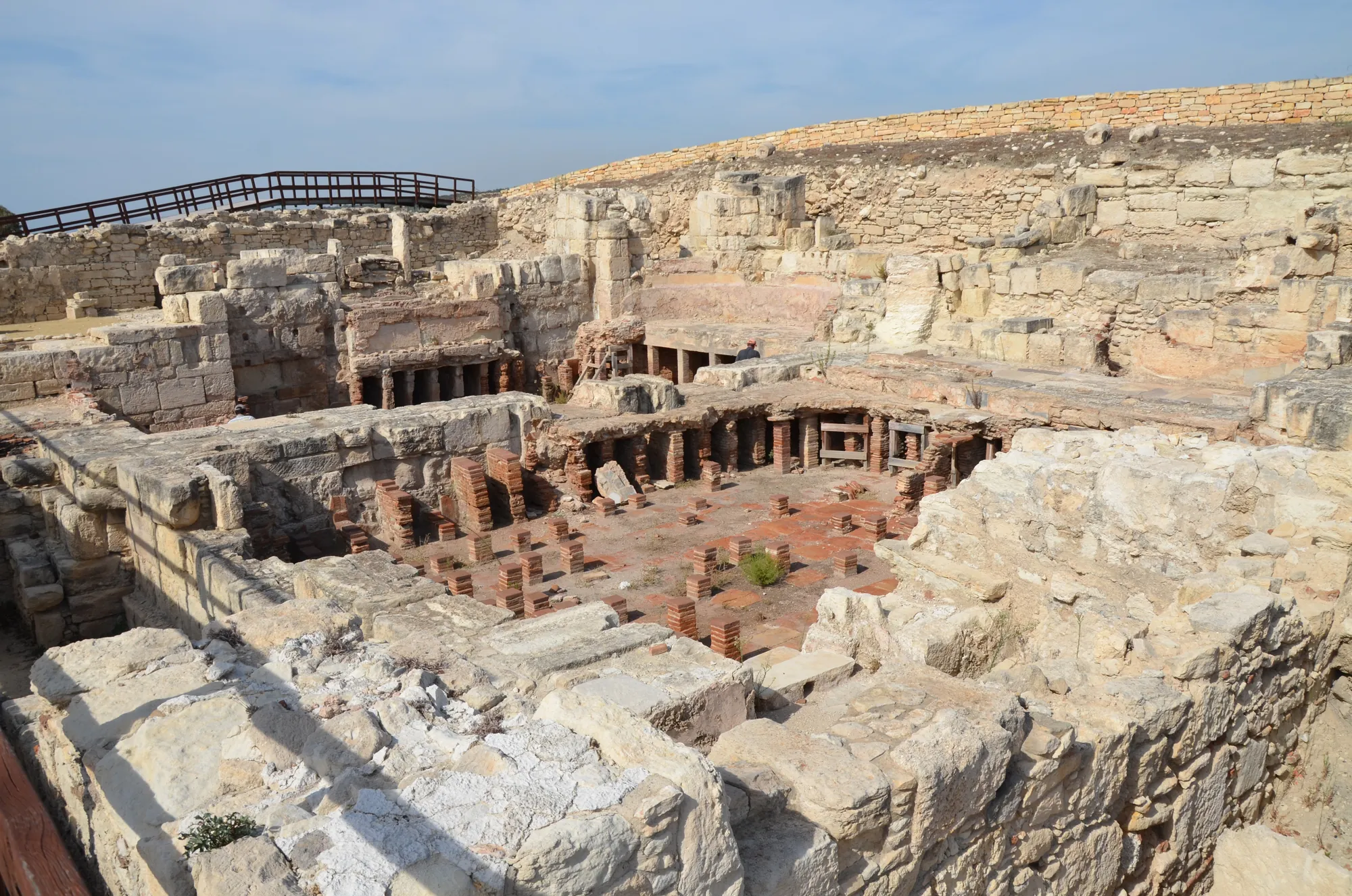
In the centre of the bluff, Christou excavated the forum, a colonnaded public building beside it, a monumental fountain house (nymphaeum) and the public baths [3, p. 19]; the fountain house and baths were renovated under Trajan [3, p. 13]. Whether the colonnade belonged to a gymnasium or to the forum is still discussed. The water for fountain and baths came along the two Roman conduits: the western one, about 11 km long, from near Sotira, built in the 1st century AD, and the eastern, from a spring near Souni, in the 2nd century [6; 3, p. 14].
The warm and hot rooms of the public baths, with the pillars that carried the heated floor.Photo: Carole Raddato, cropped · CC BY-SA 2.0 · Wikimedia Commons
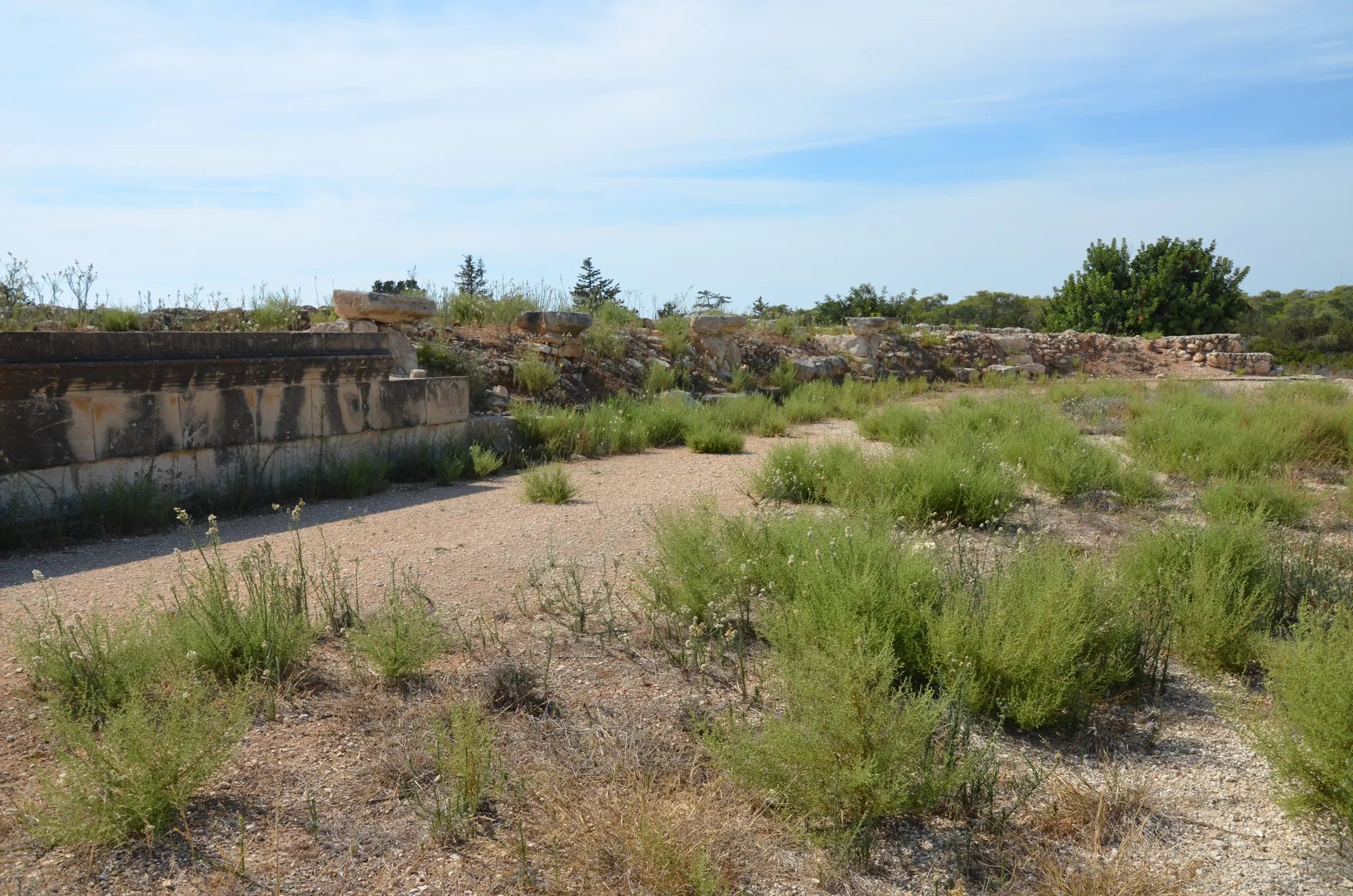
The stadium lies west of the city, beside the road towards the sanctuary. It was built in the Antonine period, in the mid-2nd century AD, as a long U-shaped track with seven rows of seats for about 6,000 spectators [34, pp. 205–206; 3, p. 14]. The Pennsylvania expedition began clearing it, and the Department of Antiquities finished the work in 1966 and rebuilt one section of seating [3, p. 18; 34, p. 206].
The stadium west of the city, with its rebuilt seating.Photo: Carole Raddato, cropped · CC BY-SA 2.0 · Wikimedia Commons
On 5 June 1934 J. F. Daniel, cutting a trench along the south-eastern edge of the city, found a skeleton on an earth floor beside a pot, a bronze pitcher and a lamp. "This was not a burial," he wrote. "The person seems to have been standing when the house fell, and crushed where he stood" [3, p. 20]. McFadden reported two skeletons and called them a Romeo and Juliet; the trench was then backfilled [20, p. 56].
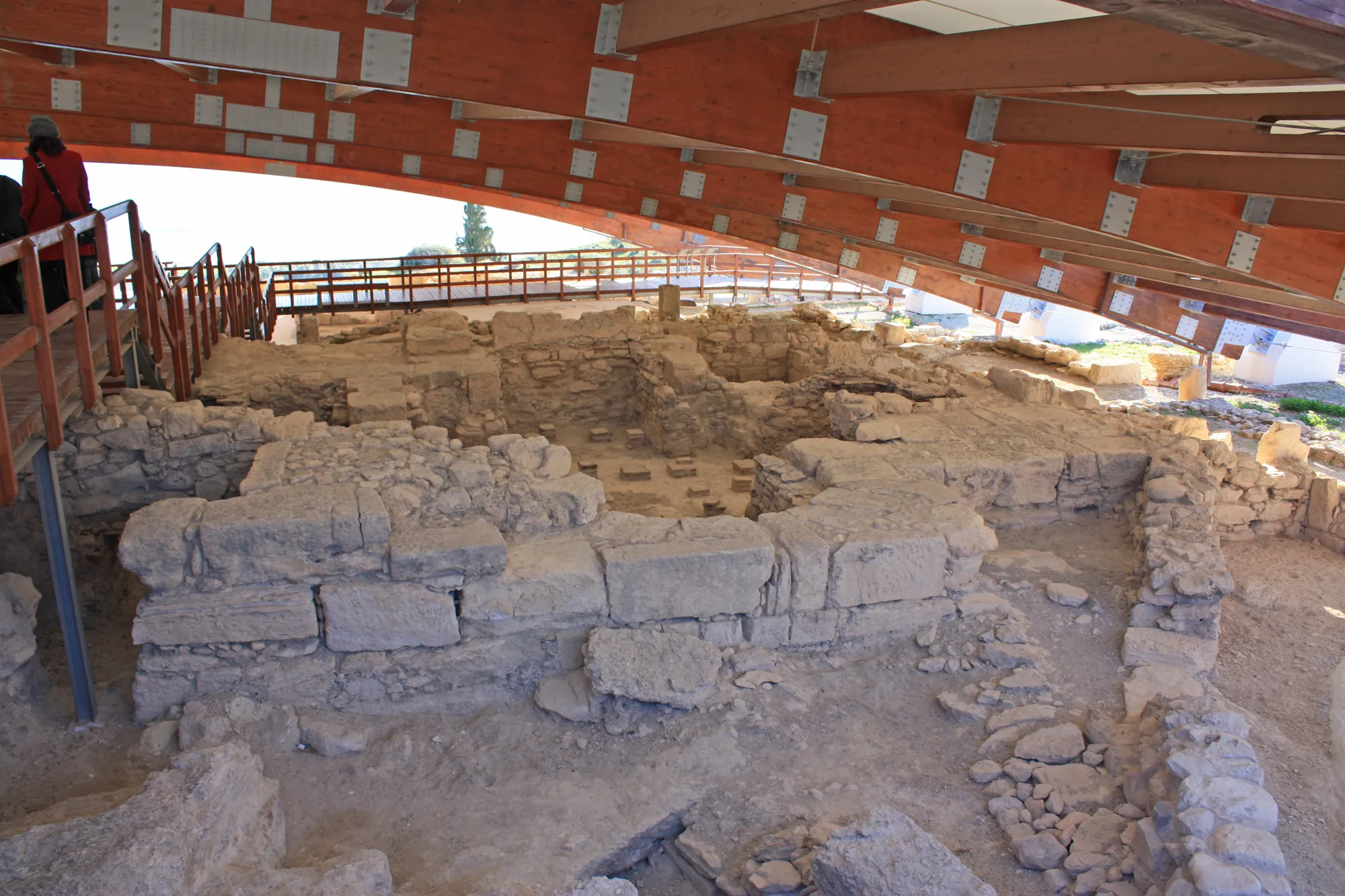
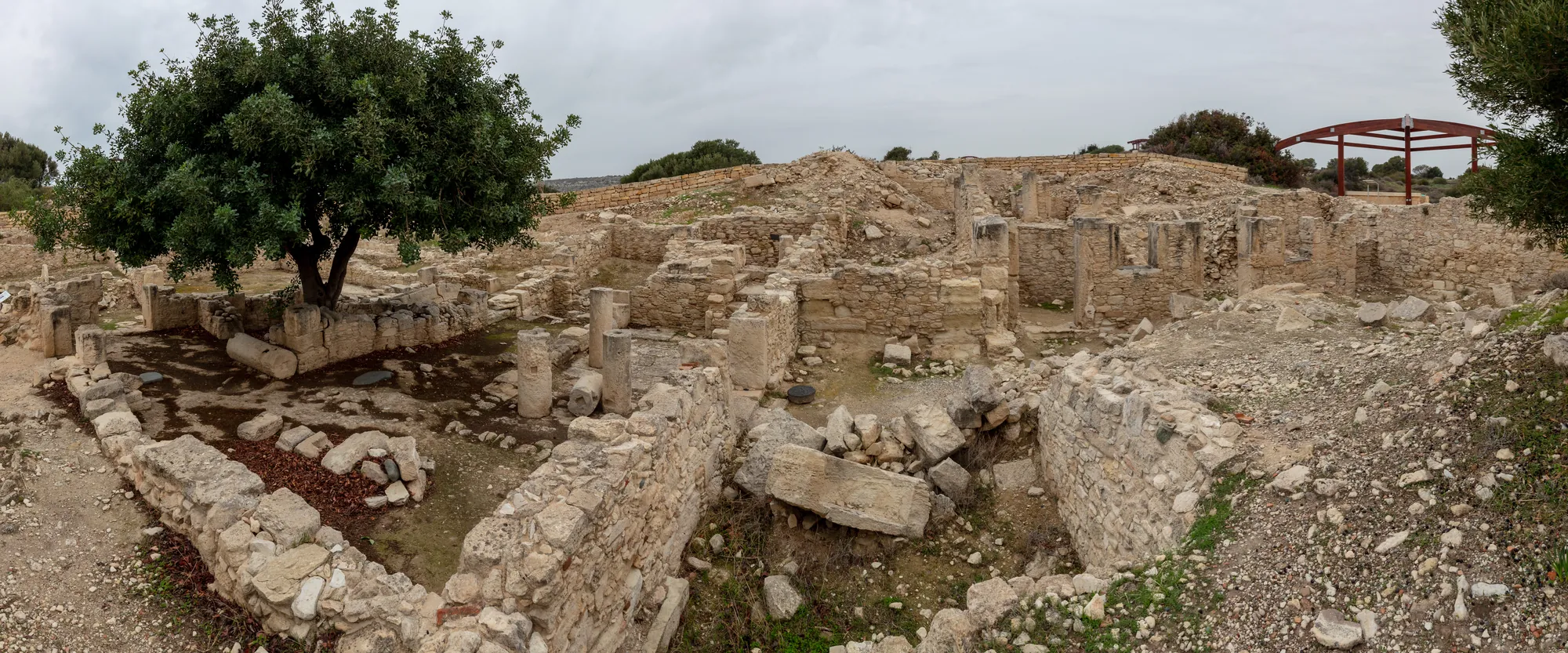
In 1984 Soren reopened it, and by 1987 the Arizona team had uncovered two buildings either side of a narrow lane: the Earthquake House, dug completely, and part of a building to its north [3, p. 21; 26]. The house had stone footings and mudbrick walls round a paved court with a small Doric portico. At its largest it covered about 397 m², a third of the size of the House of the Gladiators, with earth floors and no mosaics. By the time it fell it was divided between households, and a former room had become a stable [3, pp. 42–43]. Costello, who published the house from the excavation records, counts seven people killed in it: two adults by a door, a child of about thirteen lying on a mule still chained to its stone trough, a man in the yard, and three people together in a back room [3, pp. 97, 106]. Among the finds was a bronze ring with the Christian chi-rho monogram [34]. The group of three is shown in the museum at Episkopi.
The Earthquake House on the south-eastern edge of the city.Photo: Diego Delso, cropped · CC BY-SA 4.0 · Wikimedia Commons
The year of the disaster is disputed. Soren dated it by coins: the 1984 season produced 365 bronze coins, none later than the early reign of Valens, with none of Gratian or of the usurper Procopius [20, pp. 55–56]. The numismatist Eugene Lane concluded that "a date in mid-365 seems dictated by the numismatic evidence alone" [34, p. 112], and Soren identified the destruction with the great earthquake of 21 July 365 described by Ammianus Marcellinus [20, pp. 54–55]. That identification became the popular story of Kourion.
Costello has questioned it [3, p. 15]. A coin gives only the earliest possible date of the layer it lies in, and coins of distant mints could take years to reach Cyprus. The epicentre of the earthquake of 365 lay off western Crete, about 860 km from Kourion, too far to wreck a city on a bluff with no harbour. Later scholars have placed the Cypriot destruction around 370 or 375. Costello concludes that it happened "sometime during the later 4th century AD, possibly ca. AD 370–380" [3, p. 15], and Davis also prefers a date around 370 [37; 29]. The coins show that the house fell after about 364; the exact year is not known. The wider series of earthquakes on the island is described under earthquakes in ancient Cyprus.
Plan · later 4th century AD
The Earthquake House at Kourion
Kourion
The last day: the earthquake, later 4th century AD
05 m
Scale bar: 5 metres.
Choose a number on the plan, or a name below, to read what was found there and how well it is known.
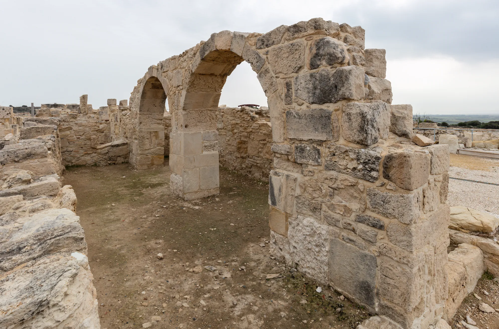
After some decades of abandonment the bluff was rebuilt as a Christian town [3]. Its largest building is the episcopal basilica, built in the first third of the 5th century AD over the ruins of a Roman civic building. It is usually attributed to Bishop Zeno, who represented Cyprus at the Council of Ephesus in 431, where the independence of the Cypriot Church was upheld [2]. The church had a nave and two aisles divided by two rows of columns, an apse, a colonnaded atrium, a baptistery and the bishop's residence beside it; much of it was built of reused stone, including blocks from the ruined Sanctuary of Apollo [2].
Arches in the episcopal precinct of the 5th-century church.Photo: Diego Delso, cropped · CC BY-SA 4.0 · Wikimedia Commons
The Christian town suffered in the Arab raids on Cyprus from AD 647/649. The acropolis was largely abandoned in the later 7th century; a gold coin of Constantine IV of about 670 is among the latest finds, and Megaw argued that the failure of the water supply settled the matter [2]. The bishop's seat moved to Episkopi below. Recent work on the bluff has reassessed how and when the town ended [38; 29]. See Late Antique Cyprus for the period.
The cemeteries lie on the plain and the slopes below the bluff: Kaloriziki, the oldest [10]; Ayios Ermoyenis, where McFadden excavated a tomb [19] and Christou found the built tomb described above; and the Amathous Gate cemetery outside the eastern gate of the Roman city, excavated from 1995 to 2000 [28].
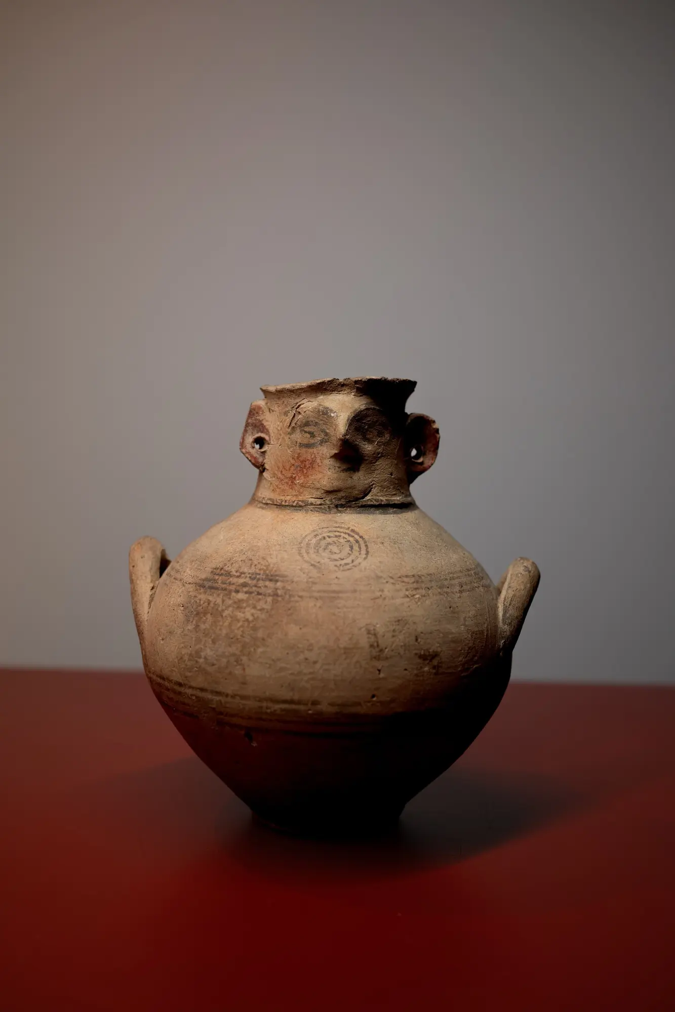
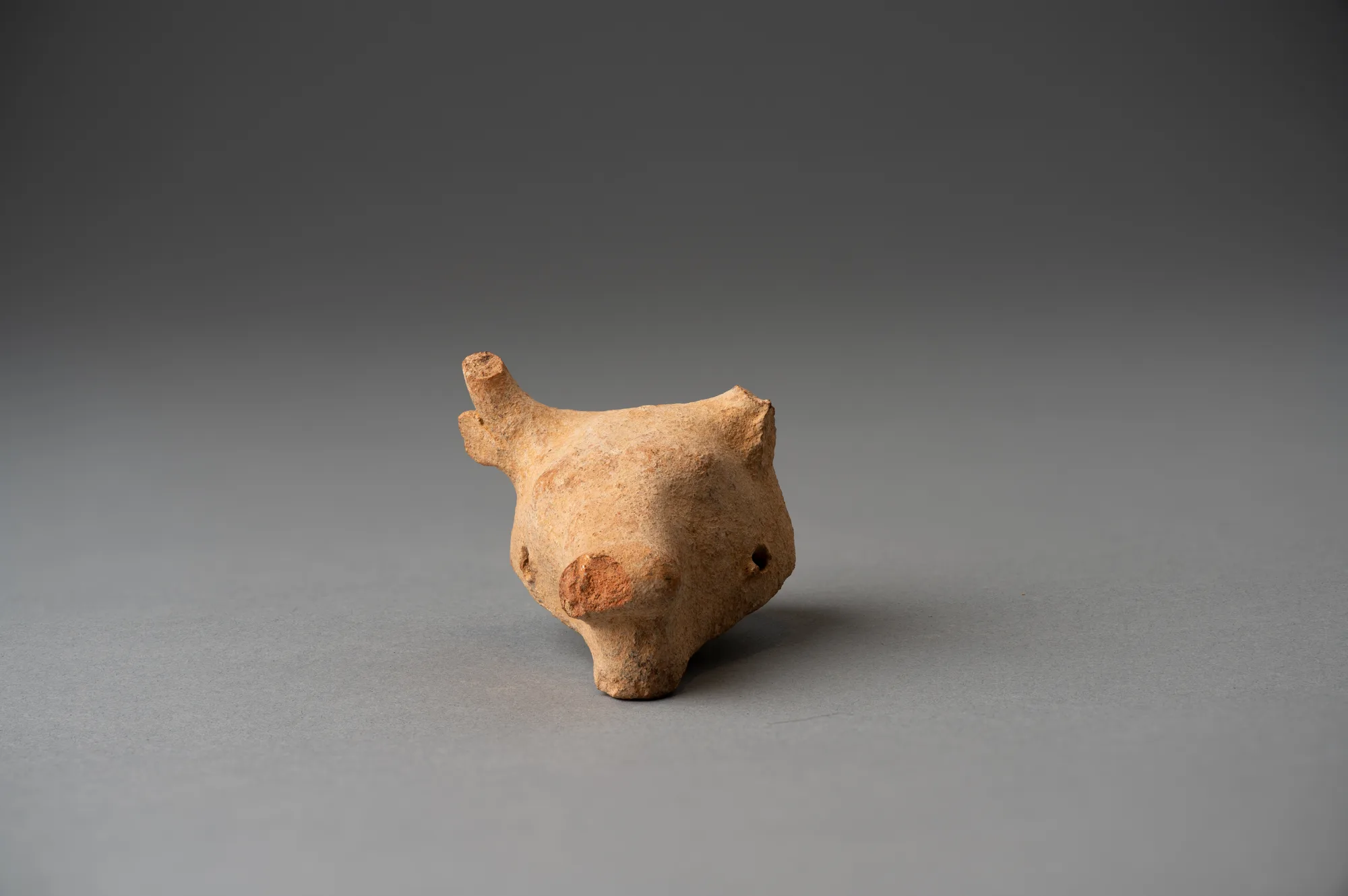
Most objects from Kourion in museum collections come from these tombs. The British Museum's excavation of 1895 is the best documented early group: pottery, terracottas and jewellery from Cypro-Geometric to Cypro-Classical graves [15; 16]. They include Black-on-Red vessels, a free-field jug with birds and trees, horse-and-rider figurines, gold and silver jewellery, and a silver cup inscribed in the Cypriot syllabary with the name of a priest, Onasas. They are listed below as finds from the site.
From the British Museum's excavation of the Kourion tombs in 1895: a silver cup inscribed for the priest Onasas, a gold armlet with rams' heads, and a free-field jug.
The ancient city lies on the bluff above the old coast road from Limassol to Paphos, near the village of Episkopi. It is in the area of the British Sovereign Base of Akrotiri but is managed by the Department of Antiquities of the Republic of Cyprus [39]. Paths and boardwalks link the excavated buildings and cross the mosaics; the ground is rocky and has little shade. The Sanctuary of Apollo Hylates and the stadium lie to the west along the road towards Paphos, and the sanctuary is a separate site [39].
Finds from Kourion are shown in the local museum in Episkopi village, in the former house of the Pennsylvania expedition [39]; the Episkopi Museum page has more on it. The sceptre from Kaloriziki is in the Cyprus Museum in Nicosia. Opening times and tickets change; check the current details with the Department of Antiquities or Visit Cyprus before going.
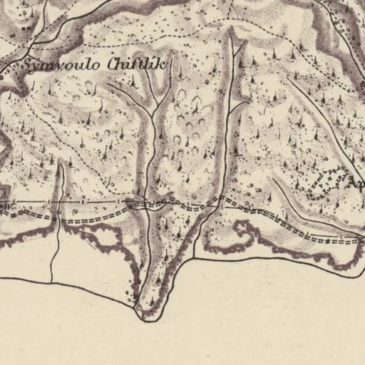
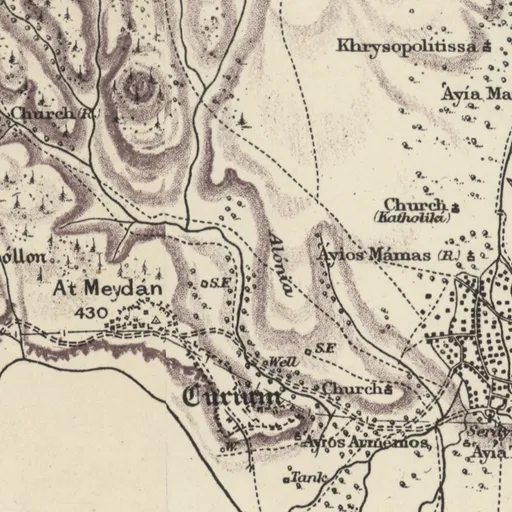
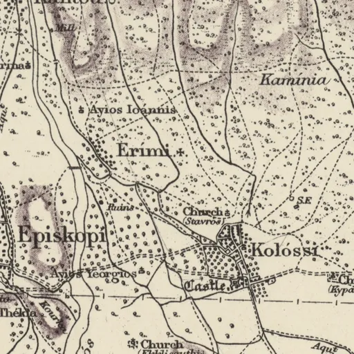
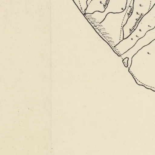
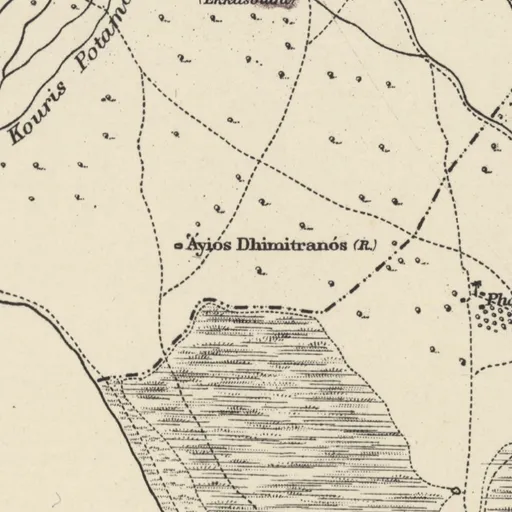
Sheet 14. H. H. Kitchener, Trigonometrical Survey of Cyprus, 1 inch to 1 mile, 1882 (scans: National Library of Scotland, CC BY)Open on Kitchener's map
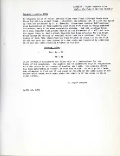
163 photographs (104 other, 51 in the field, 8 of objects), 87 object cards, 85 manuscripts, 35 letters, 34 documents, 4 drawings and 2 plans. A selection is shown here.
Reported by Ross (1852): Ancient city on a rocky height west of the chapel; tomb cut in soft rock with steps was washed open by rain, pottery sherds and glass…
L. Ross, Reisen nach Kos, Halikarnassos, Rhodos und der Insel Cypern (1852)
Vassos Karageorghis, «Chronique des fouilles et découvertes archéologiques à Chypre en 1971», 1972, p. 1083; BCH 96 (1972), Chronique, p. 1083; BCH 98 (1974), Chronique, p. 894
Νέα Μονογραφία διά την Προϊστορικήν Κύπρον (1962-08-17)
1962
The University of Pennsylvania Museum published Dr Porphyrios Dikaios's monograph 'Sotira' on the Neolithic settlement of Sotira, with copies to be sold at…
Press and Information Office, Republic of Cyprus, press release of 1962-08-17
New excavations at the stadium of Curium (1963-12-11)
1963
The Department of Antiquities completed its first season at the Stadium of Curium, directed by J. S. Last, cleaning the outer facade from the south gate to…
Press and Information Office, Republic of Cyprus, press release of 1963-12-11
Νέαι ανασκαφαί εις το Στάδιον του Κουρίου (1963-12-11)
1963
The Department of Antiquities completed the first excavation season at the Stadium of Kourion; J.S. Last supervised on site with Department members, and the…
Press and Information Office, Republic of Cyprus, press release of 1963-12-11
Έλλην αρχαιολόγος εν Κύπρω θα γνωμοδοτήση επί της αναστηλώσεως αρχαίων θεάτρων (1964-05-08)
1964
Archaeologist-architect John Travlos arrived in Cyprus from Athens at the Antiquities Department's request to advise on restoring the theatres of Salamis…
Press and Information Office, Republic of Cyprus, press release of 1964-05-08
Ετήσια έκθεσις του Διευθυντού του Τμήματος Αρχαιοτήτων διά το έτος 1963 (1964-11-05)
1964
Excavations were carried out in 1963 by the French mission at Enkomi and by the Department of Antiquities at Kition, Salamis, Paphos, Kourion, Aigialousa and…
Press and Information Office, Republic of Cyprus, press release of 1964-11-05
Η αρχαιολογική δραστηριότης εν Κύπρω (1965-12-02)
1965
The Department of Antiquities excavated at Salamis, Kition, Kato Paphos, Aigialousa, Amathounta and Kourion, producing significant finds for the museums.
Press and Information Office, Republic of Cyprus, press release of 1965-12-02
38.Pamela Armstrong, Guy Sanders (2023). Kourion in the Long Late Antiquity: a reassessment. In Cyprus in the Long Late Antiquity: History and Archaeology Between the Sixth and Eighth Centuries, 121–135. Oxford: Oxbow Books.

 Tin-bronze scepter headLate Bronze Age II · 1450–1050 BCMetropolitan Museum of Art
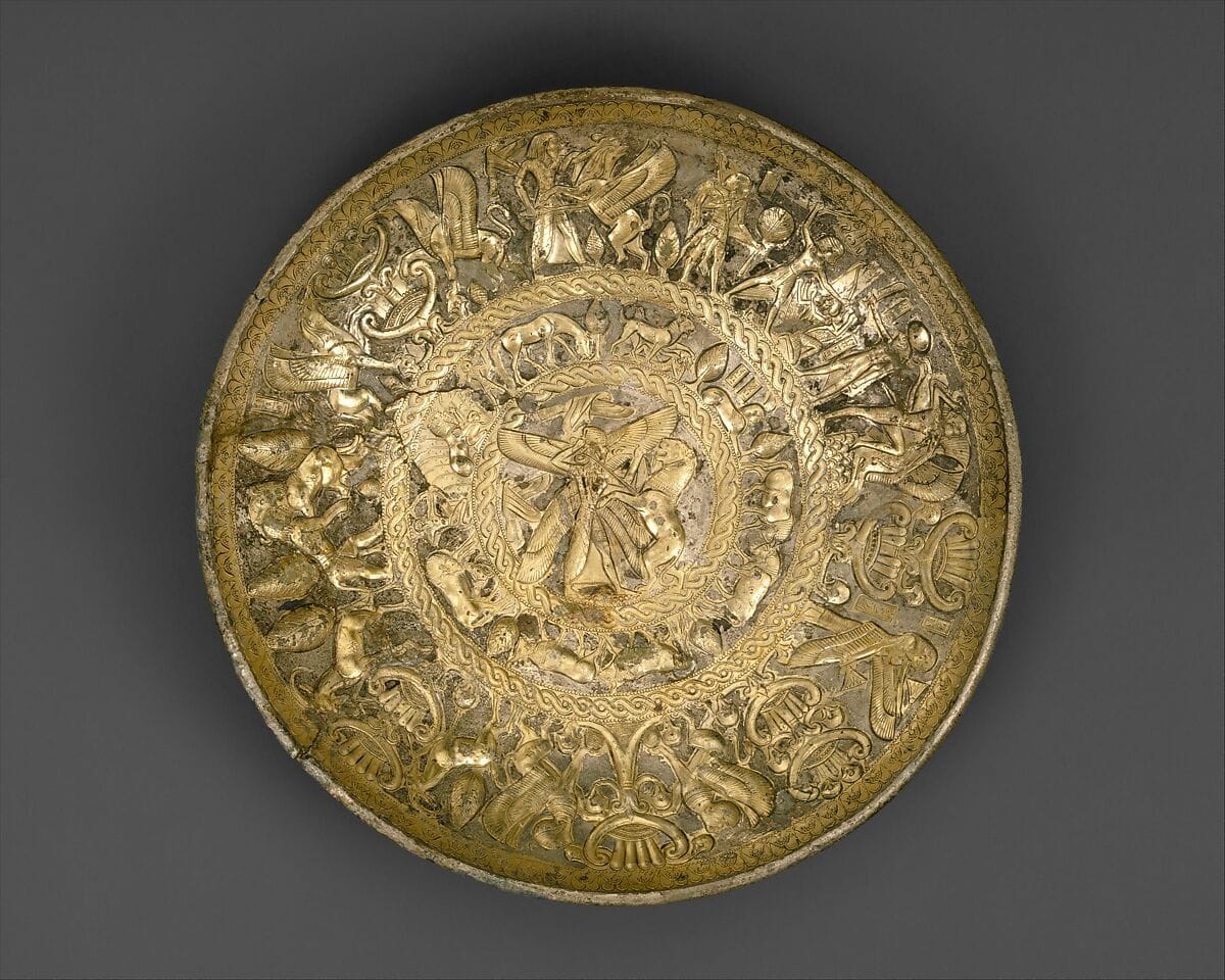 Silver-gilt bowlArchaic I · 725–675 BCMetropolitan Museum of Art
 Limestone statue of a bearded warriorHellenistic · 330–250 BCMetropolitan Museum of Art
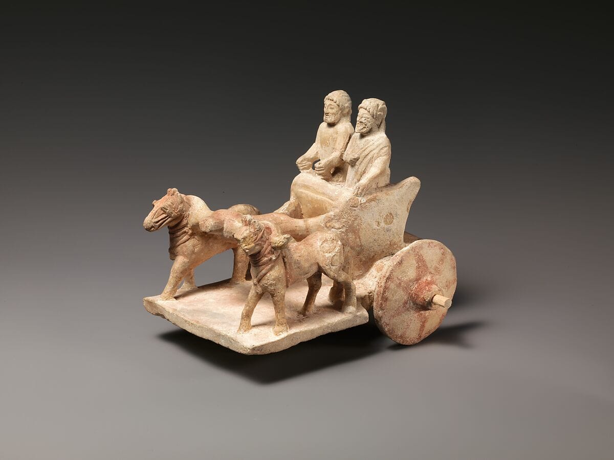 Limestone model of chariot drawn by two horsesArchaic II · 500–450 BCMetropolitan Museum of Art
 Silver Mastos Cup with Onasas InscriptionClassical · 400–300 BCBritish Museum
 Gold Armlet with Ram HeadsClassical · 450–400 BCBritish Museum
 White Painted Figural OinochoeArchaic I · 750–600 BCBritish Museum
 Black-On-Red Ox AskosArchaic I · 750–600 BCBritish Museum
 Terracotta Horse Rider FigurineArchaic I · 750–600 BCBritish Museum
 Gilded Silver Bust PlaqueArchaic I · 750–500 BCBritish Museum
 Bronze Lotus Lamp StandArchaic II · 700–480 BCBritish Museum
 Bronze Lotus Lamp StandArchaic II · 600–500 BCBritish Museum
 Carnelian and Gold Bead NecklaceArchaic II · 600–400 BCBritish Museum
 Spiral Silver Pennanular BraceletArchaic II · 550–400 BCBritish Museum
 Cypriot Centaur FigureArchaic II · 550–500 BCBritish Museum