
Ancient Cypriot Architecture·Lesson 2
The First Villages: Round Houses of the Neolithic
Klimonas's sunken hall, Khirokitia's round rooms grouped round a court, Sotira's rounded corners: how the first villagers of Cyprus built in stone, earth and reed, how they roofed their houses, and why the famous domes come from one leaning wall.
Alexis Drakopoulos·Period by period·14 min read
Share


Lesson 2·Course contents, 14 lessons
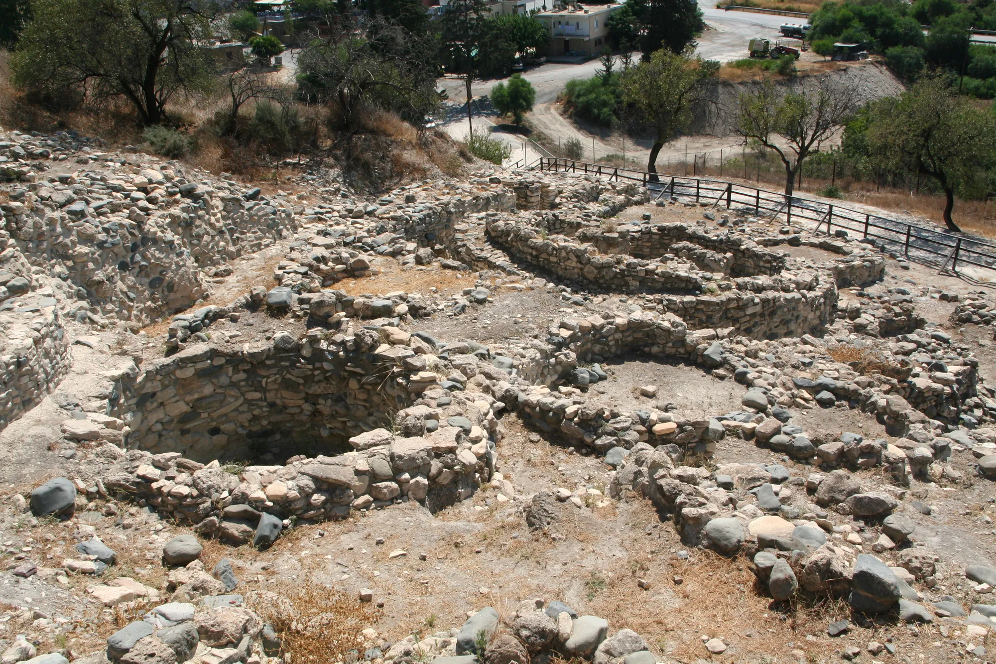
Early in its life, a small round house on the west side of the hill at Khirokitia caught fire, and its roof came down in a single piece. When Alain Le Brun's team cleared the room, numbered S.85, in 1983, they found its floor covered in lumps of earth baked hard by the heat, 5 to 8 cm thick. One face of each lump was flat and smooth. The other carried the negative prints of branches and reeds laid side by side, and in nearly every piece that face lay downwards, as it had hung over the room. No post-holes cut the floor. Le Brun reconstructed a flat roof of branches and reeds under coats of earth, carried on wooden crosspieces that rested on top of the wall, the kind of roof, he noted, that Cypriot village houses still had [2].
The room was 1.85 m across [2]. A good part of what can be said about how the first villages of Cyprus were roofed rests on that small burnt deck. The picture most visitors carry of them, clusters of little domed huts like beehives, rests on something slighter: one wall that had leaned downhill.
One round building, one room
Khirokitia stands on a steep hill in a bend of the Maroni river, between Larnaca and Limassol. It gave its name to the Khirokitian, the Late Aceramic Neolithic (aceramic: before pottery), about 7000 to 5200 BC. Porphyrios Dikaios dug there from 1936 to 1946 and called the buildings tholoi, the word for the beehive tombs of Mycenaean Greece. Le Brun, who led a French mission there from 1977, prefers the neutral "unit".
A unit is a circle of wall 2.3 to 9.2 m across on the outside and only 1.4 to 4.8 m across inside [1, p. 19]. The walls ate the floor. One unit, XV(II), had a wall 1.20 to 1.30 m thick round a room about 2 m wide [1, p. 47]. The builders used pale limestone picked up from the surface, dark diabase cobbles carried up from the river bed, and earth mixed with straw. The earth went into walls either as mudbrick, shaped and dried in the sun, or as pisé, the excavators' term for earth laid by the handful and built up in lifts. The commonest wall was a double ring, an outer ring of stone and an inner ring of earth, set straight onto levelled ground with no foundation trench. A whitish earth plaster covered both faces and ran on across the floor, and sometimes a row of flat stones set on edge round the foot of the wall kept the rain from eating into it [1, p. 19]. The bricks Dikaios measured, in Tholos XXV, are 25 to 30 cm long and 6.5 to 7.5 cm thick, laid so that each joint sits over the middle of the brick below [3].
Cut through the wall of one of the larger rooms and the build reads from the outside in: whitish plaster, a low ring of stone with earth laid by hand above it, an inner ring of mudbrick, and plaster again. Open each layer to see how it is known: the plaster and the bricks are measured on the remains, the heights of stone and earth are worked out.
Layer by layer
Khirokitia household
Aceramic Neolithic, about 7000 to 5200 BC. Through the wall of S.97 on the court side, along one roof bearer.
Outer stone ring · 26 cm thick to 1.00 m in S.97 and Unit N; 18 cm to 0.90 m elsewhere; S.99 a 40 cm socle
Walls
- Material
- Limestone slabs and grey diabase cobbles bedded in mud
- Size
- 26 cm thick to 1.00 m in S.97 and Unit N; 18 cm to 0.90 m elsewhere; S.99 a 40 cm socle
- Known
- Strong inferenceindirect but good evidence
Walls are often two concentric rings, the outer of stone and the inner of pisé or mudbrick, built straight onto levelled ground with no foundation trench (Le Brun 1997, p. 21). The heights here are ours.
Fittings
- Excavated
- Strong inference
The wall of S.97, a room of a household by the village entrance, from the court side: a stone outer ring and a mudbrick inner ring, plastered on both faces. The roof above is drawn pale. A schematic section, drawn from the reconstruction's own dimensions. Each band is as thick as the reconstruction makes it (the bar is one metre); the wall is shortened at the break line, and levels are in metres in the reconstruction's own frame. The line round each band shows how well that layer is known. The unlabelled fill round the timber ends is mud packing, a reconstruction. Pale bands are drawn for context only. After Le Brun 1997, BCH 1984 and Dikaios 1953.
Doors were narrow, usually about 0.5 m wide, often with a paved threshold, and many sat above the floor, so that one stepped up to them and down again inside [1, p. 19]. The one doorway that survives to its full height, in Tholos V, is 1.63 m tall [3]. Windows were rare; one unit had three, about 0.45 m wide [1, p. 19]. Cooking happened indoors on a small rectangular platform topped with a stone slab, built to hold charcoal carried in from fires lit outside, which kept smoke in the room to a minimum [1, p. 22].
Some of the larger units hold pairs of stone piers, rectangular pillars standing free of the wall; in Tholos IA two notched piers stand 1.30 m apart. They look like roof props, and Le Brun argues they were not. Unit VII received its pair only on the latest of its three floors, so it had stood, roofed, without them, and Unit XVII, 5 m across inside and among the widest rooms on the site, has none [1, pp. 48, 53]. He reads the piers as supports for a raised platform or loft [1, p. 21], and Dikaios had already compared such a loft to the sende, the timber loft of traditional Cypriot village houses [3]. No platform has survived anywhere, so the loft remains a reading of the piers.
A household of round rooms
Since a unit was a single room, a household needed several. Le Brun describes the house as "a compound of several of these circular units around an unroofed space, a sort of small inner 'courtyard'", with a fixed quern, the bedded lower stone for grinding grain, set in pebble paving at its centre [1, p. 22]. Grain was ground outdoors, food cooked indoors, and a group Dikaios dug shows the division plainly. Unit XXVII was a living room divided by two partition walls, XXVIII a kitchen with a central hearth, and XXIX a semicircular bay open to the court and given over to grinding, with a quern raised on a platform half a metre high and a stone tray at its foot to catch the flour [1, pp. 50-51].
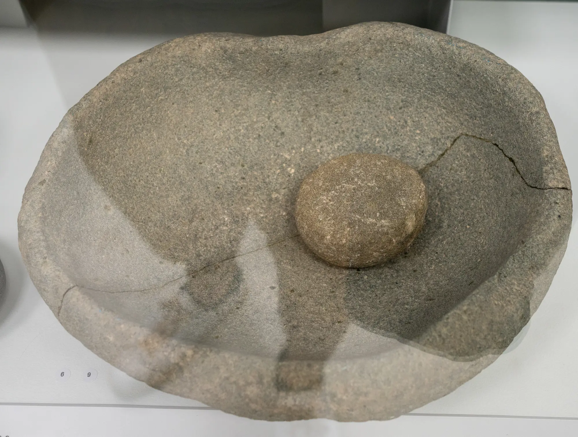
Between the houses ran narrow passages, used for getting about and for dumping rubbish [1, p. 24]. Units were rebuilt on their own stumps for centuries, so the plan exposed on the hill today is, in Le Brun's comparison, like a doubly exposed photograph [1, p. 45].
The dead stayed in the house. They were buried in small pits under the floors, the floor was replastered over them, and the household went on living above [3]. Tholos XLVII, occupied through eight successive levels, held 29 burials, 24 of them newborn babies [1, pp. 54-55].
Open the model in the courtyard of a household that stood by the village entrance. Five round houses close round a court only a few paces across, plastered except where the quern sits in its paving, and their doors open onto it; narrow passages lead off between the walls.
Opens on the guided tour, stop 5 of 9: the courtyard.
A Khirokitia Household
Open the full reconstructionc. 7000 to 5200 BC · Khirokitia
A household of one building level by the entrance, after Le Brun's plan. The excavators counted five rooms round the court; the plan shows four, so the fifth is placed by the reconstruction.
The dome that was a leaning wall
In his final report of 1953 Dikaios wrote that in the first period "the tholoi were mostly of small size with a dome of mud-brick or pisé on a low masonry substructure" [3]. His proof was Tholos XLVII, whose wall curves inwards. He read the curve as the springing of a vault and restored a dome some 3.70 m high over a room about 3 m across [1, p. 54]. Later guidebooks went further and put cones of thatch on central wooden poles. Drawn over the same room at one scale, the candidates ask very different things of the wall beneath them.
Key to the line styles and hatching
Line: how well it is known
- ExcavatedMeasured on excavated remains
- Strong inferenceIndirect but good evidence
- ReconstructionWorked out from experiment, engineering or parallels
- SpeculativeNo direct evidence
- RejectedRuled out by the evidence; shown for comparison
Hatching: material
- Stone, seen in elevation
- Stone, cut
- Stone rubble in mud
- Mudbrick
- Pisé and mud
- Earth plaster
- Roof earth
- Terrace fill and floor make-up
- Natural ground and rock
- Branches
- Reeds (and rejected thatch)
- Timber, along the grain
- Timber, cut across
Favoured
Favoured. The burnt roof of S.85 fell flat onto its floor in one piece.
Rejected
Dikaios read the lean of one wall as the start of a vault 3.71 m high; the wall had toppled on the slope.
Rejected
The guidebooks' cone needs a central post; no Khirokitia floor has a sure post-hole.
Speculative
Sleeping platform: light poles on the partition, as at S.117. We know of none in S.97.
Four roofs for S.97, one of the larger rooms, cut through the middle at one scale: the flat earth roof after the burnt roof of S.85, Dikaios's dome, the guidebook cone of thatch on a post, and the flat roof again with a light sleeping deck, a guess. The cone is schematic, since no dimensions were ever given for it.
Drawing from A Khirokitia Household, fig. 5, where its sources are given in full.
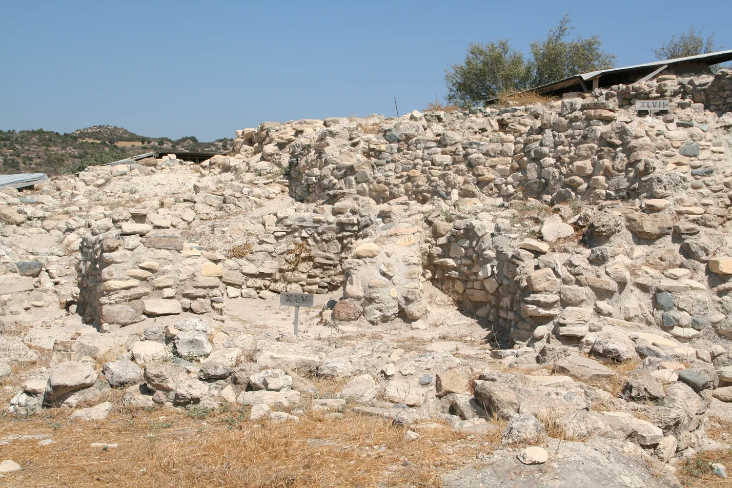
Le Brun looked at the same wall and found no vault in it. A vault of stone or brick is normally built by corbelling, laying each horizontal course a little further in than the one below until the courses meet, so that nothing pushes outwards. "Nothing of the sort is apparent here," he wrote; "the wall in its entirety appears to have toppled over." A mudbrick wall just north of XLVII has courses that lean south at the same angle as Dikaios's vault, and on a hill this steep the weight of earth pressing downslope bends walls most in their upper parts [1, pp. 54-55]. He found no post-holes or other traces of the internal support a cone would need [1, p. 19]. S.85 supplied the positive case: by 1997 Le Brun could describe its roof as a wooden frame on the wall top, two crossed layers of plants, probably reeds, and several layers of pisé and earth [1, pp. 19-20]. His guide records some of the burnt fragments on display in the Larnaca District Museum [1, p. 19].
Open the model at the roof stop, where every roof of the household is sliced through: roundwood bearers on the wall-head, two layers of branches and reeds, a first coat of straw-tempered earth, then more earth smoothed flat. Then look at the shading over the two big rooms.
Opens on the guided tour, stop 7 of 9: the roof in section.
A Khirokitia Household
Open the full reconstructionc. 7000 to 5200 BC · Khirokitia
The S.85 build carried over every room. Step on one stop to see the dome Dikaios restored, kept for comparison.
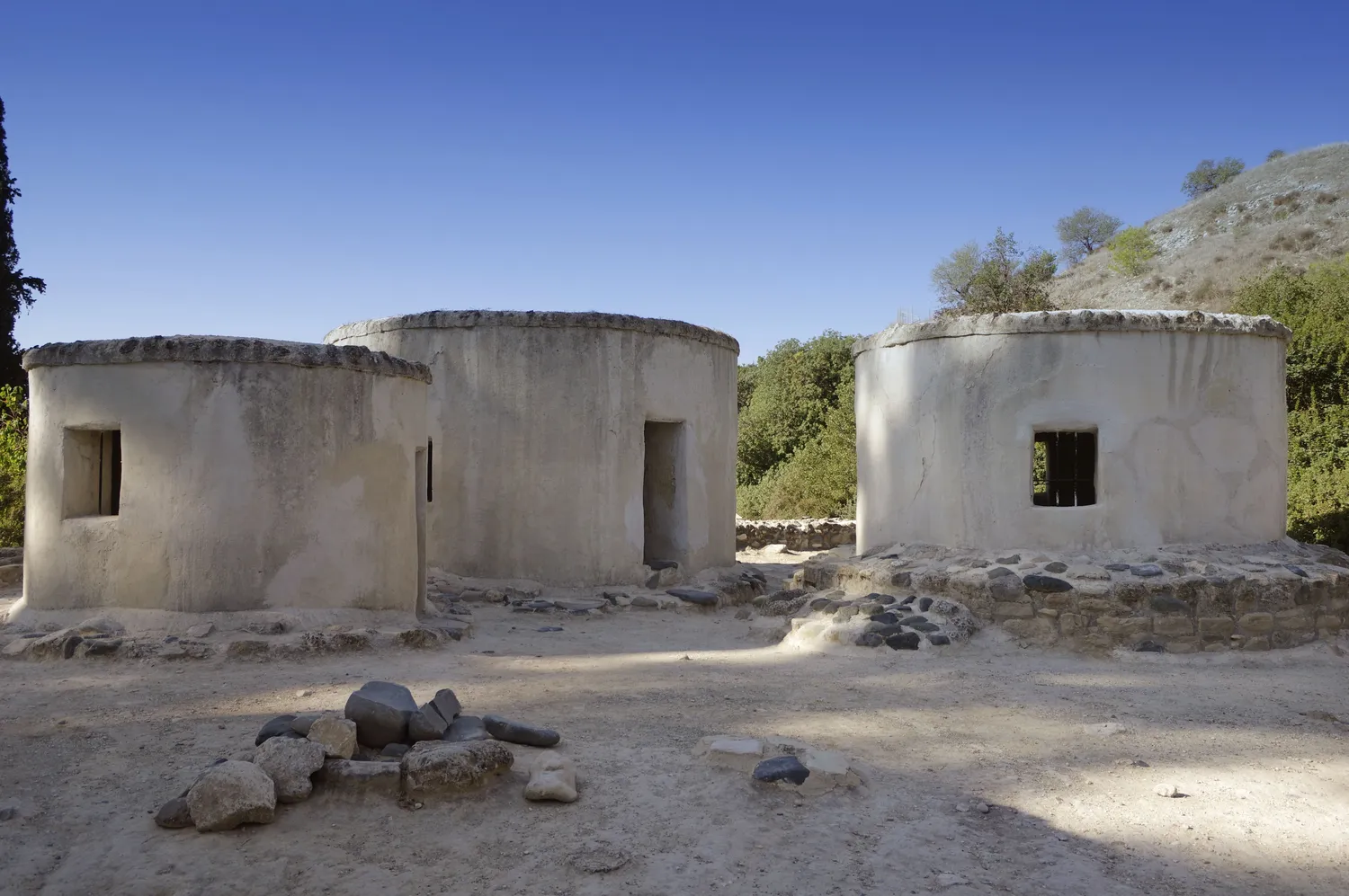
The argument has a weak joint. S.85 spans 1.85 m; the larger units are twice as wide or more, and carrying its roof across a 4 m room is an extrapolation, one Le Brun makes openly. Dikaios had already found a second burnt roof of timber and pisé over the corridor of Tholos IA, with sockets for its beam ends left in the wall [3]. The five replica houses on the site, built by the Department of Antiquities in the 1990s from the French mission's plans, have flat roofs taken from the imprints on the fallen fragments (Hadjisavvas, in [1, pp. 61-62]). They are themselves a composite: two copy S.117 and S.125, units of an earlier phase on the east side of the hill [1, p. 60], and they stand beside a copy of an entrance built later on the west.
That entrance belongs to the village wall. Dikaios traced it for about 185 m and called it the Main Road [3]; Le Brun showed it was a wall, the second of three. The last, wall 284, survives more than 3 m high [1, p. 16]. To climb the more than 2 m from the ground outside to the village, the builders set a stone block over 10 m long against its outer face and built into it a narrow stair in three flights at right angles, the middle one hidden from view [1, pp. 17-18, 57-58]. What such walls were for is the subject of Lesson 11.
Before Khirokitia: a sunken hall and wells in the rock
Khirokitia is late. Nearly two thousand years earlier, around 8800 BC, villagers at Ayios Tychonas-Klimonas, on a hillside above the sea east of Limassol, dug a round pit 10 m across and at least 1 m deep, shifting some 75 m³ of earth and rock. Round its edge they cut a ditch and raised in it a wall of cob, earth and straw built up by hand [4]. The period is the Cypro-PPNA, named after the Pre-Pottery Neolithic A of the mainland, and the building, Building 10, matches the large sunken communal buildings of the Euphrates villages, such as Jerf el-Ahmar, thought to have served for storage, meeting and ritual [4]. Its four elaborate hearths were arranged in a circle; it was rebuilt at least four times on the same spot; and the smaller round houses of the village, 3 to 8 m across and also sunk into the ground, never encroached on it [5].
Its roof is unknowable: the upper part had been destroyed. But its mud kept a record of its builders' fields. Impressions of chaff in fired building earth from the site identify emmer wheat and barley, and emmer does not grow wild on Cyprus, so the first farmers brought it with them [4].
The next settlers dug downwards for water. At Kissonerga-Mylouthkia, near Paphos, shafts about 7 and 8 m deep were cut into havara, the soft secondary limestone of the island's coasts, to reach water running underground, with hand and foot holds cut into their sides; the earliest dates to about 8600 to 8200 BC, among the earliest wells known anywhere [6; 7]. At Parekklisha-Shillourokambos, inland from Limassol, the earliest buildings were of posts and timber, and round buildings of stone came later [7]. The round plan was there from the start; stone followed.
Tenta: rings on a hilltop
Kalavasos-Tenta sits on a small hill about 20 m above the floor of the Vasilikos valley [8]. Recalibrated, its radiocarbon dates put its main building phases in the 8th and early 7th millennia BC, so its standing buildings are older than Khirokitia's by up to a thousand years [15]. Some forty round buildings crowded the hilltop inside an enclosure wall, which survives to about 1.2 m and probably carried mudbrick above its stone [8], with a ditch about 1.65 m deep cut into the rock outside it on the south [9].
On the summit stood three large round buildings in succession, each built over the filled remains of the one before. The last, Structure 14, had three concentric walls with an outer diameter of 12.32 m, a central court about 4.2 m across and two rings of small cells between radial cross-walls [10]. Its predecessor, Structure 17, had a red-painted plaster floor [10]. Ian Todd, who excavated the site from 1976, found no evidence of ritual in them and kept their purpose open [11]. Edgar Peltenburg classed Structure 14 as a "circular radial building" and saw in it a plan close to Jerf el-Ahmar's [10]. Joanne Clarke and Alexander Wasse read the summit buildings as communal, and Structure 14 as formally closed at the end of its life: backfilled, its entrance blocked [5].
Structure 11, a modest building on the south side of the hill, has a double wall, mudbrick outside and a skin of stone within, and a rectangular pier in the middle. On the east face of the pier someone painted two red figures with raised arms and five-fingered hands, and later covered them with plain plaster. Khirokitia has painted plaster too [3], but no motif there can be read; Tenta's are the only figures known in Neolithic wall painting on Cyprus. Todd warned against giving it a religious meaning "at least until much stronger evidence comes to hand" [9]. The southern part of the painting was lifted and is in the Cyprus Museum in Nicosia; it is often credited, wrongly, to Structure 14.
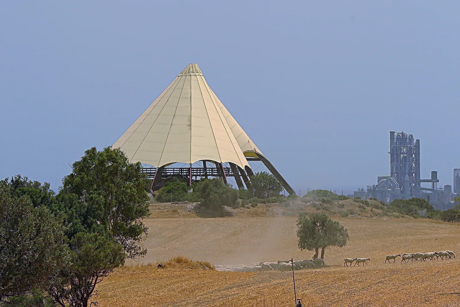
Tenta's piers have also been read as loft supports, but Todd found no collapsed upper floors, so the loft rests on the piers alone. On roofs he was undecided: mostly light flat roofs of earth and brushwood, he thought, though some mudbrick walls leaning inwards might suggest a vault [11]. The tall conical shelter over the hilltop today dates from the 1990s, and its shape says nothing about the roofs beneath it.
Peltenburg points out how odd this is. Mainland villagers had moved into rectilinear, many-roomed houses during these same millennia, while the Aceramic villages of Cyprus kept building circles: "the curvilinear tradition stands out as a particularly strong anomaly within general Near Eastern architectural developments" [10].
Corners and hollows: the Ceramic Neolithic
The Khirokitian villages were abandoned around 5200 BC, and after a gap whose length is still argued, the pottery-making villagers of the Ceramic Neolithic, or Sotira culture (about 5200 to 4000 BC), began building corners into the circle. At Sotira-Teppes, on a hilltop west of Limassol, Dikaios uncovered some forty-seven houses of six plan types, from nearly circular to square. The commonest is a rectangle with rounded corners [12; 13]. Stone footings 0.40 to 0.50 m thick, preserved 0.30 to 0.60 m high, carried walls of mudbrick or pisé, and floors averaged about 16 m² [12; 13]. Roofs of reeds and mud lay on pole rafters, and wider spans rested on posts set in cupstones, boulders with a conical hollow pecked into them to seat the foot of a post; Dikaios saw "an elaborate system of posts supporting the roof which in many cases must have been flat" [12]. The typical hearth was a round mud platform with a pit in the middle, some with a post at each of its four corners. Houses grew into pairs and threes of rooms, and the dead now went into pits outside them, no longer under the floors [12].
On the north coast, 9 km east of Kyrenia, Ayios Epiktitos-Vrysi looks like Sotira's opposite. Peltenburg excavated it from 1969 to 1973, and work there could not resume after 1974. Its houses were built down into two hollows up to about 6 m deep, wall against wall, each rebuilt on its predecessor's stump, so that House 1 survived as two or three superimposed buildings standing 3.60 m high, with six floors [14, p. 22]. For one wall of House 2B, Peltenburg calculated a total height of 1.90 m, 58 percent stone and 42 percent pisé [14], a rare excavated measure of how tall a Neolithic wall stood. He argued that, for all the difference in setting, Sotira and Vrysi share house sizes, materials, fittings and hearth-centred plans: one culture, two terrains [13].
On a map the two lie far apart: Sotira on its hilltop west of Limassol, Vrysi on the north coast beyond the Kyrenia range, while every Aceramic village in this lesson lies in the south and west of the island.
Map of Cyprus
- Before Khirokitia
- Late Aceramic Neolithic
- Ceramic Neolithic
- Ground above 200, 500, 1,000 m
Sites on this map
- 1Ayios Tychonas-Klimonas (approx.)
- 2Kissonerga-Mylouthkia
- 3Parekklisha-Shillourokambos (approx.)
- 4Kalavasos-Tenta
- 5Khirokitia
- 6Sotira-Teppes
- 7Ayios Epiktitos-Vrysi (approx.)
The clearest fallen roof at Vrysi lay on Floor 5 of House 1: reeds pressed flat and fanning out from the south-west, the dark traces of beams along the same line, and over them about 10 cm of clean mud or clay [14, p. 22]. It looked like an ordinary flat mud roof, except that the reed cross-members such a roof needs were missing. Peltenburg set out five readings: the cross-members had simply decayed; the timbers came from a timber-framed upper wall; the beams belonged to a sende and the reeds to a flimsy roof above it; the roof was conical or lean-to; or the whole was shoring against the north wall. One post lay diagonally, lined up with where the main roof support of the later houses would stand, which fitted the cone, but there were no post-holes in the floor to hold it. "The evidence, good though it is," he wrote, "is deficient in several respects" [14, p. 23].
Quiz
Check yourself
Question
Sort these statements about the first villages by how well they are known.
Tap a statement, then the bin it belongs in
To sort (6)
Question
Dikaios read the inward curve of Tholos XLVII's wall as the start of a dome. What would a vault built by corbelling show that this wall does not?
Question
The burnt roof of S.85 is the best evidence for how Khirokitia was roofed. How wide was the room it covered, in metres?
Question
Unit VII at Khirokitia received its pair of stone piers only on the latest of its three floors. What does Le Brun conclude?
Question
Put these buildings in the order they were first built, earliest first.
Tap an item, then tap its place. Or use the arrows
Question
Where were the painted red figures of Kalavasos-Tenta found?
Question
You uncover a house with rounded corners on stone footings half a metre thick, posts seated in cupstones, and a round mud platform hearth with a pit in the middle. When was it built?
What to look for
- A circle of wall that is very thick for the room it encloses (often half the outer diameter is wall) is the Aceramic Neolithic signature. At Khirokitia the usual build is a stone outer ring with earth or brick inside it, set on the ground with no foundation trench; Tenta's Structure 11 reverses the order.
- Treat each round building as one room. Look for several of them grouped round a small open court, and for a quern or a patch of paving in the court.
- Paired stone piers inside a round room carried, on Le Brun's reading of Khirokitia, a platform or loft; the roof rested on the walls. No loft itself has survived.
- Before believing in a dome, check a wall that leans inwards for horizontal courses stepped in one above the other (corbelling). A wall that tips as one piece on a slope is collapse; at Khirokitia the evidence is for flat roofs of timber, reeds and earth.
- A doorway set well above the floor, with steps in and out, is normal at Khirokitia; so is a small rectangular hearth platform with a stone top.
- Rounded corners, stone footings about half a metre thick, posts on cupstones and a round platform hearth with a central pit point to the Ceramic Neolithic (Sotira culture), after about 5200 BC.
- Modern shelters and replicas are separate layers: the Tenta cone is a 1990s roof over the ruins, and the Khirokitia replica village combines units of different phases.
Go deeper
Take the Khirokitia household apart, roof by roof, in the reconstruction A Khirokitia household, and read the sites at Khirokitia, Kalavasos-Tenta and Sotira. The wider story is in the compendium's Neolithic, Architecture and Neolithic and Chalcolithic burial pages.
References
- 1.Le Brun, A. (1997). Khirokitia: A Neolithic Site. Nicosia: Bank of Cyprus Cultural Foundation. (With S. Hadjisavvas on the reconstructed houses.)
- 2.Karageorghis, V. (1984). Chronique des fouilles et découvertes archéologiques à Chypre en 1983. Bulletin de correspondance hellénique 108 (Khirokitia: season report by A. Le Brun).
- 3.Dikaios, P. (1953). Khirokitia: Final Report on the Excavation of a Neolithic Settlement in Cyprus on Behalf of the Department of Antiquities, 1936–1946. London: Oxford University Press.
- 4.Vigne, J.-D., Briois, F., Zazzo, A., Willcox, G., Cucchi, T., Thiébault, S., Carrère, I., Franel, Y., Touquet, R., Martin, C., Moreau, C., Comby, C., & Guilaine, J. (2012). The first wave of cultivators spread to Cyprus earlier than 10,600 years ago. Proceedings of the National Academy of Sciences, 109(22), 8445-8449.
- 5.Clarke, J., & Wasse, A. (2019). Time out of joint: a re-assessment of the Cypriot Aceramic Neolithic site of Kalavasos-Tenta and its regional implications. Levant, 51(1), 26-53.
- 6.Peltenburg, E. (ed.) (2003). Lemba Archaeological Project III.1: The Colonisation and Settlement of Cyprus. Investigations at Kissonerga-Mylouthkia, 1976-1996 (SIMA 70:4). Sävedalen: Paul Åströms Förlag.
- 7.Peltenburg, E., Colledge, S., Croft, P., Jackson, A., McCartney, C., & Murray, M. A. (2001). Neolithic dispersals from the Levantine Corridor: a Mediterranean perspective. Levant, 33, 35-64.
- 8.Todd, I. A. (1978). Vasilikos Valley Project: Second Preliminary Report, 1977. Journal of Field Archaeology, 5(2), 161-195.
- 9.Todd, I. A. (1982). Vasilikos Valley Project: Fourth Preliminary Report, 1979-1980. Journal of Field Archaeology, 9(1), 35-77.
- 10.Peltenburg, E. (2004). Social space in early sedentary communities of Southwest Asia and Cyprus. In E. Peltenburg & A. Wasse (eds), Neolithic Revolution: New Perspectives on Southwest Asia in Light of Recent Discoveries on Cyprus (Levant Supplementary Series 1), 71-89. Oxford: Oxbow Books.
- 11.Todd, I. A. (1987). Vasilikos Valley Project 6: Excavations at Kalavasos-Tenta, Volume I (SIMA 71:6). Göteborg: Paul Åströms Förlag.
- 12.Dikaios, P. (1961). Sotira. Philadelphia: The University Museum, University of Pennsylvania.
- 13.Peltenburg, E. J. (1978). The Sotira culture: regional diversity and cultural unity in Late Neolithic Cyprus. Levant, 10, 55-74.
- 14.Peltenburg, E. J. (1982). Vrysi: A Subterranean Settlement in Cyprus. Excavations at Prehistoric Ayios Epiktitos-Vrysi 1969-73. Warminster: Aris & Phillips.
- 15.Todd, I. A. (ed.) (2005). Vasilikos Valley Project 7: Excavations at Kalavasos-Tenta, Volume II (SIMA 71:7). Sävedalen: Paul Åströms Förlag (the revised chronology by C. McCartney and I. A. Todd).