
Contents
No census of Cyprus survives from antiquity. Every figure for the number of people living on the island, in a valley or in a village before then is therefore a model: a measured quantity (hectares of settlement, square metres of roofed floor, surface scatters, tombs, bushels of grain) multiplied by a coefficient that someone chose. The coefficients carry the result. This entry sets out the methods archaeologists use, gives each published estimate with its author, its method and its assumptions, and shows where the methods have been tested and found wanting. Two cautions frame it. Maria Iacovou called a much-repeated range of Late Cypriot town sizes "an amazingly resilient pseudo-fact" [1, p. 3], and Catherine Kearns, after producing her own figures for the Iron Age south coast, described them as "largely notional" [2, p. 167]. The prehistoric figures below are counts for single sites or single valleys. The only island-wide figure for antiquity is Classical and is built from written sources, so the numbers cannot be joined into one population curve. The entry sits in the daily life hub beside the village-life leaves for the Early, Middle and Late Bronze Age, which describe the communities these numbers try to size.
The historical anchor
The nearest thing to a benchmark comes from the late medieval and early modern period. Sturt Manning reviewed the reports for 1490 to 1878 CE and found that pre-modern figures for Cyprus "are few and of various and differing quality"; most fall "in a range between about 100,000–200,000 total population", while a few higher ones (250,000 in 1600, 259,782 in 1876) "seem clearly suspect or mere guesses" [3, pp. 107–108]. The lowest figure he treats as somewhat credible is 106,000 in 1490, and the rough maximum is about 200,000 near the Venetian high point, both from Papadopoulos's 1965 study, which Manning warns may lean toward an upward Venetian trend [3, p. 108]. For density, Christodoulou's figures give about 20 persons per km² for the whole island in 1881 and about 59.5 in 1958 [3, p. 107].
These are not ancient numbers, but they bound the problem. Andreas Parpas notes that in the mid-sixteenth century, with a population of about 200,000, grain output peaked at roughly two and a half to three times its mid-nineteenth-century level [4, p. 221]: the island could feed that many people only when farming was pushed hard. Manning's judgement is that most estimates for Bronze Age sites and regions, made on various criteria, arrive at figures "consonant with such a relatively low population by region", citing Alison South's 2014 study of the Vasilikos Valley as an example [3, p. 108].
Four ways to make a number
The first and simplest method, settlement area multiplied by density, measures a site in hectares and multiplies by a number of people per hectare. A common coefficient is Renfrew's 200 inhabitants per hectare for lowland Mediterranean farming sites, which Edgar Peltenburg applied at Kissonerga while warning that it "must be treated with caution, at least in the Cypriot context" [5, p. 20]. A variant replaces hectares with roofed floor area and divides by a figure of square metres per person, such as Naroll's 10 m², a coefficient meant to hold everywhere.
Richard Yerkes tested the floor-area method against a living village. At Petrophani, in the Athienou district of central Cyprus, the Athienou Archaeological Project measured 3,126 m² of residential floor area. Divided by Naroll's 10 m² per person, that gives 313 people. The village's highest recorded census figure, from 1973, was 171, which Yerkes points out "is less than half that number"; to reach 171 from the floor area you need about 18.3 m² per person [6, pp. 25–26]. The team counted 35 household compounds, about five people per household, and set this beside census medians for rural Cyprus of 3.69 persons per household in 1946 and 3.93 in 1960, and beside the tightly packed village of Alambra, where 108 compounds held about 600 people in 1976, or 5.5 per household [6, p. 26]. His conclusion is that "universal coefficients like Narroll's ... would have led to very inflated population estimates" [6, p. 27]. The test is a single loosely built village, and it points in one direction: at Petrophani the universal coefficient gave more than twice the real number.
The second method multiplies survey sites by household size. Regional surveys record scatters of surface pottery, and the demographer turns scatters into households and households into people. Kearns lists the "numerous problems in building models of ancient demographic dynamics from surface survey": the calculation needs a site or catchment area, a household size and a building area, and each is a choice. Alcock's rule of thumb treats a rural scatter of 0.1 to 0.3 ha as one household, and twentieth-century villages in the Vasilikos Valley "hover around three or four people per household" [2, p. 166]. Kearns calls the usual household size of three to five people "presumed and highly arbitrary" [2, p. 167]. The survey method also has to decide how many scatters were occupied at the same time, which surface pottery rarely settles.
The third method counts tombs and burials. Cemeteries are the best-known part of the Cypriot Bronze Age, and burial counts can be turned into a population if you know how long the cemetery was used, how many people each tomb held and what share of the dead were buried there at all. At Deneia, Jennifer Webb estimates the Middle Cypriot adult burials at 9,000 to 20,000, "implying a very large population which is almost certainly the result of a major influx of people" [7, p. 33]. The method's weak points show in the same pages: Deneia's Middle Cypriot chambers average 26.2 m² (eleven tombs measured) against 11.18 m² at Lapithos and 8.3 m² across the island, and Priscilla Keswani's mean of 4.19 burials per Middle Cypriot tomb at Lapithos need not hold elsewhere [7, p. 33]. Kearns notes that her Iron Age valley figures lack "bioarchaeological data to quantify population through burial frequencies" [2, p. 166]. The treatment of the dead is covered in the Bronze Age chamber tombs entry.
The fourth method, carrying capacity, asks how many people the land could feed. Manning works through the numbers. A person needs about 212 kg of wheat a year (about 254 kg of barley), or 230 to 250 kg of cereals, on the figures of Foxhall and Forbes and of Garnsey [3, p. 106]. Pre-modern barley yields may have been 425 to 530 kg per hectare, and twentieth-century Cypriot wheat ranged from 448 kg per hectare in the worst year (1951) to a best average of 1,111 kg [3, p. 106]. After setting aside 100 to 200 kg for seed, "in a bad year 1 ha of barley would have supported about two people versus at least five in a good year"; a hectare of wheat fed about one person in a bad year and "maybe four or five" in a good one [3, p. 107]. On Wilkinson's reckoning, a "modest three-hundred-person agricultural village requires some 600 ha of farmland, or all land within a 1.4-km radius" [3, p. 107]. Rainfall adds risk: at Peristerona, 18.8% of the years between 1926 and 2010 had less than 200 mm [3, p. 108]. Manning concludes that Cyprus "is able to support only a relatively low population density on average and is not a context that is generally suitable for significant intensification" [3, p. 107]. Carrying capacity sets a ceiling; it does not say how close any community came to it. The crops themselves are described in the food and diet entry.
Neolithic villages: hundreds, not thousands
The Neolithic estimates are site estimates from excavated plans. Alain Le Brun, director of the French mission at Khirokitia, gives the settlement an area of about 1.5 ha, which covers all its phases together and so yields "only a maximum approximation". Assuming the whole area was occupied at once and evenly, "the maximum population at Khirokitia lies between 300 and 600 inhabitants, but was no doubt closer to 300 than 600" [8, pp. 26–27]. The figure is an upper limit by construction, and Le Brun leans to its lower end.
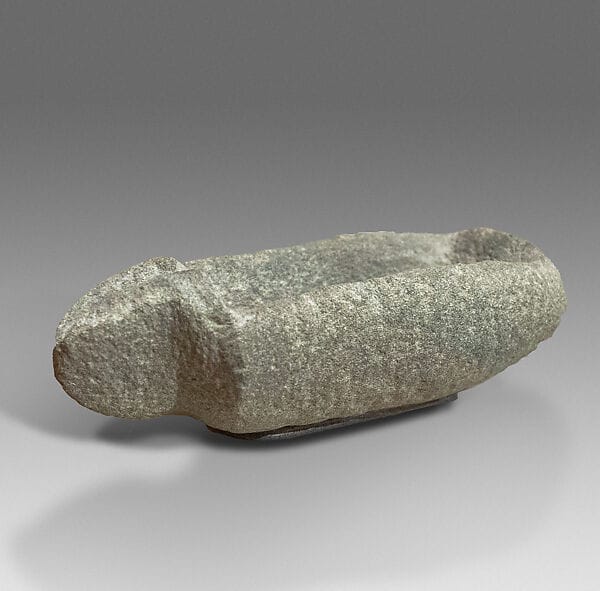
Kalavasos-Tenta, an Aceramic village on a small hill 2.3 km south-south-east of modern Kalavasos, enclosed by an outer wall and a rock-cut ditch, was smaller: "The population was small, perhaps fifty people", with the dead buried under house floors and in open areas [9, p. 262]. Both figures depend on how much of the site was lived in at once. The Khirokitia excavations also produced household equipment such as a spouted diabase bowl, found in 1934 and now lent by the Cyprus Museum to the Metropolitan Museum. Burial customs are covered in Neolithic and Chalcolithic burial.
Chalcolithic: population and social organisation
In the Chalcolithic, population figures were put to work in arguments about social organisation. Swiny's site sizes put Erimi-Pamboula at 15 ha and Kissonerga-Mosphilia at 12 ha [5, p. 20]. Peltenburg worked from the excavated sample. At Lemba-Lakkous Area II, a little over 250 m² of the 612 m² exposed was roofed; "as much as 40 percent might have been occupied, for an estimated population of 240. However, even that may be an inflated number, since only part of the site was occupied contemporaneously." Kissonerga, "densely inhabited, especially in the Late Chalcolithic", gave a different answer: "with a load factor of about 40 percent occupation, the population may have been nearly one thousand" [5, p. 20]. His conclusion was that "these crude estimates suggest that there are appreciable population differences among Chalcolithic settlements", and, following Trigger, that communities of more than 500 "might still be considered villages" but "require authoritative officials" [5, p. 20].
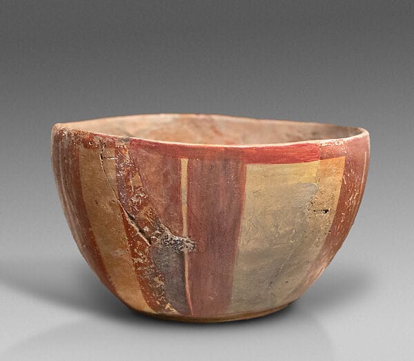
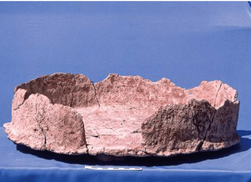
The Kissonerga figure is an area, a load factor and Renfrew's density multiplied together. At Petrophani the density term was the one that pushed the answer up. Finds from the same area include a painted terracotta bowl excavated at Kissonerga in 1984, now lent by the Cyprus Museum to the Met, and a flanged-base tray from building 152 at Kissonerga-Mylouthkia.
The Bronze Age: cemeteries, valleys and the size of towns
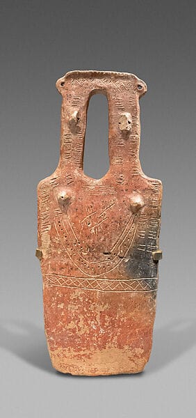
For the Early and Middle Bronze Age the evidence is mostly funerary. Webb describes the period from Early Cypriot III to Middle Cypriot II as one of "a significant increase in the number of settlements and the spread of settlement into previously uninhabited regions", with most new sites in the north-west established by Middle Cypriot I [7, p. 33]. Deneia saw an explosion of tomb building in MC I to II; eleven new sites with Middle Cypriot material appeared at Lapithos alongside the Vrysi tou Barba cemetery, and new sites were founded in EC III or MC I at Bellapais-Vounous, Karmi and Ayia Paraskevi [7, p. 33]. The Deneia estimate of 9,000 to 20,000 adults counts the dead buried over the whole use of the cemetery, so the number alive at any one time was a fraction of it. Webb reads even its lower end as evidence of people moving in rather than of natural growth. The tombs are known much better than the houses: a two-headed plank-shaped figurine from Early Bronze Age tombs at Lapithos is one of their products, and the Vounous article describes a society known only from its dead.
In the Late Bronze Age some settlements become town-sized. Kalavasos-Ayios Dhimitrios covers 11.5 ha at the junction of the coastal route and the route to the copper mines [9, p. 263]. South's 2014 estimate for the Late Cypriot Vasilikos Valley, which contains Ayios Dhimitrios, is 1,575 to 1,875 people, or 10 to 12 per km², reflecting what she earlier called "a concentration of population" at the town [2, p. 167]. These are the low densities Manning expects.
The bigger coastal sites are where Iacovou's critique bites. She argues that charts of settlement size "have acquired disproportionate visibility", and that the claim that "LC IIC urban centers vary in size from 10 to 70 ha" is "an amazingly resilient pseudo-fact!" [1, p. 3]. At Palaepaphos, "not one house wall has been found of the Late Cypriot town", yet it has been given as 144 ha and as 65 ha [1, p. 3]. Keswani's argument that Enkomi was "dwarfed by Kition and Hala Sultan Tekke" rested on size estimates of 11, 70 and 27 ha [1, p. 13]. Treating all Late Cypriot centres as versions of one urban model, Iacovou writes, "promotes a dangerous pseudo-fact", and "site structure, not site size, is more likely to provide the best insight into site history" [1, pp. 8, 13]. Her objection is to the inputs: when the hectarage itself is a guess, multiplying it by 200 gives a guess with more digits.
Age at death: what the skeletons say
Skeletons do not give the size of a population, but they give its shape: who died, and when. At Khirokitia men averaged 1.61 m in height and women 1.51 m; "the infant mortality rate was high and life expectancy was 22 years. The average age reached by adults was around 35 years for men and 33 years for women" [8, p. 27]. A life expectancy at birth of 22 years is dragged down by infant deaths and does not mean adults died at 22.
The Bronze Age picture is patchier. In Deneia Tomb 789, 58% of a sample of 46 individuals died before the age of six [7, p. 33]. Infants are hard to count elsewhere: Keswani thought the niches in Lapithos tomb dromoi held infants, and no pithos burials of infants have been found at Deneia [7, p. 33]. Osterholtz's study of Bronze Age remains from Sotira-Kaminoudhia, the Kalavasos Village Tombs, Episkopi-Phaneromeni, Kalavasos-Mangia, Kalavasos-Ayios Dhimitrios and Hala Sultan Tekke covered more than 1,000 fragments from over 100 individuals. The bones "tended to be commingled and fragmentary", so she recorded elements rather than whole burials and counted a minimum number of individuals per tomb [10, pp. 228–229]. Linear enamel hypoplasia, a mark of childhood stress on the teeth, increases through time, and "individuals with a younger age at death tended to exhibit more LEHs", as the "damaged goods" hypothesis predicts. She also identified two possible cases of perinatal scurvy (at Ayios Dhimitrios and Mangia), and the Sotira-Kaminoudhia bodies may be earthquake victims [10, pp. 228–229]. Her bibliography includes Wood and colleagues' paper on "the osteological paradox", the standard caution against reading the health of a living community straight from its skeletons [10]. Medical evidence is covered in the medicine entry.
We know of no published Iron Age or Classical skeletal data on life expectancy or age at death. The age structure of the Cypriot kingdoms is not known from bone.
The Iron Age kingdoms and the one island-wide figure
For the Cypro-Geometric and Cypro-Archaic periods the best figures come from survey on the south coast, and Kearns keeps her two valleys separate. For the Vasilikos Valley between the late ninth and the fifth centuries BCE she approximates "ca. 3,700 as the minimum and 5,000 as a maximum population", adjusted for sampling bias and for small sites that were not occupied together (Bevan 2002), which works out at "25–33 persons per sq. km (using the 151 sq. km surveyed by the Vasilikos Valley Project)" [2, p. 167]. For the southern Maroni valley she gives "gross estimates of ca. 450 people ... or about 30 people per sq. km" [2, p. 167]. Cypro-Archaic I appears as "a height of occupation", with more of the landscape covered than in the Late Bronze Age, and over 40% of Archaic scatters also carry Middle or Late Bronze Age material [2, p. 165]. Her figures "raise the question of a repopulation and the accelerated growth of this south-central region during the eighth century", and it is in the same passage that she calls them "largely notional" [2, p. 167]. She ties them back to Manning's low-density carrying-capacity argument [2, p. 167].
The one walled town with an estimate is Amathus. The Archaic walls enclose 30 ha, and Petit's rough figure is 6,000 to 9,000 people, "approximately 200–300 persons per ha" [2, p. 167]. The density, 200 to 300 per hectare, starts where Renfrew's coefficient for Chalcolithic Kissonerga does, and it has not been tested against a Cypriot settlement the way Yerkes tested Naroll's. The city's history is told in the Amathus article.
The only estimate for the whole island in antiquity belongs to the Cypro-Classical period, when Cyprus was part of the Persian empire. Parpas, in his study of the island's economy down to 295 BCE, reaches it by three routes. The first apportions Achaemenid tribute: Phoenicia and Palestine with two other regions made up 75 to 80% of the Fifth Satrapy and held about 600,000 people, which implies 750,000 to 800,000 for the satrapy, of which Cyprus's 20 to 25% share gives about 160,000 to 200,000 [4, p. 187]. Comparison with neighbouring regions gives 187,500, and comparative theoretical models give 178,600. He proposes an "average population" in the order of 160,000 to 200,000, to be used "only in the background for guidance and rough reference" [4, p. 188]. Parpas calls the three routes independent. None of them starts from a count of anything on Cyprus: all three work by comparison and apportionment, so their agreement shows that the comparisons are consistent with each other more than it confirms the total. The Persian context is covered under Achaemenid Persia. The result falls inside the early modern range of 100,000 to 200,000 that Manning reports.
The estimates side by side
| Period | Place | Estimate | Method | Source |
|---|---|---|---|---|
| Aceramic Neolithic | Khirokitia (c. 1.5 ha) | Maximum 300–600, "closer to 300" | Site area, assuming all of it occupied at once | Le Brun [8] |
| Aceramic Neolithic | Kalavasos-Tenta | "Perhaps fifty" | Size of the excavated village | OEANE, "Kalavasos" [9] |
| Chalcolithic | Lemba-Lakkous | c. 240, "may be an inflated number" | Roofed area, 40% load, 200 per ha | Peltenburg 1991 [5] |
| Late Chalcolithic | Kissonerga-Mosphilia (12 ha) | "Nearly one thousand" | Area, 40% load, 200 per ha | Peltenburg 1991 [5] |
| Middle Cypriot | Deneia cemetery | 9,000–20,000 adult burials over the cemetery's use | Tomb counts | Webb 2009 [7] |
| Late Cypriot | Vasilikos Valley | 1,575–1,875 (10–12 per km²) | Survey | South 2014, via Kearns [2] |
| Late 9th–5th c. BCE | Vasilikos Valley (151 km²) | 3,700–5,000 (25–33 per km²) | Survey, households of 3–5 | Kearns 2022 [2] |
| Cypro-Archaic | Maroni southern valley | c. 450 (c. 30 per km²) | Survey | Kearns 2022 [2] |
| Cypro-Archaic | Amathus (30 ha) | 6,000–9,000 | 200–300 per ha | Petit 2019, via Kearns [2] |
| Cypro-Classical | Whole island | 160,000–200,000 | Tribute share, regional comparison, models | Parpas 2022 [4] |
| 1490–1878 CE | Whole island | Mostly 100,000–200,000 | Historical reports | Papadopoulos 1965, via Manning [3] |
Read down the "Method" column before the "Estimate" column. The Neolithic and Chalcolithic rows are single sites; the Bronze and Iron Age survey rows are single valleys of the south coast; the Deneia row counts the dead; and only the last two rows cover the island, one from ancient texts and one from early modern ones. The Chalcolithic and Amathus rows use a density coefficient of 200 per hectare or more, the kind of universal figure that gave more than twice the real number at Petrophani.
Conclusion
The published figures agree on one thing: at every period the communities of Cyprus were small by modern standards. Villages of a few hundred, valleys of a few thousand, and an island for which the one ancient estimate and the early modern reports both fall between about 100,000 and 200,000: these results come from methods that share few assumptions, and Manning's carrying-capacity arithmetic explains why none of them runs high. Beyond that the numbers are only as good as their coefficients. Yerkes's Petrophani test shows density methods running high; Iacovou shows that some of the areas being multiplied were never measured; Kearns labels her own valley totals notional; and the one island-wide figure is apportioned from Persian tribute rather than counted. Anyone quoting a population for an ancient Cypriot site should give the method and the multiplier with it, as the authors above do.
Objects on this page
References
- 1.Iacovou, M. (2007). Site size estimates and the diversity factor in Late Cypriot settlement histories. Bulletin of the American Schools of Oriental Research, 348, 1–23. https://www.jstor.org/stable/25067035
- 2.Kearns, C. (2022). The rural landscapes of Archaic Cyprus: An archaeology of environmental and social change. Cambridge University Press.
- 3.Manning, S. W. (2019). Chapter in C. Kearns & S. W. Manning (Eds.), New directions in Cypriot archaeology. Cornell University Press.
- 4.Parpas, A. P. (2022). The maritime economy of ancient Cyprus in terms of the New Institutional Economics. Archaeopress.
- 5.Peltenburg, E. (1991). Kissonerga-Mosphilia: A major Chalcolithic site in Cyprus. Bulletin of the American Schools of Oriental Research, 282/283. https://www.jstor.org/stable/1357260
- 6.Yerkes, R. W. (2000). Ethnoarchaeology in central Cyprus: Interdisciplinary studies of ancient population and agriculture by the Athienou Archaeological Project. Near Eastern Archaeology, 63(1), 20–34. https://www.jstor.org/stable/3210805
- 7.Webb, J. M. (2009). Deneia: A Middle Cypriot site in its regional and historical context. In I. Hein (Ed.), The formation of Cyprus in the 2nd millennium B.C.: Studies in regionalism during the Middle and Late Bronze Ages (Contributions to the Chronology of the Eastern Mediterranean 20). Österreichische Akademie der Wissenschaften.
- 8.Le Brun, A. (1997). Khirokitia: A Neolithic site (L. Steel, Trans.). Bank of Cyprus Cultural Foundation.
- 9.Kalavasos. (1997). In E. M. Meyers (Ed.), The Oxford encyclopedia of archaeology in the Near East (Vol. 3). Oxford University Press.
- 10.Osterholtz, A. J. (2021). Biocultural aspects of culture contact, exchange, and population movements on Cyprus. In G. Schug (Ed.), The Routledge handbook of the bioarchaeology of environmental change. Routledge.