
Contents
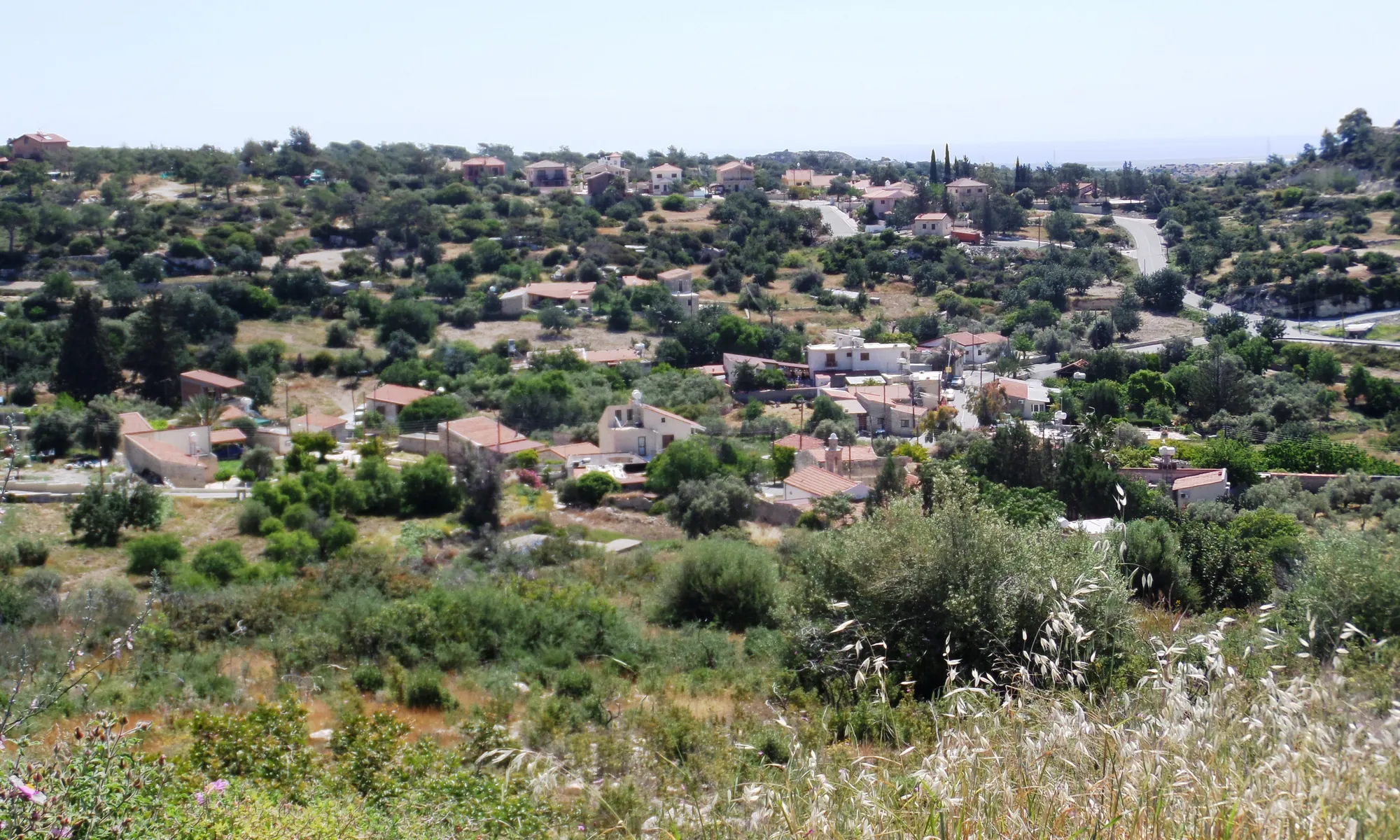
Two prehistoric sites lie at the edge of the village of Sotira, in the hills above the Kouris valley in Limassol District. Sotira-Teppes, on a small hilltop, is a farming village of the later 5th millennium BC, roughly 4500 to 4000 BC. It gave its name to the Sotira culture, the Ceramic Neolithic of Cyprus. Sotira-Kaminoudhia, on terraces about 400 m to the north-east [1, p. 3], is an Early Bronze Age village of stone houses with two cemeteries, lived in until about 2200 BC [2, p. 66]. Some two thousand years separate the two. Both were excavated and published as monographs, Teppes by Porphyrios Dikaios in 1961 [3] and Kaminoudhia by Stuart Swiny, George Rapp and Ellen Herscher in 2003 [1].
The hills above the Kouris
Sotira and the villages before it grew up around three perennial springs, which Swiny calls "the prime impetus for human occupation in the area" [1, p. 3]. Each site takes its name from the village and a local field name, and Teppes stands a little higher than the ground around it [1, p. 3]. It is a hilltop about 330 m above sea level, "high above and overlooking the Kouris River Valley" [4, p. 56], with a flat top and steep sides. Frankel describes it as "the relatively flat top of a small conical hill" [5, p. 318]. The plateau covers about 0.25 ha, and houses may also have spread over some 1.25 ha of its south-eastern slopes [6, p. 56].
Kaminoudhia means "small lime kilns". The name belongs to "a series of southward sloping terraces that borders the northern limits of Sotira village" [1, p. 3]. The Bronze Age village covers about a hectare of these terraces [2, p. 9], and the site datum stands at 288 m above sea level [2, p. 10]. The bedrock is the Pakhna Formation, reddish marly chalks and limestones [7, p. 463]. The local limestone splits naturally into slabs often 10 to 15 cm thick, and the Kaminoudhia villagers built their walls from it [2, p. 59].
The two sites belong to a cluster of prehistoric settlements in the lower Kouris valley. Erimi-Pamboula, the type site of the Chalcolithic (see Erimi), lies nearby, and the Bronze Age settlement of Episkopi-Phaneromeni lies about 7.5 km to the south-east on the banks of the Kouris [1, p. 3]. Another Ceramic Neolithic village, Kantou-Kouphovounos, excavated by Eleni Mantzourani, is a neighbour of Teppes [5, p. 317].
Discovery and excavation
Teppes
Dikaios, then Curator of the Cyprus Museum [1, p. 3], found Teppes in February 1934, "on the same day that he identified the more famous Neolithic site of Khirokitia" [5, p. 317]. He came back to excavate it for the University Museum of the University of Pennsylvania [1, p. 3], with the Department of Antiquities, in seasons in 1947, 1951–1952, 1954 and 1956 [4, p. 56]. Most of the work was on the plateau, called Area V, where he uncovered about 2,000 m²; Areas I to IV lie on the slopes [5, p. 318; 4, p. 56]. Frankel credits much of the quality of the record to the excavation foreman, Kakoullis Georgiou, whose skill at telling floors from other deposits underpins every later study of the site [5, p. 318].
Dikaios published the excavation in 1961 as Sotira, with specialist appendices that include J. Lawrence Angel's report on the human remains [3]. After this report the "Sotira culture" became the reference point for the Ceramic Neolithic of Cyprus [1, p. 3]. The record was good enough to be studied again: Edgar Peltenburg compared Sotira with the north-coast village of Ayios Epiktitos-Vrysi [6], Nicholas Stanley-Price re-worked its building sequence [8], and David Frankel has re-read its floor deposits [5, p. 318].
Kaminoudhia
During the 1947 season Dikaios also excavated a tomb at Kaminoudhia, which he called "Copper Age". It was mentioned in the Penn Museum's bulletin for 1948 and in his guide to the Cyprus Museum, but its finds were never published in full [1, p. 3]. It is now known as Tomb 1 of Cemetery A, and it is the earliest of the Philia-phase tombs there [1, p. 502].
In 1978 Swiny's survey of the Episkopi region for Kent State University relocated Dikaios's tomb area and recorded three looted rock-cut chambers on the opposite hillside to the east, later called Cemetery B [1, p. 3]. A four-week exploratory season in 1981 for the Cyprus American Archaeological Research Institute (CAARI) opened soundings on the terraces and found "a settlement that covered at least a hectare" [1, pp. 3–5]. Full excavation followed as a joint project of CAARI and the Archaeometry Laboratory of the University of Minnesota-Duluth, with Swiny in charge of the archaeology, Rapp of the archaeological science, and Herscher of the ceramics [1, p. 5]. In the 1983 season Rapp carried out a sub-surface survey of the settlement, and a final short season followed in 1986 [1]. The final report appeared in 2003 [1]; the radiocarbon dates had been published by Sturt Manning and Swiny in 1994 [9].
Two villages, two thousand years apart
Dikaios dated Teppes to the 4th millennium BC, before radiocarbon dates could be calibrated, and Winkelmann's catalogue still repeats that date [4, p. 56]. The Ceramic Neolithic is now placed in the 5th millennium BC [5, p. 317]. At Kaminoudhia ten radiocarbon dates give "a radiometric chronology of ca. 2400–2174 B.C.E." for the two phases of the excavated village [1, p. 7], and Swiny puts the latest occupation at about 2200 BC [2, p. 66]. The tombs begin earlier: four are of the Philia phase, the start of the Early Bronze Age, and settlement and cemeteries together span "almost the entire Early Cypriot Bronze Age" [1, p. 502]. The latest tombs belong to the same Early Cypriot III horizon as the village; we know of none that is securely later than its abandonment.
Between the two, Sotira has little to show. Chalcolithic sherds turned up at Kaminoudhia in 1981, and most of the Middle and Late Chalcolithic pottery came from the Phase I level of Area A [1, pp. 5, 7], but no Chalcolithic building is reported.
Phases
- Teppes, Phase 1later 5th millennium BC
The plateau is levelled. Nine buildings stand apart from each other. A fire destroys the northern part of the village.
- Teppes, Phase 2
New houses beside the survivors fill the whole plateau, with annexes and paired buildings. The houses collapse, in Dikaios's view in an earthquake.
- Teppes, Phase 3to about 4000 BC
Most of the larger houses are reoccupied and a retaining wall is built along the northern edge. The village is then abandoned.
- Gapabout 4000 to 2400 BC
Chalcolithic sherds at Kaminoudhia, but no known settlement.
- Kaminoudhia, Philia tombsPhilia phase
Tomb 1 and three other tombs in Cemetery A.
- Kaminoudhia, later tombsEarly Cypriot I–III
Tombs with north-coast pottery beside the Philia tombs; the cemeteries stay in use alongside the village.
- Kaminoudhia village, Phases I and IIabout 2400 to 2200 BC
Stone houses on the terraces, Early Cypriot III. Abandoned around 2200 BC and never reoccupied.
Sotira-Teppes: the Neolithic village
Houses on the plateau
How many houses Teppes had depends on what is counted as a house. Peltenburg counts "some forty-seven houses ... compactly arranged" on the plateau [6, p. 56], Winkelmann 40 structures in Area V [4, p. 56], and Frankel "about three dozen houses and associated structures" [5, p. 318]. Most are free-standing single rooms, roughly square with rounded corners, with an average floor area of about 16 m² [6, p. 56]. Their stone foundations, irregular or faced with rubble infill, are only 0.40 to 0.50 m wide. They carried walls of mudbrick or pisé and roofs of reeds and mud [6, p. 56], probably close to flat [4, p. 56]. Little fallen pisé lay on the floors, so the houses may have been fairly low [6, p. 57]. Doorways 0.50 to 0.60 m wide, some with steps, open onto winding passages between the houses [6, p. 57].
Each house was arranged around a raised hearth, with benches of pisé or stone, fixed utensils and "often a semi-circular partition wall demarcating a small corner area" [6, pp. 57–58]. In Houses 2 and 12 Dikaios thought these corner enclosures were used for grinding grain; House 5 has two of them, one holding broken vessels and a stone figurine, the other two querns [4, p. 57]. A household could have up to three rooms [4, p. 56]. Peltenburg stressed the "extreme uniformity" of the houses in shape, size and contents and concluded that "the most likely socioeconomic division therefore is one family per house", with annexes added as families grew [6, p. 62]. On Area III, on the slope, Dikaios found a curved wall 9 m long and 1.2 m wide. He wondered whether it was a "Main Road" like the one at Khirokitia or part of a large building, and its purpose is still unknown [4, p. 57].
The plan below shows the houses of Area V in Phase 2, after Frankel's version [5, p. 323] of Stanley-Price's phase plan [8]. It separates the walls kept from Phase 1, the walls of Phase 2 and the walls added later in that phase.
Plan · later 5th millennium BC
The Neolithic village on Sotira-Teppes
Sotira-Teppes, the plateau on the hilltop (Area V)
Later in Phase 2: annexes and rooms added between the houses
Choose a number on the plan, or a name below, to read what was found there and how well it is known.
Key
- Wall
- Wall, restored
- Edge of a house
- Limit of excavation
- Contours at 1 m
Fire, collapse and the last phase
Dikaios divided the occupation into four phases. Stanley-Price later argued for three, and Frankel and Winkelmann follow his scheme [5, p. 318; 8]. The villagers first levelled the plateau. In Phase 1 nine buildings stood well apart, and a fire destroyed the northern part of the village. In Phase 2 new houses were built beside the surviving ones until they covered the whole plateau, and annexes and paired buildings were added. The end of Phase 2 was another destruction, "this time most probably by an earthquake". In Phase 3 people moved back into most of the larger Phase 2 houses but built little else, and this last phase was probably short [4, p. 56]. Buildings on the slopes cannot be tied to the plateau sequence, but the village probably began on the plateau and spread downhill [4, p. 56].
For Dikaios the second disaster was "an earthquake which brought down the superstructure of almost all the houses, burying under the debris all the belongings and tools of the inhabitants" [3, p. 221]. Frankel points out that a collapse of that kind should have left many whole pots on the floors, yet "no more than 20 are even partially reconstructable". If there was an earthquake, the houses were still accessible afterwards, and people took away what could be used [5, p. 319]. After this destruction a retaining wall was built: four straight walls along the edges of the plateau, filled behind with boulders and soil, which in Dikaios's view held the debris and steadied the slopes [4, p. 57]. Peltenburg considered that the disruption at Sotira might have been part of a wider upheaval that also saw northern villages abandoned around the same time [6, p. 67]. The earthquake remains a possible reading of the destruction; it has not been demonstrated.
Burials on the lower slope
The dead were buried outside the houses [6, p. 61], unlike at Khirokitia, where they lie under the floors. In Area I, on the lower eastern slope, a trench of 20 by 12 m uncovered twelve pit graves north-west of the partly excavated Structure 41. Each held one body, mostly adults, laid on the side with the legs drawn up, and stones or boulders were usually placed on top. Graves 6 and 7 had been badly disturbed. The area may have been a separate burial ground, though it lay close to houses [4, p. 57]. The pits were simple and the grave goods few [6, p. 62]. For burial customs of the period, see Neolithic and Chalcolithic burial.
Pottery
Dikaios defined a dozen wares. In order of quantity they are Red Lustrous, Combed, Coarse, Red Slip, Red-on-White, Red-on-White and Combed, Grey Lustrous, Plain White, Black Lustrous, Red-on-Red, Red-on-Black Lustrous and Black Combed [5, p. 320]. Most of the pottery at Sotira is monochrome, "up to 45% is combed and up to 6% has painted designs". At Vrysi on the north coast almost all the pottery is painted, and combed ware stays below 5% [6, p. 66]. Peltenburg used this contrast to define a Southern Group and a Northern Group of contemporary villages [6, p. 66]. Combed Ware has a red slip that was combed while still wet with a toothed tool (see Neolithic and Chalcolithic wares). The pots were probably fired in the raised hearths on the house floors: one floor had a possible waster in a burnt hollow, and the bowls match the fire pits in size [6, p. 61].
Frankel's study of the floor deposits shows Combed Ware becoming more common over time at the expense of Red Lustrous [5, p. 321]. Stanley-Price had found more Combed Ware in some houses than in others and suggested two kin groups. Frankel's analysis of Phase 2 shows a more complicated pattern, though he doubts the data can bear much social interpretation [5, p. 321].
Pieces in the Drakopoulos collection of kinds found at this site. None of them comes from the site.
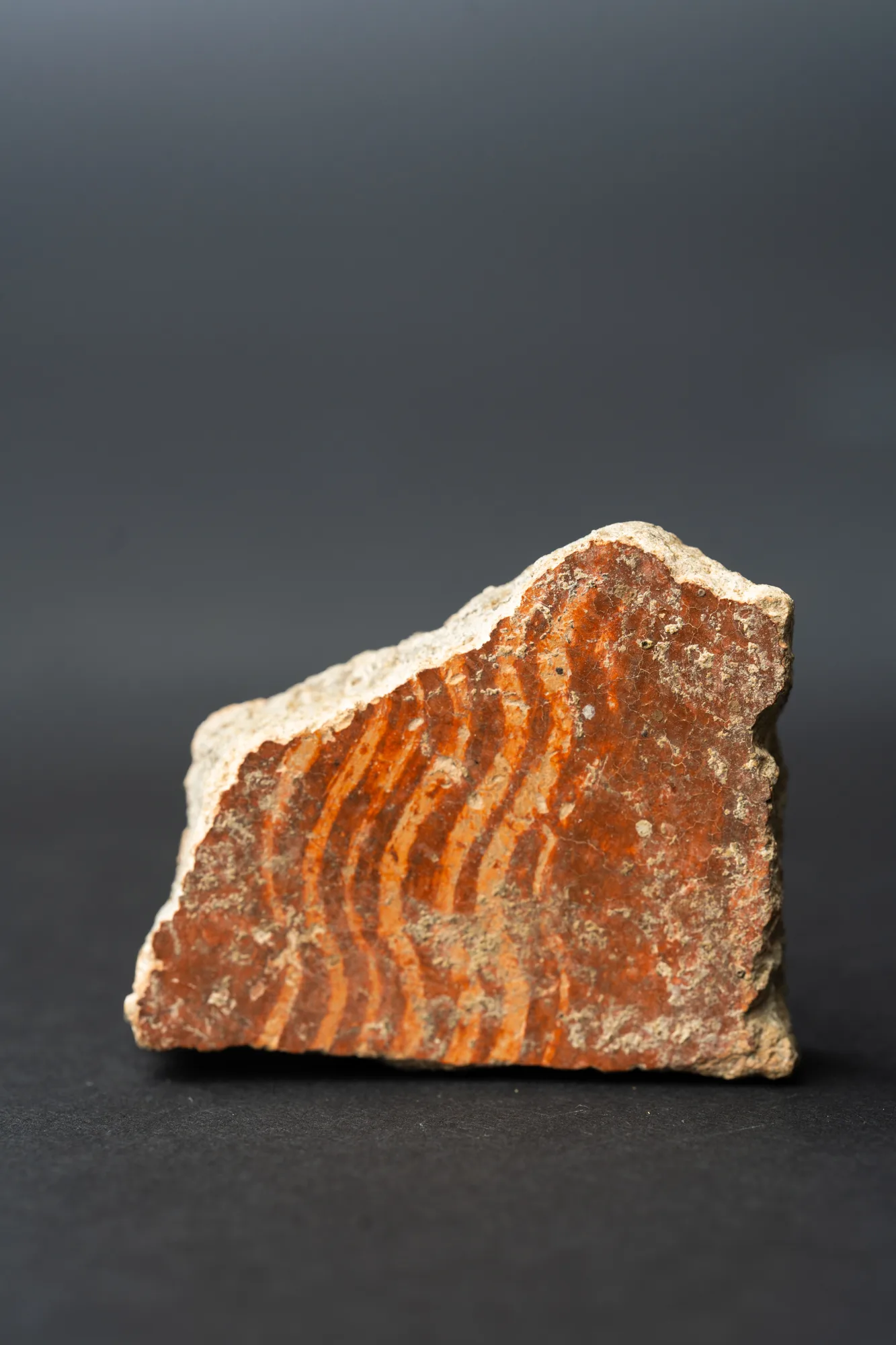 Combed Ware Bowl Fragment with Multiple Wavy BandsNeolithic · 4500–3900 BCDrakopoulos collection
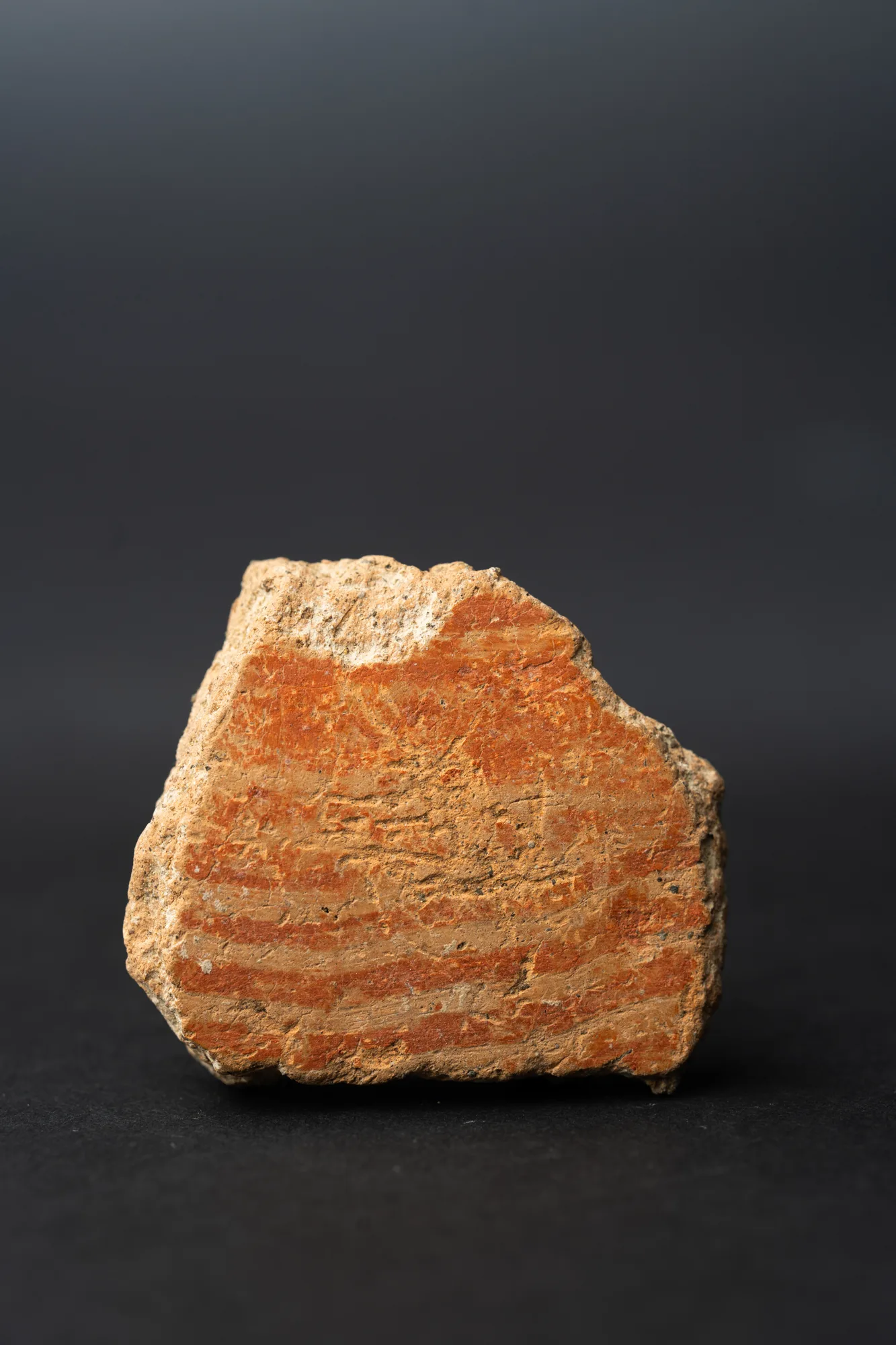 Combed Ware Bowl Fragment with Parallel BandsNeolithic · 4500–3900 BCDrakopoulos collection
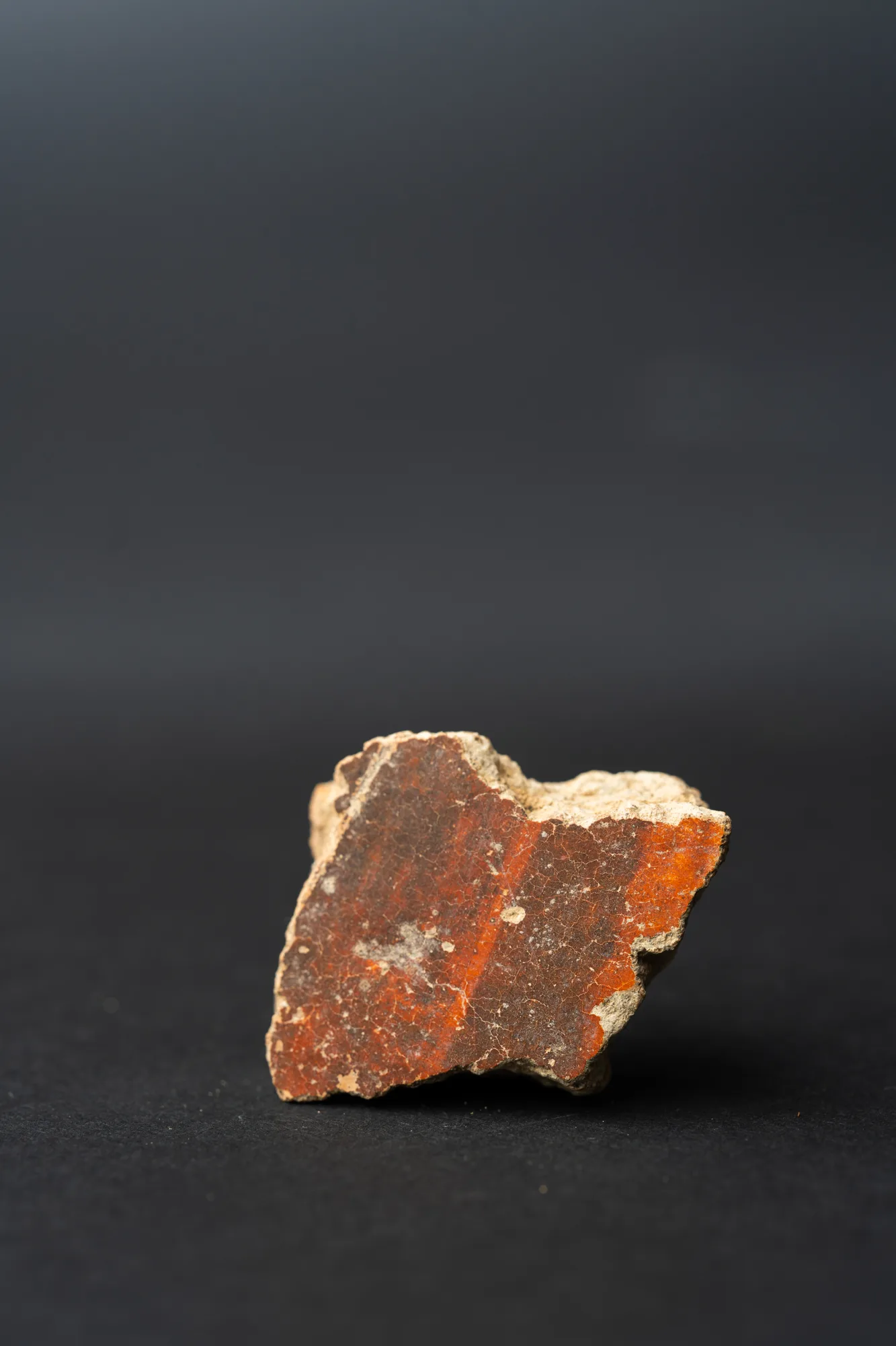 Red Lustrous Ware Body Sherd with Fire-Mottled SlipNeolithic · 4500–3900 BCDrakopoulos collection
A figurine from House 5
One stone figurine comes from the village. It is a flat limestone pebble 16.5 cm high, with a mushroom-shaped head and a deep groove separating the legs, and it was found in the north-east corner enclosure of House 5, on a Phase II floor in Dikaios's numbering. It is in the Cyprus Museum [4, p. 457]. Winkelmann sees "no indication of sex" [4, p. 457], while Christou includes it among images that may be deliberately ambiguous [10]. Peltenburg, comparing Sotira with Vrysi, noted that the figurines from both villages came from ordinary houses, and took this as a sign of household cults, with "no evidence for village shrines or a specialized, priestly caste" [6, p. 61]. See Neolithic and picrolite figurines.
Tools, fields and deer
Flint blades with sickle gloss, and the many querns, rubbers, pounders and mortars, show that the villagers harvested and ground cereals [6, p. 64]. Axes were made inside the settlement [6, p. 59]. The animal bones were studied twice, with conflicting results: one list includes large proportions of pig, deer and goat, and in a later list P. Ducos counted 76% deer, enough for him to suggest some form of semi-domestication. Peltenburg warns that we do not know whether either sample was representative [6, p. 64]. Spindle whorls and fine needles, usually linked with goats and sheep, are much rarer at Sotira than at Vrysi, and antler picks and handles are more common, so the people of Teppes may have depended more on deer [6, p. 64].
The Sotira culture
Peltenburg proposed the name "Sotira culture" in 1978 for the villages that share this way of building, burying and making pots, because Sotira "still gives us the fullest picture" of it [6, p. 61]. Dikaios had looked for its origin in the Beersheba culture of southern Palestine. Peltenburg found the architectural parallels weak and the pottery parallels weaker, and he argued for a local development [6, p. 71]. The Ceramic Neolithic shares strong common features across the island, together with regional and local differences in settlement, material culture and economy [5, p. 317].
Sotira-Kaminoudhia: the Early Bronze Age village
Houses and alleys
The Kaminoudhia houses are "accretive, mostly rectilinear stone-built domestic structures, communicating with one another by means of long, narrow alleyways". A unit usually has two or three rooms that open into one another, with rectangular hearths, low benches, stone mortars sunk in the floor, lime-plaster bins and "high monolithic thresholds, complete with pivot holes" [1, p. 5]. The excavators could detect no specialised quarters [1, p. 5]. Three areas were opened. Area A, at the north-east edge of the settlement, had buildings over 40 by 20 m, of which 375 m² were excavated. Area B lies 35 m to the west and Area C 50 m to the south [2, pp. 9–10]. Area A has two building phases; in Phase II large spaces were subdivided and benches added [2, p. 10].
Every wall was of stone: "No sun-dried mudbrick was used in wall construction" [2, p. 59]. Several long walls fell flat with their courses still in order, so their original height can be measured from the fallen stones. Wall WI in Area A stood at least 1.93 m high, and wall WH in Area B at least 3.04 m. Swiny concluded that some walls stood "to at least 2 m and probably closer to 3 m in height, without any use of mudbrick or pisé" [2, pp. 11, 56]. For houses and households of the period elsewhere, see Early Bronze Age village life.
Plan · c. 2300 to 2200 BC
A stone house at Sotira-Kaminoudhia
Sotira-Kaminoudhia, Area A
Choose a number on the plan, or a name below, to read what was found there and how well it is known.
Key
- Excavated
- Roofed floor
- Court or yard
- Fitting
- Area marked on the floor
- Neighbour
A Red Polished III bottle found in a wall niche in Area A shows that Early Cypriot III began some time before 2236 BC, the corrected median of the Phase II dates [1, p. 505].
A piece in the Drakopoulos collection of a kind found at this site. It does not come from the site.
Fields, flocks and games
The village grew cereals and pulses and had olive and perhaps vine. Large spouted stone troughs may have been used to make olive oil. The villagers kept sheep, goats and pigs and hunted fallow deer, and cattle appear at Kaminoudhia, "reintroduced for the first time since the earliest Aceramic Neolithic phase" [1, p. 7]. Querns, rubbers, pounders and chert sickle blades were found with Red Polished bowls, jugs, amphorae and a few storage jars, clay spindle whorls and loom weights [1, pp. 5, 7]. The 663 ground stone objects from the settlement are the largest such group published from an Early or Middle Bronze Age site in Cyprus [1, p. 221]. Copper-based objects are rare: two broken knives, an axe, chisels, awls, needles and ornaments, with picrolite pendants and beads [1, p. 7].
Gaming stones, slabs cut with rows of small hollows for a board game, turned up from the first season [1, p. 5]. Unit 10 held seven of them, a cattle skull whose facial bones had been cut away, perhaps so that it could be worn on the head, and sherds from as many as ninety-three small Red Polished bowls. Swiny suggests that feasting, "perhaps ritualistic", took place there [2, pp. 46–47].
The end of the village
Kaminoudhia was abandoned around 2200 BC and never reoccupied [2, pp. 53, 66]. Several rooms had burnt, with ash on their floors, and burnt flint was found in all three areas [2, pp. 53–54]. Swiny, with Rapp, argued for an earthquake followed by fire. Rapp calls the earthquake "possible" [7, p. 466], and Swiny himself attributes some fallen walls to the pressure of the slope after the houses were abandoned [2, p. 11]. Human remains lay in three rooms: an intact young woman in Unit 22 in Area C, and scattered bones in Units 6 and 16 that may belong to one person [2, p. 51]. The reviewers of the final report doubted a sudden catastrophe. Jennifer Webb noted that 80% of the 74 registered vessels are incomplete, "making the overall case for catastrophic abandonment difficult to sustain". She also pointed to burials inside the settlement at Marki, which cast doubt on reading the Unit 22 woman as the victim of an earthquake [11, p. 375]. Frankel read her as a burial in an abandoned ruin [12].
The Kaminoudhia cemeteries
The tombs lie in two groups, Cemetery A with 18 tombs and Cemetery B with three [12], on either side of a narrow valley about 100 m north-north-east of the village [13, p. 103]. Many had been looted, and "only seven out of twenty-one tombs were preserved with articulated skeletal remains and grave goods" [1, p. 7]. The dead were buried with pottery, spindle whorls, stone and shell ornaments and metal, including "a diagnostic Philia Phase knife and an unforged billet of another knife" and spiral earrings of copper and tin bronze [1, p. 7]. Tin bronze may have been chosen for earrings because of its gold colour [1, p. 379]. In Tomb 6 a pair of interlocked electrum spirals lay at the feet of the only skeleton [1, p. 378], which Swiny called "to date ... the earliest occurrence of gold on the island" [1, p. 7]. See metals beyond copper.
Four tombs, including Dikaios's Tomb 1, are of the Philia phase (see Red Polished Philia ware), and others contain pottery linked to the north-coast Early Cypriot I–II styles. The two kinds of tomb lie side by side, "with no intermingling of ceramic types". For Swiny this showed that James Stewart's view of the Philia culture, as a regional variant contemporary with Early Cypriot I–II on the north coast, is incorrect [1, p. 502]. No Philia-phase houses were found. Webb and Frankel both suggest that the earlier, Philia-phase village lies in parts of the site that have not been excavated [11, p. 374; 12]. For burial practice in this period, see Vounous and Early Bronze Age burial.
Finds from the fields around Sotira
A limestone figurine of 5th-millennium style was found in a ploughed field at Arkolies, near Sotira. Its exact findspot is unknown. It was published by Helena Wylde Swiny and Stuart Swiny in 1983 [14] and has been compared with the Teppes figurine and with a cruciform figure from Yialia [10, p. 28]. The Kaminoudhia survey recorded scatters of prehistoric stone tools and sherds in the fields around Teppes, the second largest about 300 m north-west of the hill [1, p. 469].
Where the finds are
The Teppes figurine is in the Cyprus Museum in Nicosia [4, p. 457]. Other finds from Dikaios's excavations went to the Cyprus Museum and to the Penn Museum in Philadelphia, and Combed Ware sherds from Teppes are held by the Medelhavsmuseet in Stockholm and the Ashmolean Museum in Oxford. The finds from Dikaios's Tomb 1 at Kaminoudhia remain largely unpublished [1, p. 3]. We know of no presentation for visitors at either site.
Our reconstruction
Our reconstruction of a Kaminoudhia house groups Units 40, 7 and 18 of Area A into one house, with Unit 6 next door, shown in the plan above. Swiny describes Units 7 and 40 as "a single architectural unit" [2, p. 23]. The walls are stone to their full height, after the fallen walls described above. No roof survives, so the flat roof of beams, reeds, brush and earth follows the village houses of the Sotira area recorded in the 20th century, as Swiny proposed [2, p. 57].
Reconstruction · Building · Early Cypriot III
A Stone House at Sotira-Kaminoudhia
c. 2300–2200 BC
An Early Bronze Age house of three rooms on a hillside above Sotira, built of tabular limestone to the roof and covered with a flat roof of beams, reeds, brush and earth.
Formats: Measured drawings · 3D model · Build sequence · Guided tour
In the Drakopoulos collection
Pieces in the Drakopoulos collection of kinds found at this site. None of them comes from the site.
- Combed Ware Bowl Fragment with Multiple Wavy BandsNeolithic · 4500–3900 BC
- Combed Ware Bowl Fragment with Parallel BandsNeolithic · 4500–3900 BC
- Red Lustrous Ware Body Sherd with Fire-Mottled SlipNeolithic · 4500–3900 BC
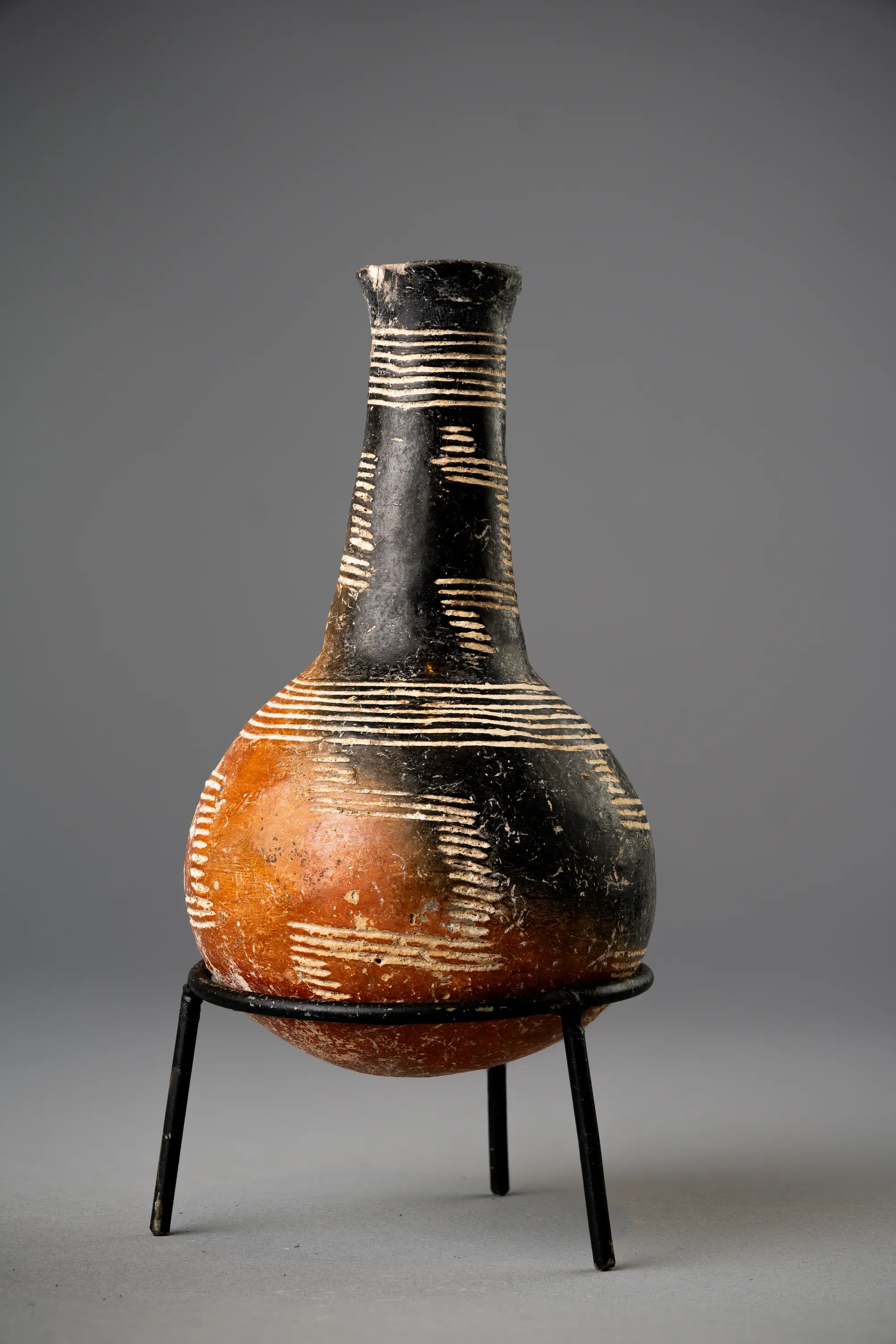 Red Polished Black-Topped Bottle with Stepped Incised BandsEarly Bronze Age II · 2300–2000 BC
Reconstructions
Nearby sites
- Kourion5.4 km
- Episkopi-Bamboula5.7 km
- Erimi6.0 km
- Alassa7.5 km
- Akrotiri-Aetokremnos19 km
- Ayios Tychonas-Klimonas24 km
Straight-line distances.
References
- 1.Swiny, S., Rapp, G., & Herscher, E. (Eds.). (2003). Sotira Kaminoudhia: An Early Bronze Age Site in Cyprus (CAARI Monograph Series 4; ASOR Archaeological Reports 8). Boston: American Schools of Oriental Research.
- 2.Swiny, S. (2003). The settlement, with an appendix on roof beams in Cypriot vernacular architecture. In S. Swiny, G. Rapp & E. Herscher (Eds.), Sotira Kaminoudhia: An Early Bronze Age Site in Cyprus (pp. 9–101). Boston: American Schools of Oriental Research.
- 3.Dikaios, P. (1961). Sotira (University Museum Monographs 23). Philadelphia: University Museum, University of Pennsylvania.
- 4.Winkelmann, C. (2020). The Neolithic and Chalcolithic Figurines of Cyprus (Marru). Münster: Zaphon.
- 5.Frankel, D. (2022). Constructing Sotira: Discard and deposition at a Neolithic village in Cyprus. In G. Vavouranakis & I. Voskos (Eds.), Metioessa: Studies in Honor of Eleni Mantzourani (AURA Supplement 10, pp. 317–324). Athens: National and Kapodistrian University of Athens. https://epub.lib.uoa.gr/index.php/aura/article/view/2393
- 6.Peltenburg, E. J. (1978). The Sotira Culture: Regional Diversity and Cultural Unity in Late Neolithic Cyprus. Levant, 10(1), 55–74. https://doi.org/10.1179/lev.1978.10.1.55
- 7.Rapp, G. (2003). Geologic and geomorphic setting and resources. In S. Swiny, G. Rapp & E. Herscher (Eds.), Sotira Kaminoudhia: An Early Bronze Age Site in Cyprus. Boston: American Schools of Oriental Research.
- 8.Stanley-Price, N. P. (1979). The Structure of Settlement at Sotira in Cyprus. Levant, 11, 46–81.
- 9.Manning, S. W., & Swiny, S. (1994). Sotira Kaminoudhia and the Chronology of the Early Bronze Age in Cyprus. Oxford Journal of Archaeology, 13(2), 149–172.
- 10.Christou, S. (2012). Sexually Ambiguous Imagery in Cyprus from the Neolithic to the Cypro-Archaic Period (BAR International Series 2329). Oxford: BAR Publishing. https://doi.org/10.30861/9781407309125
- 11.Webb, J. M. (2004). Review of S. Swiny, G. Rapp & E. Herscher (eds), Sotira Kaminoudhia: An Early Bronze Age Site in Cyprus. Journal of the American Oriental Society, 124(2), 374–375.
- 12.Frankel, D. (2004). Review of S. Swiny, G. Rapp and E. Herscher (eds), Sotira Kaminoudhia: An Early Bronze Age site in Cyprus. Bulletin of the American Schools of Oriental Research, 334, 82–83. https://www.jstor.org/stable/4150112
- 13.Swiny, S., & Herscher, E. (2003). The Cemetery. In S. Swiny, G. Rapp & E. Herscher (Eds.), Sotira Kaminoudhia: An Early Bronze Age Site in Cyprus (pp. 103–144). Boston: American Schools of Oriental Research. https://doi.org/10.5615/j.ctt2jc9wt.9
- 14.Swiny, H. W., & Swiny, S. (1983). An Anthropomorphic Figurine from the Sotira Area. Report of the Department of Antiquities, Cyprus, 56–59.