
Contents
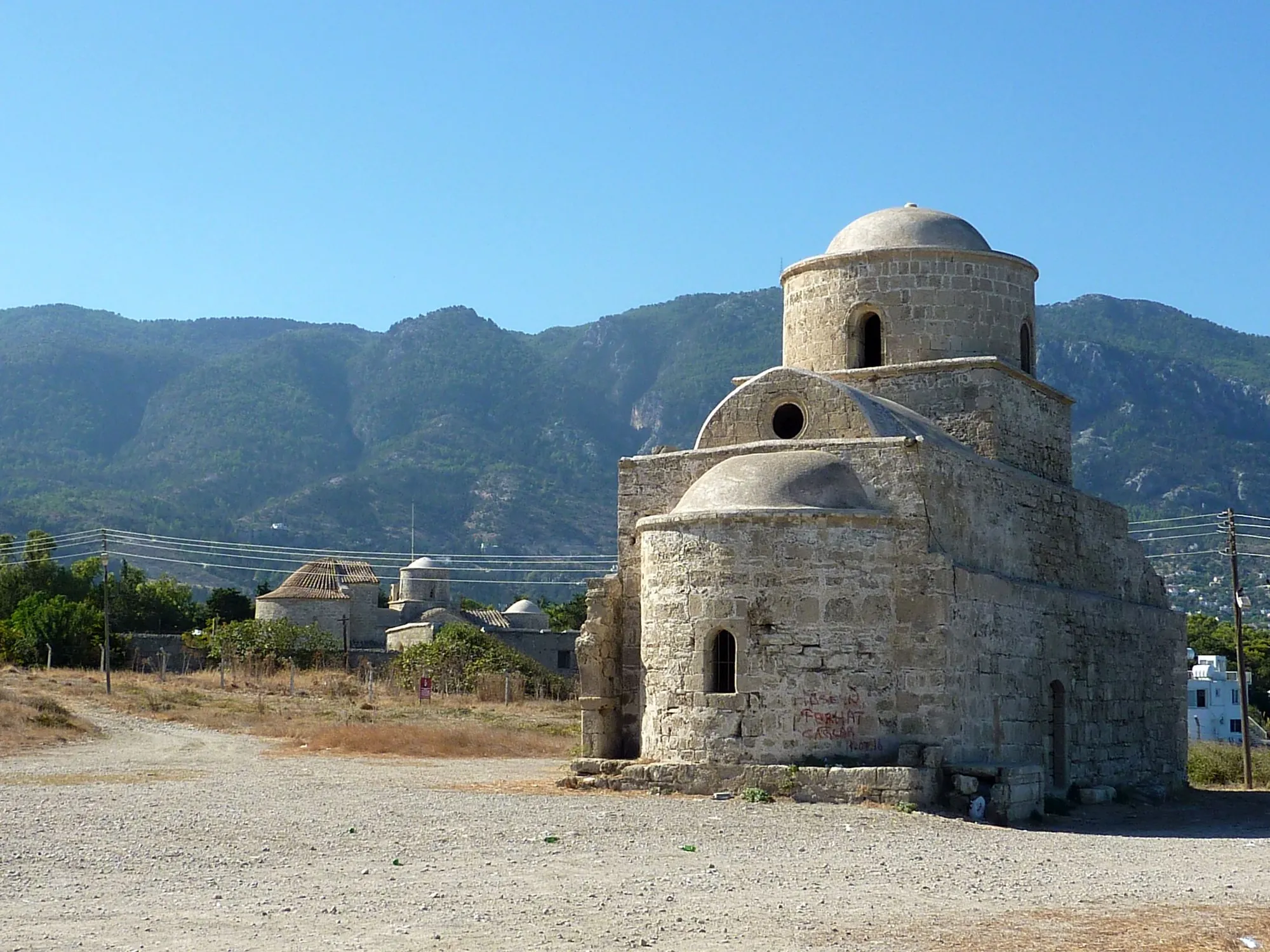
Lapithos is a village on the north coast of Cyprus, in Kyrenia District, about 14 km west of Kyrenia [1, p. 330]. Around it lie the remains of ancient Lapethos: a small Chalcolithic settlement, a large cemetery of the Early and Middle Bronze Age at Vrysi tou Barba, several cemeteries of the Cypro-Geometric period, and on the shore the town of Lambousa, which lasted into the 7th century AD. The Bronze Age tombs of Lapithos have produced about five times as much metal as those of Vounous, the other great cemetery of the north coast [2, pp. 132–133], and the Swedish Cyprus Expedition's Iron Age tombs here became the basis of the standard pottery sequence for the Cypro-Geometric period [3, p. 248]. In the Iron Age Lapethos was one of the kingdoms of Cyprus, with kings bearing both Phoenician and Greek names, until Ptolemy I abolished it in 312 BC [3, p. 243; 4, p. 440]. Almost everything we know comes from cemeteries: only one settlement has ever been excavated in the district [3, p. 252].
Where Lapithos lies
Lapithos sits on the north-western slopes of the Kyrenia range (Pentadaktylos), below Kyparissovouno, the highest peak of the range. Between the mountains and the sea runs a narrow, fertile alluvial plain up to 5 km wide [3, p. 244]. Passes cross the range at Panagra, about 9 km to the west, and at Agirdha, about 12 km to the east [3, p. 244]. One of the two most important springs of the Kyrenia range rises at Lapithos (the other is at Kythrea), fed by the Hilarion limestone, the largest water reservoir on the island [3, p. 244]. The modern village is built on terraces on the lower slopes above the coastal plain. It has no large natural harbour, but its shore is sheltered from the prevailing north-east winds [1, p. 330].
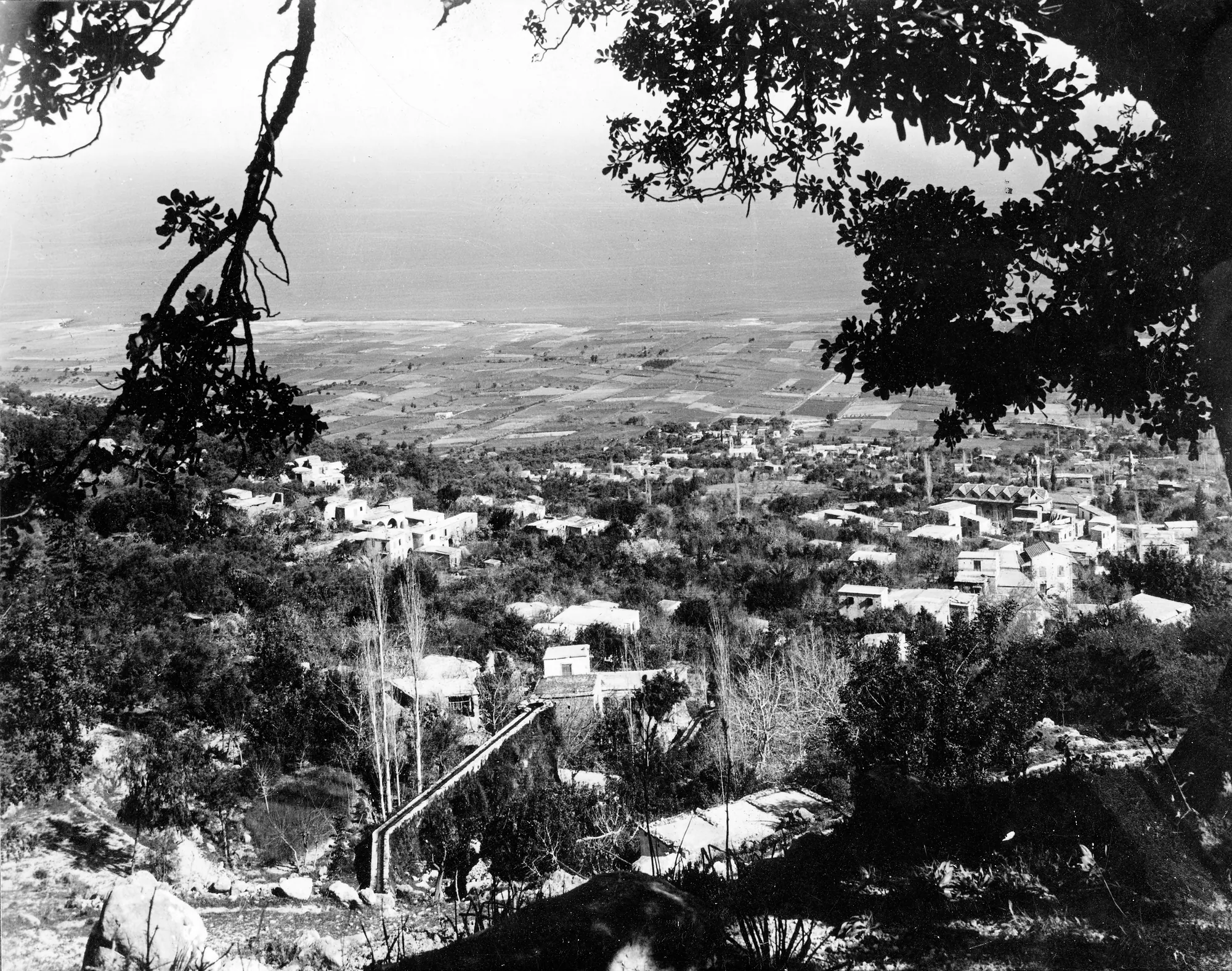
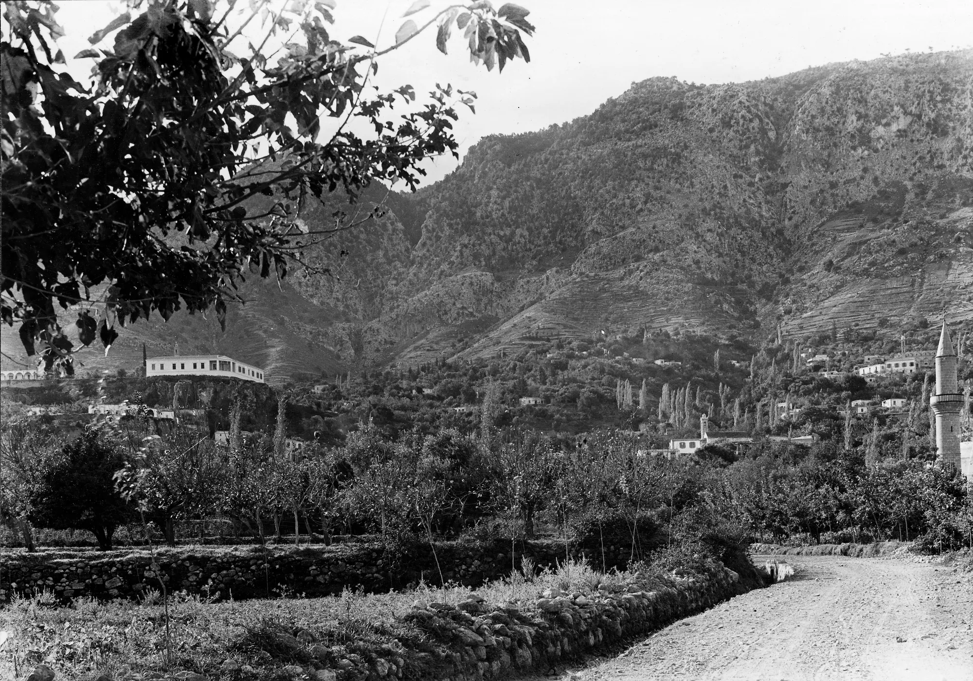
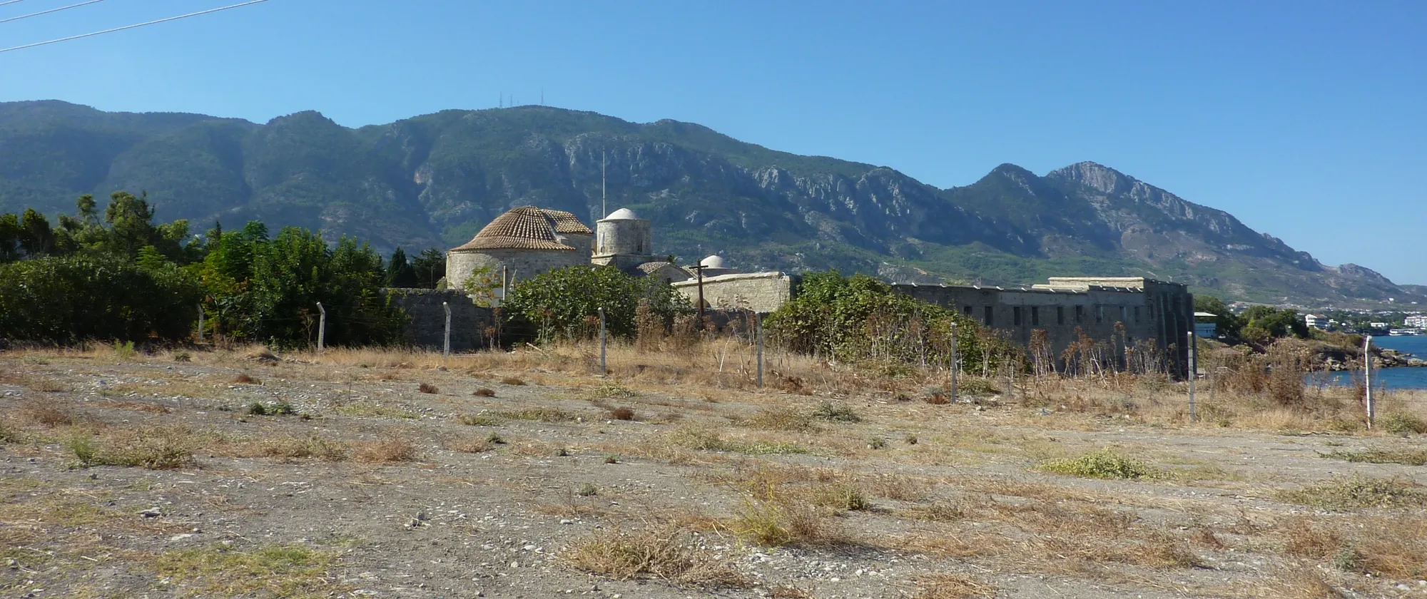
The archaeology is spread over many named localities. Vrysi tou Barba ("the spring of the old man") is the Bronze Age cemetery on the low, flat, rocky ground near the sea [5, p. 39], less than 2 km north of the Ayia Anastasia plateau in the centre of the village [3, p. 251]. Kylistra lies about 300 m south-west of Ayia Anastasia [3, p. 251], and Kastros is the plateau of the old boys' school in the village centre, about 25 m below Ayia Anastasia [3, p. 252]. Plakes, or Alonia ton Plakon, held the Chalcolithic settlement and a few later tombs; Airkotissa lies on the coast, Kato Kastros in the village centre, and Prostemenos to the south-east [3, pp. 248–249]. The ancient coastal town of Lambousa lies on the shore near Karavas, the next village to the east.
Herscher described Lapithos as a typical Cypriot pattern of sites that move from place to place within one district, all drawing on the same water. A Chalcolithic settlement was followed, after a gap, by the Bronze Age cemetery by the coast; after another gap, Late Bronze Age tombs were cut higher up the slope, and then new cemeteries were opened in the Cypro-Geometric period [1, p. 330].
Exploration and excavation
Max Ohnefalsch-Richter published finds from Lapithos in the 1890s, among them a tomb group with what he called "late Mykenaean vases" [3, pp. 247, 250]. The first organised excavation came in 1913, when John L. Myres and Menelaos Markides, with L. H. Dudley Buxton, dug for the Cyprus Museum Committee. They explored Classical remains at Lambousa and opened tombs at Vrysi tou Barba, which Myres published only in a preliminary report [3, p. 247; 6]. Markides went on digging for the Cyprus Museum until 1917, at Vrysi tou Barba and in three tombs on the Ayia Anastasia plateau [3, pp. 247, 249]. The number of tombs from these campaigns differs between accounts. Jennifer Webb counts 59 tombs dug in 1913 and 18 dug by Markides in 1917 [2, pp. 132–133]; Stella Diakou gives about seventy-five for the two together [3, p. 247].
In 1927 the Swedish Cyprus Expedition excavated at Lapithos. Erik Sjöqvist excavated the cemeteries, and the expedition published them in full in its first volume in 1934 [7; 3, p. 248]. Einar Gjerstad later used the Iron Age tombs to build his typology of Cypro-Geometric pottery [3, p. 248; 8].
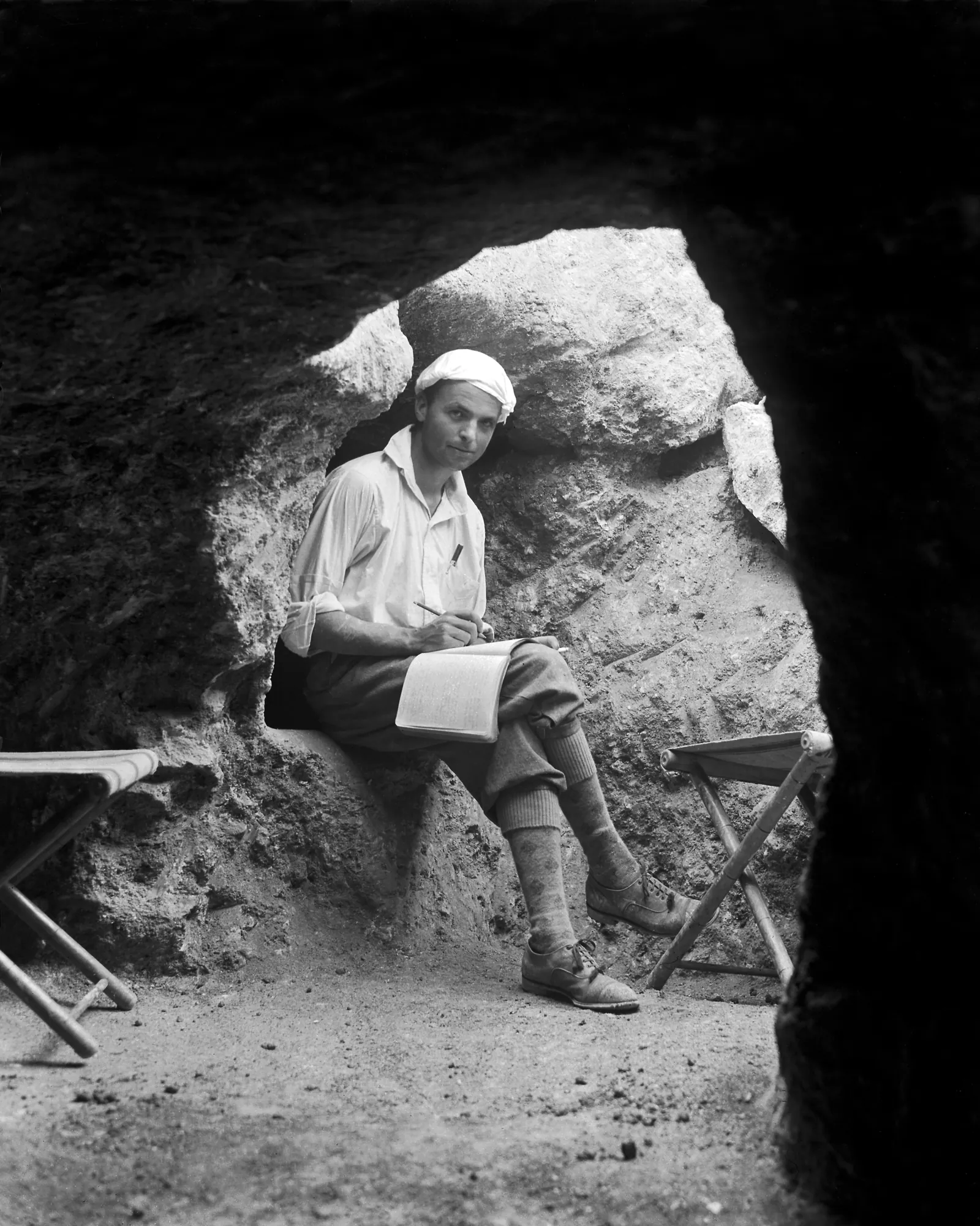
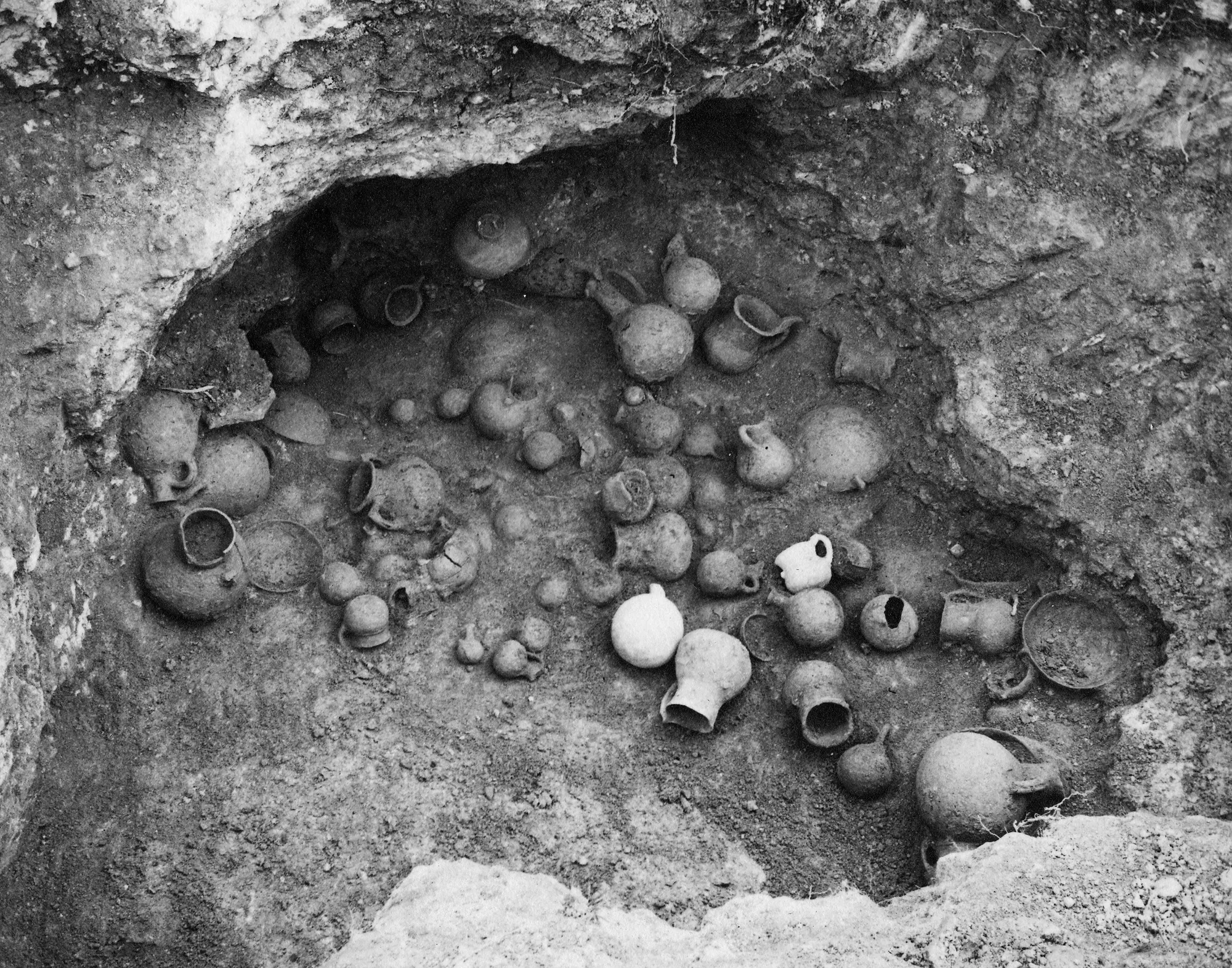
The University of Pennsylvania Museum sent an expedition under Bert Hodge Hill in September 1931; within four months it had excavated sixty-five tombs of the Bronze and Iron Ages [3, p. 248]. Its staff included Lucy Talcott, Virginia Grace and the architect Dorothy Cox [5, p. 39]. Most of its results stayed unpublished for decades [3, p. 248]. Ellen Herscher studied its Bronze Age tombs [5; 9], Grace published one tomb with a Minoan import [10], and Diakou has published its Upper Geometric cemetery [11].
After the Second World War Hector Catling's Cyprus Survey recorded many possible settlement and burial sites in the district, from the Neolithic to the Hellenistic period, most of them unpublished [3, p. 241]. The Department of Antiquities excavated another 25 tombs at Vrysi tou Barba in 1954 and 1968 to 1969, "almost all of which are said to have produced spearheads and knives" [2, p. 133], and Cypro-Geometric tombs in the 1950s and in 1973 [3, pp. 249–250].
| Years | Excavators | Localities and finds |
|---|---|---|
| 1913 | Myres, Markides and Buxton, Cyprus Museum Committee | Vrysi tou Barba, Bronze Age tombs; Lambousa, Classical remains |
| 1914–1917 | Markides, Cyprus Museum | Ayia Anastasia, Tombs 501–503; Vrysi tou Barba, Bronze Age tombs (1917) |
| 1927–1928 | Swedish Cyprus Expedition (Sjöqvist) | Vrysi tou Barba, 23 tombs; Kylistra, 2 tombs; Kastros, 28 Cypro-Geometric tombs; Plakes, 3 tombs and the Chalcolithic settlement |
| 1931–1932 | University of Pennsylvania Museum (Hill) | Vrysi tou Barba, Tombs 801–838; Airkotissa, Tombs 451–470; Kato Kastros, Tombs 471–486; Prostemenos, a Classical sanctuary |
| 1950s | Cyprus Survey (Catling) | Possible settlements and cemeteries across the district |
| 1954–1973 | Department of Antiquities | Vrysi tou Barba, 25 tombs; Vathyrkakas and other Cypro-Geometric tombs |
The table follows Diakou's list of the campaigns [3, pp. 247–250]. Since 1974 Lapithos has been in the part of the island outside the control of the Republic of Cyprus, where no legal archaeological work can be carried out under international conventions [3, p. 241]. No map relating the cemeteries to one another was ever published, and the finds of the different expeditions were scattered between museums and never studied as whole assemblages [3, p. 243]. Diakou relocated the cemeteries from the excavators' archives, early cadastral maps and aerial photographs [3, p. 250]. In 2019 she noted that of the 136 tombs excavated (Keswani's count), only half had been studied and about a fifth properly published [3, p. 251]. Webb's volumes on the tombs of 1913 and 1917 have since begun to close that gap [12; 13; 14].
Phases
Phases
- Chalcolithic settlementabout 3400–2900 BC
Huts, a hearth and pits at Alonia ton Plakon, rebuilt over four periods.
- Gap
No settlement or tomb is known from the following centuries.
- Early and Middle Bronze Age cemeteryabout 2300–1650 BC
Chamber tombs at Vrysi tou Barba, from Early Cypriot II to the end of the Middle Cypriot period.
- Late Bronze Ageabout 1650–1050 BC
A few tombs higher up the slope, at Kylistra and Ayia Anastasia.
- Cypro-Geometric cemeteriesabout 1050–750 BC
Kastros, Kato Kastros, Plakes and Airkotissa.
- Kingdom of Lapethoslate 6th century to 312 BC
Coins with Phoenician legends; kings with Phoenician and Greek names.
- Hellenistic and Roman Lapethos312 BC to the 7th century AD
Phoenician inscriptions to 274 BC; the town of Lambousa on the shore.
The dates follow Webb for the Bronze Age, with Early Cypriot I and II at about 2300/2250 to 2150/2100 BC and Early Cypriot III and the Middle Cypriot period at about 2150/2100 to 1700/1650 BC [2, pp. 129, 131]. Diakou puts the Bronze Age tombs at about 2250 to 1750/1700 BC and the Cypro-Geometric tombs at about 1050 to 750 BC [3, p. 241].
The Chalcolithic settlement at Alonia ton Plakon
The only settlement excavated at Lapithos lies at Plakes, also called Alonia ton Plakon. The Swedish expedition dug it in 1927 and published it as Neolithic [3, p. 252; 7, pp. 13–33]. It is now placed in the Middle Chalcolithic, about 3400 to 2900 BC, alongside Ayios Epiktitos-Mezarlik and the second period at Lemba [15], and Herscher called it "the Chalcolithic settlement at the locality Alonia ton Plakon" [1, p. 330]. See the Chalcolithic period.
The excavators found an eastern and a western settlement and four layers of occupation. The huts stood on foundations of a single course of rubble, too fragmentary to give their plans, with floors of trodden earth. In the eastern settlement a circular hearth cut into the rock, 1.60 m across, was lined with burnt stones set in sea sand, and three rock-cut pits nearby were filled with what had been swept out of it. Gjerstad thought the pits held sacred refuse, buried to keep it from being profaned. Floods later washed away much of the site, and Cypro-Geometric tombs were cut through it [7, pp. 13–33].
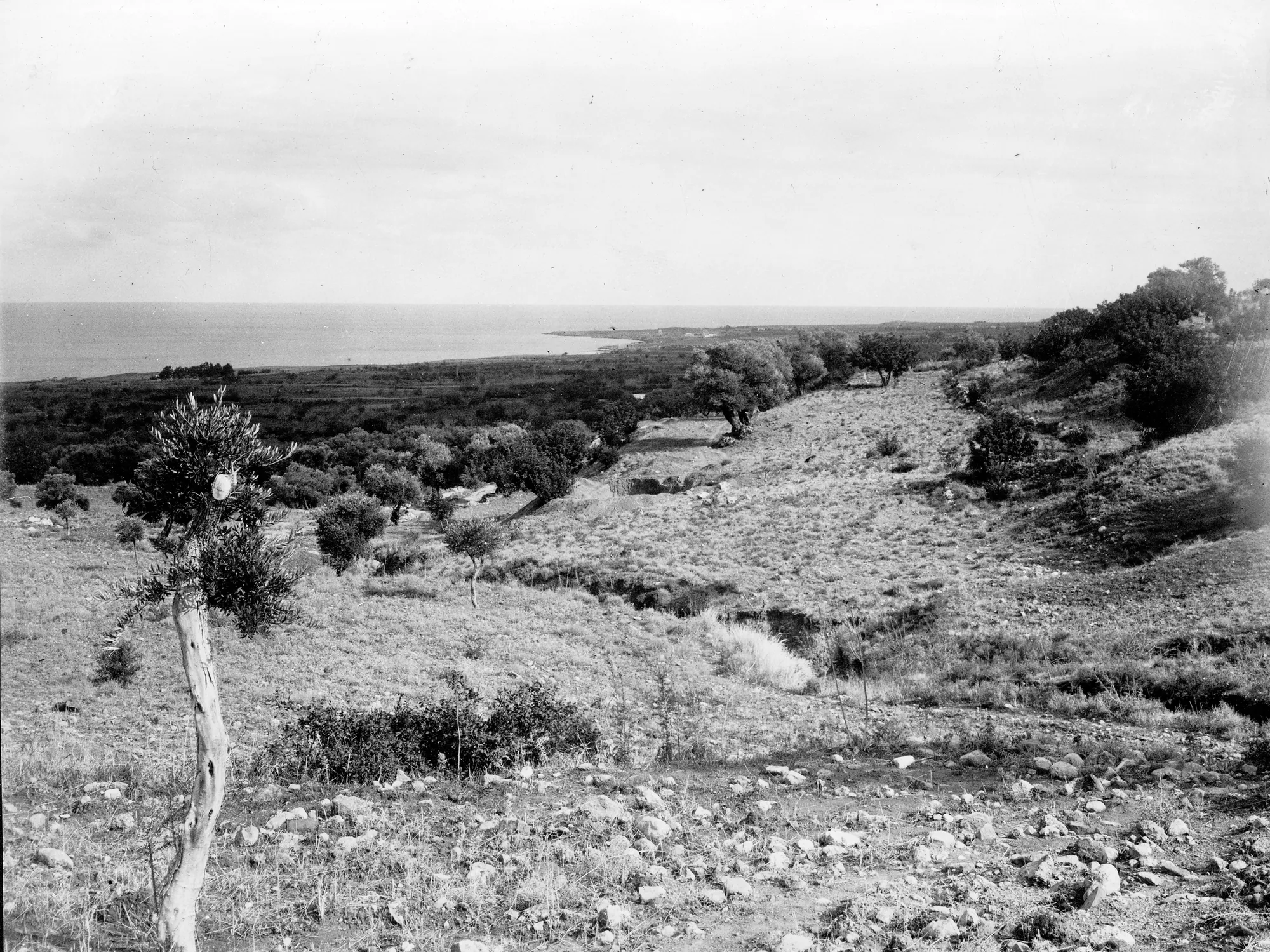
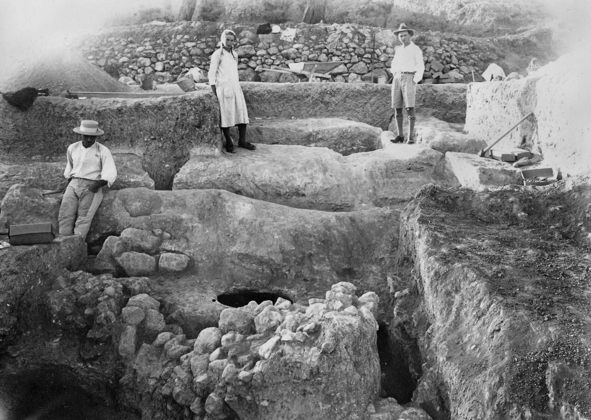
The Bronze Age cemetery at Vrysi tou Barba
Tombs and burials
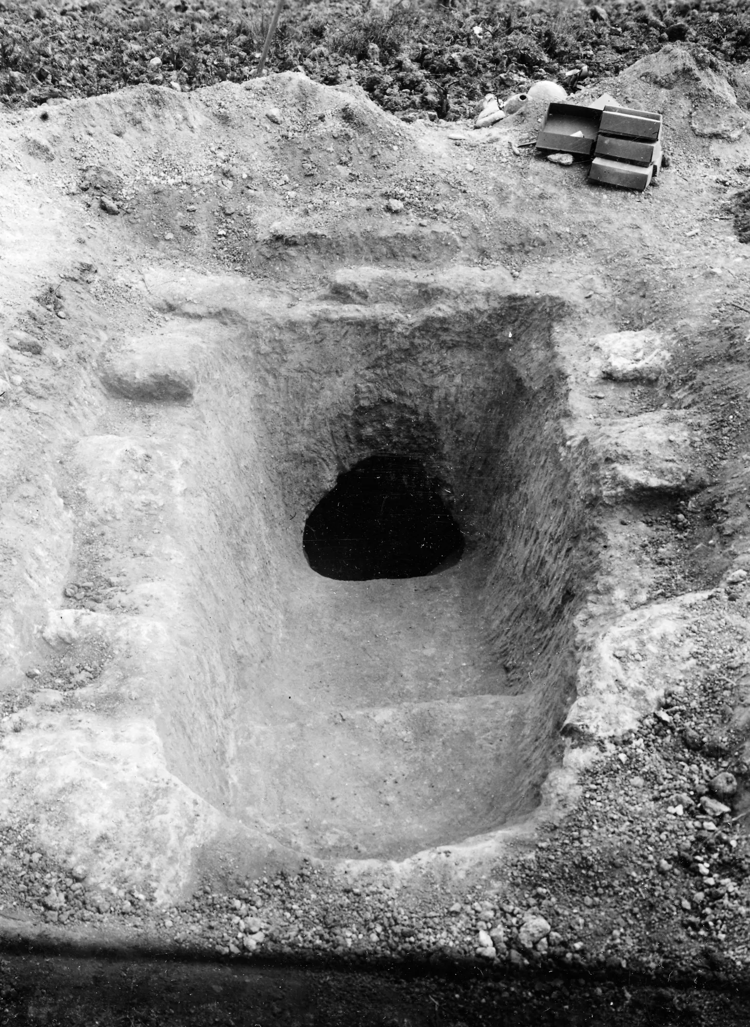
The cemetery lies on low, flat, rocky ground close to the sea, an unusual position for Cypriot tombs of the period. The tombs are close together, and a chamber sometimes cuts into an earlier one. As at Vounous, most are laid out north to south with the main chamber door facing north. Each has a bathtub-shaped entrance shaft, the dromos, opening into one to four chambers. Some chambers are divided by a pier left in the rock, and raised burial niches are common [5, pp. 39–40]. Many dromoi have tiny chambers cut into their walls. The latest Penn tomb had eighteen, "sealed in the same manner as the large chambers and containing miniature pots, tiny rings, and other gifts suitable for infants" [5, p. 40]. For the type see Bronze Age chamber tombs.
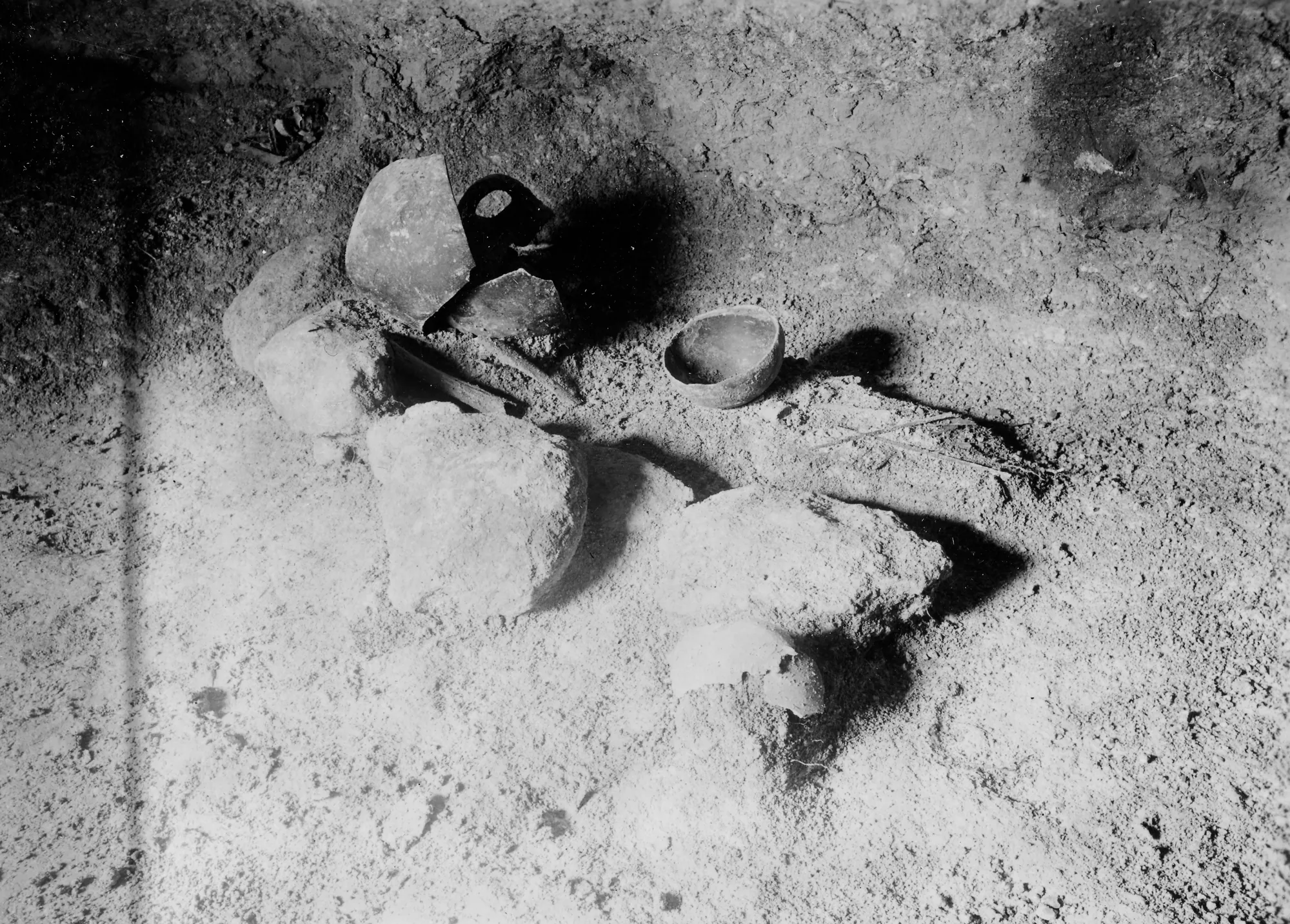
The Penn expedition dug three areas about 500 m apart. The earliest tombs lay to the west and the latest to the east, "although no rigid ordering can be detected". In the western area the rock surface was covered by a grid of shallow rectangular cuttings, about 1 by 0.5 m, older than the tombs [5, p. 40]. Herscher took them for agricultural features; Priscilla Keswani suggests they may have been graves emptied when their dead were moved into the chamber tombs [16, p. 60].
The Penn tombs run from Early Cypriot II to the end of Middle Cypriot III. The early ones held plain Red Polished pottery, large jugs and bowls with lugs. Bronzes become common only from Early Cypriot IIIB. The latest tomb, 804, farthest from the sea, held Black Slip and White Painted wares, and its 74 bronzes were a quarter of all the bronzes found that season [5, p. 40]. The cemetery went out of use at the end of the Middle Bronze Age [3, p. 251].
Some tombs held many burials laid out together. Swedish Tomb 313 had an estimated 26 burials, 15 of them in chamber A, "very carefully arranged in the niches and in a circle upon the floor of the chamber", with 134 copper-based objects in the tomb [16, p. 60]. Keswani reads chamber A as the result of one or two great ceremonies in which several bodies were exhumed and reburied together. Chamber A of Swedish Tomb 322 is the largest chamber found at Lapithos, well over 20 m² in floor area. It held only scraps of human bone, while the tomb as a whole produced 82 copper-based objects, gold and silver ornaments, cult vessels, figurines and the bones of cattle and equids [16, p. 60]. Gjerstad wrote that "splendid funeral ceremonies must, surely, have taken place in connection with many of the burials" [16, p. 60]. Webb has since studied Tomb 322 and the burials with weapons in detail [17; 18].
Copper, silver and weapons
Lapithos rose as Vounous declined. Webb sees the leading centre of the north coast shifting from Vounous, about 20 km to the east and paramount in Early Cypriot I and II, west to Lapithos in Early Cypriot III and Middle Cypriot I [2, p. 131]. "Lapithos was located close to a protected bay and better placed than Vounoi (Vounous) to take advantage of a resurgence of seaborne trade" [2, p. 132]. Metal objects were placed in 74 per cent of the chambers of Early Cypriot III and Middle Cypriot I, and in 96 per cent of those of the Middle Cypriot period [2, p. 132].
The quantities are large. In Webb's count, 122 Early and Middle Cypriot tombs at Lapithos have produced over 1,740 metal objects, "almost five times the number" from 164 excavated tombs at Vounous, which gave 367. The 59 tombs of 1913 alone held over 980 copper-based objects and 34 of silver, silver-lead and gold, far more than earlier studies had recorded [2, pp. 132–133]. Every type of metal object is more common at Lapithos than at Vounous. Some, such as exotic pins, "hair pins", a socketed hook and a spindle, are found only at Lapithos, and there are imported knives, tweezers, pins, small silver vessels and silver and gold ornaments [2, p. 133]. In some tombs metal was stored in caches. Webb argues that "metal artefacts were no longer viewed as the inalienable possessions of particular ancestors but as a source of real or symbolic capital to be curated, managed and accumulated", and calls Lapithos "at present ... the only site on the island with an excess or redundancy of metal" [2, p. 133].
Spearheads are the clearest sign of this wealth. Vounous and Lapithos together account for 81.6 per cent of the spearheads from Early and Middle Cypriot tombs on the island, and Lapithos has almost four times as many as Vounous. Most are working weapons, and Webb thinks the shift of power from Vounous to Lapithos "involved intense competition and probably the use of force"; Keswani reads the spearheads as items of ceremonial display [2, p. 133]. See Bronze Age weapons.
There is no copper ore on the north coast. Webb links the metal of Lapithos to new villages near the ore bodies of the north-west, among them Ambelikou-Aletri, a mining and metalworking village "with close ties to Lapithos", from which ingots could have travelled round Cape Kormakiti by sea or overland by the Panagra pass. Pottery from Dhenia found at Lapithos and nearby villages points to an alliance with the centre of the island [2, p. 132]. See copper metallurgy.
Map of Cyprus
- Ground above 200, 500, 1,000 m
Sites on this map
- 1Vasilia-Kafkallia (approx.)
- 2Lapithos
- 3Karmi-Palealona (approx.)
- 4Bellapais Vounous
- 5Ambelikou-Aletri
- 6Dhenia
Figurines and imports
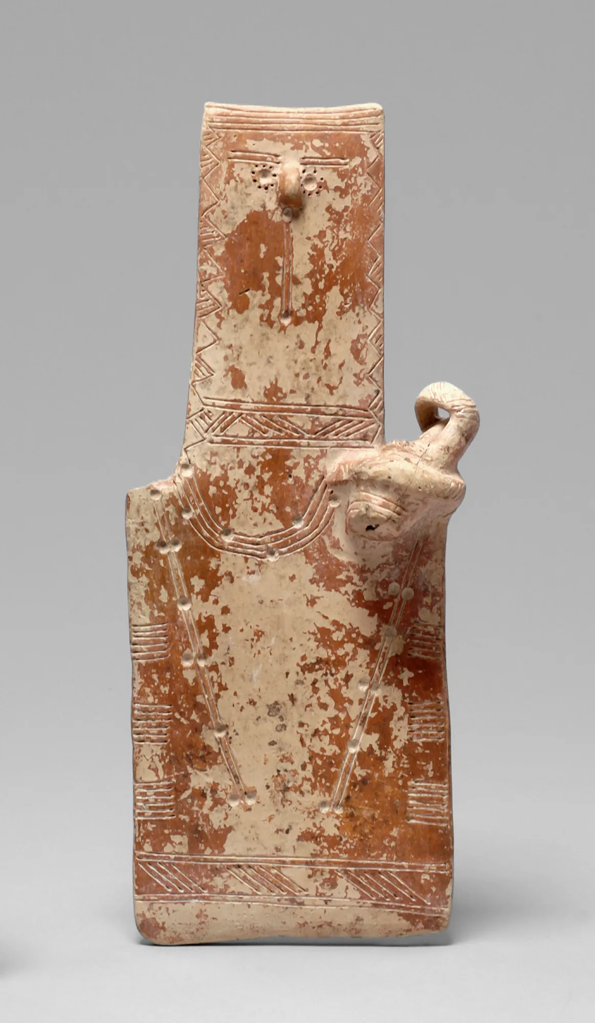
The tombs held figurines of the flat, rectangular kind called plank figures, among them two-headed examples and the figure of a woman holding an infant in a cradle from Swedish Tomb 313. Gjerstad's "marble idol" came from chamber D of Tomb 322, with a "fetish stone" [16, p. 60]. A Middle Minoan jar from Penn Tomb 806A, published by Grace, is in Herscher's words "the earliest import to Cyprus from the Aegean" [10; 1, p. 330]. See the Minoans.
After the Middle Bronze Age
The number of known sites falls sharply in the Late Bronze Age, at Lapithos and across the north coast. After the last burials at Vrysi tou Barba, the only tombs of the period are a few at Kylistra and on the Ayia Anastasia plateau. The decline may reflect what survey can see, but Diakou thinks it more likely that fewer people lived here, or that they had moved to another centre [3, p. 251].
Two vessels in Vienna, a ship-shaped vase and a bird-shaped vase of about 1125 to 1050 BC, were bought from Ohnefalsch-Richter in 1884 as coming from Lapithos. Their findspot rests on his word.
 Form of a shipLate Bronze Age III · 1125–1050 BCVienna Museum
 Form of a birdLate Bronze Age III · 1125–1050 BCVienna Museum
The Cypro-Geometric cemeteries
In the 11th century BC new cemeteries were opened at Lapithos, as at many places in Cyprus. The Cypro-Geometric period is the only horizon with firm evidence here between the Middle Bronze Age and the Cypro-Archaic period, "when the excavation record again becomes mute" [3, pp. 251–252]. The Swedish expedition dug 28 tombs at Kastros and three at Plakes. The Penn expedition dug a "Lower Geometric" cemetery on the coast at Airkotissa and an "Upper Geometric" one at Kato Kastros, and the Department of Antiquities opened four tombs at Vathyrkakas in Karavas [3, pp. 248–249]. Penn Tomb 474 at Kato Kastros was the richest Cypro-Geometric tomb, and the only Penn tomb given to the Cyprus Museum under the antiquities law of 1905 [3, p. 248].
Gjerstad's sequence of Cypro-Geometric pottery, including the White Painted ware of the period, rests largely on these tombs [3, p. 248; 8]. They also date the arrival of Black-on-Red ware: Kastros Tomb 428 comes just before it, while Tombs 401 to 403 already contain early Black-on-Red [19, p. 28].
Several Kastros tombs, 412, 417, 420 and 422, and one other Lapithos tomb held one to three bodies in the dromos, outside the sealed chamber and usually without offerings. They have been read as retainer burials, people who were killed to go with the dead. Louise Steel notes that such burials appear in other societies at the stage when an elite was first forming, as a display of its wealth and power [20, p. 24].
The kingdom of Lapethos
The Iron Age kingdom is known mainly from its coins, from the end of the 6th century BC, and from Diodorus, who records its end [3, p. 243]. Lapethos is not among the kingdoms named on the prism of the Assyrian king Esarhaddon of 673/2 BC [21], and the site of its city has not been located with certainty [22]. Greek tradition made it a foundation of Laconians from Therapne under Praxandros (Strabo 14.6.3), while the geographer known as Pseudo-Skylax called it Phoenician [4, p. 441].
Its kings wrote their names on their coins in the Phoenician alphabet, whether the names were Phoenician, such as Sidqmelek and Ba'alzakor, or Greek, such as Androkles and Demonikos [22]. A Phoenician inscription of the later 4th century BC names a king Berekshemesh and, before him, a Greek king whose name ends in "-ippos", son of Demonikos [4, p. 440]. The last king, Praxippos, was arrested in 312 BC on the orders of Ptolemy I, who abolished the Cypriot kingdoms (Diodorus 19.79.4) [4, p. 440; 22]. See the Phoenicians and coins.
Little of the city's religious life has been excavated. The Penn expedition uncovered the scant remains of a Classical sanctuary at Prostemenos in 1931 and 1932, still unpublished [3, p. 248]. A spear-butt of the 5th century BC dedicated to the goddess Anat came from "the sanctuary of Athena in Lapethos" [23, p. 14]. Seven terracotta figures of the 6th and early 5th centuries BC, votaries, a lyre-player and a figure holding a dove, reached the British Museum in 1900 as from near Lapithos, a gift of William Haynes Smith, the High Commissioner. The sanctuary they came from is not known.
 Terracotta Lyre Player FigurineArchaic II · 600–500 BCBritish Museum
 Terracotta Votive Female FigurineArchaic II · 600–550 BCBritish Museum
 Terracotta Votary FigureArchaic II · 500–475 BCBritish Museum
 Terracotta Bird Votary FigureArchaic II · 600–500 BCBritish Museum
Hellenistic and Roman Lapethos
Phoenician remained in official use at Lapethos after the end of the kingdom. An altar from Larnakas tis Lapithou, south of the range, is dedicated in Greek to Athena Soteira Nike and King Ptolemy and in Phoenician to Anat; it probably dates from the early 3rd century BC [23, pp. 14–15]. In 274 BC a "chief of the land", Yatonbaal son of Gerashtart, recorded with six generations of his ancestors that he had built a temple for Melqart in the reign of Ptolemy. It is probably the last official inscription in Phoenician from Cyprus [23, p. 15].
In the Roman period Lapethos had a gymnasium. On the birthday of Tiberius, 16 November AD 29, when Lucius Axius Naso was proconsul, a hereditary priest named Adrastos son of Adrastos consecrated a temple and a statue of the emperor that he had built in the gymnasium at his own cost. The Greek inscription was found near the Acheiropoietos monastery, and a later Adrastos, son of Adrastos, probably of the same family, set up a statue of Trajan [24, pp. 120, 179–180]. A study of the city wall of Lambousa describes the tombs and other features cut into it [25], and rock-cut fish tanks survive on the shore [26].
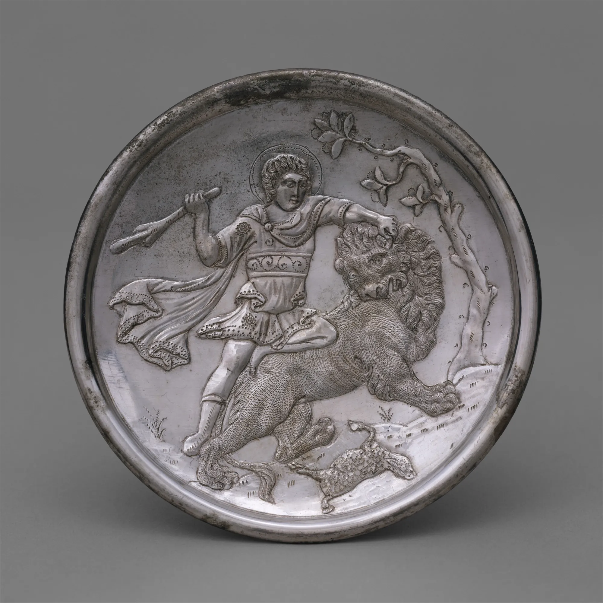
Two hoards of Byzantine silver were found in the ruins of Lambousa by men from Karavas quarrying for stone, the first in the 1890s and the second, with the David plates, in 1902 [27; 28]. The modern village of Lapithos is said to have been founded in AD 654 by people from Lambousa seeking safety from Arab raids [1, p. 330].
Where the finds are
The finds of 1913 to 1917 and of the Department's excavations are in the Cyprus Museum in Nicosia. The Swedish finds were divided between the Cyprus Museum and the Medelhavsmuseet in Stockholm, and the Penn finds between the Cyprus Museum and the Penn Museum in Philadelphia [5, p. 41; 3, p. 243]. The Lambousa silver is in the British Museum, the Metropolitan Museum of Art and the Cyprus Museum [27; 28].
Lapithos today
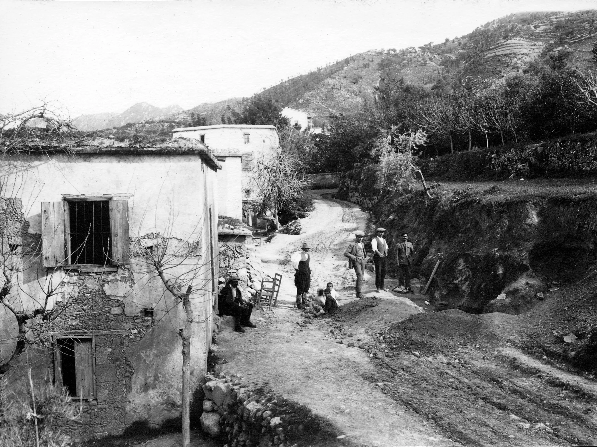
Lapithos (Turkish Lapta) lies in Kyrenia District in the north of the island, outside the control of the Republic of Cyprus since 1974. No excavation has taken place there since then [3, p. 241]. We know of no marked visitor site at any of the ancient localities. Their finds can be seen in the Cyprus Museum, the Medelhavsmuseet, the Penn Museum and the Metropolitan Museum of Art.
Finds from Lapithos
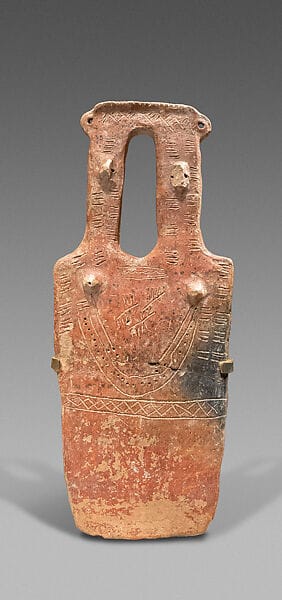 Terracotta two-headed, plank-shaped figurineMiddle Bronze Age I · 2000–1900 BCMetropolitan Museum of Art
- Form of a shipLate Bronze Age III · 1125–1050 BCVienna Museum
- Form of a birdLate Bronze Age III · 1125–1050 BCVienna Museum
 Votary Terracotta FigureArchaic II · 600–550 BCBritish Museum
- Terracotta Lyre Player FigurineArchaic II · 600–500 BCBritish Museum
 Terracotta Female FigureArchaic II · 600–500 BCBritish Museum
- Terracotta Bird Votary FigureArchaic II · 600–500 BCBritish Museum
- Terracotta Votive Female FigurineArchaic II · 600–550 BCBritish Museum
 Yon Workshop FigurineArchaic II · 600–500 BCBritish Museum
- Terracotta Votary FigureArchaic II · 500–475 BCBritish Museum
 Limestone head of a female votaryArchaic II · 500–490 BCMetropolitan Museum of Art
In the Drakopoulos collection
Pieces in the Drakopoulos collection of kinds found at this site. None of them comes from the site.
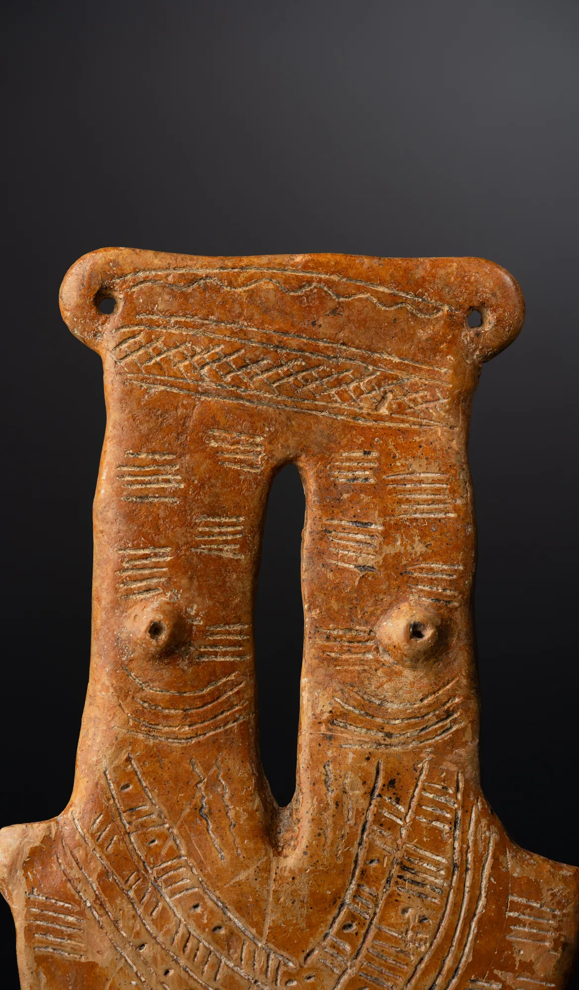 Red Polished Two-Necked Plank FigureMiddle Bronze Age I · 2000–1850 BC
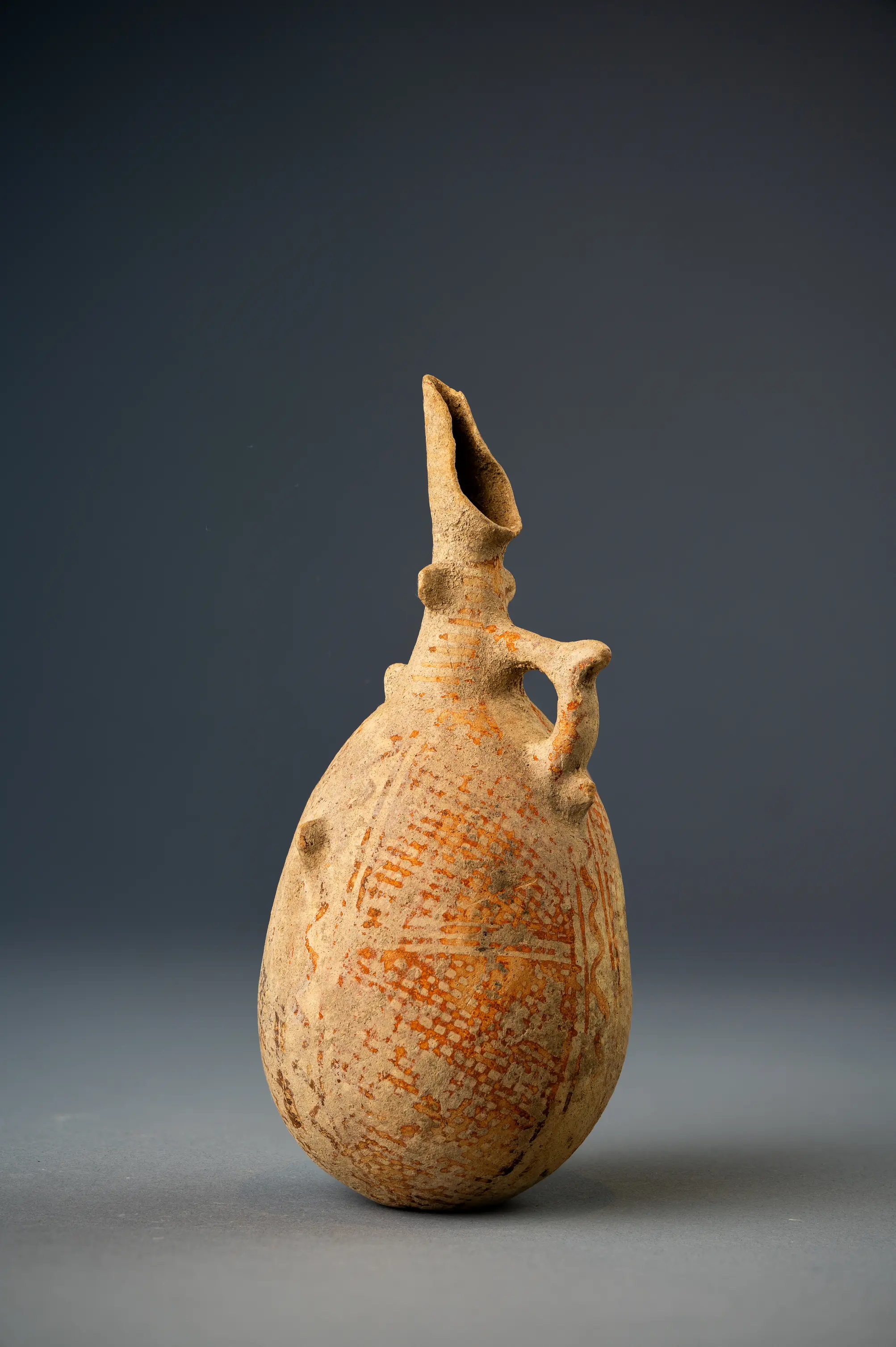 White Painted II Jug with Cut-away Neck and Lattice PanelsMiddle Bronze Age I · 2000–1800 BC
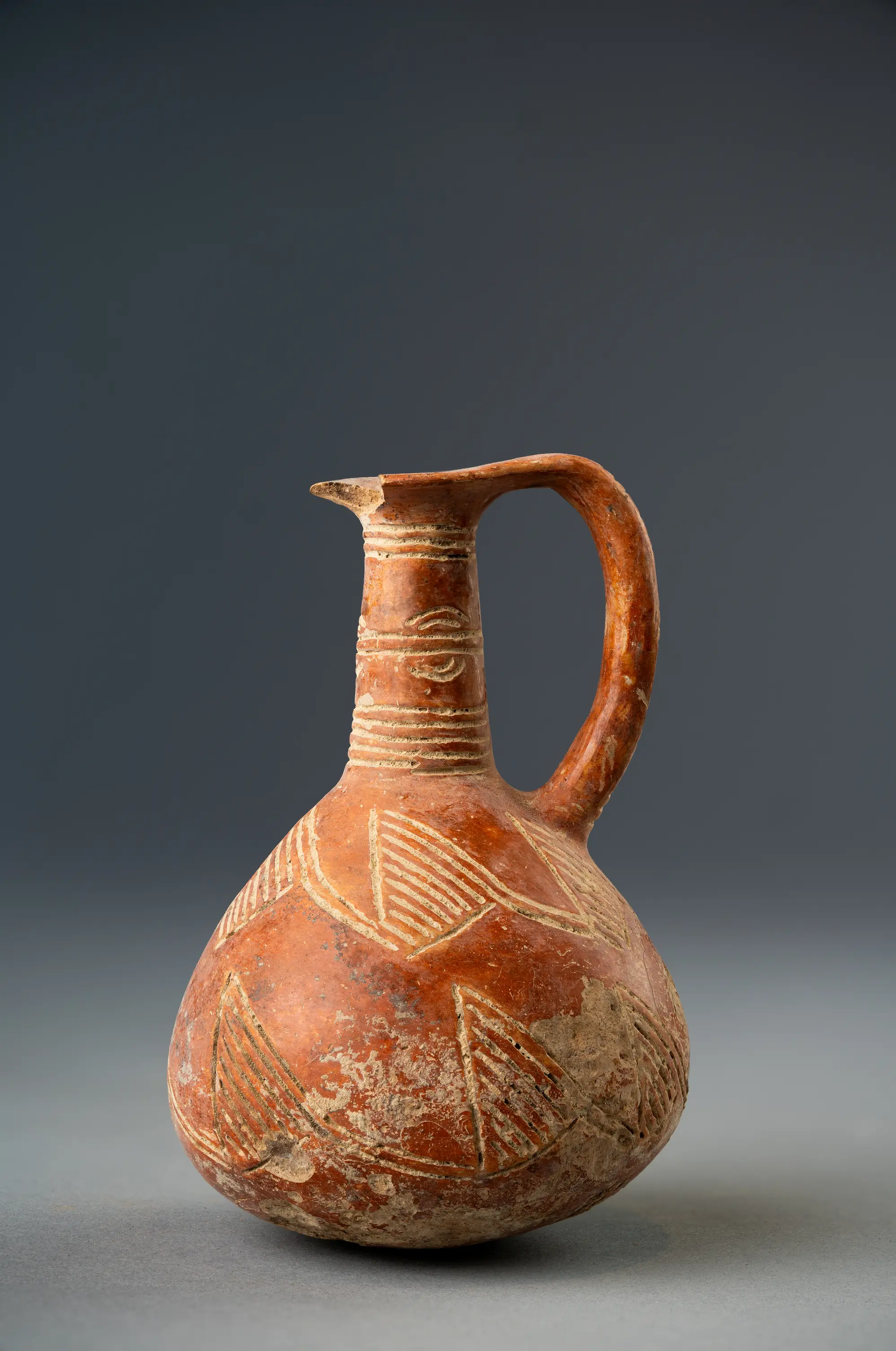 Red Polished Juglet with Hatched TrianglesEarly Bronze Age III · 2100–1800 BC
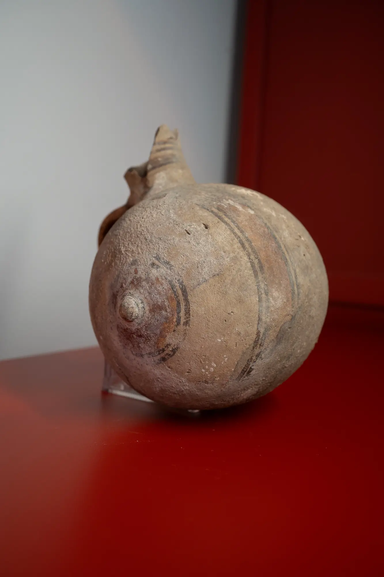 Bichrome Barrel Jug with Circled End-KnobsGeometric III · 850–750 BC
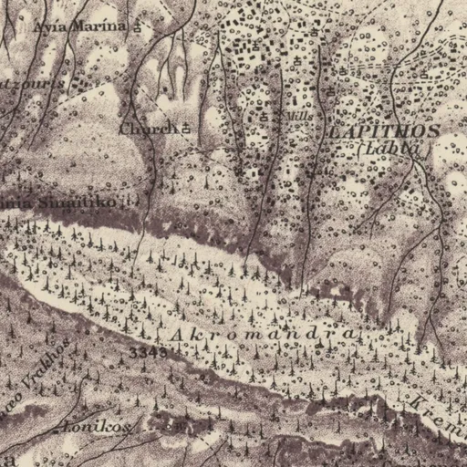
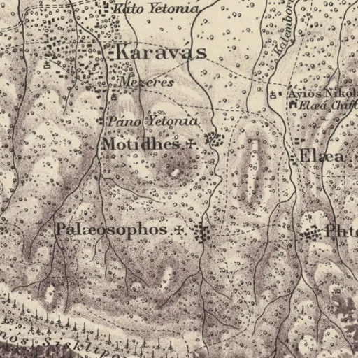
On Kitchener's map (1882)
LAPITHOS (Labta) · Town
Excavation history
- 1913–1917Myres and Markides for the Cyprus MuseumDirected by John Linton Myres, Menelaos Markides and L. H. Dudley BuxtonExcavation
- 1913Lefkoniko: Myres's excavation for the Cyprus MuseumDirected by John Linton MyresExcavation
- 1915–1916Katydhata and Laonarka: Markides's tomb excavationsDirected by Menelaos MarkidesExcavation
- 1927–1928The Swedish Cyprus ExpeditionDirected by Einar Nilson Gjerstad and Erik SjöqvistExcavation
- 1931–1932The Pennsylvania Cyprus ExpeditionDirected by Bert Hodge HillExcavation
- 1954–1973Department of Antiquities rescue excavationsDirected by Vassos Karageorghis, Angeliki Pieridou and A. ChristodoulouRescue excavation
- 1957–1959Kyrenia range and western Kyrenia coast: the Cyprus Survey (Catling and Nicolaou)Directed by Hector Catling and Kyriakos NicolaouSurvey
- 1971Cyprus harbours: the Raban and Linder survey of 1971Directed by Avner Raban and Elisha LinderSurvey
- before 1894Lambousa: Constantinides's clearance of the rock-cut chapelDirected by Eustathios ConstantinidesClearance and early digging
- UndatedLapithos (Prostemenos plateau): Ohnefalsch-Richter's diggingDirected by Max Ohnefalsch-RichterExcavation
In the Archive
1,137 photographs: 881 of objects, 256 in the field. A selection is shown here.
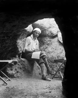 C00015Erik Sjöqvist in Tomb 306 at Lapithos
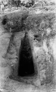 C00103Tomb 406, dromos at Lapithos
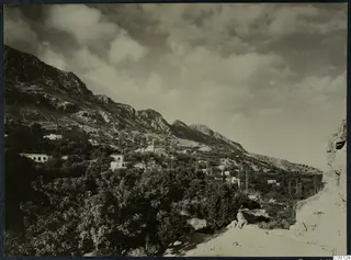 C00124Lapithos, landscape view
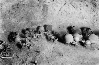 C00174Tomb 311 A at Lapithos, grave goods
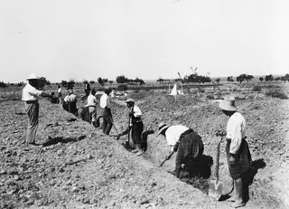 C00307Work in progress at Lapithos
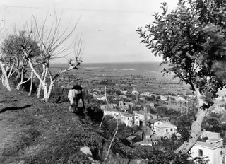 C00325View over Lapithos, a horse or donkey
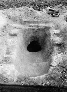 C00410Tomb 317, dromos at Lapithos
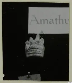 C00411Tomb 317 at Lapithos, dromos
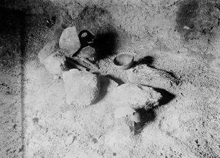 C00412Tomb 317 at Lapithos, interior
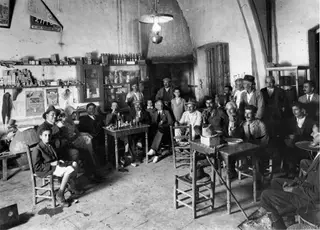 C00419Café at Lapithos with Erik Sjöqvist and John Lindros
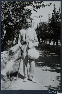 C00426Erik Sjöqvist at Lapithos
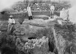 C00793Work in progress at Plakes, Lapithos
Photographs: Swedish Cyprus Expedition, Medelhavsmuseet, Stockholm (CC0)
Reconstruction
Nearby sites
- Vasilia-Kafkallia2.9 km
- Vasilia-Myliades3.1 km
- Karavas3.5 km
- Karavas-Kallamoullin3.5 km
- Karavas-Vathyrkakas3.5 km
- Vasilia-Harman Tarlası4.0 km
Straight-line distances.
Mentioned in
155 mentionsDocuments · 63
- Field diary D II:1 D: Dali (Idalion) acropolis, autumn 1928, book II; Lapithos
1928 · p. 41
village near which the Plakes excavation took place
Sjöqvist 1928; Lapithos, p. 41
- A Cypriote Tomb and Minoan Evidence for its Date
1940 · pp. 10, 11, 51
excavated tombs including Tomb 6A
Grace 1940, p. 10
- New Directions in Cypriot Archaeology
2019 · pp. 10, 241, 247
North coast village whose archaeology Diakou reconstructs
Kearns & Manning 2019, p. 10
- Field diary D II:4 A: Siffror (numbers): Dali, Lapithos, Anastasia and others
pp. 27, 45
surveyed site with river, road and burial-ground readings
Anon., n.d., Field diary D II:4 A, p. 27
- Archives des missions scientifiques et littéraires
1850 · p. 108
Reported in France. Ministère de l'Instruction Publique (1850): Identified with ancient Lapethas; a village marked on few maps, one of the prettiest villages…
- Reisen nach Kos, Halikarnassos, Rhodos und der Insel Cypern
1852 · p. 147
Reported by Ross (1852): Ruins of the ancient city of Lapethos beside the Acheropoetos monastery; ruins of cut rock blocks and buildings extend along the shore.
L. Ross, Reisen nach Kos, Halikarnassos, Rhodos und der Insel Cypern (1852)
Lectures and videos · 42
- 2nd Annual ARU Study Day: Cypriot Bronzes, Copper at Kition, the Vouni Hoard, and Maritime Outreach
2017
Papasavvas et al. 2017
- Innovative Educational Programmes in Museums: The Ministry of Education and the Leventis Municipal Museum
2017
Lambrianou & Lymperopoulou 2017
- Mapping a moment in the agrarian economy of Cyprus: the first Ottoman census of 1572
2017
Hadjikyriacou 2017
- Second Annual Study Day of the Archaeological Research Unit: Prehistoric Stone, Palaepaphos, and Ceramic Studies
2017
Georgiou et al. 2017
- The Archaeological Work of the University of Cyprus, 2016 (Part 1)
2017
Kassianidou et al. 2017
- Under the Mediterranean: Harbours at Amathus, Dreamer's Bay and Paphos, and the Carob and Copper Trades
2017
Empereur et al. 2017
Tomb records · 13
- Lapithos, Cyprus Museum Tomb 11
1913
Belgiorno 1984
- Lapithos, Cyprus Museum Tomb 14D
1913
Frankel 1974
- Lapithos, Cyprus Museum Tomb 20
1913
Benson 1973
- Lapithos, Cyprus Museum Tomb 203B
1913
Gagné 2012
- Lapithos, Cyprus Museum Tomb 203C
1913
Maguire 1990
- Lapithos, Cyprus Museum Tomb 3
1913
Chamber tomb, Middle Cypriot (Middle Bronze Age)
Dikaios 1953
Institutions · 15
- British School at Athens
Photographs of it · 1909
Terracotta figurines from Lapithos
British School at Athens, Archive 1909
- Pitt Rivers Museum
Probably · Photographs of it · 1913
Two men standing on a steep slope, with several pots and a basket on the ground in front of them, part of archaeological excavations (probably a tomb).
Pitt Rivers Museum, University of Oxford, photograph, 1913
- Antikensammlung, Staatliche Museen zu Berlin
Objects from it in the collection
3 object records giving it as the find-place
Antikensammlung, Staatliche Museen zu Berlin, collection online
- Ashmolean Museum of Art and Archaeology
Objects from it in the collection
51 object records giving it as the find-place
Ashmolean Museum of Art and Archaeology, collection online
- British Museum
Objects from it in the collection
33 object records giving it as the find-place
British Museum, collection online
- Cyprus University of Technology
Possibly · Photographs of it
Gold necklace and earrings of the Early Byzantine Period from the treasures of Lampousa
Cyprus University of Technology, photograph
Press releases 1962–74 · 4
- Ανασκαφαί του Τμήματος Αρχαιοτήτων εις Σαλαμίνα (1962-04-23)
1962
A second royal tomb of the same period was excavated in 1957 under Dr P. Dikaios on the same site, with richer finds, and a neighbouring tumulus was excavated…
Press and Information Office, Republic of Cyprus, press release of 1962-04-23
- Έληξαν αι εργασίαν του Διεθνούς Αρχαιολογικού Συμποσίου (1972-04-01)
1972
A. Pieridou of the Cyprus Museum presented ivory objects found in a tomb at Lapithos, discussed decorative motifs, and argued for ivory-working workshops in…
Press and Information Office, Republic of Cyprus, press release of 1972-04-01
- Η Κύπρος εις Διεθνή Έκθεσιν Βυζαντινής τέχνης (1964-03-30)
1964
Cyprus will take part in the International Exhibition of Byzantine Art with silver dishes of Lampousa, jewellery and icons from the Cyprus Museum, and a cross…
Press and Information Office, Republic of Cyprus, press release of 1964-03-30
- Άφιξις Γάλλων περιηγητών (1965-04-22)
1965
A group of 400 French tourists arriving on the steamship 'Tzerousalem' is scheduled to tour ancient and medieval sites, including the Temple of Apollo at…
Press and Information Office, Republic of Cyprus, press release of 1965-04-22
News · 8
- Children painted some 'crude' Bronze Age pots at Kalopsidha, new book on Cypriot ceramics argues
2026
- Jennifer Webb's forthcoming book studies 3,327 Early and Middle Bronze Age metal finds from Cyprus
2026
- Karavas churches of 1804 and 1854 restored by Greek Cypriot and Turkish Cypriot conservators
2026
- Lapithos symposium on 7 November follows the occupied town from antiquity to displacement
2026
- Presidential Palace tours in Nicosia show figurines returned from Munich in 2024
2026
- Swedish Cyprus Expedition centenary conference in Nicosia calls for papers by 31 October
2026
- Excavations · 10listed under Excavation history
- Archivelisted under In the Archive
References
- 1.Herscher, E. (1997). Lapithos. In E. M. Meyers (Ed.), The Oxford Encyclopedia of Archaeology in the Near East, vol. 3, 330–331. Oxford University Press.
- 2.Webb, J. M. (2017). Vounoi (Vounous) and Lapithos: north-coast cemeteries of the Early and Middle Cypriot Bronze Age. In D. Pilides & M. Mina (Eds.), Four Decades of Hiatus in Archaeological Research in Cyprus: Towards Restoring the Balance, 128–139. Verlag Holzhausen.
- 3.Diakou, S. (2019). The Archaeology of the North Coast of Cyprus. The Evidence from Lapithos. In C. Kearns & S. W. Manning (Eds.), New Directions in Cypriot Archaeology, 241–265. Cornell University Press.
- 4.Gjerstad, E. (1948). The Swedish Cyprus Expedition, Vol. IV Part 2: The Cypro-Geometric, Cypro-Archaic and Cypro-Classical Periods. The Swedish Cyprus Expedition.
- 5.Herscher, E. (1975). New Light from Lapithos. In N. Robertson (Ed.), The Archaeology of Cyprus: Recent Developments, 39–60. Noyes Press.
- 6.Myres, J. L. (1940-1945). Excavations in Cyprus, 1913. Annual of the British School at Athens, 41, 53–104.
- 7.Gjerstad, E., Lindros, J., Sjöqvist, E., & Westholm, A. (1934). The Swedish Cyprus Expedition: Finds and Results of the Excavations in Cyprus 1927-1931, Vol. I (text). The Swedish Cyprus Expedition.
- 8.Adelman, C. M. (1976). Cypro-Geometric Pottery: Refinements in Classification (Studies in Mediterranean Archaeology 47). Paul Åströms Förlag.
- 9.Herscher, E. (1978). The Bronze Age Cemetery at Lapithos, Vrysi tou Barba, Cyprus: Results of the University of Pennsylvania Museum Excavation, 1931. PhD dissertation, University of Pennsylvania.
- 10.Grace, V. (1940). A Cypriote Tomb and Minoan Evidence for its Date. American Journal of Archaeology, 44, 10–52.
- 11.Diakou, S. (2018). The Upper Geometric Cemetery at Lapithos: University of Pennsylvania Museum Excavations 1931-1932 (Studies in Mediterranean Archaeology 146). Åström Editions.
- 12.Webb, J. M. (2018). Lapithos Vrysi tou Barba, Cyprus. Early and Middle Bronze Age Tombs Excavated by Menelaos Markides (Studies in Mediterranean Archaeology 148). Åström Editions.
- 13.Webb, J. M. (2020). Lapithos Vrysi tou Barba, Cyprus. Early and Middle Bronze Age Tombs Excavated in 1913. Tombs 1-47 (Studies in Mediterranean Archaeology 152). Astrom Editions.
- 14.Webb, J. M. (2025). Lapithos Vrysi tou Barba, Cyprus. Early and Middle Bronze Age Tombs Excavated in 1913. Tombs 48-50, 101-108, 201-205 (Studies in Mediterranean Archaeology 160). Astrom Editions.
- 15.Levy, T. E. (2013). Introduction to the Levant During the Chalcolithic Period: Regional Perspectives. In A. E. Killebrew & M. Steiner (Eds.), The Oxford Handbook of the Archaeology of the Levant: c. 8000-332 BCE. Oxford University Press. https://doi.org/10.1093/oxfordhb/9780199212972.013.014
- 16.Keswani, P. (2004). Mortuary Ritual and Society in Bronze Age Cyprus (Monographs in Mediterranean Archaeology 9). Equinox.
- 17.Webb, J. M. (2017). Lapithos Tomb 322: Voice, context and the archaeological record. In Text and the material world: Essays in honour of Graeme Clarke (Studies in Mediterranean Archaeology Pocket-book 185). Åströms Förlag.
- 18.Webb, J. M. (2022). Weapon-bearers at Middle Bronze Age Lapithos, Cyprus. In Metioessa: Studies in Honor of Eleni Mantzourani (AURA Supplement 10). Athens.
- 19.Birmingham, J. (1963). The Chronology of Some Early and Middle Iron Age Cypriot Sites. American Journal of Archaeology, 67(1), 15–42.
- 20.Steel, L. (1995). Challenging preconceptions of Oriental 'barbarity' and Greek 'humanity': human sacrifice in the ancient world. In N. Spencer (Ed.), Time, Tradition and Society in Greek Archaeology: Bridging the 'Great Divide', 18–27. Routledge.
- 21.Iacovou, M. (2013). Historically elusive and internally fragile island polities: The intricacies of Cyprus's political geography in the Iron Age. Bulletin of the American Schools of Oriental Research, 370, 15–47. https://doi.org/10.5615/bullamerschoorie.370.0015
- 22.Parpas, A. P. (2022). The Maritime Economy of Ancient Cyprus in Terms of the New Institutional Economics. Archaeopress.
- 23.Zeman-Wiśniewska, K. (2023). Cypriot Phoenicians and their cultural identity. Saeculum Christianum, 30, 5–17. https://doi.org/10.21697/sc.2023.30.1.16
- 24.Fujii, T. (2013). Imperial Cult and Imperial Representation in Roman Cyprus (Heidelberger althistorische Beiträge und epigraphische Studien 53). Franz Steiner Verlag.
- 25.Zeischka-Kenzler, A. (2016). Of Death and Life. Funerary and Other Features of the Multi-functional City Wall of Lambousa. In The Northern Face of Cyprus: New Studies in Cypriot Archaeology and Art History, 277–297. Istanbul.
- 26.Nicolaou, K. (1976). Ancient fish-tanks at Lapithos, Cyprus. 1. Introduction. International Journal of Nautical Archaeology, 5(2), 133–136.
- 27.Merrillees, R. S. (2009). The modern history of the first Lambousa treasure of Byzantine silverware from Cyprus. The Antiquaries Journal, 89, 389–403. https://doi.org/10.1017/S0003581509000079
- 28.Leader, R. E. (2000). The David Plates Revisited: Transforming the Secular in Early Byzantium. The Art Bulletin, 82(3), 407–427. https://doi.org/10.2307/3051395
Corrections and additions
Do you know this site?
Help us keep this page right: recent work, the site as it is now, and what we may have missed.
Missing from this record
- Location approximate
We would like to hear about
- Recent fieldwork or publications
- A wrong location or name
- Access, opening times or the site's state today
- Photographs we may use
Tell us if you would like to be thanked by name on the page.