
The Ruins on Kitchener's Map of Cyprus, and What Became of Them
Kitchener's survey of Cyprus, printed in 1885, marks 341 antiquities, from ancient cities to ruined chapels and slag heaps. We followed each one through the travellers, excavators and gazetteers who came after, and found the Golgoi sanctuaries under a plain 'Ruins', a Lusignan castle carted off to mend a road, and 112 marks that no source we have read explains.

Alexis Drakopoulos
November 9, 2026·History · Archeology · Research·24 min read


Share


Alexis Drakopoulos is a Greek Cypriot Machine Learning Engineer working in Financial Crimes. He is passionate about Archeology and making it accessible to everyone. About Me.
In 1882, by Rupert Gunnis's account, Kitchener was surveying at Phasoula, a village in the hills above Limassol, and wanted a fig tree cut down. It grew out of a ruined wall of the church of St Rheginos and got in the way of his observations. No one in Phasoula would pick its figs, since whoever ate them was said to find his face swelling and breaking out in boils. The villagers talked him into sparing it and built him a platform high enough to see over the branches. When Gunnis told the story, the tree was still growing on the wall.[1]
Half a mile south of the village the surveyors wrote "Kástron (R.)" beside a steep conical hill.[2][4] On its top stood a sanctuary of Zeus Labranios.[2][3] Gunnis took the ruin for a large Roman fort. He describes huge stones, some of them six feet square, the remains of a paved road that climbed the hill, and life-sized statues lying in the middle, every one of them headless. A villager kept some of the heads, which Gunnis judged to be of about the fourth century AD.[1]
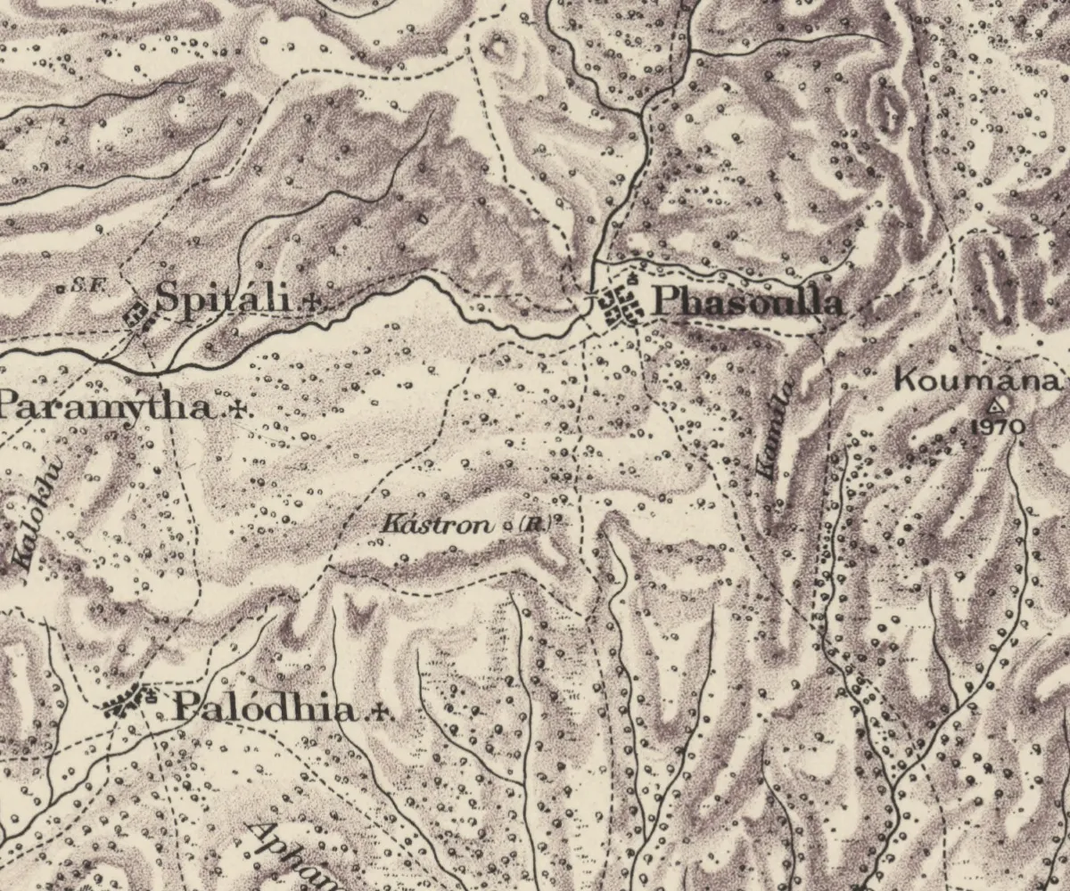
That "(R.)" is all the map says about the place. The fifteen sheets of Kitchener's survey, printed in London in 1885, mark 341 places in this way as antiquities: ruined chapels, castles, tombs, slag heaps, deserted villages and a few ancient cities. We compared every one of them with the excavation records, travellers' accounts and gazetteers that followed, to find out what the surveyors had seen and what was left of it a generation or a century later.
All 341 are on the map below. Choose a mark to read what we found, then drag the divider to set Kitchener's sheet against a map of the same ground from the 1960s.
Explore the map
All 341 antiquities, mark by mark
Medieval or later · Sheet 10
“Ruins”
Ruin with no name, as the survey lettered it
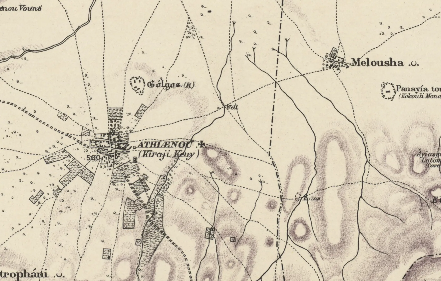
Ayios Photios. The ruin is the church of that name. In the fields round it lay the two sanctuaries of Golgoi, where Cesnola's diggers found the colossal head in 1870.
A four-sided limestone altar turned up here by chance in 1969.
The map of the 1960s prints “Ayios Photios (ruins)” close by, which may be the same place.
Sources: Cesnola 1877, pp. 117–119; Ohnefalsch-Richter 1893, pp. 14–15; Gunnis 1947, p. 342.
A mark counts as identified where a source we have read describes the place. The 25 that were already in our register of sites are counted with them. Positions are our fit of the 1882 sheets, on which a building typically lies about 160 m from its true place. Maps: Kitchener's survey, National Library of Scotland (CC BY 4.0); US Army Map Service, series K715, Library of Congress.
R. = Ruins
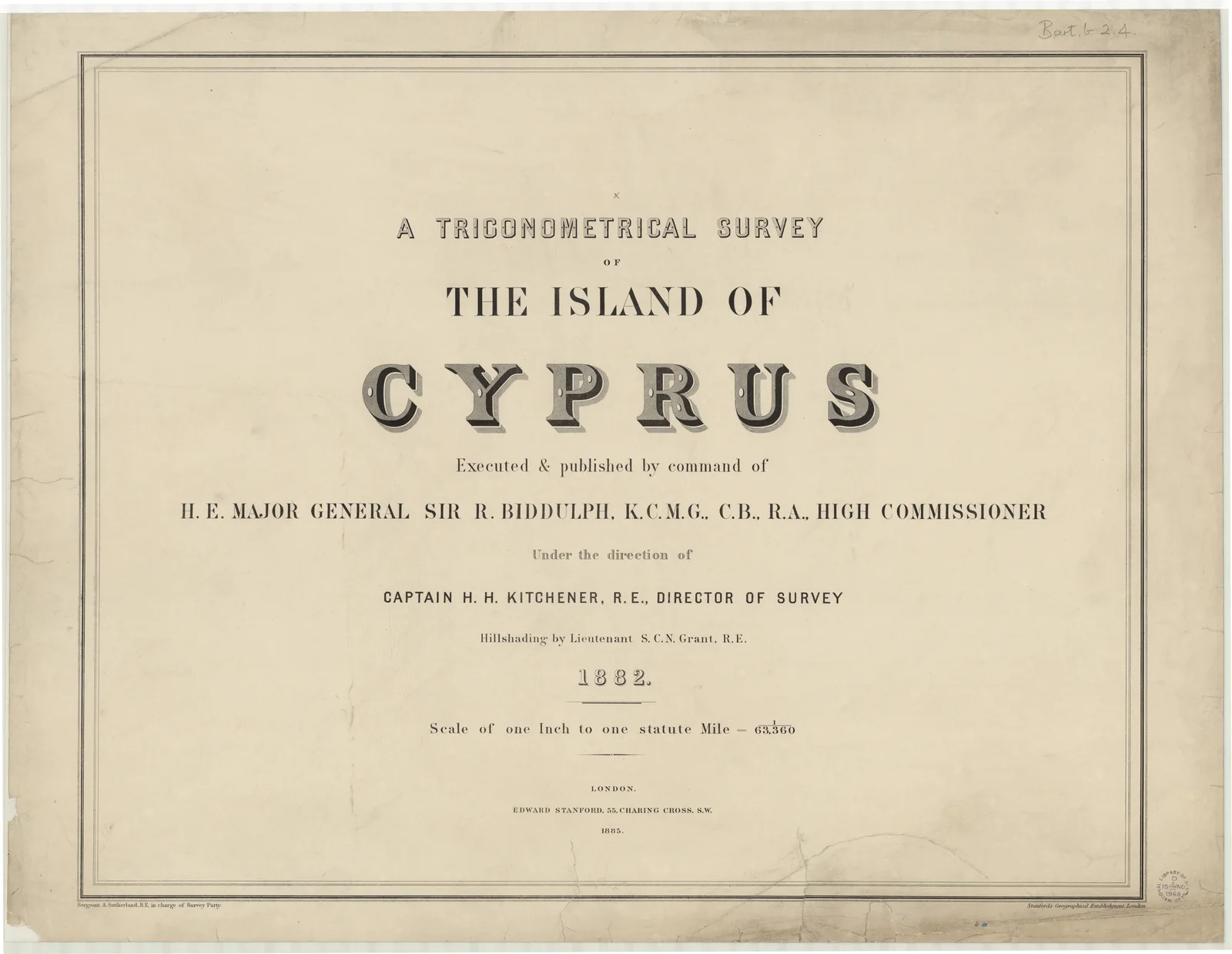
Kitchener, then a lieutenant of the Royal Engineers, left for Cyprus on 19 September 1878, nine days after finishing the map and memoirs of his survey of Palestine. In April 1879 he was made military vice-consul at Kastamuni in Anatolia. He came back to Cyprus in 1881 to complete the survey, finished it in 1882 and left for Egypt at the end of that year.[5] Most of the fieldwork was done by the end of 1881.[6] The sheets are dated 1882, and Edward Stanford published them in 1885.[4][5] The title sheet names "Sergeant A. Sutherland, R.E. in charge of Survey Party".[4] Michael Given notes that the surveyors used local guides and interpreters and collected as many place names as they could, localities as well as villages.[7]
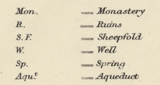
The key, on sheet 15, explains vineyards, telegraph lines, district boundaries, and the cross and crescent that mark a village as Christian or Muslim. It has no entry for antiquities. Among its abbreviations it gives "R. = Ruins", the only convention for antiquities it defines.[4] The rest is left to the lettering, which is a looser code than it looks. Ancient cities are named in black-letter, the Gothic type of a newspaper masthead: "Curium", "Sálamis", "Solí", "Palœa Páphos". Given reads the Gothic script as the map's way of marking an antiquity.[7] Among the 316 antiquities that were not already in our site register, black-letter says nothing about age. Twelve labels use it in whole or in part. Seven are ancient, three of them only the ancient names of capes and places, and five are medieval castles: Kolossi, Kantara, Sigouri, St Hilarion and Buffavento.[4] It marks an antiquity of note, ancient or Lusignan.
The upright roman type is the steadier sign. It carries the saints' names of churches and monasteries, and 126 of its 161 labels turned out to be medieval or later, against 4 ancient. Italic, the face of localities, holds 25 of the 36 ancient sites and most of those we could not date. Fábrika, the ancient hill site at Paphos, is in italic.[4] An italic "Ruins" is where an unrecorded ancient site is likeliest to be.
The lettering as a code
What each typeface turned out to mark
- Ancient
- Medieval or later
- Not dated
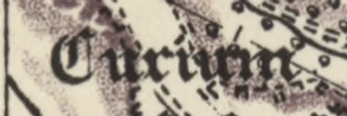
Black-letter · 12 labels
7 ancient · 5 medieval or later
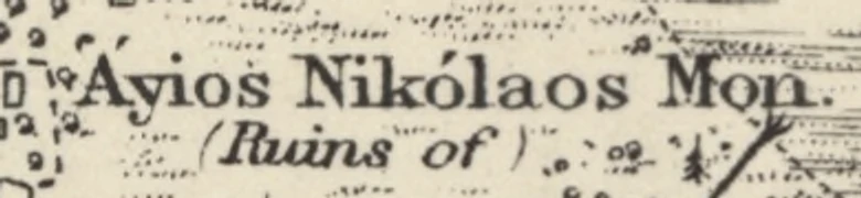
Upright roman · 161 labels
4 ancient · 126 medieval or later · 31 not dated
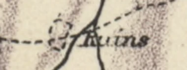
Italic · 142 labels
25 ancient · 44 medieval or later · 73 not dated
In Palestine, Kitchener's previous survey had done far more. In Galilee in 1877 alone it collected 2,773 names and visited and described 476 ruins, some with plans.[5] We know of no memoir or name list for the island, and the complete field notes are not extant.[6]
Kitchener had his own interest in antiquities. In March 1880 he offered to act as the British Museum's representative on the island, and proposed an ordinance that "all finds of antiquities by officials or others be reported to Lieut. Kitchener with the least possible delay". Charles Newton, at the Museum, doubted it would work. The excavations Kitchener did get were paid for by the South Kensington Museum, and the man who ran them, George Hake, was told to collect "from the aesthetic and decorative and not from the archaeological point of view".[8] Hake dug for him at Salamis, Gastria and Kourion in 1882.[7]
The tomb fields the map left out
The survey came at the end of two decades in which Cesnola, Lang and others had dug across the island for collectors and museums abroad, and very little of that digging shows on the map. Of 59 places where we have digging, visits, sales or finds recorded between 1860 and 1885, only 21 have one of Kitchener's antiquities within a kilometre. The clearest gaps have nothing of his within three kilometres: Pýla, dug by Robert Hamilton Lang and Luigi Palma di Cesnola in 1868; Góshi, dug by Lang the same year; Alámbra, where Cesnola dug in 1868; Arsos, dug for the Marquis de Vogüé in 1862; Kythræa, where Cesnola dug in 1874; Enkómi, dug in 1876. Larnaca district, where that digging was densest, has 18 antiquities on the whole map. Kition, Idalion and Tamassos appear only as a name in brackets after the modern town: "LÁRNAKA (Citium)", "Dáli (Idálion)", "Politikó (Tamasos)". The two cities Hake dug for Kitchener in 1882, Salamis and Kourion, are both there in black-letter.[4]
Cesnola, the American consul in Cyprus since 1865, describes the problem without meaning to. Some years before 1870 he went to look at a spot near Athienou where de Vogüé was said to have found "some fine stone heads and statues; but when I visited it, the barley which covered the fields was just coming into ear, and nothing was visible of these excavations".[9] Once the holes are filled and the barley sown, a dug field gives a surveyor nothing to draw. As far as we can tell, the map records what stood above the ground and what the guides had a name for.
The Golgoi sanctuaries under a plain "Ruins"
The spot was called Ayios Photios. Cesnola, by his own account, "quite neglected" it for several years. Early in 1870 two of his diggers asked leave to dig at Athienou, and he paid them to dig at Ayios Photios instead. Nearly a week later, while he was at breakfast in Larnaca, a muleteer arrived with word that they had found "an enormous stone head and other sculptures" and wanted a cart before the landowner interfered. Cesnola, as doyen of the consular corps, had to chair its meeting that afternoon, so Andrea Vondiziano, one of his consular staff, rode out in his place, sent back for two ox-carts, and found the sculptures too heavy to lift without calling in men from the village.[9] Finds from his Golgoi temple were in "the New York Museum" by 1877.[9] The colossal head is now in the Metropolitan Museum of Art, which bought Cesnola's collection by subscription in 1874–76; its catalogue records the head as "said to be from near the temple at Golgoi".[21][22]
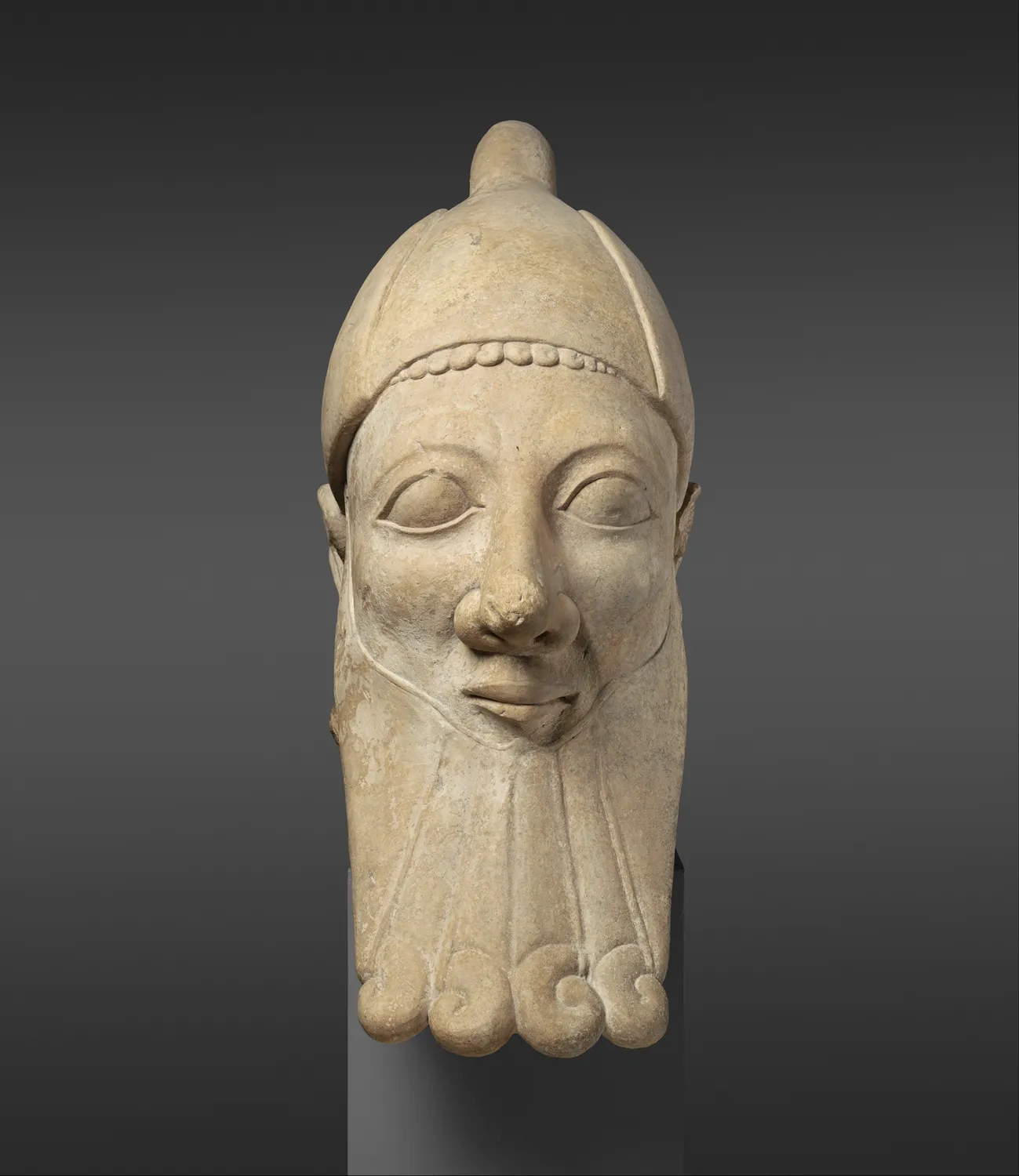
Kitchener's sheet 10 letters "Gólgos (R)" in black-letter beside a dotted enclosure on the rise just north of Athienou, the town de Vogüé had identified as ancient Golgoi.[4][9] The sanctuaries are elsewhere. About 2.7 kilometres to the south-east, beside a field track, the same sheet has a small ruin mark and the word "Ruins" in italic.[4] That is Ayios Photios.
Ohnefalsch-Richter went there at least twice with Vondiziano, and with Georgi Sotiri of Athienou, who had been present when the colossal head came out. He brought the German scholars Dümmler, Furtwängler, Oberhummer and Dörpfeld to see it. He describes two sanctuaries of Apollo several hundred metres apart, with a hill between them: the older and richer near "the ruined church of Hag. Photios", the later one, of the fourth century BC and after, to the east. The work done at Cesnola's expense, he wrote, "consisted only of burrowing holes in the find-stratum after the fashion of moles". The row of "enormous mole-hills" could still be seen at the western site; the eastern one had been levelled and long cultivated.[10] The ruin the surveyors marked stands where that church stands. Gunnis, writing of the neighbouring village of Melousha, found only its north and west walls, with traces of painting.[1] In 1969 a four-sided limestone altar turned up at Ayios Photios by chance.[11]
Kataraméni and the cave of Apollo Hylates
Oberhummer, one of the visitors Ohnefalsch-Richter took to Ayios Photios, published a map of Cyprus with his essay on the island in the Berlin Zeitschrift für Erdkunde. He took its positions from Kitchener's map and its lettering from Kiepert's.[10] East of Kato Paphos, on the way to Yeroskipou, Kitchener's sheet 12 shows a long low ridge lettered "Kataraméni", with "(Ruins)" in black-letter.[4] Under the ridge a passage leads down from the south into a rock-cut shrine of two chambers, the inner one round and domed, with a hole cut through the top of the dome. Two inscriptions in the Cypriot syllabary, of the later fourth century BC, record that a man whose name is read as Satrapas cut "the entry to this cave" for Apollo Hylates at a god's command.[12]
Most writers call the place Alonia tou Episkopou. Jolanta Młynarczyk noted that Oberhummer alone called it "Katarameni".[12][18] Katarameni is the name on Kitchener's sheet, and it is also the name the cadastral survey gives to the land there, with Alonia tou Episkopou marked just to the west.[4][18] As late as 1980 the sanctuary had never been methodically excavated.[12]
Castles and villages taken for stone
The surveyors' "Ruins" sometimes caught a building near its end. On Leondari Vouno, the flat-topped hill outside Nicosia, sheet 10 prints "Ezdarhá" in italic and "Ruins" in black-letter beside a building mark in the middle of the plateau.[4] This was La Cava, the castle James I of Lusignan built in 1385, named after a great cistern cut in the rock. Until 1870 its vaulted hall, curtain wall and two towers still stood. In that year most of it was pulled down to build the church of the Phaneromeni in Nicosia, and by 1947 little remained but part of a great tower.[1][13] What the survey marked was what was left after the demolition.
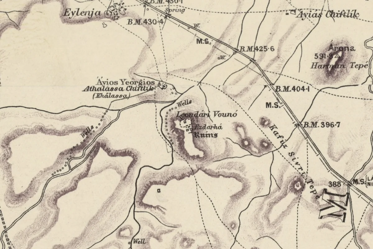
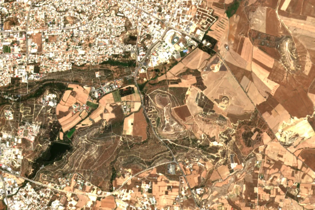
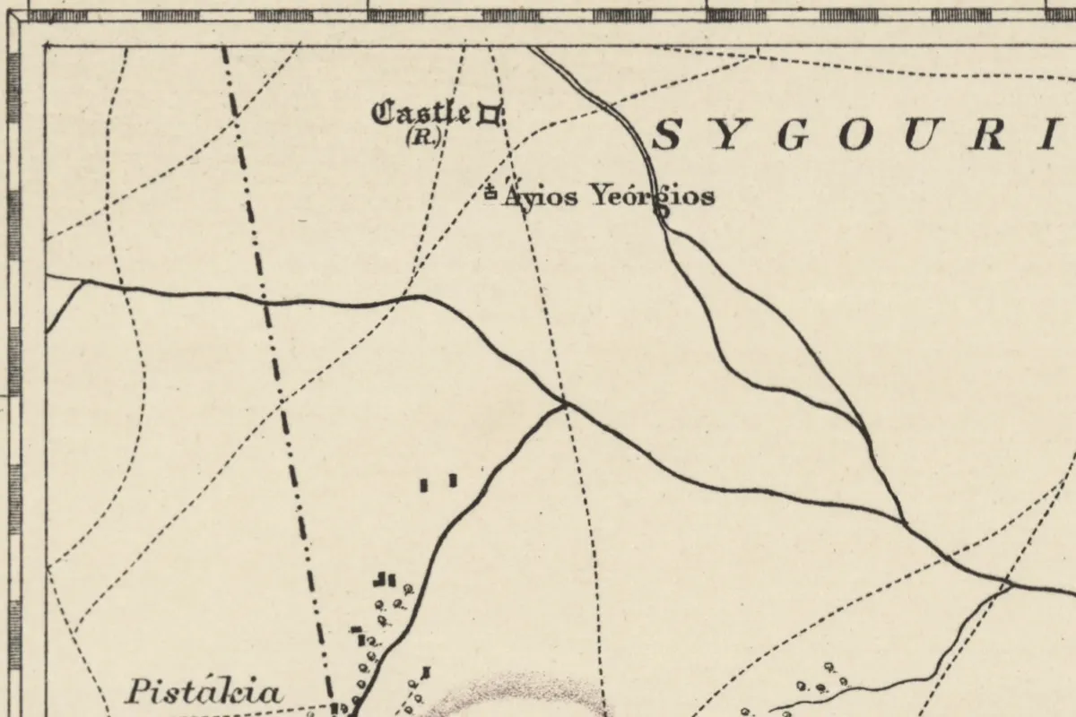
The next full record of the island's ruins came from George Jeffery, whose Description of the Historic Monuments of Cyprus was published in Nicosia in 1918. He had the "map of 1885" to hand and checked it: a ruined Carmelite convent near Kato Polemidia, he notes, "is not marked on Kitchener's map".[13] On the road from Kouklia to Prastio in the Mesaoria, sheet 11 prints "Castle" in black-letter with "(R.)" beneath and a square castle mark, beside the spaced capitals of "SYGOURI".[4] Jeffery calls it "the famous castle of Sigouri, of which now hardly the outlines of its walls and moat survive". The last of its masonry had been "removed within recent years to repair the high road in its vicinity".[13] At Khirokitia the commandery of the Templars and then the Hospitallers, round which the battle of 1426 was fought, appears on sheet 15 as "Serayia (R.)". Jeffery found its remains "almost completely destroyed"; the villagers had used much of its masonry to rebuild the well.[4][13]
In the Mesaoria, sheet 5 puts a small "R." just north-west of the village of Orníthi, which in the Middle Ages had been an estate of the Dean and Chapter of Nicosia.[4] Jeffery went looking for the medieval village: "The original Christian village has completely disappeared, even those traces which were marked on the map of 1885."[13] His sentence and the letter on the map are all we have found of it.
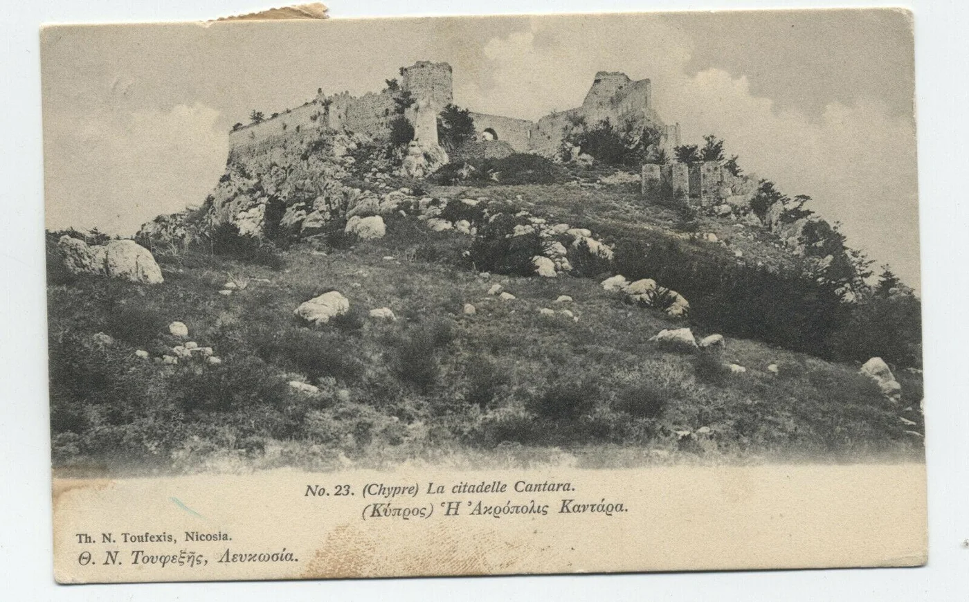
A few went the other way. "Palæó Mon. (R.)", a small domed Byzantine church at Trimithi in Kyrenia district, had been "restored to use with the addition of a modern nave" by 1918.[4][13] The great castles fared best. Kantara, St Hilarion and Buffavento, all in black-letter on the map, were among the monuments protected under the Antiquities Law by 1915.[4][13] Beside two of them the surveyors also wrote what the villagers called them: "Ekatón Spítia", the Hundred Houses, at Kantara, which Hogarth called "the Hundred Chambers", and "Spítia Riyénnis", the Queen's Houses, at Buffavento, a castle with its own legend of a besieged "queen".[4][13][14]
Ornithi, Sigouri, Trimithi and the three castles lie in the area occupied by Turkey since 1974. For Sigouri and Ornithi we have found no account later than Jeffery's.
Slag heaps from Limni to Teredhia
Ten of the map's antiquities are mines and slag heaps, the dark glassy waste left by smelting copper ore. Most of them lie in the foothills of the Troodos, from Limni near Polis, where the traveller David Hogarth saw in 1888 "old adits and slag-heaps" that "remind us of the ancient fame of the copper-island", to the hills south of Mathiati.[14][4] At Skouriotissa the italic "Slag" lies beside a monastery that takes its name from the heaps; by 1947 an American company was mining the ground again.[1][4] Above the monastery the sheet shows a hill lettered "Phoukása", with a triangulation station on its top and the slag along its west side.[4] That hill now lies inside the workings of the modern mine.
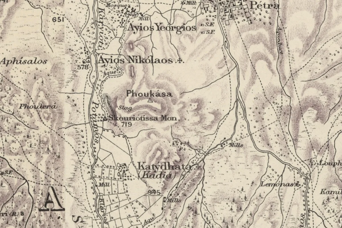
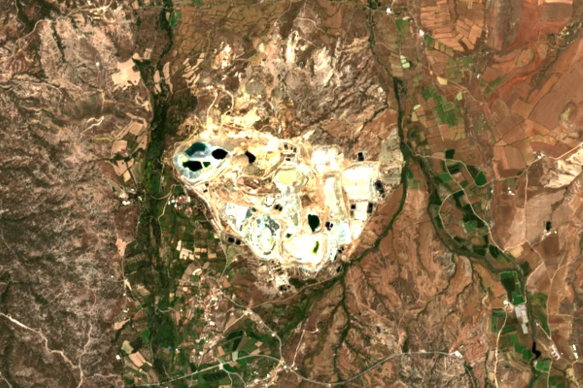
Ninety years after the survey, the American Expedition to Idalion went looking for the slag around its city. In 1972 Arthur Steinberg and Frank Koucky visited all the mine and slag sites near Idalion, round Sha, Mathiati, Lythrodonda, Mitsero and Kalavasos. They noted "a huge pile at Kapedhes", two piles south of Mathiati and a heap south of Lythrodonda on the road to Kyprovasa, and judged the heaps "mainly of Roman date".[15] Kitchener's sheets 9 and 10 mark a "Slag" at each of these places, very probably the same heaps.[4] The Idalion report places the Kapedhes pile no closer than the village, so Kitchener's mark is the only position we have for it.
One of them shows how little a label dates. North-west of Lythrodonda, sheet 9 prints "Slag" beside the locality name "Teredhia".[4] The Idalion team noted "a very interesting complex" there,[15] and soundings in 1975 and 1976 found a building beside the slag heap that had held a small foundry. The settlement belonged wholly to the late medieval period.[16] The heap itself may be older than the foundry; the reports we have read do not date it.
Hogarth and Jeffery with the map in hand
The first scholars to take the map into the countryside used it and corrected it. Hogarth refers to "the Survey" throughout his book on his journey of 1888. In the Karpas, between Leonarisso and the sea, he found three sites choked with scrub. The largest, "now known as Mazaraes and not marked on the Inch Survey", was a wilderness of grey stone nearly half a mile square. The second, "marked on the map as Kakozonara", was "very small and unimportant", probably "an outlying village built about a well". Further east, he wrote, Chelones "should be marked on the Survey Map", at the ruined shrine of Agia Pappou, where a slip for launching ships is cut in the rock of the shore.[14] Kitchener's sheet does show the shrine, as "Ayía Pappou Ruins", but not the name Hogarth wanted.[4]
In the Akamas, at the western tip of the island, where the forest ran for thirteen miles without a village, he came on "a point marked on the Survey as Agios Konon and Agios Giorgios": the remains of a large village, probably Byzantine, with a holy spring that never failed. The map gave him two shrines there, the larger church of Ayios Konon to the north and, south of it, a shrine of Ayios Yeoryios built on to the mouth of a cave. His guide named the two the other way round. Hogarth kept to the map. All the buildings, he wrote, were "mere shells inhabited only by countless myriads of fleas, which swarmed up our persons with exuberant joy after a Lenten abstention probably of many months' duration".[14][4]
On the north coast Hogarth went to the ruins facing the Galounia islets, which the map marks as "Limionas (Ruins)". Earlier writers had taken them for Aphrodisium, one of the lost towns of that coast. He found a ruin field of 200 by 100 yards, a fragment of triglyph, some columns, and a harbour "ill-formed even by nature". "I arrived at Galounia fully prepared to accept it as Aphrodisium," he wrote, "but left it with the conviction that ... the larger city was to be found further west."[14] For Kakozonara, Chelones and Limionas, the accounts of Hogarth and Jeffery are the last we have; all three lie in the area occupied by Turkey since 1974.
Press stones at Pakhna, cats at Akrotiri
Near Pakhna, in the hills of Limassol district, sheet 13 marks "Áyios Stéphanos (Rs.)".[4] On the village site there stood four pierced stones, of a kind Hogarth listed place by place across the south-west: upright blocks with a long slot cut through them. Cesnola was not the only traveller who had "sought a religious explanation" for them. They had been taken, Hogarth wrote, for "menhirs, emblems of fertility", "counterparts of Jachin and Boaz in Solomon's Temple". In April 1888 Dr F. H. H. Guillemard proposed in the Athenaeum "a far more prosaic theory, that they are the remains of ancient presses, whose use the modern Cypriote has forgotten". Hogarth agreed. The slot, he thought, had held the beam of an olive press. The villagers had found a use of their own for the stones. At another of them a stump was "covered with rags, the repositories of fevers", and the slot of one of the Ayios Stephanos stones "was full of vicarious pebbles".[14]
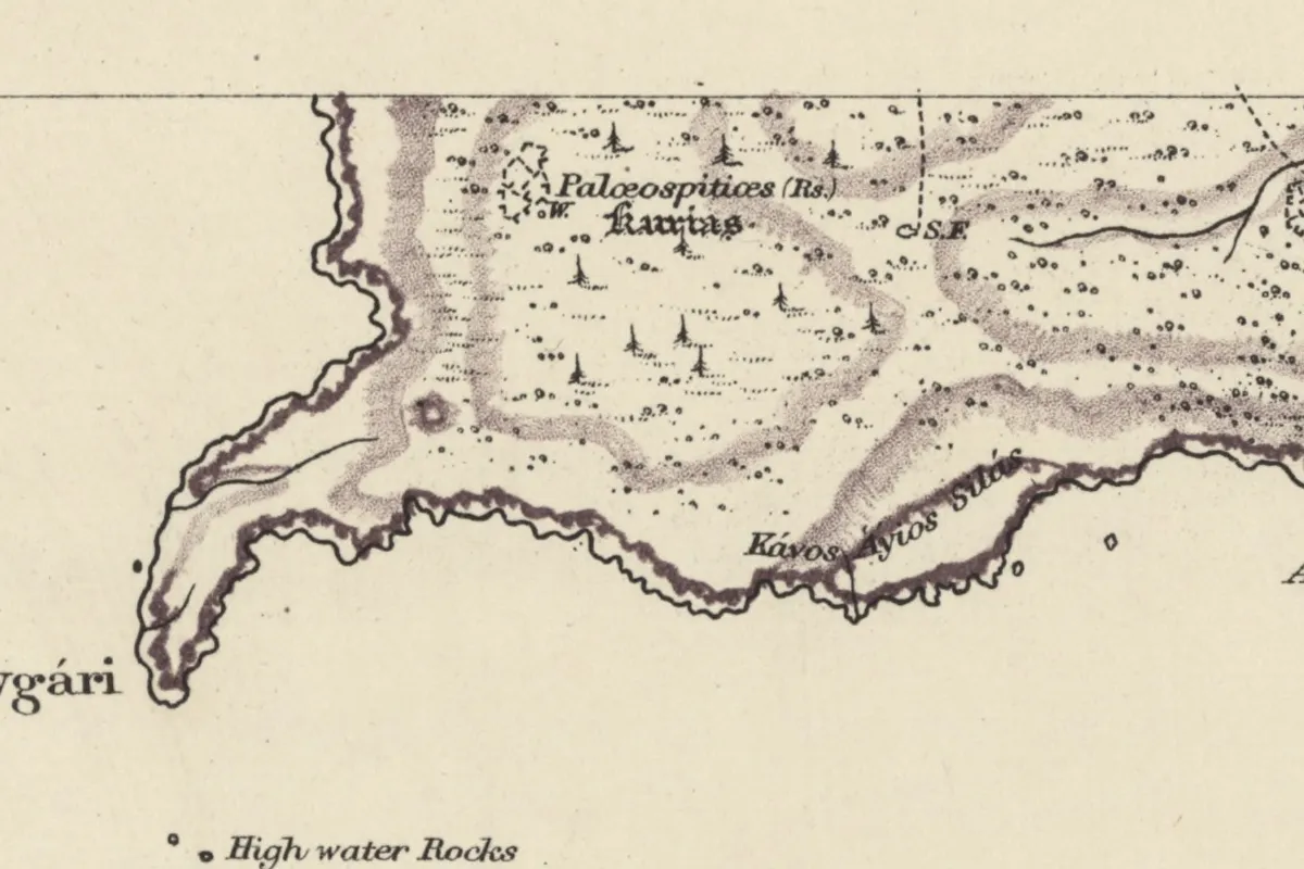
The map's boldest guess is on the Akrotiri peninsula south of Limassol, drawn as an inset on sheet 14. Inland, on the southern part of the peninsula, the inset shows a dashed enclosure of ruins with a well, lettered "Palœospitiœs (Rs.)", "old houses", and beneath it in black-letter the ancient name "Kurias".[4] Jeffery was not impressed: a site "surveyed by Hogarth and others but does not seem to be more than an ancient village in ruins of no importance".[13] Recent work on the peninsula suggests that Kourias may have been only the name of the cape, and notes that Kitchener "confidently labelled one of its ancient settlements as 'Kourias'" although the site lies well inland.[17] The pages we have read do not say which of the ruin sites now known on the peninsula it is.
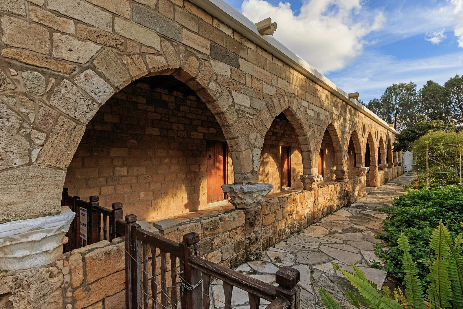
On the plain south of the salt lake the same inset shows a cluster of walls and wells lettered "Áyios Nikólaos Mon. (Ruins of)".[4] This was St Nicholas of the Cats. Medieval travellers told how its monks kept cats to hunt the snakes of the peninsula, and how a bell called the cats in from the fields to be fed. "Nearly all are maimed by the snakes," one account runs: "one has lost a nose, another an ear; the skin of one is torn, another is lame." After the Ottoman conquest of 1570 the monks were killed or driven out. The traveller Villamont, in 1588, found the abbey deserted and the cats "dead for want of food", their memory kept in the name of the cape, Capo delle Gatte.[1][13] In 1918 only the church and one arcade of the cloister stood, and Gunnis found the floor of the church "dug by treasure-seekers".[13][1]
The same ruins on a map of the 1960s
In the 1960s the US Army Map Service printed its own map of Cyprus at 1:50,000, compiled from the British military survey and revised from air photographs. Its Nicosia sheet was compiled in 1964 and checked in the field in 1967.[23] The sheets we hold cover 318 of Kitchener's 341 antiquities; the other 23 lie in the Karpas. We set each mark beside the same ground on the later map and read what is printed there.
The later map has no sign for a ruin. It shows one only in words, as "(ruins)" after a name.[23] It prints the word at 71 of the 318 places, most of them churches, which were still ruins and still known by name about eighty-five years after the survey. Kitchener's "Church (R.)" in the hills north of Trimiklini is its "Panayia Saittiotissa (ruins)", the church of the Virgin Saittiotissa whose ruins Gunnis put a mile and a half north-east of the village.[1][4][23] In the Mesaoria it prints "Sigouris' Castle (ruins)", fifty years after Jeffery found hardly the outlines of the walls.[13][23] St Nicholas of the Cats is on it as a monastery, with no "(ruins)", and the village of the pierced stones as "Ayios Stephanos (ruins)".[23]
Kitchener's 'Church (R.)' north of Trimiklini, and the same hillside on the map of the 1960s, which prints 'Panayia Saittiotissa (ruins)'. Maps: Kitchener's survey, National Library of Scotland (CC BY 4.0); US Army Map Service, series K715, Library of Congress.
At 175 of the 318 the later map prints nothing. That says little about the ground, because a ruin with no name had no way onto the sheet. Of the 104 bare "R." and "Ruins" marks it covers, 77 have nothing beside them.
Five of Kitchener's nameless ruins do get a name from it. Near Bellapais his "Church (R.)" lies about 200 metres from the later map's "Stavros (ruins)". An "R." near Trakhoni in the Mesaoria and an "Rs." near Ayios Theodoros in the Solea valley are each an "Ayios Yeoryios (ruins)". An "R." near Kouklia is "Ayia Marina (ruins)", and a "Ruins" near Paramytha, above Limassol, is "Arkhangelos (ruins)".[4][23] In each case the named ruin is about 200 to 250 metres from Kitchener's mark with no other ruin near it, and that is as closely as the two maps agree anywhere, so we take these five as probable.
On one point the later map sides with a guide of 1888 against the survey. At Ayios Konon in the Akamas it prints the two shrines as Hogarth's guide named them: "Ayios Yeoryios (ruins)" to the north, where Kitchener has Ayios Konon, and "Ayios Konon (ruins)" to the south.[14][23] It has slips of its own. Kitchener's "At Meydán", beside the stadium of Kourion, is "At. Meyoan" on the later sheet, and his "Apóllon" is "Appollon".[4][23]
The comparison also measures the survey. The triangulation stations on Kitchener's sheets fall within about 45 metres of the summits they stand on. His buildings are placed more loosely. The 290 churches, monasteries and ruins that both maps draw lie a median of 160 metres apart. One in seven is more than 300 metres out, and the errors have no common direction: two chapels a mile apart can be out by 200 metres in opposite ways. The stations were fixed by triangulation, and the detail between them was evidently drawn in with less care. Anyone looking for one of these ruins on the ground should search a circle of 300 metres round the mark.
Kitchener against the 1960s
Where the later map puts his buildings
about 160 m
the median distance, drawn as the red circle
- 25%
- within 100 m
- 67%
- within 200 m
- 86%
- within 300 m
- 10
- more than 500 m out
Thirty-eight churches and monasteries that Kitchener drew without an "R." are "(ruins)" on the later map.[4][23] We have not yet followed them through the written record.
What the rest turned out to be
Twenty-five of the 341 were already in our register of sites, most of them the black-letter cities. Set against all our records, 211 of the 341 appeared nowhere: no recorded site within a kilometre, no mention in the literature, no excavation. Among them were 81 church ruins and 81 ruins with no name at all, only the word or the letter.
Working through the travellers and gazetteers place by place, we identified 89 of the other 316 with reasonable confidence. Fifty-five turned out to be medieval or later: ruined chapels, small monasteries, deserted villages, a Hospitaller tower. Twenty-six were ancient. Eight are described well enough to place but not to date. For 112 we found nothing that says what they were, and for the remaining 115 we have only a tentative reading. Counting every reading, firm or tentative, 175 of the 316 look medieval or later, 36 ancient, and 105 cannot be dated from anything we have read. A name made the difference. A bare "Ruins" or "R." could be identified about one time in eight, and bare ruins are 76 of the 112 we could not read at all; a named locality or an ancient name, about four times in ten.
About a third of the 341 lie in the area occupied by Turkey since 1974. For them, the latest accounts we have used are Jeffery's of 1918, Gunnis's of 1947 and the yearly chronicles of excavation up to 1973.
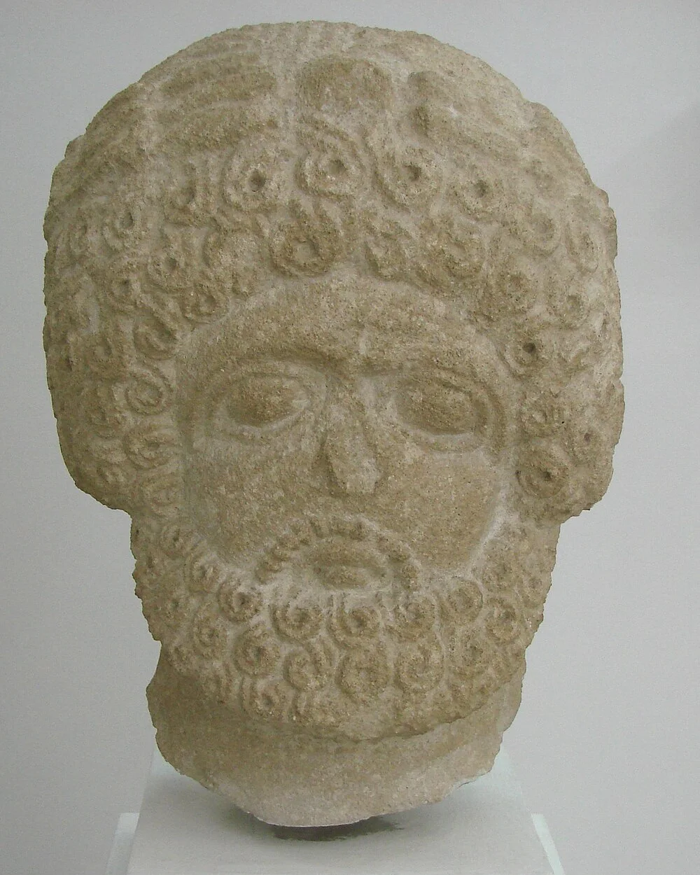
In 1958 Vassos Karageorghis found the hill at Phasoula as Mitford had described it, a heap of stones on the summit and broken statues scattered on the slopes. He had every fragment on the slopes taken to the district museum in Limassol: at least fifty statues, all of them headless, of about the fourth or fifth century AD. Seven limestone heads said to come from Phasoula, which the Cyprus Museum had bought from a dealer who had kept them for many years, matched them in style, and one fitted a body from the slopes. The site had never been systematically excavated.[3] Pieces found by chance in the fields were bought from Phasoula villagers in 1964, and another head entered the Limassol museum in 1979.[19][20] In Gunnis's time, on the Tuesday after Easter, the village carried a small icon of the Virgin in a carved frame to the top of the hill it called Castra, held a short service, and brought the icon back down to the church. Gunnis wondered whether the custom kept some memory of a pagan festival.[1]
References
- 1.Gunnis, R. (1947). Historic Cyprus: A Guide to its Towns and Villages, Monasteries and Castles (2nd ed.). London: Methuen, pp. 74, 156–159, 235, 259, 342, 383–384, 445.
- 2.Mitford, T. B. (1947). Notes on Some Published Inscriptions of Roman Cyprus. Annual of the British School at Athens, 42, 201–230, at p. 208.
- 3.Karageorghis, V. (1959). Chronique des fouilles et découvertes archéologiques à Chypre en 1958. Bulletin de correspondance hellénique, 83, 336–361, at pp. 343, 359–360.
- 4.Kitchener, H. H. (1885). A Trigonometrical Survey of the Island of Cyprus, 1 inch to 1 mile, 15 sheets and title sheet. London: Edward Stanford (sheets dated 1882; scans: National Library of Scotland).
- 5.Jerrold, W. (n.d.). Earl Kitchener of Khartoum: The Story of his Life. London: Joseph Johnson, pp. 38–39, 49–54.
- 6.Hadjikyriacou, A., Papadias, E., Vradis, A., & Chalkias, C. (c. 2021). Combining historical maps and censuses of Cyprus from the sixteenth to the twentieth century: a geospatial approach. Conference paper, pp. 2, 4.
- 7.Given, M. (2025). Over the landscape, in the landscape? Knowledge and agency in Cypriot archaeology, 1870–1910. In T. Kiely, A. Reeve & L. Crewe (eds), Empire & Excavation (pp. 35–48). Leiden: Sidestone Press.
- 8.Kiely, T. (2010). Charles Newton and the archaeology of Cyprus. Cahiers du Centre d'Études Chypriotes, 40, 231–251.
- 9.Cesnola, L. P. di (1877). Cyprus: Its Ancient Cities, Tombs, and Temples. A Narrative of Researches and Excavations during Ten Years' Residence as American Consul in that Island. London: John Murray, pp. 117–119, 145, 150.
- 10.Ohnefalsch-Richter, M. (1893). Kypros, the Bible and Homer. London: Asher & Co., pp. 14–15, 341.
- 11.Karageorghis, V. (1970). Chronique des fouilles et découvertes archéologiques à Chypre en 1969. Bulletin de correspondance hellénique, 94, 191–300, at p. 205.
- 12.Młynarczyk, J. (1980). The Paphian Sanctuary of Apollo Hylates. Report of the Department of Antiquities, Cyprus, 239–252, at p. 239.
- 13.Jeffery, G. (1918). A Description of the Historic Monuments of Cyprus. Nicosia: Government Printing Office, pp. 14, 198–200, 206–208, 273, 318, 349–350, 360, 371–373.
- 14.Hogarth, D. G. (1889). Devia Cypria: Notes of an Archaeological Journey in Cyprus in 1888. London: Henry Frowde, pp. 2, 13, 41, 47–51, 69, 79–80, 94–96, 99.
- 15.Steinberg, A., & Koucky, F. (1974). Preliminary metallurgical research on the ancient Cypriot copper industry. In L. E. Stager, A. Walker & G. E. Wright (eds), American Expedition to Idalion, Cyprus: First Preliminary Report, Seasons of 1971 and 1972 (ch. IX, at p. 149). Cambridge, MA: American Schools of Oriental Research (Supplementary Studies 18).
- 16.Karageorghis, V. (1977). Chronique des fouilles et découvertes archéologiques à Chypre en 1976. Bulletin de correspondance hellénique, 101, 707–779, at p. 769.
- 17.James, S., Blue, L., Rogers, A., & Score, V. (2021). From phantom town to maritime cultural landscape and beyond: Dreamer's Bay Roman-Byzantine 'port', the Akrotiri Peninsula, Cyprus, and eastern Mediterranean maritime communications. Levant. doi:10.1080/00758914.2021.1887647.
- 18.Młynarczyk, J. (1985). Remarks on the Classical Settlement on the Site of Nea Paphos. Archaeologia Cypria, 1, 69–78, at p. 72.
- 19.Karageorghis, V. (1965). Chronique des fouilles et découvertes archéologiques à Chypre en 1964. Bulletin de correspondance hellénique, 89, 231–300, at p. 253.
- 20.Karageorghis, V. (1980). Chronique des fouilles et découvertes archéologiques à Chypre en 1979. Bulletin de correspondance hellénique, 104, 761–803, at p. 772.
- 21.Karageorghis, V. (2000). Ancient Art from Cyprus: The Cesnola Collection in The Metropolitan Museum of Art. New York: The Metropolitan Museum of Art, no. 171.
- 22.The Metropolitan Museum of Art, New York, 74.51.2857, Limestone head of a bearded man. The Cesnola Collection, Purchased by subscription, 1874–76.
- 23.Army Map Service, Corps of Engineers, U.S. Army (1965–69). Cyprus 1:50,000, Series K715, Edition 2-AMS. Washington, D.C. (sheet 4011 II, Nicosia South: compiled 1964, field checked 1967; scans: Library of Congress, Geography and Map Division).
Corrections and additions
Spotted an error, or know more?
We correct errors of fact and add a dated note saying what was wrong.
We would like to hear about
- An error of fact
- A source or publication we have missed
- Photographs or documents that belong here
Tell us if you would like to be thanked by name on the page.