
Series·Salamis, French mission 1964–1974
Plans and drawings
474 plans · 1890–1986
Sites: Salamis, Salamis-Campanopetra
Drawing: F. Bady, 1968. Mission archéologique française de Kition-Salamine (MOM, Lyon), Nakala, SAL_OBPL_141095_0001. "Map of Cyprus in the Classical period, with relief and rivers". CC BY 4.0. Resized. 
Drawing: F. Bady, 1968. Mission archéologique française de Kition-Salamine (MOM, Lyon), Nakala, SAL_OBPL_141095_0002. "Plan of the Salamis site and its surroundings". CC BY 4.0. Resized. 
Drawing: Mission archéologique française de Kition-Salamine (MOM, Lyon), Nakala, SAL_OBPL_141095_0003. "Map of Greece showing the distribution of poets and men of letters". CC BY 4.0. Resized. 
Drawing: Mission archéologique française de Kition-Salamine (MOM, Lyon), Nakala, SAL_OBPL_141095_0004. "Map of the Greek world, dispersal of poets and men of letters". CC BY 4.0. Resized. 
Drawing: Mission archéologique française de Kition-Salamine (MOM, Lyon), Nakala, SAL_OBPL_141095_0005. "Cadastral plan of Salamis, sheets XXIV 34 E and XXIV 35 W". CC BY 4.0. Resized. 
Drawing: M. Calvet, 1964. Mission archéologique française de Kition-Salamine (MOM, Lyon), Nakala, SAL_OBPL_141095_0006. "Map of Cyprus with ancient site names". CC BY 4.0. Resized. 
Drawing: Mission archéologique française de Kition-Salamine (MOM, Lyon), Nakala, SAL_OBPL_141095_0007. "Nautical chart of Famagusta Bay". CC BY 4.0. Resized. 
Drawing: Monroe and Tubbs, 1890. Mission archéologique française de Kition-Salamine (MOM, Lyon), Nakala, SAL_OBPL_141095_0008. "Plan of Salamis after Monroe and Tubbs survey of 1890". CC BY 4.0. Resized. 
Drawing: Mission archéologique française de Kition-Salamine (MOM, Lyon), Nakala, SAL_OBPL_141095_0009. "Map of Classical Asia Minor, scale 1/4000000". CC BY 4.0. Resized. 
Drawing: Mission archéologique française de Kition-Salamine (MOM, Lyon), Nakala, SAL_OBPL_141095_0010. "Copy of an English plan of Salamis". CC BY 4.0. Resized. 
Drawing: Mission archéologique française de Kition-Salamine (MOM, Lyon), Nakala, SAL_OBPL_141095_0026. "Map of Cyprus with place names in Greek". CC BY 4.0. Resized. 
Drawing: P. A. Pironin. Mission archéologique française de Kition-Salamine (MOM, Lyon), Nakala, SAL_OBPL_141095_0101. "Map of Mediterranean amphora stamp find-spots and production sites". CC BY 4.0. Resized. 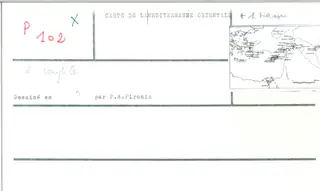
Drawing: P. A. Pironin. Mission archéologique française de Kition-Salamine (MOM, Lyon), Nakala, SAL_OBPL_141095_0102. "Map of the eastern Mediterranean". CC BY 4.0. Resized. 
Drawing: Beaufort and Graves, 1897. Mission archéologique française de Kition-Salamine (MOM, Lyon), Nakala, SAL_OBPL_141095_0119. "Map of the Caramanian coast and Cyprus, after Beaufort and Graves". CC BY 4.0. Resized. 
Drawing: A. Pironin. Mission archéologique française de Kition-Salamine (MOM, Lyon), Nakala, SAL_OBPL_141095_0141. "Map of Cyprus showing relief and river". CC BY 4.0. Resized. 
Drawing: P. A. Pironin, 1972. Mission archéologique française de Kition-Salamine (MOM, Lyon), Nakala, SAL_OBPL_141095_0145. "Map of Cyprus with relief, rivers and sites". CC BY 4.0. Resized. 
Drawing: P. A. Pironin, 1973. Mission archéologique française de Kition-Salamine (MOM, Lyon), Nakala, SAL_OBPL_141095_0150. "Map of Cyprus showing relief, rivers and sites". CC BY 4.0. Resized. 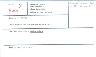
Drawing: P. A. Pironin, 1973. Mission archéologique française de Kition-Salamine (MOM, Lyon), Nakala, SAL_OBPL_141095_0151. "Map of Cyprus with rivers and located sites". CC BY 4.0. Resized. 
Drawing: Mission archéologique française de Kition-Salamine (MOM, Lyon), Nakala, SAL_OBPL_141095_0151bis. "Map of Cyprus, scale 1:1,000,000". CC BY 4.0. Resized. 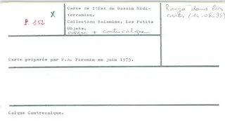
Drawing: P. A. Pironin, 1973. Mission archéologique française de Kition-Salamine (MOM, Lyon), Nakala, SAL_OBPL_141095_0152. "Map of the eastern Mediterranean basin". CC BY 4.0. Resized. 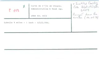
Drawing: 1973. Mission archéologique française de Kition-Salamine (MOM, Lyon), Nakala, SAL_OBPL_141095_0153. "Road map of Cyprus, 1973". CC BY 4.0. Resized. 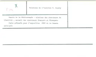
Drawing: 1974. Mission archéologique française de Kition-Salamine (MOM, Lyon), Nakala, SAL_OBPL_141095_0194. "Map of the Bassin de la Méditerranée research centre, prepared for the CNRS and Canada exhibition". CC BY 4.0. Resized. 
Drawing: O. Callot, 1975. Mission archéologique française de Kition-Salamine (MOM, Lyon), Nakala, SAL_OBPL_141095_0196. "Map of the Mediterranean for the lamps of the Nicosia museum". CC BY 4.0. Resized. 
Drawing: Mission archéologique française de Kition-Salamine (MOM, Lyon), Nakala, SAL_OBPL_141095_0206. "General plan of Salamis". CC BY 4.0. Resized. 
Drawing: Tubbs and Monroe. Mission archéologique française de Kition-Salamine (MOM, Lyon), Nakala, SAL_OBPL_141095_0209. "General plan of the site, Salamis". CC BY 4.0. Resized. 
Drawing: Mission archéologique française de Kition-Salamine (MOM, Lyon), Nakala, SAL_OBPL_141095_0214. "Map of Cyprus, plan or drawing". CC BY 4.0. Resized. 
Drawing: Mission archéologique française de Kition-Salamine (MOM, Lyon), Nakala, SAL_OBPL_141095_0217. "Plan of site contour lines, Campanopetra". CC BY 4.0. Resized. 
Drawing: F. Bady, 1976. Mission archéologique française de Kition-Salamine (MOM, Lyon), Nakala, SAL_OBPL_141102_0011. "Partial grid plan of Campanopetra and Rampart, Salamis". CC BY 4.0. Resized. 
Drawing: F. Bady, 1967. Mission archéologique française de Kition-Salamine (MOM, Lyon), Nakala, SAL_OBPL_141102_0012. "Partial grid plan, Campanopetra and Rampart sectors". CC BY 4.0. Resized. 
Drawing: F. Bady, 1968. Mission archéologique française de Kition-Salamine (MOM, Lyon), Nakala, SAL_OBPL_141102_0013. "Partial grid plan of Campanopetra and Rampart, Salamis, 1967-1968". CC BY 4.0. Resized. 
Drawing: F. Bady, 1966. Mission archéologique française de Kition-Salamine (MOM, Lyon), Nakala, SAL_OBPL_141102_0014. "Extended grid plan, Campanopetra, 1966". CC BY 4.0. Resized. 
Drawing: 1970. Mission archéologique française de Kition-Salamine (MOM, Lyon), Nakala, SAL_OBPL_141102_0015. "Extended grid plan of the Salamis excavation, 1970". CC BY 4.0. Resized. 
Drawing: F. Bady, 1972. Mission archéologique française de Kition-Salamine (MOM, Lyon), Nakala, SAL_OBPL_141102_0016. "Partial grid plan of Salamis sectors, 1972". CC BY 4.0. Resized. 
Drawing: P. A. Pironin, 1970. Mission archéologique française de Kition-Salamine (MOM, Lyon), Nakala, SAL_OBPL_141102_0017. "Partial grid plan of Campanopetra and the rampart, 1970". CC BY 4.0. Resized. 
Drawing: F. Bady, 1966. Mission archéologique française de Kition-Salamine (MOM, Lyon), Nakala, SAL_OBPL_141102_0018. "Plan of the excavation extension at the end of the 1966 season". CC BY 4.0. Resized. 
Drawing: Mission archéologique française de Kition-Salamine (MOM, Lyon), Nakala, SAL_OBPL_141102_0019. "Plan of the Campanopetra extended grid, 1966". CC BY 4.0. Resized. 
Drawing: F. Bady, 1972. Mission archéologique française de Kition-Salamine (MOM, Lyon), Nakala, SAL_OBPL_141102_0020. "Plan of principal monuments, Campanopetra and Rampart, 1968". CC BY 4.0. Resized. 
Drawing: 1970. Mission archéologique française de Kition-Salamine (MOM, Lyon), Nakala, SAL_OBPL_141102_0021. "Plan of the main monuments, Campanopetra and Rampart, 1970". CC BY 4.0. Resized. 
Drawing: F. Bady, 1972. Mission archéologique française de Kition-Salamine (MOM, Lyon), Nakala, SAL_OBPL_141102_0022. "Plan of Salamis sectors Campanopetra, Rampart and Huilerie, 1972". CC BY 4.0. Resized. 
Drawing: F. Bady, 1968. Mission archéologique française de Kition-Salamine (MOM, Lyon), Nakala, SAL_OBPL_141102_0023. "Plan of Campanopetra and Rampart sectors, October 1968". CC BY 4.0. Resized. 
Drawing: F. Bady and Chr. Polycarpou, 1972. Mission archéologique française de Kition-Salamine (MOM, Lyon), Nakala, SAL_OBPL_141102_0024. "Contour survey plan of the excavation area, Campanopetra". CC BY 4.0. Resized. 
Drawing: Ch. Polycarpou, 1970. Mission archéologique française de Kition-Salamine (MOM, Lyon), Nakala, SAL_OBPL_141102_0025. "Contour survey plan of the Temple of Zeus, 1970". CC BY 4.0. Resized. 
Drawing: F. Bady, 1965. Mission archéologique française de Kition-Salamine (MOM, Lyon), Nakala, SAL_OBPL_141102_0027. "Excavation state plan, western area, Campanopetra, 1965". CC BY 4.0. Resized. 
Drawing: P. A. Pironin and F. Bady, 1966. Mission archéologique française de Kition-Salamine (MOM, Lyon), Nakala, SAL_OBPL_141102_0028. "Plan of excavation state, Campanopetra, April 1966". CC BY 4.0. Resized. 
Drawing: P. A. Pironin and F. Bady, 1967. Mission archéologique française de Kition-Salamine (MOM, Lyon), Nakala, SAL_OBPL_141102_0029. "Plan of excavation state, Campanopetra, October 1967". CC BY 4.0. Resized. 
Drawing: P. A. Pironin, 1967. Mission archéologique française de Kition-Salamine (MOM, Lyon), Nakala, SAL_OBPL_141102_0030. "Excavation plan of the shops of the great courtyard, Campanopetra". CC BY 4.0. Resized. 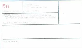
Drawing: P. A. Pironin, 1968. Mission archéologique française de Kition-Salamine (MOM, Lyon), Nakala, SAL_OBPL_141102_0031. "Plan of the basilica nave and apses, Campanopetra, May 1968". CC BY 4.0. Resized. 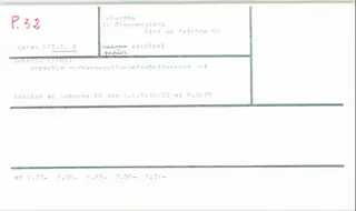
Drawing: P. A. Pironin and F. Bady, 1968. Mission archéologique française de Kition-Salamine (MOM, Lyon), Nakala, SAL_OBPL_141102_0032. "Plan of excavation state, narthex, patio, nave, apse, east courtyard". CC BY 4.0. Resized. 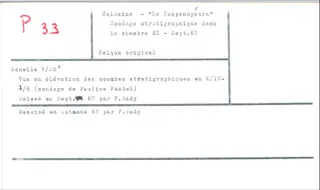
Drawing: F. Bady, 1967. Mission archéologique française de Kition-Salamine (MOM, Lyon), Nakala, SAL_OBPL_141102_0033. "Stratigraphic section of Chamber XI, Campanopetra". CC BY 4.0. Resized. 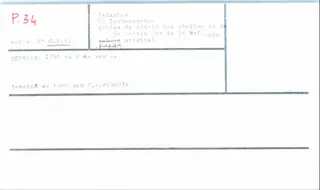
Drawing: P. A. Pironin, 1968. Mission archéologique française de Kition-Salamine (MOM, Lyon), Nakala, SAL_OBPL_141102_0034. "Detailed plan of the apses and east part of the nave, Campanopetra". CC BY 4.0. Resized. 
Drawing: Mission archéologique française de Kition-Salamine (MOM, Lyon), Nakala, SAL_OBPL_141102_0035. "Plan of the Boutiques Nord, Campanopetra". CC BY 4.0. Resized. 
Drawing: Mission archéologique française de Kition-Salamine (MOM, Lyon), Nakala, SAL_OBPL_141102_0036. "Plan of Campanopetra, west courtyard, April 1966". CC BY 4.0. Resized. 
Drawing: P. A. Pironin, 1969. Mission archéologique française de Kition-Salamine (MOM, Lyon), Nakala, SAL_OBPL_141102_0037. "Plan of the South sarcophagus and apse, partial basilica". CC BY 4.0. Resized. 
Drawing: P. A. Pironin, 1969. Mission archéologique française de Kition-Salamine (MOM, Lyon), Nakala, SAL_OBPL_141102_0038. "Plan of the nave and apses, Campanopetra 1969". CC BY 4.0. Resized. 
Drawing: P. A. Pironin. Mission archéologique française de Kition-Salamine (MOM, Lyon), Nakala, SAL_OBPL_141102_0039. "Plan of the Basilica and eastern court, state in 1961". CC BY 4.0. Resized. 
Drawing: Mission archéologique française de Kition-Salamine (MOM, Lyon), Nakala, SAL_OBPL_141102_0040. "Plan of the basilica beneath the Baths, Campanopetra". CC BY 4.0. Resized. 
Drawing: J. Bruchet. Mission archéologique française de Kition-Salamine (MOM, Lyon), Nakala, SAL_OBPL_141102_0041. "Plan of Les Baths, Campanopetra, 1969". CC BY 4.0. Resized. 
Drawing: P. A. Pironin. Mission archéologique française de Kition-Salamine (MOM, Lyon), Nakala, SAL_OBPL_141102_0042. "Plan of the Basilica eastern court and Baths, Campanopetra". CC BY 4.0. Resized. 
Drawing: P. A. Pironin. Mission archéologique française de Kition-Salamine (MOM, Lyon), Nakala, SAL_OBPL_141102_0043. "Plan of the basilica, Campanopetra sector". CC BY 4.0. Resized. 
Drawing: J. Bruchet and F. Bady and P. A. Pironin, 1971. Mission archéologique française de Kition-Salamine (MOM, Lyon), Nakala, SAL_OBPL_141102_0044. "Plan of the basilica at Campanopetra, state in October 1971". CC BY 4.0. Resized. 
Drawing: Mission archéologique française de Kition-Salamine (MOM, Lyon), Nakala, SAL_OBPL_141102_0045. "Plan of Campanopetra, October 1965". CC BY 4.0. Resized. 
Drawing: Mission archéologique française de Kition-Salamine (MOM, Lyon), Nakala, SAL_OBPL_141102_0046. "Study of the west courtyard, Campanopetra". CC BY 4.0. Resized. 
Drawing: Mission archéologique française de Kition-Salamine (MOM, Lyon), Nakala, SAL_OBPL_141102_0047. "Study plan of the West Courtyard, Campanopetra". CC BY 4.0. Resized. 
Drawing: F. Bady, 1965. Mission archéologique française de Kition-Salamine (MOM, Lyon), Nakala, SAL_OBPL_141102_0048. "Hatched plan of the Rampart excavation, levels trial". CC BY 4.0. Resized. 
Drawing: F. Bady, 1965. Mission archéologique française de Kition-Salamine (MOM, Lyon), Nakala, SAL_OBPL_141102_0049. "Plan of the Rampart, early excavation, squares K V/γ8-δ10". CC BY 4.0. Resized. 
Drawing: F. Bady, 1965. Mission archéologique française de Kition-Salamine (MOM, Lyon), Nakala, SAL_OBPL_141102_0050. "Plan of the early excavations, Rampart, squares K VI/1-3 and K V/8-10". CC BY 4.0. Resized. 
Drawing: F. Bady, 1965. Mission archéologique française de Kition-Salamine (MOM, Lyon), Nakala, SAL_OBPL_141102_0051. "Late wall, north elevation and stratigraphic section, Rampart". CC BY 4.0. Resized. 
Drawing: F. Bady, 1965. Mission archéologique française de Kition-Salamine (MOM, Lyon), Nakala, SAL_OBPL_141102_0052. "Late wall south elevation and stratigraphic section, Rampart". CC BY 4.0. Resized. 
Drawing: F. Bady, 1965. Mission archéologique française de Kition-Salamine (MOM, Lyon), Nakala, SAL_OBPL_141102_0053. "Detail of a pottery deposit in the excavation, Rampart". CC BY 4.0. Resized. 
Drawing: F. Bady, 1965. Mission archéologique française de Kition-Salamine (MOM, Lyon), Nakala, SAL_OBPL_141102_0054. "Elevation of an in-situ brick wall, Rampart". CC BY 4.0. Resized. 
Drawing: F. Bady, 1966. Mission archéologique française de Kition-Salamine (MOM, Lyon), Nakala, SAL_OBPL_141102_0055. "Plan of the western extension of the excavations, Rampart sector". CC BY 4.0. Resized. 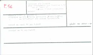
Drawing: F. Bady, 1966. Mission archéologique française de Kition-Salamine (MOM, Lyon), Nakala, SAL_OBPL_141102_0056. "Plan of the eastern extension of excavations, provisional state, Rampart". CC BY 4.0. Resized. 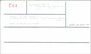
Drawing: F. Bady, 1966. Mission archéologique française de Kition-Salamine (MOM, Lyon), Nakala, SAL_OBPL_141102_0057. "Plan of the southern extension of the excavation, Rampart, October 1966". CC BY 4.0. Resized. 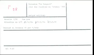
Drawing: F. Bady, 1966. Mission archéologique française de Kition-Salamine (MOM, Lyon), Nakala, SAL_OBPL_141102_0058. "Excavation state plan, Rampart, October 1966". CC BY 4.0. Resized. 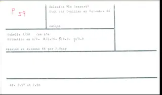
Drawing: F. Bady, 1966. Mission archéologique française de Kition-Salamine (MOM, Lyon), Nakala, SAL_OBPL_141102_0059. "Excavation state plan, Rampart, October 1966". CC BY 4.0. Resized. 
Drawing: F. Bady, 1966. Mission archéologique française de Kition-Salamine (MOM, Lyon), Nakala, SAL_OBPL_141102_0060. "North-south stratigraphic section A and B, Rampart, October 1966". CC BY 4.0. Resized. 
Drawing: F. Bady, 1966. Mission archéologique française de Kition-Salamine (MOM, Lyon), Nakala, SAL_OBPL_141102_0061. "Transverse stratigraphic section CD, Rampart, October 1966". CC BY 4.0. Resized. 
Drawing: F. Bady, 1966. Mission archéologique française de Kition-Salamine (MOM, Lyon), Nakala, SAL_OBPL_141102_0062. "Elevation details of brick walls A, B, C, Rampart". CC BY 4.0. Resized. 
Drawing: F. Bady, 1967. Mission archéologique française de Kition-Salamine (MOM, Lyon), Nakala, SAL_OBPL_141102_0063. "Plan of the rampart extension, stone wall with batter". CC BY 4.0. Resized. 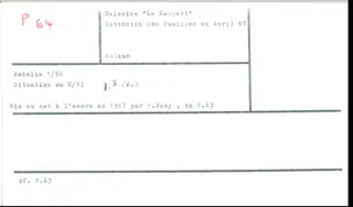
Drawing: F. Bady, 1967. Mission archéologique française de Kition-Salamine (MOM, Lyon), Nakala, SAL_OBPL_141102_0064. "Plan of the Rampart extension to the west, April 1967". CC BY 4.0. Resized. 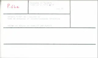
Drawing: F. Bady, 1967. Mission archéologique française de Kition-Salamine (MOM, Lyon), Nakala, SAL_OBPL_141102_0064a. "Column drums and Byzantine house drain, Rampart". CC BY 4.0. Resized. 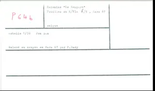
Drawing: F. Bady, 1967. Mission archéologique française de Kition-Salamine (MOM, Lyon), Nakala, SAL_OBPL_141102_0064b. "Plan of the Rampart sector, March 1967". CC BY 4.0. Resized. 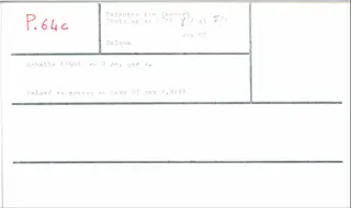
Drawing: F. Bady, 1967. Mission archéologique française de Kition-Salamine (MOM, Lyon), Nakala, SAL_OBPL_141102_0064c. "Plan of the Rampart, squares K VI/γ2 and K VI/δ2, March 1967". CC BY 4.0. Resized. 
Drawing: F. Bady, 1967. Mission archéologique française de Kition-Salamine (MOM, Lyon), Nakala, SAL_OBPL_141102_0065. "In-situ details of burials in ceramic vessels, Rampart". CC BY 4.0. Resized. 
Drawing: P. A. Pironin, 1967. Mission archéologique française de Kition-Salamine (MOM, Lyon), Nakala, SAL_OBPL_141102_0066. "Plan of ceramic burial, Tomb 10, Rampart". CC BY 4.0. Resized. 
Drawing: F. Bady, 1967. Mission archéologique française de Kition-Salamine (MOM, Lyon), Nakala, SAL_OBPL_141102_0067. "Plan of excavations, Rampart, April 1967". CC BY 4.0. Resized. 
Drawing: Mission archéologique française de Kition-Salamine (MOM, Lyon), Nakala, SAL_OBPL_141102_0068. "Photographic reduction of plan P67, Rampart". CC BY 4.0. Resized. 
Drawing: F. Bady, 1967. Mission archéologique française de Kition-Salamine (MOM, Lyon), Nakala, SAL_OBPL_141102_0069. "Detail plan of the in situ oven, Rampart, square K V/β10". CC BY 4.0. Resized. 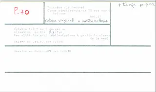
Drawing: F. Bady, 1967. Mission archéologique française de Kition-Salamine (MOM, Lyon), Nakala, SAL_OBPL_141102_0070. "North-south stratigraphic section through a brick wall, Rampart". CC BY 4.0. Resized. 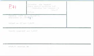
Drawing: F. Bady, 1967. Mission archéologique française de Kition-Salamine (MOM, Lyon), Nakala, SAL_OBPL_141102_0071. "East-west stratigraphic section, south elevation, Section AB, Rampart". CC BY 4.0. Resized. 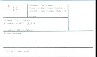
Drawing: F. Bady, 1967. Mission archéologique française de Kition-Salamine (MOM, Lyon), Nakala, SAL_OBPL_141102_0072. "East-west stratigraphic section, south elevation, Section BC, Rampart". CC BY 4.0. Resized. 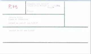
Drawing: F. Bady, 1968. Mission archéologique française de Kition-Salamine (MOM, Lyon), Nakala, SAL_OBPL_141102_0073. "Section and elevation of a hole, Rampart". CC BY 4.0. Resized. 
Drawing: F. Bady, 1968. Mission archéologique française de Kition-Salamine (MOM, Lyon), Nakala, SAL_OBPL_141102_0074. "Plan of excavation extension, upper level removed, Rampart". CC BY 4.0. Resized. 
Drawing: F. Bady, 1968. Mission archéologique française de Kition-Salamine (MOM, Lyon), Nakala, SAL_OBPL_141102_0075. "Elevation of mudbrick wall, east-west, Rampart". CC BY 4.0. Resized. 
Drawing: F. Bady, 1968. Mission archéologique française de Kition-Salamine (MOM, Lyon), Nakala, SAL_OBPL_141102_0076. "Excavation state plan of the rampart, October 1968". CC BY 4.0. Resized. 
Drawing: F. Bady, 1968. Mission archéologique française de Kition-Salamine (MOM, Lyon), Nakala, SAL_OBPL_141102_0076a. "Excavation plan of the Rampart, October 1968". CC BY 4.0. Resized. 
Drawing: 1969. Mission archéologique française de Kition-Salamine (MOM, Lyon), Nakala, SAL_OBPL_141102_0077. "Plan of excavation extension, Rampart sector, September 1969". CC BY 4.0. Resized. 
Drawing: 1969. Mission archéologique française de Kition-Salamine (MOM, Lyon), Nakala, SAL_OBPL_141102_0078. "Plan of excavation extension, Rampart, September 1969". CC BY 4.0. Resized. 
Drawing: Mission archéologique française de Kition-Salamine (MOM, Lyon), Nakala, SAL_OBPL_141102_0079. "South-north section of squares 4 to 3, rampart". CC BY 4.0. Resized. 
Drawing: P. A. Pironin, 1969. Mission archéologique française de Kition-Salamine (MOM, Lyon), Nakala, SAL_OBPL_141102_0080. "General plan of the Rampart, October 1969". CC BY 4.0. Resized. 
Drawing: F. Bady, 1969. Mission archéologique française de Kition-Salamine (MOM, Lyon), Nakala, SAL_OBPL_141102_0081. "General plan of the Rampart, October 1969". CC BY 4.0. Resized. 
Drawing: C. Bachasson, 1971. Mission archéologique française de Kition-Salamine (MOM, Lyon), Nakala, SAL_OBPL_141102_0082. "Plan of the Rampart, squares K V/α8 to ζ10, August 1971". CC BY 4.0. Resized. 
Drawing: B. Helly and J. Bruchet, 1970. Mission archéologique française de Kition-Salamine (MOM, Lyon), Nakala, SAL_OBPL_141102_0083. "Plan of scattered numbered blocks, Temple of Zeus". CC BY 4.0. Resized. 
Drawing: J. Bruchet, 1970. Mission archéologique française de Kition-Salamine (MOM, Lyon), Nakala, SAL_OBPL_141102_0084. "Detailed plan, Temple of Zeus, square E VII". CC BY 4.0. Resized. 
Drawing: P. A. Pironin, 1971. Mission archéologique française de Kition-Salamine (MOM, Lyon), Nakala, SAL_OBPL_141102_0085. "Plan of the superimposed excavation grids, 1965-1966". CC BY 4.0. Resized. 
Drawing: P. A. Pironin, 1971. Mission archéologique française de Kition-Salamine (MOM, Lyon), Nakala, SAL_OBPL_141102_0086. "Plan of rampart excavation, overlay of 1965 and 1966 grids". CC BY 4.0. Resized. 
Drawing: F. Bady, 1968. Mission archéologique française de Kition-Salamine (MOM, Lyon), Nakala, SAL_OBPL_141102_0087. "Excavation plan with altitudes, Rampart, 1968". CC BY 4.0. Resized. 
Drawing: P. Garczynski, 1971. Mission archéologique française de Kition-Salamine (MOM, Lyon), Nakala, SAL_OBPL_141102_0088. "Addition to the plan of the West atrium of the basilica". CC BY 4.0. Resized. 
Drawing: P. Garczynski, 1971. Mission archéologique française de Kition-Salamine (MOM, Lyon), Nakala, SAL_OBPL_141102_0089. "Overall plan of the basilica, East and West courts, Baths, Campanopetra". CC BY 4.0. Resized. 
Drawing: P. A. Pironin, 1969. Mission archéologique française de Kition-Salamine (MOM, Lyon), Nakala, SAL_OBPL_141102_0090. "Plan of the apse of the so-called Huilerie building, 1969". CC BY 4.0. Resized. 
Drawing: P. A. Pironin. Mission archéologique française de Kition-Salamine (MOM, Lyon), Nakala, SAL_OBPL_141102_0091. "Apse of the building known as the Huilerie". CC BY 4.0. Resized. 
Drawing: P. A. Pironin, 1969. Mission archéologique française de Kition-Salamine (MOM, Lyon), Nakala, SAL_OBPL_141102_0092. "Apse of the Huilerie building, plan print, 1969". CC BY 4.0. Resized. 
Drawing: P. A. Pironin, 1969. Mission archéologique française de Kition-Salamine (MOM, Lyon), Nakala, SAL_OBPL_141102_0093. "Apse of the so-called Huilerie building, plan 1969". CC BY 4.0. Resized. 
Drawing: P. A. Pironin, 1969. Mission archéologique française de Kition-Salamine (MOM, Lyon), Nakala, SAL_OBPL_141102_0094. "Plan of the apse and corridor openings, Huilerie 1969". CC BY 4.0. Resized. 
Drawing: P. A. Pironin, 1970. Mission archéologique française de Kition-Salamine (MOM, Lyon), Nakala, SAL_OBPL_141102_0095_0095bis. "Operating scheme of the Huilerie, 1970". CC BY 4.0. Resized. 
Drawing: P. A. Pironin, 1969. Mission archéologique française de Kition-Salamine (MOM, Lyon), Nakala, SAL_OBPL_141102_0096. "Plan of the apse and start of the corridors, Huilerie". CC BY 4.0. Resized. 
Drawing: J. Chevalier and C. Bachasson, 1971. Mission archéologique française de Kition-Salamine (MOM, Lyon), Nakala, SAL_OBPL_141102_0097. "Plan of the Huilerie, square I III, autumn 1971". CC BY 4.0. Resized. 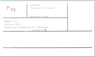
Drawing: J. Chevalier and C. Bachasson, 1971. Mission archéologique française de Kition-Salamine (MOM, Lyon), Nakala, SAL_OBPL_141102_0098. "Plan of the Huilerie, autumn 1971". CC BY 4.0. Resized. 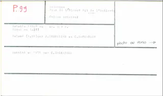
Drawing: J. Chevalier and C. Bachasson, 1971. Mission archéologique française de Kition-Salamine (MOM, Lyon), Nakala, SAL_OBPL_141102_0099. "Plan of the building known as the Huilerie, 1971". CC BY 4.0. Resized. 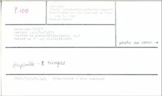
Drawing: Chr. Polycarpou, 1971. Mission archéologique française de Kition-Salamine (MOM, Lyon), Nakala, SAL_OBPL_141102_0100. "Levelling survey plan, Temple of Zeus sector, 1971". CC BY 4.0. Resized. 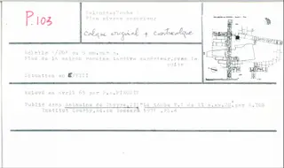
Drawing: P. A. Pironin, 1965. Mission archéologique française de Kition-Salamine (MOM, Lyon), Nakala, SAL_OBPL_141102_0103. "Plan of the upper level of a Late Roman house with well, Tomb 1". CC BY 4.0. Resized. 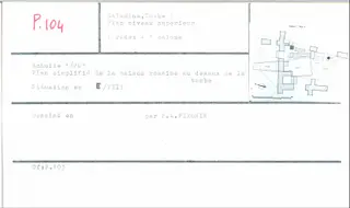
Drawing: P. A. Pironin. Mission archéologique française de Kition-Salamine (MOM, Lyon), Nakala, SAL_OBPL_141102_0104. "Upper level plan of the Roman house above Tomb 1". CC BY 4.0. Resized. 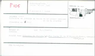
Drawing: P. A. Pironin. Mission archéologique française de Kition-Salamine (MOM, Lyon), Nakala, SAL_OBPL_141102_0105. "North-south section (A-B) of Roman house and chamber". CC BY 4.0. Resized. 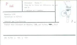
Drawing: P. A. Pironin. Mission archéologique française de Kition-Salamine (MOM, Lyon), Nakala, SAL_OBPL_141102_0106. "Plan of Tomb 1 and elevation of wall B". CC BY 4.0. Resized. 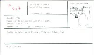
Drawing: P. A. Pironin. Mission archéologique française de Kition-Salamine (MOM, Lyon), Nakala, SAL_OBPL_141102_0107. "West-East section (C-D) through Roman house and well, Tomb 1". CC BY 4.0. Resized. 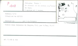
Drawing: P. A. Pironin. Mission archéologique française de Kition-Salamine (MOM, Lyon), Nakala, SAL_OBPL_141102_0108. "Plan of the chamber and upper level of vases, Tomb 1". CC BY 4.0. Resized. 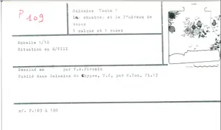
Drawing: P. A. Pironin. Mission archéologique française de Kition-Salamine (MOM, Lyon), Nakala, SAL_OBPL_141102_0109. "Plan of the chamber and second level of vases, Tomb 1". CC BY 4.0. Resized. 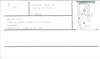
Drawing: F. Bady, 1968. Mission archéologique française de Kition-Salamine (MOM, Lyon), Nakala, SAL_OBPL_141102_0110. "Plan of the stone tomb found on the beach, Tomb XI". CC BY 4.0. Resized. 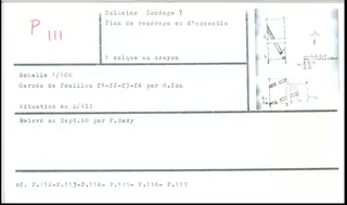
Drawing: F. Bady, 1968. Mission archéologique française de Kition-Salamine (MOM, Lyon), Nakala, SAL_OBPL_141102_0111. "Location and overall plan, Sondage Y, September 1968". CC BY 4.0. Resized. 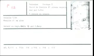
Drawing: F. Bady, 1968. Mission archéologique française de Kition-Salamine (MOM, Lyon), Nakala, SAL_OBPL_141102_0112. "Excavation plan of Sondage Y, square E VII/f1, upper level". CC BY 4.0. Resized. 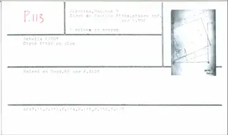
Drawing: F. Bady, 1968. Mission archéologique française de Kition-Salamine (MOM, Lyon), Nakala, SAL_OBPL_141102_0113. "Plan of excavation square F1 bis, lower level, Sondage Y". CC BY 4.0. Resized. 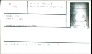
Drawing: F. Bady, 1968. Mission archéologique française de Kition-Salamine (MOM, Lyon), Nakala, SAL_OBPL_141102_0114. "Excavation square plan, Sondage Y, square E VII/f2". CC BY 4.0. Resized. 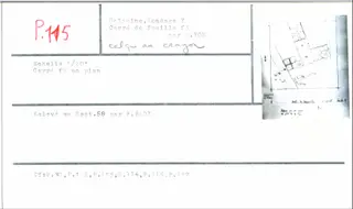
Drawing: F. Bady, 1968. Mission archéologique française de Kition-Salamine (MOM, Lyon), Nakala, SAL_OBPL_141102_0115. "Plan of excavation square E VII/f3, Sondage Y, September 1968". CC BY 4.0. Resized. 
Drawing: F. Bady, 1968. Mission archéologique française de Kition-Salamine (MOM, Lyon), Nakala, SAL_OBPL_141102_0116. "Plan of excavation square F4 bis, lower level, Sondage Y". CC BY 4.0. Resized. 
Drawing: F. Bady, 1968. Mission archéologique française de Kition-Salamine (MOM, Lyon), Nakala, SAL_OBPL_141102_0117. "Excavation square plan, upper level, Sondage Y". CC BY 4.0. Resized. 
Drawing: F. Bady and Ch. Polycarpou, 1968. Mission archéologique française de Kition-Salamine (MOM, Lyon), Nakala, SAL_OBPL_141102_0118. "Plan of the whole Salamis site, 1968". CC BY 4.0. Resized. 
Drawing: 1966. Mission archéologique française de Kition-Salamine (MOM, Lyon), Nakala, SAL_OBPL_141102_0120. "Excavation state plan of the East Atrium, Campanopetra". CC BY 4.0. Resized. 
Drawing: J. P. Tallhman, 1970. Mission archéologique française de Kition-Salamine (MOM, Lyon), Nakala, SAL_OBPL_141102_0121. "Stratigraphic sections, Sanctuary, square K V/ζ6". CC BY 4.0. Resized. 
Drawing: J. P. Tallhman, 1970. Mission archéologique française de Kition-Salamine (MOM, Lyon), Nakala, SAL_OBPL_141102_0122. "Stratigraphic sections, Sanctuary, square K V/ζ6". CC BY 4.0. Resized. 
Drawing: P. A. Pironin and F. Bady and P. Garczynski. Mission archéologique française de Kition-Salamine (MOM, Lyon), Nakala, SAL_OBPL_141102_0123. "Plan of the basilica and east atrium, Campanopetra". CC BY 4.0. Resized. 
Drawing: J. Bruchet and P. A. Pironin and P. Garczynski and F. Bady, 1971. Mission archéologique française de Kition-Salamine (MOM, Lyon), Nakala, SAL_OBPL_141102_0124. "Reduced plan of Campanopetra, squares L IV, K IV and K V, 1971". CC BY 4.0. Resized. 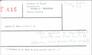
Drawing: F. Bady, 1971. Mission archéologique française de Kition-Salamine (MOM, Lyon), Nakala, SAL_OBPL_141102_0125. "Basilica and west atrium, state in 1971". CC BY 4.0. Resized. 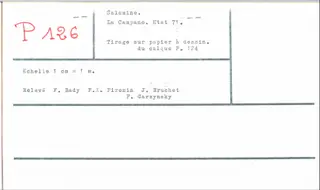
Drawing: J. Bruchet and P. A. Pironin and P. Garczynski and F. Bady. Mission archéologique française de Kition-Salamine (MOM, Lyon), Nakala, SAL_OBPL_141102_0126. "Plan of Campanopetra, squares L IV, K IV and K V, 1971". CC BY 4.0. Resized. 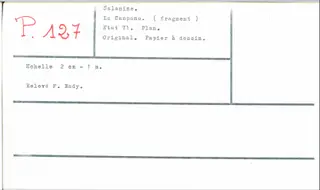
Drawing: F. Bady. Mission archéologique française de Kition-Salamine (MOM, Lyon), Nakala, SAL_OBPL_141102_0127. "Plan of Campanopetra, squares J IV, J V, K IV, K V and L IV". CC BY 4.0. Resized. 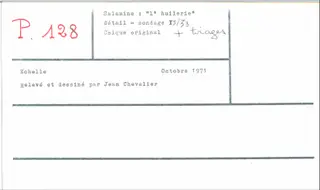
Drawing: J. Chevalier, 1971. Mission archéologique française de Kition-Salamine (MOM, Lyon), Nakala, SAL_OBPL_141102_0128. "Detail of sounding, Huilerie, October 1971". CC BY 4.0. Resized. 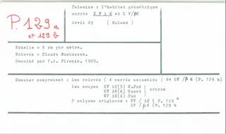
Drawing: C. Bachasson and P. A. Pironin, 1969. Mission archéologique française de Kition-Salamine (MOM, Lyon), Nakala, SAL_OBPL_141102_0129ab. "Plan of the geometric habitation, Sanctuary, April 1969". CC BY 4.0. Resized. 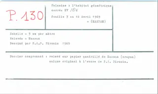
Drawing: P. A. Pironin, 1969. Mission archéologique française de Kition-Salamine (MOM, Lyon), Nakala, SAL_OBPL_141102_0130. "Plan of the geometric habitation, Sanctuary, square K V/θ6". CC BY 4.0. Resized. 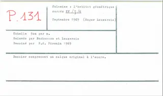
Drawing: Bachasson and Lauxerois and P. A. Pironin, 1969. Mission archéologique française de Kition-Salamine (MOM, Lyon), Nakala, SAL_OBPL_141102_0131. "Plan of the geometric habitation, Sanctuary sector, square K V/η6". CC BY 4.0. Resized. 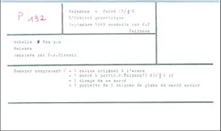
Drawing: P. A. Pironin, 1969. Mission archéologique française de Kition-Salamine (MOM, Lyon), Nakala, SAL_OBPL_141102_0132. "Plan of the geometric habitation, Sanctuary, square K V/ζ6". CC BY 4.0. Resized. 
Drawing: P. A. Pironin, 1969. Mission archéologique française de Kition-Salamine (MOM, Lyon), Nakala, SAL_OBPL_141102_0133. "Plan of the geometric habitation, Sanctuary, square K V/κ6". CC BY 4.0. Resized. 
Drawing: S. Dupré, 1970. Mission archéologique française de Kition-Salamine (MOM, Lyon), Nakala, SAL_OBPL_141102_0134. "Plan of Campanopetra, square L IV/γ 7, October 1970". CC BY 4.0. Resized. 
Drawing: 1970. Mission archéologique française de Kition-Salamine (MOM, Lyon), Nakala, SAL_OBPL_141102_0135. "Plan of the Sanctuary, Salamis, square L V/α6". CC BY 4.0. Resized. 
Drawing: J. Bruchet, 1970. Mission archéologique française de Kition-Salamine (MOM, Lyon), Nakala, SAL_OBPL_141102_0136. "North-west corner and Western Portico, Temple of Zeus". CC BY 4.0. Resized. 
Drawing: C. Bachasson, 1972. Mission archéologique française de Kition-Salamine (MOM, Lyon), Nakala, SAL_OBPL_141102_0137. "Plan of the Huilerie, square I III, 1972". CC BY 4.0. Resized. 
Drawing: C. Bachasson, 1972. Mission archéologique française de Kition-Salamine (MOM, Lyon), Nakala, SAL_OBPL_141102_0138. "Plan of the Huilerie, square I III, 1972". CC BY 4.0. Resized. 
Drawing: O. Callot, 1972. Mission archéologique française de Kition-Salamine (MOM, Lyon), Nakala, SAL_OBPL_141102_0139. "Reconstruction attempt of the apse room decoration, Huilerie". CC BY 4.0. Resized. 
Drawing: O. Callot, 1972. Mission archéologique française de Kition-Salamine (MOM, Lyon), Nakala, SAL_OBPL_141102_0140. "Elevation of the decoration of the apsidal room, Huilerie". CC BY 4.0. Resized. 
Drawing: 1970. Mission archéologique française de Kition-Salamine (MOM, Lyon), Nakala, SAL_OBPL_141102_0142. "Sketch plan, Sanctuary, square K V/ε5". CC BY 4.0. Resized. 
Drawing: 1970. Mission archéologique française de Kition-Salamine (MOM, Lyon), Nakala, SAL_OBPL_141102_0143. "Sketch plan of the Sanctuary, square K V/ε6". CC BY 4.0. Resized. 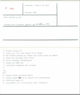
Drawing: B. Helly and J. Bruchet, 1971. Mission archéologique française de Kition-Salamine (MOM, Lyon), Nakala, SAL_OBPL_141102_0144. "Compilation of ten plans and sections, Temple of Zeus, Salamis". CC BY 4.0. Resized. 
Drawing: P. A. Pironin, 1972. Mission archéologique française de Kition-Salamine (MOM, Lyon), Nakala, SAL_OBPL_141102_0146. "Partial grid plan, Campanopetra and Rampart, 1972". CC BY 4.0. Resized. 
Drawing: P. A. Pironin. Mission archéologique française de Kition-Salamine (MOM, Lyon), Nakala, SAL_OBPL_141102_0147. "Plan of the chamber and upper level of vases, Tomb 1". CC BY 4.0. Resized. 
Drawing: P. A. Pironin. Mission archéologique française de Kition-Salamine (MOM, Lyon), Nakala, SAL_OBPL_141102_0148. "Plan of the chamber and second level of vases, Tomb 1". CC BY 4.0. Resized. 
Drawing: P. A. Pironin, 1972. Mission archéologique française de Kition-Salamine (MOM, Lyon), Nakala, SAL_OBPL_141102_0149. "General grid plan, Salamis, 1972". CC BY 4.0. Resized. 
Drawing: O. Callot, 1974. Mission archéologique française de Kition-Salamine (MOM, Lyon), Nakala, SAL_OBPL_141102_0154. "General plan of the Temple of Zeus after 1973 excavation". CC BY 4.0. Resized. 
Drawing: O. Callot, 1974. Mission archéologique française de Kition-Salamine (MOM, Lyon), Nakala, SAL_OBPL_141102_0155. "Plan of paved court southeast of the Temple of Zeus, 1974". CC BY 4.0. Resized. 
Drawing: O. Callot, 1973. Mission archéologique française de Kition-Salamine (MOM, Lyon), Nakala, SAL_OBPL_141102_0156. "General plan of the temple after the 1973 excavation". CC BY 4.0. Resized. 
Drawing: O. Callot, 1973. Mission archéologique française de Kition-Salamine (MOM, Lyon), Nakala, SAL_OBPL_141102_0157. "North-South and West-East sections, Temple of Zeus, square L IV". CC BY 4.0. Resized. 
Drawing: O. Callot, 1973. Mission archéologique française de Kition-Salamine (MOM, Lyon), Nakala, SAL_OBPL_141102_0158ab. "Reconstruction plan of the Temple of Zeus, 1st century AD". CC BY 4.0. Resized. 
Drawing: O. Callot, 1973. Mission archéologique française de Kition-Salamine (MOM, Lyon), Nakala, SAL_OBPL_141102_0159. "Chronology of the Temple of Zeus, 2nd to 1st century BC". CC BY 4.0. Resized. 
Drawing: O. Callot, 1973. Mission archéologique française de Kition-Salamine (MOM, Lyon), Nakala, SAL_OBPL_141102_0160. "Plan of the Temple of Zeus, chronology of the temple, 1st century". CC BY 4.0. Resized. 
Drawing: O. Callot, 1974. Mission archéologique française de Kition-Salamine (MOM, Lyon), Nakala, SAL_OBPL_141102_0161. "Chronology of the Temple of Zeus: collapse of the ramp, late 2nd to early 3rd century AD". CC BY 4.0. Resized. 
Drawing: O. Callot, 1974. Mission archéologique française de Kition-Salamine (MOM, Lyon), Nakala, SAL_OBPL_141102_0162. "Plan of the Temple of Zeus, chronology phase 4, 3rd century AD repairs". CC BY 4.0. Resized. 
Drawing: O. Callot, 1974. Mission archéologique française de Kition-Salamine (MOM, Lyon), Nakala, SAL_OBPL_141102_0163. "Temple of Zeus chronology: 6th-century destruction plan". CC BY 4.0. Resized. 
Drawing: O. Callot, 1974. Mission archéologique française de Kition-Salamine (MOM, Lyon), Nakala, SAL_OBPL_141102_0164. "Plan of the Temple of Zeus, chronology of the 6th century". CC BY 4.0. Resized. 
Drawing: O. Callot, 1974. Mission archéologique française de Kition-Salamine (MOM, Lyon), Nakala, SAL_OBPL_141102_0165. "Plan of the Temple of Zeus, chronology of the temple, 1974". CC BY 4.0. Resized. 
Drawing: O. Callot, 1974. Mission archéologique française de Kition-Salamine (MOM, Lyon), Nakala, SAL_OBPL_141102_0166. "Chronology of the Temple of Zeus, plan at 1:200". CC BY 4.0. Resized. 
Drawing: O. Callot, 1974. Mission archéologique française de Kition-Salamine (MOM, Lyon), Nakala, SAL_OBPL_141102_0167. "Chronology plan of the Temple of Zeus, 1974". CC BY 4.0. Resized. 
Drawing: O. Callot, 1974. Mission archéologique française de Kition-Salamine (MOM, Lyon), Nakala, SAL_OBPL_141102_0168. "Section through the access ramp, Temple of Zeus, 1974". CC BY 4.0. Resized. 
Drawing: O. Callot, 1974. Mission archéologique française de Kition-Salamine (MOM, Lyon), Nakala, SAL_OBPL_141102_0169. "Schematic plan of excavation with partial reconstruction, Temple of Zeus". CC BY 4.0. Resized. 
Drawing: C. Bachasson, 1973. Mission archéologique française de Kition-Salamine (MOM, Lyon), Nakala, SAL_OBPL_141102_0170. "General plan of the Huilerie, 1973". CC BY 4.0. Resized. 
Drawing: C. Bachasson, 1973. Mission archéologique française de Kition-Salamine (MOM, Lyon), Nakala, SAL_OBPL_141102_0171. "Plan of the cistern entrance, northern trench, Huilerie 1973". CC BY 4.0. Resized. 
Drawing: J. Chevalier, 1973. Mission archéologique française de Kition-Salamine (MOM, Lyon), Nakala, SAL_OBPL_141102_0172. "Plan of objects located in the Sanctuary, 1973". CC BY 4.0. Resized. 
Drawing: J. Chevalier and J. C. Decourt and P. Garivier, 1973. Mission archéologique française de Kition-Salamine (MOM, Lyon), Nakala, SAL_OBPL_141102_0172bis. "Plan of object locations, Fosse 3c and 2B, Sanctuary". CC BY 4.0. Resized. 
Drawing: J. Chevalier, 1974. Mission archéologique française de Kition-Salamine (MOM, Lyon), Nakala, SAL_OBPL_141102_0173. "Plan of Byzantine level, Sanctuary, 1974". CC BY 4.0. Resized. 
Drawing: J. Chevalier, 1974. Mission archéologique française de Kition-Salamine (MOM, Lyon), Nakala, SAL_OBPL_141102_0174. "Plan of the Sanctuary, level 1A, 1974". CC BY 4.0. Resized. 
Drawing: J. Chevalier, 1974. Mission archéologique française de Kition-Salamine (MOM, Lyon), Nakala, SAL_OBPL_141102_0175. "Plan of the Sanctuary, level 1B, 1974". CC BY 4.0. Resized. 
Drawing: J. Chevalier, 1974. Mission archéologique française de Kition-Salamine (MOM, Lyon), Nakala, SAL_OBPL_141102_0176. "Plan of level 2A, Sanctuary sector, April 1974". CC BY 4.0. Resized. 
Drawing: J. Chevalier, 1974. Mission archéologique française de Kition-Salamine (MOM, Lyon), Nakala, SAL_OBPL_141102_0177. "Plan of the Sanctuary, level 2B, square K V". CC BY 4.0. Resized. 
Drawing: J. Chevalier, 1974. Mission archéologique française de Kition-Salamine (MOM, Lyon), Nakala, SAL_OBPL_141102_0178. "Plan of Sanctuary, level 3A, 1974". CC BY 4.0. Resized. 
Drawing: J. Chevalier, 1974. Mission archéologique française de Kition-Salamine (MOM, Lyon), Nakala, SAL_OBPL_141102_0179. "Plan of the Sanctuary, level 3B, Salamis". CC BY 4.0. Resized. 
Drawing: P. Garczynski, 1972. Mission archéologique française de Kition-Salamine (MOM, Lyon), Nakala, SAL_OBPL_141102_0180. "North-South transverse section, Campanopetra 1972". CC BY 4.0. Resized. 
Drawing: J. Chevalier, 1974. Mission archéologique française de Kition-Salamine (MOM, Lyon), Nakala, SAL_OBPL_141102_0181. "Byzantine level plan of the Sanctuary sector". CC BY 4.0. Resized. 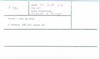
Drawing: J. Chevalier, 1974. Mission archéologique française de Kition-Salamine (MOM, Lyon), Nakala, SAL_OBPL_141102_0182. "Plan of the Sanctuary, Hellenistic level, October 1974". CC BY 4.0. Resized. 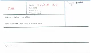
Drawing: J. Chevalier, 1974. Mission archéologique française de Kition-Salamine (MOM, Lyon), Nakala, SAL_OBPL_141102_0183. "Plan of the Sanctuary, level 3C, 1974". CC BY 4.0. Resized. 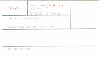
Drawing: J. Chevalier, 1974. Mission archéologique française de Kition-Salamine (MOM, Lyon), Nakala, SAL_OBPL_141102_0184. "Plan of the Sanctuary, level 3B, 1974". CC BY 4.0. Resized. 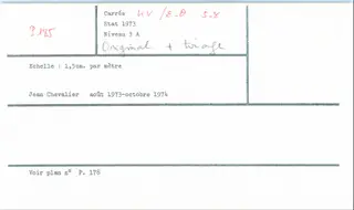
Drawing: J. Chevalier, 1974. Mission archéologique française de Kition-Salamine (MOM, Lyon), Nakala, SAL_OBPL_141102_0185. "Plan of the Sanctuary, level 3A". CC BY 4.0. Resized. 
Drawing: J. Chevalier, 1974. Mission archéologique française de Kition-Salamine (MOM, Lyon), Nakala, SAL_OBPL_141102_0186. "Plan of the Sanctuary, level 2B, 1974". CC BY 4.0. Resized. 
Drawing: J. Chevalier, 1974. Mission archéologique française de Kition-Salamine (MOM, Lyon), Nakala, SAL_OBPL_141102_0187. "Plan of the Sanctuary, Level 2A, squares K V/ε5–θ8". CC BY 4.0. Resized. 
Drawing: J. Chevalier, 1974. Mission archéologique française de Kition-Salamine (MOM, Lyon), Nakala, SAL_OBPL_141102_0188. "Plan of the Sanctuary, Level 1B, October 1974". CC BY 4.0. Resized. 
Drawing: J. Chevalier, 1974. Mission archéologique française de Kition-Salamine (MOM, Lyon), Nakala, SAL_OBPL_141102_0189. "Plan of Sanctuary, level 1A, October 1974". CC BY 4.0. Resized. 
Drawing: 1974. Mission archéologique française de Kition-Salamine (MOM, Lyon), Nakala, SAL_OBPL_141102_0190. "Plan or drawing of the Byzantine level, Sanctuary sector". CC BY 4.0. Resized. 
Drawing: J. Chevalier, 1973. Mission archéologique française de Kition-Salamine (MOM, Lyon), Nakala, SAL_OBPL_141102_0191. "Plan of the Sanctuary sector, 1973". CC BY 4.0. Resized. 
Drawing: 1969–73. Mission archéologique française de Kition-Salamine (MOM, Lyon), Nakala, SAL_OBPL_141102_0192. "Plan by quadrant, Sanctuary, square K V". CC BY 4.0. Resized. 
Drawing: 1969–72. Mission archéologique française de Kition-Salamine (MOM, Lyon), Nakala, SAL_OBPL_141102_0193. "Non-definitive plan of squares K V, Sanctuary sector". CC BY 4.0. Resized. 
Drawing: O. Callot, 1975. Mission archéologique française de Kition-Salamine (MOM, Lyon), Nakala, SAL_OBPL_141102_0195. "General plan of the excavation after the 1974 campaign". CC BY 4.0. Resized. 
Drawing: Mission archéologique française de Kition-Salamine (MOM, Lyon), Nakala, SAL_OBPL_141102_0197. "Site plan, Salamis (plan or drawing)". CC BY 4.0. Resized. 
Drawing: Mission archéologique française de Kition-Salamine (MOM, Lyon), Nakala, SAL_OBPL_141102_0198. "Site plan, drawing SAL_OBPL_141102_0198". CC BY 4.0. Resized. 
Drawing: O. Callot, 1975. Mission archéologique française de Kition-Salamine (MOM, Lyon), Nakala, SAL_OBPL_141102_0199. "General plan of the excavation site, 1975". CC BY 4.0. Resized. 
Drawing: O. Callot, 1975. Mission archéologique française de Kition-Salamine (MOM, Lyon), Nakala, SAL_OBPL_141102_0200. "Plan of the Temple of Zeus, square E VII, 1975". CC BY 4.0. Resized. 
Drawing: O. Callot, 1975. Mission archéologique française de Kition-Salamine (MOM, Lyon), Nakala, SAL_OBPL_141102_0201. "Plan of the area west of the Temple of Zeus, square E VII". CC BY 4.0. Resized. 
Drawing: O. Callot, 1975. Mission archéologique française de Kition-Salamine (MOM, Lyon), Nakala, SAL_OBPL_141102_0202. "Plan of the paved courtyard to the east, Temple of Zeus, 1975". CC BY 4.0. Resized. 
Drawing: O. Callot, 1975. Mission archéologique française de Kition-Salamine (MOM, Lyon), Nakala, SAL_OBPL_141102_0203. "Plan of the north façade of the Temple of Zeus, reconstruction attempt (1974)". CC BY 4.0. Resized. 
Drawing: O. Callot, 1975. Mission archéologique française de Kition-Salamine (MOM, Lyon), Nakala, SAL_OBPL_141102_0204. "East facade of the Temple of Zeus, reconstruction attempt". CC BY 4.0. Resized. 
Drawing: P. Pironin, 1965. Mission archéologique française de Kition-Salamine (MOM, Lyon), Nakala, SAL_OBPL_141102_0205. "Plan of the Salamis site, coastal structures". CC BY 4.0. Resized. 
Drawing: O. Callot, 1980. Mission archéologique française de Kition-Salamine (MOM, Lyon), Nakala, SAL_OBPL_141102_0207. "General plan of the building, Huilerie sector". CC BY 4.0. Resized. 
Drawing: F. Bady, 1967. Mission archéologique française de Kition-Salamine (MOM, Lyon), Nakala, SAL_OBPL_141102_0208. "Location sketch of funerary deposits 1 and 2, Rampart". CC BY 4.0. Resized. 
Drawing: F. Bady. Mission archéologique française de Kition-Salamine (MOM, Lyon), Nakala, SAL_OBPL_141102_0210. "Plan of the Campanopetra and Rampart sectors, after Polycarpou". CC BY 4.0. Resized. 
Drawing: F. Bady. Mission archéologique française de Kition-Salamine (MOM, Lyon), Nakala, SAL_OBPL_141102_0211. "Site and surroundings after Polycarpou, plan". CC BY 4.0. Resized. 
Drawing: P. A. Pironin. Mission archéologique française de Kition-Salamine (MOM, Lyon), Nakala, SAL_OBPL_141102_0212. "Plan of the Campanopetra sector, Salamis, 1972". CC BY 4.0. Resized. 
Drawing: Mission archéologique française de Kition-Salamine (MOM, Lyon), Nakala, SAL_OBPL_141102_0213. "Plan of Campanopetra, blocks of various squares". CC BY 4.0. Resized. 
Drawing: O. Callot, 1974. Mission archéologique française de Kition-Salamine (MOM, Lyon), Nakala, SAL_OBPL_141102_0215. "Plan of the Baptistery and other structures, Campanopetra". CC BY 4.0. Resized. 
Drawing: O. Callot, 1974. Mission archéologique française de Kition-Salamine (MOM, Lyon), Nakala, SAL_OBPL_141102_0216. "Plan of excavations north-west of the basilica and east atrium, Campanopetra". CC BY 4.0. Resized. 
Drawing: O. Callot and B. Helly, 1981–82. Mission archéologique française de Kition-Salamine (MOM, Lyon), Nakala, SAL_OBPL_141102_9999. "General illustration of the Huilerie, Salamis". CC BY 4.0. Resized. 
Drawing: O. Callot. Mission archéologique française de Kition-Salamine (MOM, Lyon), Nakala, SAL_OBPL_C_141095_0001. "Plan of the eastern part of the Mediterranean basin". CC BY 4.0. Resized. 
Drawing: P. Defarges, 1981. Mission archéologique française de Kition-Salamine (MOM, Lyon), Nakala, SAL_OBPL_C_141095_0002. "Map of the island of Cyprus". CC BY 4.0. Resized. 
Drawing: P. Defarges, 1981. Mission archéologique française de Kition-Salamine (MOM, Lyon), Nakala, SAL_OBPL_C_141095_0003. "Map of the Mediterranean basin". CC BY 4.0. Resized. 
Drawing: O. Callot, 1980. Mission archéologique française de Kition-Salamine (MOM, Lyon), Nakala, SAL_OBPL_C_141095_0004. "Plan or drawing, number SAL_OBPL_C_141095_0004". CC BY 4.0. Resized. 
Drawing: Mission archéologique française de Kition-Salamine (MOM, Lyon), Nakala, SAL_OBPL_C_141095_0005. "Plan of the Near East after Father Howes' map". CC BY 4.0. Resized. 
Drawing: Caroline Florimmol, 1986. Mission archéologique française de Kition-Salamine (MOM, Lyon), Nakala, SAL_OBPL_C_141095_0006. "Plan or drawing, record SAL_OBPL_C_141095_0006". CC BY 4.0. Resized. 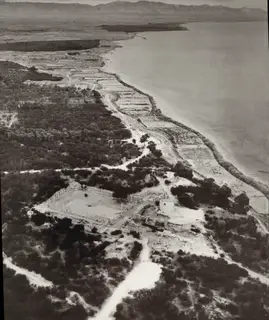
Drawing: Mission archéologique française de Kition-Salamine (MOM, Lyon), Nakala, SAL_PA_123978_0001. "Plan of Campanopetra, squares L IV, K IV, J V, K V and J IV". CC BY 4.0. Resized. 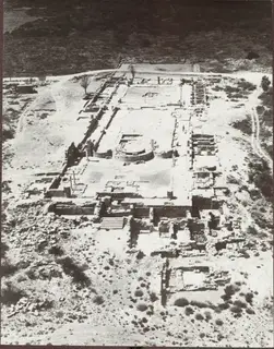
Drawing: Mission archéologique française de Kition-Salamine (MOM, Lyon), Nakala, SAL_PA_123978_0002. "Plan of the Temple of Zeus, square E VII". CC BY 4.0. Resized. 
Drawing: Mission archéologique française de Kition-Salamine (MOM, Lyon), Nakala, SAL_PA_123978_0003. "Plan of Campanopetra, squares J IV to L IV". CC BY 4.0. Resized. 
Drawing: Mission archéologique française de Kition-Salamine (MOM, Lyon), Nakala, SAL_PA_123978_0004. "Plan of Campanopetra, squares L IV, K IV, J IV, K V and J V". CC BY 4.0. Resized. 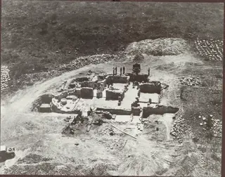
Drawing: Mission archéologique française de Kition-Salamine (MOM, Lyon), Nakala, SAL_PA_123978_0005. "Plan of the Huilerie, square I III". CC BY 4.0. Resized. 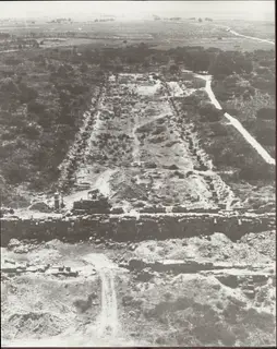
Drawing: Mission archéologique française de Kition-Salamine (MOM, Lyon), Nakala, SAL_PA_123978_0006. "Plan of Campanopetra, squares J IV to K V". CC BY 4.0. Resized. 
Drawing: Mission archéologique française de Kition-Salamine (MOM, Lyon), Nakala, SAL_PA_123978_0007. "Plan of Campanopetra, squares L IV, K IV, K V, J IV and J V". CC BY 4.0. Resized. 
Drawing: Mission archéologique française de Kition-Salamine (MOM, Lyon), Nakala, SAL_PA_123978_0008. "Plan of Campanopetra, squares J IV to L IV". CC BY 4.0. Resized. 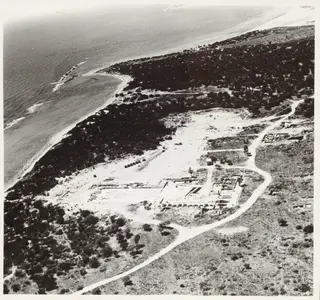
Drawing: Mission archéologique française de Kition-Salamine (MOM, Lyon), Nakala, SAL_PA_123978_0009. "Plan of Campanopetra, squares L IV, K IV, K V, J IV and J V". CC BY 4.0. Resized. 
Drawing: Mission archéologique française de Kition-Salamine (MOM, Lyon), Nakala, SAL_PA_123978_0010. "Plan of Campanopetra, squares L IV, K IV, K V, J IV and J V". CC BY 4.0. Resized. 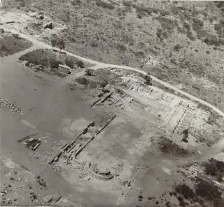
Drawing: Mission archéologique française de Kition-Salamine (MOM, Lyon), Nakala, SAL_PA_123978_0011. "Plan of Campanopetra, squares J IV, J V, K IV, K V and L IV". CC BY 4.0. Resized. 
Drawing: Mission archéologique française de Kition-Salamine (MOM, Lyon), Nakala, SAL_PA_123978_0012. "Plan of Campanopetra, squares J IV to L IV". CC BY 4.0. Resized. 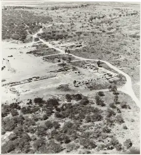
Drawing: Mission archéologique française de Kition-Salamine (MOM, Lyon), Nakala, SAL_PA_123978_0013. "Plan of Campanopetra, squares J IV, J V, K IV, K V and L IV". CC BY 4.0. Resized. 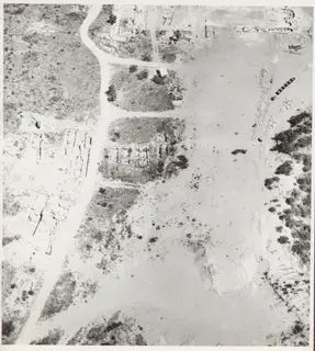
Drawing: Mission archéologique française de Kition-Salamine (MOM, Lyon), Nakala, SAL_PA_123978_0014. "Plan of Campanopetra and Rampart sectors, squares J IV to L VI". CC BY 4.0. Resized. 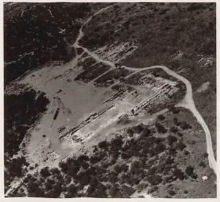
Drawing: Mission archéologique française de Kition-Salamine (MOM, Lyon), Nakala, SAL_PA_123978_0015. "Plan of Campanopetra, squares L IV, K IV, K V, J IV and J V". CC BY 4.0. Resized. 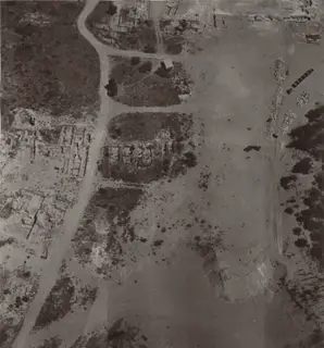
Drawing: Mission archéologique française de Kition-Salamine (MOM, Lyon), Nakala, SAL_PA_123978_0016. "Plan of Campanopetra and Rampart sectors, squares J IV to L VI". CC BY 4.0. Resized. 
Drawing: Mission archéologique française de Kition-Salamine (MOM, Lyon), Nakala, SAL_PA_123978_0017. "Plan of Campanopetra, squares J IV to L IV". CC BY 4.0. Resized. 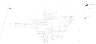
Drawing: J. Chevalier and C. Bachasson, 1971. Mission archéologique française de Kition-Salamine (MOM, Lyon), Nakala, SAL_PLAN_132452_0099. "Plan of the building known as the Huilerie, 1971". CC BY 4.0. Resized. 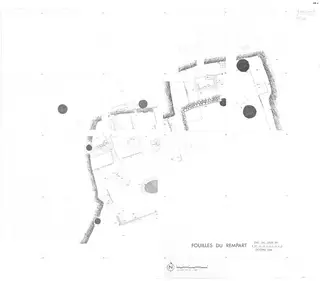
Drawing: F. Bady, 1968. Mission archéologique française de Kition-Salamine (MOM, Lyon), Nakala, SAL_PLAN_132453_0076. "Excavation state plan, Rampart, October 1968". CC BY 4.0. Resized. 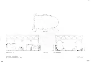
Drawing: O. Callot, 1972. Mission archéologique française de Kition-Salamine (MOM, Lyon), Nakala, SAL_PLAN_132455_0139. "Reconstruction essay of the decoration of the apse room, Huilerie". CC BY 4.0. Resized. 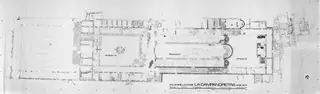
Drawing: J. Bruchet and P. A. Pironin and P. Garczynski and F. Bady, 1971. Mission archéologique française de Kition-Salamine (MOM, Lyon), Nakala, SAL_PLAN_132456_0124. "Plan of Campanopetra, 1971 (reduced)". CC BY 4.0. Resized. 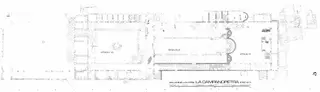
Drawing: J. Bruchet and P. A. Pironin and P. Garczynski and F. Bady. Mission archéologique française de Kition-Salamine (MOM, Lyon), Nakala, SAL_PLAN_132456_0126. "Plan of Campanopetra, sectors L IV and K IV-K V, 1971". CC BY 4.0. Resized. 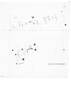
Drawing: F. Bady, 1968. Mission archéologique française de Kition-Salamine (MOM, Lyon), Nakala, SAL_PLAN_132457_0076a. "Excavation state plan of the Rampart, October 1968". CC BY 4.0. Resized. 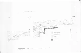
Drawing: F. Bady, 1967. Mission archéologique française de Kition-Salamine (MOM, Lyon), Nakala, SAL_PLAN_132458_0070. "North-south stratigraphic section through a brick wall, Rampart". CC BY 4.0. Resized. 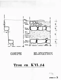
Drawing: F. Bady, 1968. Mission archéologique française de Kition-Salamine (MOM, Lyon), Nakala, SAL_PLAN_132492_0073. "Detail of a hole, section and elevation, Rampart". CC BY 4.0. Resized. 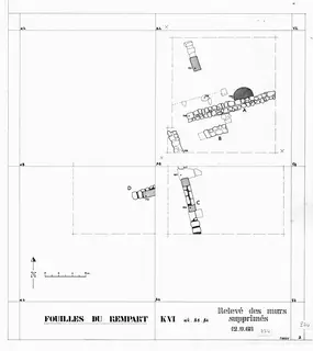
Drawing: F. Bady, 1968. Mission archéologique française de Kition-Salamine (MOM, Lyon), Nakala, SAL_PLAN_132492_0074. "Plan of the extension of the excavations, rampart, upper level removed". CC BY 4.0. Resized. 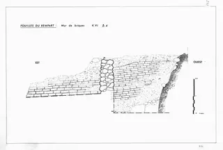
Drawing: F. Bady, 1968. Mission archéologique française de Kition-Salamine (MOM, Lyon), Nakala, SAL_PLAN_132492_0075. "Mudbrick wall, east-west elevation, Rampart". CC BY 4.0. Resized. 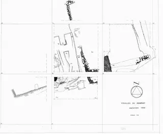
Drawing: 1969. Mission archéologique française de Kition-Salamine (MOM, Lyon), Nakala, SAL_PLAN_132492_0077. "Plan of the rampart excavation extension, September 1969". CC BY 4.0. Resized. 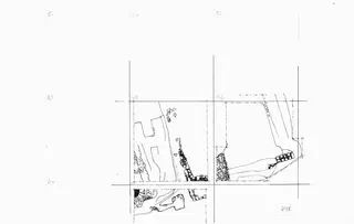
Drawing: 1969. Mission archéologique française de Kition-Salamine (MOM, Lyon), Nakala, SAL_PLAN_132492_0078. "Plan of the Rampart excavation extension, September 1969". CC BY 4.0. Resized. 
Drawing: Mission archéologique française de Kition-Salamine (MOM, Lyon), Nakala, SAL_PLAN_132492_0079. "South-North section, rampart, squares 4 to 3". CC BY 4.0. Resized. 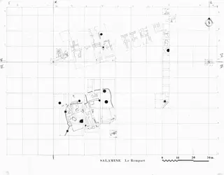
Drawing: P. A. Pironin, 1969. Mission archéologique française de Kition-Salamine (MOM, Lyon), Nakala, SAL_PLAN_132492_0080. "General plan of the Rampart, October 1969". CC BY 4.0. Resized. 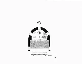
Drawing: P. A. Pironin, 1969. Mission archéologique française de Kition-Salamine (MOM, Lyon), Nakala, SAL_PLAN_132493_0090. "Apse of the building known as the Huilerie, plan". CC BY 4.0. Resized. 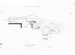
Drawing: F. Bady, 1967. Mission archéologique française de Kition-Salamine (MOM, Lyon), Nakala, SAL_PLAN_132494_0071. "Stratigraphic section of the Rampart, south elevation, section AB". CC BY 4.0. Resized. 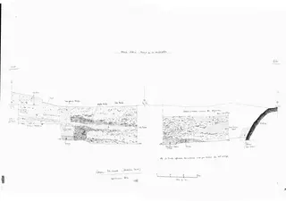
Drawing: F. Bady, 1967. Mission archéologique française de Kition-Salamine (MOM, Lyon), Nakala, SAL_PLAN_132495_0072. "East-west stratigraphic section of the Rampart, south elevation, Section BC". CC BY 4.0. Resized. 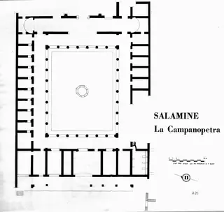
Drawing: P. A. Pironin and F. Bady, 1967. Mission archéologique française de Kition-Salamine (MOM, Lyon), Nakala, SAL_PLAN_132498_0029. "Plan of Campanopetra, state of excavation, October 1967". CC BY 4.0. Resized. 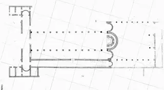
Drawing: P. A. Pironin, 1968. Mission archéologique française de Kition-Salamine (MOM, Lyon), Nakala, SAL_PLAN_132498_0031. "Plan of the basilica nave and apses, Campanopetra, May 1968". CC BY 4.0. Resized. 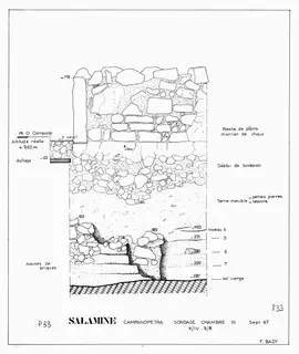
Drawing: F. Bady, 1967. Mission archéologique française de Kition-Salamine (MOM, Lyon), Nakala, SAL_PLAN_132498_0033. "Stratigraphic section of Chamber XI, Campanopetra". CC BY 4.0. Resized. 
Drawing: Mission archéologique française de Kition-Salamine (MOM, Lyon), Nakala, SAL_PLAN_132498_0047. "Study of the West courtyard, Campanopetra". CC BY 4.0. Resized. 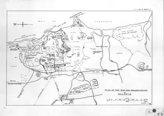
Drawing: F. Bady, 1968. Mission archéologique française de Kition-Salamine (MOM, Lyon), Nakala, SAL_PLAN_132499_0002. "Plan of the Salamis site and its surroundings". CC BY 4.0. Resized. 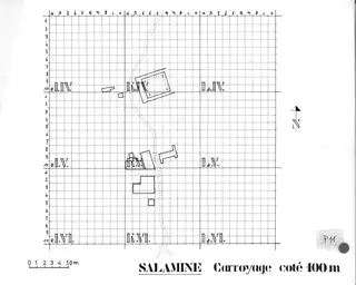
Drawing: F. Bady, 1976. Mission archéologique française de Kition-Salamine (MOM, Lyon), Nakala, SAL_PLAN_132499_0011. "Partial grid plan, Campanopetra and Rampart". CC BY 4.0. Resized. 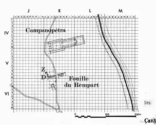
Drawing: F. Bady, 1967. Mission archéologique française de Kition-Salamine (MOM, Lyon), Nakala, SAL_PLAN_132499_0012. "Partial grid plan of Campanopetra and Rampart, 1967-1968". CC BY 4.0. Resized. 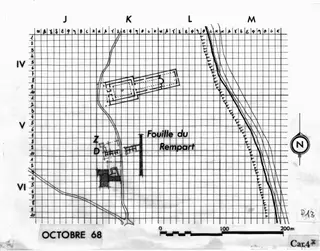
Drawing: F. Bady, 1968. Mission archéologique française de Kition-Salamine (MOM, Lyon), Nakala, SAL_PLAN_132499_0013. "Partial grid plan, Campanopetra and Rampart, 1967-1968". CC BY 4.0. Resized. 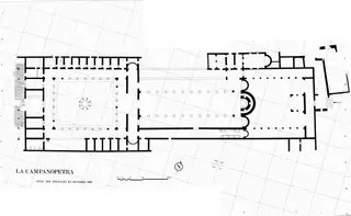
Drawing: P. A. Pironin. Mission archéologique française de Kition-Salamine (MOM, Lyon), Nakala, SAL_PLAN_132500_0043. "Plan of the basilica at Campanopetra, Salamis". CC BY 4.0. Resized. 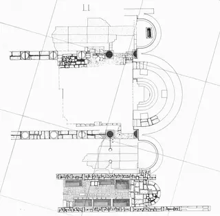
Drawing: P. A. Pironin, 1969. Mission archéologique française de Kition-Salamine (MOM, Lyon), Nakala, SAL_PLAN_132501_0037. "Sarcophagus and south apse, partial basilica, Campanopetra". CC BY 4.0. Resized. 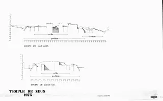
Drawing: O. Callot, 1973. Mission archéologique française de Kition-Salamine (MOM, Lyon), Nakala, SAL_PLAN_132504_0157. "South-North and West-East sections, Temple of Zeus, 1973". CC BY 4.0. Resized. 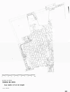
Drawing: O. Callot, 1974. Mission archéologique française de Kition-Salamine (MOM, Lyon), Nakala, SAL_PLAN_132505_0155. "Plan of the paved courtyard south-east of the Temple of Zeus". CC BY 4.0. Resized. 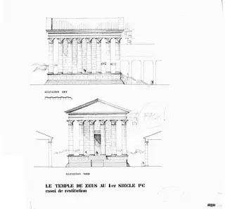
Drawing: O. Callot, 1973. Mission archéologique française de Kition-Salamine (MOM, Lyon), Nakala, SAL_PLAN_132506_0158. "Reconstruction plan of the Temple of Zeus, 1st century AD". CC BY 4.0. Resized. 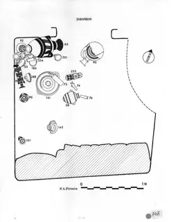
Drawing: P. A. Pironin. Mission archéologique française de Kition-Salamine (MOM, Lyon), Nakala, SAL_PLAN_132510_0108. "Plan of the chamber and upper level of vases, Tomb 1". CC BY 4.0. Resized. 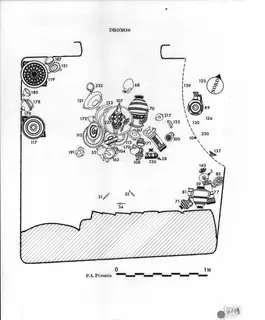
Drawing: P. A. Pironin. Mission archéologique française de Kition-Salamine (MOM, Lyon), Nakala, SAL_PLAN_132510_0109. "Plan of Tomb 1 chamber and second level of vases". CC BY 4.0. Resized. 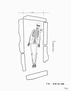
Drawing: F. Bady, 1968. Mission archéologique française de Kition-Salamine (MOM, Lyon), Nakala, SAL_PLAN_132510_0110. "Plan of the stone tomb found on the beach, Tomb XI". CC BY 4.0. Resized. 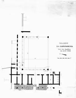
Drawing: 1966. Mission archéologique française de Kition-Salamine (MOM, Lyon), Nakala, SAL_PLAN_132510_0120. "Excavation state plan, East Atrium, Campanopetra". CC BY 4.0. Resized. 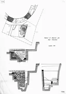
Drawing: J. Chevalier, 1971. Mission archéologique française de Kition-Salamine (MOM, Lyon), Nakala, SAL_PLAN_132510_0128. "Detail of the sounding in the Huilerie, square I III/ζ3". CC BY 4.0. Resized. 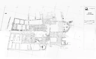
Drawing: C. Bachasson, 1972. Mission archéologique française de Kition-Salamine (MOM, Lyon), Nakala, SAL_PLAN_132510_0137. "Plan of the Huilerie, 1972". CC BY 4.0. Resized. 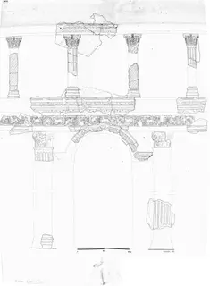
Drawing: O. Callot, 1972. Mission archéologique française de Kition-Salamine (MOM, Lyon), Nakala, SAL_PLAN_132510_0140. "Elevation of the apse room decoration, Huilerie". CC BY 4.0. Resized. 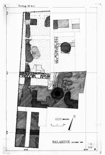
Drawing: F. Bady, 1965. Mission archéologique française de Kition-Salamine (MOM, Lyon), Nakala, SAL_PLAN_132511_0048. "Hatched plan of the Rampart by level, trial". CC BY 4.0. Resized. 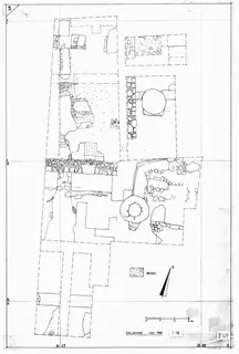
Drawing: F. Bady, 1965. Mission archéologique française de Kition-Salamine (MOM, Lyon), Nakala, SAL_PLAN_132511_0049. "Plan of the Rampart, first excavations, October 1965". CC BY 4.0. Resized. 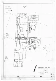
Drawing: F. Bady, 1965. Mission archéologique française de Kition-Salamine (MOM, Lyon), Nakala, SAL_PLAN_132511_0050. "Plan of the first excavations at the Rampart, with old grid". CC BY 4.0. Resized. 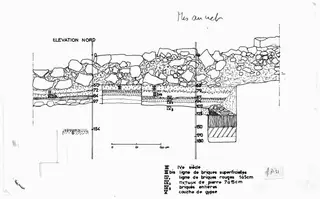
Drawing: F. Bady, 1965. Mission archéologique française de Kition-Salamine (MOM, Lyon), Nakala, SAL_PLAN_132511_0051. "Late wall, north elevation and stratigraphic section, Rampart". CC BY 4.0. Resized. 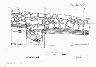
Drawing: F. Bady, 1965. Mission archéologique française de Kition-Salamine (MOM, Lyon), Nakala, SAL_PLAN_132511_0052. "Late wall, south elevation and stratigraphic section, Rampart". CC BY 4.0. Resized. 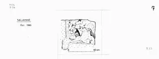
Drawing: F. Bady, 1965. Mission archéologique française de Kition-Salamine (MOM, Lyon), Nakala, SAL_PLAN_132511_0053. "Detail of a pottery deposit in the Rampart excavations". CC BY 4.0. Resized. 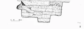
Drawing: F. Bady, 1965. Mission archéologique française de Kition-Salamine (MOM, Lyon), Nakala, SAL_PLAN_132511_0054. "Elevation of a mud-brick wall in place, Rampart". CC BY 4.0. Resized. 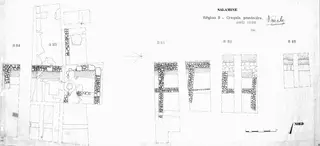
Drawing: F. Bady, 1966. Mission archéologique française de Kition-Salamine (MOM, Lyon), Nakala, SAL_PLAN_132511_0056. "Plan of the eastern excavation extension, rampart, April 1966". CC BY 4.0. Resized. 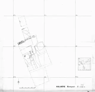
Drawing: F. Bady, 1966. Mission archéologique française de Kition-Salamine (MOM, Lyon), Nakala, SAL_PLAN_132511_0057. "Plan of the southern extension of the excavation, Rampart, October 1966". CC BY 4.0. Resized. 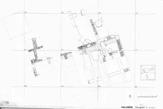
Drawing: F. Bady, 1966. Mission archéologique française de Kition-Salamine (MOM, Lyon), Nakala, SAL_PLAN_132511_0058. "Excavation state plan, Rampart, October 1966". CC BY 4.0. Resized. 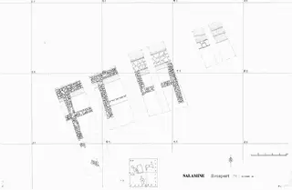
Drawing: F. Bady, 1966. Mission archéologique française de Kition-Salamine (MOM, Lyon), Nakala, SAL_PLAN_132511_0059. "Excavation state plan of the Rampart, October 1966". CC BY 4.0. Resized. 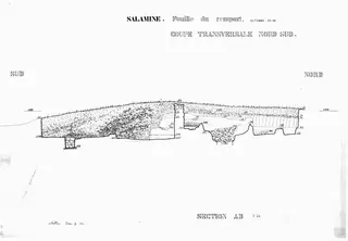
Drawing: F. Bady, 1966. Mission archéologique française de Kition-Salamine (MOM, Lyon), Nakala, SAL_PLAN_132511_0060. "North-South stratigraphic section A and B, Rampart, October 1966". CC BY 4.0. Resized. 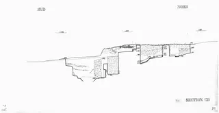
Drawing: F. Bady, 1966. Mission archéologique française de Kition-Salamine (MOM, Lyon), Nakala, SAL_PLAN_132511_0061. "Stratigraphic cross-section CD, Rampart, Campanopetra". CC BY 4.0. Resized. 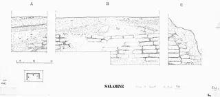
Drawing: F. Bady, 1966. Mission archéologique française de Kition-Salamine (MOM, Lyon), Nakala, SAL_PLAN_132511_0062. "Elevation details of brick walls A, B, C, Rampart". CC BY 4.0. Resized. 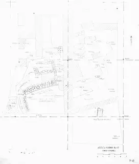
Drawing: F. Bady, 1967. Mission archéologique française de Kition-Salamine (MOM, Lyon), Nakala, SAL_PLAN_132514_0063. "Plan of the extension of excavations, stone wall with batter, Rampart". CC BY 4.0. Resized. 
Drawing: F. Bady, 1967. Mission archéologique française de Kition-Salamine (MOM, Lyon), Nakala, SAL_PLAN_132514_0064. "Plan of the western extension of the excavations, Rampart". CC BY 4.0. Resized. 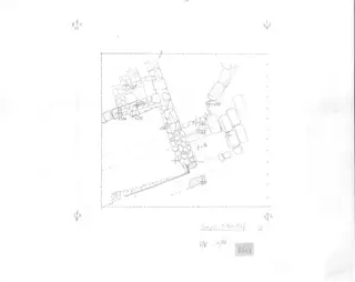
Drawing: F. Bady, 1967. Mission archéologique française de Kition-Salamine (MOM, Lyon), Nakala, SAL_PLAN_132514_0064a. "Column drums and Byzantine house drain, Rampart". CC BY 4.0. Resized. 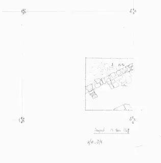
Drawing: F. Bady, 1967. Mission archéologique française de Kition-Salamine (MOM, Lyon), Nakala, SAL_PLAN_132514_0064b. "Plan of the Rampart, square K VI/δ5, March 1967". CC BY 4.0. Resized. 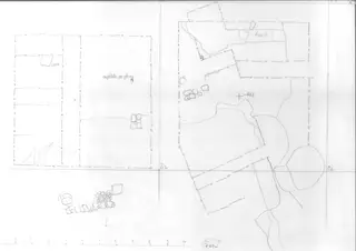
Drawing: F. Bady, 1967. Mission archéologique française de Kition-Salamine (MOM, Lyon), Nakala, SAL_PLAN_132514_0064c. "Plan of the Rampart, sector K VI/γ2 and K VI/δ2". CC BY 4.0. Resized. 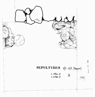
Drawing: F. Bady, 1967. Mission archéologique française de Kition-Salamine (MOM, Lyon), Nakala, SAL_PLAN_132514_0065. "In situ burials in ceramic vessels, Rampart". CC BY 4.0. Resized. 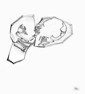
Drawing: P. A. Pironin, 1967. Mission archéologique française de Kition-Salamine (MOM, Lyon), Nakala, SAL_PLAN_132514_0066. "Plan of Pottery Burial, Tomb 10, Rampart Sector". CC BY 4.0. Resized. 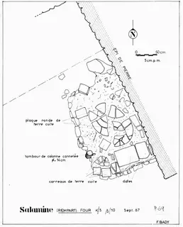
Drawing: F. Bady, 1967. Mission archéologique française de Kition-Salamine (MOM, Lyon), Nakala, SAL_PLAN_132514_0069. "Detail of in-situ kiln, Rampart, square K V/β10". CC BY 4.0. Resized. 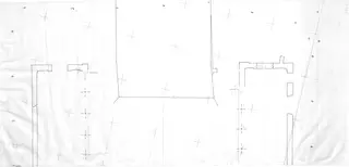
Drawing: J. Bruchet, 1970. Mission archéologique française de Kition-Salamine (MOM, Lyon), Nakala, SAL_PLAN_132515_0084. "Detailed plan, Temple of Zeus, square E VII". CC BY 4.0. Resized. 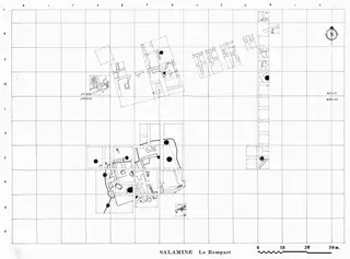
Drawing: F. Bady, 1969. Mission archéologique française de Kition-Salamine (MOM, Lyon), Nakala, SAL_PLAN_132516_0081. "General plan of the Rampart, October 1969". CC BY 4.0. Resized. 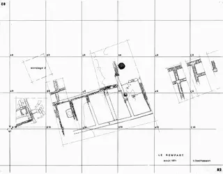
Drawing: C. Bachasson, 1971. Mission archéologique française de Kition-Salamine (MOM, Lyon), Nakala, SAL_PLAN_132517_0082. "Plan of the Rampart, squares K V/α8 to ε10, 1971". CC BY 4.0. Resized. 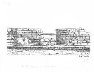
Drawing: P. A. Pironin. Mission archéologique française de Kition-Salamine (MOM, Lyon), Nakala, SAL_PLAN_132520_0091. "Apse of the Huilerie building, plan". CC BY 4.0. Resized. 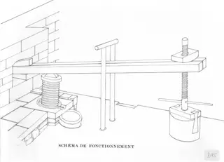
Drawing: P. A. Pironin, 1970. Mission archéologique française de Kition-Salamine (MOM, Lyon), Nakala, SAL_PLAN_132520_0095_0001. "Operating diagram of the Huilerie, 1970". CC BY 4.0. Resized. 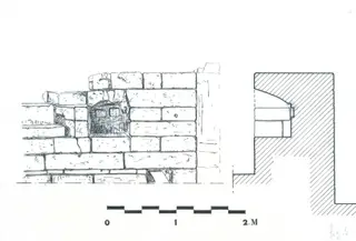
Drawing: P. A. Pironin, 1970. Mission archéologique française de Kition-Salamine (MOM, Lyon), Nakala, SAL_PLAN_132520_0095_0002. "Operating diagram of the Huilerie, 1970". CC BY 4.0. Resized. 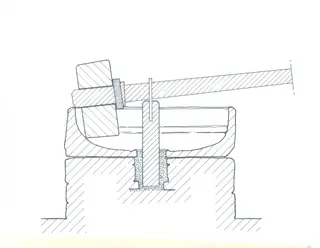
Drawing: P. A. Pironin, 1970. Mission archéologique française de Kition-Salamine (MOM, Lyon), Nakala, SAL_PLAN_132520_0095_0003. "Operating diagram of the Huilerie, 1970". CC BY 4.0. Resized. 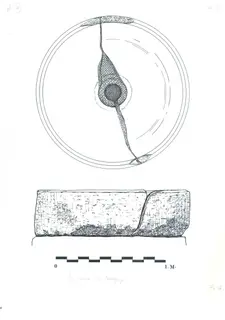
Drawing: P. A. Pironin, 1970. Mission archéologique française de Kition-Salamine (MOM, Lyon), Nakala, SAL_PLAN_132520_0095_0004. "Operating diagram of the Huilerie, 1970". CC BY 4.0. Resized. 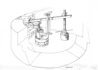
Drawing: P. A. Pironin, 1970. Mission archéologique française de Kition-Salamine (MOM, Lyon), Nakala, SAL_PLAN_132520_0095_0005. "Operating scheme of the Huilerie, 1970". CC BY 4.0. Resized. 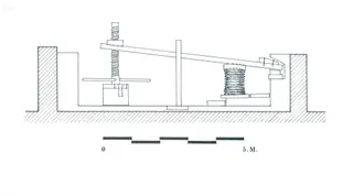
Drawing: P. A. Pironin, 1970. Mission archéologique française de Kition-Salamine (MOM, Lyon), Nakala, SAL_PLAN_132520_0095_0006. "Operating diagram of the Huilerie, 1970". CC BY 4.0. Resized. 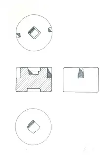
Drawing: P. A. Pironin, 1970. Mission archéologique française de Kition-Salamine (MOM, Lyon), Nakala, SAL_PLAN_132520_0095_0007. "Operating scheme of the Huilerie, 1970". CC BY 4.0. Resized. 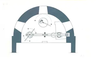
Drawing: P. A. Pironin, 1970. Mission archéologique française de Kition-Salamine (MOM, Lyon), Nakala, SAL_PLAN_132520_0095_0008. "Operating diagram of the Huilerie, 1970". CC BY 4.0. Resized. 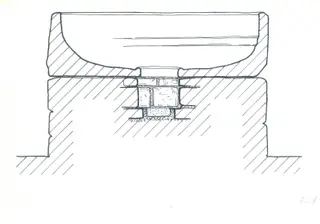
Drawing: P. A. Pironin, 1970. Mission archéologique française de Kition-Salamine (MOM, Lyon), Nakala, SAL_PLAN_132520_0095_0009. "Operating diagram of the Huilerie, 1970". CC BY 4.0. Resized. 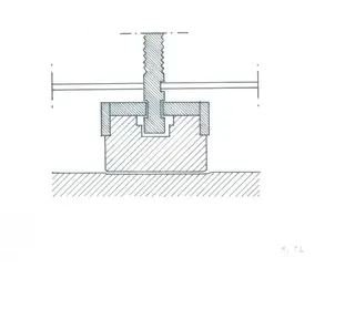
Drawing: P. A. Pironin, 1970. Mission archéologique française de Kition-Salamine (MOM, Lyon), Nakala, SAL_PLAN_132520_0095_0010. "Operating diagram of the Huilerie, Salamis, 1970". CC BY 4.0. Resized. 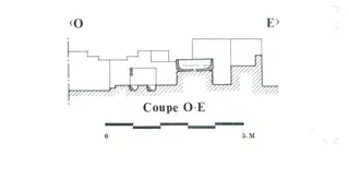
Drawing: P. A. Pironin, 1970. Mission archéologique française de Kition-Salamine (MOM, Lyon), Nakala, SAL_PLAN_132520_0095_0011. "Working diagram of the Huilerie, 1970". CC BY 4.0. Resized. 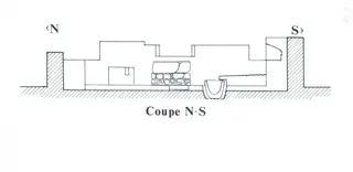
Drawing: P. A. Pironin, 1970. Mission archéologique française de Kition-Salamine (MOM, Lyon), Nakala, SAL_PLAN_132520_0095_0012. "Operating diagram of the Huilerie, 1970". CC BY 4.0. Resized. 
Drawing: O. Callot, 1975. Mission archéologique française de Kition-Salamine (MOM, Lyon), Nakala, SAL_PLAN_132527_0202a. "Plan of the paved court to the east, Temple of Zeus". CC BY 4.0. Resized. 
Drawing: O. Callot, 1975. Mission archéologique française de Kition-Salamine (MOM, Lyon), Nakala, SAL_PLAN_132527_0202b. "Plan of the paved courtyard to the east, Temple of Zeus". CC BY 4.0. Resized. 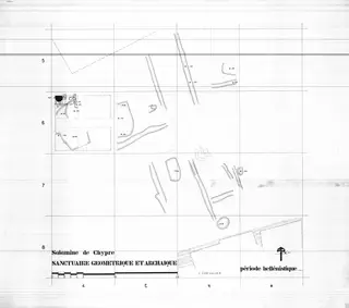
Drawing: J. Chevalier, 1974. Mission archéologique française de Kition-Salamine (MOM, Lyon), Nakala, SAL_PLAN_132529_0181. "Plan of the Sanctuary, Byzantine level, October 1974". CC BY 4.0. Resized. 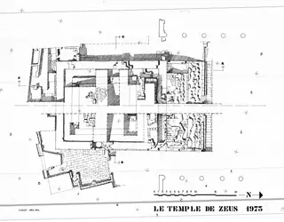
Drawing: O. Callot, 1973. Mission archéologique française de Kition-Salamine (MOM, Lyon), Nakala, SAL_PLAN_132533_0156. "General plan of the Temple of Zeus after the 1973 excavation". CC BY 4.0. Resized. 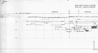
Drawing: J. Chevalier, 1973. Mission archéologique française de Kition-Salamine (MOM, Lyon), Nakala, SAL_PLAN_132534_0172. "Plan locating objects V_1178, V_1176, V_1177, SAL_7685, SAL_7681, SAL_7693". CC BY 4.0. Resized. 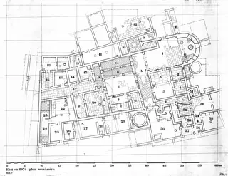
Drawing: O. Callot, 1980. Mission archéologique française de Kition-Salamine (MOM, Lyon), Nakala, SAL_PLAN_132535_0207. "General plan of the Huilerie building, French excavation". CC BY 4.0. Resized. 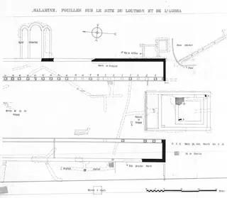
Drawing: Mission archéologique française de Kition-Salamine (MOM, Lyon), Nakala, SAL_PLAN_132539. "Plan of the Temple of Zeus, Salamis". CC BY 4.0. Resized. 
Drawing: Mission archéologique française de Kition-Salamine (MOM, Lyon), Nakala, SAL_PLAN_139817_8032. "Plan of the Sanctuary, level 4, squares K V/ε5–θ8". CC BY 4.0. Resized. 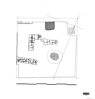
Drawing: Mission archéologique française de Kition-Salamine (MOM, Lyon), Nakala, SAL_PLAN_139818_8033. "Plan of the Sanctuary, levels 5-6". CC BY 4.0. Resized. 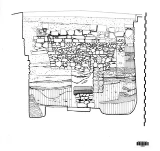
Drawing: J. P. Tallhman, 1970. Mission archéologique française de Kition-Salamine (MOM, Lyon), Nakala, SAL_PLAN_139823_0121. "Stratigraphic sections of the Sanctuary, 1970". CC BY 4.0. Resized. 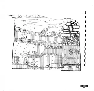
Drawing: J. P. Tallhman, 1970. Mission archéologique française de Kition-Salamine (MOM, Lyon), Nakala, SAL_PLAN_139824_0122. "Stratigraphic sections, Sanctuary, square K V/ζ6". CC BY 4.0. Resized. 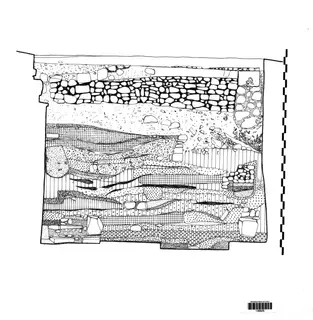
Drawing: P. Garczynski, 1972. Mission archéologique française de Kition-Salamine (MOM, Lyon), Nakala, SAL_PLAN_139826_0180. "North-south transverse section, Campanopetra, 1972". CC BY 4.0. Resized. 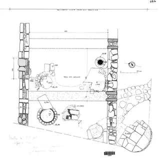
Drawing: P. A. Pironin, 1969. Mission archéologique française de Kition-Salamine (MOM, Lyon), Nakala, SAL_PLAN_139828_0130. "Plan of the geometric habitation, Hassan, Sanctuary, 1969". CC BY 4.0. Resized. 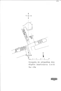
Drawing: F. Bady, 1967. Mission archéologique française de Kition-Salamine (MOM, Lyon), Nakala, SAL_PLAN_139908_0208_0001. "Site sketch plan of funerary deposits 1 and 2, Rampart". CC BY 4.0. Resized. 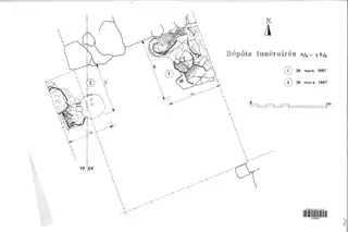
Drawing: F. Bady, 1967. Mission archéologique française de Kition-Salamine (MOM, Lyon), Nakala, SAL_PLAN_139909_0208_0002. "Sketch plan of funerary deposits 1 and 2, Rampart". CC BY 4.0. Resized. 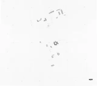
Drawing: J. Chevalier, 1974. Mission archéologique française de Kition-Salamine (MOM, Lyon), Nakala, SAL_PLAN_139911_0174. "Plan of the Sanctuary, level 1A, April 1974". CC BY 4.0. Resized. 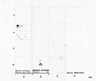
Drawing: J. Chevalier, 1974. Mission archéologique française de Kition-Salamine (MOM, Lyon), Nakala, SAL_PLAN_139912_0182. "Plan of the Sanctuary, Hellenistic level, October 1974". CC BY 4.0. Resized. 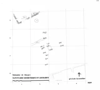
Drawing: J. Chevalier, 1974. Mission archéologique française de Kition-Salamine (MOM, Lyon), Nakala, SAL_PLAN_139914_0173. "Plan of the Sanctuary, Byzantine level". CC BY 4.0. Resized. 
Drawing: Mission archéologique française de Kition-Salamine (MOM, Lyon), Nakala, SAL_PLAN_139915_0035. "Plan of the Boutiques Nord, Campanopetra". CC BY 4.0. Resized. 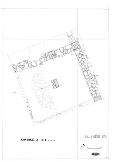
Drawing: 1966. Mission archéologique française de Kition-Salamine (MOM, Lyon), Nakala, SAL_PLAN_139952_8025. "Plan of Sondage Z, trench 1, 1966". CC BY 4.0. Resized. 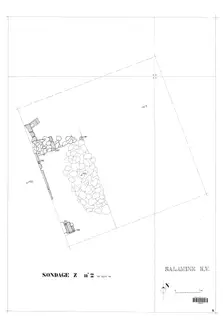
Drawing: 1966. Mission archéologique française de Kition-Salamine (MOM, Lyon), Nakala, SAL_PLAN_139953_8026. "Plan or drawing of Sondage Z no. 2, 1966". CC BY 4.0. Resized. 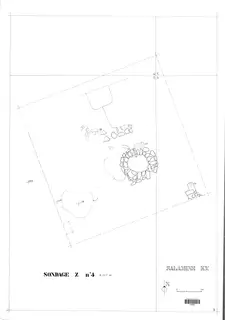
Drawing: 1966. Mission archéologique française de Kition-Salamine (MOM, Lyon), Nakala, SAL_PLAN_139955_8028. "Plan of Sondage Z, trench 3, 1966". CC BY 4.0. Resized. 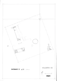
Drawing: 1966. Mission archéologique française de Kition-Salamine (MOM, Lyon), Nakala, SAL_PLAN_139956_8027. "Plan of Sondage Z, trench 5". CC BY 4.0. Resized. 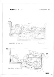
Drawing: 1966. Mission archéologique française de Kition-Salamine (MOM, Lyon), Nakala, SAL_PLAN_139957_8030. "Elevation of the NE and NW walls, Sondage Z". CC BY 4.0. Resized. 
Drawing: Mission archéologique française de Kition-Salamine (MOM, Lyon), Nakala, SAL_PLAN_139958_8031. "Plan of the Sanctuary, level 1, squares L V/6 and K V/5-7". CC BY 4.0. Resized. 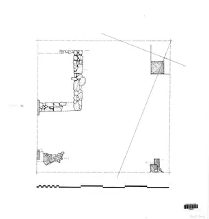
Drawing: F. Bady. Mission archéologique française de Kition-Salamine (MOM, Lyon), Nakala, SAL_PLAN_139959_8029. "Plan of the Sanctuary, Level 3". CC BY 4.0. Resized. 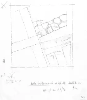
Drawing: F. Bady, 1968. Mission archéologique française de Kition-Salamine (MOM, Lyon), Nakala, SAL_PLAN_141056_0117. "Plan of excavation square E VII/f4, upper level, Sondage Y". CC BY 4.0. Resized. 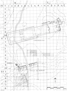
Drawing: P. A. Pironin, 1972. Mission archéologique française de Kition-Salamine (MOM, Lyon), Nakala, SAL_PLAN_141057_0146. "Partial grid plan with 10 m squares, Campanopetra". CC BY 4.0. Resized. 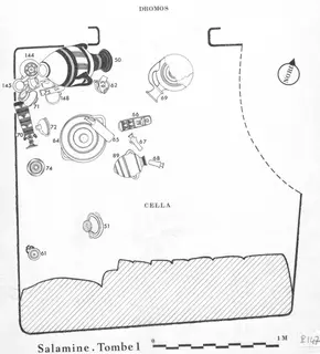
Drawing: P. A. Pironin. Mission archéologique française de Kition-Salamine (MOM, Lyon), Nakala, SAL_PLAN_141058_0147. "Plan of the chamber and upper level of vases, Tomb 1". CC BY 4.0. Resized. 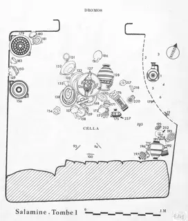
Drawing: P. A. Pironin. Mission archéologique française de Kition-Salamine (MOM, Lyon), Nakala, SAL_PLAN_141059_0148. "Plan of the chamber and second level of vases, Tomb 1". CC BY 4.0. Resized. 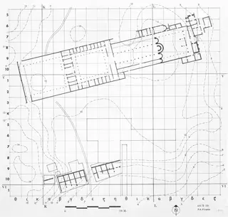
Drawing: P. A. Pironin, 1972. Mission archéologique française de Kition-Salamine (MOM, Lyon), Nakala, SAL_PLAN_141060_0149. "General grid plan, Salamis, 1972". CC BY 4.0. Resized. 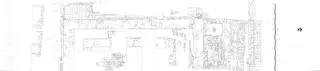
Drawing: O. Callot, 1974. Mission archéologique française de Kition-Salamine (MOM, Lyon), Nakala, SAL_PLAN_141061_0154a. "General plan of the Temple of Zeus after the 1973 excavation". CC BY 4.0. Resized. 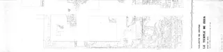
Drawing: O. Callot, 1974. Mission archéologique française de Kition-Salamine (MOM, Lyon), Nakala, SAL_PLAN_141061_0154b. "General plan of the Temple of Zeus after the 1973 excavation". CC BY 4.0. Resized. 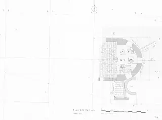
Drawing: P. A. Pironin, 1969. Mission archéologique française de Kition-Salamine (MOM, Lyon), Nakala, SAL_PLAN_141063_0092. "Apse of the Huilerie building, print of plan P_0091". CC BY 4.0. Resized. 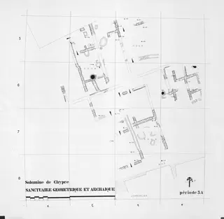
Drawing: J. Chevalier, 1974. Mission archéologique française de Kition-Salamine (MOM, Lyon), Nakala, SAL_PLAN_141064_0185. "Plan of the Sanctuary, level 3A, 1974". CC BY 4.0. Resized. 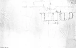
Drawing: O. Callot, 1974. Mission archéologique française de Kition-Salamine (MOM, Lyon), Nakala, SAL_PLAN_141065_0216. "Plan of excavations, north-west side of basilica and east atrium, Campanopetra". CC BY 4.0. Resized. 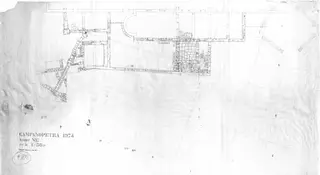
Drawing: O. Callot, 1974. Mission archéologique française de Kition-Salamine (MOM, Lyon), Nakala, SAL_PLAN_141066_0215. "Plan of the baptistery and adjacent area, Campanopetra, May 1974". CC BY 4.0. Resized. 
Drawing: C. Bachasson, 1973. Mission archéologique française de Kition-Salamine (MOM, Lyon), Nakala, SAL_PLAN_141067_0170a. "General plan of the Huilerie, square I III". CC BY 4.0. Resized. 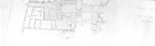
Drawing: C. Bachasson, 1973. Mission archéologique française de Kition-Salamine (MOM, Lyon), Nakala, SAL_PLAN_141067_0170b. "General plan of the Huilerie, square I III". CC BY 4.0. Resized. 
Drawing: P. A. Pironin. Mission archéologique française de Kition-Salamine (MOM, Lyon), Nakala, SAL_PLAN_141068_0042. "Plan of the Basilica eastern court and Baths, Campanopetra". CC BY 4.0. Resized. 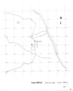
Drawing: 1970. Mission archéologique française de Kition-Salamine (MOM, Lyon), Nakala, SAL_PLAN_141069_0015. "Extended grid plan of the excavation, 1:2000". CC BY 4.0. Resized. 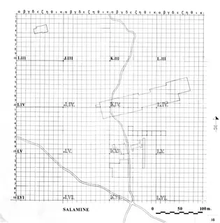
Drawing: F. Bady, 1972. Mission archéologique française de Kition-Salamine (MOM, Lyon), Nakala, SAL_PLAN_141069_0016. "Partial grid plan of Salamis sectors, 1972". CC BY 4.0. Resized. 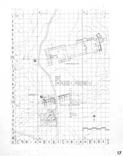
Drawing: P. A. Pironin, 1970. Mission archéologique française de Kition-Salamine (MOM, Lyon), Nakala, SAL_PLAN_141069_0017. "Grid plan of Campanopetra and the rampart, Salamis, 1970". CC BY 4.0. Resized. 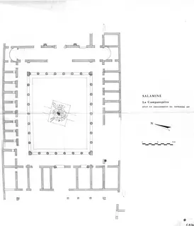
Drawing: P. A. Pironin, 1967. Mission archéologique française de Kition-Salamine (MOM, Lyon), Nakala, SAL_PLAN_141070_0030. "Plan of excavations, shops of the great phiale courtyard, Campanopetra". CC BY 4.0. Resized. 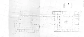
Drawing: P. A. Pironin and F. Bady, 1968. Mission archéologique française de Kition-Salamine (MOM, Lyon), Nakala, SAL_PLAN_141071_0032. "Plan of the Campanopetra excavations, October 1968". CC BY 4.0. Resized. 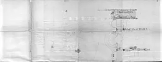
Drawing: P. A. Pironin, 1968. Mission archéologique française de Kition-Salamine (MOM, Lyon), Nakala, SAL_PLAN_141072_0034a. "Detail plan of the apses and east part of the nave, Campanopetra". CC BY 4.0. Resized. 
Drawing: P. A. Pironin, 1968. Mission archéologique française de Kition-Salamine (MOM, Lyon), Nakala, SAL_PLAN_141072_0034b. "Detail plan of the apses and east part of the nave, Campanopetra". CC BY 4.0. Resized. 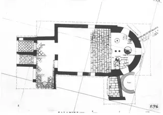
Drawing: P. A. Pironin, 1969. Mission archéologique française de Kition-Salamine (MOM, Lyon), Nakala, SAL_PLAN_141073_0096. "Plan of the Huilerie apse and start of the corridors, 1969". CC BY 4.0. Resized. 
Drawing: J. Bruchet, 1970. Mission archéologique française de Kition-Salamine (MOM, Lyon), Nakala, SAL_PLAN_141074_0136. "North-west corner and Western Portico, Temple of Zeus". CC BY 4.0. Resized. 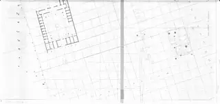
Drawing: P. A. Pironin, 1971. Mission archéologique française de Kition-Salamine (MOM, Lyon), Nakala, SAL_PLAN_141075_0085a. "Plan of the grid superimposition, 1965-1966 grid". CC BY 4.0. Resized. 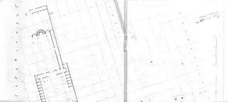
Drawing: P. A. Pironin, 1971. Mission archéologique française de Kition-Salamine (MOM, Lyon), Nakala, SAL_PLAN_141075_0085b. "Plan of the superimposed excavation grids, 1965-1966". CC BY 4.0. Resized. 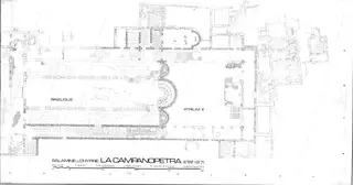
Drawing: P. A. Pironin and F. Bady and P. Garczynski. Mission archéologique française de Kition-Salamine (MOM, Lyon), Nakala, SAL_PLAN_141076_0123. "Plan of the basilica and east atrium, Campanopetra". CC BY 4.0. Resized. 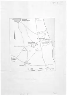
Drawing: Mission archéologique française de Kition-Salamine (MOM, Lyon), Nakala, SAL_PLAN_141077_0206. "General plan of Salamis". CC BY 4.0. Resized. 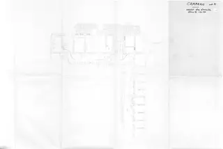
Drawing: P. Garczynski, 1971. Mission archéologique française de Kition-Salamine (MOM, Lyon), Nakala, SAL_PLAN_141078_0088. "Addition to the plan of the West atrium of the basilica, Campanopetra". CC BY 4.0. Resized. 
Drawing: J. Chevalier and C. Bachasson, 1971. Mission archéologique française de Kition-Salamine (MOM, Lyon), Nakala, SAL_PLAN_141079_0098_0001. "Plan of the Huilerie, autumn 1971". CC BY 4.0. Resized. 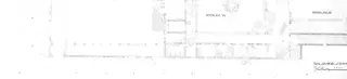
Drawing: J. Chevalier and C. Bachasson, 1971. Mission archéologique française de Kition-Salamine (MOM, Lyon), Nakala, SAL_PLAN_141079_0098_0002. "Plan of the Huilerie, autumn 1971". CC BY 4.0. Resized. 
Drawing: J. Chevalier and C. Bachasson, 1971. Mission archéologique française de Kition-Salamine (MOM, Lyon), Nakala, SAL_PLAN_141079_0098_0003. "Plan of the Huilerie, autumn 1971". CC BY 4.0. Resized. 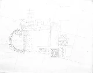
Drawing: J. Chevalier and C. Bachasson, 1971. Mission archéologique française de Kition-Salamine (MOM, Lyon), Nakala, SAL_PLAN_141079_0098_0004. "Plan of the Huilerie, autumn 1971". CC BY 4.0. Resized. 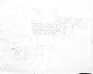
Drawing: J. Chevalier and C. Bachasson, 1971. Mission archéologique française de Kition-Salamine (MOM, Lyon), Nakala, SAL_PLAN_141079_0098_0005. "Plan of the Huilerie, autumn 1971". CC BY 4.0. Resized. 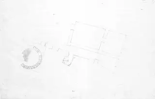
Drawing: J. Chevalier and C. Bachasson, 1971. Mission archéologique française de Kition-Salamine (MOM, Lyon), Nakala, SAL_PLAN_141079_0098_0006. "Plan of the Huilerie, square I III, autumn 1971". CC BY 4.0. Resized. 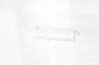
Drawing: J. Chevalier and C. Bachasson, 1971. Mission archéologique française de Kition-Salamine (MOM, Lyon), Nakala, SAL_PLAN_141079_0098_0007. "Plan of the Huilerie, autumn 1971". CC BY 4.0. Resized. 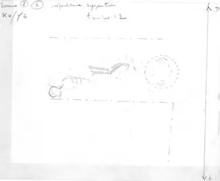
Drawing: 1974. Mission archéologique française de Kition-Salamine (MOM, Lyon), Nakala, SAL_PLAN_141080_0190_0001. "Plan of the Sanctuary, Byzantine level, October 1974". CC BY 4.0. Resized. 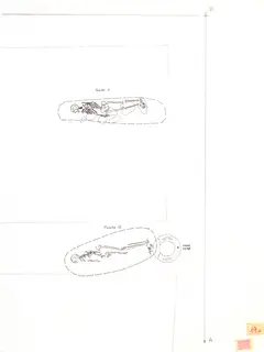
Drawing: 1974. Mission archéologique française de Kition-Salamine (MOM, Lyon), Nakala, SAL_PLAN_141080_0190_0002. "Plan of the Sanctuary, Byzantine level, October 1974". CC BY 4.0. Resized. 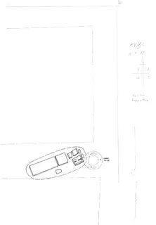
Drawing: 1974. Mission archéologique française de Kition-Salamine (MOM, Lyon), Nakala, SAL_PLAN_141080_0190_0003. "Plan of the Sanctuary, Byzantine level, October 1974". CC BY 4.0. Resized. 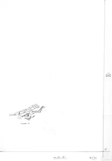
Drawing: 1974. Mission archéologique française de Kition-Salamine (MOM, Lyon), Nakala, SAL_PLAN_141080_0190_0004. "Plan of the Sanctuary, Byzantine level". CC BY 4.0. Resized. 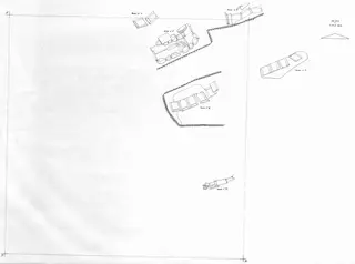
Drawing: 1974. Mission archéologique française de Kition-Salamine (MOM, Lyon), Nakala, SAL_PLAN_141080_0190_0005. "Plan of the Sanctuary, Byzantine level, October 1974". CC BY 4.0. Resized. 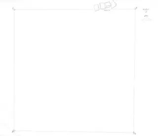
Drawing: 1974. Mission archéologique française de Kition-Salamine (MOM, Lyon), Nakala, SAL_PLAN_141080_0190_0006. "Plan of the Sanctuary, Byzantine level, October 1974". CC BY 4.0. Resized. 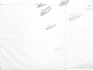
Drawing: 1974. Mission archéologique française de Kition-Salamine (MOM, Lyon), Nakala, SAL_PLAN_141080_0190_0007. "Plan of the Sanctuary, Byzantine level, October 1974". CC BY 4.0. Resized. 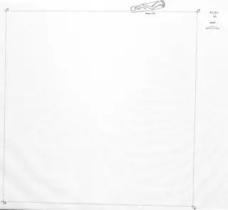
Drawing: 1974. Mission archéologique française de Kition-Salamine (MOM, Lyon), Nakala, SAL_PLAN_141080_0190_0008. "Byzantine level plan of the Sanctuary, October 1974". CC BY 4.0. Resized. 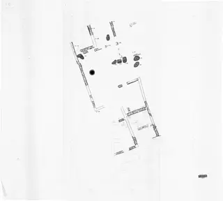
Drawing: 1974. Mission archéologique française de Kition-Salamine (MOM, Lyon), Nakala, SAL_PLAN_141080_0190_0009. "Plan of the Sanctuary, Byzantine level, October 1974". CC BY 4.0. Resized. 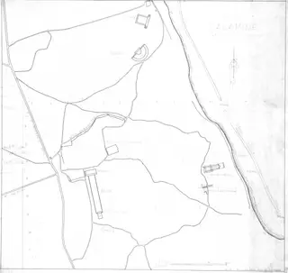
Drawing: F. Bady and Ch. Polycarpou, 1968. Mission archéologique française de Kition-Salamine (MOM, Lyon), Nakala, SAL_PLAN_141083_0118. "Plan of the whole Salamis site, 1968". CC BY 4.0. Resized. 
Drawing: Mission archéologique française de Kition-Salamine (MOM, Lyon), Nakala, SAL_PLAN_141084_0198. "Site plan of Salamis, full extent". CC BY 4.0. Resized. 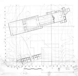
Drawing: P. A. Pironin. Mission archéologique française de Kition-Salamine (MOM, Lyon), Nakala, SAL_PLAN_141085_0212. "Plan of the Campanopetra sector, Salamis, 1972". CC BY 4.0. Resized. 
Drawing: Mission archéologique française de Kition-Salamine (MOM, Lyon), Nakala, SAL_PLAN_141089_0217. "Plan of contour lines on the Campanopetra site". CC BY 4.0. Resized. 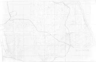
Drawing: Chr. Polycarpou, 1971. Mission archéologique française de Kition-Salamine (MOM, Lyon), Nakala, SAL_PLAN_141090_0100. "Supplementary levelling plan of the Temple of Zeus sector, 1971". CC BY 4.0. Resized. 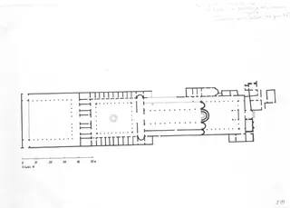
Drawing: O. Callot, 1975. Mission archéologique française de Kition-Salamine (MOM, Lyon), Nakala, SAL_PLAN_141091_0199. "General plan of Campanopetra, 1975". CC BY 4.0. Resized. 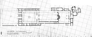
Drawing: J. Bruchet and F. Bady and P. A. Pironin, 1971. Mission archéologique française de Kition-Salamine (MOM, Lyon), Nakala, SAL_PLAN_141097_0044. "Plan of the basilica at Campanopetra, state in October 1971". CC BY 4.0. Resized. 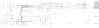
Drawing: P. Garczynski, 1971. Mission archéologique française de Kition-Salamine (MOM, Lyon), Nakala, SAL_PLAN_141097_0089. "Provisional plan of the Campanopetra basilica and Baths courtyards". CC BY 4.0. Resized. 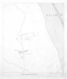
Drawing: F. Bady. Mission archéologique française de Kition-Salamine (MOM, Lyon), Nakala, SAL_PLAN_141103_0210. "Plan of the Salamis site, Campanopetra and Rampart sectors". CC BY 4.0. Resized. 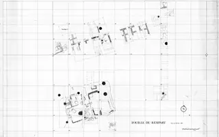
Drawing: F. Bady, 1966. Mission archéologique française de Kition-Salamine (MOM, Lyon), Nakala, SAL_PLAN_143201_0055. "Plan of the western extension of the Rampart excavations". CC BY 4.0. Resized. 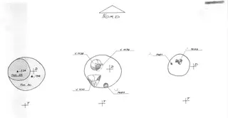
Drawing: J. Chevalier and J. C. Decourt and P. Garivier, 1973. Mission archéologique française de Kition-Salamine (MOM, Lyon), Nakala, SAL_PLAN_143202_0172bis. "Plan of object locations, Pit 3c and 2B, Sanctuary". CC BY 4.0. Resized. 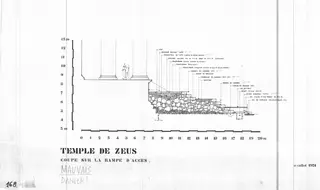
Drawing: O. Callot, 1974. Mission archéologique française de Kition-Salamine (MOM, Lyon), Nakala, SAL_PLAN_143203_0168. "Section through the access ramp, Temple of Zeus". CC BY 4.0. Resized. 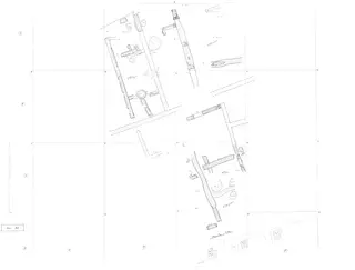
Drawing: J. Chevalier, 1974. Mission archéologique française de Kition-Salamine (MOM, Lyon), Nakala, SAL_PLAN_143231_0178. "Plan of the Sanctuary, Level 3A, 1974". CC BY 4.0. Resized. 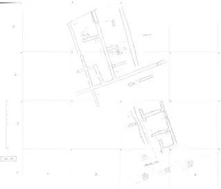
Drawing: J. Chevalier, 1974. Mission archéologique française de Kition-Salamine (MOM, Lyon), Nakala, SAL_PLAN_143237_0177. "Plan of the Sanctuary, Level 2B, April 1974". CC BY 4.0. Resized. 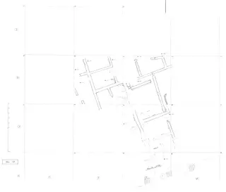
Drawing: J. Chevalier, 1974. Mission archéologique française de Kition-Salamine (MOM, Lyon), Nakala, SAL_PLAN_143238_0175. "Plan of the Sanctuary, level 1B". CC BY 4.0. Resized. 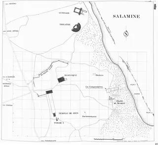
Drawing: F. Bady, 1972. Mission archéologique française de Kition-Salamine (MOM, Lyon), Nakala, SAL_PLAN_143239_0022. "Plan of the Salamis site, Campanopetra, Rampart and Huilerie, 1972". CC BY 4.0. Resized. 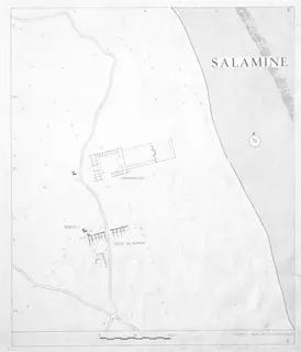
Drawing: F. Bady, 1968. Mission archéologique française de Kition-Salamine (MOM, Lyon), Nakala, SAL_PLAN_143239_0023. "Plan of Salamis site sectors, Campanopetra and Rampart, October 1968". CC BY 4.0. Resized. 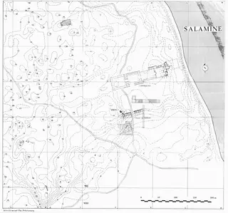
Drawing: F. Bady and Chr. Polycarpou, 1972. Mission archéologique française de Kition-Salamine (MOM, Lyon), Nakala, SAL_PLAN_143239_0024. "Survey plan of the Campanopetra excavation sites, 1972". CC BY 4.0. Resized. 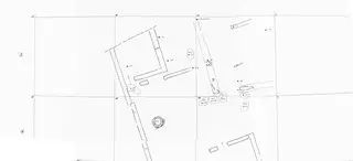
Drawing: J. Chevalier, 1974. Mission archéologique française de Kition-Salamine (MOM, Lyon), Nakala, SAL_PLAN_143239_0179. "Plan of the Sanctuary, level 3B, April 1974". CC BY 4.0. Resized. 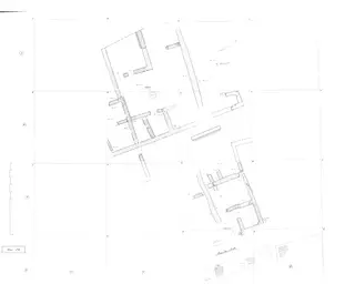
Drawing: J. Chevalier, 1974. Mission archéologique française de Kition-Salamine (MOM, Lyon), Nakala, SAL_PLAN_143245_0176. "Plan of the Sanctuary, level 2A, 1974". CC BY 4.0. Resized. 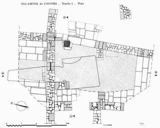
Drawing: P. A. Pironin, 1965. Mission archéologique française de Kition-Salamine (MOM, Lyon), Nakala, SAL_PLAN_143246_0103. "Plan of the upper level, Late Roman house with well, Tomb 1". CC BY 4.0. Resized. 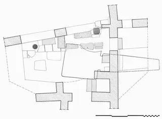
Drawing: P. A. Pironin. Mission archéologique française de Kition-Salamine (MOM, Lyon), Nakala, SAL_PLAN_143246_0104. "Upper-level simplified plan of the Roman house above Tomb 1". CC BY 4.0. Resized. 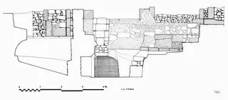
Drawing: P. A. Pironin. Mission archéologique française de Kition-Salamine (MOM, Lyon), Nakala, SAL_PLAN_143246_0105. "North-south section (A-B) of the Roman house and chamber". CC BY 4.0. Resized. 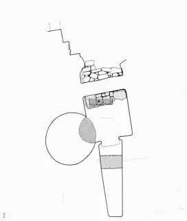
Drawing: P. A. Pironin. Mission archéologique française de Kition-Salamine (MOM, Lyon), Nakala, SAL_PLAN_143246_0106. "Plan of Tomb 1 and elevation of wall B". CC BY 4.0. Resized. 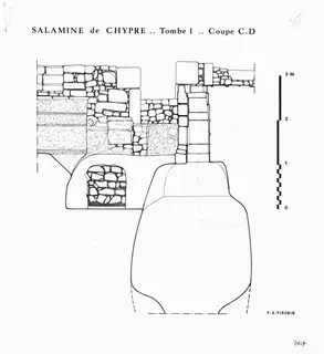
Drawing: P. A. Pironin. Mission archéologique française de Kition-Salamine (MOM, Lyon), Nakala, SAL_PLAN_143246_0107. "West-East section (C-D) through the Roman house and well". CC BY 4.0. Resized. 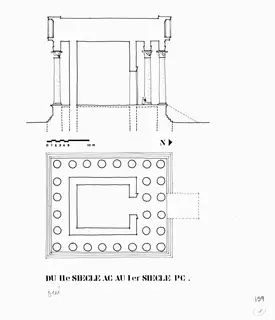
Drawing: O. Callot, 1973. Mission archéologique française de Kition-Salamine (MOM, Lyon), Nakala, SAL_PLAN_143246_0159. "Chronology of the Temple of Zeus, 2nd to 1st century BC". CC BY 4.0. Resized. 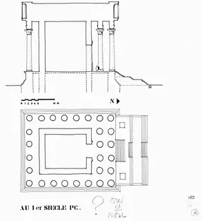
Drawing: O. Callot, 1973. Mission archéologique française de Kition-Salamine (MOM, Lyon), Nakala, SAL_PLAN_143246_0160. "Plan of the Temple of Zeus, chronology of the temple, 1973". CC BY 4.0. Resized. 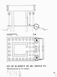
Drawing: O. Callot, 1974. Mission archéologique française de Kition-Salamine (MOM, Lyon), Nakala, SAL_PLAN_143246_0161. "Plan of the Temple of Zeus, chronology of the temple, 1974". CC BY 4.0. Resized. 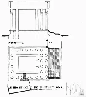
Drawing: O. Callot, 1974. Mission archéologique française de Kition-Salamine (MOM, Lyon), Nakala, SAL_PLAN_143246_0162. "Chronology of the Temple of Zeus, 3rd century AD repairs". CC BY 4.0. Resized. 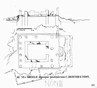
Drawing: O. Callot, 1974. Mission archéologique française de Kition-Salamine (MOM, Lyon), Nakala, SAL_PLAN_143246_0163. "Chronology of the Temple of Zeus, 6th century AD destruction". CC BY 4.0. Resized. 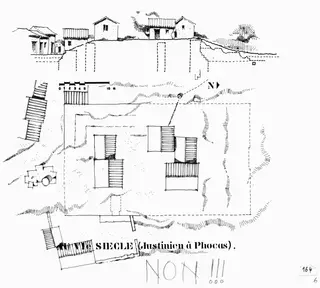
Drawing: O. Callot, 1974. Mission archéologique française de Kition-Salamine (MOM, Lyon), Nakala, SAL_PLAN_143246_0164. "Chronology plan of the Temple of Zeus, 6th century AD". CC BY 4.0. Resized. 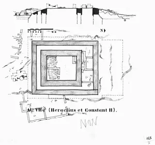
Drawing: O. Callot, 1974. Mission archéologique française de Kition-Salamine (MOM, Lyon), Nakala, SAL_PLAN_143246_0165. "Chronology of the Temple of Zeus, seventh century AD". CC BY 4.0. Resized. 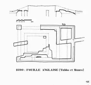
Drawing: O. Callot, 1974. Mission archéologique française de Kition-Salamine (MOM, Lyon), Nakala, SAL_PLAN_143246_0166. "Chronology of the Temple of Zeus, plan, 1974". CC BY 4.0. Resized. 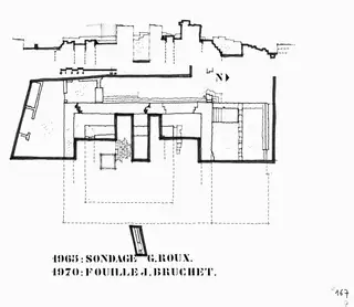
Drawing: O. Callot, 1974. Mission archéologique française de Kition-Salamine (MOM, Lyon), Nakala, SAL_PLAN_143246_0167. "Plan of the Temple of Zeus, chronology of the temple, 1974". CC BY 4.0. Resized. 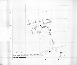
Drawing: J. Chevalier, 1974. Mission archéologique française de Kition-Salamine (MOM, Lyon), Nakala, SAL_PLAN_143248_0189. "Plan of the Sanctuary, Level 1A, October 1974". CC BY 4.0. Resized. 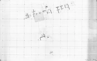
Drawing: F. Bady, 1967. Mission archéologique française de Kition-Salamine (MOM, Lyon), Nakala, SAL_PLAN_143249_0067. "Plan of excavation state, Rampart, April 1967". CC BY 4.0. Resized. 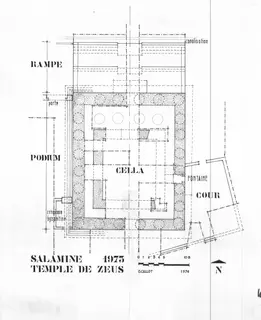
Drawing: O. Callot, 1974. Mission archéologique française de Kition-Salamine (MOM, Lyon), Nakala, SAL_PLAN_143253_0169. "Schematic plan of the Temple of Zeus excavation, 1974". CC BY 4.0. Resized. 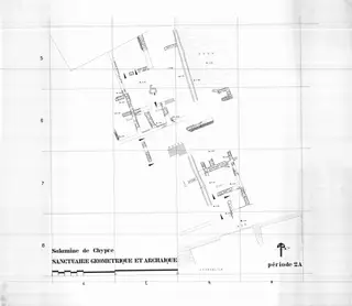
Drawing: J. Chevalier, 1974. Mission archéologique française de Kition-Salamine (MOM, Lyon), Nakala, SAL_PLAN_143254_0187. "Plan of the Sanctuary, level 2A". CC BY 4.0. Resized. 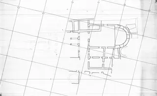
Drawing: J. Chevalier and C. Bachasson, 1971. Mission archéologique française de Kition-Salamine (MOM, Lyon), Nakala, SAL_PLAN_143255_0097. "Plan of the Huilerie, autumn 1971, square I III". CC BY 4.0. Resized. 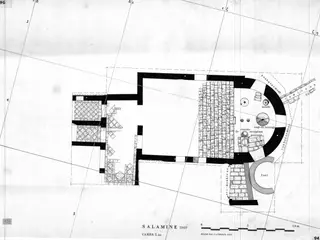
Drawing: P. A. Pironin, 1969. Mission archéologique française de Kition-Salamine (MOM, Lyon), Nakala, SAL_PLAN_143256_0094. "Plan of the apse and corridor openings, Huilerie". CC BY 4.0. Resized. 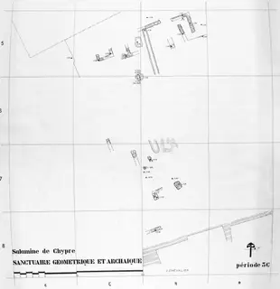
Drawing: J. Chevalier, 1974. Mission archéologique française de Kition-Salamine (MOM, Lyon), Nakala, SAL_PLAN_143259_0183. "Plan of the Sanctuary, level 3C, October 1974". CC BY 4.0. Resized. 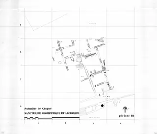
Drawing: J. Chevalier, 1974. Mission archéologique française de Kition-Salamine (MOM, Lyon), Nakala, SAL_PLAN_143260_0188. "Plan of the Sanctuary, Level 1B, 1974". CC BY 4.0. Resized. 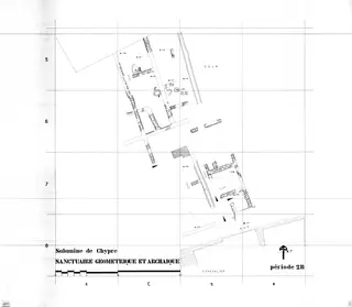
Drawing: J. Chevalier, 1974. Mission archéologique française de Kition-Salamine (MOM, Lyon), Nakala, SAL_PLAN_143265_0186. "Plan of the Sanctuary, level 2B". CC BY 4.0. Resized. 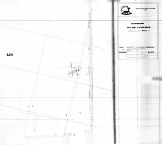
Drawing: C. Bachasson, 1973. Mission archéologique française de Kition-Salamine (MOM, Lyon), Nakala, SAL_PLAN_143266_0171. "Plan of the cistern entrance, Huilerie, north trench". CC BY 4.0. Resized. 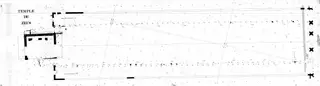
Drawing: B. Helly and J. Bruchet, 1970. Mission archéologique française de Kition-Salamine (MOM, Lyon), Nakala, SAL_PLAN_143271_0083. "Site plan showing numbered scattered blocks, Temple of Zeus". CC BY 4.0. Resized. 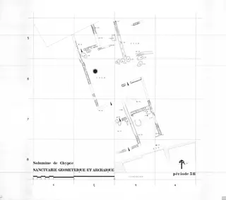
Drawing: J. Chevalier, 1974. Mission archéologique française de Kition-Salamine (MOM, Lyon), Nakala, SAL_PLAN_143272_0184. "Plan of the Sanctuary, level 3B". CC BY 4.0. Resized. 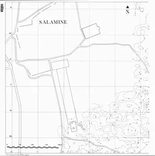
Drawing: Ch. Polycarpou, 1970. Mission archéologique française de Kition-Salamine (MOM, Lyon), Nakala, SAL_PLAN_143486_0025. "Contour survey plan of the Temple of Zeus, Salamis, 1970". CC BY 4.0. Resized. 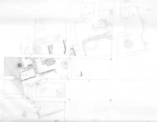
Drawing: F. Bady, 1968. Mission archéologique française de Kition-Salamine (MOM, Lyon), Nakala, SAL_PLAN_143620_0087. "Plan of the Rampart excavation with spot heights, 1968". CC BY 4.0. Resized. 
Drawing: C. Bachasson, 1972. Mission archéologique française de Kition-Salamine (MOM, Lyon), Nakala, SAL_PLAN_143622_0138a. "Plan of the Huilerie, square I III, 1972". CC BY 4.0. Resized. 
Drawing: C. Bachasson, 1972. Mission archéologique française de Kition-Salamine (MOM, Lyon), Nakala, SAL_PLAN_143623_0138b. "Plan of the Huilerie, square I III, 1972". CC BY 4.0. Resized. 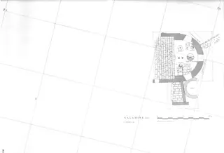
Drawing: P. A. Pironin, 1969. Mission archéologique française de Kition-Salamine (MOM, Lyon), Nakala, SAL_PLAN_143624_0093. "Apse of the so-called Huilerie building, plan". CC BY 4.0. Resized. 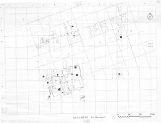
Drawing: P. A. Pironin, 1971. Mission archéologique française de Kition-Salamine (MOM, Lyon), Nakala, SAL_PLAN_143625_0086. "Plan of the Rampart excavation grids, 1965 and 1966 overlaid". CC BY 4.0. Resized. 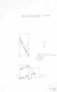
Drawing: F. Bady, 1968. Mission archéologique française de Kition-Salamine (MOM, Lyon), Nakala, SAL_PLAN_143626_0111. "Location and overall plan, Sondage Y, September 1968". CC BY 4.0. Resized. 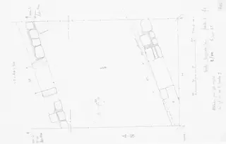
Drawing: F. Bady, 1968. Mission archéologique française de Kition-Salamine (MOM, Lyon), Nakala, SAL_PLAN_143628_0112. "Plan of excavation square E VII/f1, Sondage Y, upper level". CC BY 4.0. Resized. 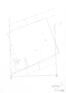
Drawing: F. Bady, 1968. Mission archéologique française de Kition-Salamine (MOM, Lyon), Nakala, SAL_PLAN_143629_0113. "Plan of excavation square F1 bis, lower level, Sondage Y". CC BY 4.0. Resized. 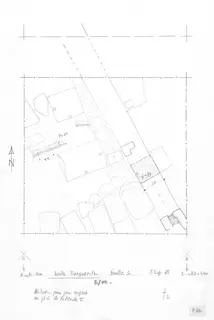
Drawing: F. Bady, 1968. Mission archéologique française de Kition-Salamine (MOM, Lyon), Nakala, SAL_PLAN_143630_0114. "Plan of Sondage Y, square E VII/f2, September 1968". CC BY 4.0. Resized. 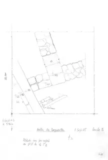
Drawing: F. Bady, 1968. Mission archéologique française de Kition-Salamine (MOM, Lyon), Nakala, SAL_PLAN_143631_0115. "Plan of Sondage Y, square E VII/f3, September 1968". CC BY 4.0. Resized. 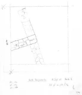
Drawing: F. Bady, 1968. Mission archéologique française de Kition-Salamine (MOM, Lyon), Nakala, SAL_PLAN_143632_0116. "Plan of excavation square F4 bis, lower level, Sondage Y". CC BY 4.0. Resized. 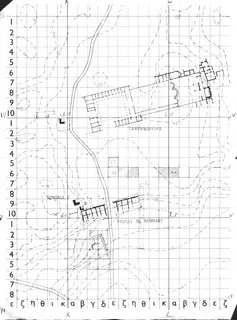
Drawing: 1970. Mission archéologique française de Kition-Salamine (MOM, Lyon), Nakala, SAL_PLAN_144314_0021. "Plan of the Campanopetra and Rampart sectors, Salamis, 1970". CC BY 4.0. Resized. 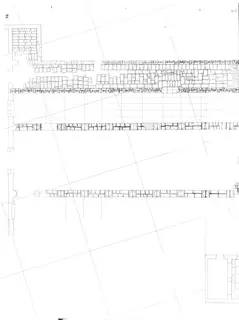
Drawing: P. A. Pironin, 1969. Mission archéologique française de Kition-Salamine (MOM, Lyon), Nakala, SAL_PLAN_147899_0038a. "Plan of the nave and apses, Campanopetra, 1969". CC BY 4.0. Resized. 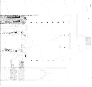
Drawing: P. A. Pironin, 1969. Mission archéologique française de Kition-Salamine (MOM, Lyon), Nakala, SAL_PLAN_147899_0038b. "Plan of the nave and apses, Campanopetra, 1969". CC BY 4.0. Resized. 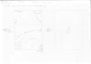
Drawing: S. Dupré, 1970. Mission archéologique française de Kition-Salamine (MOM, Lyon), Nakala, SAL_PLAN_147901_0134. "Plan of Campanopetra, square L IV/γ 7, October 1970". CC BY 4.0. Resized. 
Drawing: 1970. Mission archéologique française de Kition-Salamine (MOM, Lyon), Nakala, SAL_PLAN_147902_0135_0001. "Plan of the Sanctuary, square L V/α6". CC BY 4.0. Resized. 
Drawing: 1970. Mission archéologique française de Kition-Salamine (MOM, Lyon), Nakala, SAL_PLAN_147902_0135_0002. "Plan of the Sanctuary, square L V/α6". CC BY 4.0. Resized. 
Drawing: 1970. Mission archéologique française de Kition-Salamine (MOM, Lyon), Nakala, SAL_PLAN_147902_0135_0003. "Plan of the Sanctuary, square L V/α6". CC BY 4.0. Resized. 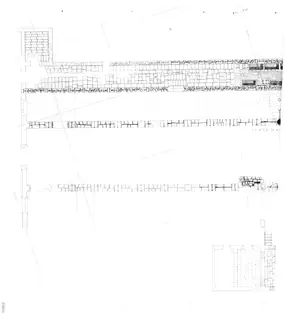
Drawing: P. A. Pironin. Mission archéologique française de Kition-Salamine (MOM, Lyon), Nakala, SAL_PLAN_147905_0039a. "Plan of the basilica and east courtyard, state in 1961". CC BY 4.0. Resized. 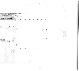
Drawing: P. A. Pironin. Mission archéologique française de Kition-Salamine (MOM, Lyon), Nakala, SAL_PLAN_147905_0039b. "Plan of the basilica and eastern court, state in 1961". CC BY 4.0. Resized. 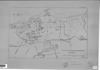
Drawing: Tubbs and Monroe. Mission archéologique française de Kition-Salamine (MOM, Lyon), Nakala, SAL_PLAN_147906_0209. "General plan of the site, Salamis". CC BY 4.0. Resized. 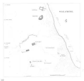
Drawing: F. Bady. Mission archéologique française de Kition-Salamine (MOM, Lyon), Nakala, SAL_PLAN_147907_0211. "Plan of the site and its surroundings after Polycarpou". CC BY 4.0. Resized. 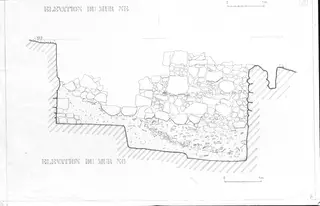
Drawing: F. Bady and A. Pironin. Mission archéologique française de Kition-Salamine (MOM, Lyon), Nakala, SAL_PLAN_147923_9001. "Elevation of the NE Wall, Sondage Z". CC BY 4.0. Resized. 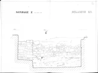
Drawing: F. Bady and A. Pironin, 1966. Mission archéologique française de Kition-Salamine (MOM, Lyon), Nakala, SAL_PLAN_147923_9002. "Section drawing, Sondage Z, 1966". CC BY 4.0. Resized. 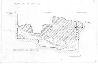
Drawing: F. Bady and A. Pironin. Mission archéologique française de Kition-Salamine (MOM, Lyon), Nakala, SAL_PLAN_147923_9003. "Elevation of the NW Wall, Sondage Z". CC BY 4.0. Resized. 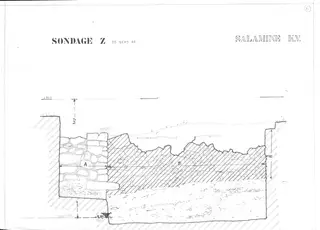
Drawing: F. Bady and A. Pironin, 1966. Mission archéologique française de Kition-Salamine (MOM, Lyon), Nakala, SAL_PLAN_147923_9004. "Section drawing, Sondage Z, 1966". CC BY 4.0. Resized. 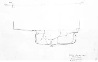
Drawing: Mission archéologique française de Kition-Salamine (MOM, Lyon), Nakala, SAL_PLAN_147924_9005. "East-west section, final level, Sondage Z". CC BY 4.0. Resized. 
Drawing: Mission archéologique française de Kition-Salamine (MOM, Lyon), Nakala, SAL_PLAN_147924_9006. "Plan of Sondage Z, cutting face S". CC BY 4.0. Resized. 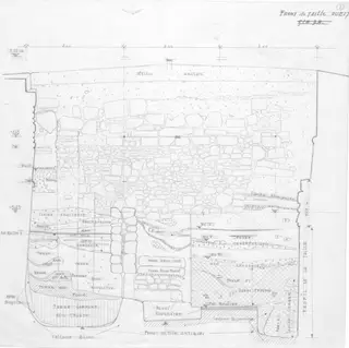
Drawing: Mission archéologique française de Kition-Salamine (MOM, Lyon), Nakala, SAL_PLAN_147924_9007. "Plan or drawing of Sondage Z, west face". CC BY 4.0. Resized. 
Drawing: Mission archéologique française de Kition-Salamine (MOM, Lyon), Nakala, SAL_PLAN_147924_9008. "Plan or drawing of Sondage Z, north face". CC BY 4.0. Resized. 
Drawing: Mission archéologique française de Kition-Salamine (MOM, Lyon), Nakala, SAL_PLAN_147924_9009. "Section drawing, Sondage Z, east face". CC BY 4.0. Resized. 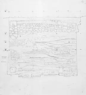
Drawing: Mission archéologique française de Kition-Salamine (MOM, Lyon), Nakala, SAL_PLAN_147924_9010. "Plan of the Sondage Z face, Salamis". CC BY 4.0. Resized. 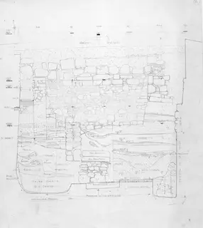
Drawing: Mission archéologique française de Kition-Salamine (MOM, Lyon), Nakala, SAL_PLAN_147924_9011. "Section drawing of Sondage Z, Salamis (1966)". CC BY 4.0. Resized. 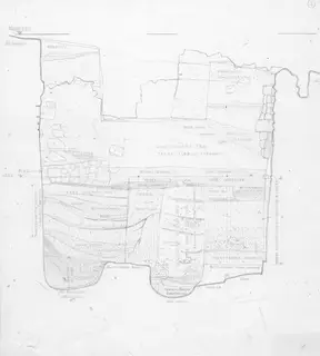
Drawing: Mission archéologique française de Kition-Salamine (MOM, Lyon), Nakala, SAL_PLAN_147924_9012. "Plan of the Front de taille, Sondage Z". CC BY 4.0. Resized. 
Drawing: Mission archéologique française de Kition-Salamine (MOM, Lyon), Nakala, SAL_PLAN_147924_9013. "Plan of the Front de taille, Sondage Z". CC BY 4.0. Resized.
Corrections and additions
Do you hold related material?
Photographs, papers and records that belong with this collection are often held elsewhere, or privately.
We would like to hear about
- Related photographs, letters, diaries or records
- Identifications for items in the collection
- A mistake in our description of the collection
Tell us if you would like to be thanked by name on the page.