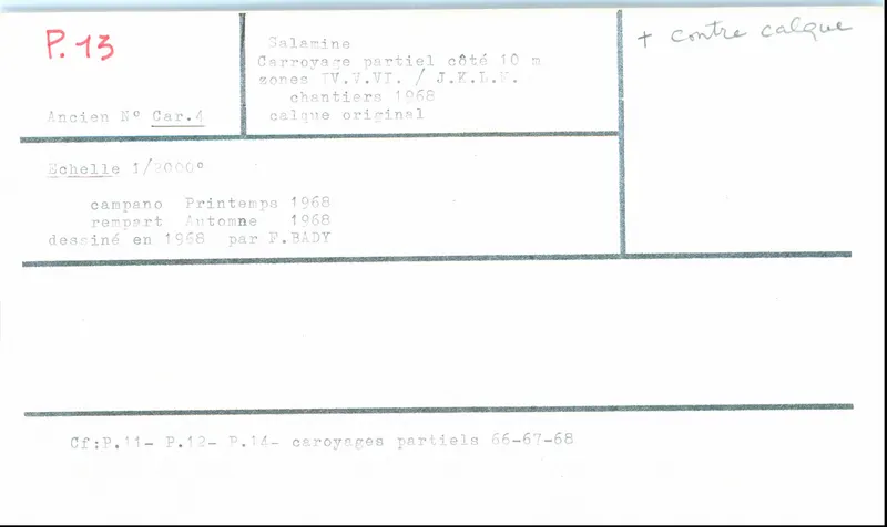
Partial grid plan of Campanopetra and Rampart, Salamis, 1967-1968
Drawing: F. Bady, 1968. Mission archéologique française de Kition-Salamine (MOM, Lyon), Nakala, SAL_OBPL_141102_0013. "Partial grid plan of Campanopetra and Rampart, Salamis, 1967-1968". CC BY 4.0. Resized.
Plan SAL_OBPL_141102_0013
English, translated from the French record
Plan of partial grid squares with 10 m sides, at scale 1/2000, drawn by F. Bady in 1967 and 1968; cross-referenced to Plan_0011, Plan_0012 and Plan_0014 (partial grids of 1966). Coverage includes squares J IV, J V, J VI, K IV, K V, K VI, L IV, L V, L VI, M IV, M V and M VI, along with the Campanopetra sector (spring 1968) and the Rampart (autumn 1968).
French, as on the record
1967 et 1968
Carroyage partiel côté 10m
cf. Plan_0011 Plan_0012 et Plan_0014 : Carroyages partiels 1966
Corrections and additions
Can you tell us more about this?
If you can identify, date or place this item, or know where else it is recorded, we would like to hear.