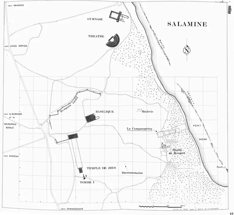
Plan of the Salamis site, Campanopetra, Rampart and Huilerie, 1972
Drawing: F. Bady, 1972. Mission archéologique française de Kition-Salamine (MOM, Lyon), Nakala, SAL_PLAN_143239_0022. "Plan of the Salamis site, Campanopetra, Rampart and Huilerie, 1972". CC BY 4.0. Resized.
Plan SAL_PLAN_143239_0022
English, translated from the French record
Plan of the whole site at Salamis at a scale of 1/2000, drawn by F. Bady in January 1972 after the survey by CH. Polycarpou, completed with a 100 m grid and updating an earlier plan by F. Bady. It shows the main monuments of Campanopetra, Rampart and Huilerie, with states of 1971 and cf. Plan_0020 (1968 state) and Plan_0021 (1971 state).
French, as on the record
D'après le relevé de CH. Polycarpou complété avec carroyage (côté 100m), ancien plan de F. Bady mis à jour
Principaux monuments
cf. Plan_0020 (état 1968) et Plan_0021 (état 1971)
Corrections and additions
Can you tell us more about this?
If you can identify, date or place this item, or know where else it is recorded, we would like to hear.