
mixed village · Sheet 14
Kalavasó
- 1881 census
- Kalavaso
- Greek
- Καλαβασός · Kalavasós (ELOT 743) (Wikidata)
- Spellings in our records
- Kalavaso, Καλαβασό, Kalavasos, Kalavassos, Καλαβασός, KALAVASOS, Kalavasós
- In the literature
- Kalavassos, Kalavasos, Kalavaso
- Sites
- Kalavasos-Alonia tou Pano Zyou · Kalavasos-Arkhangelos · Kalavasos-Ayios Dhimitrios · Kalavasos-Ayious · Kalavasos-Kafkalla · Kalavasos-Kokkinoyia · Kalavasos-Kopetra · Kalavasos-Mangia · Kalavasos-Manikia · Kalavasos-Mitsingites · Kalavasos-Pamboules · Kalavasos-Platies · Kalavasos-Skouries · Kalavasos-Spilios (Petra mine, Skourka slag heap) · Kalavasos-Tenta · Kalavasos tombs · Kalavasos-Village · Kalavasos-Yirtomylos · Kalavasos-Zoulofdidhes · Vasilikos Valley
Nearby on the sheet
Villages within 3 km
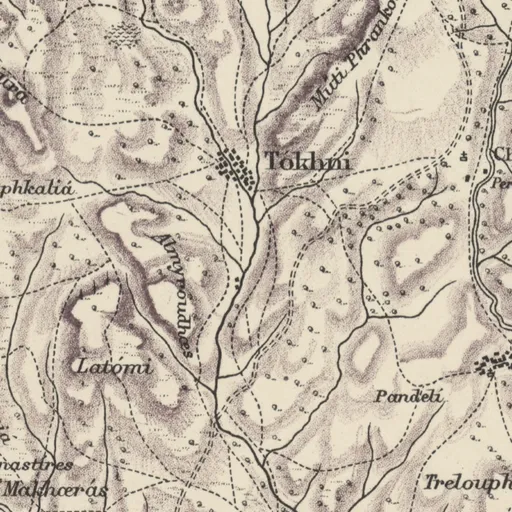
- Tókhni · village2.7 km E
Distances are straight lines between the positions of the names on the sheet.
In the literature
The place's names as printed in works published up to 1974, with the pages they appear on.
Kalavassosprinted 161 times
- P. Åström; L. Åström (1972). The Swedish Cyprus Expedition, Vol. IV, Part 1D: The Late Cypriote Bronze Age. Other Arts and Crafts. Relative and Absolute Chronology, Foreign Relations, Historical Conclusions. Lund, pp. 476, 477, 521, 532, 540 and 7 more
- P. Dikaios (1953). Khirokitia: Final Report on the Excavation of a Neolithic Settlement in Cyprus on Behalf of the Department of Antiquities, 1936-1946. Oxford, Oxford University Press, pp. 276, 313, 314, 318, 319 and 7 more
and 21 more works
Kalavasosprinted 25 times
- P. Dikaios (1953). A Guide to the Cyprus Museum. Nicosia, Cyprus Government Printing Office, pp. 1, 2, 3, 5, 7 and 3 more
- S. Casson (1937). Ancient Cyprus: Its Art and Archaeology. London, Methuen, pp. 22, 24, 211
and 2 more works
Kalavasoprinted 12 times
- O. Davies (1930). The Copper Mines of Cyprus. In Annual of the British School at Athens 30. pp. 74-, pp. 75, 83, 85
- J. L. Myres; M. Ohnefalsch-Richter (1899). A Catalogue of the Cyprus Museum. Oxford, Clarendon Press, pp. 14, 187, 198
and 3 more works
Our records that name the place
Records are matched to this place by name and position; a record may mean another place of the same name.
Excavations9 excavations
- Dhekelia camp and Kalavasos-Ayios Dhimitrios: Department of Antiquities tomb rescues
- Kalavasos-Ayios Dhimitrios: the Vasilikos Valley Project excavations
- Kalavasos-Ayious: the Vasilikos Valley Project excavations
- Kalavasos: Department of Antiquities rescue tombs
- Kalavasos-Kopetra: Department of Antiquities test trenching, plot 260
- Kalavasos Prehistoric Project (Kokkinoyia and Pamboules)
- Kalavasos-Tenta: the Vasilikos Valley Project excavations
- Kalavasos village: Vasilikos Valley Project rescue of Bronze Age tombs
- Vasilikos Valley Project: the survey
Tombs, by excavation25 tombs
- Kalavasos-Ayios Dhimitrios: the Vasilikos Valley Project excavations · 10 tombs
- Kalavasos-Tenta: the Vasilikos Valley Project excavations · 4 tombs
and 11 more
Documents127 documents
- A Brief History of Cyprus
- Actualités chypriotes
- A Cypriot Village of Late Antiquity. Kalavasos-Kopetra in the Vasilikos Valley
- Amilla: The Quest for Excellence: Studies Presented to Guenter Kopcke in Celebration of His 75th Birthday
- Amphorae and underwater survey: Making sense of Late Roman trade from scattered sherds and shipwrecks
- Ancient Jewelry and Archaeology
- Annual Report of the Department of Antiquities for the year 2008
- Annual Report of the Department of Antiquities for the year 2009
- Another look at Red Lustrous arm-vessels
- A preliminary investigation of systems of ceramic production and distribution in Cyprus during the Late Bronze Age
- Archaeological Field Survey of the Neolithic and Chalcolithic Settlement Sites in Kyrenia District, North Cyprus: Systematic Surface Collection and the Interpretation of Artefact Scatters
- Archaeological News from Cyprus, 1977-1978
and 115 more
People117 people
- Vassos Karageorghis
- Porphyrios Dikaios
- Ian A. Todd
- Edgar J. Peltenburg
- Vassiliki Kassianidou
- Stuart Swiny
- Joanna S. Smith
- Carole McCartney
- Sophocles Hadjisavvas
- Henry Beauchamp Walters
- Ellen Herscher
- Demos Christou
and 105 more
Museum records29 records
Museum of Archaeology and Anthropology, Cambridge (16) · British Museum (9) · Medelhavsmuseet, Stockholm (2) · Ashmolean Museum, Oxford (2)
Sources
- Map
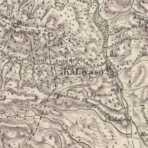
- H. H. Kitchener, Trigonometrical Survey of Cyprus, 1 inch to 1 mile, 1882 (scans: National Library of Scotland, CC BY)
- 1881 census
- 1881 census places: Harokopio University, Mendeley Data 10.17632/dvvm9cns2x.2 (CC BY 4.0)
- Lands and Surveys
- Department of Lands and Surveys, Geographical Names and Localities (INSPIRE), data.gov.cy (CC BY 4.0)
- Greek names
- Greek names: Wikidata (CC0); romanised by ELOT 743
- GeoNames
- Greek names where Wikidata has none, and other modern names: GeoNames, geonames.org (CC BY 4.0)
- Toponyms
- Department of Lands and Surveys, Toponyms (cadastral map layer 19), data.gov.cy dataset 157 (CC BY 4.0)
All the names on the sheets: Place names on Kitchener's map