

Contents
Ayia Varvara-Asprokremnos lies in central Cyprus, on the boundary between the villages of Ayia Varvara and Mathiati in Nicosia District, on the east bank of the Yialias river [1, p. 48]. People came back to it again and again between about 8900 and 8550 BC, in the period archaeologists call the Cypro-PPNA, contemporary with the late Pre-Pottery Neolithic A of the Levant [2, pp. 693, 699; 1, p. 49]. They built four round, semi-sunken structures one after another, knapped some three tonnes of chert, and ground and processed ochre and other mineral pigments in quantities far beyond their own needs [1, pp. 48–49, 56]. With Ayios Tychonas-Klimonas near the south coast, it is one of the two excavated sites that fill part of the long gap between the foragers of Akrotiri-Aetokremnos and the first farming villages of the Aceramic Neolithic [2, p. 699; 1, p. 49]. Its excavator, Carole McCartney, called it "a late PPNA specialized site" [1, p. 47].
The saddle by the Yialias
The site lies "on a saddle between two low hills" in the transition between the Troodos foothills and the central plain, bounded on the west by the Yialias river [2, p. 694] and on the south by a hillock [1, p. 49]. The Yialias flows east into Famagusta Bay, facing the Levantine coast [1, p. 48]. The ground under the structures lies at about 318 m above sea level [2, p. 694], and the national terrain model gives 318 to 319 m there [3]. The 337 m of McCartney's later report [1, p. 49] is about 19 m higher and appears to be a height on the excavation's own site datum.
The river gave water and a riverine habitat for the wild pigs, birds, freshwater crabs and turtles that the visitors ate. Rocks eroded from the Troodos, and the chalks of the surrounding hills, gave stone for querns, grinders and vessels. The site sits on the boundary between the Lefkara chalks, which contain replacement cherts of various qualities, and the Pera Pedi Formation, a source of umbers and yellow ochre. Next to it, outcrops of the lower pillow lavas offer celadonite, a soft green pigment known as terra verde that was processed on the site, and about a kilometre to the east the Mathiati–Sia ore body yields iron oxides and hydroxides in a wide range of bright colours [1, p. 48].
Discovery and excavation
The site was found by the son of a former director of the Cyprus American Archaeological Research Institute, who drew McCartney's attention to it in 1995. A first study of a grab sample of surface finds showed that it might be an Early Neolithic site [1, p. 48]. McCartney published it in 1998 [4].
In 2005 the Elaborating Early Neolithic Cyprus project (EENC) was set up to record the surface sites in the landscape around Asprokremnos and to survey the site itself [1, p. 48; 2, p. 694; 5]. The project was a collaboration between the University of Cyprus, Cornell University and the University of Toronto, directed by McCartney and Vasiliki Kassianidou, Sturt Manning and Sarah Stewart [1, p. 57 note 1]. Of the 23 early-looking sites the survey found, Asprokremnos alone had intact deposits below the surface [2, p. 694], and the 2005 collection showed that deep ploughing was destroying them [1, p. 48].
Seven seasons of small-scale excavation followed between 2006 and 2013 [1, p. 48; 6]. They recovered about 3,000 kg of chipped stone, about 20 kg of pigments, and more than 1,300 ground stone objects, most of them of diabase [1, pp. 48–49]. Ground-penetrating radar survey by Manning found no trace of occupation to the north and east of the excavated area; two possible buried features lie on the terrace immediately to the west and remain untested [1, p. 49].
Dates and phases
Six charcoal samples from the chert dump in Trench 06 were dated by radiocarbon. Together they fall between 9141 and 8569 cal BC at 95.4% probability; modelled as one phase, they place the dated activity "in round terms" between about 8800 and 8630 cal BC [2, pp. 698–700].
| Context | Lab no. | Age BP | Cal BC, 95.4% | Modelled BC |
|---|---|---|---|---|
| Tr 06/130 | Hd-27217 | 9525 ± 49 | 9141–8724 | 8841–8711 |
| Tr 06/130 | Hd-27242 | 9497 ± 46 | 9126–8640 | 8829–8710 |
| Tr 06/130 | Hd-27180 | 9477 ± 43 | 9119–8633 | 8822–8706 |
| Tr 06/105 | Hd-27170 | 9465 ± 46 | 9119–8624 | 8821–8701 |
| Tr 06/101 | Hd-27227 | 9452 ± 25 | 8807–8639 | 8804–8709 |
| Tr 06/99 | Hd-27228 | 9432 ± 49 | 9107–8569 | 8815–8686 |
The six radiocarbon dates, after Manning et al. 2010, Table 1, where the paired ETH numbers are also given; the charcoal samples from contexts 101 and 99 are identified there as deciduous [2, p. 700]. Context 130 is the fill of pit F126 at the base of the chert dump; 105, 101 and 99 are the chert layers above it.
McCartney later set these dates into the sequence of the site. The earliest structure, F300, is undated, but a dump sealing it (context 426) is dated 8940–8779 cal BC. Pit F126 gives an average date of 8730 cal BC and the chert layers above it 8579 cal BC; both are tied by the stratigraphy to the second structure, F848. F840 and F541 came after F848 had been abandoned [1, p. 49].
Phases
- Structure F300before about 8900 BC
The first and most carefully built structure. It burns at its last abandonment and is sealed by a dump dated 8940–8779 cal BC.
- Structure F848 and the chert dumpabout 8730 to 8580 BC
A simpler round structure south of a growing dump of chert waste. It too ends under a burnt layer.
- Ochre workshop, F840 and F541after about 8580 BC
A purple sediment buries F848 and becomes a pigment workshop. F840, a shallow pit structure, and the small F541 are used beside it.
- Abandonmentabout the mid 9th millennium BC
We know of no later occupation on the saddle.
- Survey and excavation1995, 2005, 2006–2013
Found in 1995; surveyed by the EENC project in 2005 and excavated by Carole McCartney in seven seasons.
Four round structures, one after another
"The four structures found at the site do not form a small village or hamlet", McCartney wrote, "but were used sequentially with a single large structure dominating each of three main phases" [1, p. 49]. The three larger ones are all circular and dug into the ground, and each was built with less effort than the one before [1, pp. 49–50]. F300 lies to the north of the excavated area with the chert dump to its east; F848 lies south of the dump, and F840 south of F848, with F541 just to its west [1, p. 49].
Plan · about 8900 to 8550 BC
The four structures at Ayia Varvara-Asprokremnos
Ayia Varvara-Asprokremnos, the saddle on the east bank of the Yialias
F840 and F541: after about 8580 BC
Choose a number on the plan, or a name below, to read what was found there and how well it is known.
Key
- Structure in use (schematic)
- Radar survey blocks
- Earlier structure, abandoned
- Excavation trenches (schematic)
- Contours at 1 m
F300, the earliest, was also the most elaborate. It was a steep-sided pit 5 m across, dug into the havara, the soft sediment that overlies the bedrock. A broad channel ran round the foot of the wall, interrupted only by a segment on the west side that the excavators read as the entrance, and posts were set at regular intervals in the channel. Because the structure burned when it was finally abandoned, the impressions of these posts survive in the mud plaster that covered them. Smaller post and stake holes on the north side may have carried a loft [1, p. 50].
F848 was simpler. The half excavated is 4.5 m across and only about 20 cm deep. It had the same channel at the foot of the wall round a flat floor of trampled earth, but no posts set in the wall and no clusters of stake holes. Irregular pits in the middle of the floor were filled with ground stone tools, mostly grinders and pounders [1, p. 50].
F840 was "a simple hemi-spherical pit 4.5 m in diameter" with a single central post and a heap of river stones, some used as grinders [1, p. 50]. It served as a store and workplace: a bench was formed round the central pile of stones, with grinders and anvils on either side of a central "seat" and a row of grinders at its foot [1, p. 53]. F541, a small structure immediately west of F840, was probably in use at the same time [1, p. 49].
Repeated visits
On the floor of F300 there are no distinct floors, only patches of ash, trampled earth and occupation debris laid down at random, and usable tools lying beside one ashy patch were buried by later layers. Two stretches of the wall, on the north-west and south-east, collapsed while the structure stood empty. In every structure the heavy querns were stored upside down near the wall and the hand tools stacked in piles or small pits, ready for the next visit [1, pp. 50–53].
The chert dump tells the same story. Lenses of fresh, unused blades and knapping waste alternate with sterile layers of river silt, sometimes thick, which McCartney took for winter flooding while the site was empty. Since the saddle is also chilled by mountain winds in winter, she suggested that the visits fell in late spring or summer [1, p. 53]. In her words, "any potential initial thoughts of permanent settlement had been quickly replaced by frequent temporary re-occupation" [1, p. 50].
A. Bernard Knapp, noting the shallow deposits, the light structures and the lack of burials or middens, reached a similar view: the site "may only have been occupied seasonally or periodically" [7; 8, p. 23].
Chert, ochre and ground stone
Blades and arrowheads
The knappers worked with "a very high degree of skill". Most cores are unidirectional and pyramidal, made to strike standardised narrow blades, and most were worked to exhaustion; the coarser Lefkara chert gave the same results as the finest [1, p. 55]. By 2010 the excavators had counted more than a hundred arrowheads, most of them made on small blades and bladelets with a short, lozenge-shaped tang, a form paralleled at Mureybet, Cheikh Hassan and Dja'de in the northern Levant, at the end of the PPNA and the start of the PPNB [2, pp. 697–698]. Blades with sickle gloss are rare, about 1.3% of the tools, and wear on their edges shows that reeds were cut as well as cereals [1, p. 55].
Grinding stones and vessels
Of the 1,357 ground stone objects recorded, the querns, grinding slabs, anvils, grinders and pounders are of diabase. Small stone vessels of softer calcareous stone were made on the site, as the crude wasters show, and there are cup-marked stones and large chalk slabs used as cutting boards [1, p. 55]. One finely made bowl was painted with ochre, a piece without parallel in Cyprus that recalls the decorated stone bowls of the Euphrates [2, p. 696].
Ochre and pigments
Many of the grinding tools of every kind carry traces of ochre, and querns that would elsewhere be taken for grinding cereals were used here for pigment. The share rises through time: 28 objects with ochre residue in F300, about a third of the grinders in F848, and more than half of those in F840 [1, p. 55]. In F300 a lump of fused ochre nodules was kept in a large stone bowl, left in place when fire ended the structure [1, p. 55].
After F848 was abandoned, layers of dark purple Pera Pedi sediment covered it, and on them lay "one of two ochre working spaces currently unique in Cyprus". Flat chalk slabs were set round a roughly circular pile of burnt stone and ash, bordered by shallow pits and small stake holes. Ochre nodules of many colours lay scattered with scrapers and used blades. When the chalk slabs were turned over they proved to be cutting boards with ochre residues and cut marks. McCartney concluded that ochre was processed and pig skins tanned here [1, p. 56].
Production for exchange
McCartney argued that the pigments, perhaps stored and carried in leather bags, "were produced in large surpluses that clearly exceeded the needs of the people occupying the site". Only two objects from the site are themselves decorated with ochre, and contemporary Klimonas has comparatively little of it. In her reading, the site was chosen for "mineral and stone commodities, not farm land", and its occupants were craft specialists working within the wider eastern Mediterranean world [1, pp. 56–57]. She acknowledged that tracing such widespread materials to a source is "a daunting prospect", and pointed to a couple of red-coloured arrowheads from Göbekli Tepe in south-east Anatolia as one possible mainland destination [1, p. 57]. We know of no ochre or chert from Asprokremnos yet identified on the mainland.
Figurines and the closing of the structures
F300 and F848 each ended under a burnt layer about 20 cm thick, and on top of each burnt layer someone laid a stone figure. McCartney called these abandonment "gifts" [1, p. 53]. The figure left in F300 is a small stone bust, G382, about 10 cm tall, placed on its side [1, p. 53]. It has two swellings, a head tilted back and a torso, divided by a deep notch, with traces of a white coating and red colour [8, pp. 98, 435]; it is one of the two objects from the site decorated with ochre [1, p. 57].
The figure that closed F848, G848, is much larger. It is a statuette of diabase 31 cm tall, found in 2013 lying on its side with a stone sphere and two flat river-worn cobbles [1, p. 53]. It is kept in the Cyprus Museum; the catalogue of the 2019 exhibition Cyprus: A Dynamic Island gives its height as 31.6 cm and its width as 13.7 cm. The figure is phallic in outline, with two prominent sculpted breasts; one of the cobbles found with it carries ochre [9, p. 71]. Later figures are described under Neolithic and picrolite figurines.
The later structures were closed in the same way with other objects. On the final fill of F840 lay a unique baked clay "toggle", and on that of F541 a large incised pendant of bluish-green stone (5.6 cm), placed face down [1, p. 53]. A fragment of a baked clay figure about 4 cm in size, a torso with stumps for arms, came from the fill of a natural channel that the excavators read as a foundation deposit of the earliest occupation [8, p. 98; 2, p. 697].
Ties with the mainland
Besides the arrowheads and the painted bowl, mainland parallels include fragments of incised shaft-straighteners, grooved stones used to straighten arrow shafts: McCartney counted three, all thrown on the central dump [1, p. 53]. They are the earliest of their kind on Cyprus, and their decoration is matched at Jerf el-Ahmar in Syria [2, pp. 696–697].
Pig dominates the animal bones, with fewer birds and the occasional freshwater crab [2, p. 698], and turtle is present in every phase [1, p. 55]. The dates are earlier than the first domestic pigs of the Near East, so these were possibly wild pigs that people had brought to Cyprus and restocked there [2, p. 698]. No charred plant remains had been found by 2010, and there was "little indication of early plant domestication" [2, p. 698]; at Klimonas emmer wheat and barley were grown [10]. Animals, objects and ideas shared with the mainland all imply regular sea crossings, and McCartney argued that the Neolithic groups could have made these crossings themselves [1, pp. 56–57].
Neighbouring sites
Ayios Tychonas-Klimonas, to the south-west in Limassol District, was occupied at the same time. The two share artefact types and techniques but differ in their dominant arrowheads, their figurines, their ground stone and their plans, and McCartney saw them as "distinct groups" within one late PPNA world [1, pp. 49, 55]. Around Asprokremnos the EENC survey recorded scatters of stone tools, among them Agrokipia-Paleokamina and Agrokipia-Kottafoi, with others at Politiko, Pera Chorio, Alambra and Ayia Varvara itself (Pervolia and Poupes). They are read as places visited briefly for particular tasks [8, p. 24].
Map of Cyprus
- Excavated Cypro-PPNA sites
- Survey scatters attributed to the Cypro-PPNA
- Ground above 200, 500, 1,000 m
Sites on this map
- 1Ayia Varvara-Asprokremnos
- 2Ayios Tychonas-Klimonas (approx.)
- 3Agrokipia Paleokamina
- 4Agrokipia Kottafoi
The site today
The site lies in farmland and is not laid out for visitors. The statuette G848 is in the Cyprus Museum in Nicosia [9, p. 71], and the small bust G382 is probably there too [8, p. 435].
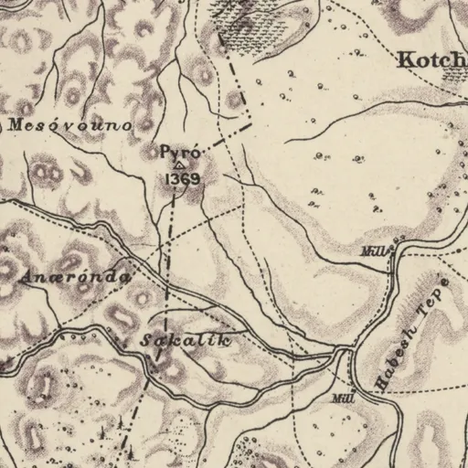
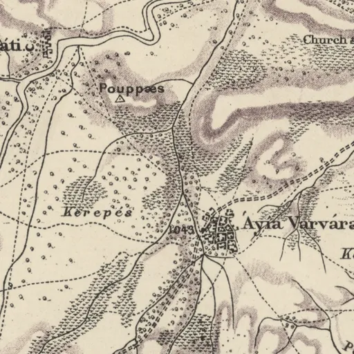
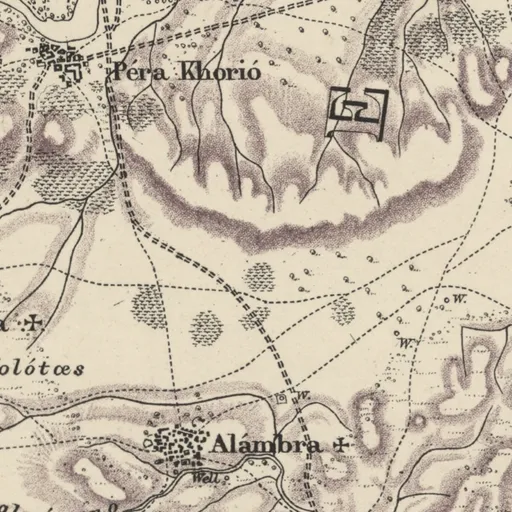
On Kitchener's map (1882)
Áyia Varvára · Christian village
Excavation history
- 1996McCartney's surface sample (1996)Directed by Carole McCartneySurvey
- 2005–2011The EENC projectDirected by Carole McCartneyExcavation
Nearby sites
- Kotsiatis2.1 km
- Kotsiatis-Asprokremmos2.1 km
- Kotsiatis-Ayia Varvara2.1 km
- Ayia Varvara-Poupraes2.7 km
- Ayia Varvara-Almyras3.1 km
- Marki-Alonia3.3 km
Straight-line distances.
Mentioned in
10 mentionsDocuments · 6
- Preliminary Report on the Chipped Stone Assemblage from the Aceramic Neolithic Site of Ayia Varvara Asprokremnos, Cyprus
1998 · pp. 85, 86, 89
subject; surface site of Aceramic Neolithic chipped stone
McCartney 1998, p. 85
- The earlier Neolithic in Cyprus: recognition and dating of a Pre-Pottery Neolithic A occupation
2010 · pp. 694, 695, 696
early Neolithic excavated site in central Cyprus
Kromer & Stewart 2010, p. 694
- Annual Report of the Department of Antiquities for the Year 2007
2008
Flourentzos 2009
- The early process of mammal domestication in the Near East: New evidence from the pre-Neolithic and pre-Pottery Neolithic in Cyprus
2011 · pp. S256, S260
site with painted stone vessels and early lithics
Briois & Guilaine 2011, p. S256
- Early Neolithic chert variability in central Cyprus: Geo-chemical and spatial analyses
2020 · pp. 3, 6
PPNA site with blade-based industry and ground stone
Manning & Hancock 2020, p. 3
- Building in Prehistoric Cyprus. Tracing Transformations in the Built and Social Environment of Early Cypriot Communities
2023 · p. 69
Amadio 2023
Lectures and videos · 2
- Maritime connections in Eastern Mediterranean prehistory
2021 · 0:40:10; 0:24:03
Functioned as a specialised site processing pigments and chipped stone for export, according to its excavator
Moutsiou & Kassianidou 2021
- Issues of Continuity in Cypriot Prehistory: The Case of the Roudias Terrace in Upland Cyprus
2022 · 0:51:52
Aceramic site with radiocarbon dates relevant to the transition from hunting to farming
Efstratiou & Kyriakou 2022
- Excavations · 2listed under Excavation history
References
- 1.McCartney, C. (2017). Ayia Varvara Asprokremnos: a late PPNA specialized site on Cyprus. In J.-D. Vigne, F. Briois & M. Tengberg (Eds.), Nouvelles données sur les débuts du Néolithique à Chypre / New data on the beginnings of the Neolithic in Cyprus (Séances de la Société préhistorique française 9, pp. 47–58). Société préhistorique française. https://www.prehistoire.org/offres/file_inline_src/515/515_pj_020517_101056.pdf
- 2.Manning, S. W., McCartney, C., Kromer, B., & Stewart, S. T. (2010). The earlier Neolithic in Cyprus: recognition and dating of a Pre-Pottery Neolithic A occupation. Antiquity, 84(325), 693–706. https://doi.org/10.1017/S0003598X00100171
- 3.Department of Lands and Surveys, Cyprus. Digital Terrain Model of Cyprus (5 m grid). Nicosia: Department of Lands and Surveys.
- 4.McCartney, C. (1998). Preliminary Report on the Chipped Stone Assemblage from the Aceramic Neolithic Site of Ayia Varvara Asprokremnos, Cyprus. Levant, 30(1), 85–90. https://doi.org/10.1179/lev.1998.30.1.85
- 5.McCartney, C., Manning, S., Sewell, D., & Stewart, S. T. (2006). Elaborating Early Neolithic Cyprus (EENC). Report of the Department of Antiquities, Cyprus, 39–62.
- 6.McCartney, C., Manning, S. W., Sewell, D., & Stewart, S. T. (2007). The EENC 2006 Field Season: Excavations at Agia Varvara-Asprokremnos and Survey of the Local Early Holocene Landscape. Report of the Department of Antiquities, Cyprus, 27–44.
- 7.Knapp, A. B. (2013). The archaeology of Cyprus: From earliest prehistory through the Bronze Age. Cambridge University Press.
- 8.Winkelmann, C. (2020). The Neolithic and Chalcolithic Figurines of Cyprus (Marru). Zaphon.
- 9.Halbertsma, R. B., & Pilides, D. (Eds.). (2019). Cyprus: A dynamic island. Sidestone Press.
- 10.Vigne, J.-D., Briois, F., Zazzo, A., Willcox, G., Cucchi, T., Thiébault, S., Carrère, I., Franel, Y., Touquet, R., Martin, C., Moreau, C., Comby, C., & Guilaine, J. (2012). The first wave of cultivators spread to Cyprus earlier than 10,600 years ago. Proceedings of the National Academy of Sciences, 109(22), 8445–8449.
Corrections and additions
Do you know this site?
Help us keep this page right: recent work, the site as it is now, and what we may have missed.
We would like to hear about
- Recent fieldwork or publications
- A wrong location or name
- Access, opening times or the site's state today
- Photographs we may use
Tell us if you would like to be thanked by name on the page.