
Drawing·Fig.5-6·2005
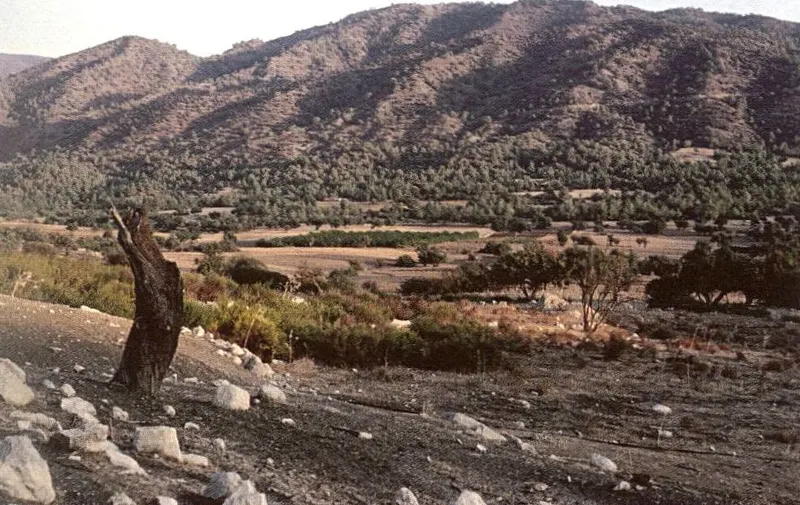
North landmark: slopes of the Troodos massif above the Amathus survey area
Drawing
English, translated from the French record
North landmark showing the slopes of the Troodos massif. The bordering escarpment rises several hundred metres above a corridor eroded at its foot, running east to west, which separates the mountain from the hills of Amathus, whose limestone strata appear in the foreground. October 1991.
French, as on the record
Repère Nord : les versants du massif du Troodos. L’escarpement bordier domine de plusieurs centaines de mètres un couloir évidé à son pied d’Est en Ouest. Il sépare la montagne des collines d’Amathonte, dont les assises calcaires apparaissent au premier plan. Octobre 1991.
Corrections and additions
Can you tell us more about this?
If you can identify, date or place this item, or know where else it is recorded, we would like to hear.
We would like to hear about
- What it shows or records
- Its date, place or author
- Where else it is published or held
- A mistake in our description
Tell us if you would like to be thanked by name on the page.