
Drawing·Fig.13-13·2005
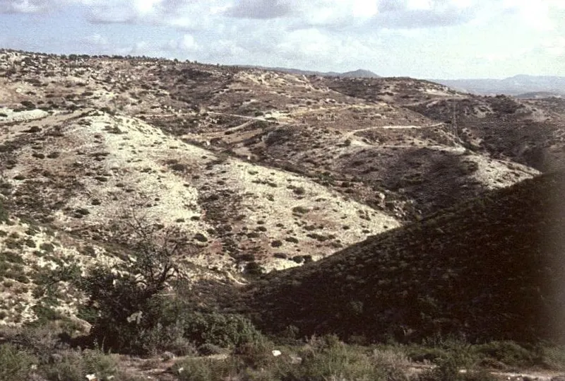
Dissection landforms above Agios Tychonas, upper hill sector
Drawing
English, translated from the French record
View to the east, across the general direction of drainage, over dissection forms in crushed limestone beds above Agios Tychonas in the upper sector of the second-tier hills: long regularised slopes and some interfluve flats. These forms evolve below a large regularised slope, visible in the penultimate plane, which corresponds to an older topography of the Troodos piedmont, shaped from the mountain front down to the coast. October 1992.
French, as on the record
Au-dessus d’Agios Tychonas, dans le secteur amont des collines du deuxième échelon. Vue vers l’Est, transversalement à la direction générale du drainage. Formes de dissection dans des assises de calcaire broyées : longs versants réglés et quelques replats d’interfluves. Ces formes évoluent en contrebas d’un grand versant régularisé, visible à l’avant-dernier plan et qui correspond à une ancienne topographie du piémont du Troodos, élaborée depuis le front montagneux jusqu’au littoral. Octobre 1992.
Corrections and additions
Can you tell us more about this?
If you can identify, date or place this item, or know where else it is recorded, we would like to hear.
We would like to hear about
- What it shows or records
- Its date, place or author
- Where else it is published or held
- A mistake in our description
Tell us if you would like to be thanked by name on the page.