
Page 29Scan 11 of 90
28
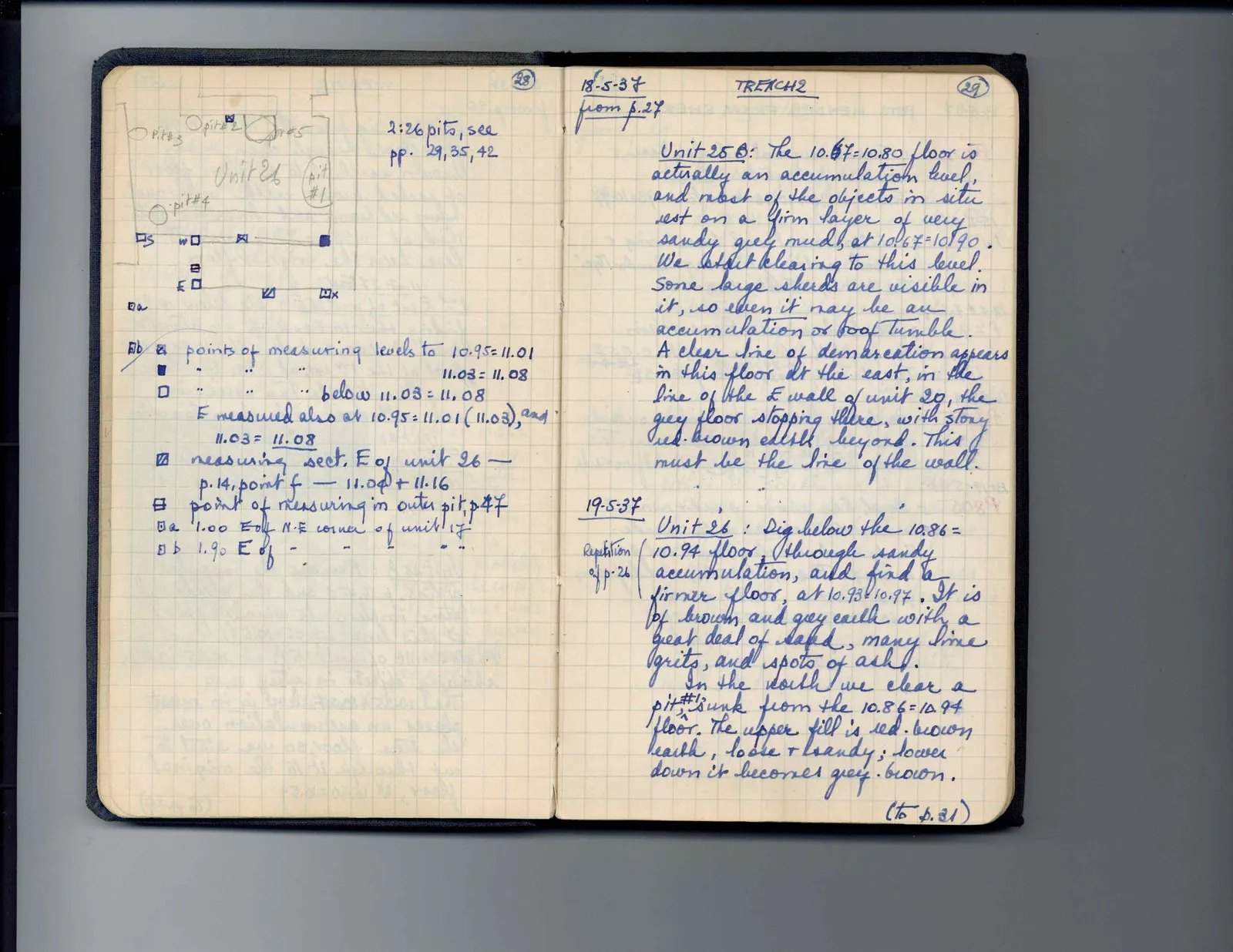
Drawing: labeled plan of excavation unit; labels: pit #3, pit #2, pit #5, Unit 26, pit #1, pit #4, S, W, E, a, b, points of measuring levels to 10.95 = 11.01, below 11.03 = 11.08, E measured also at 10.95 = 11.01 (11.03), and 11.03 = 11.08, measuring sect. E of unit 26 - p. 14, point f - 11.04 + 11.16, point of measuring in outer pit, p 47, 1.00 E of N.E. corner of unit 17, 1.90 E of " " " " "
2:26 pits, see pp. 29, 35, 42
Right page
18-5-37 from p. 27
TRENCH 2
Unit 25 B: The 10.67 = 10.80 floor is actually an accumulation level, and most of the objects in situ rest on a firm layer of very sandy grey mud, at 10.67 = 10.90. We start clearing to this level. Some large sherds are visible in it, so even it may be an accumulation or roof tumble. A clear line of demarcation appears in this floor at the east, in the line of the E wall of unit 20, the grey floor stopping there, with stony red-brown earth beyond. This must be the line of the wall.
19-5-37[margin left: Repetition of p. 26] Unit 26: Dig below the 10.86 = 10.94 floor, through sandy accumulation, and find a firmer floor, at 10.93 = 10.97. It is of brown and grey earth with a great deal of sand, many lime grits, and spots of ash. In the north we clear a pit#1 sunk from the 10.86 = 10.94 floor. The upper fill is red-brown earth, loose + sandy; lower down it becomes grey-brown.
(to p. 31)
65 figures hard to readstruck struck outadded written in above” jug ditto, and what it repeatsword reading not certain