
Field photograph·C09833·1927–1931
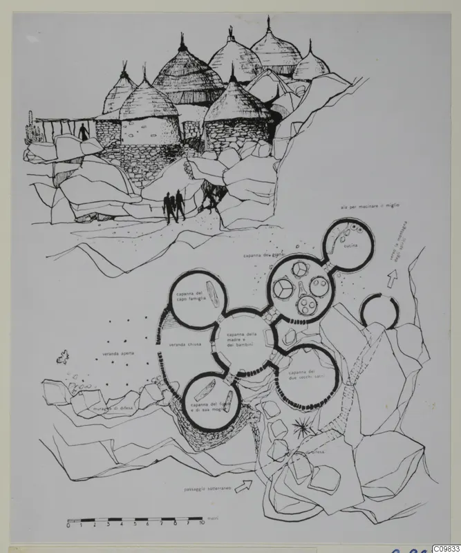
Plan and elevation of the huts of a Matakam tribe farm
Description
A drawn elevation at the top shows several round huts with conical thatched roofs and stone walls on rocky ground, with small figures near the base. Below, a ground plan shows linked circular rooms, a curved enclosing wall and a scale bar marked in metres, with printed labels beside the rooms. The drawing is in black ink on a pale sheet.
English, translated from the Swedish record
Africa. Comparative architecture. Plan and elevation of the huts of a Matakam tribe farm.
Swedish, as on the record
Afrika Comparativ Arkitektur Plan and elevation of the huts of a Matakam tribe farm.