
Field photograph·C09831·1927–1931
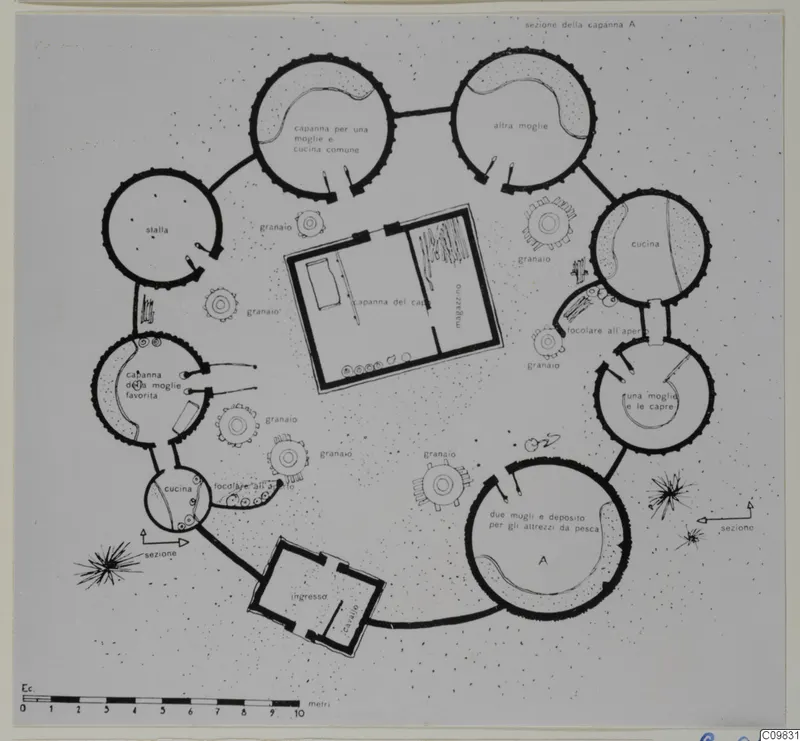
Plan and elevation of a Musgum farm, Lake Tchad
Description
Ink line drawing in plan view of a farm compound: a ring of circular huts of varying sizes, some with thick walls and dotted ground around them. A larger rectangular building with two rooms stands at the centre, and several small round structures lie between the huts. A scale bar runs along the lower left, and printed labels name the huts and areas.
English, translated from the Swedish record
Plan and elevation of a farm of the Musgum tribe. In the Lake Tchad prairies where there is no prevailing wind the circular plan is generally adopted. The chef's hut is surrounded by the services buildings and the wives' huts.
Swedish, as on the record
Afrika Comparativ Arkitektur Plan and elevation of a farm of the Musgum tribe. In the Lake Tchad prairies where there is no prevailing wind the circular plan is generally adopted. The chef-s hut is surrounded by the services buildings and the wives huts