
Page 124Scan 16 of 40
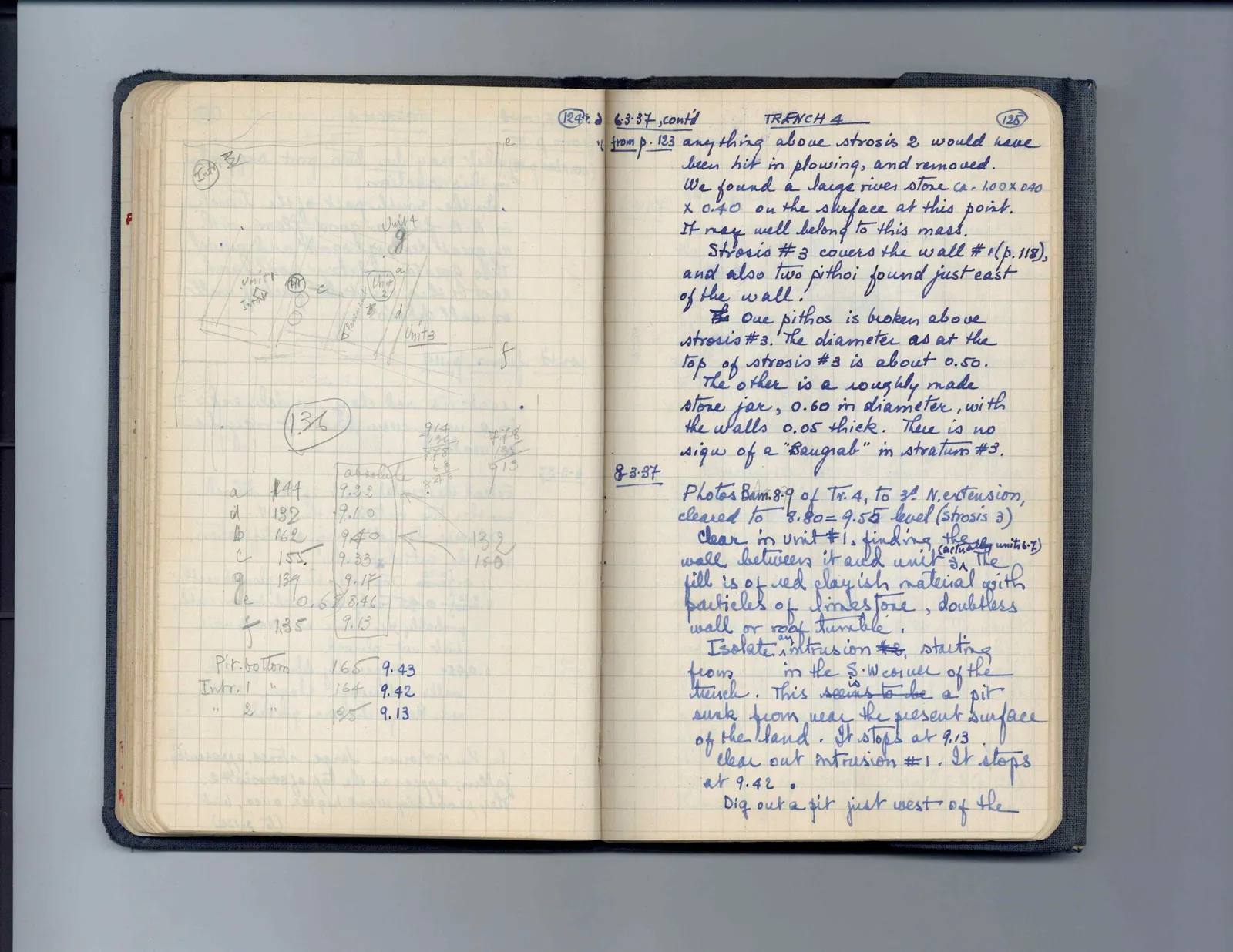
Drawing: plan of trench units and features; labels: Intr. II, Unit 4, g, Unit 1, Intr 1, Pit, c, a, Unit 2, Pavement, b, d, Unit 3, e, f
136
| absolute | 914 | 778 | ||
| 136 | 135 | |||
| 778 | 913 | |||
| 68 | ||||
| 846 | ||||
| a | 144 | 9.22 | ||
| d | 132 | 9.10 | ||
| b | 162 | 9.40 | 132 | |
| c | 155 | 9.33 | 160 | |
| g | 139 | 9.17 | ||
| e | 0.68 | 8.46 | ||
| f | 1.35 | 9.13 |
| Pit-bottom | 165 | 9.43 |
| Intr. 1 " | 164 | 9.42 |
| " 2 " | 135 | 9.13 |
Right page
6-3-37cont'd_ TRENCH 4 from p. 123 anything above strosis 2 would have been hit in plowing, and removed. We found a large river stone ca. 1.00 x 0.40 x 0.40 on the surface at this point. It may well belong to this mass. Strosis #3 covers the wall #1 (p. 118), and also two pithoi found just east of the wall. The One pithos is broken above strosis #3. The diameter as at the top of strosis #3 is about 0.50. The other is a roughly made stone jar, 0.60 in diameter, with the walls 0.05 thick. There is no sign of a "Baugrab" in stratum #3.
8-3-37Photos Bam. 8-9 of Tr. 4, to 3^d N. extension, cleared to 8.80 - 9.55 level (strosis 3) Clear in unit #1, finding the wall between it and unit ^(actually units 6-7) 3. The fill is of red clayish material with particles of limestone, doubtless wall or roof tumble. Isolate ^an intrusion #2, starting from in the S.W corner of the trench. This seems to be is a pit sunk from near the present surface of the land. It stops at 9.13. Clear out intrusion #1. It stops at 9.42. Dig out a pit just west of the
65 figures hard to readstruck struck outadded written in above” jug ditto, and what it repeatsword reading not certain