
Unnumbered pageScan 84 of 97
[printed: CURIUM EXCAVATIONS EPISKOPI, LIMASOL CYPRUS]
Margin left: Copy 16 Dec 1947
penciled figures not in original
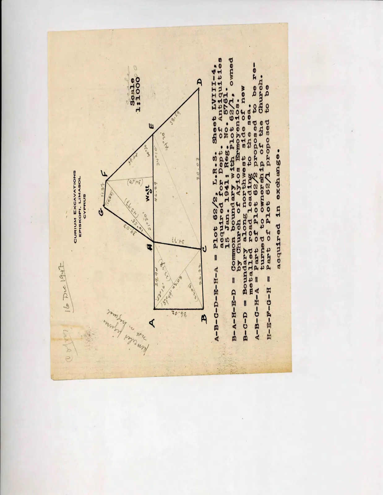
Drawing: geometric plot boundary diagram with vertices A, B, C, D, E, F, G, H; labels: A, B, C, D, E, F, G, H, 36.02, 29.94, (23.97), 53° 16', /37° 49'\ 43.08, (22.08), 26.32, 34.77, 39.03, 14° 58', 51° 30', (43.97), (10.08), 11.87, (34.50), Wall, 46.89, 39.64, 60° 30', 34° 10', 44° 20', 38.59, 70.03, [pencil: Scale], Scale
1:1000]
A-B-C-D-E-H-A = Plot 62/2, L.R.S. Sheet LVIII-4, acquired for Dept. of Antiquities 15 Jan. 1941: Reg. No. 5761.
B-A-H-E-D = Common boundary with Plot 62/1, owned by Church of Ayios Ermoyenios.
B-C-D = Boundary along northwest side of new metalled road leading to the sea.
A-B-C-H-A = Part of Plot 62/2 proposed to be returned to ownership of the Church.
H-E-F-G-H = Part of Plot 62/1 proposed to be acquired in exchange.
65 figures hard to readstruck struck outadded written in above” jug ditto, and what it repeatsword reading not certain