
Unnumbered pageScan 67 of 87
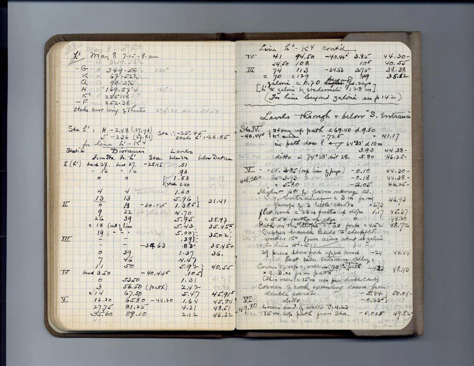
136 May 8 7.15-8. am
- G 349.56 1/2 K - K 67-52 1/2 Q - Q 90.03 1/2 H - K4 169.57 1/2 K4 235.18 3/8 - F 252.38 Stake west wing of Theater 274°-21' dir. c 34.50
Sta L' = H - 2.48 (27.93) J - 2.36 (27.81) Sta ∴ -25.45 for line L' - K4 stake L' = -26.85
Table
Sta. Distances Levels From Sta. Fr. L' Sta. below Sta below Datum I (K') back 27. -25.45 .51 1'6" 1'6" .93 o o 1.53 26.98 (stake 1.40 27.05 4 4 (beginning descent to cave) 1.60 13 13 5.96 31.41 II o 13 -30.325 1.385 9 22 (fork of steep slope) 4.70 26 39 5.95 35.97 c 18 (out of line 5.43. 35.455 19 (" d[illegible] to ledge) 5.00 35.02 III - - .39 35.45+ - - -34.63 .83 o 39 1.37 36. 7 46 4.47 11 50 5.92 40.55 IV back 3.50 -40.445 .105 o 53.50 1.31 41.75 3 56.50 (path) 2.42 42.86 c 14 67.50 5.47 45.915 V 12.30 65.80 -44.20 1.64 45.84 27.75 81.25 4.31 48.51 35.60 89.10 2.12 46.32 41
/table
Right page
Line L' - K4 cont'd IV 41 94.50 -40.445 3.85 44.30- 54.50 108 105 40.55 III 74 113 -34.63 3.75 38.38 c 90 c 129 .49 35.12
Zaloni c 0.70 beyond higher than 49. sap
L' to zalmi h stadiameter 120 m
(For line beyond zaloni see p 142)
Levels through & below "S. Entrance" Sta. IV. stone up path ∠ 69.40 d. 9.50 -40.445 [K4] -3.26 = 41.17 in path down l & 64°33' d 10 m 3.93 44.38- ditto ∠ 74°28' dist 28. 5.80 46.25- V - -IV. 3.85 (top line of page) -0.10 44.30- 44.20- 3.93 -0.18 44.38- 5.80 -2.05 46.25- Highest pt fo promontory W. of entrance c 3 m from edge of little canto 2.73 46.93 flat rock c 20 m further up slope 1.17 45.37 c 5.50 further up rock -.02 44.20 Path on this ledge of rock (center) = at fork c 4.52 48.72 (Upper branch leads to shuffle board Sta V under K4 town aims almost at zalmi on line K4 - L9a +4.395 29 paces above fork upper branch -.24 44.44 Highest East side entrance valley = Corner W, top of wall to (NE) in path / -4.23 48.43 * c. 2.00 from path flat rock (This wall c 15 m up from double canto) Corner of rock extending down from double canto -5.84 50.04- VI wall ditto -0.235 48.43 49.80 Lower end of wall V - 4.23 5.84 50.04 Sta. V 15m, 80° path from Sta. -0.015 49.82 low end wall V - 4.23 = -015 = 49.82 15 m up path from mark
65 figures hard to readstruck struck outadded written in above” jug ditto, and what it repeatsword reading not certain