
Unnumbered pageScan 24 of 31
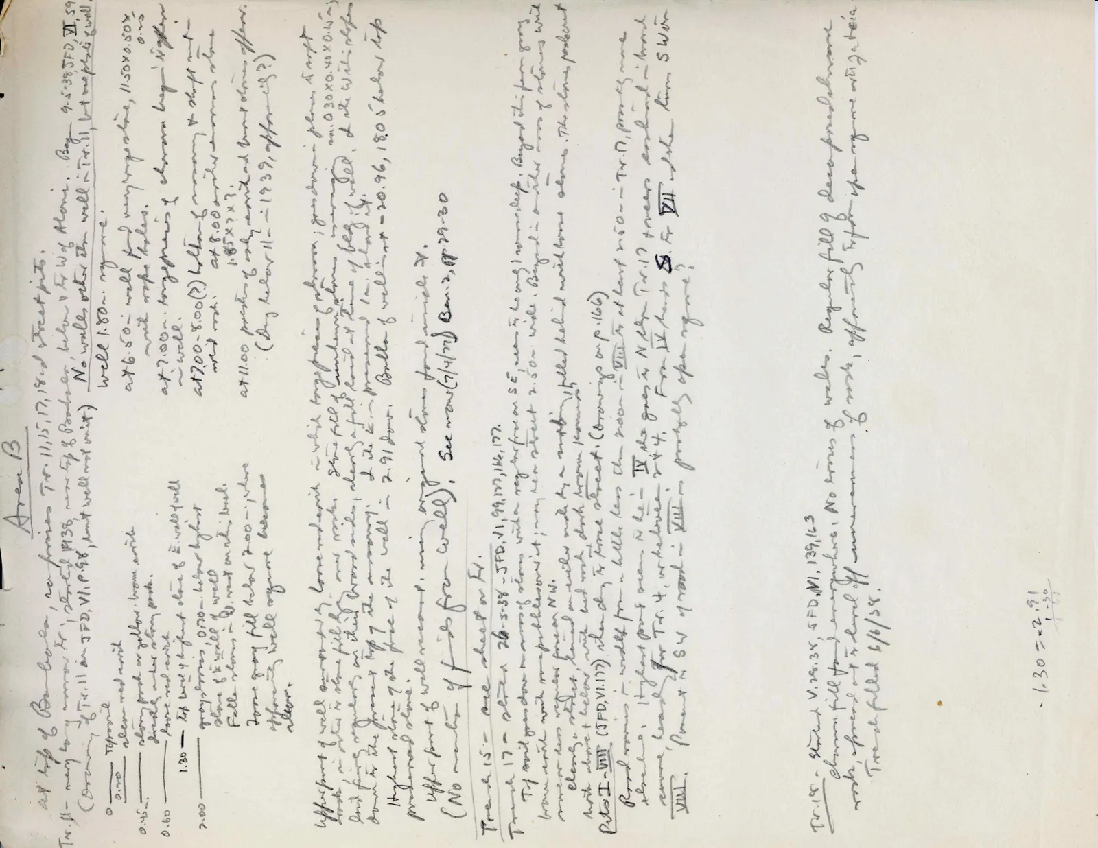
Area B at top of Bamboula, no houses Tr. 11, 15, 17, 18, + street pits.
Tr. 11- may be a narrow tr., started 1938, run by E. Proctor, below & to W of Aloni. Beg. 9-5-38, JFD, VII, 59 No walls, other than well = Tr. 11, but no pls. to well (Drawing of Tr. 11 in JFD, VI, p. 58, but well not out) Well 1.80 m. sq. me. at 6.50 - well found very regular & nice, 11.50 × 0.50x with rope holes. 0.25 at 7.00 - toughness of chevron bag begins to soften ~of well~ at 7.00-8.00(?) bottom of masonry & shaft cut in solid rock. at 8.00 begins a narrower stone 1.85 × ? × ? at 11.00 pieces of early revival and burnt debris appear. (Dug below 11- 1939, after eig?)
0 Topsoil — 0.20 above red earth — 0.45 above pink or yellow-brown earth directly above stony pack. — 0.60 above red earth — 1.30 — top level of highest stone of E. wall of well gray-brown, 0.70 m. below highest stone of E wall of well Fallen stones in W. wall on this level. — 2.00 Loose gray fill below 2.00 m., where above of well org. are becomes clear.
Upper part of well surrounded by loose red earth in which large pieces of chavara, goes down to p. lower stones & sculpt looks in places like a stone fill, and rocks. Some fill of tumbled down stones, missing one ca. 0.30 × 0.40 × 0.45 m. laid fairly regular on their \2\ broad sides, clearly a fill laid at time of beg. of well, & at W side: slopes down to the present top of the masonry; → its K. in prominent 1 m. island etc./ Highest stone of the face of the well = 2.91 down. Bottom of well in + -20.96, 18.05 below top preserved stone. Upper part of well re-const.; many original stones found inside it. (No number of pls from well) See now (7/4/39) B. in 2, pp. 29-30
Trench 15- see sheet on Tr.
Trench 17 - started 26-5-38-JFD, VI, 99, 100, 166, 177. Top soil goes down on row of stones, with a reg. surface on SE, seem to be a wall, 1 masonry deep. Beyond this firm gray brown earth with some pebbles covers it in my. re a street 2.50 m wide. Beyond = another row of stones with more or less regular faces on NW. clearly a street, based on earlier made by a canal-filled behind with loose stones. The stones pack out both above + below, with bed rock, dark brown porous soil.
Pits I-VIII (JFD, VI. 177) run along Tr to trace street (drawing on p. 166) Road wears in width from a little less than 3.00 m - VIII & at least 2.50 m - Tr. 17, possibly more elsewhere. Highest point seems to be in IV & then goes s. to N edge Tr. 17 & seems continued in broad canal, least to Tr. 4, whatever it is. From IV slopes to S. To VII & then turns SW in VIII. Pavement to SW of road in VIII - possibly open square?
Tr. 18- started V. 28.38, 5FD, VI, 139, 163 chavara fill found everywhere. No traces of walls. Regular fill of decomposed chavara rock, spread out to level off unevenness of rock, apparent by turf at top & pure rock at 1.30 to ca. Trench filled 6/6/38.
-1.30 = -2.91 -1.30 -1.61
65 figures hard to readstruck struck outadded written in above” jug ditto, and what it repeatsword reading not certain