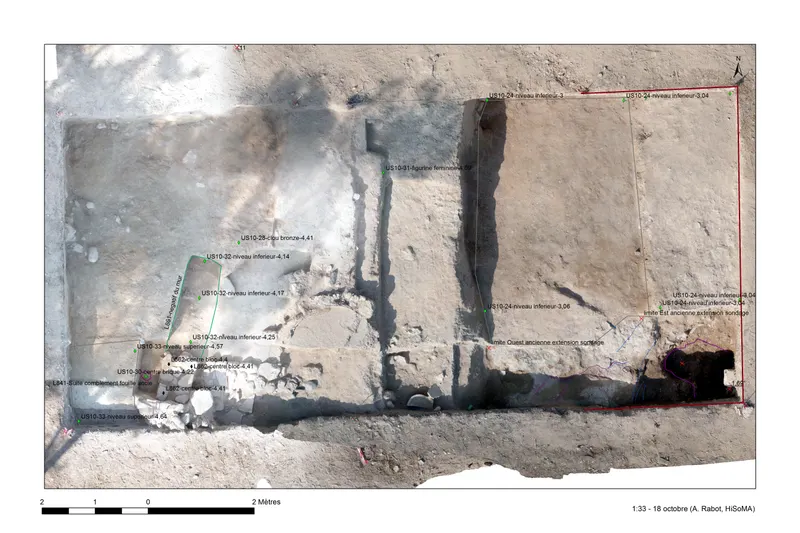
Sondage 10, GPS survey plan of 18 October, Kition-Bamboula
Drawing: Alexandre Rabot, 2018. Mission archéologique française de Kition-Salamine (MOM, Lyon), Nakala, KIT16-NIMFO-0171. "Sondage 10, GPS survey plan of 18 October, Kition-Bamboula". CC BY 4.0. Resized.
Plan
English, translated from the French record
GPS survey plan of Sondage 10 dated 18 October, showing wall 862 under stratigraphic unit S10-30, locus 861 under US S10-32, US S10-28, S10-31 (locus 860) and S10-33 being excavated, and the end of US S10-24. 2016 season.
French, as on the record
Sondage 10, relevé GPS du 18 octobre : mur 862 sous US S10-30, locus 861 sous US S10-32, US S10-28, S10-31 (locus 860) et S10-33 en cours, fin de l'US S10-24
Corrections and additions
Can you tell us more about this?
If you can identify, date or place this item, or know where else it is recorded, we would like to hear.

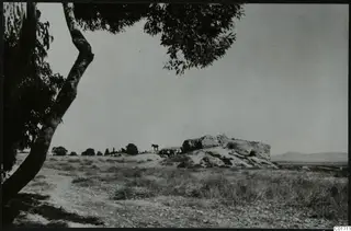 C01711Kition, Bamboula from the south
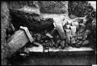 C01719Kition cult room, statues in situ
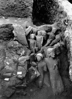 C01728Cult room, large deposit at Kition, detail with larger sculptures